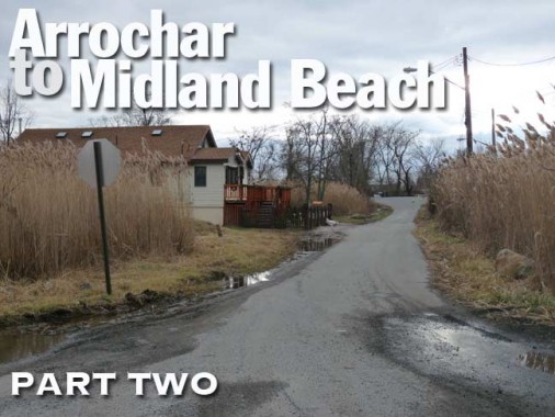
When I left off last week, I had just entered Midland Beach, which is only partially developed as the ground is quite marshy and punctuated by the meandering New Creek. I had just traversed Slater Boulevard, which crosses the marshlands, and found a row of ancient bungalows paralleling Father Capodanno Boulevard on Staten Island’s southeast shore.
During the early 20th Century, Midland Beach, which roughly runs between Seaview Avenue, Father Capodanno Boulevard, Hylan Boulevard and Miller Field, a former military airbase, was thought of as a seaside resort, and the bungalows were only occupied during the summer. A series of fires and the onset of pollution that rendered South Beach unswimmable for a time doomed the amusement parks and resorts, though some of the funfairs did hang on into the 1960s, since I vaguely remember them.
Here’s my route for the day on Google Maps. It follows roughly the S51 and S52 bus lines, but this walk takes you places you can’t see out the bus window. On this page, I’ll be heavier on insights than information, as my research on the outlying areas of Staten Island is sketchy, right down to the street names. I can tell you this: most streets on Staten Island had different names until about 1912, when they received new names; as with Queens, many neighborhoods duplicated names, so it was thought best to eliminate the duplicates.
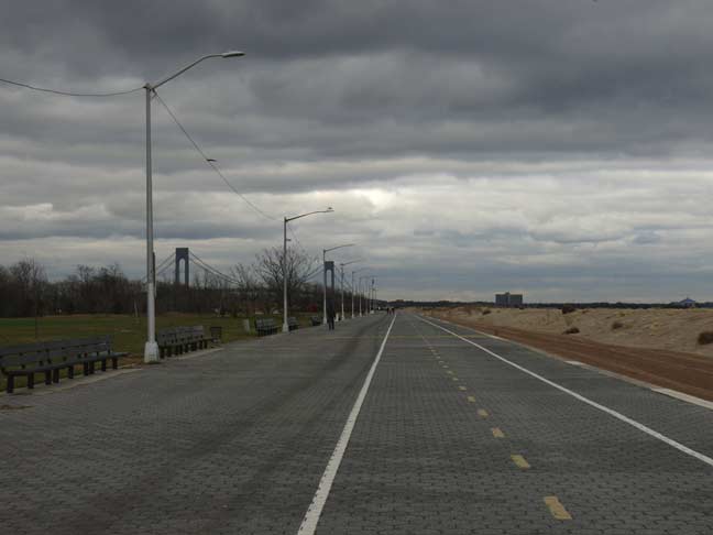
I crossed Capodanno Boulevard and headed right for the beach. The air temperature was about 40 and the sky a typical December dishrag gray. Though the Franklin D. Roosevelt Boardwalk ends just south of Seaview Avenue, it remains one of NYC’s intact boardwalks, as Parks seems set on replacing Coney Island’s iconic boardwalk with a faux version made of concrete, while the Rockaway Beach boardwalk was destroyed by Sandy and Parks is taking its time constructing a new one.
Even though the boardwalk doesn’t make it this far south (Capodanno at Graham Boulevard) the pedestrian and bike path does; it makes it all the way to New Dorp Lane, skimming the edge of Miller Field, which is now a public park.
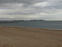
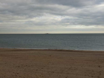
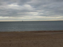
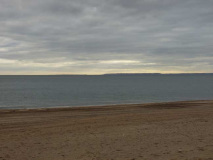
Four views southeast and south from South Beach Park, which stretches between the boulevard and the bike path. I’m actually standing on the beach at this point. Looking across Lower Bay, you can see Coney Island (squint to see the Parachute Jump) as well as the tip of Breezy Point just above the horizon, and the New Jersey Highlands to the southeast. Avoiding the Rockaway peninsula and sailing to the east, you would eventually reach the Portuguese coast.
Good Lights
Straining my 18x zoom on my Panasonic Lumix to the utmost, I was able to capture the two lighthouses of Lower Bay: Romer Shoal (left) and West Bank (right).
From FNY’s Lighthouses of Southern New York Harbor page:
Romer Shoal:
Southeast of West Bank Light and north of the tip of Sandy Hook is 54-foot tall Romer Shoal Light, raised in 1898. The lighthouse, and the shoals in Lower Bay, were named for Colonel Wolfgang William Romer, a British military engineer (of German birth) who sounded the waters of New York Bay in 1700 on order of the governor of New York. There has been a day beacon, and later, a lighthouse, on this site since 1838. Along with other lighthouses of the Lower Bay, it kept close watch for enemy vessels during World Wars I and II. The aforementioned Joe Esposito helped save it when there was a possibility that it might be torn down.
The light is “in excess to the needs of the Coast Guard” and may be moved to the planned Staten Island Lighthouse Museum, which has been talked about for over a decade but is scheduled to open in 2013… we’ll see.
A shoal is a sandbar, where the sandy bottom comes close to the surface. Lighthouses warn vessels away from them.
West Bank:
The West Bank Light, raised in 1901, is located in Lower NY Bay approximately equidistant from Staten Island and the west end of the Rockaway peninsula. It is 55 feet in height, stands on a J-shaped rock jetty, and works in tandem with the land-bound Staten Island Lighthouse near Richmondtown.
Lighthouse life is not necessarily quiet. Generators for the lights and sound equipment hum all day and night. The there are the storms…
I met a lady once who was all filled up with what she called the romance of the lighthouse. She said she often longed to be a keeper and live alone in a tower on a rock far out in the sea, and have peace and quiet. She couldn’t understand why I snorted. Peace and quiet! A lighthouse is about the noisiest place in the world. Out there on West Bank, for instance, with a gale blowing. When I was there the tower rose right out of the water, with no footing at all around it, so the waves crashed against the whole tower; shook it until sometimes the mantles over the burners in the light broke. Sometimes the waves went clear over the gallery, and the spray over the light itself. –Longtime West Bank keeper Ed Burge
West Bank Light was finally automated in the early 1980s.
Unfortunately, another lighthouse in Raritan Bay, the Old Orchard (cf. above link) was destroyed by Hurricane Sandy, just a few weeks after I went past it.
Looking north along the bike path you can see the iconic gangplank to Brooklyn, which shows up nicely when you apply the 18X zoom.
This shot looks almost directly south toward New Dorp Beach and beyond that, Great Kills Harbor and Park.
From here I turned inland again and straight down Graham Boulevard, which except for a few homes clustered at Capodanno Boulevard, runs straight through the New Creek Bluebelt area.
It has to be said that even though these roads are desolate, accentuated by the gun metal sky, all the sparse routes are well-lit and for the most part, have adequate street signage, so you do know where you are even if you don’t have a GPS in the car.
From the previous shot you can see that Graham Boulevard is bridged over this branch of New Creek.
I mentioned in Part One that Quincy Avenue exists in pieces in Arrochar and South and Midland Beaches. This is another piece, trailing off at the side of the creek. This piece serves as a driveway to a private house hidden behind the bushes on the right. Fearing rabid watchdogs, I usually don’t venture behind “no trespassing” signs.
Houses are tough to come by in this stretch of Midland Beach. This one-block stretch of Patterson Avenue exists only because…
…only because #640-642 Patterson Avenue sits on it. The house is surrounded by marshes and phragmite reeds. Patterson Avenue is paved and this one block is lit by two streetlamps, attached to a telephone poles. You can see the telephone and electricity wires at the top of the photo.
Patterson Avenue runs to Jefferson Avenue, where there is one more house.
Looking south on Graham Boulevard toward the beach, just past Patterson Avenue.
Baden Place, named for an ancient German state, dead-ends on either side of Graham Boulevard. The house on the west side has a very large lawn, which is kept meticulously neat by the owner.
In Part One, I noted the vestiges of streets named in alphabetical order. In this part of Midland Beach, we see a similar situation in rough form. The sequence begins with Baden Place, with Patterson Avenue, which was originally mapped to begin in Arrochar (that section was never built) standing in for the A street. It continues with Colony Avenue; with Olympia Boulevard replacing the D street; no E street; Freeborn Street; Grimsby Street; Nugent Avenue replacing the H, I and J; Kiswick Street; no L; Moreland Street; Mason Avenue replacing the N; Oldfield; Poultney; no Q; Rudyard; and Salinac.
Curiously, the avenue between Salinac Street and Hylan Boulevard, the western edge of Midland Beach, is called Boundary Avenue, lending credence to the thought that Midland Beach was developed privately with the streets given names in alphabetical order. As in Arrochar, I’d have to say there are too many streets thet begin with consecutive letters for this to be purely coincidental.
If you think the street patterns in NYC are wacky, all I can tell you is, try Philadelphia.
I have to mention that the New Creek Bluebelt area is an anomaly. South of Hunter Avenue, the regular grid resumes, and it looks less like Outlandia and more like a quiet NYC neighborhood. A sure sign that Modernity is creeping in is this monstrosity on Graham Boulevard near Baden Place.
Here’s something unusual, but explainable. This house is on Graham Boulevard — however, the front entrance is up a flight of steps, facing a lawn. The mailbox is marked “121 Colony Avenue” — however there is at present no Colony Avenue on the east side of Graham Blvd., but there is a dead-end stub on the west side.
Originally, though, all these streets were once mapped to cross the New Creek Bluebelt and form a grid on top of it. Practicalities, though, got in the way, and it would be a massive expense to drain the marshes and construct stable foundations — thus, the area remains relatively undeveloped.
The house, then, was built on a piece of Colony Avenue that was mapped, but never built.
An overhead view provides a look at the New Creek Bluebelt.
I turned left at Olympia Boulevard — the same street I rambled down in Arrochar in Part 1. This piece of Olympia Blvd. presents a different aspect as it traverses the New Creek Bluebelt. Once again, it’s well-paved and lit, but in NYC the sight of such a road running a cross a phragmites-lined swamp is an odd sight indeed.
Paralleling Freeborn Street also makes its way across the bluebelt.
Approaching Hunter Avenue on Olympia, I have made my way across the bluebelt and spot several worse for Sandy buildings, some about to fall apart and some bearing the Tyvek sheath of renewal.
Along Olympia Boulevard can be spotted several die-cut wood stars bearing hopeful messages. These can also be spotted on the side streets of Rockaway Park, way down in southern Queens. What common element unites these two far-flung regions? Hurricane Sandy.
They are the work of an organization called Stars of Hope, initiated after an EF-5 tornado leveled Greensburg, Kansas in May 2007. Stars of Hope, supported by donations, produces thousands of plain wood stars, which are then decorated by residents (especially children) of areas and neighborhoods devastated by acts of God and man, attaching them to public utility poles to help communities recover in spirit.
Hunter Avenue roughly marks the southern border of the bluebelt area, though some of the streets south of here still have some marshy empty lots. Along the road there were some more houses still under repair.
Quality control is getting to be a major problem that can be increasingly seen with misspellings on street signs, print publications, television captions and many other places. As I’ve been told, though, until this starts affecting the bottom line, companies will continue to de-emphasize the importance of spelling. The average person now pays no attention to spelling while texting and uses ‘twitter shorthand.’
Soon, writing will be the province of a separate class in society, like the scribes of the Middle Ages.
New Creek and its bluebelt, meanwhile, skim across the northern edge of Hunter Avenue, and occasionally the creek widens enough to form a pond. Locals have to be dissuaded from treating it as a dumping ground.
Walking west on Hunter Avenue, I had a couple of surprises up ahead.
You can now talk about FNY in terms of decades. Way back in 2003, I thought I’d discovered all of Staten Island’s hidden brooks and streams and the bridges that cross them! How idiotic I was.
Here’s another ones that local denizens have known about for decades themselves, but I had no idea. I dub thee the Hunter Avenue Bridge, a narrowing of the avenue with a bridge made of warped wood planks that crosses a short tributary of New Creek. Though it was a weekday afternoon, it was still fairly busy and I waited for several cars to cross before I was able to get free for a number of shots.
Local Staten Islanders, some of them, anyway, use the Hunter Avenue Bridge to dispose of trash, unfortunately.
But it’s not the only bridge I found: the curiously-named Idlease Place, which runs from Adams to Hamden Avenue across Hunter, runs across a bridge that’s the identical twin of the Hunter Avenue Bridge.
In case you think “New Creek” is a new name, here’s an 1874 F.W. Beers atlas plate showing it cutting through the marshes. “Middletown” was one of the subdivided towns of Staten Island; the towns were dissolved when Staten Island joined NYC in 1898. “Red Lane” is likely Midland Avenue.
Actually, Hunter Avenue becomes even more rural in aspect for a few blocks west of Idlease Place, but I decided to tack more toward the Staten Island Railway at Grant City. I wanted to make it beck to Manhattan before peak fares at the LIRR beginning at 4 PM!
At Mason and Hamden Avenues, another Sandy-ravaged house…
… and nearby a note of defiance.
Turning onto Midland Avenue, the main east-west road in Midland Beach, formerly called Red Lane, possibly from soil color. Before Midland Avenue passes between midland Field, PS 38, Intermediate School #2 (the John Egbert School) and the southwest end of the New Creek Bluebelt, it passes a now-rare red-blinking Cyclops caution stoplight at Oldfield Street.
I then walked through the PS 38 playground to Lincoln Avenue.
At Lincoln Ave. and Salinac Street is, as far as I can tell, the western aboveground reach of New Creek as it here enters into the city sewer system.
“Civilization” at last at Lincoln Avenue and Hylan Boulevard! White Castle, Planet Wings, Auto Zone, strip malls, traffic jams, Papa Johns, McDonalds and Party City.
Hylan Boulevard was laid out in the 1920s as Southside Boulevard, but was quickly named for NYC mayor from 1918-1925, John Hylan, who was defeated for reelection in 1925 by Jimmy Walker. It’s easily Staten Island’s busies local traffic route and runs from Rosebank to Tottenville.
Following his mayoralty, his successor Jimmy Walker, whom Hylan had criticized, appointed him to Queens Children’s Court. When Alva Johnston asked Walker why he would appoint a rival, he quipped that it was so “the children now can be tried by their peer”. wikipedia
I haven’t seen a NYC Department of Transportation like this one elsewhere around town.
As if one route named Hylan wasn’t enough, a short dead-end at Lincoln just north of the boulevard is called Hylan Place.
I am back in Grant City in central Staten Island. This part of the island was settled before the Civil War, and after the war ended in 1865 the small town was renamed for General Ulysses S. Grant. Several other neighborhood streets also bear names connected to the war — Abraham Lincoln; U.S. Grant’s first Vice-President, Schuyler Colfax; John C. Frémont, the first Republican Party Presidential candidate; and journalism giant Horace Greeley.
It also has a street with my name on it.
In the winter of 2010, I did another major walk through Grant City and New Dorp.
From that article:
The magnificent building above, at Lincoln Avenue and Edison Street, was constructed in Victorian “stick style” (so called because thin pieces of wood are used in the detailing) about 1890. The years 1885-1915 produced NYC’s most beautiful architecture, chockblock full of ornamentation and detailing. I don’t think a building needs a lot of detailing to be attractive — Frank Lloyd Wright is my favorite architect, and his work is stylish without being overly busy.
Ideas of what is admirable or desirable housing had changed by the 1950s and 1960s, and multifloor, multiunit buildings became commonplace, even in Staten Island. The Lincoln Avenue Condominiums likely started out as rental units.
Time to think about the journey back. The Grant City Staten Island Railway station has had a neat brick headhouse since the railroad was placed in an open cut in 1965, and still has a window from which tickets were dispensed. After 1985 you simply purchased your ticket from the conductor once boarded.
This changed in 1997 when MetroCard fare system became universal. Now, fare is collected only at St. George (with Tompkinsville added a couple of years ago to beat the fare beaters). Most Staten Islanders who use SIRT take it to the ferry terminal and back, though in my experience I can tell you that I use the Long Island Rail Road from Little Neck as a shuttle to stations like Bayside or Auburndale and more often than not, the conductor doesn’t take my ticket!
When I first began journeying to and exploring in Staten Island as far back as the early 1970s, the R-44 units employed on the line were new. Now, with the cars breaking the 40-year mark (despite recent renovations that have replaced the orange and yellow seats with robins’ egg blue) the cars are in line for replacement.
Here’s a full review of the Stations of the Staten Island Railway.
1/25/15
