By SERGEY KADINSKY
Forgotten NY correspondent
FLATBUSH Avenue is not the longest road in Brooklyn (Bedford Avenue edges it out) but it comes close to the record on its lengthy route between Manhattan Bridge and Gil Hodges Marine Parkway Bridge. The latter connects to Jacob Riis Park, a unit within the Gateway National Recreation Area.

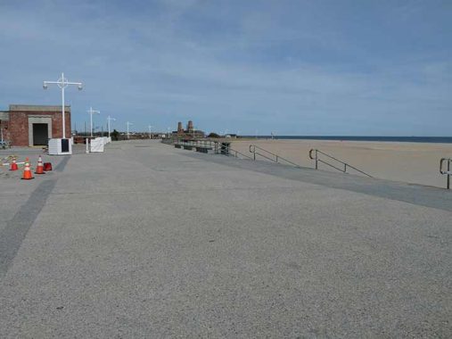
The design of the boardwalk is similar to Jones Beach, with sand-colored concrete and bricks laid out in an Art Deco form.

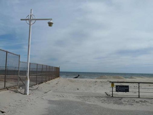
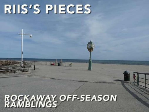
In resemblance to Orchard Beach, the concrete promenade takes a curved route along the beach, but the shoreline here is straight, shaped by the current that has extended the length of the Rockaway Peninsula. Along the way are unique lampposts which Kevin dutifully noted as he is the taxonomist of all city lamppost designs, species and genus. Orchard Beach has them too!

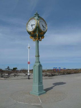
Among the park’s defining features is the sidewalk clock, which usually appears in busy commercial areas and we’ve documented its siblings. The Wise Clock, named for its previous owner William A. Wise, was gifted to the park after Wise’s jewelry store in downtown Brooklyn closed in 1941.
Because the beach walkway here is made from concrete rather than wood, I’d call it a promenade rather than a boardwalk. The term is fluid as the official name of the Rockaway Beach boardwalk is Ocean Promenade and since its reconstruction following Hurricane Sandy, its boards were replaced with concrete. But most folks still call it a boardwalk.
The curved pavilion is nearly identical to the bathhouses in Orchard Beach, which were built in the same decade by the same architects. Both beaches were designed by landscape architect Gilmore Clarke of Clarke & Rapuano, NYC Parks Chief of Architectural Design Clinton Lloyd, and architect Aymar Embury II, with input and approval by Robert Moses.
The Art Deco style includes its own lettering in the Broadway font, which appears on restroom entrances at this park.
[The Riis Park men’s room is surprisingly clean and functional, even in the off-season. — Ed.]
Abandoned handball courts testify to this national park’s past as a city park and there are hundreds of such walls across the five boroughs. With the growing use of automobiles and affordability of air trail to warmer places, Jacob Riis Park declined in usage and upkeep. It was transferred to the National Parks Service in 1972 as part of a movement to bring national parks to urban areas in recognition that many city dwellers cannot afford to visit Yellowstone or Grand Canyon. Along with Riis Park, the Gateway National Recreation Area includes Jamaica Bay Wildlife Refuge, Floyd Bennett Field, Fort Wadsworth, Crooke’s Point, Hoffman and Swinburne islands, and Sandy Hook.
The sizable park also covers Fort Tilden, which borders on Jacob Riis Park. Named for the winner of the popular vote in the 1876 presidential election, it defended New York in both world wars and was an active base until 1972 when it was included in the national park. Having visited its fortifications in the past, this time Kevin focused on its residential structures which resemble homesteads in a prairie, all that remain of a larger community of military homes.
Completed in 1952, the nondenominational chapel provided religious services for personnel on the base but after becoming a park, it stands unused. In 2014, MoMA PS1 had an art show at the chapel titled Rockaway! In partnership with Rockaway Artists Alliance to demonstrate resilience following the devastation of Hurricane Sandy two years earlier.
The fort’s theater hosts the Rockaway Theater Company. When Kevin walked by, the billboard was advertising the musical Urinetown, which is about public restrooms. It played on Broadway from 2001 through 2004. On this topic, Forgotten-NY devotees can refer to Kevin’s 2001 essay on the city’s beaux arts public restrooms. It’s an honor to pee there.
A decommissioned Nike missile testifies to the fort’s final conflict, the Cold War in which such installations appeared throughout the metropolitan region to defend against the Soviet threat.
Like any other community within the city that is not subject to the municipal DOT, street signs within Fort Tilden have their own font (Clarendon) and color, honoring military heroes. Among these is Heinzelman Road, honoring either Maj. Gen. Samuel Heintzelman, who wore the uniform between 1826 and 1869; or his grandson Maj. Gen. Stuart Heintzelman, who served between 1899 and 1935.
On the north side of Rockaway Point Boulevard is a road containing train tracks that brought ordnance from a dock on Rockaway Inlet to the batteries near the beach, one of those really short railways long forgotten but for the history trivia buffs.
As its name suggests, Marine Parkway Bridge is part of a longer highway proposed by Moses that was unrealized. An echo of this highway is Beach Channel Drive, which runs from this bridge to the border of Far Rockaway and Inwood. It is unrelated to the street near Brooklyn’s Marine Park named Marine Parkway that is not connected to this bridge. The height of this bridge was designed to allow for the possibility of Jamaica Bay becoming a seaport.
Concerning unrealized designs, since the site’s designation as a park there have been a few, each representing various recreational priorities and practical concerns. The sandy expanse was designated as Seaside Park in 1912 and then renamed Telawana Park in memory of the last known descendant of the Native Rockaway people, Culluloo Telawana, who died in the early 19th century.
The first plan for this park envisioned an Olmstedian landscape of circular paths and a central mall leading to the bathhouse. Two small parking lots faced the bathhouse. On the park’s northeast corner would have had a “basin for boating” with a constructed stream flowing into it.
Another plan for this park relocated the proposed lagoon in favor of tennis courts and a central lawn for amusement events. Again, the parking lot appears to fit fewer than a hundred cars as a trolley line was expected to link this park with the nearest train station at Beach 116th Street.
Shortly after this plan was printed, Jacob Riis died and the park was renamed in his honor. He was a leading advocate for this park and the renaming was spearheaded by former president Theodore Roosevelt. A bust of Riis looks on the park from the historic bathhouse. He is also honored with a triangle in Richmond Hill where he lived, and a NYCHA project in the East Village.
The city hosted a design competition for the park but it would take another two decades for the park to be fully developed. I found them in the Cultural Landscape Report published by the National Parks Service in 1992.
Carl F. Pilat’s design had a circular bandstand island skin to the one in Prospect Park, boathouse and wading beach on the bay side. It was a beaux-arts design with a symmetric layout of paths and amenities. This design was approved by the Parks Department but delayed and then World War I transformed most of the park into a Naval Air Station, which functioned until 1931 when nearby Floyd Bennett Field became operational. During its service as an airfield, it was the departure point of the first transatlantic flight in 1919. With the departure of the Navy, civic groups submitted proposals for the park.
In 1932 the Regional Plan Association left no inch untouched within the park. Its entire bay side is lined with marinas, two piers protrude into the ocean, there’s a meadow and pageant space, and a traffic circle at Marine Parkway Bridge. I can imagine a water tower placed there in the manner of Jones Beach.
The 1933 plan by J.V. Burgevin and Julius Gatringer preserves the central mall, flanking it with parking lots on each side, a nine-hole golf course and athletic fields. But Robert Moses had to insert his input and a year later had his preferred architect Gilmore Clarke and W. Earle Andrews designed an “inner city metropolitan replica of Jones Beach,” with massive parking lots and little else inside the park.
Residents of Neponsit opposed the plan fearing an influx of working-class and minority parkgoers to the area. They preferred upscale amenities such as tennis and golf for the park.
The 1935 plan for Jacob Riis Park envisioned a bus turnaround loop, mall walkway to the boathouse, pitch and putt golf, and the massive parking lot for 14000 cars. Beach Channel Drive had not yet been constructed so the only entrance connecting the park to the neighborhoods of the Rockaways is at Rockaway Beach Boulevard. The traffic circle at Marine Parkway Bridge later became a tangle of ramps and the boat piers on Rockaway Inlet were never built.
The final design for the park had the parking field ringed by Rockaway Beach Boulevard and Beach Channel Drive, with undeveloped space on its eastern edge as a buffer between the park and the Neponsit neighborhood. It had a golf course, tennis, basketball, shuffleboard, and a playground.
At the bathhouse, Moses ordered a concrete section inserted in the center that doesn’t match with the rest of the building, a scar on an otherwise beautiful structure. The creative elements are on the inland side of the building with Moorish columns and arches at the entrances.
As for the parking lot, it is rarely filled to capacity and I can imagine it trimmed in size to allow for plants or recreational amenities. Tire tracks on its concrete surface testify to racing enthusiasts illegally using this parking lot for their tricks. Following its acquisition by the National Parks Service, the federal agency had its own plan for the park in 1986 that proposed sports activities for the space bordering Neponsit but to this day this section of the park remains undeveloped, with trees growing on the dunes.
Neponsit is also the name of the hospital that stood at the park’s southeast corner. Built in 1915 as a tuberculosis sanitarium, it was expanded during the Great Depression. The hospital closed in 1955 and Moses sought to expand the park by demolishing the hospital. Again, opposition from Neponsit residents who wanted either for the hospital to reopen or convert to a school. As a compromise it became a nursing home. Suffering damage in a storm in 1998, it was vacated and deteriorated further until all of it was demolished in early 2023. A posthumous victory for Robert Moses.
The border between Jacob Riis Park and Fort Tilden is Beach 169th Street, known as Telawana prior to numerization. The only address on this street is FDNY Engine Company 329, whose firehouse was built in 1961. Continuing west to the tip of the peninsula, the next numbered street is Beach 193rd where the city proposed high-rise towers in the 1970s. Beyond that road is Breezy Point, the private co-op neighborhood that we last visited in 2010. That’s where the final number on the peninsula grid appears: Beach 227th Street.
To return home, Kevin picked up the bus to Brooklyn at Beach 169th Street where the Q22 and Q35 lines connect to subway terminals either at Rockaway Park or Brooklyn College. In recent years, private bus lines catering to tattooed hipsters run directly between the Rockaways, northern Brooklyn, and lower Manhattan, using rented school buses for that feeling of youth. Keeping on this theme, visitors can spend the night at Fort Tilden with its glamping experience titled Camp Rockaway.
You can learn more about Jacob Riis Park and Fort Tilden by visiting each of the hyperlinks posted in the essay above.
Sergey Kadinsky is the author of Hidden Waters of New York City: A History and Guide to 101 Forgotten Lakes, Ponds, Creeks, and Streams in the Five Boroughs (2016, Countryman Press), adjunct history professor at Touro University and the webmaster of Hidden Waters Blog.
As always, “comment…as you see fit.” I earn a small payment when you click on any ad on the site. Take a look at the new JOBS link in the red toolbar at the top of the page on the desktop version, as I also get a small payment when you view a job via that link.
4/7/24
