I USUALLY return to my old pages unannounced. If I have something new on a certain subject I usually just drop it in without really notifying anyone; one day, you’re looking at a page, and the next, why there’s been something added. Keeps people coming back again and again.
But when I revisited Roosevelt Island six years after my initial foray (except for a brief visit to the Smallpox Hospital, in 2003; its grounds were briefly open in the early 2000s) I found so many things had changed, and so much that I had initially missed, that I thought it would be best to revamp the page and bill it as new, since, essentially, this page is about 75% new.
Manhattan is an island. But did you know there’s an island in Manhattan?
Located in the East River between Manhattan and Queens, two-mile long Roosevelt Island since 1971 has been the home of a small town of about 8,300 people in the midst of a huge city. Though it is technically a part of Manhattan, between 1958 and 1976 the only way to get there was by a bridge at 36th Avenue and Vernon Blvd. in Astoria, Queens. (Before 1958 a trolley would let you off on the Queensboro Bridge, where an elevator would transport you to the island.) The bridge is still the only way to get there by car or bus. Since 1976, the only tramway in NYC has run from Second Avenue and 60th Street and subway service was initiated in 1989.
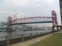
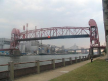
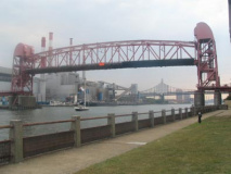
In September 2005 I was lucky enough to pass by at the same time the bridge was raised to allow a flotilla through…
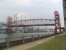
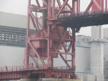
Showing the bridge with roadway raised and lowered. The bridge is technically known as a lift bridge, quite descriptive in that the roadway is lifted to allow ships to pass. There’s another lift bridge nearby, the pedestrian bridge connecting East 103rd Street and Wards Island, open only in spring and summer.
It is telling that all during NYC’s great bridge-building era, 1883 through 1964, it was never considered to bridge Roosevelt Island to Manhattan. As we’ll see, this island was where undesirables, those with contagious diseases and criminals, were sent; not till 1955 was it even bridged to Queens.
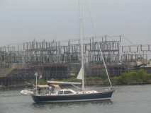
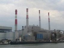
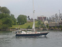
The bridge lifted to allow a procession of relatively tall-masted sloops through. The island presents a perfect view of Big Allis, the largest Keyspan National Grid power generator in the city, producing 25% of NYC’s electricity.

The 1955 Roosevelt Island Bridge,like the island, has many anachronistic aspects. It still contains a flock of vintage “Whitestone Bridge” streamlined crossbar lampposts (the bridge was a particular stronghold for them). The posts kept incandescent Westinghouse cuplight fixtures until the early 2000s.
[these were removed during a 2010 renovation]

Blackwell House
Native Americans called the island Minnehanak (“a great place to live”), but it has gone under a variety of names in English. The Dutch called it Varkens, or Hog Island. Its first permanent resident was Captain John Manning, a disgraced British naval officer who allowed Fort Amsterdam (on Governor’s Island) to fall to the Dutch in 1673.
Upon Manning’s death the island was passed on to his stepdaughter Mary and her husband, Robert Blackwell, and the island stayed in the Blackwell family till 1823, retaining the name “Blackwell’s Island” for years after that.
Blackwell’s Island became Welfare Island in 1921, and finally, since 1973, Roosevelt Island; a substantial memorial to Franklin Delano Roosevelt was supposed to occupy the island’s southern tip, but the plans were scotched when architect Louis Kahn passed away. Other accounts have Roosevelt Islanders wanting more open space rather than a memorial.
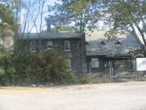
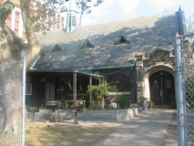
The oldest building on Roosevelt Island is the Blackwell Farmhouse which dates to 1796.
In 1828, the farmhouse was purchased by the city, and it later became the administrative center for the succession of institutions that sprung up on Blackwell’s Island beginning that year.
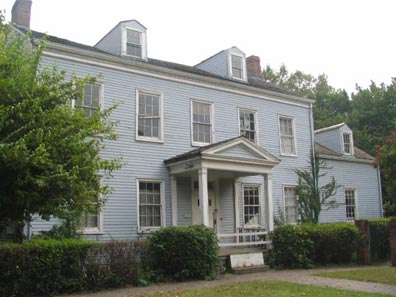

But the damage is especially noticeable when you walk around to the back. The porch is a ruin and the windows are sagging, some broken.


[2012: the house has been shored up and repaired, but is still generally closed to the public.]
photos: Andrew Harris
1828 was the year that a long succession of institutions and hospitals appeared on the island. The first lunatic asylum appeared in 1841 to be followed by an almshouse (debtor’s prison) in 1847 and the first hospital in 1849. Charles Dickens visited the island in the 1840s and delineated the inhumanely harsh conditions of the asylums.
In 1858, City Hospital, a handsomely built but poorly administrated hospital opened, and the years between 1956 and 1867 saw a variety of hospitals treating various maladies such as smallpox, epilepsy and paralysis. Gradually, Blackwells Island had obtained a reputation as the place they put you if you were no longer wanted or considered too sick to return to society.
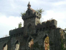
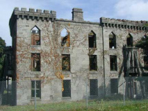
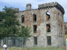
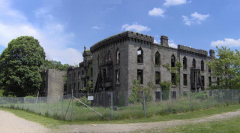
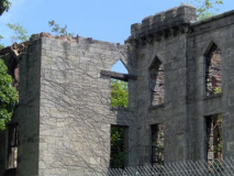
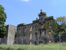
Ruins of the Smallpox Hospital, built in 1856 on the southern tip of the island, remain inaccessible to the public except on special tours. Visitors can view the “magnificently” ruined castle-like structure from the outside, but the interior has yet to be made safe for the public. Unusually, it is well-lit at night and its ghostly outline can be readily seen from Manhattan Island after dark.
In 2005 access to the Smallpox Hospital and Strecker Lab in Southpoint Park was again closed by the city “until further notice”; apparently, there is a diplomat staying on the island, fearful someone may take a potshot from the weeds, so, once again, no one is welcome.
[2012: parts of Southpoint Park have reopened. A FDR Memorial, depicting the President in a wheelchair, is due to open soon.]
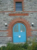
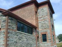
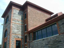
The Strecker Laboratory, in the 1890s the premier facility for bacteriological research, was constructed in a Romanesque revival style by architects Frederick Withers and Walter Dickson. In 2000, the Laboratory was renovated and restored; in 2004 it still stands all alone in an empty lot south of the Smallpox Hospital, awaiting visitors. Since it closed in the 1950s it had been allowed to collapse for nearly 40 years despite its landmarking in 1975.


The path to Strecker Labs commands an impressive view of the towers of Midtown.


Views from the southern tip of Roosevelt Island.

Date on Queensboro Bridge anchor

Bird S. Coler Hospital. Coler (1867-1941) was the first Comptroller of the newly consolidated NYC in 1898. He later became Brooklyn borough president and commissioner of charities.
The Octagon
What is today known as “The Octagon” was in fact the crumbling remnant of Blackwells’ Island’s first lunatic asylum, designed by Alexander Jackson Davis and first constructed in 1839 and opened in 1841. It is just south of the park at the island’s northern tip.

The Octagon in 1999


The Octagon is being restored with a new dome designed to look like the one it acquired after a renovation in 1879, as part of a new high rise development named for it.


The original dome collapsed from neglect long ago; by 2006, the new one looked much like the old.
By the 1920s and 1930s Blackwell’s Island (renamed Welfare Island in 1921) had become a bizarre fiefdom of gangsters serving time in the neglectful tenure of Joseph McCann, who ran the penitentiary. The mobsters were able to have all the comforts of home smuggled in and lived like kings amid the deteriorating, squalid conditions surrounding them. The penitentiary was closed and moved to Rikers Island in 1936.


Chapel of the Good Shepherd
The oldest church on Roosevelt Island, the Chapel of The Good Shepherd (Episcopal) was designed by British architect Frederick Clarke Withers, built in 1889 and was restored when new development came to the island in the early 1970s.
Episcopal Church of the Holy Spirit
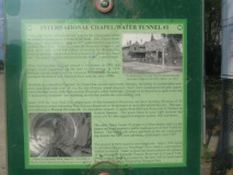
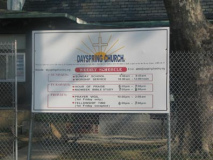
It turns out that Roosevelt Island’s other old church is also an Episcopal church. Built in 1924 from island-quarried gneiss as a chapel for Metropolitan Hospital, with an attached rectory for the hospital’s chaplain, it stood abandoned between 1955 and 1975 after Metropolitan moved to Manhattan. It has subsequently been the Redeemed Christian Church of God and Dayspring Church. It’s located on the west side of mid-island facing Manhattan.
Main Street
By the 1930s the era of institutionalization on Welfare Island was winding down. Goldwater Memorial Hospital (not Barry but Dr. S.S. Goldwater, Commissioner of Hospitals) opened in 1939 and Bird S. Coler Hospital in 1952. The rest of the island was in ruins by this time.
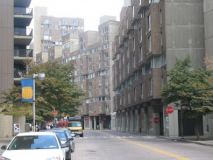
Various plans for park and residential development which would include a subway connection began to circulate in the 1960s. Finally, a plan envisioned by legendary architect Philip Johnson and John Burgee was decided upon. The Urban Development Corporation, inaugurated in 1969, hired developers and construction began. At first, Roosevelt Island (it was renamed for FDR in 1973) featured high rise developments with a promenade on the eastern and western sides of the island. No dogs were allowed on the island at first, and cars were discouraged (they were allowed only in the parking garage near the bridge; buses transported people up and down Main Street, the one of two named streets in the development).


Roosevelt Island has lost some of its insularity in the past decade as developers have begun to notice its grand views and have consequently begun to build expensively-priced high-rise towers. Parkland occupies the northern end, middle near the parking garage, and southern end (whenever it’s open).
Island Artwork
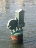
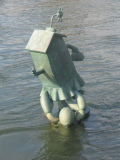
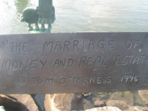
NYC’s ubiquitous sculptureartist, Tom Otterness, installed a series of sculptures showing “The Marriage of Money and Real Estate” in the water on the island’s west side in 1996. More or less of the sculptures are revealed depending on tide.


Sept. 2005: I had not walked along the island’s west side since 1988, which meant I had missed the old Church of the Holy Spirit and this lookout, which is shaped like he prow of a ship. How long has this been here?

It has apparently been a long time since a boat docked on Roosevelt Island; you can get there by car, tram, subway and helicopter but I haven’t seen a pier of any kind, except for these moors, which I suppose can be pressed into action to tie a vessel if necessary.


The 59th Street Bridge and the Roosevelt Island Tramway can be seen in this view of the western promenade (left). Above, Lighthouse Park.
[nggalery id=6289]
Lighthouse Park
Lighthouse Park is named for the lighthouse built by architect James Renwick Jr. in 1872. It replaced a small fort built by Thomas Maxey, a patient in the nearby lunatic asylum
A plaque commemorating island resident Vicki Holland can be found beside the lighthouse.
An earlier plaque carved by another patient, John McCarthy, who claimed to have assisted in its construction, is reported to have been here until the 1960s, when it was stolen. It read:
This is the work
Was done by
John McCarthy
Who built the light
House from the bottom to the
Top all ye who do pass by may
Pray for his soul when he dies

From the island’s northern tip, you can see the Hell Gate, Mill Rock and Ward’s Island (the ward’s Island footbridge can be faintly seen left center).
Sources:
The Other Islands Of New York City, Sharon Seitz and Stuart Miller , 1996 Countryman Press
AIA Guide to New York City, Elliott Willensky and Norval White, 1988 Harcourt Brace Jovanovich
Thanks to Judy Berdy, Vice President, Roosevelt Island Historical Society.
10/1/2005

2 comments
Please make your website articles available to be e-mailed–i don’t do facebook or twitter.
Thank you for this. I was named after my father who was given the name Bird S Coler Southern with the blessing of Mr. Coler. That was 1902, the year Mr. Coler was defeated in the election for New York State Governor. He continued to show interest in my father and wrote letter(s) of recommendation for employment when he became a young man. I had heard about the hospital when I was young and looked for information about the facility without much success.