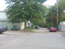
A lonely outpost even by Staten Island standards is Travis, a small village of about two thousand at the western end of Victory Boulevard. In the colonial period, it was an important crossing point (New Blazing Star Ferry) over the Arthur Kill to Carteret, New Jersey, from whence horses and carriages could continue on to Philadelphia and points south.
Just as Proctor and Gamble made Mariners Harbor a company town for many years, so did the American Linoleum Company in Travis between 1873 and 1931; the industry became so identified with the region that the town became known as Linoleumville during that time. After the company moved to Philadelphia, residents voted to rename the town for early settler Captain Jacob Travis. From Time Magazine, December 8, 1930:
The town, situated on the west shore of Staten Island, was first called Long Neck, but the post office address was discontinued in 1866. In 1873 appeared Joseph Wild Co., later becoming American Linoleum Manufacturing Co. First superintendent of the factory was a man named Melvin. Later two communities sprang up, Travisville (after an early settler) and Linoleumville. Subsequently the post office address of both places was called Linoleumville, becoming a part of New York City in 1898.
As the balloting got underway last week at the Atlantic Hook & Ladder firehouse there were three main schools of thought. Spokesman for the Travis faction said, somewhat erroneously: “Now the name of these diggings was Travisville in the beginning. That’s his story anyway. Travis was an old ship captain and from what I hear he was some boy. Let’s stick to the old name of Travisville, but let’s cut off the ville. That sounds too much like a hick place. . . . Imagine going into some of them big Manhattan department stores to buy and giving your home address as Linoleumville!”
Said the leader of the Melvin cabal: “Old man Melvin brought the linoleum factory here over 50 years ago. He did a great deal for the community. . . . They say Travis was a ship’s captain who gave a bell to the Methodist Church. Well, I like Melvin and that’s what my gang is voting for.”
Die-hards wanted to retain Linoleumville because, they claimed, out of the town of that name went more men to the War than from any other U. S. town its size.
After a spirited torchlight procession and the display of such banners as “It Won’t Cost You Anything To Change The Name,” the votes were cast. Results: Linoleumville, 4: Melvin. 58; Travis, 333.
The neighborhood is close to the now-closed Fresh Kills Landfill, the largest waste disposal facility in the world at over 2000 acres.
The 814-acre Davis Wildlife Refuge, named for the great Staten Island naturalist and entomologist, was New York City’s first such sanctuaries, and was established by Davis in 1933, in the heart of the Depression. The park is about equal in size to Central Park. Much of the enclosure is a salt marsh that provides a rich milieu for flora and fauna…over 100 bird species can be found here including sharp-tailed sparrows, ducks, wading egrets, barn, great-horned and short-eared owls, many hawk varieties, as well as snapping turtles, crabs and muskrats. The Refuge is best seen by canoeing in the broad Main and Springville Creeks.
Travis is at the end of Victory Blvd, reachable by the S61 bus; by car, take the West Shore Expressway (rechristened the Pearl Harbor Memorial Expressway) to Exit 7.
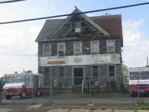
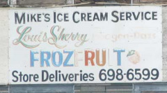
On Victory Blvd. south of Travis Avenue (which links Travis and New Springville) there is the Davis Refuge’s Native Plant Propagation Nursery, along with an ice cream distributor with a decades- old sign.
Victory Blvd. is an Indian trail that was straightened and expanded in the Colonial era. It was known as Richmond Turnpike until 1918, when it was renamed to commemorate the victory over Germany in World War I.


American Legion post. The town’s annual Fourth of July parade, said to be the country’s oldest, was inaugurated in 1911 and perennially attracts the NYC mayor and other politicians.

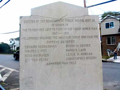
At the intersection of Victory Blvd. and Cannon Avenue, named for a prominent local French Huguenot family, is a World War I memorial consisting of a small cannon and a stone marker depicting a gun-toting doughboy. The cannon was found decades ago and likely dates to the Revolutionary War, when British soldiers were billeted in the area.
A doughboy goes “over the top” on the memorial face.
ForgottenFan James Sarlo: I am an avocational historian from Staten Island. I am currently working on a book about Staten Island’s Revolutionary War history. Specifically, I’m creating a historic-archeological reference guide detailing the locations of Staten Island’s forgotten British forts. (My book is entitled The Lost Redoubts. Staten Island’s Forgotten British Forts.)
As part of my research I looked into the origins of the gun barrel located at the W.W. I memorial. The gun was unearthed onthe north side of the Sylvan Grove Cemetery{Ye’ Old Burial Ground} when homes where being constructednearby. Itook several photos and detailed measurements of the gun and forwarded that information to a vintagecannon restoration company . They confirmed that the gun barrel is actually a Civil War era 6 pounder. After the Civil War it was quite common for barrels to be donated to towns and they were often displayed in cemeteries. This gun may have been displayed on the Cannon family grave, or as part of a memorial for the Grand Army of the Republic Veterans†entombed in the Sylvan Grove Cemetery.
During the Revolution Travis was known as New Blazing Star, and was named so after the ferry landing that was located at the end of present day Victory Blvd. Several Loyalist units were station in the area during the course of the British occupation. My research indicates that the hill top at the “Ye Old Burial Ground” was where a redoubt {fort} was once located. In August of 1777 a skirmish was fought at this site between Rebel and Loyalist units. This action was a part of the battle of Staten Island also known as General Sullivan’s Raid.
I hoped that the cannon was an artifact which would reinforce the historic importance of the Burial Ground, and was disappointed to discover otherwise. I haven’t been able to discover the origins of the false cannon legend, but I almost certain that the history of the area mainly lead to the miss assumption.
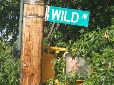
Joseph Wild invented the process for making inlaid linoleum (a process involving rolling ground cork and oxidized linseed oil) in 1874 when he was superintendent of the American Linoleum Company in Travis. A neighboring avenue is named Melvin for the longtime supervisor of the company, David Melvin.

PS 26 was built in 1880, when the area was called Long Neck, and finished in 1896.

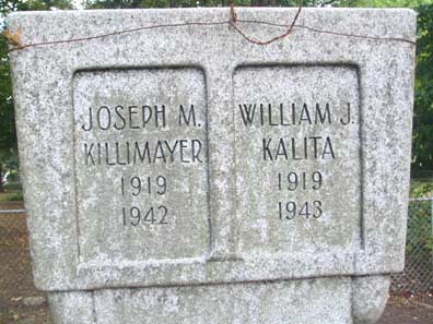
Travis’ World War II memorial across the street from St. Anthony of Padua on Shelley Avenue and Victory Blvd. NYC claims hundreds of small war memorials like this one.

St. Anthony of Padua Roman Catholic Church (1908)
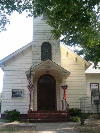
The interdenominational Staten Island Christian Church, Victory Blvd. and Church Avenue

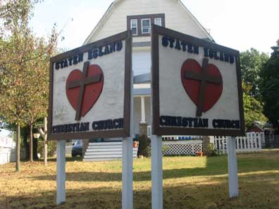
SI Christian Church was built in 1871 as the Dickinson Methodist Church at a cost of $3000. It was sold to SI Christian in 1974.
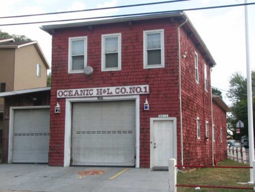
Travis, like Broad Channel in Queens, has a volunteer fire department, Oceanic Hook and Ladder, built in 1881 at Victory Blvd. and Burke Avenue. Staten Island’s other volunteer fire department is in Richmondtown.

As we’ll see, Travis is chockfull of dead-ends and alleys such as Towers Lane, at left.

Wicked pickets on Victory Blvd.
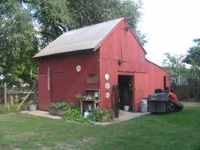

Travis’ rural past is evident in the pocket farms, complete with barns and chickens, found in backyards of some of its homes, like this one at Victory Blvd. and Cannon Avenue.
Arleen McNamara Brahn recalls in the winter 2000 Staten Island Historian:
My family moved to Travis in the summer of 1945. Our house was a large farmhouse built over 100 years before, with four acres of property, at 3920 Victory Boulevard. Later it became McNamara’s Picnic Grove…
The property was overgrown and the house needed work but soon we were the proud owners of a goat, sheep, pigs, geese, ducks, rabbits, turkeys, chickens, cats, dogs and a donkey named Cybil. In addition to our menagerie, the area was host to garter snakes, hawks, bats, owls, box turtles, rabbits, opossums, toads, all kinds of birds and my favorites, pheasants. They would walk right up to the house.
Soon we had swings, a slide and a seesaw. John Steckelman (Yonk), who made a living cutting and selling salt hay, which grew abundantly on Staten Island marshes, plowed our land and the gardening began. My mother planted a huge garden herself and tended to it daily. My grandfather and uncle had another garden. They grew tomatoes, peppers, cabbage, green beans, lettuce, eggplant, watermelon, white corn, carrots, sweet potatoes, peas and rhubarb. The vegetables were planted for our own use, but we did sell strawberries. Also, corn was planted to feed the chickens and animals.
Every meal included homegrown vegetables, and we ate lots of hearty soups, chicken and eggs. Mom’s pots were cast iron (they looked like cauldrons). They were too heavy for me to lift, but I dreamed of the day when I would be able to.

But all too soon, the rout was on. Mrs. Braun’s family sold half an acre to the City for a landfill project in 1947, and the first garbage scows arrived via the Arthur Kill the following year. In time, Fresh Kills Landfill, just to the south of Travis, would become the world’s biggest garbage dump.
ABOVE: The landfill, a high mountain with a thin skin of soil and vegetation, looms over Beresford Avenue.
The landfill was closed during the Giuliani administration, except for a brief period after the 9-11 attacks; at present, it’s slated to become a park.
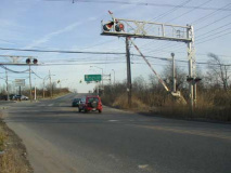
Travis, at present, is the site of Staten Island’s only freight railroad, the Travis Branch of CSX. It runs from Howland Hook in Mariners Harbor south along the Arthur Kill and serves New York Container Terminal at Howland Hook, the Department of Sanitation’s Fresh Kills Transfer Facility, Visy Paper and VanBro Corp.
The city intends to reactivate the North Shore line of the SIRT which runs from Howland Hook to St. George, not for passenger traffic, but for freight. The line connects to RRs in New Jersey via a recently reactivated bridge crossing the Arthur Kill from Mariners Harbor.
ABOVE: The Travis Branch crosses Chelsea Road near the West Shore Expressway.
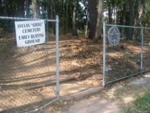
Sylvan Cemetery
This green triangle at Victory Blvd. and Glen Street reflects both the town’s past and the inescapable realities of urban living today.
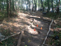
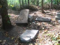
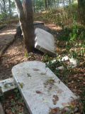
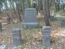
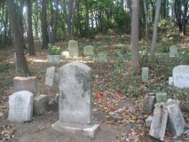
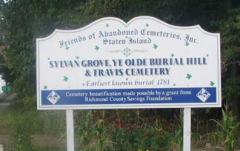
Perhaps no other extant cemetery in NYC has been as affected by vandalism quite as much as Sylvan, or Grove, Cemetery, though it is in much better shape than when I first saw it in 1999. It has been stabilized by Friends of Abandoned Cemeteries.


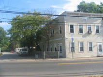
Travis substituted for the rural Kansas of the 1920s when Splendor in the Grass, the 1960 weepie starring Natalie Wood, Robert Wagner and Warren Beatty, was filmed here in 1960; some key scenes were filmed on Victory Blvd. just outside the cemetery. Some of the houses on Victory Blvd. seem unchanged since then…


A massive mall, Showplace Center, has been constructed at Victory Blvd. and the West Shore Expressway; it has siphoned off traffic from businesses on the boulevard, though a few mom and pop shops and pizzerias remain, as well as Hair to Dye For.
Across the Expressway
After Victory Blvd. crosses the West Shore Expressway you see some of those roadside signs that used to be all over the island, but are now relagated to this far off post. They ain’t Burma-Shave caliber but they’re still funny, especially the juxtapositioning.

In Travis, they will obey…otherwise…

…they’ll get stuffed!
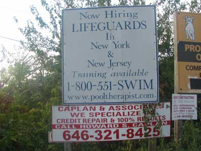
You used to be able to swim the Arthur Kill. These days, you can just walk across.
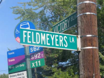
The name’s longer than the alley. Feldmeyer’s Lane is where you will find Vincent’s Automotive, here since 1916.
In length, though, the name is far from Staten Island’s longest in letter-per-alley ratio. In Rosebank, several miles to the northeast, we have Kaltenmeier and Shaughnessy Lanes.

Crabb’s Lane doesn’t make most maps. A previous yellow and black Crabb’s Lane sign can be found at, where else, the Waterfront Crabhouse in Long Island City.
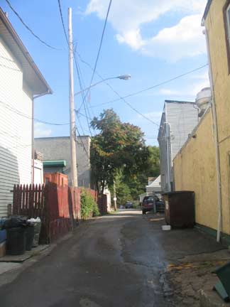

A stroll up Crabb’s Lane (a feat probably not accomplished by anyone who doesn’t actually live on it) reveals a slight bend to the south on which you’ll find a bungalow-style house and a couple of ancient wagon wheels.

Looking down Crabb’s Lane, you have a view of the massive Con Ed facility. From 1873-1931 this was the site of the American Linoleum Company, and from 1941-1955, Richmond County Airport; then Con Ed took it over. Crabb’s Lane has seen a lot.
Crabb’s Lane was probably not named for this guy, who spells his name with a K. (Like me.)
South of Wild Avenue, which curves around to meet Victory Blvd. again south of the expressway (it was where the American Linoleum Company built housing for its workers in the early 20th Century) Victory Blvd. runs through the rushes and peters out at the Arthur Kill. It’s a dead end now, but in the colonial route it was an important route to New Jersey and Philadelphia via ferry.
This page was photographed in September 2005 and completed March 11, 2006.
erpietri@earthlink.net


