Hunters Point is a community in Queens on the edge — in more ways than one. It sits on the extreme western edge of the borough, just across Newtown Creek from Greenpoint (mystifyingly, both pedestrian crossings to Brooklyn were severed in the middle of the 20th Century) and can be said to be on the edge of Manhattan–Midtown is tantalizingly close, just across the East River. That very edge, with its Manhattan views, is now being developed and massive high-rise towers (Queens West and other communities) are rising to take advantage of the spectacular location. But will this shift in neighborhood, character and income drastically affect the Hunters Point that has lay seemingly dormant for decades? Time will tell. Meanwhile today we’ll take a look at just a few of Hunters Point’s secrets…and see if they will last.
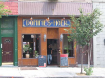
Dominie’s Hoek (Hook), originally the western end of the town of Newtown, was originally settled when a tract of land was awarded to Everard Bogardus, a Dutch Reformed minister (dominie), in 1643. The land was later owned by British sea captain George Hunter and by 1825 had become known as Hunter’s Point. It began the transition from rural farmland in the 1860s when the Long Island Rail Road built a terminal that would be its primary connection with Manhattan until the East River tunnels and Pennsylvania Station were built in 1910.
LEFT: Dominie’s Hoek, 48-17 Vernon Boulevard
Other Hunters Point bars [New York]
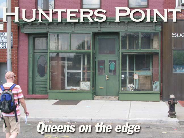
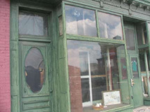
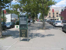
I began a walk in Hunter’s Point at the wide Vernon Boulevard mall, between 50th and Borden Avenues. The Queens Midtown Tunnel is directly underneath. I seized on a storefront that seemed to be unchanged and unaffected for decades.
In the display window are objects that once were shoes.
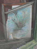
Faded painting with a cracked frame, and a flower basket. Can an old time Hunters Pointer tell me what went on here?
ForgottenFan Laura Ciavarella-Sanchez: The store front you asked about used to be an antiques shop. The windows were usually filled with unusual items which my siblings, friends, and I used to look at and think it was just “old stuff.” I never remember seeing anyone going into or out of the shop; it always seemed to be closed! The shoes are probably holdovers from the “Murray’s Space Shoes” shop that was next to the antiques store. The shoes were made there and there was always a display of them (very ugly) in the window.
As we’ve said, Vernon Boulevard widens considerably from 50th Avenue to Borden Avenue and gains a concrete mall. The reason is that this spot has formerly been the location for a succession of bridges that crossed Newtown Creek from Hunters Point to Greenpoint, the first built in 1840 by the Ravenswood, Hallett’s Cove and Williamsburg Turnpike and Bridge Company (that also constructed Vernon Blvd. along the shoreline). In 1903 that bridge was replaced by a swing bridge across the creek, but the bridge was doomed when the Pulaski Bridge was built in 1954. Earlier the Kosciusko Bridge had spelled the end for Penny Bridge, which connected Meeker and review Avenues.
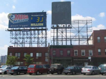
RIGHT: huge billboards on Vernon Blvd. Mall for the benefit of Queens Midtown Tunnel traffic.
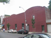
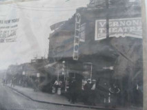
On the east side of the Vernon Blvd. Mall at 10-10 50th Avenue we find the vestiges of the Vernon Theatre, a small (550-seat) second-run picture house that opened in 1922 and lasted a few decades. photo top left courtesy Bernard Ente.
I found the picture top right mounted on a utility pole; perhaps the remains of an art project.
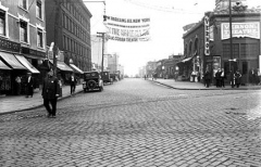
Check this photo for a look at 50th Avenue (then called 4th Street) toward the East River and the smokestacks of the LIRR powerhouse that were removed in 2005 as the building converts to luxury condos. Playing at the Vernon is “What’s Wrong With the Women?” with Hedda Hopper, the future gossip columnist, in a supporting role.
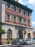
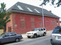
The three-story neo-classical 108th Precinct Police Station was built in 1903 on 50th Avenue west of Vernon Blvd. in a flamboyant baroque style. It continues to serve its original use and is one of the most architecturally significant buildings in the area. Community Archeology
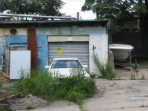
What were perhaps the stables are adjacent on 50th Avenue.
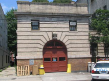
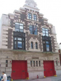
The FDNY is not to be outgunned in Hunters Point. Engine 258/Ladder 115, at 10-40 47th Avenue near Vernon, features a stepped Dutch gable. It was designed in 1903 by Bradford Gilbert, who was more noted for building railroad depots.
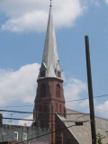
The steeple of St. Mary’s Roman Catholic Church, which dates to 1887 and was built by renowned church architect Patrick Keely. Vernon Blvd. at 49th Avenue. It is the third church on the site; cinders from the LIRR powerhouse burned down its predecessor.
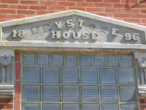
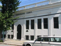
A smattering of 49th Avenue scenes: Mutual Hardware, now apartments; the 1892 Keystone House; Central Time Clock; and a backyard boat.
The Long Island City Long Island Rail Road terminal was once one of the city’s busiest, as it was the LIRR’s closest approach to NYC before Pennsylvania station and the East River tunnels were completed in 1910, as ferries brought patrons to Manhattan from the terminal. The old station house, the powerhouse minus its smokestacks, and sidewalk grate still attest to the railroad’s presence. The LIRR still makes a few runs per day to the terminal. 2nd Street between Borden and 51st Avenues.
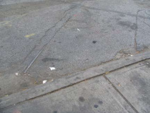
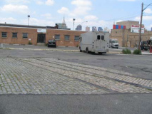
Hunters Point was also a trolley terminal, as many lines converged here leading to Manhattan ferries. These remnants are on Vernon Blvd. and 50th Avenue (left) and 54th Avenue near Vernon (right, near the old Fink Bakery “Fink Makes Good Bread”)
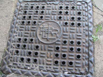
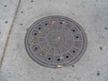
Can this Vernon Blvd. manhole be from 1874? The grate says it is.
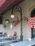
LEFT: shortie bishop crook lamppost at a favorite FNY location, the Waterfront Crabhouse, 2nd Street and Borden Avenue. There has been a restaurant/bar/hotel here most years since 1881, when Tony Miller built a riverside roadhouse. Full story on FNY’s Bar Some page.
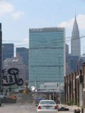
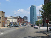
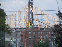
Hunters Point allows sights of some prime NYC real estate: The Queensboro Bridge from Vernon Blvd.; the Citigroup tower as seen from Jackson Avenue, and the UN Secretariat Building and the Chrysler Building from 5th Street (as well as the entire panoply of East Side and Midtown skyscrapers).
Toward the center of the Citigroup photo note the brick building just below the cloud: theHackett Building was razed early in 2007.
Below right, note the giant neon Pepsi Cola sign. It originally marked the site of a Pepsi bottling plant and was first installed in 1936.
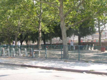
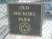
Former Parks Commissioner Henry Stern was having a little fun with us when he named the small park at Jackson Avenue and Vernon Boulevard “Old Hickory Park.” “Old Hickory” was the nickname of the USA’s 7th President and War of 1812 hero Andrew Jackson; however, Jackson Avenue was not named for him but for the road’s builder, John Jackson, who created the road as a tolled turnpike from the East River across Trains Meadow (now Jackson Heights) to Flushing in the 1850s. The road is known as Jackson Avenue and Northern Boulevard.
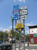
SIGNS indicating Rte. 25A (Jackson Avenue) and I-495 (the Long Island Expressway) and the Queens-Midtown Tunnel, also I-495.
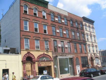
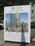
Days of future passed: 50th Avenue buildings across from the old Vernon Theatre, and a rendering of a new riverside residential tower.
photographed July 2006; page completed August 30, 2007
erpietri@earthlink.net
©2007

