March 2008: Believe it or not we’re beginning to consider Forgotten NY in terms of decades. Your webmaster first conceived of FNY in 1998 and did a lot of principal photography that year (I’ve discarded much of that work because I was just starting out then, had no photography experience, and a good deal of it was unusable). Still I knew I had a good idea and the fact that I’m still at it 10 years later, and will be at it as long as I am able to do it, speaks to the worthiness of the project, as far as I’m concerned. FNY’s value has been reinforced the last few years as many of our older buildings and sites have been plowed under in overdevelopment mania. You can’t root for a recession (I need to work) but it seems only that can halt the madness.
Broad Channel was one of my first destinations when I was conceiving of the FNY category You’d Never Believe You’re in NYC. Here is an island in the middle of Jamaica Bay, seemingly a part of New York only reluctantly; it has more in common with Nassau County communities like Island Park than any other NYC neighborhood: I was drawn to its other-ness. The locations I describe in the YNBYINYC category gain their other-ness precisely because they can be contrasted with the rest of the five boroughs’ urbanity.
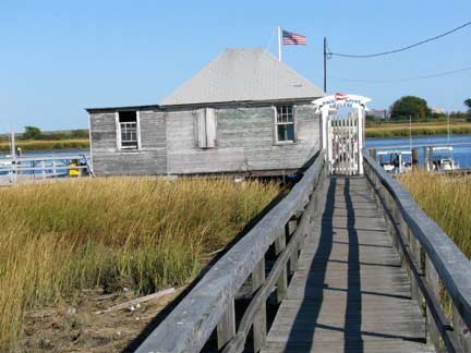
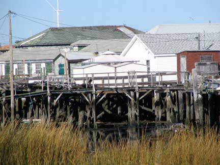
East of Cross Bay Boulevard between East 10th and 14th Roads there are houses built on stilts over an inlet of Jamaica Bay (also known as Broad Channel). Above: East 12th Road
Broad Channel is the province of seagulls, roaring jets taking off from Kennedy Airport, The Jamaica Bay Wildlife Refuge, and a proud, insular neighborhood. Unlike many NYC mainland neighborhoods (such as Glendale, Laurelton, Marine Park or Throgs Neck, it features a subway stop. Cross Bay Boulevard is the main artery and carries traffic between Broad Channel and the mainland, as well as the Rockaway peninsula. Many Broad Channel families have been there for two or three generations, since the island began to become populated in the 1880s. The island remains the only populated island in Jamaica Bay.
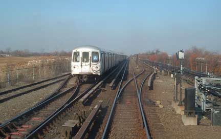
IND 8th Avenue Line A train approaches Broad Channel. The Jamaica Bay run of this line resembles no other NYC subway, be it on an elevated structure or tunnel. The route was purchased from the Long Island Rail Road in the 1950s, which had tired of constantly having to repair or restore the wooden trestle that spanned the bay since 1892, when it had first opened. The city purchased it from the Long Island for $8.5M and then spent $47.5M more to improve it, which included building a fireproof steel bridge; subway service began in 1956.
Earlier, the city had the opportunity to buy the LIRR Whitestone Branch in the late 1920s. The city declined, and the Whitestone line was abadoned in 1932. Photo: NYCSubway
Prior to about 1910 or so Broad Channel was primarily a haven for fishermen and birders, and also claimed some hotels for summer loungers. The area was was largely built up by the Broad Channel Corporation, which in the 1910s filled in marshes and rented parcels of land for $116 per year for anyone building a summer home in the area. Subway trains began crossing Jamaica Bay and stopping in Broad Channel in 1956. Until 1975, passengers were compelled to pay an extra fare upon exiting from stations in Broad Channel and the Rockaways, since the stations were so far away from everywhere else in the system. For many years, Broad Channel and three other stops along what was first the NY, Woodhaven & Rockaway Railroad, then the LIRR and lastly a part of the NYC subway system were shacks for fishermen. By the 1910s, however, Jamaica Bay began to be too polluted for any commercial fishing to be feasible.
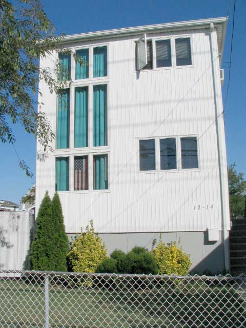
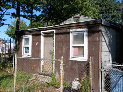
Two faces of Cross Bay Boulevard. New buildings shoulder up beside one-story fishing shacks.
The Roaring Twenties brought Prohibition and concurrent rum-running on the isolated island, which had no vehicular connection to the rest of New York City until Cross Bay Boulevard was built from 1923-1925. The boulevard is connected to Howard Beach by the Joseph P. Addabbo Bridge and to the Rockaway Peninsula by the Cross Bay Veterans Memorial Bridge. The Marine Parkway Bridge, later renamed the Gil Hodges Memorial Bridge for the Brooklyn Dodger first baseman and New York Met manager who lived in Marine Park, bridged the bay beginning in 1937.
When the Broad Channel Corporation went bankrupt in 1939, the City took title to all homes on the island; residents did not truly own their own homes until 1982, when “tenants” finally purchased the land from the City. Broad Channel did not have sewers until 1988 and is still protected by a proud volunteer fire department.
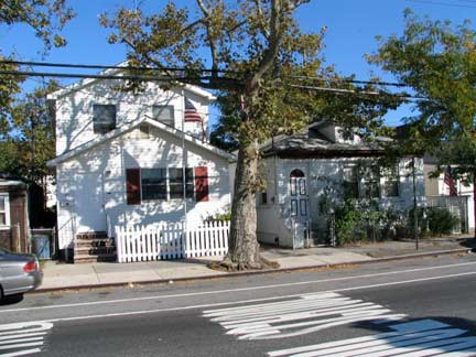
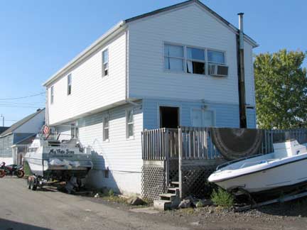
In Broad Channel you are as likely to find a boat or two parked outside as you are to find a car.
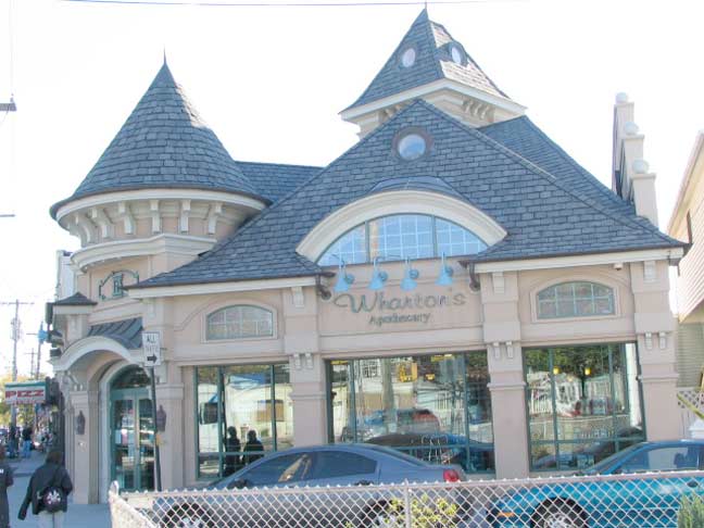
Wharton’s Apothecary, on Cross Bay Boulevard and West 9th Road, opened a few years ago and is Broad Channel’s only drugstore. There are delis and pizzerias but many Broad Channelers drive to Howard Beach or the Rockaway peninsula for provisions, gasoline, clothing and other necessities.
The building is a decent facsimile of the detailed styles favored in the late 1800s, and received an award from the Queens Chamber of Commerce in 2006. The interiors also continue the period feel.
There is no Wharton, by the way; owner and builder Charles Howard, a Channeler, called it Wharton’s Apothecary because he noticed that names of many great American companies – Wal-Mart, Woolworth’s, Waldbaum’s – start with the outsize letter W. [New York Times]
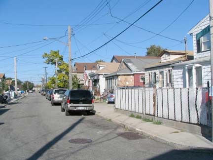
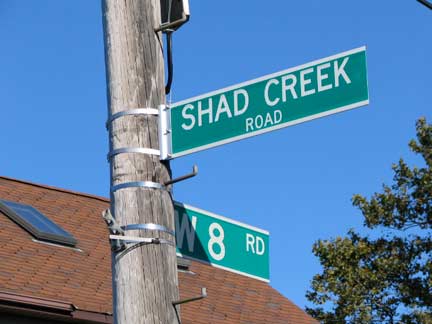
Shad Creek Road, which runs from Cross Bay Blvd. at 7th Road southwest to West 10th Road, is lined with pleasant houses and bungalows; nothing particularly interesting here, except that I wanted to show you a street in NYC called Shad Creek Road.
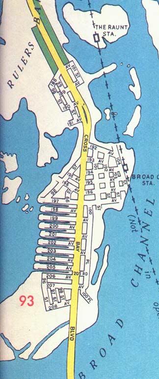
Broad Channel’s street map bears no relation to the rest of Queens, with the exception of Cross Bay Boulevard, which links it to the mainland. There are a series of East and West numbered streets from 1 to 22, with just a few named north-south streets in Broad Channel’s widest section: Church, Walton, Lanark and West Roads, and east-west Noel Road. Channel Road is sometimes shown on maps, by exists only in short dead end pieces. In the 1960s and 70s, some maps showed Broad Channel’s east-west roads as Avenues in the 190s and 200s (Howard Beach’s highest numbered Avenue is 165th) and I imagine the City wished to renumber BC to conform to the rest of Queens’ system, and do it as if there were intervening avenues in the middle of Jamiaca Bay! This plan never flew, and BC retains its unique system.
The map above shows Hagstrom’s rendition of Broad Channel in 1953. I cannot be sure if this system was ever adopted by Broad Channel; I suspect not. Note, also, the dotted line representing the LIRR; by then, the line was no longer running here, the City had purchased it and was rehabbing it, replacing the bridge over Jamica Bay, and service would resume in 1956. The Raunt (shown) and Goose Creek stations, open seasonally for fishermen, would close permanently and have left no trace today. map courtesy Skip Horner
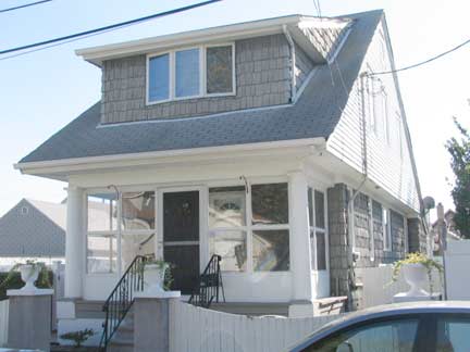
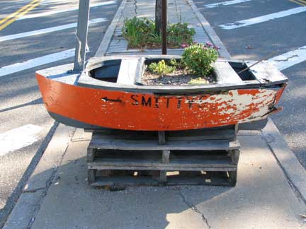
Jewel-box house on West 8th Road; Smitty’s sculpture, center median, Cross Bay Blvd. Smitty’s boat rental, bait-and-tackle shop, retail fishing and crabbing gear has been a Broad Channel institution for nearly 70 years.
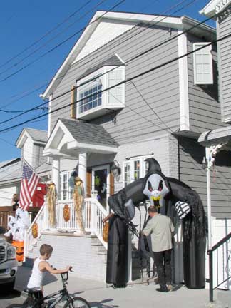
Church Road
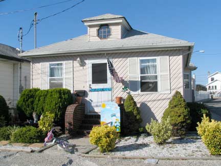
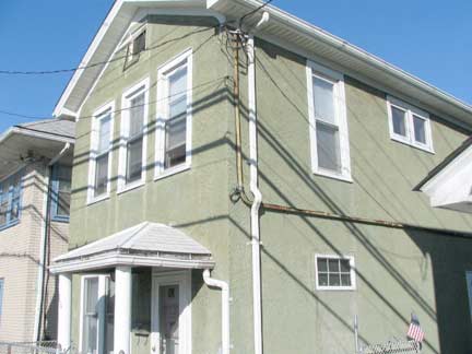
Bungalows, East 7th and Noel Roads. The photos are from September 29th, but Channelers were getting into the Halloween mood early.
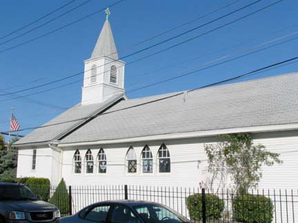
Broad Channel’s only two churches, Christ Presbyterian …
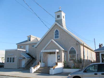
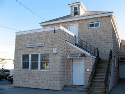
and St. Virgilius Roman Catholic, are only a half block away from each other on Noel Road (not Church Road as you might think; the road is probably named for the Presbyterian church). The Catholic church and school are refreshingly modest buildings dating to 1924.
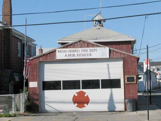
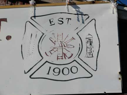
Some outlying NYC neighborhoods, such as Broad Channel and Travis, Staten Island, have their own volunteer fire departments. The BCFD, on Noel and Church Roads, has been in operation since 1905 (the sign says 1900, their website 1905) and has been run out of this firehouse since 1908.
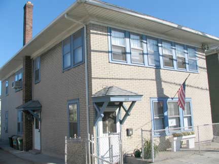
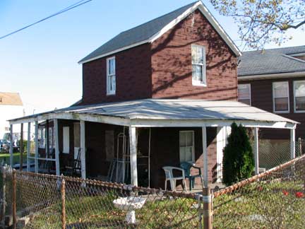
Two more of the many faces of Cross Bay Blvd.
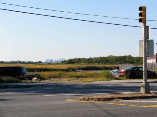
Midtown Manhattan appears as if in a far-away glimpsed, unattainable dream from Broad Channel.
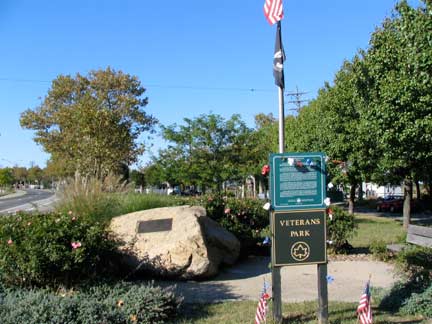
Veterans Park, center median Cross Bay Boulevard and 5th Road.
The park’s flagpole has a granite monument at its base dedicated to Broad Channel resident, veteran, and community activist George Riekers (1921-1996). Riekers joined the Army in January 1940, and served throughout the United States involvement in World War II, until October 1945. He attained the rank of Sergeant earning two Battle Stars, the Good Conduct Medal, the American Defense Medal, and the European African Middle Eastern Service Medal. Riekers brought Veterans of Foreign Wars Post 260 to Broad Channel. He served as its Commander several times, organizing food handouts and annual parades.
Riekers also served the American Legion Post 1404. As president of the Broad Channel Civic Association and United Community Organization, he was indispensable in negotiating the 1982 purchase of Broad Channel land from the city. As a member of Community Board 14, Riekers promoted the initiative that allowed for the installation of sewers in Broad Channel. In addition, he also acted as a substitute pastor and Sunday school teacher for the Christ Presbyterian Church by the Sea. [NYC Parks]
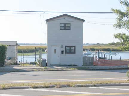
Lone house overlooks a Jamaica Bay inlet.
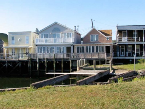
The fishing is easy from these bayside Broad Channel homes.
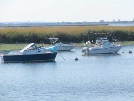
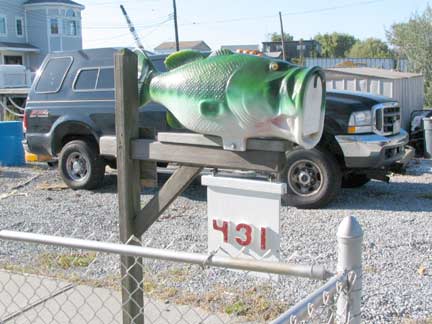
…but boats are always an option here. Street numbering in Broad Channel is sans hyphens, unusual for Queens; house numbers follow the street numbering from 1 to 22.
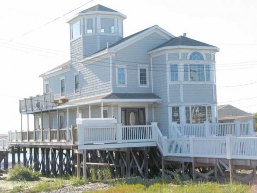
Magnificent home in northern Broad Channel complete with cupola which permits views of Manhattan and southern Brooklyn. Protecting such homes against winter nor-easters and summer storms must be expensive.
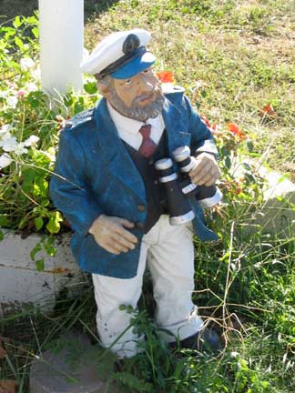
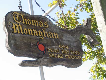
Some nautically themed home decoration.
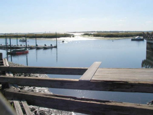
A view of Jamaica Bay, Rulers Bar (foreground) and the Marine Parkway-Gil Hodges Bridge (in the distance).
Photographed September 29, 2007; page completed March 16, 2008
erpietri@earthlink.net

