Back in June [2010] I was dazedly puttering around the Middletown and Pelham Bay neighborhoods in the northeast Bronx, the kinds of New York City areas the AAA Guide or Time Out New York choose to ignore. Yet, thousands of people live and work there and these neighborhoods have their own histories, stories and their own set of artifacts. There was one small wedge of Pelham Bay I didn’t show you on the page linked above, lying between the Hutchinson River Parkway, Pelham Parkway, and Westchester Avenue, the subject of today’s page.
While Pelham Bay Park is huge — New York City’s largest park by acreage as a matter of fact — there’s no actual Pelham Bay. The park, and the various Pelhams and Pells found on town names and street signs in the northern Bronx and Westchester regions — all come from one man, colonial-era landholder Thomas Pell, whose descendants’ mansion still stands in the park. The park borders on Eastchester Bay.
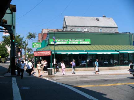

Where was I? At Crosby and Westchester Avenues, where several years ago I had an excellent lunch at George’s Restaurant, not to be confused with the George’s Restaurant on Coney Island Avenue in Kensington. Both serve diner fare, which I usually indulge in 2-3 times per month. In fact, I cannot recall the last time I was in a really fancy restaurant. It’s been years. Green is the colour in the area, as George’s is drenched in green as is the BP gas station across the street (lotsa business that day, not) and even the el trestle.
Westchester Avenue, formerly Westchester Turnpike, once ran from the Hub only to Westchester Square, once the seat of a separate village. When the IRT Lexington Avenue El was rammed through on its way to Pelham Bay Park in 1920, Westchester Avenue was extended along its route. As we’ll see, it absorbed a couple of older roads on the way.

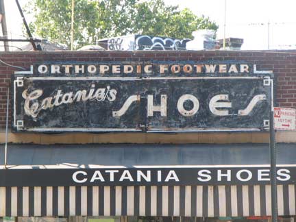
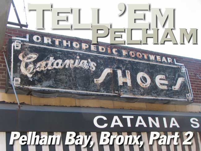
3015 Westchester Avenue across from Buhre: I have already showed you the glorious Catania Shoes 1940s-era neon sign on the Westchester Avenue page linked above. What I don’t know is if it lights up at night. Can any Pelham Bay Parkers tell me?

Used to be, the word “Knickerbocker” was slapped on everything in New York, to produce overall pride or sell products. There was a Knickerbocker Trust Company, Knickerbocker Beer, and of course, the New York Knickerbockers, who, as of 2010, have been toiling through moribundity for over a decade.
Part of it may be that the word Knickerbocker is fun to say. (Well, I think so, anyway.) In Dutch the word can be roughly translated as “marble baker” (an artisan, not a maker of marble cake). Washington Irving wrote his satirical History of New York under the pseudonym Diedrich Knickerbocker, and the word, and its derivatives, have been slapped on myriads of things; knickers (man’s pants that end at the knee in the USA, women’s panties in England); ice cream sundaes are called Knickerbocker glories in England; there are hotels, clubs and roads called Knickerbocker all over the USA and not just in NYC.
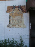
In the late 19th and into the mid-20th Century, a kindly-looking white-haired Dutchman in buckled shoes, breeches and tricorn hat represented New York in advertisements, magazine articles, and other light hearted fare (I’ve seen him turn up on Hagstrom Maps from the mid-1900s). This was Father Knickerbocker, the personification of NYC as was the crotchety Uncle Sam and England’s bluff John Bull. You saw him on Knickerbocker Beer ads, and you see him here on this faded Knickerbocker Bank ad.
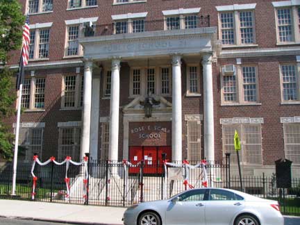
Rose E. Scala School, PS 71, 3040 Roberts Avenue between Jarvis and Hobart. Bunting from June graduation is still festooning the front gate. Rose Scala (1908-2005) was the longtime principal of PS 71.


The Bronx is the Borough of Apartment Buildings,especially along subway or el lines. Here are two magnificent (on the exterior at least) examples of the genre on Roberts and Jarvis and Hobart.

I’m a map foamer. As a kid, and well into adulthood, I purchased dozens, perhaps a couple of hundred, maps of cities all over the USA and Europe — many cities I’ll probably not ever get around to visiting. It didn’t matter to me because I have always been esthetically attracted to maps, with their bright colors, thick red and yellow lines, and precise lettering. (New computer generated maps like Google’s don’t hold quite the interest for me, though I do have them). As part of my obsession I would concentrate and memorize street patterns. For example I know instinctively that Avenue D and East 35th Street has to be in a different part of Brooklyn than say, 17th Avenue and 84th Street is. The Philadelphia street layout, for example, makes no sense at all until you look at a large map and see what the original surveyors were trying to do.
Why bring that up now? Look at the two circled areas on this Google map excerpt of the Westchester Square and Pelham Bay areas. Roberts Avenue is fairly unique in that it has a short section in Westchester Square as well as in Pelham Bay. When it was first laid out, Westchester Creek, which now runs underground here, separated the two neighborhoods; now it’s the Hutchinson River Parkway. Which raises the question, why? Was Roberts Avenue originally meant to have more importance than it does now? (4 other roads span the two neighborhoods: Bruckner Boulevard/Expressway, Westchester Avenue and East Tremont Avenues, which are major thoroughfares, and Waterbury Avenue, which I’ll have to research more.) And, Morris Park Avenue, until it was renamed St. Theresa Avenue, was found in Morris Park and Pelham Bay.
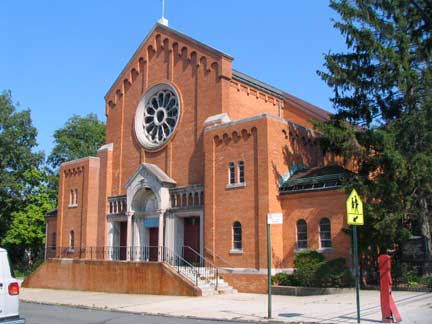
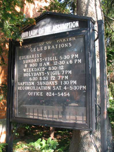
I was raised Catholic and am still proud of it. But if you’re not from the Catholic tradition, some of those church names can be head-scratchers. For example, there’s Our Lady of the Assumption at Roberts and Mahan. (Who is ‘our lady’ and what she is assuming? Heaven. In many Christian traditions, including Catholicism, Mary, the mother of Christ, is believed to have been taken, or “assumed” body and soul into Heaven at the end of her life.) Meanwhile, back on earth, OLA parish was founded in 1923 and its handsome orange brick chuch constructed in 1960.
One of these years I’m going to get a comprehensive photo collection of these stencil black and white message boards outside church. I love ’em. Like movie marquees with movable letters, they’re throwbacks to a previous era.

As a rule I disdain modern-day housing complexes, since they’re either shoddily designed or stultifyingly boring, but I had a soft spot for Waterbury Estates, in the trianngle formed by Middletown road, Jarvis Avenue, and Bruckner Boulevard. (Perplexingly it’s several blocks away from Waterbury Avenue). The 47 homes on the site were originally priced at $800K and many sell for half that now.
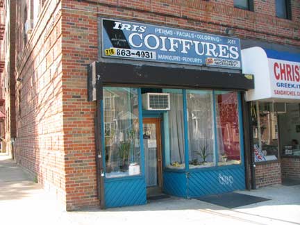
Great hand lettered sign at Middletown Rd and Mahan Avenue.
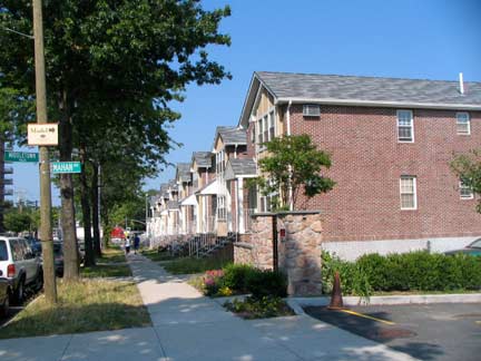
I suspect Mahan Avenue is pronounced ‘Mann” but I could be wrong.
May-han, I hear.

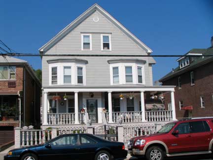
Mahan Avenue scenes between Buhre and Westchester Avenues. Light brown brick Jewish Center of Pelham Bay, left, and one of the older porched homes.
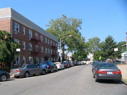
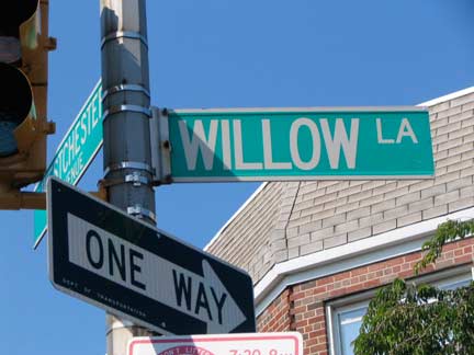
Willow Lane, which runs east from Westchester and Mahan Avenues and then turns abruptly southeast for a block before merging with Bruckner Boulevard, is one of Pelham Bay’s older roads; in fact, it was once one of the major roads in the area. It one assumed all of Bruckner Boulevard’s present route southeast into Throg(g)s Neck, was widened and renamed Eastern Boulevard shortly after 1900, and finally Bruckner Boulevard in 1942. This small piece was left over, and renamed Willow Lane in 1927 after several years as Becker Street.


Normally I wouldn’t highlight the outwardly nondescript Pelham Bay Home Center, 3073 Westchester, with the generic vinyl awning sign, but I noticed another sign on the wall near the door. A few decades ago, Paul McCartney met a meter maid he rather liked.

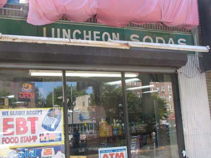
Getting dry, I went into the grocery at Westchester and Buhre for a Snapple® and noted that while its sign was being replaced, the store’s former role as a soda fountain was revealed. In the 1930s and onward, the local soda fountain replaced the general store as a place to get sundries; normally, you wouldn’t associate stationery, or writing paper (so called because the paper stays in one place while the pen moves) with lunch counters, ice cream, and soda. Then again, decades ago, many drug stores contained soda fountains, and I wouldn’t associate Band-Aids® and Vicks Vapo-Rub® with hot fudge sundaes.
ForgottenFan Toni Wheeler: Originally the term “stationery” referred to all products sold by a stationer, whose name indicates that his book shop was on a fixed spot – usually near a university – and permanent, while medieval trading was mainly ambulant – by peddlers (including chapmen, who sold books) and others (such as farmers and craftsmen) – at non-permanent markets such as fairs. So, it’s the shop itself that stands still, not the merchandise per se.

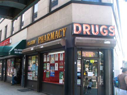
Pelham Bay remains a majority Italian neighborhood, and restaurants and bakeries are sprinkled around. The wedge formed by the corner of Westchester, Buhre and Edison Avenues is occupied by Pilgrim Pharmacies, taking its name from Pilgrim Avenue, one block to the west. As we’ll see below, streets in the area were named relatively early (around 1900) in honor of the settlers of the Plymouth colony, with Pilgrim, Puritan, Mayflower, and Bradford Avenues.
Yore Blues

I took an interest in Yore Butchers on Crosby just south of Westchester Avenue…
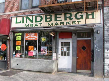
because I know there is another Yore Butchers, or Yore Meat Market (originally the Lindbergh) on Fort Hamilton Parkway, Brooklyn, between 71st and 72nd Streets (right). What are the chances two butcher shops would be called “Yore”? Do they have the same owner?

Before proceeding further on the tour, let me show you a 1900 Hyde map of the Pelham Bay neighborhood we’re in. (The black box at the right bottom is a thumbnail that was in the screen shot I got from the David Rumsey Map Collection — the entire Bronx map can be viewed here.) So, we’re at Westchester and the NW corner of Buhre, which on the present map would be at the “P” in Pelham (below Amsterdam). Willow Lane and Middletown Road were already in place then, as were the Plymouth colony-themed streets. Buhre Avenue was then called “Libby Street” (see below) and Pelham Road, which was the main highway in the colonial era, is now Westchester Avenue but also encompassed Buhre Avenue as well.
Note also on the triangle at Middletown Road, today’s Jarvis Avenue and (Eastern) Boulevard is inscribed “K.A. Waterbury.” This is the site of the present Waterbury Estates, seen above. We do know that there were Waterburys in the area in the colonial era, and Waterbury Avenue, several blocks to the south, was named for them.
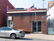
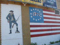
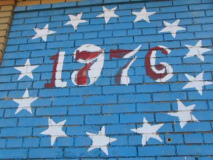
Along Buhre Avenue (and again, pronunciation please? I’m guessing “Byoor”) you can be un-selfconsciously patriotic. There’s the Lawrence F. Keane American Legion Post 1498, and a 1776-1976 mural. I wonder if this has survived intact from 1976 to 2010 without touchups along the way.
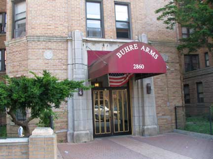

I looked to the right to Buhre Arms. There, I said it. A fab Deco apartment building between Pilgrim and Mayflower. RIGHT: 18-story apartment tower at Buhre and Mulford. It looks west toward Morris Park and beyond.
When It Says Libby’s Libby’s Libby’s
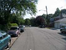
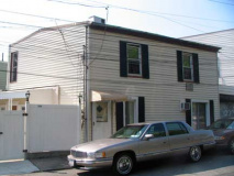
As mentioned earlier, Buhre Avenue used to be called Libby Street. There’s still a very short street called Libby Place running between Buhre and Mulford and the Hutchinson River Parkway. This short street, along with stretches of Buhre and Westchester Avenues, were once part of Pelham Road, a colonial-era road running through the countryside. Libby Place still retains touches from a previous era, such as no sidewalks in spots, bluestone sidewalks in others, and salt box houses that look old even though they’re covered in siding these days. The name could refer to a 19th Century landowner, Elizabeth Cornell, whose friends might have called her Libby. I think Elizabeth and Margaret are tied for having the most pet names.


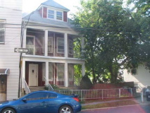
Sample houses on Mulford — I especially liked the brickwork on the right, especially the entrance staircase. While shooting the building at right, I heard a woman’s voice with the familiar “Can I help you?” (Translated: “Put that camera away, asshole.”) If pressed I would tell her I was taking pictures of houses on her block, I am protected by the First Amendment, and inquire what problem she has with this. Politely. And give her my card.

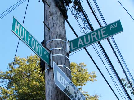
You’ve seen Libby. You might like her sister, Laurie. Laurie Avenue runs one block between the Hutchinson River Parkway and Mulford north of Buhre. According to Bronx historian the late John McNamara, the street is named for a Revolutionary War-era landowner, Mildred Laurie, nee Paul. General Washington’s staff billeted at the Laurie farm.
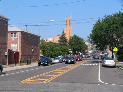
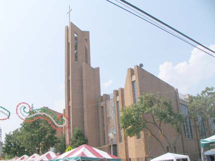
Mulford and St. Theresa Avenues, and the modern St. Theresa Church, erected 1970. From my Westchester Avenue page:
The Bronx has a number of streets that turn up where you wouldn’t expect them. While Morris Park Avenue runs through its titular neighborhood, there used to be a second section that ran for a few blocks in the Pelham Bay-Middletown area. It’s unknown why this section, formerly known as Liberty St. and Alice Avenue, was renamed Morris Park Avenue. In any case, in 1968 Morris Park Avenue became St. Theresa Avenue in honor of the parish it runs past. St. Theresa was founded in 1927 and the existing, modern church dates to 1970.
In the Roaring Twenties, Pelham Bay was far from the heavily populated, suburban neighborhood it is today. Indeed, the Bronx itself had only recently seceded from Westchester County and become part of New York City. Farmland covered much of what we now know as Mulford, Mayflower, Pilgrim and Wilkinson Avenues. Where now prominently stands 1950 Hutchinson River Parkway was a water-logged swamp with a meadow and dirt road running through it. One house stood where Hutchinson River Parkway now meets St.Theresa Avenue. A chicken market occupied the area where Mulford Avenue meets Wilkinson Avenue and the area between Pilgrim Avenue and Mayflower Avenue hosted goat farms. St. Theresa Parish
Back to the Bronx soon!
6/18/10

