Almost ten years ago, I walked Jamaica and shot a number of photos on curving Beaver Road, which skirts the northern edge of Prospect Cemetery before making an unusual curve southwest to 150th Street. I was vaguely aware that it defined the edge of a now-filled in pond, and when I went to research the pond, I found that FNY Correspondent Sergey Kadinsky had already done the legwork — so I’ll turn the matter over to him before I start rattling on ad infinitum.
By SERGEY KADINSKY
Forgotten NY correspondent
The most forgotten body of water in Queens helped develop arguably one of its its most important neighborhoods — Jamaica, home of the borough’s Central Library, its biggest train station, and a series of court houses. Beaver Pond lies forgotten beneath an industrial park on the neighborhood’s south side.
The industrious beaver is New York’s historical state animal. It brought riches to the Dutch colonists, who placed the creature on the seal of New Netherland, and a street in downtown Manhattan. The beaver also appears on the Astor Pace subway station. The Astor family became wealthy through beaver fur.
The beaver’s age can also be related to my alma mater, as it is the official mascot of the oldest public college in the state, the venerable CCNY.
CCNY picked the Beaver first, but here are some other campuses that share this mascot:
- Babson College (Wellesley, Massachusetts)
- Bemidji State University (Bemidji, Minnesota)
- Blackburn College (Carlinville, Illinois)
- Bluffton College (Bluffton, Ohio)
- Buena Vista University (Storm Lake, Iowa)
- California Institute of Technology (Pasadena, California)
- Champlain College (Burlington, Vermont)
- Massachusetts Institute of Technology, (Cambridge, Massachusetts)
- Minot State University (Minot, North Dakota)
- Oregon State University (Corvallis, Oregon. Their mascot is also named Benny)
- University of Maine at Farmington (Farmington, Maine)
The beaver is also found on Canadian currency. How many other mammals can build such extensive homes, and dam streams?
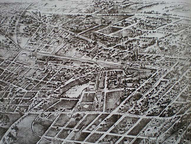
This 1850s image shows downtown Jamaica’s street grid, which has changed little since then. Cutting across the center of the image is the Long Island Rail Road. Beaver Pond can be seen in the left center.
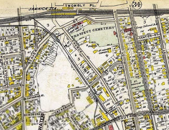
By 1909, the pond was drained by the city, but the local streets have not yet been assigned numbers. Water Street ran atop the pond’s outlet, Baisley Creek, which ran south to Jamaica Bay. The Prospect Cemetery has been on the map since the colonial days. This is from the 1909 the G.W. Bromley real estate atlas.

Before the railroad arrived in 1834, the pond was an integral part of the village, which was founded as Rustdorp in 1656. The “Road to Hempstead” was the old name for Jamaica Avenue. The road on the left of the pond is Beaver Road, and it leads south towards the Rockaways.
Not only did the pond contribute to the village’s early growth, but its native name, Jameco, was corrupted to Jamaica, making it the namesake for the neighborhood. The name Rustdorp simply did not catch on. In 1683, it became the county seat of Queens.
{Recent scholarship suggests that Jamaica, Queens is indeed named for the Caribbean island; both were once under British control.]
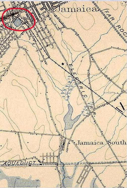
Baisley Creek emptied out of Beaver Pond, running south to Baisley Pond, which still exists today. From the pond, the stream continues as Cornell’s Creek, emptying out into Jamaica Bay.
The Electric Railroad on this map is a streetcar line that later became Guy R. Brewer Boulevard. In the postwar years, the streetcars were replaced by the Q111 and Q113 bus routes.
The Aqueduct line on the bottom brought water from Long Island to Brooklyn. It later became Conduit Avenue, and formed the right of way for Belt Parkway. The name Aqueduct was preserved on the horse racing track in South Ozone Park.
Land south of the Aqueduct became the Idlewild Golf Course in the early 20th century, and an airport in 1947. It was renamed after President John F. Kennedy in Dec. 1963.
In 1668, the pond’s longest lasting neighbor, Prospect Cemetery, accepted its first burial. Since then, it has accepted revolutionaries, Civil War veterans, and members of local prominent families. The last internment took place in 1988.
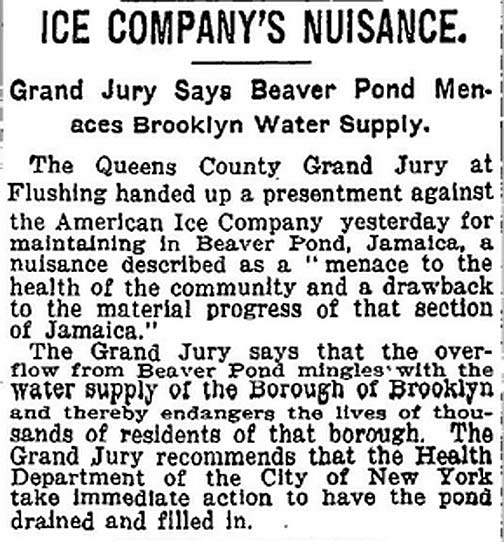
This April 26, 1906 NY Times article describes how an ice company’s use of the pond created pollution, and resulted in the pond’s burial.
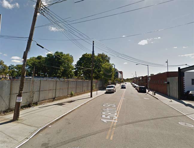
158th Street looking south from Beaver Road. This was once the eastern shoreline of the pond. Prospect Cemetery is on the left. Back in 1668, the cemetery was on the shore of the pond.

Between the Van Wyck Expressway and the Hillside Facility, the main branch of the LIRR widens to almost ten tracks, acting like a Chinese wall between the downtown Jamaica Center area and the seemingly forgotten South Jamaica. Between the Van Wyck Expressway and theHillside Facility, twelve tunnels breach this wall. The tunnel at the merge of Beaver Street and 150th Street still has patches of Belgian block showing up amid the asphalt. The city often neglects to pave over such long, dark underpasses.
This overpass may be old, but its design is smart- no rafters, therefore no pigeon droppings.
Because 158th Street was part of an earlier street plan, it runs northwest against the grid. Travelers going east on Archer Avenue, where 158th Street ends after exiting the tunnel, may be a bit confused to see that the next numbered street going east is… 153rd Street!

Beaver Road and 94th Avenue, at a Long Island Rail Road branch heading south toward Long Island’s south shore.
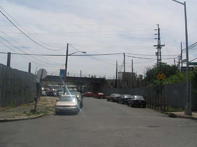
Beaver Road at its “official” beginning, at 158th Street looking west. East of here, Beaver Road is a private driveway running along the north end of Prospect Cemetery.
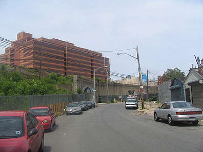
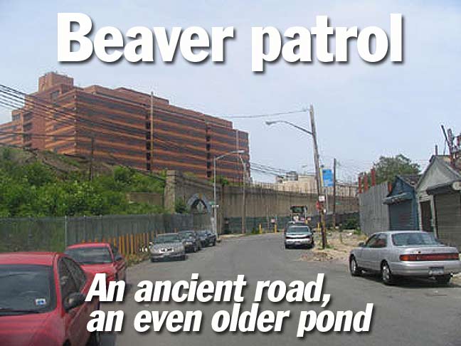
Here, Beaver Road makes a southwest curve along what was once the shoreline of Beaver Pond. This stretch of the road is lined with slaughterhouses, industrial parks and auto repair places. The photo is dominated by One Jamaica Center Plaza, an 11-story federal administrative building also known as the Joseph P. Addabbo Federal Building. It’s protected by bollards on all sides to deter terrorism.

In 2005 your webmaster found this wrought-iron sign above one of the Beaver Road iron works.

Curving Beaver Road, one of the most industrially oriented streets east of the Iron Triangle in Corona.
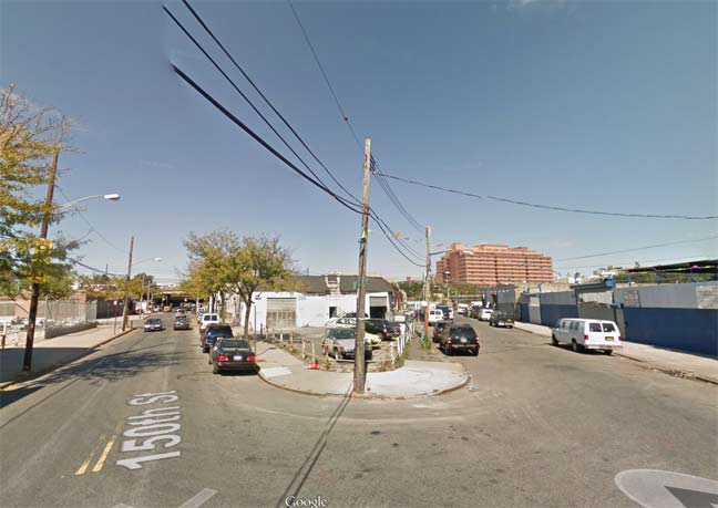
Beaver Road runs southwest until it meets 150th Street, shown at left.
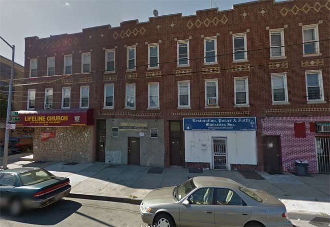
Across the street from the body shops and garages is a block of storefront churches at the junction of 150th Street and Beaver Road. Four in a row. No steeples or stained glass windows. The only signs of godliness here are within the congregants’ hearts. South of Beaver Road, 150th Street was once known as the Rockaway Turnpike, connecting Jamaica to the Five Towns area. A few blocks south, the old turnpike’s path is taken by Sutphin Boulevard, and then Rockaway Boulevard. After crossing the county line into Nassau, it regains the original Rockaway Turnpike name.
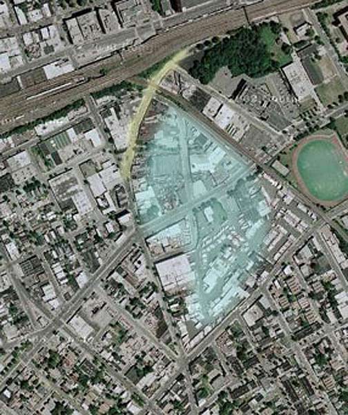
The namesake pond is in light green, and Beaver Road is in yellow, outlining its northern shore.
The historic Prospect Cemetery is in dark green at upper right.
7/15/14

8 comments
Talk about “a Chinese wall effect”: this is an apt description. For nearly 20 years my employer’s headquarters was in Gertz Plaza (162 St between Jamaica Ave. & Archer Ave.) Only once during that time did I venture south of the LIRR tracks (I was invited to a graduation ceremony at York College). The office was on the 6th floor & faced south, so I had a bird’s view of southern Jamaica but I never went there. The barrier formed by the tracks was so formidable that it seemed as if only the numerous dollar vans ventured south.
How did the ice company pollute the pond?
Excellent work by Sergey.
Sergey-Great Work. i have been researching groundwater in the vicinity of York College and Baisley Pond and the third map you posted with your research broke a logjam i was having wide open. could you tell me which atlas the map is from? i’ve tried to locate the map on-line to no avail.
Thanks again,
Doug
Bromley’s 1909 atlas has the dried-up outline of the pond.
I grew up in the Sixties not very far from Prospect Cemetery and the long-lost Beaver Pond. What a shame that, all because of the negligence of a stupid ice company, such a wonderful historic pond is no more. Thanks for all your wonderful research!
How did they build over the old pond. So sutphin blvd was a pond before the started to build there
Have you ever found any evidence of how the pond was fed? Any info on streams to the North of Beaver Pond, or a spring?