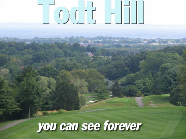
Todt Hill, Staten Island’s 412-foot tall mountain, is in the center of the borough and is at once wild, wide-open and untrammeled and manages, at the same time, to be one of Staten Island’s most exclusive and expensive areas…for people on both sides of the law. Join your webmaster as he climbs and ascends the hill between Clove Lakes and New Dorp…
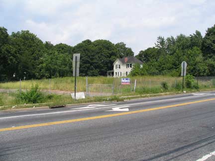
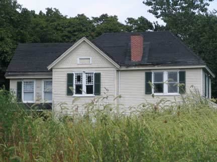
We begin at the NE corner of one of the busiest intersections in Staten Island, two colonial highways, Victory Blvd. (formerly Richmond Turnpike) and Clove Road. All alone in a field stands the John Frederick Smith farmhouse at 1213 Clove, owned and restored by Dorothy Valentine Smith, who also occupied the adjoining John King Vanderbilt House at 1197. Both houses date to the early to mid 1800s. Dorothy V. Smith wrote several historical books about Staten Island and helped found the Historic Richmond Town collection. Each house has been unoccupied since 1984.
On the NW corner is a former gas station that stands atop the Old Clove Baptist Church Cemetery, established in 1809; it was becoming ovegrown by the 1890s and all but obliterated by the 1970s. However, the old cemetery’s presence explains why Clove Lakes Park doesn’t occupy the space. Two tombstones were discovered there by the Friends of Abandoned Cemeteries in 1998!
Look a little on the Sunnyside
Think Sunnyside and you would ordinarily think Sunnyside, Queens, but Staten Island has its very own Sunnyside south of Clove Lakes Park along Victory Blvd., named for a former roadhouse at the corner of Victory Blvd. and Clove Road. The Vanderbilt family was attracted to this former fox hunting grounds early and constructed several homes in the area in the 1840s, including the two cited above. Streets in the area are named for Indian tribes and Vanderbilt in-laws.
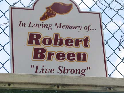
Robert Breen was a local athlete who passed away at the young age of 16; a shrine can be found at Victory Blvd. and Seneca Avenue.
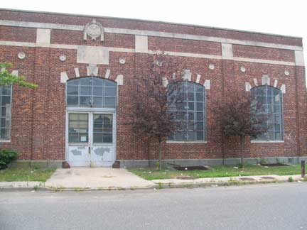
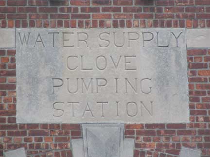
There’s an old pumping station at Victory Blvd. and Ontario Avenue. Ice harvesting and pumping of spring water were prominent industries in Sunnyside in the 19th Century. This building, which would make a good school or community center, is presently used for storage.
Northern Exposure
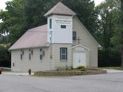
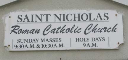
At Northern Blvd. and Labau Avenue is St. Nicholas, the smallest Roman Catholic Church I’ve seen, at least in the five boroughs. It is a chapel of St. Teresa on Northern Boulevard.
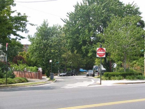
Yes, Sunnyside, Staten Island has a Northern Boulevard, just as Queens’ does. Queens’ Northern Boulevard is one of the lengthiest roads in Long Island and, as Route 25A, reaches all the way to Orient Point at the tip of Long Island’s North Fork. Staten Island’s Northern Boulevard, though, runs only about 4 blocks…though its width suggests that perhaps, it was meant for greater things.
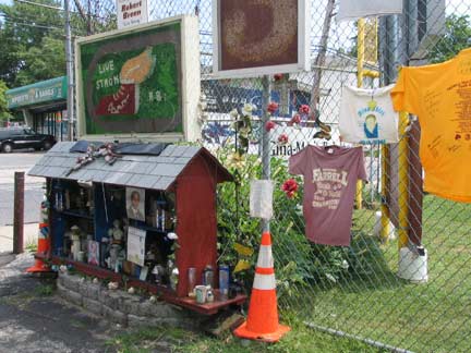
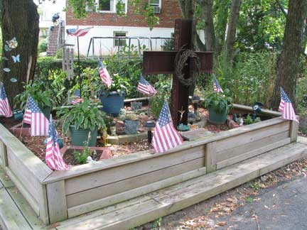
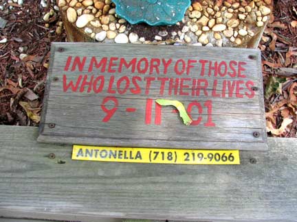
A shrine to 9/11/01 is on Northern Blvd. near Renwick Avenue, that perhaps contains a beam from the original site.
Just as Arne Saknussemm of Jules’ Verne’s Journey to the Center of the Earth left Runic characters to mark his way for future explorers, the NYC Parks Department leaves “blazes” to mark the way for the interepid explorers of its wilderness areas. The “Moses Folly” (see below) Blue Trail appears to have been rerouted, for now, along Little Clove Road, which skirts Staten Island Expressway. Of late, the Parks Department blazes have become slightly more obvious.
Ascending Todt Hill
Little Clove Road becomes Windsor Road; where it intersects wide Slosson Avenue, we begin our lengthy trip up Todt Hill. It’s likely that Slosson was widened when the Clove lakes (now staten Island) Expressway was built in the early 1960s.
An intriguing transformation occurs at Fine Boulevard, where Slosson Avenue is also intersected by a narrow lane trickling in from the northwest. This is Todt Hill Road, which parasitically assumes Slosson’s route and charges up the hill, pedal to the metal.
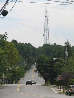
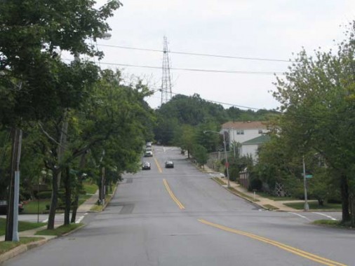
Todt Hill as seen from Fine Boulevard and Todt Hill Road. It’s a gradual climb, but insistent. The radio tower, transmitting WSIA 88.9 FM of the College of Staten Island at the summit is one of a few in the area.
Oh what heights we’ll hit
Todt Hill Road’s sidewalks drop away once you get south of Tillman Street and the local routes have no sidewalks and no shoulders to speak of. So, a walk up or down Todt Hill Road between Tillman Street and Richmond Road, or most of its length, means dodging some very busy auto and truck traffic –and the road bends and turns often. Fortunately many parts of the road do have clearings on the side where you can duck when things get heavy.
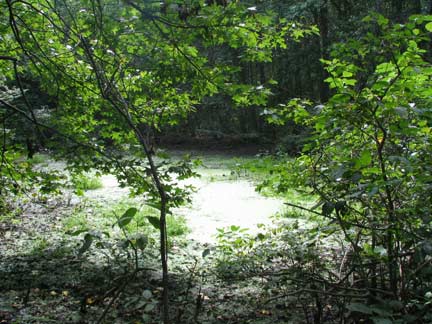
Just past the busy intersection of Todt Hill Road and Ocean Terrace is what Staten Island pathfinder Bruce Kershner calls “Highest Point Pond.” It’s one of many kettle ponds in the area left over by a retreating glacier at the end of the last ice age. It’s not the actual highest point, but is close.
At Merrick Avenue you will find a pipeline conduit that leads to The Summit, a 412-foot (or 409, depending on your source) height that is actually the highest point along the East Coast south of Maine.
At the southwest corner of Ocean Terrace and Todt Hill Road, the Blue Trail, marked by blazes, winds northeast past high hills made of serpentine stone. Eventually you will end up at the abandoned ramps that were supposed to connect the Staten Island Expressway to”Moses’ Folly,” what was going to be an extension of Richmond Parkway (now Korean War Veterans Parkway) which ends at Richmond Avenue and Arthur Kill Road. Mr. Moses was stopped in this attempt and the concept was finally abandoned in the early 1970s; it’s now part of Staten Island’s greenbelt instead. I’ll probably follow the trail in winter when the leaves are down.
Remnants of this aborted highway do remain. Tillman Street at Townley and Motley Avenues was originally going to be the Richmond Parkway service road.
Did I actually reach The Summit? No, since I didn’t feel like macheteing my way through the brush and then tweezing off the ticks after I got home. As with so many other NYC locales, though, the Bridge and Tunnel Club has already been there.
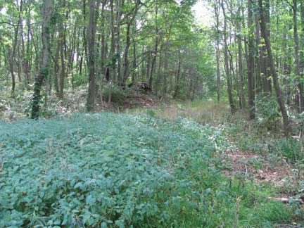
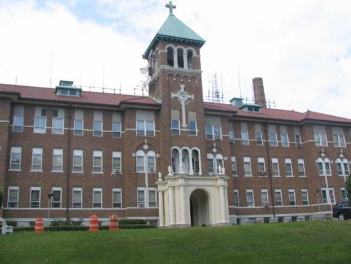
Nothing but wilderness up here huh? Just past The Summit, behold the St. Francis Friary and Center for Spirituality, 500 Todt Hill Road. I felt a little funny creeping about snapping pictures, but nary a soul, Brother, or soul brother accosted me, and I got my pictures in peace and tranquility. It was built as a Roman Catholic seminary in 1928. The surrounding “parkland,” really wilderness area was purchased by NY State in 1997, and it has gloriously been maintained as the same woods as it was when seminarians sought quietude, with blazed park trails, kettle ponds, spreading trees and only the occasional radio tower.
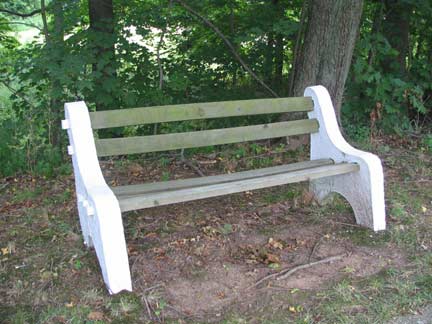
I had thought I had found some old-style NYC park benches…but it looks like these are original to the seminary.
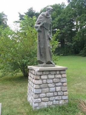
LEFT: Hey, what’s he doing here? This is a Franciscan friary! St. Anthony of Padua (1195-1231) was actually a follower of Francis of Assisi himself, one of the most renowned orators the Church ever produced, and is believed to have produced miracles during his many conversions of nonbelievers before his death at the young age of 36.
RIGHT: Frankie is here. St. Francis of Assisi (1181-1226) has been called the most beloved Catholic saint, and representations of him are certainly the most recognizable (other than, perhaps, St. Sebastian with the arrows). His story as a preacher, mystic and founder of the Franciscan Order would make a terrific Hollywood movie (but who would make it? Mel Gibson?)
Francis is known as the patron saint of animals and is often depicted with them. The story goes that while traveling with friends he happened upon an unusual number of birds in the trees along the road. He excused himself and said to the birds: “My sister birds, you owe much to God, and you must always and in everyplace give praise to Him; for He has given you freedom to wing through the sky and He has clothed you…you neither sow nor reap, and God feeds you and gives you rivers and fountains for your thirst, and mountains and valleys for shelter, and tall trees for your nests. And although you neither know how to spin or weave, God dresses you and your children, for the Creator loves you greatly and He blesses you abundantly. Therefore…always seek to praise God.” wikipedia
Continuing on Todt Hill Road …
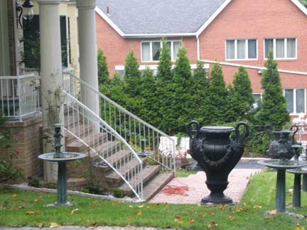
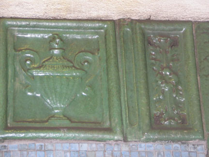
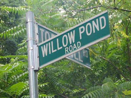
That’s the biggest amphora I’ve ever seen. The two-handled Greek vases are favorite depictions in art; a number of them even turn up in terra cotta decorations in the older IRT subway stations like Astor Place (below). We’re entering the exclusive, walled-off part of Todt Hill, especially on Benedict, Circle and Willow Pond Roads.
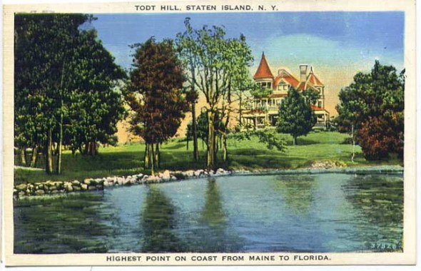
Not sure what, exactly, this postcard is depicting but I have a feeling…
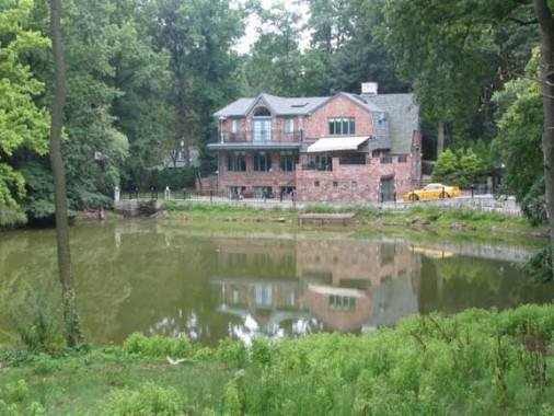
…it’s Willow Pond, just south of its namesake raod along Todt Hill Road’s curviest section. The turreted Victorian mansion may be gone but some lucky duck has a pond view every day.
Stone House
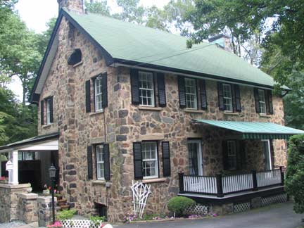
I noted this ancient-looking stone house on Todt Hill Road just south of Willow Pond. With its stone-wrought exterior it resembles Brooklyn’s re-created “Old Stone House” as well as the Valentine-Varian House in Norwood, Bronx, and may be of similar vintage. I had thought it was the Abram Burbanck homestead (built in about 1802) but my Holden’s Staten Island places that further up the road, at 501 Todt Hill across from the Franciscan friary (I’ll have to look for it there later.) The Burbanck family burial yard is under a huge tree at Four Corners Road 9see below).
Any ideas what this old stone house is, and how old?
Out of Town Jasper
Jasper Cropsey (1823-1900) was born on Staten Island, in what is now Rossville. He became one of the greatest landscape artists of the Hudson River School, while he depicted locales all along the east coast, including the White Mountains of New Hampshire. His studio “Ever Rest” in Hastings-on-Hudson is open to tours, and he and his wife Maria are buried in Sleepy Hollow Cemetery in that recently renamed Hudson River town (coincidentally Staten Island has a Sleepy Hollow Road and the ‘real’ Ichabod Crane, a 19th Century military officer, made his home in Staten Island and is buried nearby!)
In 1895 Cropsey painted the view of New Dorp, Raritan Bay and the New Jersey Highlands (“Looking Oceanward from Todt Hill”) then obtainable from Todt Hill, which unfortunately doesn’t turn up online…but can be found in the Staten Island Institute of Arts and Sciences in St. George.
And the view itself is still obtainable too. But how to get there?
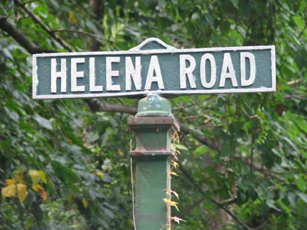
Find an almost-unmarked pathway called Helena Road that drifts off to the west from Todt Hill Road just south of the Stone House.
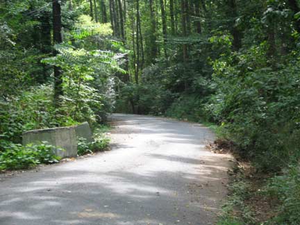
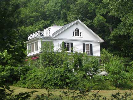
Don’t mind the “private” and “no trespassing” signs; they are there mainly to protect yet another radio tower that is just ahead. (The Parks Department maintains blazed trails here.) You will pass by a number of expensive mansions before Helena makes an abrupt right turn, and then another left.
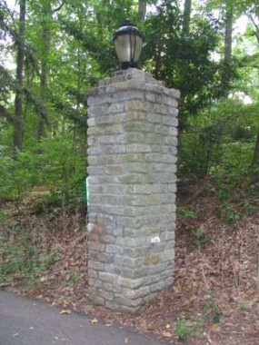
We are now on Cliffwood Avenue, which Helena becomes after the turn. It splits into two: take the right fork, which runs past some lighted gateposts like this one; they mark yet another estate that you will pass by. Cliffwood Avenue seemingly ends at a driveway leading into a big mansion with a yard, but follow the muddy trail a few more yards and you will come upon the Blue/Yellow Trail, marked generously by Parks. Turn left and follow the path toward a clearing…
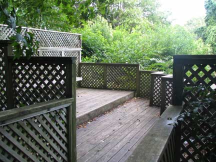
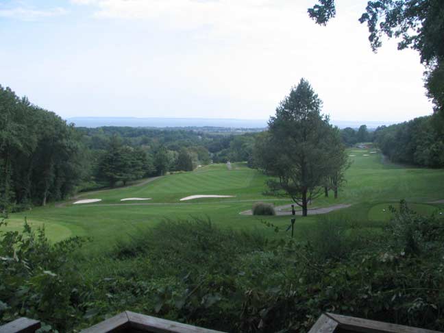
…and you will come upon what looks like a fairly generic patio-like setting. This is the Cropsey Outlook.
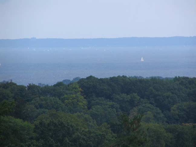
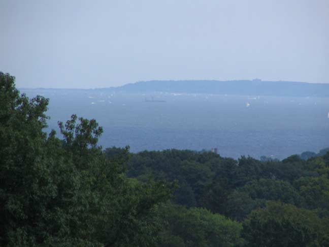
This is the same view Jasper Cropsey had when painting “Looking Oceanward from Todt Hill”, with, of course, the addition of the Richmond County Country Club in the foreground. You say it’s a little hazy and it’s hard to see all the way to New Jersey?
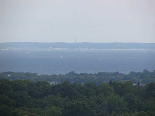
Just turn on the zoom lens.
There’s another radio tower in the distance in NJ. Which one is it? It’s very tall if you can see it from here.
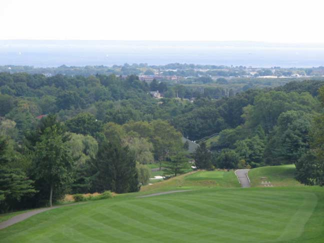
A closer view of New Dorp and Dongan Hills.
Retrace back to Todt Hill Road where we begin our long descent of the hill.




4 comments
Beautiful photos and historical facts!!
I watched my father build those benches at st francis in the mid 1930s he was the night watchman. When the seminary was built in 1927 he was hired as custodial engineer and lived his life In the. Residence provided . As a child I roamed all the woods and ponds in the area around the property
The writer notes: “Little Clove Road becomes Windsor Road; where it intersects wide Slosson Avenue, we begin our lengthy trip up Todt Hill. It’s likely that Slosson was widened when the Clove lakes (now staten Island) Expressway was built in the early 1960s.”
In the 1960’s Slosson Avenue ran from Martlings Avenue to Vicory Boulevard and ended there. Slosson Avenue beyond Victory (up to Todt Hill Road) was built around the time that the expressway was built. Originally Todt Hill Road descended from Ocean Terrace to Victory Boulevard where the current remnants of the old Todt Hill Road remain – just north of Hodges Place.
Does anyone know the boundaries of todt hill? I moved to the area and I was told that my house was part of Told hill. All the way at the bottom of Ocean Terrace where ocean terrace crosses over Manor Rd. Is that still part of Todt Hill? They called it Lower Todt Hill. I’m from NJ and in NJ we have defined boundaries which doesn’t seem to be the case for Staten Island.