Is walking the best way for your webmaster to get around in NYC? I think so. When in a car or bus, whatever interests me goes by in a hurry; all I can do is make a mental note or jot it down on scrap paper. On a bike, I tend to concentrate so much on not getting hit by traffic I tend to not notice things as much.
Only on foot do I have the opportunity to not only notice things but also record them. Consequently 95% of my Forgottening is done walking. I used to awkwardly carry a film camera in a small bag when bicycling but even that was too uncomfortable for me. (By the way what is it with bicycling outfits: the tight black pants, the multicolored clown shirts, the cleats etc? When I ride a bike, I dress in dungarees,a T shirt, a jacket if it’s cool, and bind my right pants leg with a rubberband and I’m good to go). Gloves, since my hands chafe, and a helmet.
On Labor Day (September 3, 2007) my intent was to walk from Penn Station up 1st Avenue, a road I have overlooked over the years, and like the Energizer bunny, I kept going across two bridges into Astoria. Here’s what I noticed along the way.
I made my way east on West 33rd Street to start, past the King of All Buildings, which oddly looks less impressive from Midtown; you have to see it from the Rockaway Peninsula, or perhaps the NJ Meadowlands, or perhaps Blissville in Queens to truly appreciate the majesty.
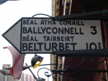
I passed an Irish pub that imported a directional sign from Ireland. They’re terrific signs: light gray, with black embossed letters. Brookline, Massachusetts, uses the same method, with a different font. Notice the place names are in both Irish and English. In Gealtacht, or Irish speaking areas in the west of Ireland, directional signs are in Irish only! Irish is a language pronounced nothing at all like it’s spelled, incidentally, but the same can be said for much of English.
The sign indicates these locales are north of here but actually they are about 3000 miles to the northeast.
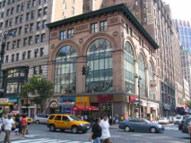
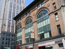
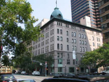
The Empire State Building might get all the attention on 5th Avenue between 33rd and 34th Streets, but for your webmaster the real action is across the street, where this turn of the 20th century building (335 5th), with 5 incredibly high arched windows holds court. And, how about the ten eyelet windows above those! The years 1890-1935 or so was all about detailing.
It resembles the Mechanics and Traders Building in Greenpoint: check the Tour 30 page.
The Queens Midtown Tunnel links Manhattan with the Queens Midtown Expressway, which becomes the Horace Harding Expressway at Queens Blvd. and then, the Long Island Expressway at the Nassau line. When finished in 1940, it linked to Horace Harding Blvd., which was upgraded and expanded in the fab Fifties.
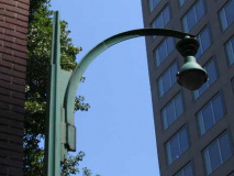
There are a pair of access roads in Murray Hill on either side of Second Avenue called, prosaically enough, Tunnel Entrance and Tunnel Exit Streets. Both favor these early examples of cobra neck lightposts, which must have looked modernist in 1940 and are just odd today. They look like something Marvin the Martian has in his weapons drawer. After 60+ years, they still have Westinghouse AK-10 “cuplights.”
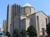
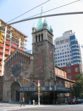
St. Vartan Cathedral of the Armenian Orthodox Church at East 34th and 2nd Avenue was built in 1967: the first cathedral of that denomination to be built in NYC. The beetling Corinthian looms in the background (more later). Check the exterior for inscriptions in Armenian; inside you will find stone crosses that date to the 1400s.
Vartan was a 5th-century Armenian warrior who opposed Persia (today’s Iran) and helped spead Christianity in opposition to the main Persian religion of the era, Zoroastrianism. If you’d like to slog through a few centures of Armenian medieval history, this is your page.
Armenia was the site of a mass slaughter by the Ottoman Empire during World War I, but Turkey still officially denies it took place.
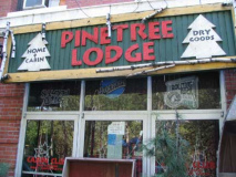
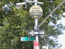
I found a handsome woodcut banner sign at the Pine Tree Lodge on East 35th between 1st and 2nd Avenues, and an old Queens Midtown Tunnel sign at 1st. The green belongs to St. Vartan’s Park.
Domes intact, the old Kips Bay Brewing Company building still faces 1st Avenue between East 37th and 38th. It was constructed in 1898; the brewer closed in 1948 and it has been mixed-use since then.
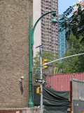
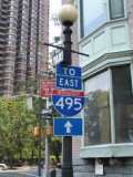
The city installed retro “gaslight” posts, with crossbar, outside the old brewery several years ago. They have become encrusted with traffic signs.
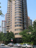
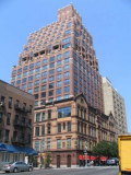
The incredible Corinthian apartment tower, with its myriad bay windows, was constructed in 1987 by architect Michael Schimenti on 645 1st Avenue between East 37th and 38th.
According to Jim Naureckas of New York Songlines, Corinthian “is used to mean ‘luxurious’ because Corinth was the party town of ancient Greece–noted as the home of Aphrodite’s sacred prostitutes. The fountain in front of the building is called Pierene – named for the fountain in Corinth where the flying horse Pegasus was captured.” Of course you remember Ricardo Mantalban’s “Corinthian leather” car commercials in the Super Seventies.
When I hear “Corinthian,” though, I recall Neil Gaiman’s Corinthian character from the Sandman series in the 1990s. At first a killer and later more sympathetic, the Corinthian usually wore sunglasses, to hide the fact that his eyes were open mouths.
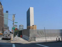
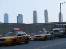
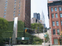
Of late I have had the habit of photographing views that will soon be unavailable. Until this year (2007), these views of the 1952 UN Secretariat Building (which is much thinner than it is wide) and the view of Queens’ Citigroup and Queens West towers, were unavailable due to the presence of an immense Con Edison plant. They will soon not exist anymore, since developer Sheldon Solow plans to raise several luxury towers here.
Regarding the photo on the right, to me it sort of looks like photos of lower Manhattan from the 20s through the 50s: tall towers rising seemingly out of nothing, as fellow buildings were much shorter. Eventually, in lower Manhattan, buildings rivaling their height were built, and structures like 40 Wall Street (now known, with its owner’s typical lack of humility, as the Trump Building) don’t stand out quite as much when viewed from afar. Will this happen in Long Island City?
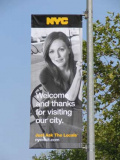
If only everyone was this nice! (You have to catch your webmaster on a good day.) These banners have appeared in Midtown as part of a new tourism push. Julianne Moore’s entry appears at 1st Avenue and East 42nd Street.
Just west of 1st Avenue in the East 40s is a very steep cliff. Tudor City was developed in the 1920s by developer Fred F. French to take advantage of the views. Steps at West 43rd Street and 1st Avenue lead up to the “city within a city.” The plaza was named for the great UN Diplomat Ralph Bunche (1903-1971) in 1979. The steps are named for Anatoly (Natan) Shcharansky (1948-), a former Soviet dissident who served in a Siberian labor camp for nine years. He is currently (2007) president of the Jewish Diaspora Museum in Tel Aviv.
1st Avenue and East 50th Street. Your webmaster covered this building a few years ago in a page called What Lies Beneath, as the guts of a turn of the century building were removed and a luxury tower rose inside its exterior shell. (A similar feat was pulled off on a more massive scale in 2005 by British architect Norman Foster on 8th Avenue’s Hearst Tower.)
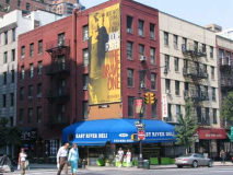
Speaking of movie stars, Jodie Foster promoted her 2007 vehicle, “The Brave One” (an hommage of sorts to1974’s “Death Wish”) with a 4-story banner. ( Your webmaster wonders how the people whose windows are covered feel about it!) Aside from that, this is a very typical scene from the Turtle Bay region, the East Side in the East 50s.
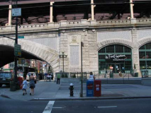
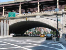
The Queensboro (59th Street) Bridge, designed by bridge engineer Gustav Lindenthal with aid from Leffert Lefferts Buck and Henry Hornbostel, who designed the Williamsburg Bridge (1903), opened March 30, 1909 and nearly immediately transformed Queens from a rural backwater to a true and undeniable part of NYC. The bridge crosses 1st Avenue via a massive stone arch large enough to accommodate a series of markets over the years, including today’s Food Emporium supermarket and upscale restaurant Guastavino’s.
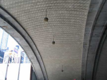
The crisscross brickwork on the vaultlike stone crossing is the signature of Rafael Guastavino, the Spanish tileworker whose exquisite work (with his son Rafael) can also be seen at the Oyster Bar at Grand Central Terminal, the Lincoln, Nebraska State Capitol, the U.S. Army War College in Washington, D.C., the now-closed City Hall IRT subway station, and many other locales.
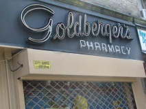
1st Avenue and East 65th. Goldberger’s Pharmacy has been here since 1898 and the neon sign, for perhaps a few decades. It’s not NYC’s oldest pharmacy, however; Kiehl’s, at 3rd Avenue and East 13th Street, was founded in 1851.
Church of St. John Nepomucene, 1st Avenue and East 66th Street, was built in 1925 by John Van Pelt. John of Nepomuk (1340-1393) is the patron saint of Bohemia in today’s Czech Republic.
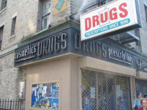
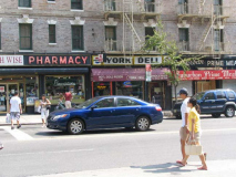
At York Avenue (named for World War I hero Sergeant Alvin C. York (1887-1964), and not for NYC’s namesake English city) and East 79th an interesting tableau presents itself: three “old school” storefront signs in a row.
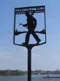
Finley Walk
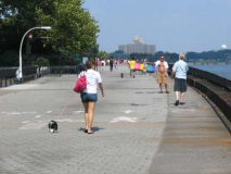
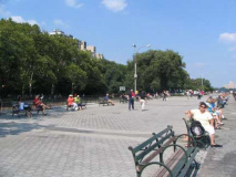
John Finley Walk, the top deck of Franklin D. Roosevelt Drive, runs along the East River from East 81st Street to Gracie Mansion where it loses its width and continues north to East Harlem. It is rather similar to Promenade in Brooklyn Heights, with rather less spectacular views, though they’re still good. It was named for Harper’s Weekly editor and City College president John Finley (1863-1940)
Finley Walk is a prime spot for dog walkers, kite flyers and sunbathers (which your webmaster didn’t photograph lest their boyfriends pummel me). It meets Carl Schurz Park, named for a mid-19th century German immigrant (1829-1906) who became a US Senator from Missouri (1869-1875), Rutherford Hayes’ Secretary of the Interior (1877-81), editor of the New York Tribune and Harper’s Weekly (that magazine again!) A statue of Schurz can be found at Morningside Drive and East 116th Street, and a lengthy avenue in Throgs Neck, Bronx, also commemorates him. Yorkville was heavily German in the past, and the park celebrates one of their own. His most famous quote was: “Our country right or wrong. When right, to be kept right; when wrong, to be put right.”
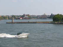
A speedboat chugs past the 1872 James Renwick, Jr. lighthouse at the northern end of Roosevelt Island. We see the newly landmarked (and future condo-ized) Sohmer Piano Factory in Long Island City in the background at right.
Finley Walk’s distinctive iron signs were designed by cartoonist Edwin Marcus and architect Harry Stevenson.
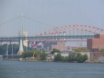
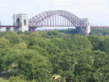
Finley Walk presents terrific views of the Triboro Bridge in the foreground and the Hell Gate Bridge in the background. We’ll see more of them later.
Finley Walk becomes much narrower just before Gracie Mansion (which is hidden by shrubbery and a guard detail, so it’s impossible to photograph in the summer, though in winter views are possible (scroll down on this photo page) and accompanies the FDR Drive, which rises from its covering here.
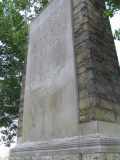
A pair of stiles marking the East River Drive, since renamed the FDR Drive, appear opposite East 92nd Street. The Grand Central Parkway also sports a pair of these in Astoria, Queens.
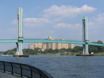
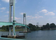
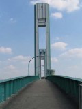
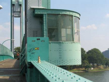
The Ward’s Island pedestrian bridge was opened May 18, 1951, spanning the Harlem River to Ward’s Island at about East 103rd Street. It was designed to accommodate visitors to Wards Island’s park, stadium, psychiatric hospitals, and athletic facilities. It is a lift bridge: the center span, between the towers, can slide up to allow taller ship traffic to pass, though this happens rarely. The bridge also lifts into the closed position during the winter. It is the only pedestrian bridge crossing a major river in New York City.
Ward’s Island is named for brothers Jaspar and Bartholomew Ward, who purchased the island previously called Great Barn Island in 1807, hoping to build a farming community but instead developing a cotton mill. The Wards constructed the first bridge to Manhattan, but it burned down in 1821. The island became home to the same motley collections of insane asylums and orphanages that other East River islands hosted, but business picked up in 1934 when Robert Moses set about demolishing the asylums and building the recently demolished Downing Stadium (since replaced by Icahn Stadium in 2005). He also built acres and acres of ballfields and tennis courts and landfilled the space between Ward’s and Randall’s Island, making them one large island. Ward’s Island, however, remains a rather forbidding place, since it features a sewage treatment plant, a homeless shelter, and the remaining Manhattan Psychiatric Center (which interestingly carries the address 600 East 125th Street, though it is really opposite 110th).
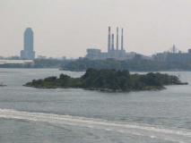
From the bridge: Mill Rock Island, the site of the largest planned explosion in NYC history, is in the foreground, while we see Citigroup Tower and the Big Allis Con Ed plant in Long Island City in the background.
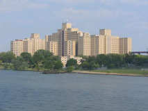
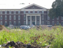
The Manhattan Psychiatric Center looks like a generic hospital scene you might find in the opening scenes of old doctor shows like Ben Casey, Dr. Kildare, Marcus Welby MD or Medical Center.
Charles H. Gay homeless center. With a 953-bed capacity, Charles H. Gay Center is the largest homeless shelter in New York City.
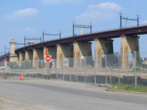
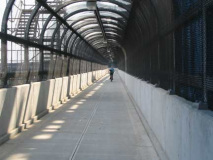
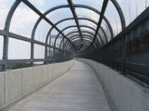
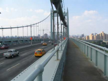
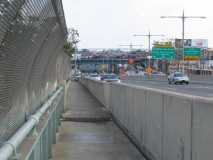
Step and repeat. The lengthy ramp to the Hell Gate railroad bridge, and the tunnel-like pedetrian and bike approach to the Triboro Bridge, both seem to copy themselves into infinity.
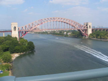
The Hell Gate Bridge was the final piece in the puzzle of running railroad trains into Midtown Manhattan. The tubes connecting Long Island with Penn Station opened in 1910, and Hell Gate Bridge, connecting Long Island with the mainland, opened in 1916 as the lengthiest steel arch bridge in the world until surpassed by the Bayonne Bridge in 1931. “Hellgat” means ‘beautiful strait” in Dutch, but lived up to its English transliteration as an extraordinarily dangerous stretch of water due to conflicting currents of the East River and Long Island Sound, as well as a great deal of rocks that made it treacherous for shipping until the rocks were detonated into rubble (see the Mill Rock link above). The construction was overseen by Gustav Lindenthal, who worked on the Williamsburg and Queensboro bridges as well. In the mid-1990s it was painted a deep maroon, which the sun has faded to light magenta.
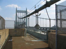
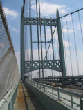
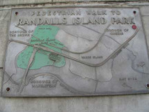
The Triboro Bridge, linking Manhattan, the Bronx and Queens via Randall’s Island, features three major bridges and a number of other smaller bridges and ramps. Though it was begun in 1929 the Depression halted construction until 1932-1937 until finished by Othmar Ammann, the Swiss-born greatest bridge builder of the 20th Century. It was the last of Robert Moses’ great bridge crossings to feature a pedestrian walk.
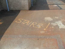
Cyclists on the bridge, who often race across, may be unprepared for the steps at either end. Therefore, a crude painted sign has been placed on the walkway by a helpful samaritan.
Forgotten Fan Steve Scofield: The “stairs” markings painted on the Triboro Bridge footpath are for the NYC Century bike ride, a 100-mile ride that takes place on the second Sunday of September every year. The route always takes riders across the Triboro Bridge, and the “stairs” markings are courtesy of Transportation Alternatives, who organize the ride and highlight other hazards, etc, along the route. On that day, the normally-empty Triboro bridge path is used by thousands of cyclists. If you ever notice a yellow or green “C” and an arrow painted on the street throughout the city, they are the the route markings for this ride.
Two cyclists passed me, and no pedestrians.
A view of the Hell Gate Bridge from the Triboro center span.
A look back at Manhattan
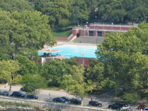
Astoria Park Pool, another Depression-era Robert Moses project.
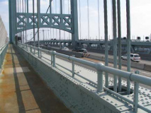
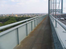
The low railing on the center span was disconcerting. A gale or a knock from a passing cyclist could send you into the river. Actually I feared dropping the camera into the drink more than anything else.
Down the ramp into Queens. The ramps are protected by a chain link fence, but the center span is not.
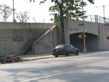
The walkway empties onto the Triboro Bridge service road, Hoyt Avenue North.
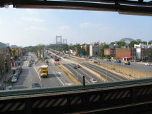
And before you know it there you are on the Astoria Blvd. el platform, looking back at where you’ve been.

