In Time Magazine this week (4/26/09) President Obama’s staffers say they think of the White House as a “living museum.” Sometimes things should be frozen right where they are, never to change. Detroit used to employ tens of thousands of people who made the best cars on the planet. The New York City waterfront used to employ the same number of dockworkers. In the late 2000s, we are now witnessing the early death throes of the newspaper business; I lived through the end of typesetting in the 1990s as new technologies meant its doom. I cannot believe people will prefer getting their news through palm-size devices; I’ve tried the IPhone and my fingers are too big to easily operate the touch keyboard, and I’m just a bit overweight, not close to obese. Perhaps I’m like the late 1960s Ray Davies, complaining about the demise of his Village Green (his uber-villain in 1973’s Preservation, Mr. Flash, was a crooked real estate developer).
St. Paul’s Avenue and the paralleling Van Duzer Street run at the bottom of Ward’s Hill, one of a chain of hills in mid-Staten Island that rank among the tallest hills on the East Coast; parts of the area are montainous with imposing hills that are too slanted for vehicles to safely climb, and step streets are frequent here. The routes mark the northwestern edge of Stapleton, once the commercial center of Staten Island’s Southfield township; the Edgewater (a small town within the township) hall still stands in Tappen Park at Wright and Canal streets (see it on this FNY page). The caves that were situated in the foothills were ideal for the fermentation and storage of beer, and there were many breweries in the area in the 1800s (Bechtel, Piels and Rubsam & Hohrmann) that survived even after Prohibition in the 1920s.
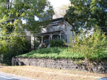
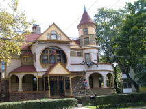
FNY’s subject today, St. Paul’s Avenue, was laid out, along with the small streets that radiate from it, in 1829-1830 by landowner Caleb T. Ward, whose home on the U-shaped Nixon Avenue at the crest of the hill still stands today. Greek Revival homes are the oldest, built mainly along Van Duzer, but there are also some houses of considerable age along St. Paul’s that exhbit the “dizzying array” (two words that are always used together) of late 1800s architecture: Second Empire, Queen Anne, Colonial Revival, and Craftsman. The more imposing of the homes have a clear view of the Narrows and the big bridge to Brooklyn.
Why did architecture flower like this in the Victorian and the Beaux Arts period that followed? In the post-Civil War era, the national zeitgeist may have had that Thomas Hobbes vibe that life is “nasty, brutish and short” and we may as well enjoy our time on the planet; as always, those who had the means did exactly that.
GOOGLE MAP: ST. PAUL’S AVENUE
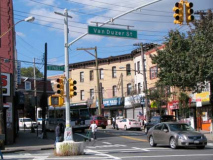
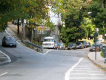
Victory Boulevard is the northern starting point for both St. Paul’s Avenue and Van Duzer Street, which meet at a V here. The Department of Transportation conveniently places a sign for both. Stapleton’s World War II memorial for local residents killed in the conflict is located here.
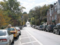
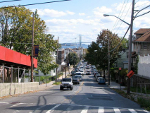
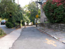
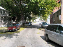
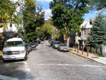
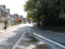
St. Paul’s Avenue stretches off for nearly a mile. Except for the late model cars this scene looks much the same as it did decades ago. When it was unpaved in the 1800s, the avenue earned the informal name “Mud Lane” because of runoff from the high hill just to the northeast. RIGHT: scene from Homer Street, a C-shaped street west of St. Paul’s that hugs the hill.
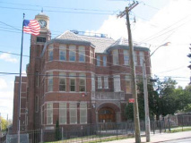
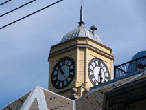
I am a fan of clock towers, and the old PS 15 at St. Paul’s and Grant Street fills the requirement nicely. The building is still run by NYC Department of Education as an office of maintence and operations. Originaly called the Middletown Twp. District School #1, it was completed in 1897 by architect and Staten Island resident Edward (né Ebenezer) Alfred Sargent (1842-1914), who designed many of the eclectic homes found along St. Mark’s Place in St. George. Sargent was also a noted painter. (Tragically a Sargent masterpiece in Westerleigh was demolished in 2008).
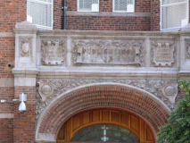
Sorry about not centering the photo left properly — I just wanted to get the dates on either side of the door. The school was founded in 1855; this is the third building on the site. The elementary school was closed in 1965. PS15 will become an early childhood center in September 2009.
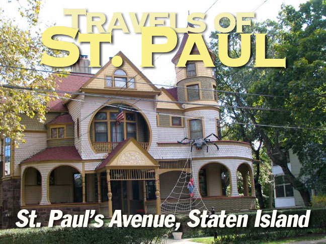
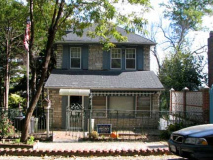
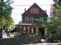
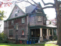
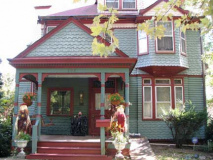
You will see some Halloween stuff here, I did this stroll in October. This house is on a St. Paul’s Avenue incline at Clinton Street. How would you like a wraparound porch like that? I would.
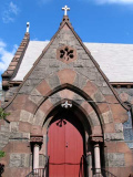
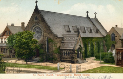
St. Paul’s Episcopal Church gave the avenue it faces its name. The Episcopal parish has been in the area since 1833; this is the second church building, constructed about 1870 and designed by architect Edward Tuckerman Potter, and consecrated by his uncle Bishop Horatio Potter … all in the family. Potter also built Mark Twain’s residence in Hartford, CT in 1874, an amazing building you can see on this page, along with some of Potter’s other Gothic buildings. St. Paul’s is rather restrained when you compare it to other buildings in the Potter oeuvre.
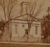
ABOVE LEFT: the preceding St. Paul’s Church, which stood at St. Paul’s Avenue and Paxton Street. The parish was established in 1833.
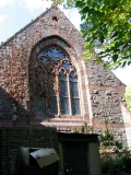
Above right, left: two more views of St. Paul’s traprock exteriors. Postcard, ca. 1900.
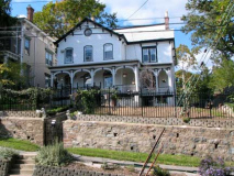
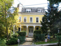
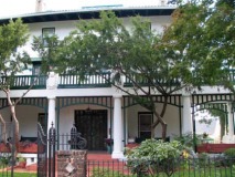
At St. Paul’s Church traveling south we begin to see some of the avenue’s classic dwellings. Above r. & l.: 237 St. Paul’s. I liked the impossibly old iron fence. Above: 231 St. Paul’s. Right: 208. The west side of the avenue faces Ward’s Hill and the houses are much higher than the avenue, requiring lots of steps. The owners don’t need a gym membership or Stairmaster.
@ Beach Street
Beach Street runs in a straight line down the hill to the heart of Stapleton at Tappen Park. A clear view of the Verrazano-Narrows Bridge is a highlight of the streetscape. The intersection of Beach and St. Paul’s marks the gathering place of many of Stapleton’s most beautiful and historic buildings.
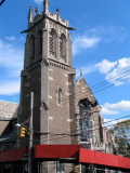
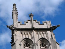
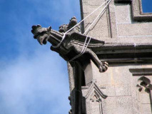
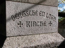
On the SE corner we find the Trinity Lutheran Church, founded in 1856: though the cornerstone reads that year, this building was built in 1913 by the architects Upjohn and Conable (Hobart Upjohn was the grandson of Trinity Church builder Richard Upjohn). The church’s original name, Deutsche Evangelische Lutheran Kirche (German Evangelical Lutheran Church) is inscribed on the cornerstone at the base of the tower, which is guarded by gargoyles which seem to be straining against their protective ropes like watchdogs on their leashes.
Beach house. Cupola’ed dwelling on the SW corner. Crossing Beach Street is tricky here because the roadbed is a couple of feet shorter than the sidewalk. Steps are necessary, with a plain iron handrail getting the job done for feet made unsteady by sidewalk cracks or winter ice.
The Walworth name in iron fittings and valves goes all the way back to 1842.
351 (l.) and 352 St. Paul’s Avenue. Houses on the west side of St. Paul’s are set back from the street uphill, with wide lawns. These homes are among the oldest on the avenue, dating to the late 1850s to late 1880ss. The homes were occupied in general by ship captains and pilots when they were first constructed.
Mediterranean-villa style 377 St. Paul’s (left), 364 (right)
387, opposite Occident Avenue, the largest and perhaps most wildly eclectic of any of St. Paul’s Avenue mansions. I’ve shown this building twice on previous FNY pages and I can’t avoid shooting it whenever I pass by it. It was constructed in 1887-1888 by Czech architect Hugo Kafka for brewery nabob Henry Bechtel as a wedding gift for his daughter Anna Bechtel Weiderer.
The NY Times profiled the house and its owners in June 2009.
A complete overview of the mansions of the St. Pauls-Stapleton Heights Historic District has been published by the NYC Landmarks Commission. Thanks ForgottenFan Joseph Ditta for this link.
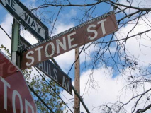
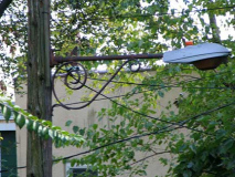
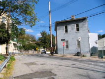
Past Occident Avenue St. Paul’s Avenue is near its ending. Surrounding the avenue and paralleling Van Duzer Street are a number of very short, very narrow side streets. Stone Street is so narrow, in fact, and it is on such an incline that it is closed to vehicular traffic. Midway through, we find a lamp mounted on a scrolled mast that is usually used to carry orange fire alarm lamps, but general streetlighting was its original purpose.
Van Duzer Street
The Van Duzer family were Dutch immigrants who came to Staten Island near the end of the Revolutionary War, but the family vanished from the rolls fairly soon after that. Nevertheless, the family name is perpetuated by one of Stapleton’s main north-south routes, running from Victory Boulevard all the way to the confluence of Vanderbilt Avenue and Richmond Road, which can be followed to Amboy and Arthur Kill Roads that each run all the way to Tottenville.
At Stone Street, much of Targee Street’s northbound traffic is transferred to Van Duzer Street. But, Van Duzer then accepts St. Paul’s Avenue’s southbound traffic a block south of that. That leaves a very short section of Van Duzer Street that I had not seen before, having never been on it on a car or a bus. Was I surprised….
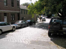
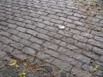
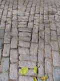
The stretch of Van Duzer between Targee and St. Paul’s is narrow, with raw Belgian-blocked paving stones. Quite a contrast from the street’s usual bustling traffic in its longer stretches.
Since Van Duzer is on a curve here, the bricklayers, decades ago, had to fill in the spaces creatively. Other than Barbey Street in Brooklyn’s Cypress Hills, this is the only Belgian blocked street in NYC that I know of that is built on a curve.
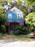
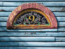
Tucked in the curve is a very old wood-timbered house. Apparently it was once a firehouse; the glass clerestory reads “Robinson Hose Co. 9, 1895.” This glass looks relatively new, however. Anyone have some history on this place?
ForgottenFan Edward Findlay: The hose company was founded as part of the Edgewater Fire Department on February 17th, 1880 on Targee Street then moved to that fire station 528 Van Duzer Street on May 7, 1889. It apparently didn’t get integrated into the FDNY when the city took over firefighting duties on the island on November 1, 1905.
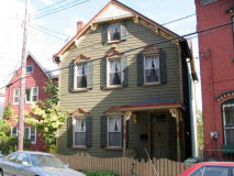
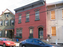
The small-town vibe is completed by these jewel-box frame and brick houses. Some are in better shape than others. You never know when these will be torn down so that soulless Fedders palaces can be constructed, so smoke ’em while you got ’em.
Van Duzer gets its groove back when St. Paul’s Avenue transfers its southbound traffic to it at this V-shaped confluence. The two streets also meet at a V at Victory Boulevard.
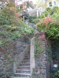
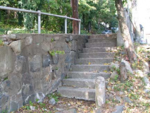
Some ancient steps and another Walworth fence assist pedestrians up the staircase necessitated by the sharp uphill on St. Paul’s Avenue.
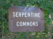
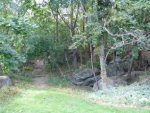
Just south of here we see the nature preserve called Serpentine Gardens, not so-called for its snakes (there are likely some small garden-variety snakes to be found though). Serpentine is the bedrock found in many Staten Island locales. Serpentine is more or less an “accidental” park, since it is the remains of a failed real estate project; a developer was trying to excavate the hillside to flatten it for residential housing, but local residents managed to get the work halted. The commons has been open to the public since 1979, and features an annual art fair.
More hikes in Staten Island’s hills coming soon!

