I recently walked from the St. George Ferry in Staten Island through Tompkinsville, Stapleton, and West Brighton, finishing at Clove Lakes Park, and had intended originally to do a Forgotten Walks page on the entire route. I had obtained nearly 250 pictures, though, and time constraints caused me to have to split things up into a number of smaller pages, of which this will be the first. These are fascinating neighborhoods in the island for me, and I return to them again and again, finding something new every time. Streets wind around hills, dead end, or go nowhere in particular, as streets in aged areas tend to do; everywhere there is the patina of lengthy history where there is no modern-day crapitecture. New Yorkers who deride Staten Island as a province of strip malls, mob mansions, and tract housing should walk around its northeast and its hills, and appreciate them for what they are, small towns that happen to be within New York City but stand apart from it in many ways.
Staten Island has had a number of ferry terminals at St. George, the section closest to Manhattan. The first ferry between Staten Island and Manhattan originated in 1817 as part of Vice President Daniel Tompkins’ Richmond Turnpike Company, purchased in 1838 by Cornelius Vanderbilt; the ferry was made part of NYC ferry operations in 1905. The “new” ferry terminal, opened in May 2005, was actually a top to bottom $130 million dollar renovation from a building that formerly resembled a non-air conditioned locker room to a showpiece featuring picture windows overlooking Upper NY Bay.
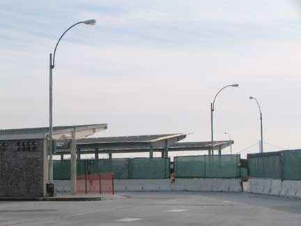
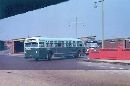
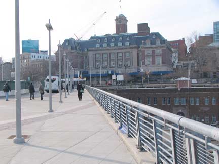
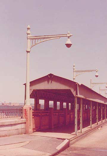
I never did take any photos at all of the old version of the terminal, and I wish I had, just to provide a contrast. At the top of the page I have photos of the bridge that crosses the Staten Island Railway, connecting the terminal with Richmond Terrace, from 2010 and what must have been the 1970s or so. I wish those gorgeous metal lampposts had been preserved somehow, but no trace exists today. The part of the terminal that is relatively unchanged, though, are the bus ramps that themselves are built atop platforms over the railroad. The brick shelters and canopies are still there, and even the old lampposts, installed in the early 1950s are still around, but with the T-bar masts replaced by cobra necks. On the right, we see a Mack bus and a General Motors “new look” “fishbowl” bus; Mack, more famed for their trucks, produced buses from 1900-1960, and GE, whose buses resembled the Macks, first produced the Fishbowls from 1959 to the early 1980s. When I was a kid I loved riding on the routes that used the Macks — I suppose I liked them because they were rarer. photo from Orchard Inn Reunion
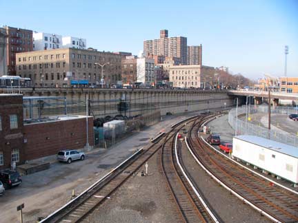
Staten Island Railway looks like a suburban railroad, a la the Long Island Rail Road or Metro-North, for much of its route. It’s likely the least-known mass-transit in New York City. Passenger rail has existed in Staten Island since 1851 when Cornelius Vanderbilt constructed a short line from Clifton to Stapleton, and by 1883, “Staten Island Rapid Transit” as we know it today existed along the north and south shores, operating in partnership with the Baltimore and Ohio Railroad, though the north shore branch ceased operations in 1953. The B&O sold the Staten Island to New York City in 1971.
Freight service reopened between New Jersey and the Arlington Yards in the early 2000s, and plans have been floated to revive the north shore branch, but transit construction costs untold millions these days. The photo left shows a bit of the north shore branch track that was reactivated in 2001, when the Staten Island Yankees began playing in the new Richmond County Bank Ballpark at St. George.
FNY looked at Staten Island Railway, its stations, and the environs around them in the 2007 Stations of the SIRT series.
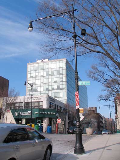
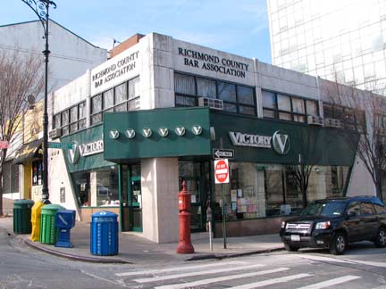
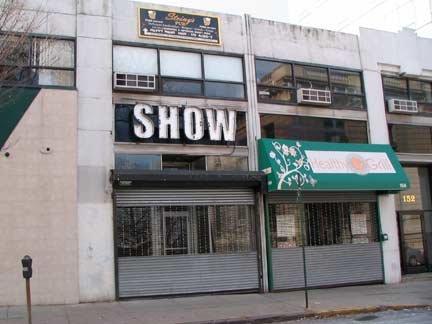
Both Stuyvesant Place and Hyatt Street near Borough Hall and the ferry have recently been given a flock of retro-Corvington lampposts, a design going back to the early 1910s. On the corner is corner is Victory State Bank, named for the boulevard, incorporated in 1997 and operating 5 branches on the island as of 2011. Show Gallery, right, has been home to works by Forgotten Fan Cynthia Von Buhler, who helped with an FNY mini-tour of the St. George area in 2009.
GOOGLE ST. GEORGE/TOMPKINSVILLE/STAPLETON MAP
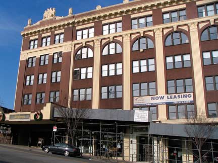
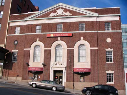
Two block Hyatt Street, which runs up a steep hill for two blocks, will reveal some of Staten Island’s more notable buildings. Staten Island Savings Bank, now SI Bank & Trust, occupies a federal style building on the north side, as does the meticulously restored 1928 St. George Theatre, in 2010 undergoing some more rehabilitation work on the exterior. It has attracted some of the bigger names in show business of late for concert dates, with Smokey Robinson and Diana Ross scheduled to appear in early 2011.
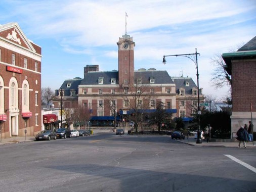
Staten Island Borough Hall was built in 1906, eight years after the island was consolidated with NYC, by architects John Carrere and Thomas Hastings. On the inside, the grand marble lobby contains a series of significant WPA reliefs and murals painted in the late 1930s by Frederick Charles Stahr, illustrating events in Staten Island history.
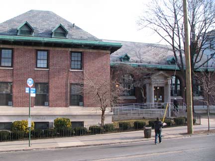
St. George’s public library (1907) is one of the many institutions built with the aid of a grant by steel industrialist/philanthropist Andrew Carnegie, who funded hundreds of them all over the country in the early 20th Century. The architects were Carrere and Hastings, same as Staten Island’s Borough Hall.
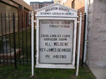
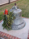
At St. Mark’s Place and Fort Place, visible from Hyatt, is the Brighton Heights Reformed Church; while it looks older, has only been here since the 1999. The original structure, constructed in the 1860s, was destroyed in a fire in June 1996. Its original bell, constructed by the Meneely Bell Co. of Troy, NY in 1864, has been preserved.
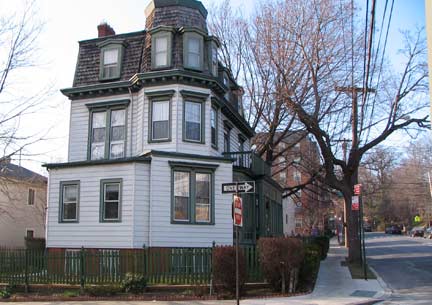
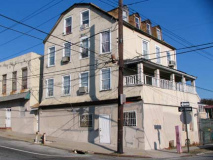
Fort Place and Montgomery Avenue

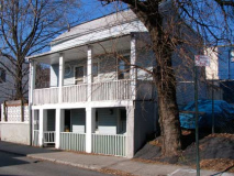
Fort Place and Belmont Place. Both homes date to the late 1800s as do a number of residences and mansions in the St. George area. Fort Place and Fort Hill take their names from an earthen fort built by the British in the pre-Revolutionary era on this high, hilly area overlooking the harbor. Thousands of British troops were stationed on the island during the war years of 1776-1783.
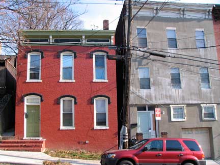
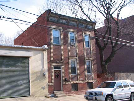
Turning south along Montgomery Avenue, which is full of old, modest brick buildings dating to the vary late 19th Century or perhaps early 20th. This part of St. George was south of the original New Brighton resort area developed on St. Marks Place, featuring beautiful buildings by prominent Staten Island architect Edward Alfred Sargent. The buildings down here are rather more mundane. But as you can see on the right, architects were also making an effort here to make their buildings stand apart: look at the terrific contrasting brickwork.
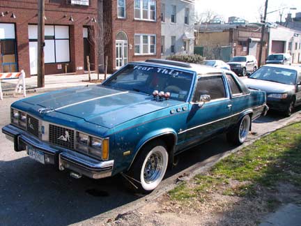
Found this classic Olds on Montgomery. According to ForgottenFan David Cohen, though, it’s not as classic as it seems.
Oy, where to start? He’s got the fake Buick portholes on the fender (of an Oldsmobile) and he’s got three on a V8 which would have four, the awful rims, awful whitewalls, the fog lights are about 20 years too new, the hood gauges, hood ornament awful Autozone tints, rain-guards, mud-flaps and inexplicably-symmetrical naked women relaxing on either side of his grille, all of which need to be relocated to the nearest landfill. At least he feels it warrants “Historical” license plates.
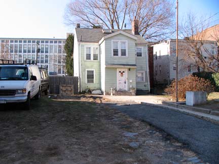
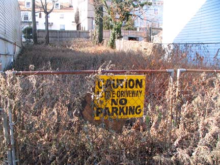
Tiny house on Montgomery behind a front yard taking up more space than the house itself. It’s set back so far that the house on adjoining Monroe Avenue appears to be next door. Adjoining is an active driveway that has not been active for awhile.
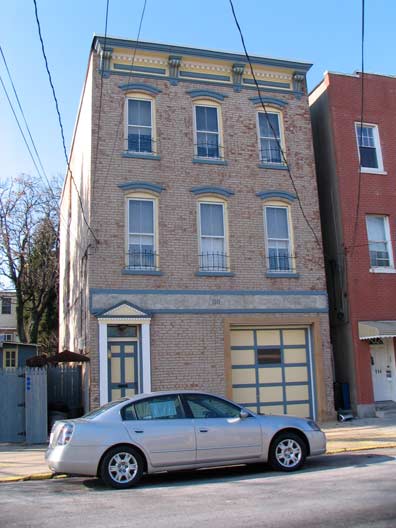
This house on Montgomery still has some original design elements including the roofline corbelling. In recent years the owners have definitely spruced it up with blue and beige paint.
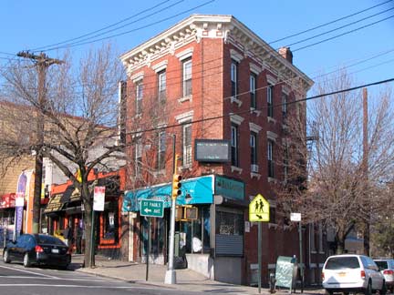
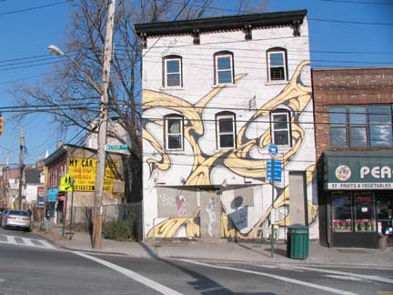
Victory Boulevard (originally Richmond Turnpike) and Montgomery. I would like to know the story, if there is one, behind the artwork on the building on the NE corner.
Entering Tompkinsville
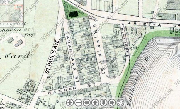
Tompkinsville was founded by a future Vice President, Daniel D. Tompkins (1774-1825) in 1815, while he was the Governor of New York State. He established a ferry service to Manhattan in 1817, possibly from the landing mentioned above at Victory Boulevard, and founded the Richmond Turnpike Company as an expedited means for wagons to travel to Philadelphia and elsewhere on the East Coast; the turnpike, called Arietta Street in Tompkinsville, was renamed Victory Boulevard after World War I. Tompkins was elected Vice President on the ticket with James Monroe in 1816, and served two terms. He died here in Tompkinsville just 3 months after leaving office and is buried in St. Mark’s Churchyard on 2nd Avenue and East 10th Street in Manhattan; nearby Tompkins Square Park also bears his name, as well as Tompkins Avenues in Staten Island and Bedford-Stuyvesant, Brooklyn.
Daniel Tompkins’ wife, Hannah Minthorne Tompkins, is also remembered by Tompkinsville’s street layout. His children were named Hannah, Sarah Ann, Griffin and Minthorne. Originally, streets in Tompkinsville bore their names; today, Van Duzer Street has replaced Sarah Ann Street, Bay Street has replaced Griffin, but Hannah and Minthorne Streets are still in place. Hyatt Street is likely named for Tompkins’ mother, Sarah Ann Hyatt Tompkins. Daniel Van Duzer was a tompkinsvile landowner in the 1830s, with Van duzer Street running through what used to be his holdings.
In 1836 Minthorne Tompkins (the son of Vice President Daniel Tompkins) and merchant William Staples established a ferry to Manhattan and founded the village at Bay and Water Streets. German immigrants built numerous breweries in the area in the 1800s including Bachmann, Bechtel, and Piels, whose brewery was in business on Staten Island until 1963. The region south of Tompkinsville took on the name Stapleton in William Staples’ honor. Above map from 1873 Beers atlas.
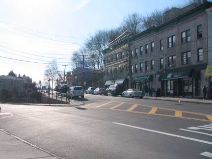
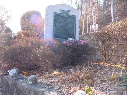
As Yogi once advised, when I got to a fork in the road, I took it. Today I followed the Van Duzer tine of the fork — I had previously traveled on the St. Paul’s Avenue tine, where most of Stapleton’s landmarked houses can be found. In the triangle formed by the two streets is the Tompkinsville World War II memorial, listing the names of area residents who gave their lives in the conflict.
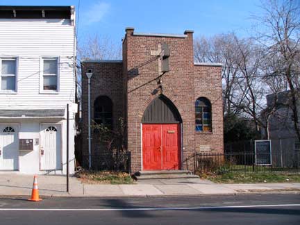
If you know where to look, Staten Island has some very small standalone church buildings (I don’t mean storefront churches, though it has those, like the other boroughs. The brick Bethel Community Church’s cornerstone indicates it was built in 1941.
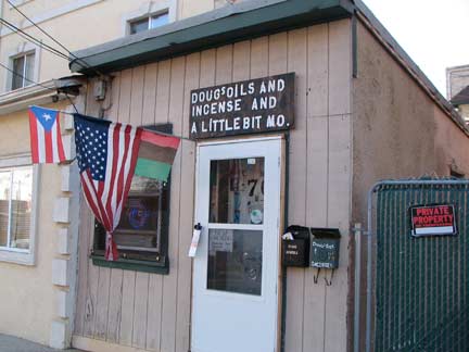
Directly across the street is Doug’s Oils and Incense and A Little Bit Mo. It’s a cultural thing, but I have never understood why people burn incense.
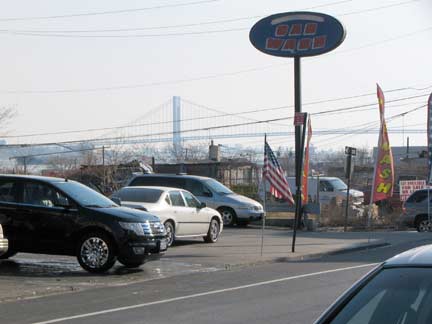
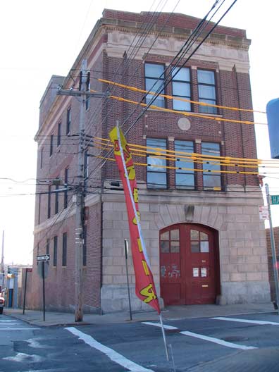
In northeast and southeast Staten Island you are never far away from a view of the Verrazano-Narrows Bridge, which was built between 1959 and 1964, such as here on Van Duzer and Hannah Streets. A decommissioned firehouse stands on the southwest corner of the two streets.
There are some very old homes and buildings in Tompkinsville, some listed and landmarked by the Landmarks Preservation Commission, some not. These are views on Van Duzer and Swan Street — note that he house at the bottom is tilted a bit athwart the other buildings. This could be from a quirk in the property line, perhaps it’s following a vanished creek, or perhaps an alley went through there at one time.
Entering Stapleton
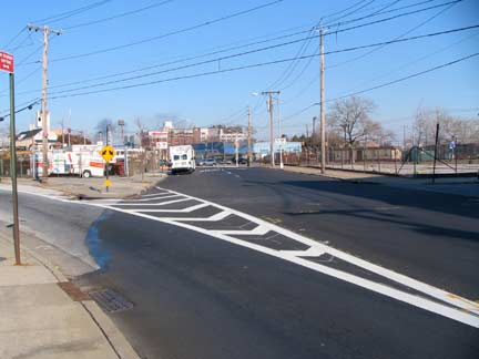
Up until the 1950s or so Van Duzer Street approached Bay Street very closely– just a block away or so at St. Julian Place — but then made a northwest turn and never intersected it. All that changed when the city condemned a couple of buildings and cut through the Van Duzer Street Extension. Since there remain no numbered addresses on it, the city decided to drop the “extension” a couple of decades ago, and now Bay is intersected by plain Van Duzer Street.
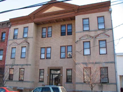
This is about the oldest multifamily building I spotted on Van Duzer, just south of the extension.
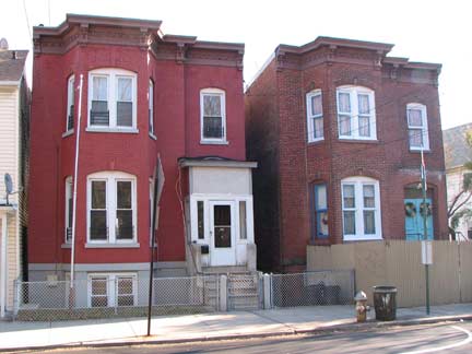
A matched pair: two two-family brick buildings at 255 and 257 Van Duzer.
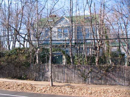
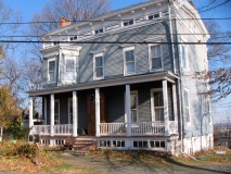
Across the street is a mansion visible only after the leaves fall.
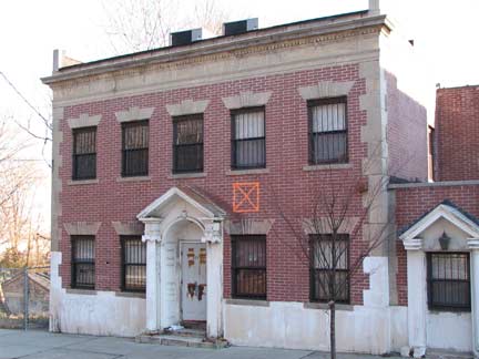
Arriving at William Street. Formerly, William Street was part of Richmond Road, as was all of Van Duzer Street south of it. In the 20th Century, Richmond Road was cut back so it begins at Vanderbilt Avenue, with Van Duzer taking over its route.
X in a box marks unsafe conditions within. This is a frather official-looking building and I wonder what its purpose used to be.
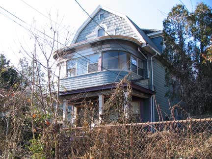
This building has two porches, open on the first floor, enclosed with curved glass windows on the second.
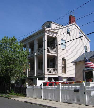
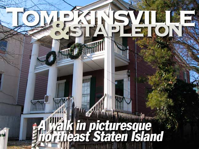
Walking west on William Street to where it ends at Jackson, you find the landmarked David Burgher House at 63 William, with a distinctive two-story portico and Doric columns. Burgher was a fisherman and served as Stapleton Town Sheriff in the mid-19th Century; Stapleton later became part of the larger Village of Edgewater.
The complete story behind the Burger House, as well as the surrounding environs, is found in this Landmarks Preservation Commission Report, from which this photo also came.
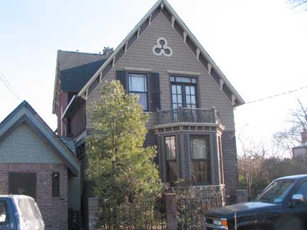
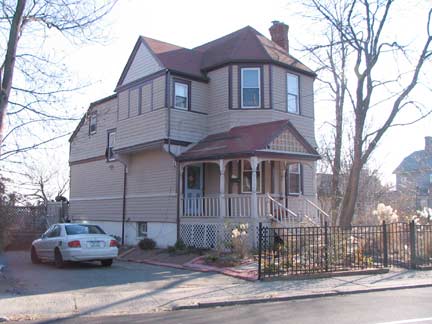
Two more of Van Duzer Street’s eclectic housing stock between William and Sands Streets.
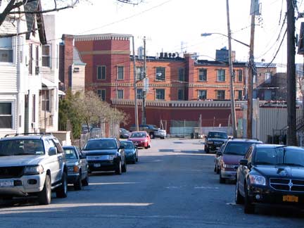
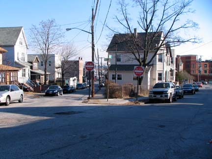
A look at the street map of Stapleton in 1876 and 2011 shows that it’s virtually the same, with some new additions, and Van Duzer Street was cut through all the way to William Street (Richmond Road). Just east of Van Duzer, Sands and Wave Streets make a V; Stapleton also has a Beach, Front, Water, and Canal Streets, where there used to be an actual canal.
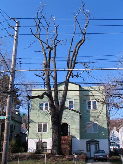
Screaming tree, Van Duzer and Prospect Streets.
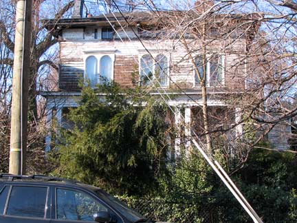
The Italianate 360 Van Duzer, the Anton Muthfessel House, a.k.a the Dr. W.C. Anderson House, was built in the 1850s; Anderson was a Navy surgeon.
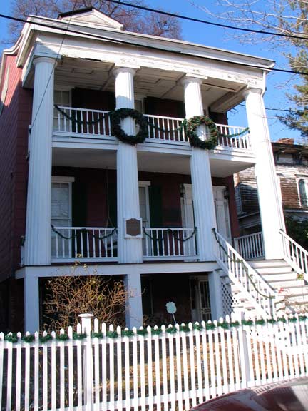
364 Van Duzer, constructed 1834, is a NYC Landmark. It is distinctive for its curving, overhanging eave and Greek-style portico with Doric columns.
Crossing Beach Street, a major intersection since the street connects Stapleton with New Brighton, we find…
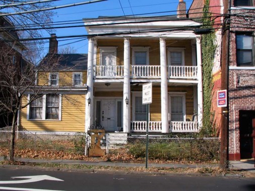
390 Van Duzer, also designated a NYC Landmark in 1973, is thought to be much older than 360, though the two buildings resemble each other. 390 may have been constructed in the late 1700s with its tow-story portico, this time with Corinthian columns, was added on later.
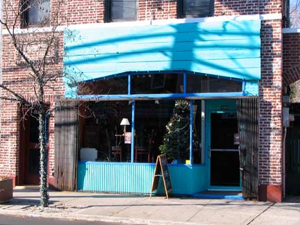
What was originally the Muddy Cup, then just The Cup, at 388 Van Duzer, closed temporarily in August 2010 after ten years. It was a music venue as well as a coffeeshop. TV shows such as The Education of Max Bickford filmed inside. The coffeeshop is now known as The Full Cup.
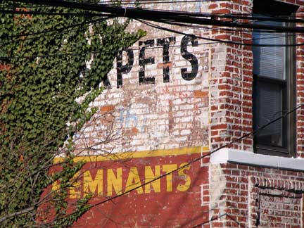
Carpets & remnants painted ad, obscured by ivy.
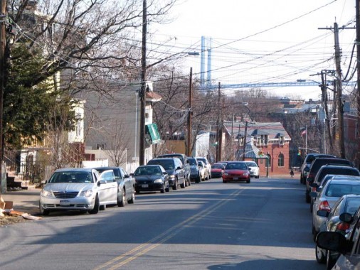
Wright Street, as seen from Van Duzer, affords a direct view of the Verrazano Bridge. At the end of the street in Tappen Park is the Edgewater Town Hall. Just as Kings County was once divided into six separate towns, so was Staten Island: the Town of Castleton comprised St. George, New Brighton, and Livingston; Edgewater consisted of Tompkinsville, Stapleton, and Clifton; Southfield, the entire South Beach area including Grant City and Dongan Hills; Middletown, the Todt Hill region; Northfield was the entire northwest of the island including Port Richmond, Mariners Harbor, Graniteville and Travis; and Southfield, most of the south shore including Richmondtown, Greenridge, Annadale, Huguenot, Prince’s Bay, Richmond Valley and Tottenville. These town distinctions were erased when Staten Island joined NYC in 1898.
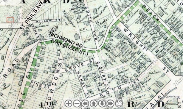
Western Stapleton street plan, 1874. Virtually every street shown here has kept its name; this is unusual in Staten Island, which underwent a great Changing of Street Names around 1912, where most streets acquired new names for some reason. Henry, between Grove and Boyd Streets, is now Hygeia Place.
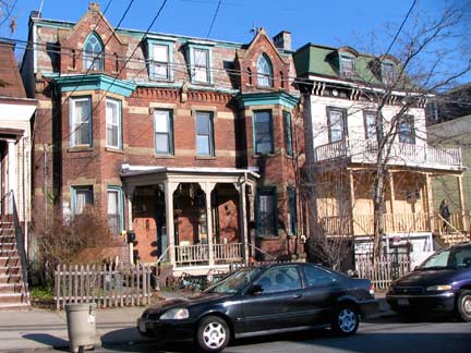
Wright Street houses between Van Duzer and Boyd Streets;
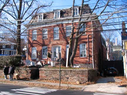
390 Van Duzer at Wright
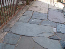
Turning down Boyd Street from Wright, at the bend in the road there’s a house that can be best described as obscure, with weathered exterior, original bluestone sidewalks, and pavement in the street worn down enough so that the underlying brickwork shows through.
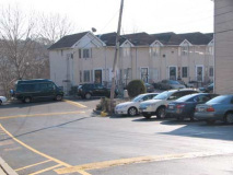
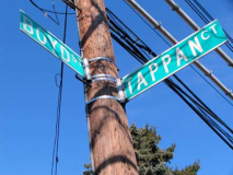
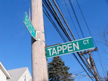
Tappen Court is a short alley off Boyd and Court Streets containing tract housing. The city and the residents of the court do not agree on how to spell it. The NYC sign, above left, is likely wrong, since the court is likely named for nearby Tappen Park, Stapleton’s town square surrounded by Wright, Canal, Water and Bay streets, commemorating a local hero, James Tappen, killed in World War I.
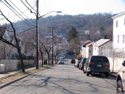
In one of the few mountain views available in NYC, we see Grymes Hill from Boyd and Court Streets.
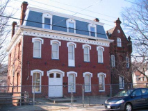
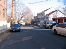
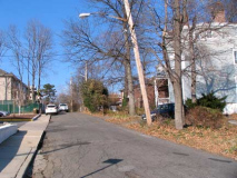
21 Court Street, an elegant brick building with a mansard (slanted) roof, faces Tompkins Court, which looks outwardly nondescript. But I like to follow dead end alleys — you never know if you’ll find something interesting…
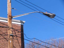
…such as this leftover Westinghouse Silverliner OV25 . The Department of Transportation has been replacing every luminaire in the city the past couple of years — they apparently missed this one. Oops! Kiss it goodbye…
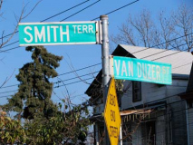
I don’t know why #2 Smith Terrace doesn’t turn up on the protected or landmarked lists. It’s turned away from Smith Terrace a bit, making an odd shaped yard in front. On the above Stapleton map from 1874, it was marked as owned by a K. Jesup. Love those eyelet windows under the eaves.
Photographed December 2010; page completed January 9, 2011
Your webmaster Kevin Walsh: erpietri@earthlink.net
©2011 FNY


1 comment
[…] New York Daily Tribune reported on February 19, 1907, that “a dwelling house, No. 34 Central in Tompkinsville, formerly the property of the late Mrs.Clarissa Dockham, has been sold under foreclosure […]
Comments are closed.