There was a time in this fair city when Sixth Avenue did not run all the way south to Tribeca. In fact, for about the first century of its existence, until about 1928, Sixth Avenue ran north from the obscure intersection of Carmine Street and Minetta Lane in Greenwich Village. The coming of subway lines in Manhattan served to extend both 6th and 7th Avenues south: the IRT was built south along the course of 7th Avenue South in the early 1910s, while Independent Rapid Transit, constructed by NYC, was run south along 6th Avenue into SoHo in the mid to late 1920s. Instead of restoring houses and businesses that were demolished to make way for the trains, the city elected to make more direct routes from Midtown to southern Manhattan and build roads over what had been open subway cuts.
When 6th Avenue was extended south (it now begins at Church and Franklin Streets) it was overlaid over several short streets in Tribeca and the Village. However, it was angled through in such a way that traces of these small routes haven’t been obliterated. In today’s page, we’ll take a look at these short streets, and what surrounds them.
Sullivan Street
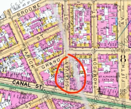
This ca. 1890 map shows Sullivan Street running south as far as Canal Street. When 6th Avenue (shown here as a gray brush stroke) was run through, Sullivan was officially truncated so that it now ends at 6th Avenue and Broome, a couple of blocks north. However, the portion of Sullivan between Canal and Grand was never eliminated, though modern street signs call it Avenue of the Americas/6th Avenue.
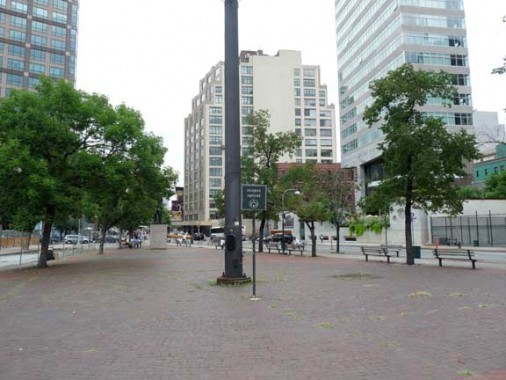
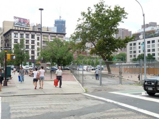
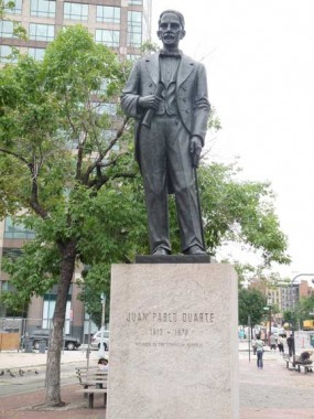 The space between 6th Avenue, Canal Street and Sullivan (now called 6th Avenue) is vast, windswept and red-bricked; at the center stands a statue of Juan Pablo Duarte, considered a founder of the Dominican Republic.
He was born in Santo Domingo in 1813; after studying in Spain from 1828 to 1833, he returned to the island of Hispaniola and conferred with several patriots and organized a secret society, La Trinitaria, to work for independence from Haiti. The Dominican Republic achieved independence from Haiti in 1844. Duarte and his followers did not gain power, however; the Dominican Republic became a military dictatorship. Duarte moved to Venezuela, where he lived most of the rest of his life.
His likeness here was sculpted by Nicola Arrighina and installed in 1978.
Political South American luminaries are recalled in statues all along 6th Avenue up to Central Park. In 1945 Mayor Fiorello LaGuardia renamed 6th Avenue “Avenue of the Americas” and medallions featuring states in North, Central and South America were installed on lampposts. New Yorkers persisted in calling Sixth Avenue by its easier numbered name, and most of the medallions were removed during a renovation in the early 1990s.
The former Sullivan Street, looking south from Grand Street and 6th Avenue
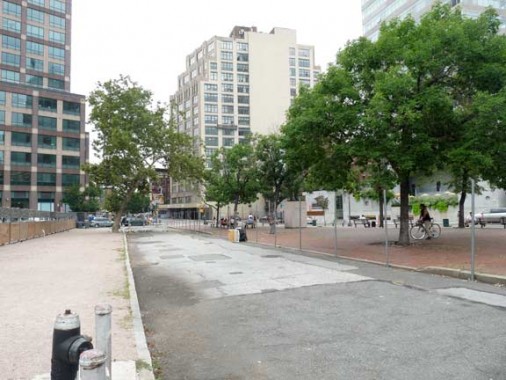
Looking west over Sullivan from 6th Avenue. The old route has been made somewhat starker since the demolition in 2007 of a Corn Exchange Bank building; it has been empty since then. In the rear we can see the 1930 Holland Plaza Building (Ely Jacques Khan, architect) home to the printing industry most of its history (I had a job interview in the building in 2000). It is now home to the Manhattan Center of Adelphi University and Metropolitan College of New York.
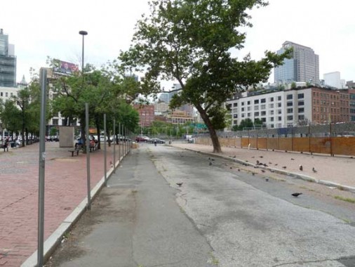
This stub of Sullivan Street is now closed to traffic (looking south at Grand and 6th). In the center, the tower of 1 World Trade Center is rising.
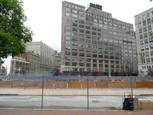
A last look at the course of Sullivan Street, looking south toward Canal. It was once lined on both sides with tenements and multifamily buildings.
Moondance and What Replaced It
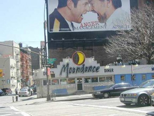
None could say with precision how old the Moondance, on 6th Avenue and Grand Street, was; most accounts had it there as early as 1933, making it the oldest freestanding diner in the city. It was originally known as the Holland Tunnel Diner (the tunnel mouth is a block away on Varick). The railway car-inspired diner retains several original and/or distinctive elements; chrome detailing, a barrel roof ceiling, wrap-around windows, counter & stools, as well as a famed retro revolving moon sign by the late architect/designer Alan Buchsbaum & designer/signmaker Jim Rogers. Actresses Courtney Cox and Kirsten Dunst have played Moondance Diner employees on TV and the movies.
After decades as a somewhat humble greasy spoon,restaurateur Larry Panish upgraded the decor and menu in the 1990s without sacrificing a classic diner feel before selling in 2001. Diner owners, The Extell Group, was set to demolish the diner and construct a high ride condo in its place. However, concerned citizens spoke up: Michael Perlman, Queens preservationist & founder of the Committee To Save The Moondance Diner, and Kyle Supley, Brooklyn preservationist, immediately joined forces & campaigned to save the diner, when its fate was in limbo in 2007..
Extell donated it to the American Diner Museum, which, in turn, sold it to Vince and Cheryl Pierce of LaBarge, Wyoming, where they moved it in 2007.
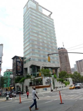
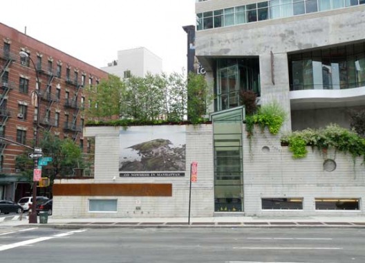
The James Hotel replaced the Moondance at 6th and Grand in 2009 (architect: Eran Chen). It is part of a chain of luxury hotels with franchises in Chicago and New York. Of interest is its rooftop pool and bar, “The Jimmy”:
Once open, the roof bar will offer some pretty stunning views stretching from river to river, as well as a great vantage point to watch the World Trade Center development in real time. Jimmy will have its own entrance on Thompson Street to keep patrons from interfering with hotel operations… [Eater]
6th and Watts
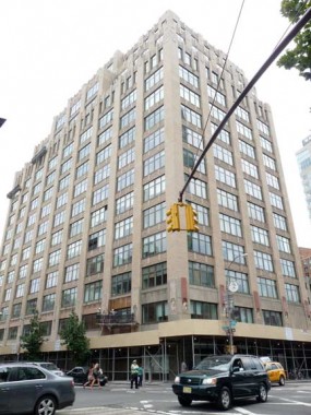
There’s an intriguing high-rise loft building on the SE corner of 6th and Watts built in 1928 (Ely Jacques Kahn, see above Holland Plaza Building).
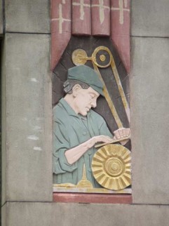
Now simply called 100 6th Avenue, it was originally known as the Green Sixth Avenue Building. Of particular interest are the colored bas reliefs of artisans and workers (both of which are using machines I don’t recognize — help me here in Comments).
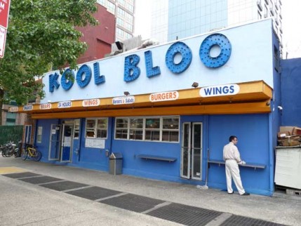
Though the Moondance is gone, the diner milieu isn’t completely absent from lower 6th. Kool Bloo, on 6th between Watts and Broome, peddles basic chow like wings and hamburgers. Oddly, it remains unreviewed in yelp or any other food website, so I van’t verify the quality.
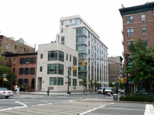
A pair of new residential buildings at the NE corner of 6th and Broome pretty much define the template of apartment house construction in 2011. I like the wraparound corner windows, a feature borrowed from the Art Deco classics on the Grand Concourse.
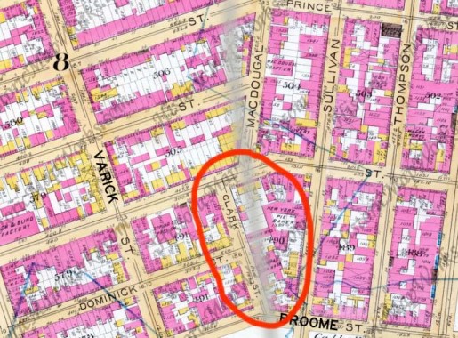
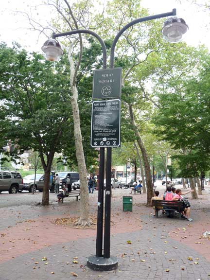
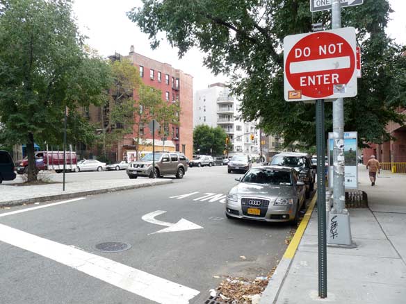
Clark Street ran, or runs, for two blocks from Broome north to Spring. When 6th Avenue, marked here by a gray brush stroke, was extended south, it went just barely to the east of Clark, which was retained in aphysiacal sense, but its identity was stripped and it became an extra western lane of 6th Avenue for two blocks. The space between 6th Avenue and 6th Avenue (formerly Clark) is now occupied by an open space called SoHo Square.
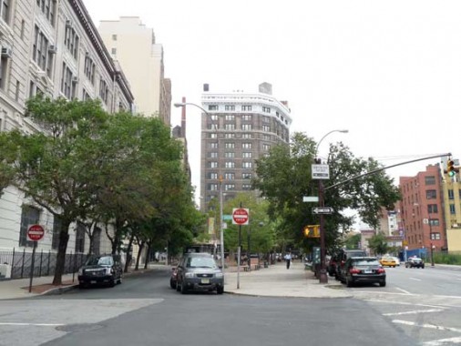
Clark Street, on the left, angled to the northwest against 6th Avenue (the avenue that absorbed it) looking north from Broome.
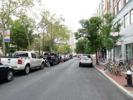
Looking south on Clark, now named 6th Avenue, from Spring Street
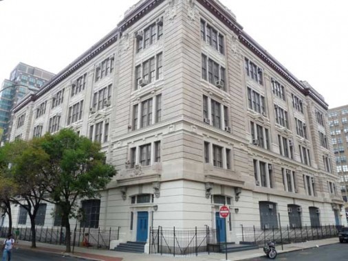
The most conspicuous building on Clark Street, between Broome and Dominick, is the Chelsea Vocational School, now Chelsea Career & Technical High School. From its website: This school was first erected in 1848 as an elementary school and rebuilt in 1858. It was remodeled in 1875. In 1912, the school moved to its new site at Public School 38 located at 8 Clark Street in Manhattan.
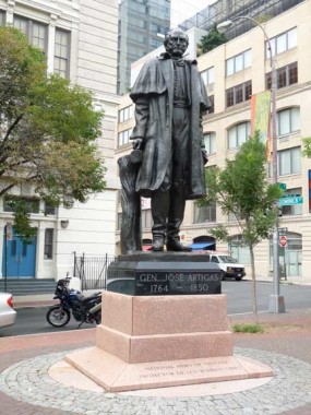 SoHo Square is centerpieced by the statue depicting General José Gervasio Artigas, a leader in Uruguay’s struggle for independence. In the early 1800’s, he raised an army to free Uruguay from Spain. In 1814, however, troops from Argentina captured Montevideo, Uruguay’s chief city. In 1815, Artigas gained control of Montevideo for Uruguay. For a short time that year, he governed most of Uruguay and parts of Argentina. Portuguese troops from Brazil captured Montevideo in 1817, and Artigas fled to Paraguay in 1820. Uruguay did not gain its independence until 1828.
The statue, sculpted by José Luis Zorrella de San Martin, was a gift from Uruguay to NYC in 1997.
6th Avenue Improvements
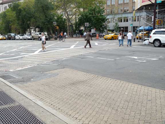
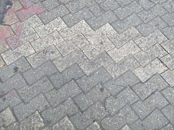
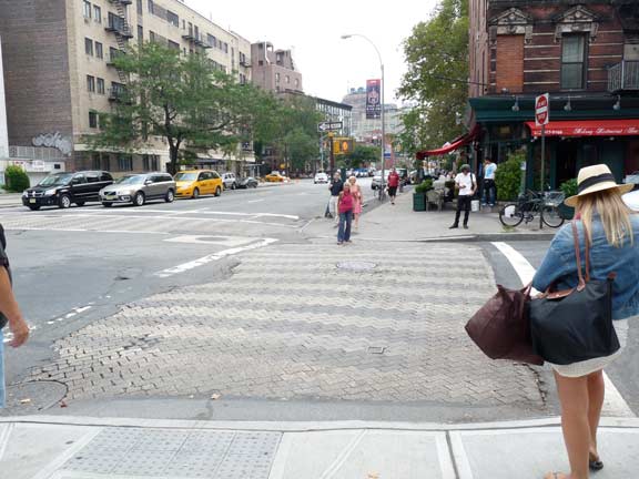
Way back in 1974-1975, lower 6th Avenue was given a makeover, with interlocking brick crosswalks and sidewalk streetlighting. The lampposts were painted chocolate brown. Amazingly most of the makeover is still in place, over 35 years since they were first done. The lampposts still get repainted in brown.
Sidewalk lampposts are davit-style (a single curved post) with “new gumball” luminaires appended.
Three examples of the 1974-1975 crosswalk pavements. When repaving is done, the pavers try to avoid paving over the crosswalks, but they’ve been chipped into over the years.
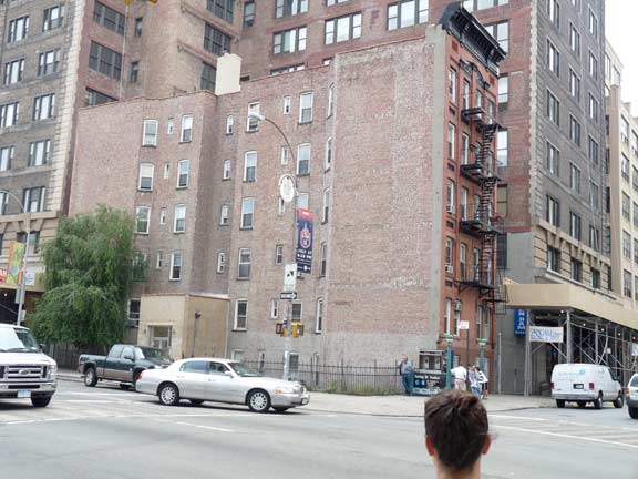
At the west side of Vandam Street is direct evidence that 6th Avenue was extended south, as the side of this apartment building faces the avenue.
Hello Father Fagan
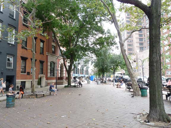
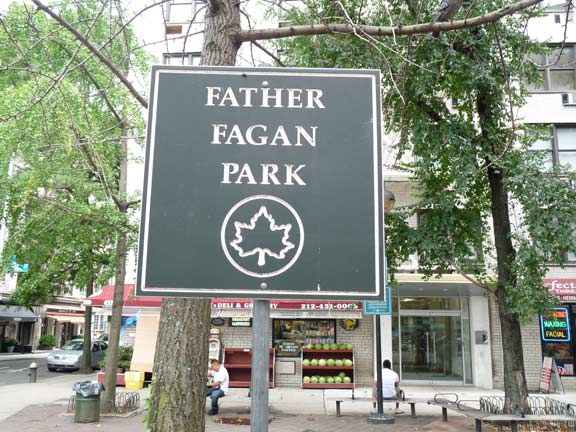
MacDougal Street now officially begins at Prince Street just east of 6th Avenue, but it used to continue south to Spring Street until 6th Avenue absorbed it. Its old course is preserved here at 6th and Prince, as an angle of apartments forms Father Fagan Park.
In 1941 a small park was built here and named for Father Richard Fagan, a young priest at nearby St. Anthony’s Church. Fr. Fagan died heroically while rescuing two other priests in a fire at the church on November 4, 1938.
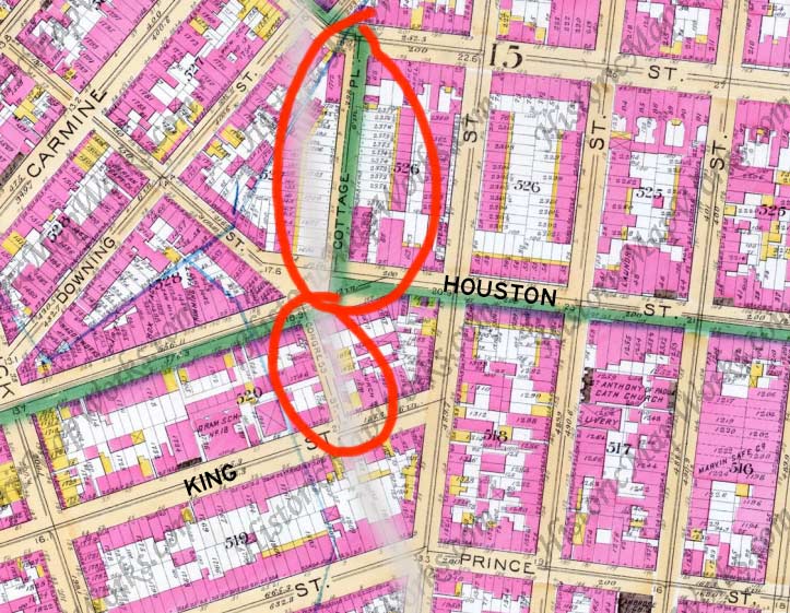
A pair of short streets were swallowed by Sixth Avenue at West Houston when the avenues were extended south.
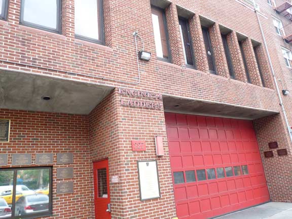
Congress Street ran for a single block, between King Street and West Houston and Bedford Streets. Sixth Avenue was extended south (shown as a gray brush stroke) just to the east of Congress, which failed to obliterate it; it simply became a west turning lane onto West Houston. Congress Street is also called Smith Street on earlier maps.
Firehouse Engine 24/Ladder 5 faces the lane that was once Congress Street.
Hancock Street, also known as Cottage Place (as on the map shown above) ran for a block from West Houston north to Bleecker. Most of it was obliterated by the Sixth Avenue extension, but a small piece of it can be discerned in a widening of 6th Avenue at Bleecker, at “Little Red Square,” named to honor the Little Red Schoolhouse…
….seen here at Bleecker and 6th. In 1921, Elisabeth Irwin founded the experimental school at P.S. 16 on East 16th Street in a red-bricked building annex; by 1932, it had moved to another red brick building at 196 Bleecker. It was among the first schools to try field trips, psychological testing, and may other ideas later adopted by mainstream education. The Schoolhouse is now located at 272 Sixth Avenue at Bleecker.
In Terry Miller’s 1990 book, Greenwich Village and How It Got That Way, resident Ermanno Stingo “remembers Hancock street as a block-long afair that teemed with people and traffic. ‘Remember, there were few through-streets connecting Bleecker and Houston before Sixth Avenue went through…’
‘I remember every Election Day Hancock Street was closed off, and crates and packing boxes were piled high as a second-floor window for great bonfires. I remember them vividly. And I also remember being taken by my mother to the cavernous Fugazy Theatre, which stood at the bottom of Hancock at Houston Street. Once, just after we paid our dime admission, some man pulled a gun and held up the box office. Mother dragged me down the aisle and hid me behind the piano. I remember the pianist went right on playing, as if nothing had happened…”
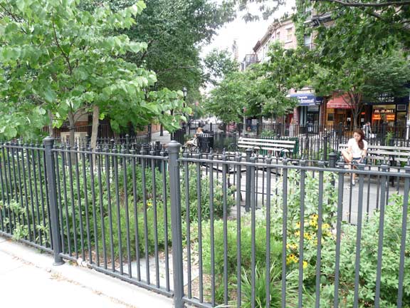
A park, unnamed as far as I can tell, separates West Houston from Bedford Street at 6th Avenue.
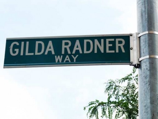
Gilda Radner (1946-1989) was a charter member in 1975 of the original Not-Ready-For-Prime-Time Players, the first and best comedy team from Saturday Night Live; her characters, still fondly remembered today, included Emily Littella and Roseann Rosannadanna (based on real-life 1970s WABC news anchor Roseanne Scamardella).
Six years after Miss Radner’s death from ovarian cancer, an organization named in her memory, Gilda’s Club, was set up as a support group for those living with cancer and their friends and loved ones. The NYC branch can be found at 195 West Houston Street.
Father Demo Square
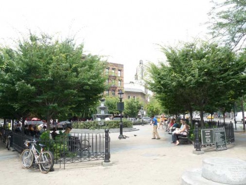
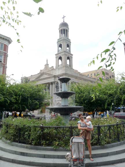
Father Antonio Demo Square, at Bleecker and Carmine Streets and 6th Avenue, was completely renovated in 2006, reopening in early 2007 with a new perimeter fence and central fountain.
The park works as a piazza in front of the high campanile of Our Lady of Pompeii Church. This is the latest of the church’s many locations, and was built in 1928. The previous church was on Bleecker and Minetta Streets…smack in the path of the expanding Sixth Avenue. The pastor, Father Antonio Demo, bought the parcel at Bleecker and Carmine Streets that had earlier hosted a vaudeville hall and St. Benedict the Moor, the first black Catholic church in the city.
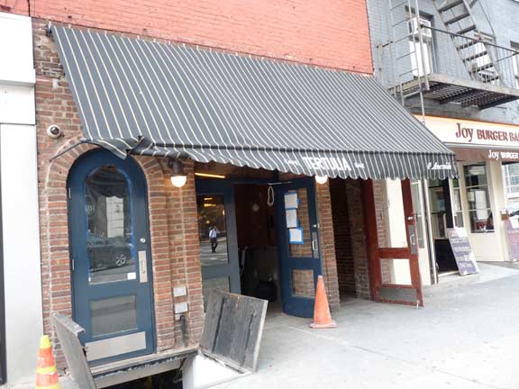
Tertulia, at 359 6th Avenue near West 3rd, is in one of a row of 183os 3-story row houses. Such a pedigree is interesting enough, but in 1922, speakeasy the Red Head held down the ground floor. After a brief move to 88 Washington Place, it moved uptown to 21 West 52nd Street, where it evolved into the 21 Club, where the big deals go to make big deals.
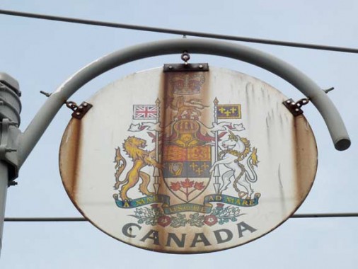
I can’t leave this stretch of 6th Avenue behind without showing one of the distinctive medallions installed around 1960 to honor the Organization of American States. Renovations along 6th Avenue robbed it of most of the medallions, which depicted the coats of arms of all North, Central and South American countries, in the early 1990s. There are still two pockets where you can find them: Greenwich Village and a couple of blocks south of Central Park. Many have rusted in the rain and wind.
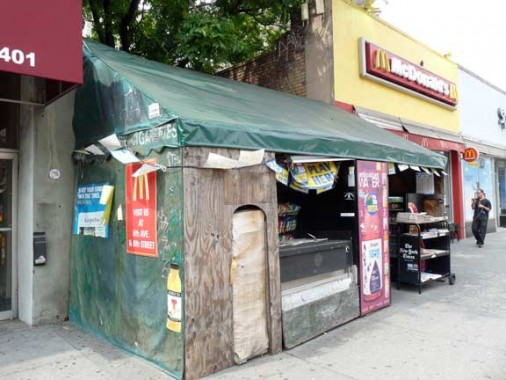
Newsstand shack, 6th Avenue south of Greenwich Avenue. Though many such newsstands around town are being replaced by clear plastic and metal CEMUSA stands, this dealer is having none of it and is still operating out of the same shack he did when I was buying imported music rags like NME here.
9/18/11





26 comments
Great job about 6th Avenue. I still call it Ave. of the Americas. Just to let u know in 1974, the old fire alarm box were installed from Canal St to Carmine St except the one of theN.W. corner of Ave. of the Americas & Broome St.
Thanks for the lovely walk down Lower 6th. The full-size photos make it a very pleasant and gracious stroll indeed!
100 Sixth– The workers seem to be smoothing or sharpening things. Their machines are powered by a belt turned by an overhead axle. The axle would have been turned by a stationary steam engine in the building. You can see similar overhead axles in mills powered by a waterwheel. It’s an old way of distributing power, with no electricity required. The building is from 1928, so the images were historical (or at least old fashioned) when made. I wonder what the idea was.
I’ve always wondered why the school is called “Chelsea” when it’s in Greenwich Village.
100 6th Ave. was the first location for the electronics supply house Lafayette Radio Electronics. Lafayette moved their operations to Liberty Ave in Jamaica and later when more stores opened, demand for a larger facility opened their Jericho Tpke. location in Syosset, LI. Lafayette faded from the scene in the early 1980’s
Would you happen to remember what floor Lafayette Radio was on at their 100 Sixth Ave. NY location?
4th Floor of 100 Six Avenue
Lafayette’s in Syosset became a KMart before it’s current incarnation as a Home Depot. The side street is still called Lafayette Drive. At least the 6th Ave location retains some charm.
My 8th grade teacher used to say that if we all didnt shape up,we’d end up at Chelsea high.Musta been a pretty nasty school at one time,but that was in 1970
In the very first paragraph you call the IND Subway the “Independent Rapid Transit”. In contrast to the IRT and BRT (Later BMT) where the “RT” stood for “Rapid Transit”, the IND never used this terminology. It was rather known simply as the “Independent Subway System” and this was how it was identified on the green signs at all their street entrances. Those signs and the BMT and IRT (blue) ones were replaced starting in the 1970’s (30 years after unification of the 3 systems!) with black ones displaying only the station name and route letter or number designators per the newly adopted graphic standards.
Thanks for the new FNY format- much easier to read and space for comments. This is a great site and contributes much to New Yorker’s knowledge and appreciation about the development of our City. Thanks.
PS- How may I attach a photo to these comments?
Not sure if you can attach a photo, will look…
Elvis seems to be visiting at the Kool Bloo diner.
[…] NY takes a look at lower 6th Avenue & the streets absorbed by its […]
I just posted an archival 1920’s photo of the corner of Watts and Sixth on our facebook page. You might want to add it here. http://www.facebook.com/pages/Lupes/97052155028
The project of the baby still continues to be spark that moves mankind ahead a lot more than teamwork.
Family farms and small businesses will be the backbone of our own communities.
Great job with all the work you guys have done thank you. It works great and looks great. christian church make it easier to there now.
There was a restaurant on the northwest corner of 6th ave & west 3rd st. It existed circa 1978. I got my first paying music gig there, playing guitar and singing. For the life of me I cannot remember the name of the establishment. Anybody know the place I’m talking about?
Phil:
There were 2 restaurants on that corner. One was La Groceria and across the street was O ‘Henry’s.
I worked at La Groceria then, an Italian restaurant, It was in the distinctive anvil-shaped building. It did not have live music, was packed every night. The owner was Gil DeLucia. Now there is a Papaya Dog and a juice bar. You probably woked at O’Henry’s.
The demolished building at the corner of Canal St and former Sullivan Street is still there on Bing Maps! –
http://binged.it/15EfiAl
However once you zoom in, the building disappears.
Does anyone know if I can purchase a book with this information in it. Lower Sixth Avenue is my old neighborhood any information I can find I would like to have to read and keep as memories.
Does anyone know if I can purchase a book with this information in it. Lower Sixth Avenue is my old neighborhood. I used to live on the corner of Grand And Sixth Ave. across from the moondance diner. I would like to get any information I can to read and keep as memories. Thanks for any help you can give.
Does anyone know where I could purchase a book with this information in it. This is my old neighborhood and I would like to have the book to read about it. Thanks for any help anyone maybe help to give me.
Great stroll up lower 6th. I’m fascinated by the changes the late 20s extension made to the neighborhood and especially loved the maps. Just a note old Our Lady of Pompeii Church was on the south side of Bleecker between Hancock and Downing STS. Facing Minetta St. And it was this building ( which resembled St. Joseph on Washington PL or St. Peter on Barclay St) that was the former site of the African American Catholic parish of St Benedict the Moor.
The machines depicted in those tableaus are belt-driven lathes. What there was before the direct-driven variety made them obsolete.
Since you showed the newsstand, which the owner has now been forced to move out of it started to make me wonder. When the WTC PATH Train was destroyed on 9/11, riders had to come to the station at Christopher Street. There was a proposal to put a new entrance in beside Bedford Street, which would have been a problem, not enough room. One person suggested that there was an entrance behind that newsstand that, because of the PATH Station at 9th Street. So today I read about the West 4th Street Station where some one was saying there might have been a exit that was located in the middle of the station, (like where that Newsstand was). Just wondering if anyone can solve this mystery. -West Village resident for 33 Years