Today’s featured walk sent me from Bay Ridge after a dental appointment southeast and east through Sunset Park and Borough Park at the border of Kensington. Well-worn territory for me, and suffused with familiarity and memories…since I was born, raised and spent my first 35 years there. Still, I can always find some little-trodden ground in any exploration. For example, I had really never walked or paid much attention to the section of Fort Hamilton Parkway between 56th Street and Ocean Parkway all that much. Why? The answer is simple: the B16 bus turns at 56th and heads for 14th Avenue (it turned on 13th before it became one way). On a bike, I mostly avoided FHP, since it tends to be a busy truck route. To get to Kensington I usually used quiet 14th Avenue…
Fort Hamilton Parkway
In this 1890 map of mid-Borough Park, the street grid has been drawn up, but little in the way of construction has been done except for pockets here and there. Roads in purple are paved. Fort Hamilton Avenue, now Parkway, is the wide road in the center. 49th Street, running from left to right, has also been paved as has New Utrecht Avenue, which ran alongside a steam railroad that was the precursor of today’s D train elevated. The diagonal line at the bottom was Cowenhoven Lane, which has now vanished except for a couple of driveways here and there.
Fort Hamilton Parkway runs northeast to southwest, connecting Ocean Parkway and its namesake Fort Hamilton, which has been a US military reservation since 1831. Ocean Parkway was built from 1874-1880, and it’s likely FHP was a feeder road from the fort to the parkway. The street grid it intersects was drawn up in the 1870s and gradually built out over the ensuing decades.
Presently the term “parkway” is a misnomer since FHP is a busy truck route.
Confraternity of the Most Precious Blood
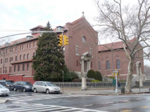
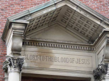
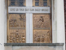
At FHP and 53rd Street there is a massive nunnery, the Sister Adorers of the Precious Blood (sounds like an organization J.R.R. Tolkein — a Catholic himself — would conceive of), which established in 1861 in St. Hyacinthe, Quebec and came to the United States and to Brooklyn in 1890 at the request of Bishop John Loughlin (of Bishop Loughlin High School fame). Their present building here was constructed from 1905-1910. Beginning in 1925 the order was under the leadership of St. Francis College graduate Father Joseph Stedman, who elevated it to prominence by publishing a massive array of Catholic-themed books under the Church imprimatur labeled Confraternity of the Precious Blood, including missals and philosophical treatises. At the time of his death, it was noted that more than 13,000,000 copies of his books had been sold. Fr. Stedman died at the youthful age of 48.
I have some of them:
Some of these were St. Joseph editions, published by the Catholic Book Publishing Corporation, which is still in business, producing daily and Sunday missals. Of these titles, My Meditations on Saint Paul and The Whole Story were issued by the Confraternity of the Precious Blood.
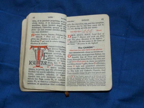
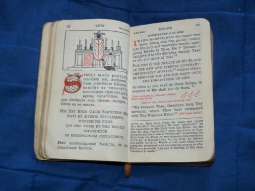
A couple of sample pages from the Sunday missal. Prior to 1967 Mass was given in Latin; after that, English was the main language used, though there remained some Latin and Greek (the Kyrie eleison). These missals strive to replicate the illuminated Bibles of the middle ages by showing a large initial letter with artwork.
Did you know that ecclesiastical Latin is spoken much differently than regular Latin? For example, Julius Caesar’s statement, veni, vidi, vici was likely pronounced “wenni, widdi, wicki” but the church version is closer to modern Italian; hence, “vayni, veedee, veechee.”
I attended Catholic schools all the way from K to college, and grew up around priests and nuns. I have a great respect for Catholic rituals and the various philosophies behind Catholicism. And, I loved collecting prayerbooks even if I didn’t do a lot of praying.
Back to Borough Park…
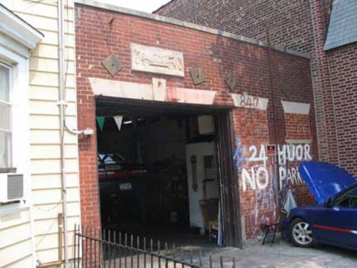
A garage on 840 52nd near 9th Avenue belies its true age when you see the flivver above the door. OK, name THAT car! 24 huor parking here.
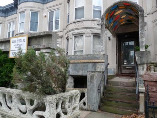
With its Aztec stylings, 974 52nd is among the true wonders of our age. I will have a complete set sometime soon.
Where It All Started
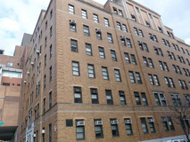
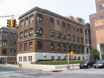
Maimonides Hospital, 4802 10th Avenue, began as the New Utrecht Dispensary in 1911. Several small dispensaries merged with Utrecht in 1919 to form the Israel Hospital of Brooklyn. In 1920 it merged with Zion hospital and became United Israel Zion Hospital. The United Israel Zion Hospital and Beth Moses Hospital merged in 1947 to give rise to the Maimonides Medical Center. The institution is named after Rabbi Moshe Ben Maimon, the 12th century philosopher who established the concept of medicine as a natural science and authored ten medical books that set forth the foundation of modern medical training of physicians.
The Maimonides Medical Center was the place of several innovations in clinical science. In 1961, the commercial pacemaker was developed in the Maimonides Research Laboratory.The same laboratory was co-developer of Intra-aortic balloon pump in 1970. Implantation of first partial mechanical heart was performed in the hospital in 1966. In the following year, the second human heart transplant in US was performed in the medical center by Dr. Adrian Kantrowitz. Several technical feats were achieved by the clinicians in the hospital, such as the first needle aspiration biopsy in US (in 1981), first robotic surgery for pediatric patients in US (in 2001), first angioplasty during a heart attack (in 1983). wikipedia
Your webmaster breathed his first in Maimonides in 1957. I’ve only been back a couple of times since then. I don’t remember which building I was born in–there was a lot going on that day.
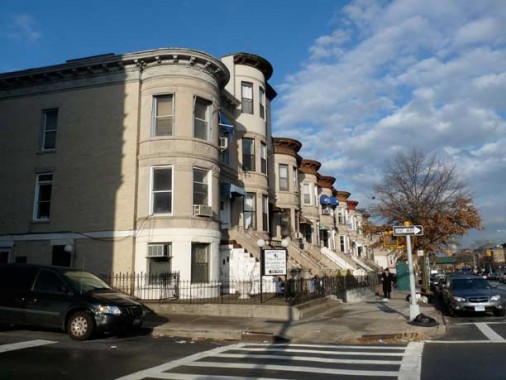
Fort Hamilton Parkway’s attached homes at 49th Street. Both sides of the route are lined with these, which probably wee built in the 19-teens.
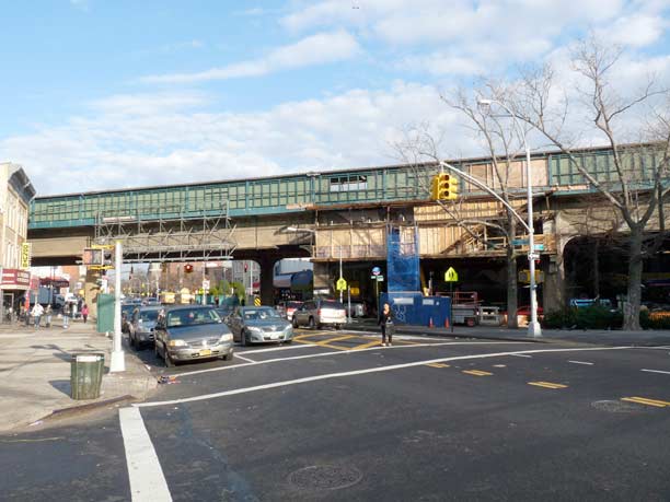
Today, the two streets make a big X against the Borough Park street grid, but in the late 1800s, Fort Hamilton “Avenue” and the “New Utrecht Plank Road” were the only routes through the farms and fields of southwest Kings County. The el has rumbled through since 1917, replacing a surface steam railroad.
St. Catherine of Alexandria Roman Catholic Church at FHP and 41st Street is a scene veteran–it was built in 1901.
…a Christian saint and virgin, who was martyred in the early 4th century at the hands of the pagan emperor Maxentius. According to her hagiography, she was both a princess and a noted scholar, who became a Christian around the age of fourteen, and herself converted hundreds of people to Christianity. Over 1,100 years following her martyrdom, St. Joan of Arc identified Catherine as one of the Saints who appeared to her and counselled her. wikipedia
The term Catherine Wheel means both an instrument of torture — it was named for the device on which St. Catherine of Alexandria was to be martyred — and also a variety of fireworks instituted in 1769 during the reign of Catherine The Great in Russia. Neither has anything to do with the other.
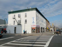
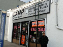
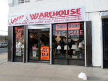
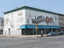
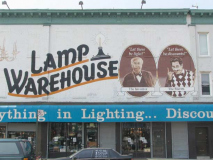
Lamp Warehouse has been in business since 1965 and for a long time they had immense painted signs on the NW corner of FHP and 39th Street signifying their presence. Apparently they have lost some space, as most of the front has been whitewashed and there’s just a small front and side entrance now.
Tracks crossing Ft. Hamilton Parkway at 37th Street belie the former presence of the South Brooklyn Railroad, a former freight line that traveled from the Cross-Harbor Railway, still in existence today at the Sunset Park waterfront through a right-of-way here, then beneath the Culver el tracks on McDonald Avenue to the Coney Island Yards. The tracks delivered rolling stock and factory materials. Today, freight traffic is simply carried on the el tracks, which have a connection to the CHRR.
Speaking of the Culver el, it used to cross the Parkway here as well, and actually had a station here. The el branched from the old 5th Avenue El, demolished in 1940, and traveled south aslong 37th Street and then down McDonald to Coney Island. After 1956, the Culver El became a shuttle connecting the West End El and the Culver on McDonald, which gained a connection to the IND Subway via a ramp. The whole shebang was abandoned in 1975, and the el was left to rot and deteriorate till it was finally demolished in 1985.
Here’s an FNY page on the abandoned Culver.
Where an el once rumbled, quiet houses and trees now stand.
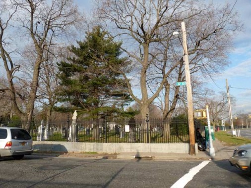
From 37th Street to McDonald Avenue, Fort Hamilton Parkway forms the eastern edge of Green-Wood Cemetery. The road was likely built after the cemetery’s edge had been defined, as it opened for interments in 1838.
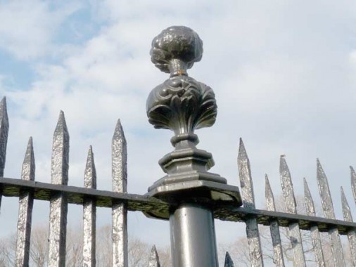
The distinctive Green-Wood Cemetery fence design–it apparently represents two bushes. There are hundreds of these along the fence surrounding the burial park, which is vast.
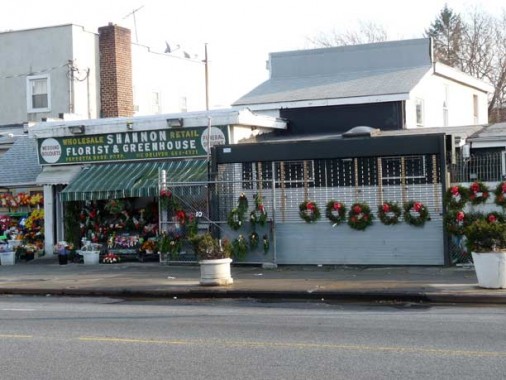
Along the cemetery, FHP is lined with fast food joints, auto repair places, and flower retailers. The cemetery’s southern entrance is on the Parkway just west of Dahill Road.
As Yogi will tell you, when there’s a fork in the road, take it. One of Brooklyn’s busier routes, Caton Avenue, branches from FHP at Dahill Road and runs east. At Coney Island, it acquires the NY State 27 designation, which it passes off to Linden Boulevard at Bedford Avenue. The Caton, Martense and Crooke families, descended from Dutch settlers, were all related by marriage, and each is honored with a Brooklyn street name. Caton Avenue accepts FHP’s eastbound traffic.
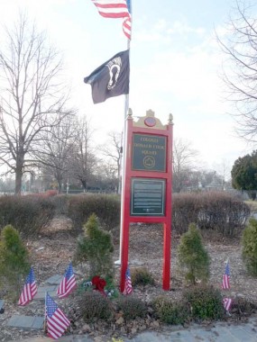
The triangle formed by FHP and Caton and McDonald Avenues has been designated Colonel Donald Cook Square.
Donald Cook was born in Brooklyn, New York. He attended Xavier High School in New York City and St. Michael’s College in Vermont. In 1956 he enlisted in the Marine Corps as a private but was quickly sent for officer training in Quantico,Virginia. He was commissioned a second lieutenant in 1957. He held a series of assignments in the Marine Corps and was sent to Vietnam in 1964, where he was wounded and captured by the Viet Cong several weeks later. He was held as a prisoner of war by the Viet Cong in the Republic of Vietnam from December 31, 1964 until his death at age 33 in 1967. He was posthumously promoted from Captain to Colonel.
Although his body was never recovered, his grave can be found in the Memorial Section MI Lot 110at Arlington National Cemetery in Virginia. wikipedia
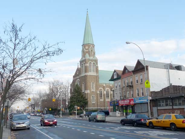
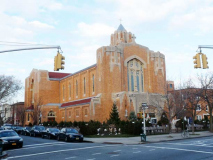
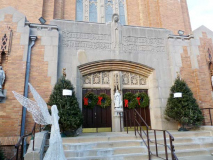
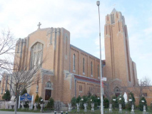
Immaculate Heart of Mary Church, Ft. Hamilton Parkway and East 4th Street. The church’s website is resolutely silent on the parish’s origins or when the building was dedicated; since this looks like 1950s construction, I’d imagine it replaced an earlier building. I can tell you I attended a wedding here in July 1988 and it was darned hot.
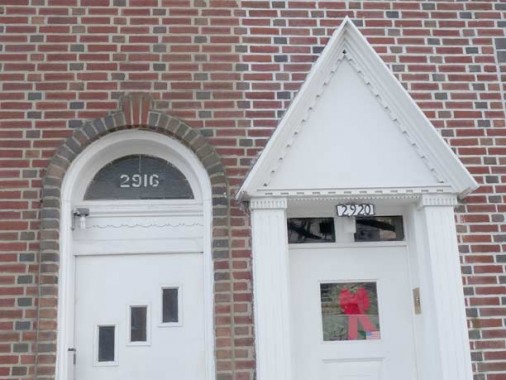
Between Ocean Parkway and Dahill Road, Fort Hamilton Parkway intersects the numbered streets that are part of the mid-Brooklyn, i.e. Flatbush, numbering system, which consist of East streets east of McDonald Avenue and West streets west of it, and it runs through East 2nd, 3rd, 4th and 5th Streets. However, the FHP house numbers carry on as if they are still progressing east from the western Brooklyn system: numbered streets without a prefix, i.e. the numbers decrease as you go north and east. The last numbered street in that sequence the Parkway passes is 36th Street, but the house numbering merrily carries on in that vein as though the Parkway intersected every street from 35th through 28th.
So, at East 3rd you have Fort Hamilton Parkway house numbers in the 2900s, even though 29th Street gets no further south than 5th Avenue at Green-Wood Cemetery.
Stephen DiBrienza law office, FHP and East 4th. In the 1990s, DiBrienza was an outsopken City Councilman from the 39th District known for sparring with Mayor Rudy Giuliani.
Attached houses, FHP and East 4th
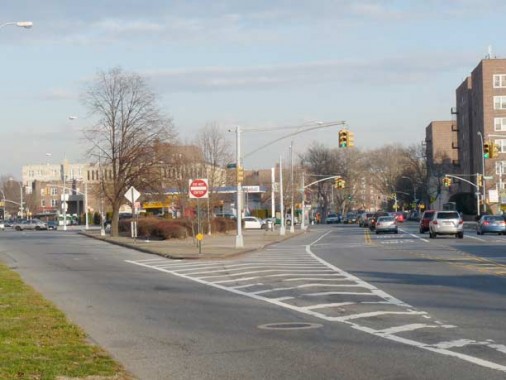
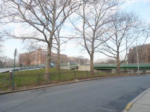
Shown here is the west end of Fort Hamilton Parkway as it becomes the left lane of Ocean Parkway; at left, another lane is bridged over the Prospect Expressway to meet Ocean Parkway on the other side. This interchange was the last pice of the Prospect to be completed, in 1962.
PS130, the Parkside School, Ocean Parkway near FHP. Like churches, architectural details on schools are sometimes harder to find than hen’s teeth.
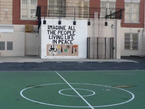
The play yard in back of the school quotes Lennon. When you really think about it, do you really want no possessions, and no religion, too?
Talk amongst yourselves. I’m going back in my hole to ponder these things on the way home.
2/22/12










17 comments
“liter”,” huor” : Brooklyn literacy, not so good. The car parked in front of that sign of iliteracy? Hard to say as the photo lacks detail. All one can say is that it’s blue with a red stripe. I hope the owner can read road signs better than he can spell. And no I’m not being insensitive to dyslectics. As for the image presented on the brick, it looks like a generic image of any runabout built between the brass era & the ’20’s (which was aproximately the life span of the Model T Ford, 1908 -27). As my geometry teacher used to say: They’re similar but not identical.
I will go out on a limb and call the flivver a Maxwell.
Donald Cook was awarded the Medal of Honor and their is also a USN Destroyer named after him.
According to Tolkien, Huor was father to Tuor who wed an elf and whose son Earendil sailed to Valinor to convince the gods to overthrow the evil god Morgoth and put him in the void. We now see the light of a silmaril on the forehead of Earendil as a symbol of hope when he sails near the sun at sunrise and sunset (Venus). What an imagination for a converted Catholic!
Walsh!
What does the initials IHS on a communion wafer and other catholic icons stand for?
I Have Suffered?
WRONG!!!
It stand for Isis,Horus and Sebus,Egyptian gods!!
What idolatry is this?
What knavery be that?
Is this the church of Christ?…..
…or The church of satan??!!!!
http://www.newadvent.org/cathen/07649a.htm
If my memory serves me correctly, IHS stood for Jesus Christ King of the Jews.
Apparently not. But INRI is something like Iesu Nazareni Rex Iudaei – Jesis of Nazareth king of the Jews.
Love reading about Brooklyn neighborhoods. Here is the link to info on the original Immaculate Heart of Mary Parish established in 1893. This is part of Kensington, not Borough Park
When the Prospect Expressway was built, it divided the parish in half. Hundreds of homes were lost to the building of the Expressway.
http://www.nycago.org/Organs/Bkln/html/ImmaculateHeartMary.html
Actually the Church is Windsor Terrace. Ft. Hamilton Parkway was the dividing line of Kensington/Windsor Terrace
Well, that’s a stretch; the church is on the north side of the parkway. You can call it either area.
That was my Parish for 29 years – I lived on Albemarle Road & E. 3rd St until 2007. The people north of Ft. Hamilton referred to themselves as living in Windsor Terrace.
As a young paper-boy delivering the NY Post, I noticed that many buildings were built on 10th Ave, as opposed to Ft Ham. Pkwy, were not face fronting in a 90* angle. One can see that Most Precious Blood is not parallel to the outside street, but would be contiguous with a street called 10th Avenue.
A little late to this posting, but it turned up in a web search. My sister and I were trying to remember the name of a Finnish Catering Hall that was on a side street in Sunset Park, perhaps off 8th Avenue. We both remember going to a kids party or two there (we lived in Bay Ridge and had several Finnish friends from our Lutheran Church) back in the early 60’s. I believe it was still operating as late as the 1980’s. I has hoping maybe you or one of your readers can help us with the name and location, and what became of it For some reason I think the name was something like “Kumatra or Sumatra Hall”, but as Kramer of Seinfeld might say, that might be “way way off”.
Thanks for any help. –Ken
Imatra Hall.
I grew up in that area and was a parishioner of IHM. Immaculate Heart of Mary Church was founded and the cornerstone laid in the year 1893. The cornerstone of the present building was laid in the year 1931. Here is a link to what I found:
http://www.nycago.org/Organs/Bkln/html/ImmaculateHeartMary.html
It was great to see the Swedish club..but you missed the Danish Club right next door. The only Scandinavian restaurant left in bay ridge/sunset park.