I found myself shambling north on York Avenue in the dishrag New York heat and humidity (wasn’t even that hot yet, being May) and was wondering if I would escape the impending downpour. (It did rain later but not that hard.) The freelance money I had been depending on has dried up at least for now, so the rag tag website Forgotten New York and its ancillary activities, comprising ads, tours, occasional appearances and articles written for other publications, are my sole source of income for now, along with the remainder of unemployment insurance that the House of Representatives refused to extend. The Wandering Sickness takes hold at times when I am ruminating about this, and I take a train somewhere, get off and begin taking pictures of what seems interesting. I carry a camera everywhere, even on job interviews. The other day I took photos of the remains of Manhattan’s Music Row on West 48th after leaving an agency on 6th Avenue.
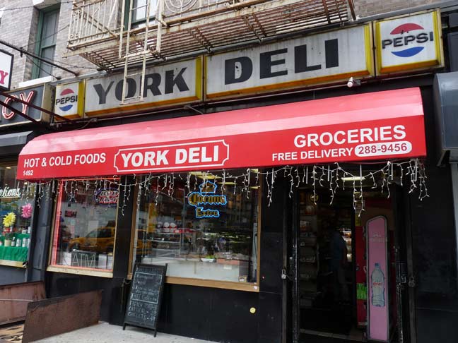
At York Avenue, named for World War I hero Sergeant Alvin York and not the “York” in New York, and East 79th Street is this sublimely simple delicatessen awning sign. There is the requisite cheap vinyl sign under it, but above it are illuminated panels featuring the Pepsi-Cola bullet logo, circa 1967 or so. The round shape is representative of a bottlecap, which appeared graphically until the early 1970s.
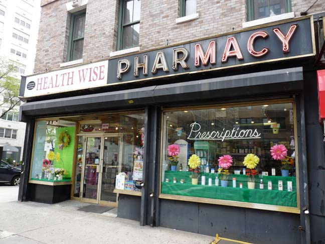
Half a classic neon drugstore sign appears on the corner store. The original name undoubtedly appeared on the left side of the sign, but has long since been removed.
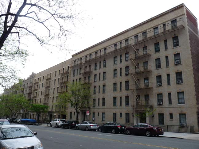
Some stolid apartment buildings along the south side of East 79th Street, or a “block of flats” as they call them in Britain.
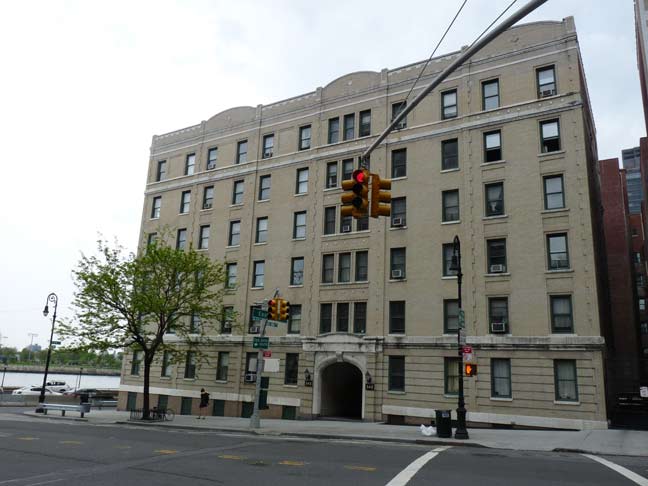
Another in the same vein at East 79th Street and East End Avenue. Yes, some of the apartments in the building have river views.
Manhattan Island bulges further east here than it does at any other point north of 23rd Street, and an additional north-south street was laid out that runs between East 79th and East 90th Street. Knowing that York Avenue was once called Avenue A, I wondered if East End Avenue was ever called Avenue B?
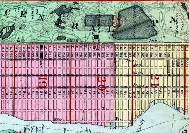
Sure it was; this atlas plate from 1885 shows it. The street was laid out in 1876 and after a campaign by local property owners, changed to East End Avenue in 1890, likely following the influence of West End Avenue, which had been changed from 11th Avenue in 1880. In the 1970s, North and South End Avenues were laid out in Battery Park City.
The “End” avenues are about as close as Manhattan street names ever got to a theme, though many streets in Tribeca are named for figures associated with Trinity Church. Because most of its streets are generically numbered, Manhattan lost out on, say, Washington, DC’s theme of avenues named for states. (The Bronx features dozens of streets for NYC mayors; Staten Island, astronauts.)
1890 also saw 9th Avenue become Columbus and 10th Avenue become Amsterdam.
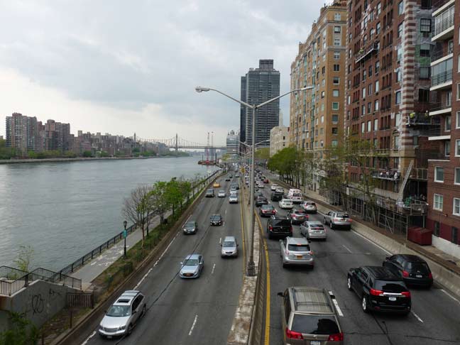
A footbridge on East 81st Street over the FDR Drive, seen looking south, is also the southern end of the John Finley Walk along the water, bridged over the FDR Drive north to Carl Schurz Park.
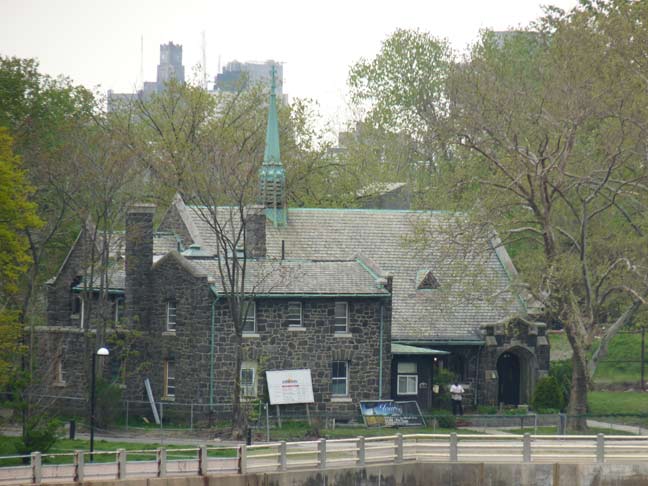
From the end of the footbridge over the FDR, I aimed the camera at Roosevelt Island. Here’s one of its littler-known older buildings, the Episcopal Church of the Holy Spirit.
Built in 1924 from island-quarried gneiss as a chapel for Metropolitan Hospital, with an attached rectory for the hospital’s chaplain, it stood abandoned between 1955 and 1975 after Metropolitan moved to Manhattan Island. It has subsequently been the Redeemed Christian Church of God and Dayspring Church. It’s located on the west side of mid-island facing Manhattan.
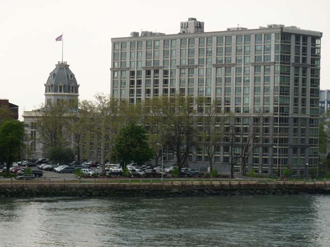
This is about a decade-old restoration/reconstruction of The Octagon, built as an island retreat in 1841 by architect Alexander Jackson Davis, featuring a decorative rotunda on an 8-sided base. Inside was a grand spiral staircase and a glass brick floor. The mansion became Metropolitan Hospital in 1894, but the hospital moved in 1955 ,and the building had decayed and mostly burned down since that time. By the time I encountered it in 1999 on;y the octagonal base remained. Beginning in 2006 the firm of Becker & Becker Associates reconstructed it using much of the original Davis layout, and it is now luxury housing.
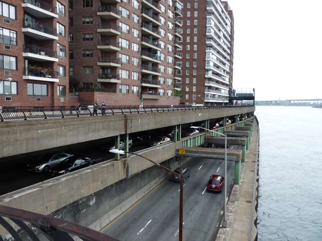
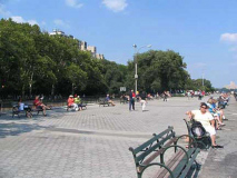
Showing the triple-decker FDR Drive, with the John Finley Walk on top. A similar triple-deck arrangement can be found in Brooklyn Heights, where the Brooklyn-Queens Expressway is double decked along the East River, with the Esplanade, or Promenade, on the top deck.
Using these two photos from a previous visit…
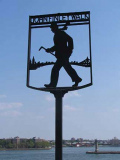
John Finley Walk, the top deck of Franklin D. Roosevelt Drive, runs along the East River from East 81st Street to Gracie Mansion where it loses its width and continues north to East Harlem. It is similar to Promenade in Brooklyn Heights, with rather less spectacular views, though they’re still good. It was named for Harper’s Weekly editor and City College president John Finley (1863-1940). Finley Walk’s distinctive iron signs were designed by cartoonist Edwin Marcus and architect Harry Stevenson.
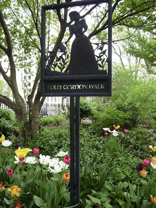
I had thought that the John Finley sign was the only one of its kind, but leaving the walk and going west along West 84th, or Gracie Square, I found the sign identifying it as Polly Gordon Walk. The sign commemorates Mary Rousmaniere “Polly” Gordon, a resident at #10 Gracie Square who was involved in community causes with her husband Al Gordon, a former CEO of Kidder Peabody, notably the local YWCA.
Gracie Square and nearby Gracie Terrace and mayoral residence Gracie Mansion are named for Scottish shipping entrepreneur Archibald Gracie (1755-1829) who purchased land at what was called Horn’s Hook after the Revolutionary War and built Gracie Mansion there in 1799. He received guests such as President John Quincy Adams and French monarch Louis Philippe. Gracie sold his estate in 1823 and it was acquired by New York City in 1891; its 11 acres were incorporated into Carl Schurz Park. Fiorello LaGuardia was the first NYC mayor to use it as a residence when he and his family moved in in 1942.
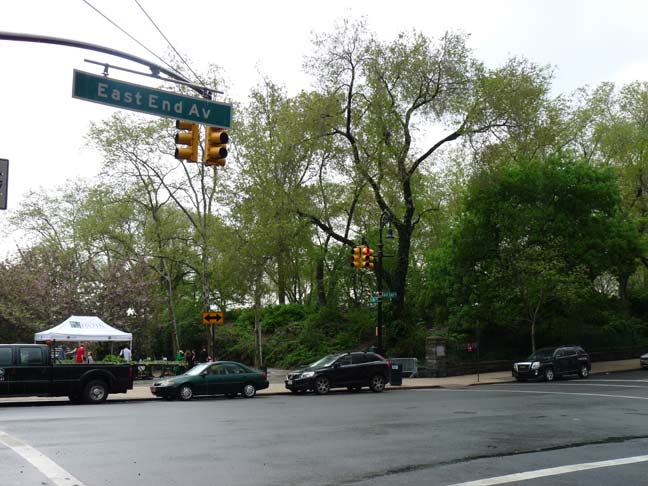
Carl Schurz Park, between East End Avenue, the FDR Drive and East 84th and 90th Streets, is named for a mid-19th century German immigrant (1829-1906) who became a US Senator from Missouri (1869-1875), Rutherford Hayes’ Secretary of the Interior (1877-81), editor of the New York Tribune and Harper’s Weekly. A statue of Schurz can be found at Morningside Drive and East 116th Street, and a lengthy avenue in Throgs Neck, Bronx, also commemorates him. Nearby Yorkville was heavily German in the past, and the park celebrates one of their own. His most famous quote was: “Our country right or wrong. When right, to be kept right; when wrong, to be put right.”
I have mentioned before in FNY that Manhattan and much of Brooklyn, unlike other older east coast cities like Boston, Philly and even Newark and Jersey City, don’t have much in the way of dead ends and alleys. Records and older maps show that downtown Manhattan and Brooklyn had had lots of them in the past, but real estate is valuable in a concentrated area and many of gthese odd lanes have been demapped and then built over.
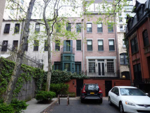
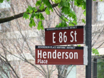
No such threat exists for Henderson Place, on East 86th Street between York and East End Avenues. Henderson Place is its very own Landmark District. The alley, and parts of East 86th & 87th Streets and East End Avenue, are home to 24 row houses of the eclectic Queen Anne style built in 1883 by the firm of Lamb & Rich (who also built Sagamore Hill, Teddy Roosevelt’s Oyster Bay home) for developer John Henderson that are dwarfed by the high-rise apartment houses that are more typical of the area. Alfred Lunt and Lynn Fontanne, the famed husband-and-wife acting couple, lived on Henderson Place for years. The houses rented for just $650 in 1883!
Henderson Place was built as a development for persons “of modest means” but has become much more expensive in subsequent decades. In the mid-2000s, a Henderson Place house would cost in the seven figures.
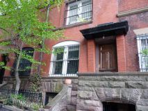
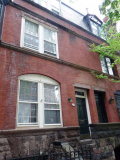
#549-553 East 86th Street feature windowed dormers and handsome arched windows.
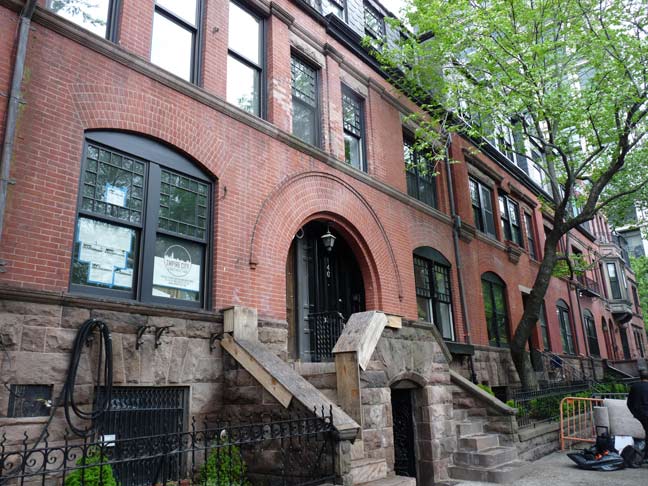
#146 East End Avenue features a massive arched brick entrance.
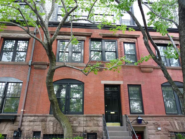
#148 and #150 are entered in two different ways. The basement entrance at 150 was a later alteration as well as the single window above it.
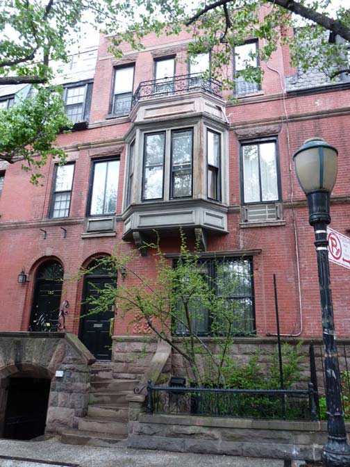
#152 and 154 East End Avenue share front landing steps and both have an arched doorway, smaller though than the one at #146. A generous bay window has been added to #154. Note that the city has installed Type B park lamps, perhaps for atmosphere.
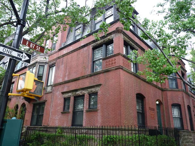
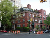
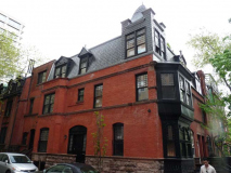
#558 East 87th Street, on the corner of East End Avenue, features a corner tower, terra cotta panels, brick bay window, gable and dormer windows.
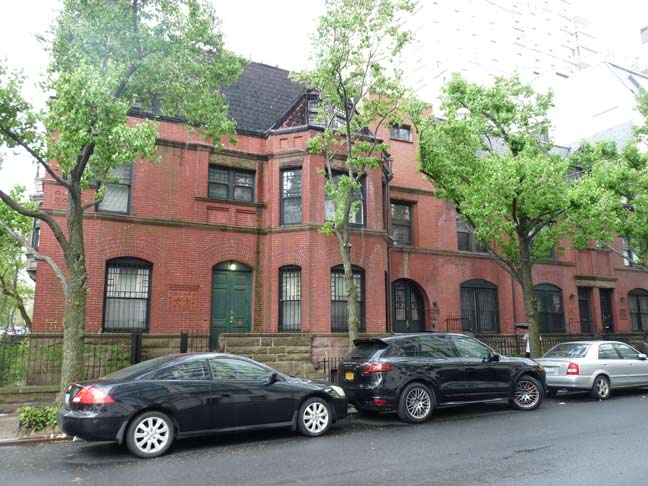
Showing #558 as well as #552-556 East 87th Street.
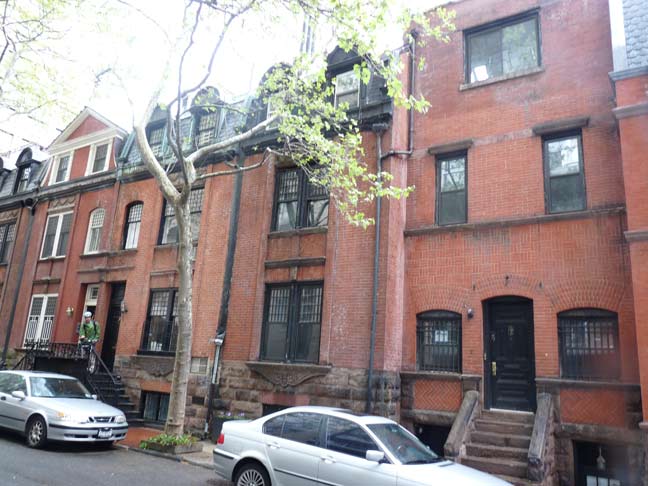
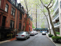
Only the east side of Henderson Place itself has retained the original brick dwellings; a high-rise apartment was built, replacing the homes on the west side, before the whole district could be landmarked.
The group of contiguous dwellings constituting the Henderson Place Historic District was designed with the characteristics of the Elizabethan manor house combined with Flemish and classic detail in a style developed in England between 1870 and 1910, principally by Norman Shaw. He was a scholarly architect who wanted to evolve a comfortable and romantic domestic style. For reasons that had little to do with the good queen, who reigned from 1702 to 1714, this late 19th Century style became popularly known as “Queen Anne.” Landmarks Designation Report
Above is #8 Henderson Place at right. The LPC report believes it was altered from its original appearance. The buildings all have different window treatments, square and arched, different entrances and different dormer treatments. Quite a different philosophy from today’s cookie cutter methods.
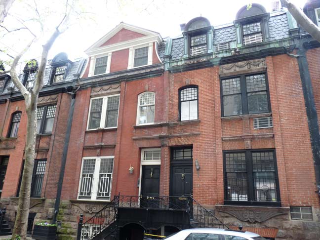
#12 and #10 Henderson Place.
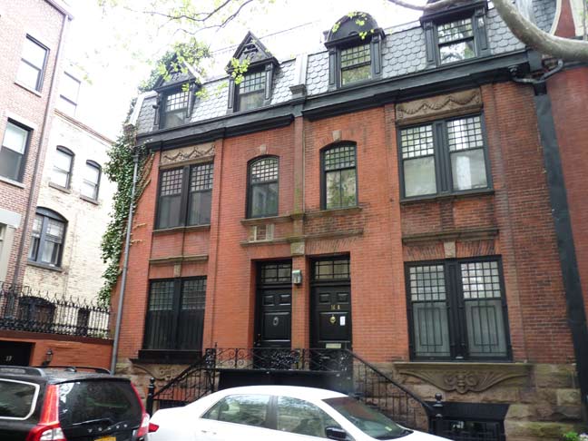
#16 and #14 at the back end. If you have a taste for architectural detail, the LPC Designation Report, linked above, is quite thorough.
Actually these are the best pictures of Henderson Place I have obtained so far. When the sun is out most of the alley is in perpetual shadow, so the overcast and rain evened out the lighting…
6/8/14

13 comments
Interestingly, Google Maps does not even have Finley Walk mapped, however they do have Henderson Place. Conversely, Bing Maps has Finley Walk mapped but not Henderson Place. Neither map shows Polly Gordon Walk. Thank you for sharing the beautiful Henderson Place Historic District and its wonderful architecture and history. The Yorkville neighborhood of Manhattan, certainly has its many gems, including Henderson Place, Gracie Mansion, Finley Walk, and even the lovely apartment blocks you featured along East 79th Street.
there used to be a huge lantern looking light at the south end of the Finley walk but The New York
Vandals Assoc. handled the job with ease
Nice play on a famous name in the title!
I like it!
Was this alley named in honor of anyone or is it just a name that was picked when the sign was first placed there?
When I first came to NYC 50 years ago for school, the picture of the building at the end of 79th St. (now an apartmenet house) was the East End Hotel for Women. Very reasonable rooms for women with 2 meals a day, cost a whopping $25.00 a week and were great accommodations for students through the 1960s.
The block of flats at 79th St. and the FDR drive are part of two groups of such apartments built by the City and Suburban company, and built for its employees. There’s another group of them between York and First Aves. around 65th Street. They were small apartments but every apartment had access to air and light, unlike many tenements. They had internal courtyards as well. The City and Suburban Company had a bank that was absorbed by Ridgewood Savings Bank.
http://streeteasy.com/profile/819985-city-suburban-leasing-office
Wow, what great pictures! Is it just my computer or are the sentences cut off on the right hand side? Still a terrific write up with terrific pictures.
Thank you very much.
Avenue A is etched into the stone on the side of PS 158 (77th and York). Cool to know there was an Aveune B.
One of Tolstoy’s family used to live on henderson Place. Also, as a teen, my brother and I used to ride our bike’s onto Roosevelt Island over the bridge. This was before the tram. It was an eery place, to me as a kid. Nothing was developed and it was an isolated place. There once was an elevator one could take onto the island from the 59th street bridge. One would travel half span, use a narrow walkpath that hung underneath the bridge and take the elevator to the island. I did this with my brother in the early 70’s, and there was still a lone elevator operator running that huge elevator. We did this with our bike’s too.
I lived in the houses on Henderson place 1955-1957 it was part of misericordia hosp nursing school.
Would you happen to know where the hospital records for all the children born in Miserricordia hospital in 1956 are kept. Ihank you.
I know of someone who is looking for birth records to a lost relative who was adopted.