As most FNY fans know I have been an aficionado of old street and road maps, and have been ever since I obtained my first Hagstrom street map of Brooklyn and Geographia Co. “little red books” that listed all Brooklyn streets, addresses and intersections. I later learned that Geogaphia had a Little Red Book for all boroughs except Staten Island, which was covered in their deluxe 5-Borough Street Guide of New York, and Georgaphia formerly had such publications for most of the USA’s major cities. Except for an ill-advised expansion in the 70s, Hagstrom covered the NYC metropolitan area as far north as Orange county and as far south as Philadelphia, and that was it.
I still occasionally pore over these books like Jewish scholars pore over the Talmud. Completist that I am, I was always frustrated to find roads in NYC that were not listed on the maps and in the street guides and did not feel a pang of satisfaction that I knew of a street that Geographia and Hagstrom did not. It was as if I required Hagstrom and Geographia to legitimize my discovery. A similar analogy can be found in pop music. On Sundays, I would listen to Casey Kasem’s syndicated American Top 40 countdown, which reported Billboard Magazine’s national survey. But many of those hits would not be played by Daaaaaaaan Ingram and the other jocks on WABC 770. Consequently, I never thought those missing songs were hits, no matter how high they rose in the Billboard chart and in Casey’s countdown.
Today I want to talk about a road in the Bronx that has been “outside the canon” and was not recognized by either Hagstrom or Geographia until approximately 30 years ago, when the construction of the Boston-Secor Houses forced a reshuffle of the street grid in the northeast Bronx.

If we get in our HG Wells Time Machines, fasten the seat belts and shift the levers to about 1900, we would find the Co-Op City area in Eastchester to have this general street layout. A major road called the Boston Post Road runs through the area and that is still there, as the simplified Boston Road. In the Bronx, what was called the Boston Post Road was a southern extension of the original Boston Post Road first laid out in the 1600s to run south to the Harlem River, where travelers could get ferries to Manhattan before the series of bridges connecting Manhattan to the mainland were built.
The Eastchester Landing Road that ran to the Hutchinson River is still partially in place as part of Peartree Avenue on today’s map.
There’s also a small grid called “The Kernels,” one of a group of small hamlets in the northern Bronx that were either absorbed into, or wiped out by, the overall Bronx grid when it was built in the early 20th Century. The Kernels was surveyed in 1859 and 1868, says the late Bronx historian John McNamara in History in Asphalt; The name was likely derived from “The Colonel” and the land may have been owned originally by a military man.
Other small settlements in the area were “Seneca Park,” “Arden Estates.” The Mill Creek on the right side eventually narrowed into Rattlesnake Brook, which was eventually rerouted into NYC’s underground water systems, with the exception of a short run of Rattlesnake Brook in Seton Falls Park.
Note the twisting road called, on this map, Reed Lane, which goes from Eastchester Landing Road south to about Mill Creek. It was one of the first roads to be laid out in the area, going back to the 1600s to an actual mill on the creek, which emptied into the Hutchinson River. According to McNamara, the mill was operated by Thomas Shute, Joseph Stanton and John Bartow and in 1790, John Reid, whose family operated it through most of the 19th Century. The mill was destroyed in a storm in 1900, but the road to it, known as Reed’s Mill Lane with a spelling adjustment, was still in place…

Here’s the situation in about 1905. By then, the street grid had been mapped (I have helpfully labeled the modern streets), while the grid of The Kernels was also still on the map at the bottom. The roads shown in pink were the only ones that actually existed at this time — one was Reeds Mill Lane, the other was Boston (Post) Road. I circled in red one of the two pieces of the original Reeds Mill Lane that is still in place. South of the red circle, the original route of Reed’s Mill Lane has disappeared.
At the left side of the map, Hollers Pond, which sat on property owned by John P. Holler, has been filled in for decades. Boston Secor Houses, opened in 1969, now stands in its place. Holler was in the ice distribution business, according to McNamara, and created the pond by damming Rattlesnake Brook. By 1950 or so the pond had been filled in.
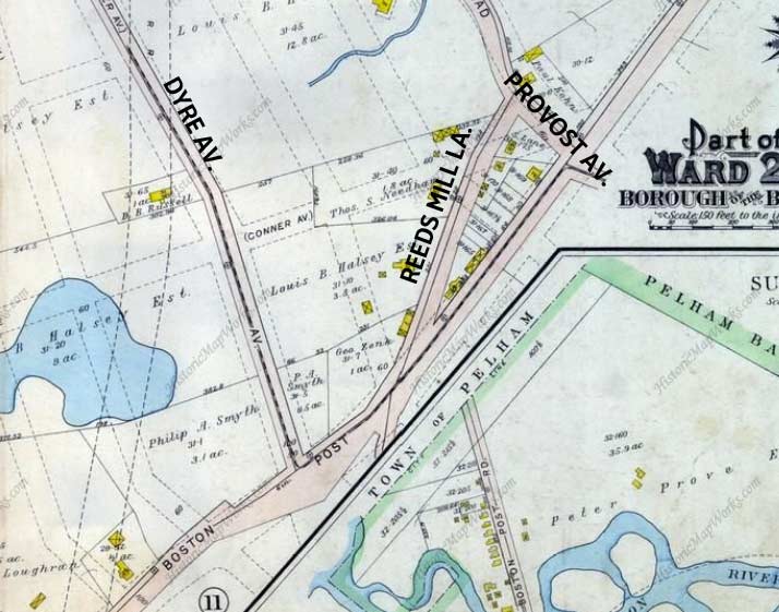
Meanwhile, there was a short bit of Reed’s Mill Lane that extended noth of Boston (Post) Road as far as today’s Provost Avenue, which extends into today’s town of Mount Vernon in Westchester County. As we will see, that section of Reed’s Mill Lane is still in place — barely.

The present-day Google map of the region. Today, the portion of Reed’s Mill Lane that is officially mapped runs in a crescent from Tillotson Avenue at the New England Thruway northeast to Steenwick Avenue (named, as many northeast Bronx streets are, for former NYC mayors). However, there are sections of Reed’s Mill Lane still in existence that are not acknowledged by NYC official maps.
Beginning in the 1950s, the construction of the Boston-Secor Houses (west of the red line here), the New England Thruway, and Co-Op City drastically altered the mapped grid on the planning boards early in the 20th Century. The grid originally extended all the way to the Hutchinson River and the Amtrak tracks bordering Pelham Bay Park, but those streets were never built. Instead, a facility called Curtiss Airport was scheduled to be built, but wasn’t; several years later, an amusement park called Freedomland occupied the space, but failed after two years; finally, Co-Op City began construction in the late 1960s. Somehow, Reed’s Mill Lane has survived on the outskirts of these projects.
Here, I have helpfully marked the former, original, Reed’s Mill Lane route with a twisting red line.

Reed’s Mill Lane from Tillotson Avenue. I began my survey of the road from its present southern limit. This one-block stretch is a relatively wide two lanes, and lined with a few homes that look as if they have been here since at least the mid-20th Century. Perhaps this portion of Reed’s Mill Lane was laid out before Boston-Secor Houses, seen toward the rear, were constructed in the 1960s, or, perhaps, this is another road, Varian Avenue, perhaps, that had been re-named Reed’s Mill Lane, though I do not know why that would happen. In short, this section of the road is something of a mystery to me.

This is the only section of Reed’s Mill Lane marked with street signs by the Department of Transportation. In glprious Highway Gothic. You cannot tell me condensed Clearview is an improvement over this.
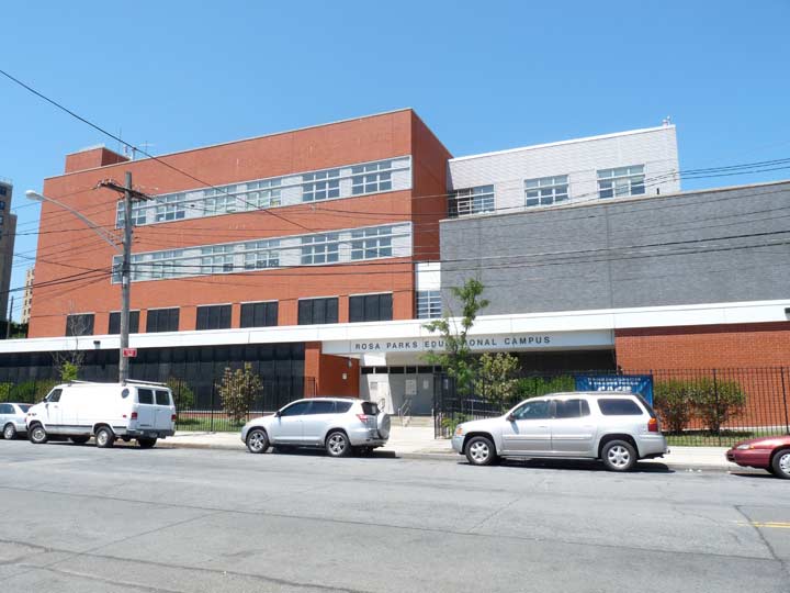
Reed’s Mill Lane curves east at the Houses, and runs past an educational complex officially known since 2011 as the Rosa Parks Educational Campus, named for the civil rights pioneer. The campus, constructed in the mid-2000s, also contains P.S. 189, M.S. 462 and P723. This is Reed’s Mil Lane’s newest rerouted section. Prior to that, the Parks campus was an empty field…
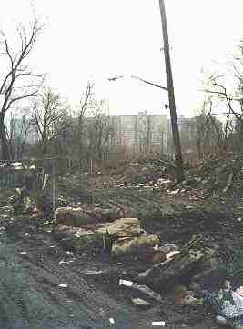
…with a rutted, swampy Reed’s Mill Lane running through it along its original path. I took this picture from Steenwick Avenue in 2000 looking south at about Hollers Avenue, when this was a muddy, swampy mess. I have the original Kodak in a closet somewhere and could scan a larger image from that, but you get the picture from this jpeg.
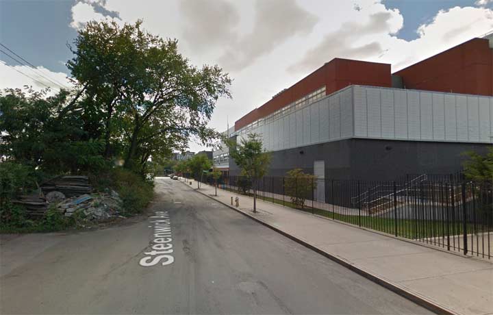
Here’s a Google Street View image of about the same spot today. The Parks campus is on the right, replacing the mill lane’s old path. The east side of Steenwick looks the same as it did when Reed’s Mill Lane issued from it here. This part of Eastchester still has some unpolished areas without sidewalks, or in the case of Hollers Avenue, some severe dips and potholes.

Along Steenwick, which is lined with auto repair shops (as is Boston Road) an unmarked road branches to the northeast. This is the original section of Reed’s Mill Lane I circled in red on the 1905 map shown above.
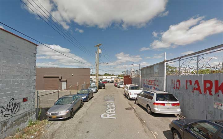
Street View shot of the original section of the road. The city does light it with streetlamps, but does not mark it with street signs.
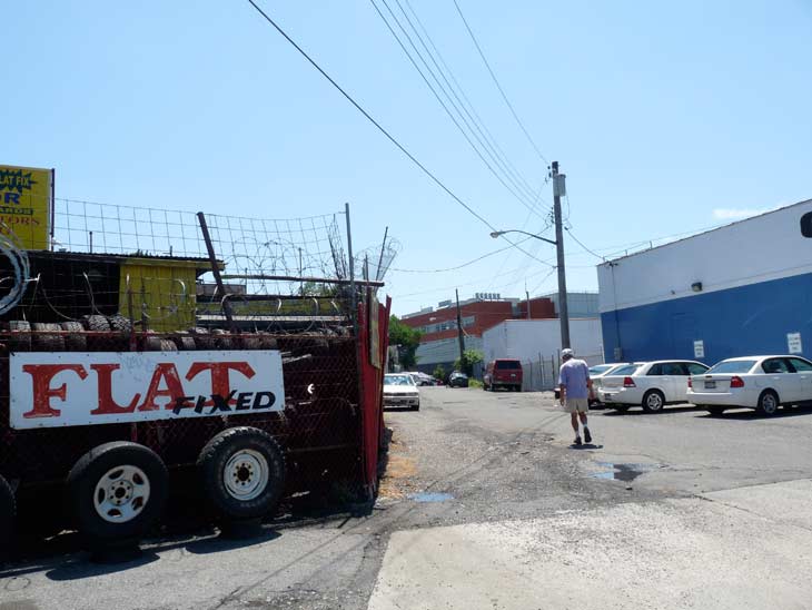
Reed’s Mill Lane and the south side of Boston Road.

There’s one more unmarked section of Reed’s Mill Lane. It issues from the north side of Boston Road and angles sharply to the northeast. Several years ago I was able to explore this section and found several antique cars. Not wishing to brave the Boston Road traffic I did npt cross to explore it, and Street View didn’t enter it as it is now a private driveway.

Google Earth, though, shows it as a dead-end lane leading to a school bus parking lot. It’s clearly the Reed’s Mill Lane from the old maps, though. There is even a brief section open to traffic at Provost Avenue and Conner Street (above the word Victory.)
12/23/15

6 comments
I lived in Hollers Estate from 1946 thru 1961, when the city seized the Hollers property thru eminent domain to build the Co op city complex. Had friend , Alfred lord, who lived on mill lane. We played on the thru way before it opened to traffic. My older siblings used to ice skate on the pond by the ice house at hollers.
Recently reconstructing memory of this area, and as expected 70+ yrs later coming up with nothing familiar until now. My Dad & siblings grew up in a farmhouse on what we always called “Mill Lane”. His family, Mercers, farmed in Eastchester until my Grandparents moved north around 1950. I recall the road as dead-ending towards a pond, it didn’t seemed well
paved, and I believe here was an Ice House on the pond. I was very young when visiting, so directions may be off. Living in NW Bronx in the late 40s so my mental image of the Bronx was urban bustle and landscaped parks. But here were fields and woods, and after hearing how our Grandfather’s and previous generations farmed, trapped and fished there in brackish water (crabs etc) I was astonished to learn that this was also the Bronx!
I grew up near Dyre Avenue during the 1950s in this general region and recall the original Reed’s Mill Lane as a very bumpy, unpaved roadway that took you into the Holler’s neighborhood, past the pond and the old ice house. Residents used to ice skate on the pond in winter and the frame houses in the Tillotson Avenue photo date most likely to the early decades of the 20th century. There was also a large landscape nursery and greenhouse business called Shemin’s which backed up from Boston Road to this neighborhood. I would love to see photos that original residents might have of the pond and its environs. There was quite an outcry when the Boston-Secor Houses were proposed as everyone knew that the project would eradicate any trace of what had been a relatively rural outpost in the NE Bronx served by a subway line on the former NYW&B railroad right-of-way.
Wow. Thanks for the history. Appreciated.
Actually, that part north of Boston Road which was original Reeds Mill Lane (that became a driveway) was once labeled as Provost Avenue. I remember seeing the blue signs for that as a kid and perhaps you can find that on a 1970’s/80’s map. It made sense because once Conner Street broke off into that little part past Boston Rd. veering into Dyre Avenue, Provost Ave connected into it (right where Clementine Avenue/”Victory” is) and goes right to the Bronx/Mt. Vernon city line.
One thing that appears to be prevalent in the entire area is GARBAGE! everything from litter to building materials and cars..people seem to think it’s ok to just “leave things behind” what was once a beautiful wild area is now a total mess!