
I’m happy to be an East Coast guy. Wherever I go in the NYC area, I’m not far from water. I’m happy about that, even though I have never swum a stroke and have never been in the Navy (though the old man was in the British Merchant Marines). No, I’m just happy to be near the water because of the photo opportunities. I think I would be doing a “Forgotten” website for any city or area in which I had lived for awhile, but things would have been less interesting in a landlocked area. New York City is built at a surfeit of tidal straits, bays and rivers. I enjoy looking seaward, and seaside photography. Herman Melville said it best in Moby-Dick:
Circumambulate the city of a dreamy Sabbath afternoon. Go from Corlears Hook to Coenties Slip, and from thence, by Whitehall, northward. What do you see?—Posted like silent sentinels all around the town, stand thousands upon thousands of mortal men fixed in ocean reveries. Some leaning against the spiles; some seated upon the pier-heads; some looking over the bulwarks of ships from China; some high aloft in the rigging, as if striving to get a still better seaward peep. But these are all landsmen; of week days pent up in lath and plaster—tied to counters, nailed to benches, clinched to desks. How then is this? Are the green fields gone? What do they here?
But look! here come more crowds, pacing straight for the water, and seemingly bound for a dive. Strange! Nothing will content them but the extremest limit of the land; loitering under the shady lee of yonder warehouses will not suffice. No. They must get just as nigh the water as they possibly can without falling in. And there they stand—miles of them—leagues. Inlanders all, they come from lanes and alleys, streets and avenues—north, east, south, and west. Yet here they all unite. Tell me, does the magnetic virtue of the needles of the compasses of all those ships attract them thither?
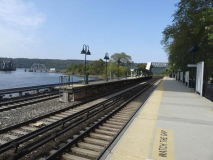
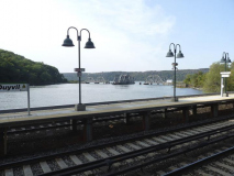
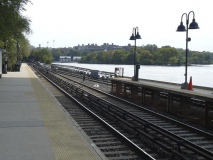
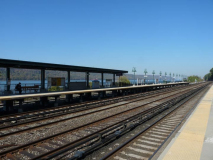
Today, I’ll combine two enthusiasms: waterside photography and railroad photography. Three Bronx Metro-North stations: Marble Hill, Spuyten Duyvil, and Riverdale — abut the Harlem and Hudson Rivers and the tracks are laid right by the riverside, and follow the Hudson north to the Capital District. Over time I have collected photos of all three stations — see if you agree with me about the enjoyable vistas.
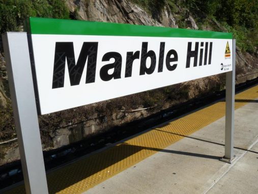
Marble Hill is the only riverside Metro North station in Manhattan. In a little-known quirk of geography, a small piece of the borough of Manhattan, known as Marble Hill, is on the mainland. It is surrounded on three sides by the Bronx and on the south by the Harlem River. It shares its character with the neighborhoods of Kingsbridge and Kingsbridge Heights on its north and east. It is protected from Spuyten Duyvil, on the west, by a steep hill.
Note that Metro-North signage in New York state consists of Helvetica Black Italic type on a white sign with a green stripe for the Hudson Line.
In 1895 it was separated from the island by the newly straightened, dredged and deepened Harlem River Ship Canal, leaving Marble Hill as an island itself. When, in about 1917, the creek was filled, Marble Hill became a part of the mainland!
No one cared much until the Broadway el was built through Marble Hill and apartment buildings were constructed in the 1920s, joining the few frame houses that were already there. Marble Hill never changed its designation as part of Manhattan, and so a part of Manhattan it stays, separated from the rest of the borough by the Harlem River.
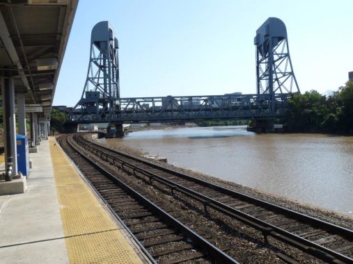
A bridge crossing one river or another can be seen from all three stations I’ll discuss on this page. In this case, it’s the Broadway Bridge spanning the Harlem River that can be seen from the Marble Hill station, which is on an island platform with tracks on both sides.
This is the fourth Broadway Bridge on site, replacing earlier ones constructed in 1895, 1905, and 1908. The 1905 bridge was floated about a mile south and is presently the University Heights Bridge. The current bridge is a lift bridge that can be raised to allow ship traffic to pass below on the Harlem River, and opened in 1962. The Broadway El was reconstructed as part of the bridge.
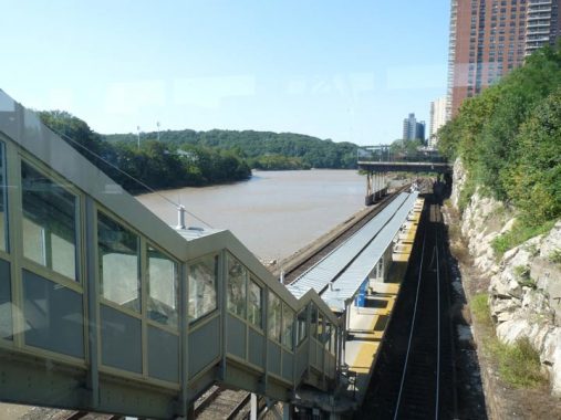
The station is accessed by a lengthy pedestrian bridge and staircase on West 225th Street west of Marble Hill Avenue. The station was constructed in 1906 when the Hudson River Railroad/New York Central realigned the tracks along Spuyten Duyvil Creek, later dredged to become the Harlem River, and the Hudson River. The railroad has had many owners: NY Central, Conrail, and finally Metro-North when it became part of the NYC Metropolitan Transportation Authority’s local network of commuter railroads in 1983.
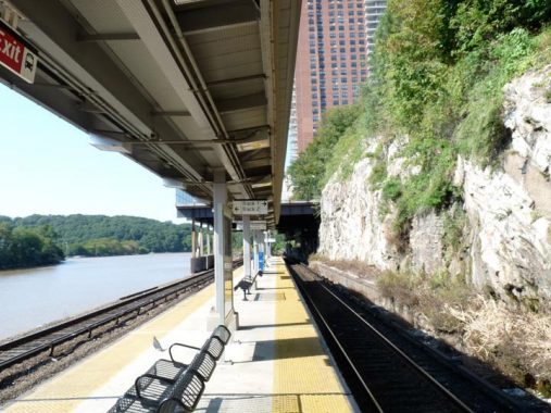
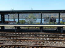
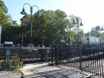
The Marble Hill station adjoins a steep cliff. Further northwest the cliffs are echoed across the Hudson as the New Jersey Palisades. On pleasant days you can sit on the benches and contemplate the views while waiting for a train.

Tennis courts are built on a platform covering the west end of the station. The tall building in the background is the Palisade Apartments high-rise.

You know what, I would have been one lonesome boy this year (2020) without Joanna Ente, who has been with me on several crucial walks this summer and fall. I haven’t seen much of anyone else except on zoom this year! Joanna, who lives near me in Bayside, drives us around, and I buy us lunch.
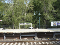
Spuyten Duyvil is tucked into the corner of the Bronx at the Hudson and Harlem Rivers, first stop beyond Marble Hill. Spuyten (unlike Marble Hill) has always been loyally Bronx. It has been known as Speight den Duyvil, Spike & Devil, Spitting Devil, Spilling Devil, Spiten Debill and Spouting Devil, among other spellings. In Dutch, “spuyten duyvil,” the mostly-accepted spelling these days though it’s in archaic Dutch, can be pronounced two ways; one pronunciation means “devil’s whirlpool” and the other means “spite the devil.”
In Washington Irving’s Knickerbocker History, a Dutch bugler vows to swim the turbulent waters of (then) Spuyten Duyvil Creek where it meets the Hudson during the British attack on New Amsterdam in the 1660s “en spijt den Duyvil,” or in “spite of the devil.” The Lenape Indians inhabited the land for hundreds of years before Europeans arrived; they called the banks of the creek “shorakapok” or “sitting-down place.” After a few hundred years, the name has been pared down and exists as a street name: Kappock (pronounced kay’ pock).
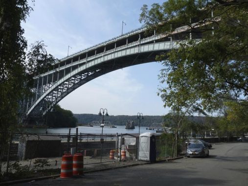
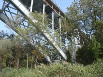
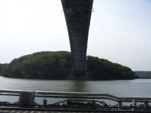
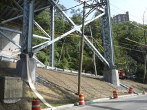
The Henry Hudson Bridge passes directly over the Spuyten Duyvil station. The bridge carries Henry Hudson Parkway traffic over the Harlem River and was the longest fixed steel arch bridge in the world when it opened to traffic in 1936. A second deck as added two years later. The toll is $2.80 with EZ Pass and $7 if you mail it in. Cash has not been taken at tollbooths since 2016.
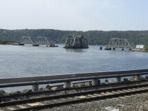
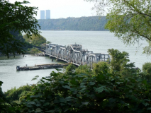
A second bridge is also visible from the Spuyten Duyvil station and also the Half Moon Overlook, named for Henry Hudson’s exploratory ship, on the Palisade Avenue cliff overlooking it. We were lucky enough to see the Spuyten Duyvil railroad bridge in both open and closed positions.
The swing bridge we see today was built in 1899 by engineer Robert Giles and is about 600 feet in length. The central section is 290 feet across and can be swung round to allow shipping to pass with the aid of an electrical engine. In 1983 a Circle Line boat struck the bridge and necessitated an overhaul. The boats that use the Harlem River at this point for the most part are Circle Line boats. The captain places a call to the bridge operator to swing the bridge open to allow passage.
New York Central/Conrail used the tracks exclusively until 1991 when Amtrak switched its terminal from Grand Central to Penn Station, necessitating running some routes along the tracks. The bridge is moved to the closed position only when a train is about to cross.
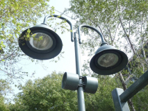
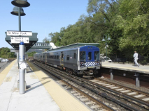
Like Marble Hill Spuyten Duyvil station is center-platformed with tracks on either side, and has the same twinned “bigloop” high intensity sodium platform lamps. The station is accessed via a pedestrian bridge and staircase from Edsall Avenue in a somewhat hard-to-reach area for pedestrians (though most commuters drive to the station and park, it’s also tough to reach by car). Because of this the MTA runs the Hudson Rail Link, a shuttle bus that leaves passengers in more populated nearby areas.
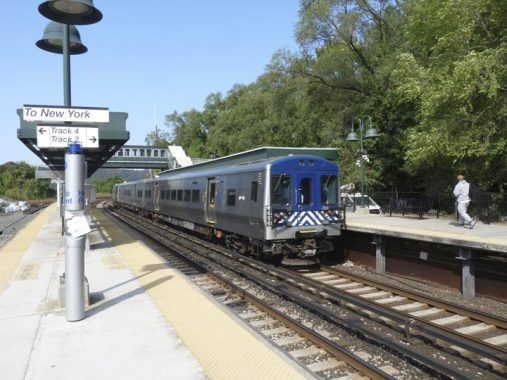
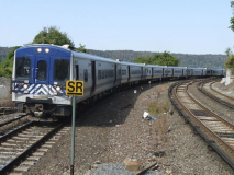
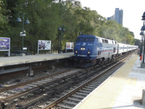
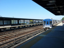
Lollygagging on the platform, we saw some typical Metro-North rolling stock including Bombardier M7A cars (entered service in 2004) and a General Electric P32AC-DM locomotive (2012). The SR sign stands for “speed restricted.” In December 2013, four Metro-North cars derailed at this station resulting in four deaths. Engineer William Rockefeller entered a rather tight curve at four times the railroad speed limit. Metro-North paid $60M in various suits and legal claims. Further details about this tragedy can be seen on this wikipedia page.

There aren’t very many commuter train platforms where you can see a couple of guys on a relaxing boat ride, but Spuyten Duyvil is one.
I am going to talk about Edsall Avenue a bit more on a later page — it’s a very unusual route that is basically a circle route accessible from only one point on Palisade Avenue. Because of the area topography this road is the only vehicular access to the Spuyten Duyvil station.
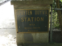
The station features a pedestrian bridge with an unusual metal sign; there are no similar ones at either Marble Hill or Riverdale.
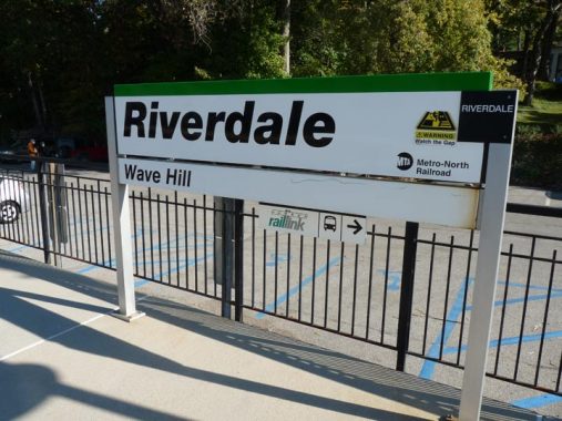
Riverdale is nestled along the Hudson River between Spuyten Duyvil on the south, Yonkers in the north and Van Cortlandt Park. With its curving, quiet lanes, spectacular views of the New Jersey Palisades and spectacular estates, it seems more a part of its neighbor to the north, suburban Westchester. The New York Times real estate section seems to agree: it has famously listed Riverdale separately from the rest of the Bronx for years. Yet, Riverdale has been a part of New York City since 1874, and the numbered street system that begins with East 1st Street in the East Village extends to Riverdale’s city line at the Yonkers border at the highest numbered street in the series, West 263rd Street.
Much of Riverdale and Fieldston, the adjacent semi-private neighborhood, was a forest owned by War of 1812 veteran Major Joseph Delafield, who in 1829 purchased 312 acres in the area west to the Hudson River and built a lime quarry and kiln. His son Edward constructed an elegant mansion that he named Fieldston Hill (which still stands on West 246th Street), and the major’s grandsons brought in architect Dwight James Baum, who designed dozens of homes in Riverdale and Fieldston in different styles. Fiorello LaGuardia was a Fieldston resident and read the comics on the radio during a newspaper strike from his study on Goodridge Avenue. And, John F. Kennedy lived in a house that still stands on Independence Avenue and West 252nd Street when he was a boy, between 1927 and 1928, when family patriarch Joseph Kennedy briefly moved his family to Riverdale.
Most people who use the station and aren’t commuters are here for Wave Hill, New York City’s best and most affordable botanic garden. Ten dollars gets you in, though in the Age of COVID you need to make reservations in advance. Even if you’re not a big flower fan, the views across the Hudson to the rock formation carved by the river over millennia are worth the price of admission. (From the Riverdale station, though, walking to Wave Hill is surprisingly a challenge, along uphill roads with no sidewalks and in the case of Sycamore Avenue, rutted conditions.)
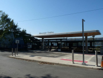
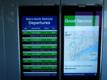
Riverdale is in the best condition of any of the three stations covered on this page (not that any of them are trashy at all). It was given a complete makeover in 2018, with a new pedestrian crossover, elevators, wifi, phone chargers, and interactive service advisory boards and maps. There are two side platforms unlike Marble Hill and Spuyten Duyvil.

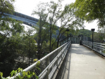
I’m pushing the theme a bit but there is a major bridge visible from the Riverdale station, especially from the pedestrian crossover: the Tappan Zee/Mario Cuomo Bridge (named for the now-deceased NYS Governor from 1983-1995 and father of present governor Andrew Cuomo; many area residents prefer to maintain the name of the predecessor span, the Tappan Zee). Crossing one of the wider parts of the Hudson River, the 3-mile-long twin cable-stayed span takes the New York State Thruway over the river but, unlike its predecessor, also contains pedestrian and bicycle lanes.
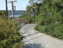
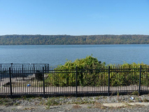
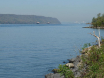
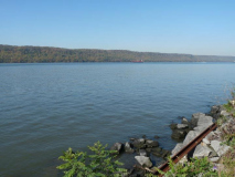
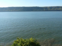
At the Riverdale station on the Manhattan-bound side, you can get a lot closer to the Hudson River than you can at other stations. That’s because a short path over a disused track gets you to the Riverdale Waterfront Promenade and Fishing Access Site, dedicated by Mayor Michael Bloomberg in 2005; it’s really a clearing by the side of the tracks where you can wander around or sit down with a fishing pole. I imagine swimming is discouraged, but I didn’t see any warning signs about it.
The station is approached via West 255th Street and there is a new bus unloading stop for the Hudson Rail Link shuttle bus.

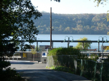
At no station are the New Jersey Palisades more visible than from Riverdale.
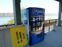
One of the new electronic departure boards. When is the last time you saw a soda pop/juice/water machine on a Long Island Rail Road platform? The “swells” of Westchester County get it just a little better than the punters riding the Long Island Rail Road, even though both are under the Metropolitan Transit Authority rubric.
More from Riverdale and Fieldston, comng soon.
Check out the ForgottenBook, take a look at the gift shop, and as always, “comment…as you see fit.”
11/15/20


21 comments
Riverdale is one of the few places in NYC where paper mapped streets have not been realized. Wealthy owners have just sodded them assuming no one will notice.
it’s avenues have a little known numbering system. 3200 would be at 232nd Street. 5500 at 255th.
Riverdale station is really hard to get to down a steep hill surrounded by only a few private houses. Far from the apartments where most people live. So the MTA runs a van service not unlike the dollar Vans in Queens.
It’s pretty but really hard to get around without a car. I’ve seen fisticuffs break our over street parking. Lol.
Just to pick a bit of a nit. Is 125th Street not considered a MetroNorth station? If so, then Marble Hill has company in Manhattan. Is there some technicality I don’t know about? I live in nearby Inwood. so I have headed north by train a number of times from Marble Hill and even Spuyten Duyvil (not to mention University Heights) over the years. I visit Wave Hill fairly often, so I have used the Riverdale station to access the views that you point out. Thanks for filling in a bit of the background and history. Also, thanks for the Moby Dick excerpt; a truly memorable set of images.
Riverside stations.
Oh. I get it now. Again, I really enjoy your posts. The ones of familiar stomping grounds and those that are revelations of new or historical significance.
Kevin, Thanks for this travelog especially the spectacular view of the new Mario Cuomo Bridge. My mother and I used to drive occasional Sundays from Staten Island through New Jersey over the original Tappan Zee Bridge to visit relatives in Tarrytown, a lovely bucolic escape from the urban hustle&bustle. It was on a small family farm there that this little city girl first plucked and ate an apple right off a tree. Yes, those Hudson River views are indeed happy experiences.
The longest steel arch bridge was the Bayonne Bridge 1931. It was replaced at no. 1 by the New River Gorge Bridge WV in 1977.
The Bayonne Bridge is a steel arch suspension bridge, not a fixed-arch bridge as Kevin mentioned.
Love the photos. May I add one minor historical correction and some additional factoids?
On the list of railroads that have owned this stretch of track, the Pennsylvania was not one of them. The Penn Central RR, a merger of the New York Central and Pennsylvania Railroads, took over on February 1, 1968, and lasted until April 1, 1976, when Conrail took over. Penn Central, incidentally, collapsed into bankruptcy in June 1970, the worst business collapse in US history up to that point. In 1983 Conrail was forced by federal law to divest itself of passenger railroads, leading MTA to create Metro-North to operate the entire thicket of commuter rail lines on both sides of the Hudson River in New York State outside of Long Island. Metro North is unique among commuter railroads because its operations touch three states. One of its key routes (the New Haven Line) serves Connecticut. The two smaller routes on the west side of the Hudson operate in New Jersey south of Rockland County before terminating in Hoboken. Connection to/from Penn Station is available at a large transfer station in Secaucus, NJ. The Metro North west of Hudson operation is part of New Jersey Transit and Metro North pays for its share of the operation.
Metro-North signage in New York State has a green stripe on the Hudson Line only. Blue stripe is on Harlem Line signs; red is found on New Haven Line signs. West of Hudson signage, in Rockland and Orange Counties, has an orange stripe.
The current Broadway Bridge structure was indeed completed in 1962, but part of it was actually opened in late 1960 as part of a rather remarkable, but now forgotten, engineering accomplishment. Over Christmas weekend in December 1960, the original 1906 structure was cut away and removed on a barge, and the new bridge, pre-assembled, was installed, for IRT #1 subway traffic only, which resumed on December 27, 1960. Motor traffic resumed in 1961. The span remained fixed until 1962 when the towers were completed, which allowed the structure to be raised for marine traffic.
Here’s a link to The NY Times article about the December 1960 work:
https://search.proquest.com/hnpnewyorktimes/docview/114926639/fulltextPDF/9BEA9A0228B54D6EPQ/2?accountid=35407
I cannot seem to open the link
I cannot either
Kevin, the problem is most likely because the article is from The NY Times archives is likely behind a paywall. I am a subscriber so I can get the articles.
Anyway, try this link from nycsubway.org: https://www.nycsubway.org/wiki/IRT_West_Side_Line
It’s free and if you scroll down to the 225th Street Station the photos shown from #101 and to #164 have many shots of the old Broadway Bridge being removed in December 1960. Good photos. Sorry for the earlier problem.
Wave Hill must be a well kept secret; I lived in NYC for 56 years without so much as a mention of this gem.
If you’re ever in AZ here’s Wave Hill’s desert equivalent:
https://www.btarboretum.org/
I believe the green stripe on the station signs denotes only Metro North’s Husdon Line. If memory serves, the Harlem Line has blue stripes, the New Haven Line has red, the Port Jervis line is orange and the Pascack Valley
line is purple.
Hi, I notice that the train tracks are almost level with the water level of the Hudson river. In light of climate change and inevitable rising sea levels, are the authorities planning to build any flood defenses or rerouting part of the line to avoid washouts or do they consider this as only a remote possibiity that won’t happen before “another hundred years” and thus is of little concern to present day riders ? By the way, I am not such a rider but used to be a NYC resident for about 25 years and knew people in Inwood.
The old man was in the British Merchant Marines?I didnt know the Royal Marines were in the retail goods business.
My memory is fuzzy. I do know he was on a merchant marine vessel, British or otherwise.
Marble Hill isn’t the only Metro-North station in Manhattan, because there is also Grand Central Terminal and 125th Street as well. The only thing that makes Marble Hill different is that it’s served by only one line, which happens to be the Hudson Line, unlike the other two that are served by all three. One other thing, is that this station’s platform was recently expanded a few years ago after a renovation that was done to it. BTW, before the Hudson Line was rerouted to its current route, it used to have a number of stops in Manhattan where Amtrak now runs on. On a side note, I do hope to see more pages here dedicated to other Metro-North Railroad stations with their surroundings in NYC as there are hardly any right now and you did say that you were going to do that in the near future when I first met you.
OK you got me. It’s the only riverside Metro North Station in Manhattan.
Isn’t the George Washington Bridge also visible from the Riverdale station? I’m pretty sure it is, a lot more easily than the Mario Cuomo/Tappan Zee.
Oh, and the MTA is the Metropolitan Transportation (not Transit) Authority. I thought you knew that. (I think you actually do. One of the agencies it controls is of course the New York City Transit Authority.)
OK, you got me. Fixing.
The 1906 Marble Hill station was on the other side of Broadway, reached by walking on a rickety wooden viaduct and stairs.
It was replaced in the Metro North era, 1980s-1990s, by the one in the modern location. A great improvement.
Is Joanna Ente related to Bernard?