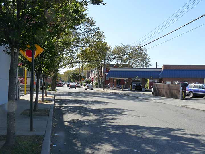
GRAVESEND Neck Road was once a major east-west artery in Gravesend and Sheepshead Bay in the days of carts and wagons. “Neck Road” as it’s called by locals and the MTA on a Q train station, is along with Kings Highway and Flatbush Avenue one of Brooklyn’s oldest roads, having been here since the colonial era and likely built over an Indian trail. It runs from Van Sicklen Street southeast and northeast, crossing Avenue V twice and ending at Avenue U and Haring Street, though it once continued on to about Gerritsen Avenue. At its west end you will find the historic Gravesend and Van Sicklen Cemeteries as well as the now-landmarked Lady Moody House.
Gravesend is likely named for the British seacoast town, Gravesend, which derived from “end of the grove”; the less likely derivation is from the Dutch s’Gravenzande, “Count’s beach.” The “neck” Gravesend Neck Road goes to was in what’s now northern Sheepshead Bay and was likely a narrow strip, or “neck” of dry land amid marshier territory.

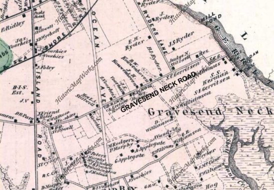
Here’s an 1873 map of Gravesend and Sheepshead Bay. Gravesend Neck Road is one of the few existing roads along with “Coney Island Road,” now Avenue. The road at the bottom is Voorhees Lane, now Jerome Avenue, while Ocean Avenue was planned but not yet built. Ryders Lane, which cut diagonally across the area, has left little trace. The small squares represent houses and their owners. Each likely sat on a small plot of land that was farmed. Names such as Ryder, Voorhees, Gerritsen, Stillwell and Applegate can still be found on street maps.
As always, “comment…as you see fit.” I earn a small payment when you click on any ad on the site.


8 comments
Very interesting as always! I’d love to chat with you sometime. I teach NYC history at Kingsborough Community College and doing some research on southern Brooklyn neighborhoods.
I lived off Neck Rd
I went to KCC and received an A.A. I eventually went on to obtain an M.A. and Ph.D. from the University of Illinois at Urbana-Champaign. Good things can happen to KCC graduates if we let them.
In the modern street grid, Gravesend Neck Rd seems to dogleg at Avenue W, but the explanation can be found in the 19th C. map– it went around what appears to be a stream. It replaces Avenue W east of the north end of Sheepshead Bay Rd. for several blocks, albeit at an oblique angle to the grid.
I had close family friends that lived on Neck rd.
Me, i lived T and e.22nd.
I love these posts and one of these days, I hope to buy your book. Earlier this year you wrote about Newtown Creek, where my grandfather owned and operated a family factory, producing fertilizer and , I think, glue. When The Great War began in Europe in 1914, He could not import chemicals from Germany due to an embargo. His business failed, eventually. But his family endured . He took the horse -drawn trolley car down Grand Street in Maspeth, riding home for the mid-day dinner. My mother , 6 years old at the time, thought he owned a team of horses and a huge carriage of his own. Many sweet New York stories like this one remind me of my home town. Thank you for your research and reporting. Best, Virginia Ellis Beech – from Middle Village , long ago. My mother was a 5th generation New Yorker.
We lived on East 15th Street and Neck Road for over 65 years starting in 1947. This is when all the neighbors were one family. We all took care of each other.
Was the best childhood ever.
Totally different today. No one cares about each other any more.
does anybody remember when neck road was a 2 way street west of ocean av?