

When I have an opportunity for a weekend off, I take it and am handing over the reins to Sergey today. –Ed.
By SERGEY KADINSKY
Forgotten New York Correspondent
In 2001 when Forgotten-NY was in its early years, Kevin Walsh documented the arches of Prospect Park, which are not as numerous as in Central Park but share that no two arches are the same in their appearance. In the quarter century since then, he’s been back to Brooklyn’s flagship park many times to document its hidden elements. Surprisingly there was one bridge that does not appear on official maps and escaped Kevin’s eagle eyes.
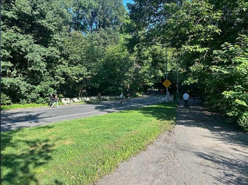
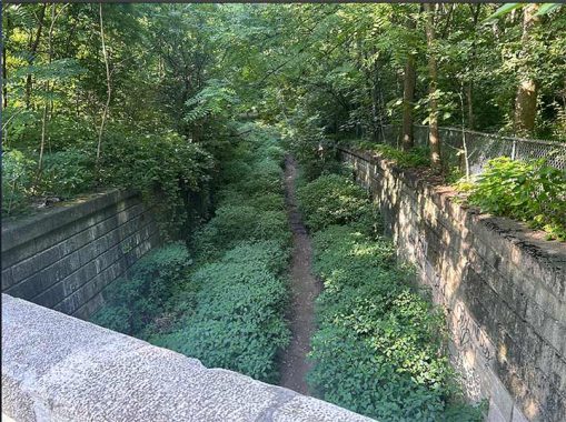
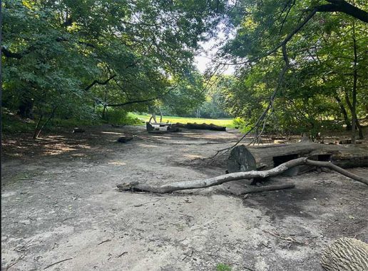
Having documented the waterways of Prospect Park Zoo, I found an overpass near it that hasn’t been previously reported on this site. Traveling on East Drive, it is hardly noticeable under thick vegetation and looking down, the path beneath the overpass appears as an abandoned bridle path or transverse road.
Architecturally, it offers little ornamentation, looking more like the Jackie Robinson Parkway than an Olmstedian drive in the park. You can still ride a horse in Prospect Park, but the bridle path is much shorter today, excluding this forgotten underpass.
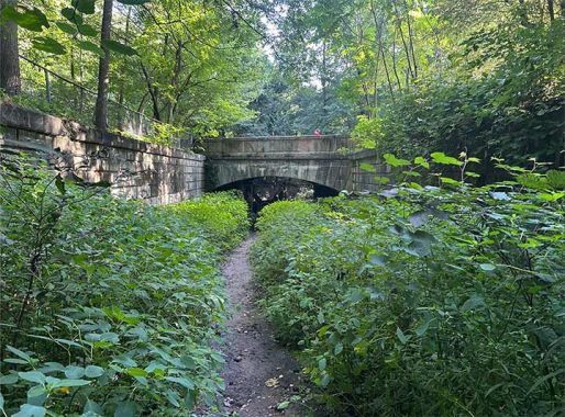
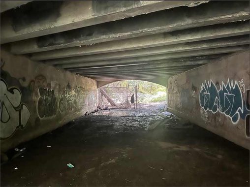
Under East Drive, it is a concrete tunnel, purely utilitarian with a flat ceiling. No wonder that this bridge evaded the attention of historians and tour guides.
A view underneath the hidden arch.
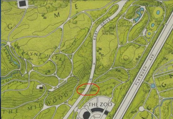
The most detailed map of the park was the 1972 map of Prospect Park by George Colbert and Guenther Vollath for the Greensward Foundation, in which the unnamed underpass appears to the east of The Midwood and north of The Zoo. The dotted lines indicate that this abandoned road connected with Flatbush Avenue.
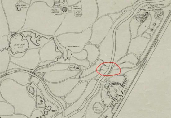
An earlier map from 1936 shows the now-abandoned bridle path dipping under East Drive and rising above the trails, along with another underpass on the zoo’s now-shuttered back entrance.
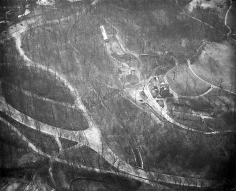
The 1934 Praeger aerial survey of Prospect Park shows Culvert Arch in good condition and a service building atop Payne Hill that was later demolished.
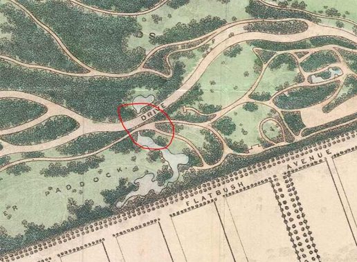
Further back in time, this map from 1888 shows a small pond next to East Drive whose constructed inflow was underneath the road. It is unclear if Culvert Arch on this map is the same as today’s arch, but the location is the same.
While documenting this forgotten arch, I visited the site of the park’s original Children’s Playground, which was overtaken by nature in recent decades. A sandy surface with logs lies on the site of this long-forgotten pond.

The Rose Garden’s pond also has seen better days. It was constructed as a formal sunken garden at the bottom of a ravine. The garden takes its name from a line in Thomas Moore’s poem Lalla Rookh. The centerpiece of the fountain was a sculpture of a nude youth holding a duck surrounded by six turtles; it was stolen in 1941. In 2021, the city and Prospect Park Alliance announced a plan to redesign the Vale of Cashmere north of the zoo, and it includes restoring the Children’s Pool on the site of the Rose Garden. Another example of a historic stream brought back to the surface!

Uphill from this pond site is the Vale of Cashmere and its three lily pools that are empty of lilies and water, also awaiting the redesign in which a pollinator meadow, play area, and amphitheater would take the place of these fountain pools. Visitors can access this section of the park through the park’s newest entrance that opened in 2021 on Flatbush Avenue.
You can learn more about Prospect Park by visiting each of the hyperlinks posted in the essay above.
Sergey Kadinsky is the author of Hidden Waters of New York City: A History and Guide to 101 Forgotten Lakes, Ponds, Creeks, and Streams in the Five Boroughs (2016, Countryman Press), adjunct history professor at Touro University and the webmaster of Hidden Waters Blog.
As always, “comment…as you see fit.” I earn a small payment when you click on any ad on the site. Take a look at the new JOBS link in the red toolbar at the top of the page on the desktop version, as I also get a small payment when you view a job via that link.
8/25/24
6 comments
Outstanding coverage, Serge!
It probably “evaded the attention of historians and tour guides” because they didn’t want to get mugged!
Or sodomuzed. Very popular cruising ground ground years ago. Made the mistake of riding my bike through there once.
Excellent research Sergey! The picture looking down from the bridge makes it look so enticing.
The team around the team of Sergey and KevinWalsh, (and others associated with them) is without doubt the leading group of NYC geographers of today.
Keep up the work, gents. You have raised the standard for others to aspire to !
Let those other groups get all the $$$ and press, we’ve got integrity!