

It’s not often that I write about something in Forgotten New York that completely stumps me, but I’ll show what I’ve found here in case some Crowns Heightsers can fill me in on what’s going on here. On Sunday afternoon I was perusing Google Maps and Google Street View, continuing a pastime I have had looking at maps for over 60 years now, when a couple of items in Crown Heights caught my attention.
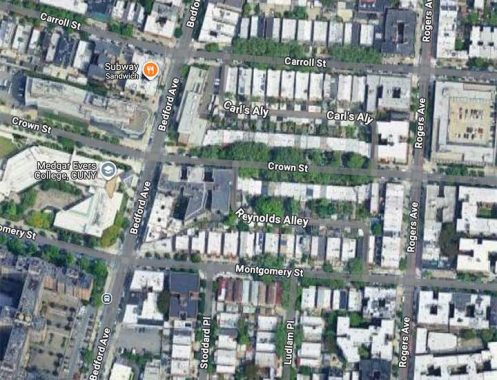
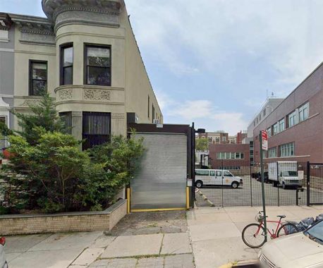
Using Google Maps’s satellite view, you can see a pair of twisting, S-shaped alleys between Carroll and Crown Streets and Crown and Montgomery Streets, between Bedford and Rogers Avenues, in the vicinity of the Medgar Evers College complex. They are named Carl’s Alley and Reynolds Alley and seem to be lined with small, squarish buildings that are likely garages. I wouldn’t be able to explore the alleys because, as seen on the title photo taken of Reynolds Alley at Crown Street, this and each opening is protected by a roll-up metal gate.
This is what Carl’s Alley looks like meeting Carroll Street east of Bedford.
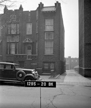
The alleys weren’t always locked up behind gates; this is what Reynolds Alley at Crown Street looked like in 1940.
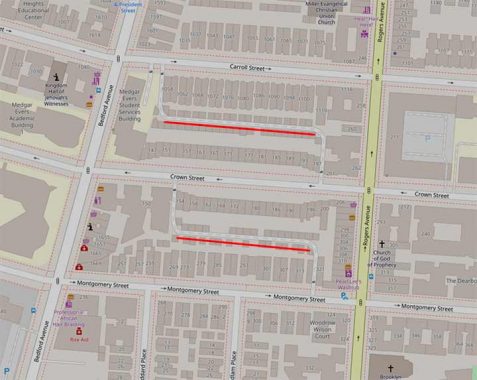
My secondary go-to map source, Open Street Map, shows the alleys and the small buildings, but doesn’t bother to add names. Needless to say the Department of Transportation doesn’t green-sign them.
Like I said, for now, I’m stumped. Maybe a FNY reader knows what’s going on here.
As always, “comment…as you see fit.” I earn a small payment when you click on any ad on the site. Take a look at the new JOBS link in the red toolbar at the top of the page on the desktop version, as I also get a small payment when you view a job via that link.
12/15/24
7 comments
Some of these alley names are the result of individuals naming them on Google Maps.
In the same manner as Wikipedia, anyone can edit and the names may not mean much.
That’s why I prefer official city maps over Google and Bing maps.
The maps I’ve been able to examine do not show any names. These accessory roadways are either referred to as “driveway” or “private right of way”.
looks like a driveway to me.
For what it’s worth, the car in the 1940 photo is a 1932 or 1933 Hupmobile.
I’m not sure about the alleys, but that diagonal building line near the intersection of Bedford Avenue and Montgomery Street caught my eye. After looking at some older maps of the area it would appear to be a remnant of the old municipal boundary between the City of Brooklyn and Flatbush Township.
Satellite view shows a line of garage structures behind the residences that front the streets. Both alleys appear to be for access to these garages. These blocks were probably developed at the same time. Now this access would invite crime. Best they are not accessible to the public.
Looking at Street View a few blocks further East, like Brooklyn, New York, Kingston avenues closer to Eastern Parkway, you see more of these alleys, unnamed, but also not gated, providing access to garages behind the houses. I’ve certainly seen them walking around the neighborhood. I keep walking past my great-grandparents’ house on President St, wondering if someone is going to renovate it some day. It was a beautiful house inside & out, I visited it once 34 years ago, but today it’s an empty shell.