

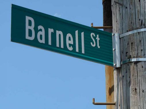
HOW does one explain Barnell Street, which seems to have popped up organically on Red Hook street maps including Google over the past couple of decades? The city doesn’t grace it with street lamps, but nonetheless, it does get a Department of Transportation street sign, which means that it appears on official DOT directories. (Compare 39th Avenue/Sandhill Road near where I live, which is the only vehicular connection between Douglaston and Little Neck north of Northern Boulevard; since the DOT doesn’t map it, it gets no street sign, them’s the rules)
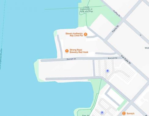
Barnell Street is a concrete-paved driveway, heading west from Van Dyke Street to Upper New York Bay. It has been there for many years, but only recently vouchsafed the Barnell Street name. It leads toward some of the venerable Beard Street warehouses along the water’s edge, which are landmarked buildings containing numerous small manufacturers and artist studios, and there is also a brewery/eatery, Strong Rope Brewery. I can also detour off it to attain Steve’s Key Lime Pies, which are always a Red Hook treat.
Who was the Barnell this “street” glommed itself onto? Comments… as always… are open.
Check out the ForgottenBook, take a look at the gift shop. As always, “comment…as you see fit.” I earn a small payment when you click on any ad on the site.
5/7/25
3 comments
Occam’s Razor guess: Barnell is the person in charge of assigning street names? 😉
Google Street View has Barnell in sort of a limbo state more commonly seen in foreign countries. There’s no official view, likely because the camera car hasn’t yet made it down the street, but GSV has a series of photos taken by an individual.
Barnell street might have been named after the Bearded Lady of Times Square and Coney Island, Jane Barnell.