

MUCH of downtown Brooklyn has given up its rich collection of one-block and dead-end alleys, with a few notable exceptions, such as Grace Court, Grace Court Alley and even Harrison Alley in Vinegar Hill. Fair Street, which you have no doubt never heard of, sits east of the Flatbush Avenue Extension on the borderline of Downtown and Fort Greene.
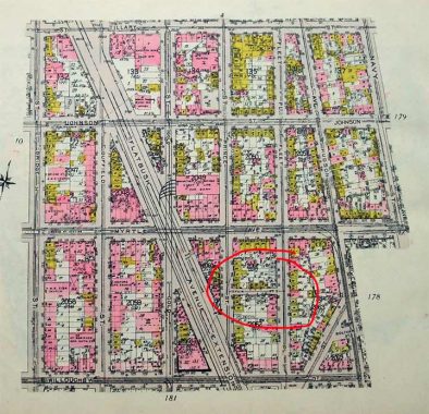
On this 1920 map of downtown Brooklyn (I was unable to zoom in further) I have circled Fair Street, located between Prince street and Fleet Place south of Myrtle Avenue. The changes to this area are innumerable. East of FAE, most of the streets were wiped out in mid-century by the Raymond Ingersoll Houses and University Towers, and, of course, Myrtle Avenue’s elevated train ended business in 1969.
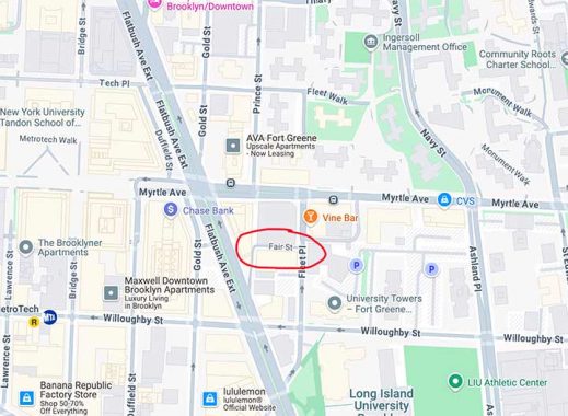
I have circled Fair Street on this 2025 Google map. It, along with a short piece of Prince, has somehow made it through both the mid-century public housing boom and the current residential/office towers boom.
If you look at Fair Street at Fleet Place in the title image, Fair Street is hemmed in by large, glassy towers including #86 Fleet Place on the right. It’s no longer a through traffic street as a curb has been placed in front of it as well as on Prince Street at the FAE.
Check out the ForgottenBook, take a look at the gift shop. As always, “comment…as you see fit.” I earn a small payment when you click on any ad on the site.
7/7/25
1 comment
On that photo on top, I’m surprised with a narrow alley like that, the street light didn’t have a shorter arm.