

WHILE going through the batch of ancient Queens photographs that led to the publication of “Forgotten Queens” with the Greater Astoria Historical Society, I came upon this shot labeled Astoria Boulevard 4/12/32 by photographer E. E. Rutter. But nowhere today does Astoria Boulevard border a body of water. Where could this be? Shacks cluster along the waterfront, accessed by rickety wooden walkways on stilts, just begging for a nor’easter to knock them down.

This excerpt from a Hagstrom map of Queens published in 1922 may clear things up a bit. It shows mostly existing streets, but with some still the dreams of developers. In 1922, Astoria Boulevard (then called Astoria Avenue) ended at Northern Boulevard and 114th Street, as it does now. There were plans for this area, though, that were later revised a few times. Berrian Boulevard, which runs for about five blocks in Steinway Village a few miles west, was to be extended along the bay, eventually meeting Northern Boulevard.
If you look carefully at the map, you see a jaggedy line just north of the dotted line representing the roadway. This was then the actual waterline of Flushing Bay, and it was there that the shacks and docks you see on the 1932 photo once were. You can also see a similar line north of Ditmars Boulevard on the left side of the map.
Under the direction of traffic czar Robert Moses, the Grand Central Parkway was instead built on landfill as the approach road to the Triboro Bridge. The 1932 photograph, along with so many others I combed through for “Forgotten Queens” book selections, were of condemned property to make way for parkways or expressways.
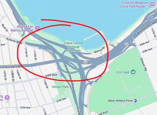
Here’s a look at a Google Map from 2025. Some years after the Grand Central Parkway was completed, the Van Wyck Expressway joined it in a cluster of spaghetti ramps. Utterly forgotten are the shacks and wharves along Flushing Bay.
I haven’t promoted Forgotten Queens here lately, but the 2013 Arcadia publication is still in print, though sales are way down. I advise that you buy direct from Arcadia as it’s much more expensive for some reason on Amazon.
Check out the ForgottenBook, take a look at the gift shop. As always, “comment…as you see fit.” I earn a small payment when you click on any ad on the site.
10/9/25
2 comments
The 1922 map has a few other nuggets, also. On the College Point side, Tallman Boulevard (along the waterfront, likely intended to continue to Tallman Island, where the Sewer Plant was later constructed) did not happen. Two things that are there, however, are of greater interest.
The first is the State Barge Canal Terminal. This, and the Erie Basin, in Brooklyn, were the most southerly connections to the old barge canal system, operated by New York State. Now almost exclusively used for pleasure boating, this system began with the construction of the Erie Canal, which was completed 200 years ago in 1825. It greatly reduced the cost, and time, of shipping goods between the Atlantic and the interior of the United States. New York City became the new gateway to the west.
The second is the Long Island Rail Road Whitestone Branch. Starting on the bottom right of the map, it passes under the newly built Roosevelt Avenue, crosses the Flushing River and goes up to College Point and Whitestone Landing. If you follow the line you will find the Bridge Street Station. (Bridge Street was the old name for Northern Boulevard here.) This was one of the two LIRR stations in Flushing, the other being at Main Street, on the Port Washington Branch. Typically, the railroad named its stations for the community at which it stopped, so the station would have simply been “Flushing”. To avoid confusion between two “Flushing” stations, one was named “Flushing Bridge Street” and the other “Flushing Main Street”. Although the Whitestone Branch, and the Flushing Bridge Street station, were abandoned in 1932, the railroad chose to continue using “Flushing Main Street” on the Port Washington Branch station instead of shortening it to just “Flushing”.
In commemoration of the 200th anniversary of the Erie canal, a canal boat replica, the Seneca Chief, has been constructed and is making its way along the canal to NYC from Buffalo. It will be in NYC on October 25 and 26 at pier 26.