

THERE are no less than 20 place names in Brooklyn named “Paerdegat.” There’s Paerdegat Park, shown below; Paerdegat Basin, which separates the communities of Bergen Beach/Georgetown and Canarsie; Paerdegat Avenue North and Paerdegat Avenue South, in the general area of the basin; and Paerdegat 1st through 15th Streets in Canarsie. There’s also the Paerdegat Yacht Club located in Canarsie at the basin. I’m not up on Dutch, so I presume the name is pronounced PAIR-dee-gat, rhyming with “scaredy-cat,”but if I’m wrong, Comments are open. Unlike, say, Amersfort and New Utrecht, there’s no corresponding town in Holland named “Paerdegat.” There’s also the new Paerdegat Basin Park, including a new nature trail entered from Bergen Avenue and Avenue T.

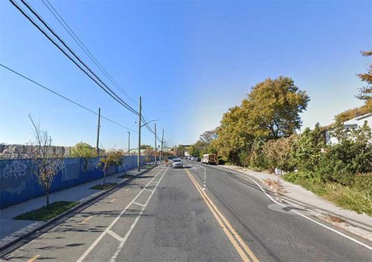
Paerdegat Park makes up the entire block between Foster Avenue and Farragut Road between East 40th Street and Albany Avenue, has one of Brooklyn’s Dutchiest of Dutch names, a transliteration of paard gat, “horse gate.” The land was acquired by NYC for public park use in 1941.
The original use in Kings County was for Paerdegat Creek (a.k.a. Bedford Creek), which once ran from about where East 31st Street and Foster Avenue would be laid out southeast into Jamaica Bay.
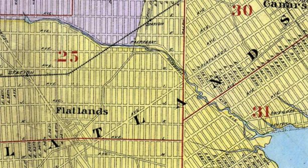
Paerdegat Avenue South and a companion avenue, Paerdegat Avenue North, were proposed by the Kings County Town Survey Commission, which between 1869 and 1874 laid out the streets in the Towns of Flatbush, Flatlands, Gravesend, New Lots and New Utrecht. Both avenues were to flank Paerdegat Basin, which was a proposed improvement of Bedford Creek by the Town Survey Commission to provide shipping access from Jamaica Bay to Flatbush.
On October 8, 1901, Paerdegat Avenue North and South, and Paerdegat Basin were closed by the New York City Council between East 31st Street and Flatlands Avenue.
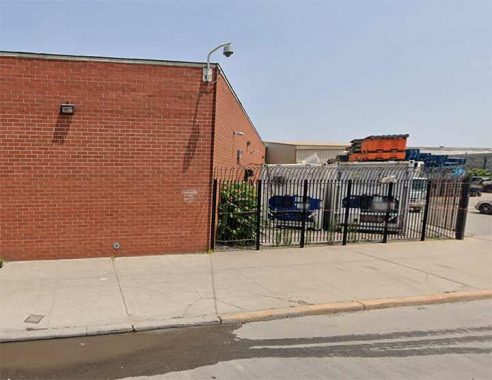
In the 1920s its northern section was filled in and the southern end dredged to make it available for shipping as the Paerdegat Basin, which today runs only as north as Flatland and Ralph Avenues, where we today find the Bureau of Sewers, seen on this FNY page. You have to use your imagination why there is a body of water named for a “horse gate.” I’m guessing that the farms in the towns of Flatbush and Flatlands had corrals to keep their horses fenced in, and all this was within spitting distance of the creek.
Hagstrom Maps 1922 rendering of the Paerdegat Basin and Bergen Beach area. These maps have to be taken with a grain of salt as in 1922, relatively few of these roads were yet built or opened; they were still in the hopes and dreams of developers. You can see that Paerdegat Avenues North and South were on either side of Paerdegat Creek, but as the straight lines atop the creek show, there were plans to dredge and straighten it for shipping. The dregdging happened, but not the shipping; today Paerdegat Basin harbors pleasure craft and sailboats.
In Bergen Beach, Paerdegat Avenue South was not built; neither were the Bergen1st thriough 20th Streets as shown. Instead, Bergen Avenue borders Paerdegat Basin on the south.
Interestingly, all that remains of Paerdegat Avenue South extends from Flatlands and Ralph Avenues to the intersection of Avenue H and Glenwood Road.
A remnant of Paerdegat Avenue South exists as a turn lane from Glenwood Road eastbound onto East 56th Street southbound.
Meanwhile, Paerdegat Avenue North was built as mapped north of Paerdegat Basin from Flatland Avenue southeast to Seaview Avenue, as were Paerdegat 1st through 15th Streets, as shown on the 1922 map.


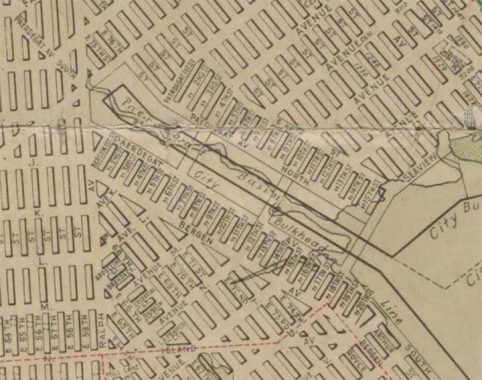
But what of the mapped Paerdegat Avenue along Paerdegat Creek in East Flatbush? The creek was relocated into the sewer system, but traces of its bordering roads traces may be found in diagonal building and lot lines between Farragut Road at East 42nd Street and East 45th Street north of Glenwood Road, and on East 37th and East 38th Streets south of Foster Avenue.
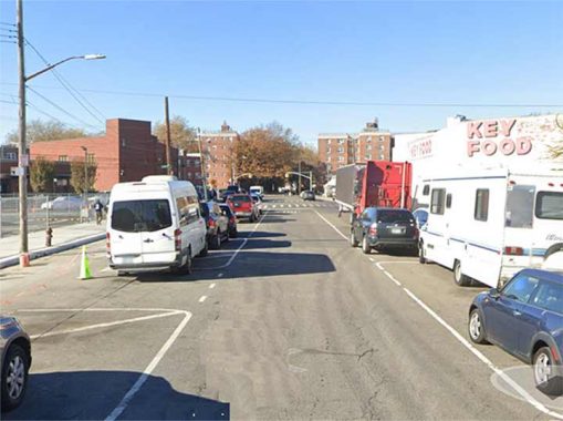
When a building is turned athwart the street grid and is built at an angle, it can sometimes indicate a lost road. That’s what happened here with #703 East 38th Street between Foster and Farragut Road. One, Paerdegat Creek flowed in the center of where the street was laid out, and a property line was drawn along the proposed Paerdegat Avenue…which turned the building on an angle. The Google Street View Smudge Machine® was turned on here, as an adjoining property owner refused to sanction Street View’s use of their property in the image.
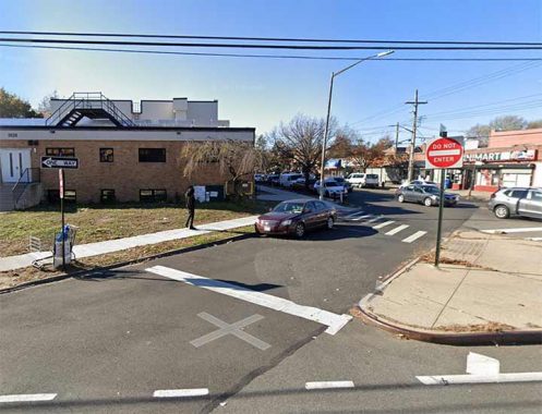
Similarly, building angles on both sides of East 43rd Street between Farragut and Glenwood Roads attest to the former presence of Paerdegat Creek and Avenue…
..as does this building on Troy Avenue which has an added attraction, a painted ad for Entenmann’s Cakes.
Check out the ForgottenBook, take a look at the gift shop. As always, “comment…as you see fit.” I earn a small payment when you click on any ad on the site.
10/2/25
12 comments
Had Paerdegat Basin become the city’s main seaport it almost certainly would be long obsolete. Modern containerized shipping requires huge amounts of space. When the city had its plans to develop the basin it anticipated using only small amounts of land because that’s all the shipping of the day needed. Sure, it could have acquired most of then-undeveloped Canarsie for incorporation into the seaport but that would have required amazing foreknowledge given that containerization was decades in the future.
New York was once a huge center of maritime commerce but now all that’s left is Howland Hook on Staten Island and a small amount of shipping in Brooklyn. It’s sad but probably unavoidable.
I reread Great Gatsby recently, and noticed that Fitzgerald mentioned a fictitious Port Roosevelt, which I had never heard of. I looked into it, and Fitzgerald was anticipating a real Port Roosevelt that was bruited in the 1920s as the north entrance/exit of a ship canal from Jamaica Bay to the Long Island Sound. This seems preposterous now, but the article I read in some current academic journal said Fitzgerald thought it might happen, and hedged his bets by mentioning Port Roosevelt, but only once in the book.
Totally fascinating!
I had relatives living on one of the Paerdegat Streets and they pronounced it with a silent R. Or maybe they were just speaking Brooklynese.
My cousin who once lived on one of the Paerdegat Streets pronounced it “Pay-duh-gate”. No “r”.
It would probably have been more like “par-de-[ch]aht,” the “a” in “Par” being like the “a” in at/bat/cat, and the square-bracket “ch” being like “Chanukah” or “Loch Lomond”– think of someone from Chicago saying that in golf today, he shot even-par, and you’d have the rough approximation of the first syllable. So rhymes-with-“scaredy-cat” is probably as close in English as you get when you are not trying to sound too pedantically affectedly Dutchy.
The Kings County Town Survey Commission envisioned a future Brooklyn, which had yet to expand to the entire county, as a world-class seaport, with the entire perimeter from Newtown Creek to Jamaica Bay developed for port use. To that end, they planned out a number of basins throughout southern Brooklyn, mostly along existing creeks or marshes, Paerdegat being one of them. Others not developed included Dyker Basin (now part of Dyker Beach Park and the golf course) and the Coney Island Canal with its related Harway, Gravesend and Stillwell Basins in Gravesend.
Paerdegat was seen as especially promising, as it potentially could have brought shipping right into Flatbush, which was rapidly developing at the time. It was never developed to that extent, and not for commercial shipping.
Imagine if all of these basins had developed for commercial shipping as planned. While initially it could have been an economic boon to Brooklyn, it could also have become a multitude of Gowanus Canal type waterways.
Does anyone know what the numbers like 234.7 5/8 and 205.9 5/8 mean as shown on the map? I once thought they might be contours (elevations) but this area is quite flat and I doubt there is so much change in elevation.
Just a wild guess, but the difference between them is just shy of 30, which could be the assigned width of a new street (from building line to building line). If that is correct (and I have no idea if it is) they are being measured from some starting point 206 feet below the bottom of the map.
Distances.
My aunt and uncle used to live there. We pronounce it pad-a-get.
Internet sources agree that ae is not used in modern Dutch. aa is used instead. paer would be pronounced as in Jack Paar. Non-rhotic Brooklynites would say paah duh g’t