

It has been awhile since I did a long form page on Hudson River Park. I have not visited often: In 2011, ForgottenTour #50 walked it from the Battery all the way to the Intrepid aircraft carrier, a distance of several miles. That was 15 years ago when all of us (I think) were in better shape. I put myself, and tourgoers, through their cardio paces for most of the 154 outdoors tours, some of which ran to six hours long. It’s still paying off but I have a couple of health issues that prevent me from really walking long distance now. In 2020, I wandered Hudson River Park as far north as Hudson Yards at the west end of 34th Street. I stood “wrong” and wrecked my lower back and had to gingerly limp over to the #7. This time, I walked HRP on a mild October 2025 day up to Christopher and had no mishaps. But they’re always around the corner.
I got 161 photos from HRP alone, more on Christopher, so this will have to be broken up to several posts.


Continuing north from North Cove, we enter Belvedere Plaza and at waterside, two very tall metal pylons that are apparently purely decorative in nature.
Irish Hunger Memorial


The Irish Hunger Famine Memorial is dedicated to raising awareness of the Great Irish Famine that killed up to a million in Ireland between the years 1845 and 1852, and the resulting waves of immigration to the United States beginning in those years. The Memorial occupies a half acre at North End Avenue and Vesey Street, also accessible from Wagner Park, and was designed collaboratively by artist Brian Tolle, landscape architect Gail Wittwer-Laird, and 1100 Architect. It was dedicated on July 16, 2002.
The landscaped plot employs stones, flora and soil imported from the western coast of Ireland, and incorporates an actual 19th-century Irish cottage. The names of some of the immigrants are displayed on the sides of a lengthy corridor, a dark passageway that leads to an open space that looks larger than it does given the limited half-acre space. Visitors can mentally shut off the traffic noise and pretend they’re on a high hill in the western counties.
Following the famine, 800,000 Irish immigrants found their way to the United States, a good percentage of whom settled in New York City.
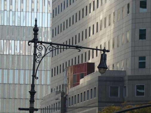
Battery Park City features “enhanced” versions of Corvington poles originally designed in the 1910s to light wider streets. There have been other variations over the years, but BPC’s poles have extra ornamentation at the apex and at the light fixture attachment.
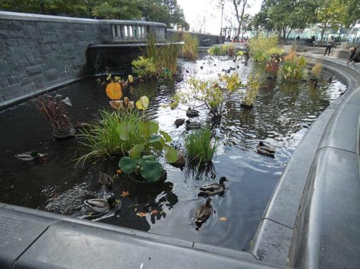
Lily Pond is a naturalistic (i.e. artificial) pond built by Delta Fountains in collaboration with the Battery Park City Association. It’s not to be confused with the Lily Pond in Central Park that has dried out since it was built in the park’s early days.


I could be wrong but I don’t know of any other public likeness of Governor Nelson Rockefeller elsewhere in NYC, and this one is pretty small, a verdigris’ed copper medallion on a stone at Rockefeller Park. “Rocky”‘s gubernatorial reign (1959-1974) overlapped with Robert Wagner’s mayoralty.
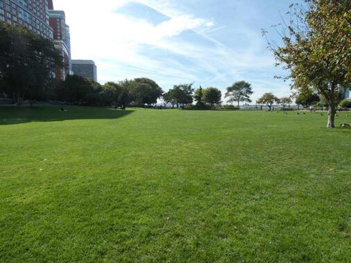
Rockefeller Park contains most of Battery Park City’s wide lawns, as well as a large playground, plantings and gardens, several public art pieces, and a sheltered pavilion. BPCA staff is available at the Gladys R. Pearlman Park House to provide assistance and information. Public restrooms are located across River Terrace at the entrance to Teardrop Park.
The park is named in honor of Governor Nelson A. Rockefeller, who signed the Battery Park City Authority Act in 1968, establishing Battery Park City. [BPCA]
Midtown’s Rockefeller Center and Lenox Hill’s Rockefeller University are named for the philanthropic family, which made its millions in Standard Oil.


We’ve seen the pond, here’s a pool and ping pong table, in Rockefeller Park along the Hudson.. You do have to bring your own cue and pingpong balls, sticks and paddles. Bryant Park also has public ping pong.
I found a number of items on this walk I wasn’t aware of (always my purpose) such as this terrace with steps going from the Rockefeller Park North Meadow up to River Terrace, one of the new streets created when Battery Park City was built, where we find…


Battery Park City’s Hurricane Maria memorial, titled “My Cry Into The World.” The storm, one of the worst (if not worst) storms in Puerto Rican history, was a Category 4 that struck on September 20, 2017 with devastating 155+ MPH winds, causing thousands of deaths and destroying the island’s infrastructure.
The memorial’s glass panels, painted by Antonio Martorell, are a pictorial representation of the chaos and disaster of the storm.
The star of the flag and its colors flow like streams of rain, fire and tears. Glass is used to represent this ethereality together with the ethereality of air, wind and water, in its transparency and translucency. The high point of the total composition – nearly 15 ½ feet high – is aligned Chambers Street axis, evident when the viewer approaches from this street. The Memorial’s orientation enhances its sun exposure on the glass spiral, projecting bright blue, orange and red beams of sunlight onto the viewers. [BPCA]
I now question the practice of assigning first names to devastating hurricanes. The worse the storm, the more the potential tainting of the name. Katrina has now been struck from the list of names assigned to hurricanes. Devastation by “Storm 13” doesn’t sound as bad, to all the Marias out there, as “Hurricane Maria,” but I’ll stop talking through my hat and show you a lamppost.
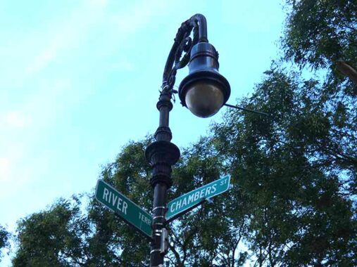
Very early on Battery Park City sported retro Bishop Crooks that looked much like the Type 24 BC models found all lover town. Nonstandard street signs were also installed, here and on West Street, but these are gradually being eased out.
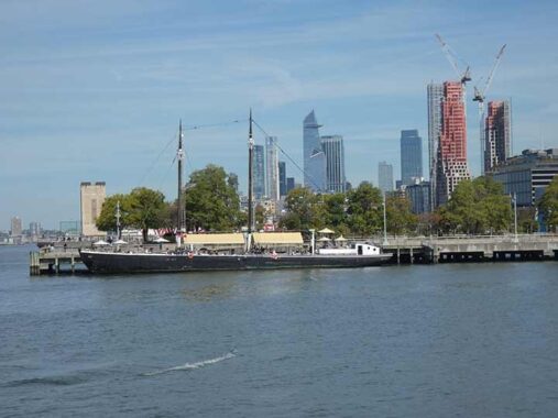
A look north toward Pier 25, Hudson River Park opposite North Moore Street, where the research vessel Robert Gray, a 1936 Army Corps of Engineers survey ship is docked. The boat was named for the American merchant sea captain and explorer born in Tiverton, Rhode Island, best known for being the first U.S. citizen to circumnavigate the globe from 1787–1790. In the background can be seen the glass towers of Hudson Yards.
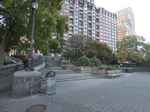
This is the north end of the Battery Park City landfill and the walkway runs east, toward West Street north of Chambers; here, Hudson River Park proper begins. Over the past three decades or so, skyscrapers have popped up in Tribeca, such as #388 Greenwich (left) now Citigroup headquarters (formerly Shearson Lehman headquarters), constructed in 1986-1987; on the right is Tribeca Pointe at #41 River Terrace, one of the tallest rental apartment buildings in BPC. Lurking in the rear is #56 Leonard, the so-called “Jenga Building.”
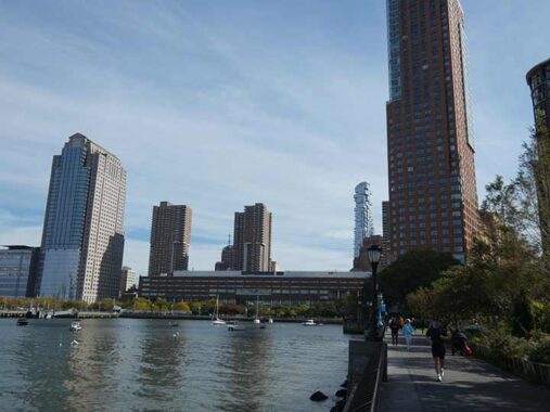
“Supertalls” were almost never constructed as residences until relatively recently; almost all, like the Empire State and Chrysler, contained offices, but today, many if not the majority are built to take advantage of the views available from on high, and are constructed, ostensibly, as living spaces.
Check out the ForgottenBook, take a look at the gift shop. As always, “comment…as you see fit.” I earn a small payment when you click on any ad on the site.
2/25/26
2 comments
How could you go to Rockefeller Park and not include photos of Tom Otterness’s The Real World! http://www.tomotterness.net/artworks/the-real-world?view=slider
Not an Otterness fan, I think there was an item about animal abuse.