

As Queens residents know, the vast amount of its streets are numbered; in general, Avenues run west to east, while Streets run from north to south. When this system was gradually adopted between 1915 and 1935, it was found that there were places where the same number had to be used between two streets and avenues, sometimes more than once, and so numbered Roads, Drives, Places, Lanes, Courts and Terraces were deployed. Brooklyn, too, has a generous system of numbered Streets and Avenues, and also East, West, North and South numbered streets as well as neighborhood-specific Bay, Beach, Brighton, etc. streets. But a constancy in Brooklyn’s system of numbered streets is that the vast majority are called “Avenue” or “Street.” But there are exceptions.
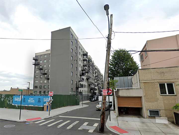
It’s escaped my notice so far, but since at least 2020, there’s been a 49th Road between 49th and 50th Streets between 19th and 20th Avenue in Brough Park. It was constructed as a service alley for a new apartment complex. If Brooklyn followed the Queens model of adding extra numbered streets, it would be called 49th Place. This has happened elsewhere in the borough.
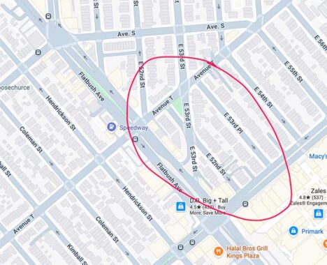
In Marine Park near Kings Plaza, there had been a north-south street running athwart the grid from Avenue T to Flatbush Avenue called Amersfort Avenue. Possibly to avoid confusion with Amersfort Place in the Brooklyn College area, in the 1970s the then-Department of Traffic decided to rename Amersfort Avenue as East 53rd Street, and also rename the existing section of East 53rd between Avenues T and U as East 53rd Place.


When new housing was developed in Bensonhurst, the street grid was changed, and thus was born a series of roads called 19th Lane, 20th Drive, 20th Lane and 21st Drive, between 19th and 21st Avenues west of Cropsey Avenue. These also broke the “unwritten rule” of no numbered streets in Brooklyn not called “Avenue” or “Street.” This change had happened by 1949 at least.
A few block west, 17th Avenue was shortened to create Bath Beach Park several decades ago, and a short street called 17th Place Court was created to link the avenue to Bay 16th Street.
Are there more examples? Comments are open. {See Comments for more examples]
Check out the ForgottenBook. As always, “comment…as you see fit.” I earn a small payment when you click on any ad on the site.
8/6/26
3 comments
Never knew about most of these. Just saw 17 Court near 17 Ave, south of Cropsey.
Actually it’s 17th Court that connects 17th Avenue with Bay 16th Street. Mill Basin has East 57th, 59th and 60th Places between Mill and Strickland Avenues. And 72nd Court peels off 72nd Street between Shore Road and Narrows Avenue in Bay Ridge.
I grew up on 51st St. between 19th and 20th Avenues. The area North of 50th St. was all warehouses, vacant lots, and the Parkville Junction section of the South Brooklyn Railroad, where freight trains could be switched to the McDonald Ave. trolley tracks to make deliveries.
I think 49th Rd. could legitimately be located in Parkville, although we kids never called it that. Yet, we had adventures throughout the neighborhood in the 50’s and 60’s, and our folks never worried about our safety. The area certainly has changed from the looks of Google maps. Brooklyn was a great place to come of age back in those days!