above: Skidmore Lane at East 92nd Street
Canarsie, a neighborhood in southeast Brooklyn at the end of the BMT L line, for many decades of its history had been derided as a backwater, a place somehow left behind on the evolutionary scale that other New York City neighborhoods were measured by. Just take a look at how the neighborhood has been described in the WPA Guide to New York City, published in 1939:
Its residential section of one- and two-family houses and shacks … is broken by weedy lots and small truck farms… along the uninviting waters of the bay is a forlorn beach resort and an amusement park called Golden City, a fishing boat center, a beach backed by a dump, and beery dance halls with an outlandish quality that made Canarsie the butt of many vaudeville jokes.
A trolley car extension of the BMT subway runs through a littered lane between the back yards and unkempt gardens of run-down houses…
It wasn’t until the 1950s that Canarsie (named for the Native American tribe that was the original inhabitants of the area) shed its remaining rural past and became truly part of the 20th Century. Golden City burned down in the 1930s and the area was cleared to make room for Robert Moses’ Belt Parkway. The trolley than ran through back yards was replaced by a bus in 1942. “The uninviting waters of the bay” are now rimmed by the rebuilt Canarsie Pier at the foot of Rockaway Parkway.
However…traces of Canarsie’s bucolic past remain in spots, most obviously in its network of alleys, that formerly were cowpaths and dusty lanes (in some cases, still are). Some of the alleys have been lost: The oddly-named Road To Lott’s House, Lane To Tyler Davis, and Battle Row are no more, but enough of them are still there to set Canarsie apart from other neighborhoods that have mostly eliminated their aboriginal roads.
![]()
This Brooklyn Eagle map (the Eagle was Brooklyn’s premier newspaper for over 100 years until 1955) shows Canarsie Lane forming the southern boundary of Holy Cross Cemetery, stretching past Ralph Avenue into Canarsie.
Canarsie Lane is one of Brooklyn’s oldest roadways, stretching from Flatbush southeast past Brooklyn’s oldest house, the Peter Claesen Wyckoff Mansion, into Canarsie. Most of it has been obliterated by development, but key pieces of it are still there.2nd from left: One of the longer extant stretches of Canarsie Lane is the portion of Cortelyou Road that curves along the southern boundary of Holy Cross Cemetery.
2nd from left: one of the longer extant stretches of Canarsie Lane is the portion of Cortelyou Road that curves along the southern boundary of Holy Cross Cemetery.
3rd from left: The Peter Claesen Wyckoff House is angled along the old path of Canarsie Lane at Clarendon Road and Ralph Avenue. About 20 years ago, Canarsie Lane’s old path was eliminated and the lawn was placed in front of the house, which had fallen into disrepair. It’s since been restored to the way it looked in the early 18th Century when it was new. The house was built between 1695 and 1700.
4th and 5th from left: This one-block piece of Canarsie Lane remains between Schenectady Avenue and East 48th Street opposite Cortelyou Road.

 City maps show Smiths Lane extending between East 92nd and Rockaway Parkway (a five-block stretch) just south of Farragut Road. In reality, most of Smith’s Lane has now been paved over and built on, and it exists now in two pieces where houses stand along it. In cases like this, Smith’s Lane is now more of a private driveway than a public street, as in the above case. A hand-lettered sign (above left) announces its presence at a construction site.

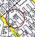 Sure, it looks like an empty lot on East 92nd Street just south of Foster Avenue inhabited only by a barking guard dog, but this clump of weeds is the last vestige of Ames Lane, a one block street that’s still on most city maps.

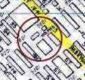 Holmes Lane, a (formerly) dirt road between East 95th and East 96th Street south of Avenue K, hid an extremely old incandescent light fixture until well into the 1980s when the Department Of Transportation finally figured out it was there and quickly replaced it with a modern high-intensity lamp.

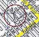 Varkens Hook Road, which connects Glenwood and Farragut Roads east of East 86th Street, is likely a shorter vestige of a longer road. (Some city maps also show a piece of it on Avenue J near East 86th Street but that piece is no longer there.) Until the mid 1980s it wasn’t paved and had a pebbly surface. “Var(c)ken” means “hog” in Dutch; could this be a place where hogs were driven on the way to market?
A couple of Dutch Forgotten Fans have weighed in on this subject.
“ ‘Hook’ is probably an English corruption of the dutch “Hoek” which means corner. According to my Dutch-English dictionary it also might have the meaning of “market”, but that meaning is absolutely no daily usage.”–Petr Kazil, Rotterdam
“The word ‘hook’ in dutch: ‘hoek’ means corner. Like in streetcorner. Hence the name Varkens Hoek. Maybe they sold pigs in that street in the old days”.–Gerben IJken, SBS Broadcasting, Amsterdam
So, what we have here is “Pigs Corner Road” or “Pig Market Road”.

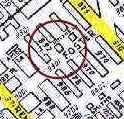 Nolan’s Lane, between East 94th and East 96th near Foster Avenue, is in fairly good shape, as forgotten alleys of Canarsie go. It still has a 35-year-old mercury T-Pole lamp that was installed there in the 1960s.

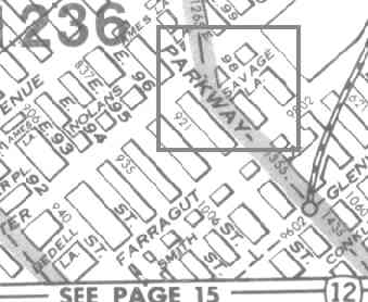 Situated near the confluence of Rockaway Avenue and Rockaway Parkway, Savage Lane is an unmarked two-block long dirt road ending at East 99th south of Foster Avenue.
2005: we hear Savage Lane has since been built over.

The Road To Lott’s House abuts Grace Church at East 92nd Street south of Avenue J. This road, also known as Church Lane where it borders Canarsie Cemetery, was one of the longer aboriginal Canarsie roads; it stretched from East 83rd NE to East 93rd.
Early maps also show this alley as “Meadow Lane.”
From the “Little Red Book” Geographia Street Guide in the 1950s:

Relatively few roads are named “The Road To…” or “The Lane To…”. Canarsie had another such road, called The Lane To Tyler Davis on East 91st Street, but all trace of it has been obliterated.
“Lott” remains a popular strret name in Brooklyn, named for a Dutch family that settled in Brueckelen in the 1600s. There is a Lott Street, Place and Avenue, a couple of extinct Lott’s Lanes, and the nearly extinct Road To Lott’s House.
Grace Church, on Church Lane (Road To Lott’s House) and East 92nd Strret, remains the tallest building in Canarsie.

Beach Place, a tiny pedestrian-only alley on East 88 Street, and Stillwells Place, another narrow lane, are adjacent to each other south of Avenue K and the Canarsie Cemetery.
Canarsie Road, an extension of East 92nd Street, stretches from Avenue M southeast toward the Belt Parkway. It has attracted small lanes and side streets the way ships attract barnicles.

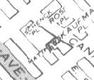
Schenck Place boasts a new pave job, but it’s not enough to prevent the pavement from buckling as the winter winds down. One of the narrower alleys in Canarsie, Schenck Place is on Canarsie Road just south of Avenue M.
“Schenck” is another popular street name in Brooklyn, again another Dutch landowner in the early days. There are a Schenck Place and Street in Canarsie, and a Schenck Avenue in East New York.

You’ll find Matthews Place a few hundred feet south of Schenck Place. It’s unusual because it’s L-shaped and changes direction abruptly, coming to an end at Avenue N from a beginning at Canarsie Road. (Other alleys that change direction like this are Jones Alley and Commerce Street in Manhattan).
At right, a view of Matthews Place in the rain from just north of Avenue N. Matthews takes a jog to the right just ahead.

On maps Truckleman’s Lane extends from Rockaway Parkway northeast to East 101st Street just south of Flatlands Avenue. The lane really makes it only to East 99th; it has survived because it has a couple of homes on it and also services some parking lots.
Old maps sometimes show it as Battle Row.

Skidmore Lane once ran continuously from East 92md to Rockaway Parkway north of Avenue J, with one interruption, but these days can be found as a pair of dead ends on East 92nd Street and East 95th Street, marked only by one lone house (seen toward the back of this picture, in back of the white fence)
Other nearly forgotten roadways in Canarsie are School Lane, which is now nearly obliterated, on East 89th near Glenwood Road; Hoyt’s Lane and Tieman’s Lane, each now gone.
Every year, new construction puts some of these throwbacks closer to extinction and with it, more of Brooklyn’s past is extinguished.
Mistakes? Corrections? I want them. Email me at erpietri@earthlink.net. Thanks for visiting the site!
SOURCES:
WPA Guide To New York City, 1939, reprinted 1982 Pantheon
The Neighborhoods of Brooklyn, edited by Kenneth Jackson, 1998 Yale University Press
Maps © Hagstrom Inc.
5 Borough Street Guide Of New York, Geographia 1952
4/24/99


