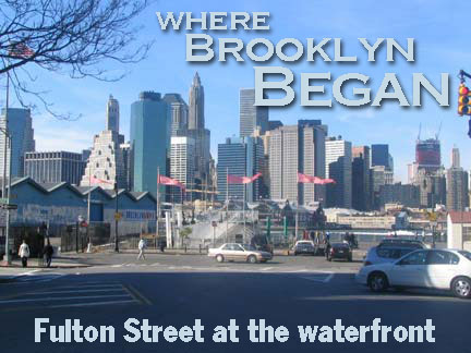
BROOKLYN starts with Fulton Street, and almost ends with it, as well. Brooklyn began as a small Dutch settlement along the East River, with easy passage to Manhattan by ferry. In the early 1700s, an Indian trail was officially named Kings Highway and extended south and east. At one time, every vehicle and conveyance traveling to or from Manhattan to Brooklyn, or vice versa, and destined for any place on the island had to come to this point or else start off here.
What we know as Fulton Street east of Flatbush Avenue was once the Brooklyn and Jamaica Turnpike, and it can be argued that Jamaica Avenue/Jericho Turnpike/Route 25, which leads to Orient Point, the easternmost point of Long Island, was once considered Fulton Street’s extension; Jamaica Avenue was once known as Fulton Street in eastern Queens. Officially, Fulton now ends at Eldert Lane and 91st Avenue at the Brooklyn-Queens border. (Jamaica Avenue received its name in 1920).
On this page we’ll take a look at Fulton Street between the East River and Fulton Mall.
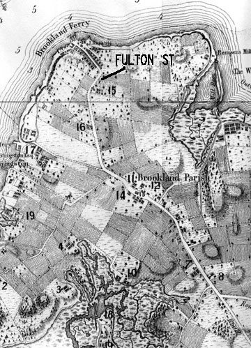
Kings Highway in 1766. The curved section near the water became Fulton Street and is still in place today. Joralemon Street (17) and Red Hook Lane (14) are also on the map. The road trailing off to the southeast was Kings Highway, and is now Flatbush Avenue.
Map from Brooklyn Geneology Information
It must be noted that nowhere on this webpage is Fulton Street officially known as Fulton Street. In the early 1950s, most of the neighborhood east of Fulton Street and Jay Street and from the Brooklyn Bridge south to Borough hall was torn down, and government offices and a bland, grassy plaza known as Reverend Parkes Cadman Plaza was built in place. The Fulton Street El, which had shrouded the street until the 1940s, also vanished. Fulton and Washington Streets, on each side of Cadman Plaza, were renamed Cadman Plaza East and West, and oddly, Fulton Street was renamed Cadman Plaza West all the way to the East River (in the tradition of continuity that saw 9th Avenue in Windsor Terrace renamed Prospect Park West even for those few blocks where it doesn’t face the park). In the 1980s, Fulton got its old name back from the Brooklyn Bridge to the river, albeit under the moniker “Old Fulton Street.” In the early 21st Century, the length of Fulton may be renamed, or subtitled “Harriet Tubman Boulevard,” for the pre-Civil War Underground Railroad heroine.
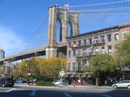
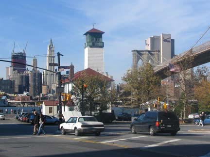
In no other NYC neighborhood do two great bridges come so close to each other, with the possible exception of Astoria, where the Triboro and Hell Gate Bridges are relatively close. The modern skyscapers of downtown Manhattan contrast nicely with the Brooklyn Bridge, which, by spanning the two independent cities of Brooklyn and Manhattan beginning in 1883, helped to unite the two cities and began the modern era that produced an ever-growing building boom that recessions, depressions and wars can never seem to slow down.
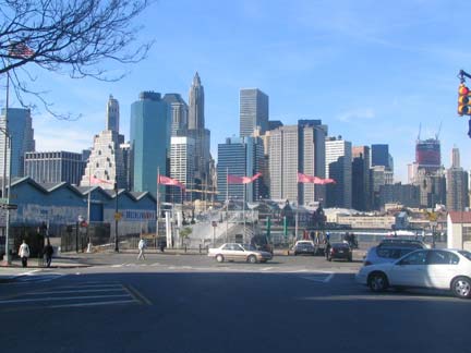
Until 9/11/01 this view was completed by the twin towers of the World Trade Center. In 2012, a new 1776-ft. tall Freedom Tower was being topped out as well as other buildings surrounding Ground Zero.
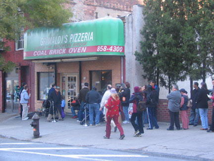
Grimaldi’s, on the north side of Old Fulton between Water and Front, is known as one of NYC’s premier pizzerias.
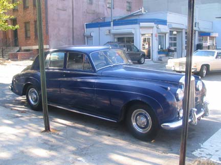
1950s Rolls or Bentley. The hood ornament would tell the story…and it’s hidden behind a pole!
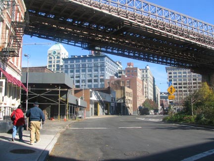
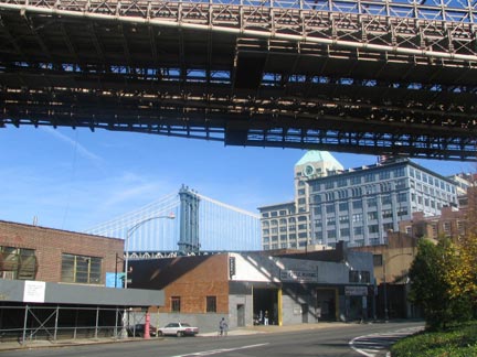
As Brooklyn Between the Bridges continues to be redeveloped, old buildings are being revamped into expensive housing for the rich. In the photos at left can be seen the Sweeney Building (foreground, blue building) and the 1915 Clock Tower, a former corrugated paper warehouse at #1 Main Street. Employees and employers of formerly thriving industrial businesses have been forced out as yuppies move in.
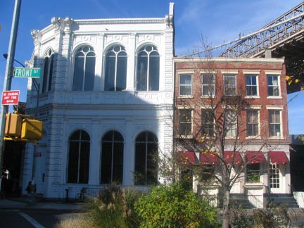
The 1868 Long Island Safe Deposit Company building at #1 Front.
From the ForgottenBook: One of Brooklyn’s more impressive cast-iron building façades is the Long Island Safe Deposit Company building, at #1 Front Street at Old Fulton, which dates to 1868 and was designed by William Mundell. The construction of the Brooklyn Bridge made life difficult for businesses on lower Fulton Street, and Long Island Safe Deposit was no exception; it closed in 1891. Its presence is a testimony to how this part of town was formerly one of Brooklyn’s business hubs; its subsequent decline was symptomatic of the neighborhood’s decline after ferry service ended in 1924. In recent years, the building has been restored to much of its old glory.

Judging by the sign, looks like “DUMBO”, commonly used for the region for about 20 years, has become the official appellation.
It’s a dopey name, as is Soho, Tribeca, Noho, and every other acronymic construction. Real neighborhoods have real names, inspired by heroic or historic figures, or geographic locations or highlights, or, perhaps, historic names in languages like Dutch or any of the Native American languages.
I’m not rich enough to live in Dumbo. Just as well…I’d be slightly embarrassed to tell people I live in a place which isn’t even named for a cartoon elephant…it’s not even named for anything!
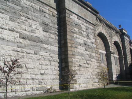
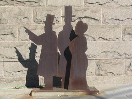
Anchorage Park is an unfinished green area opposite Hicks Street surrounding the massive, vaulted stone Brooklyn Bridge anchor. Three figures point toward the bridge; perhaps they are supposed to be set in 1883 when the bridge opened.
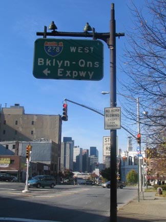
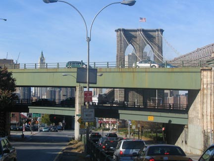
OLD FULTON and HICKS STREETS
A 1950s-era sign, complete with incandescent lights, can still be found at the Brooklyn-Queens Expressway interchange. How much better would the view had been if Robert Moses had not built the BQE along the waterfront?
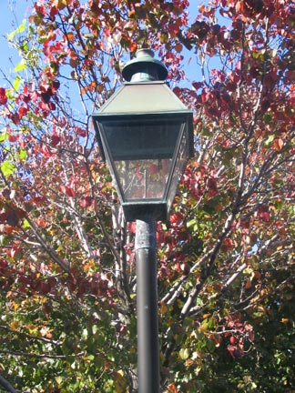
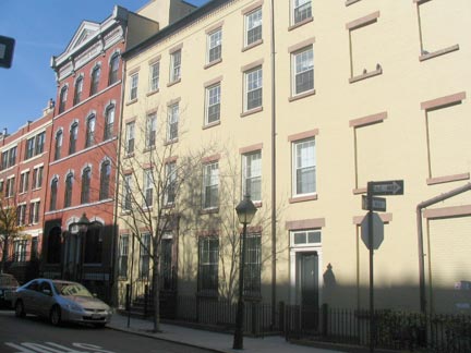
In a surprising development, the block bounded by Old Fulton, Hicks and Poplar Streets has had working gaslights installed. Not sure if they’re attached to a gas main, but they’re the first NYC gaslights on a public thoroughfare since they were supplanted by electric lamps in the 1900s and 1910s.
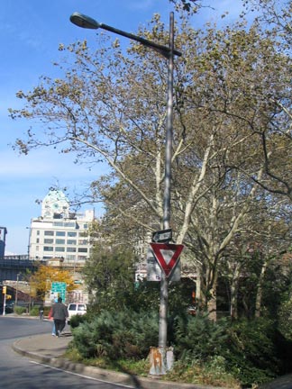
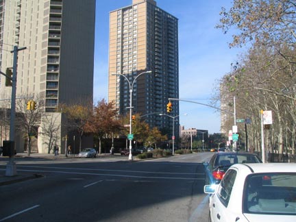
CADMAN PLAZA WEST
The old Whitestone-type lamppost is one of a handful remaining along the Brooklyn Bridge approach roads. Fulton Street is called Cadman Plaza West and runs past the large, bland plaza as well as some high rise apartments. It still, however, runs along the identical curving route that Kings Highway and the Native American trail that preceded it have taken for centuries.
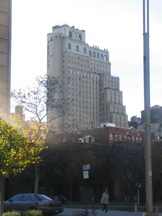
One thing that the razing of the el and the businesses along Fulton in the 1950s has done is make the St. George Hotel visible from Cadman Plaza West when traveling south. The hotel was originally built in 1885, but there were eight gradual additions, including the high-rise portion seen here that was finished in 1930. Surprisingly, the St. George was once NYC’s largest hotel and boasted the largest indoor salt water pool in the USA. Today only one of the nine original buildings (the Weller, at 100 Henry Street) is still a hotel and some of the buildings housed the homeless; for awhile vagrants had taken over many of the buildings. The St. George suffered a devastating fire in August 1995.
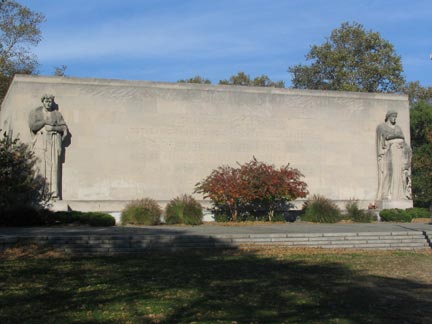
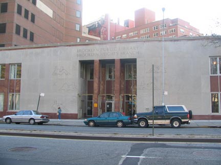
CADMAN PLAZA WEST between MIDDAGH and TILLARY STREETS
Post-classical 1951 World War II memorial in Cadman Plaza; and the Brooklyn Business Library, where your webmaster put in a couple of years in the 1980s as a shelf stocker, telephone book labeler and generally despised flunky. Don’t let that deter you; the library is a unique resource and I spent many a lunch hour and, um, some non-lunch hours perusing the volumes. There is actually a small museum inside the WWII memorial.
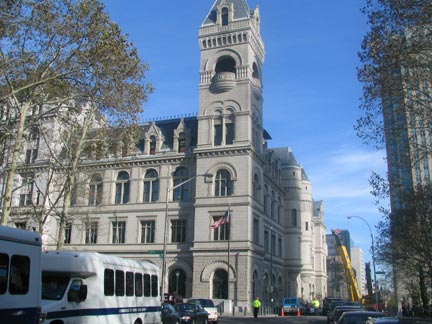
CADMAN PLAZA and JOHNSON STREET
The US Post Office dominates Cadman Plaza, especially when you view it from the south on Court Street. The Romanesque Revival building dates back all the way to 1885. Much of the post office operations decamped to the Brooklyn-Queens border in the 1990s, but the magnificent building remains as the Downtown Brooklyn Station.
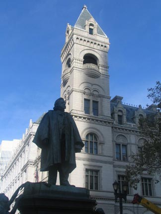
The statue is that of Henry Ward Beecher (1813-1887), the influential, abolitionist, and lusty Brooklyn Heights preacher. It dates to 1891 and is one of John Quincy Adams Ward’s many NYC creations. It is one of two Beecher statues in the area: the other one is in back of Plymouth Church on nearby Orange Street, where he held forth beginning in 1847.
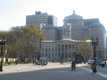
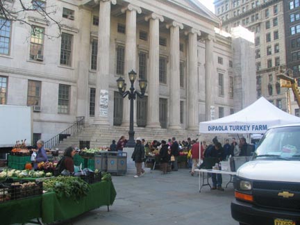
Brooklyn’s City Hall (until 1898; now it is Borough Hall) was built beginning in 1845, though its familiar cupola was not added until 1898. We are actually looking at the back of the building, since the oldest part fronts on Joralemon Street.
The Borough Hall Greenmarket takes place Tuesdays, Thursdays & Saturdays from 8:00 a.m.-6:00 p.m.
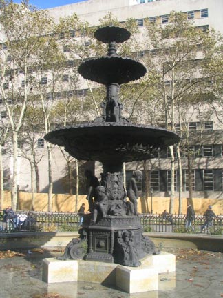
The fountain appears to have been a part of the original plaza, but it’s retro-classical; it was installed in the 1990s when the plaza at Court and Remsen Streets was reconstructed.
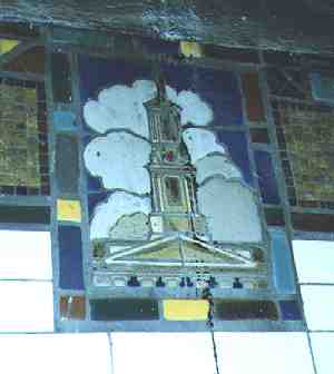
A terra cotta representation of the Borough Hall cupola can be found along the walls of the IRT subway (#2 & #3), which runs along Fulton Street’s former path just east of the building.
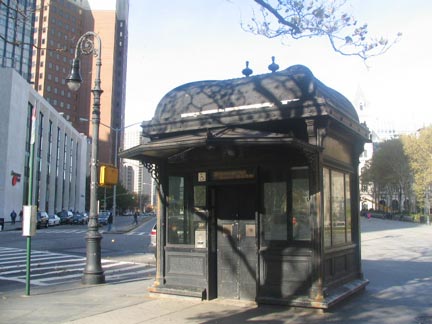
Just a pair of retro-fixtures. Each appears to be much older than it actually is. The retro-bishops crook is an imitation of styles from early in the 20th Century and was actually installed in the mid-1980s; the old-style IRT kiosk ia actually a clever new way to mask an elevator.
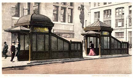
IRT kiosks at 28th Street and 4th Avenue in Murray Hill, Manhattan, about 1910
The IRT actually installed two of these massive kiosks at most of its stations in the 1900’s. There were two per station: different designs for entrances and exits. They were later considered a pedestrian roadblock and a hindrance to traffic, since the blocked the views of motorists. Most were gone by the late 1950s. The city has installed new designs at Astor Place, City Hall, and here at Borough Hall that were inspired by the old kiosks.
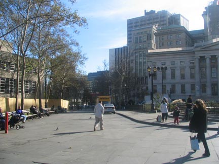
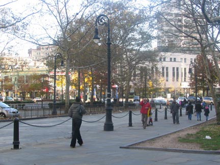
A “lost” section of Fulton Street was reconstructed during last decade’s renovations. The pedestrian walkway from Court to Joralemon east of Borough Hall was once part of Fulton Street as it curved southeast. The Fulton St. El rumbled overhead till the 1940s; the IRT Subway, built in 1908, runs underneath. The retro-crooks date to the 1980s.
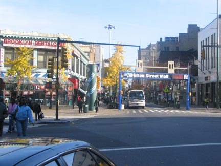
Fulton Street proper now begins at Adams Street; since 1979 it has been a modified mall with only buses and local traffic permitted. Fulton Street becomes a “street” only at the mall’s eastern end, at Flatbush Avenue.
Your webmaster took the pictures on November 6, 2004 and wrote the page on November 10.

