“Well it winds from Bensonhurst to Brownsville…”
Even though Bobby Troup never got around to writing about Kings Highway in Brooklyn, in many ways it is every bit the mother road that Route 66 is!
The road we know today as Kings Highway has a rather inauspicious beginning in Bensonhurst, where it starts as a two-lane road emanating from the intersection of Bay Parkway and 78th Street. At first home to a nondescript collection of car-crash repair shops and gas stations, it finds a role as a prime shopping street as it meanders, seemingly without aim, through Gravesend and Midwood. However, it then discovers its true calling when it reaches Ocean Avenue and Avenue P, where it grows six extra lanes and becomes a pedal-to-the metal eight-lane behemoth… until it is finally defeated by pipsqueak East 98th Street, which carries the elevated IRT above it. On the other side of East 98th Street, both Tapscott Street and Howard Avenue get wider to absorb Kings Highway’s traffic, but the jig is up at that point, and Kings Highway, for all its domination, seemingly peters out in Brownsville. Actually, though, before it ends, Kings Highway donates its power to Linden Boulevard, which in its Brooklyn incarnation becomes a powerhouse in its own right, taking Kings Highway’s traffic eastward to Conduit Boulevard…which becomes Southern Parkway…which becomes Sunrise Highway and doesn’t end until it almost reaches the southern fork of Long Island!
So in many ways, Kings Highway can be called Brooklyn’s Mother Road. Not only does it parent some of Long Island’s most important roads…Kings Highway itself has been around for over 200 years bearing that name, and it was the road that connected Kings County’s earliest settlements. Prior to that, it was a trail used by the Canarsee Indians long before European settlers arrived.
As a matter of fact Kings Highway might just be the very first road in the United States to be officially referred to as a “highway.” Early records show that Governor Peter Stuyvesant of the New Amsterdam colony first referred to it as “Highway” in a document dated June 4, 1654, in a grant. Later documents call it The Cross Road. According to some sources, Kings Highway got its present name during the colonial period and is named for King George III…the monarch the nascent United States rebelled against in 1776!

Kings Highway zigzags across Dyker Heights in this 1898 map.
By 1903, Kings Highway in Bay Ridge, Dyker Heights and Bensonhurst was demapped, meaning that developers could build on its old route. Vestiges of the old lane, including mile markers, hung on well into the 20th Century.
Kings Highway was originally much longer than it is now. It originally began at Fulton Ferry, where Old Fulton and Furman Streets are now, and ran southeast all the way to the small Dutch town of New Amersfort, now known as Flatlands. It took a sharp westward turn at that point and swept into another of Brooklyn’s original six towns, New Utrecht, and on into Yellow Hook (Bay Ridge), ending at Denyse’s Ferry, operated by a colonial-era landowner, about where Shore Road and 79th Street are now.
Fulton Street between the old ferry landing and where Borough Hall is now takes exactly the same route old Kings Highway did. Flatbush Avenue is a straightened version of Kings Highway between Fulton Street and Flatlands.
East of Flatlands, what is now Kings Highway was once a separate road entirely, known as Flatlands Neck Road well into the 19th Century. It angled northeast until ending at Hunterfly Road in what is now Brownsville. Only the tiniest vestiges of Hunterfly Road remain today, but Kings Highway in that area became an eight-lane thoroughfare in the early 1920s.
Sticking to Kings Highway we know today…from Bensonhurst to Brownsville…let’s take a walk from west to east and take in its quirks and historic sites.
New Utrecht
Like the National Hockey League, Kings County also has its Original Six. Towns, that is. Brooklyn, Bushwick, Flatlands, Flatbush, New Utrecht, and Gravesend. Over a couple of centuries, the City of Brooklyn gradually absorbed the other towns (after part of Flatlands became New Lots). By 1896, Kings County and the City of Brooklyn were finally coterminous…but Brooklyn consolidated with New York City in 1898.
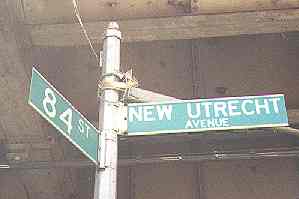
New Utrecht,named for Utrecht, Netherlands, the 4th largest city in that country. In Dutch, “Utrecht”, pronounced YOU-trekt, is derived from two words that mean “old fort,” so that “New Utrecht” actually means “New Old Fort.”
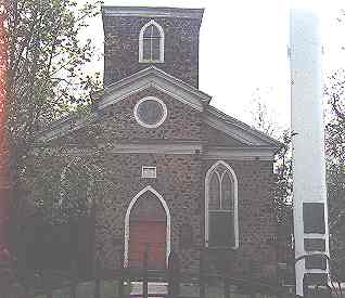
The heart of New Utrecht has always been the site of the New Utrecht Reformed Church, at 18th Avenue and 84th Street. The first church in New Utrecht was first built in 1699 and, while that church is mostly gone, this “newer” church was built in 1828 and contains some stones from its predecessor, along with Tiffany style stained glass.
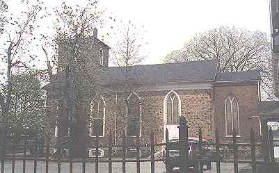
The bell of the New Utrecht Reformed Church has tolled to mark the death of every U.S. President…beginning with George Washington in 1799… and has most recently rung to mark the deaths of Joe DiMaggio and Frank Sinatra (the neighborhood of Bensonhurst that surrounds the church is still mostly Italian).
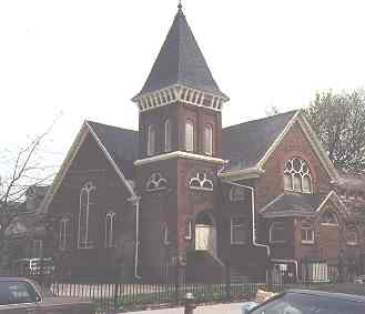
The adjacent parish house, built in 1885, is no slouch architecturally in its Shingle Style finery.
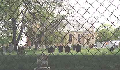
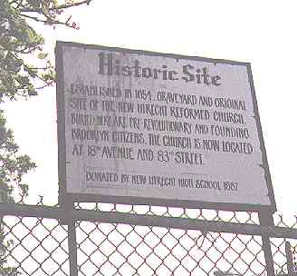
At 16th Avenue and 84th Street you will find the Reformed Church Cemetery, which is now beside the newer Metropolitan Baptist Church. The Reformed Church was originally here until 1828 when the present church was built a short distance to the east.
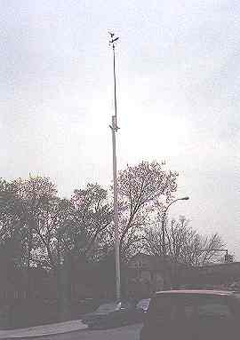
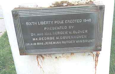
To harass the British, or to signal their defeat, Colonial patriots erected “liberty poles” on which the new American flag was raised. The first such pole was raised at this church in 1783 to celebrate American victory at the end of the Revolutionary War. Six poles have been placed here subsequently; this latest pole was raised in 1946.
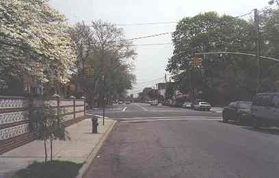
As you are going southeast, 84th Street suddenly widens at 16th Avenue and proceeds on a slightly different angle until it reaches the Reformed Church at 18th Avenue. The widening marks 84th Street’s old role…as Kings Highway.
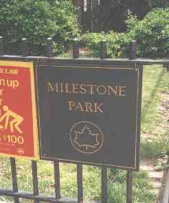
The milestone that is the centerpiece of Milestone Park is a replica of the oldest remaining milestone in New York City. The sandstone original is in the Brooklyn Historical Society, but a granite reproduction occupies the same spot where the original was placed on Kings Highway in 1741. It stands three feet high and has a base measuring one square foot. One side reads, “8-1/4 Miles to New York and 2-1/2 Miles to Denyse’s Ferry.” The other is inscribed, “10-1/2 Miles to New York Ferry, 15 Miles to Jamaica.”
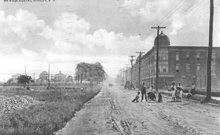
photo courtesy Brian Merlis
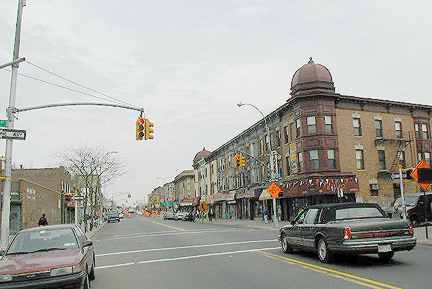
Walking east on Kings Highway, you soon arrive at the same scene depicted here. The time difference in these two photos is approximately 100 years. New multifamily buildings have begun to appear on Kings Highway’s south side. Even then, Kings Highway was hundreds of years old, and it had graduated from a dirt track used by Indians through the woods to a path connecting small European settlements. In 1900, only recently had Brooklyn come together as a city (only to be consolidated with four other boroughs as Greater New York City) and in its southern reaches, it was still very rural with numerous farms dominating the scene. This extraordinary photo shows Kings Highway on the cusp of its new incarnation as a residential and commercial strip.
In 1900, Kings Highway was still a dirt road. A modern fire hydrant, though, has been installed (the one in the recent photo may well be the same one.) The Sea Beach Railroad crossed Kings Highway about one block ahead (it would not be placed in its present open cut until the 1910’s). The buildings on the left in the distance are probably along West 6th Street.
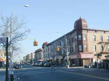
This photo, taken in the winter of 2001 at Archie Ketchum Square (named for a local World War I hero) at West 9th Street and Quentin Road shows Kings Highway as it has been since approximately the 1920s, when its present length was arrived at, and a major business and residential presence had taken hold. Our twin-domed apartment building is still there and on the exterior, at least, it has held up magnificently.
World War I is a major motif in naming conventions along Kings Highway’s route. Quentin Road is named for President Theodore Roosevelt’s youngest son, who was shot down in France behind enemy lines. He is buried in St. Laurent-sur-Mer, France, alongside his brother, General Theodore Roosevelt Jr., who died of a heart attack the day after D-Day in 1944. President Roosevelt had never recovered emotionally from the loss of his youngest son, and died in 1919 a year after Quentin’s death. After WWI, Avenue Q, which because of Kings Highway’s bend from a southeast to northeast direction has the distinction of intersecting the old route twice, was renamed for Quentin Roosevelt.
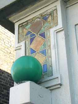
The Sea Beach Railroad got depressed in the 1910s. No, it wasn’t suicidal or anything like that; it became a part of Brooklyn Rapid Transit (the BRT) and its route was electrified and placed in an open cut between 1913 and 1915. To this day, it has retained its old name, the Sea Beach Line, though officially, it’s the N train.
Distinctive BRT (later BMT) stations, with the diamond pattern shown at left, were built along the line. The green globe, indicating 24-hour entrance, was placed there in the 1980s.
During Kings Highway’s 1920s building boom, theatres featuring live shows and later, silent movies and talkies began to proliferate. Baggy pants comics and leggy chorines gave way to Gable, Fonda, Monroe, Newman, McQueen, Connery, Nicholson, er, DiCaprio, and if they had remained open, Eminem. Maybe it’s all for the best that they did close.
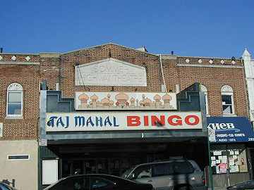
The former Sommer Highway Theatre, near the Sea Beach, represents the changing demographics of the northern end of Gravesend. The theater has become a bingo hall with an Indian motif; next door is a Russian travel agency.
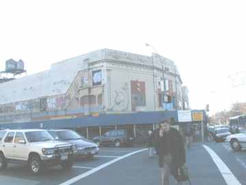
At Coney Island Avenue, you’ll find the doyenne of Kings Highway, the Kingsway Theatre. It was majestic until early 2001, when Loews went bankrupt and closed it. These days, it’s just another Walgreens. The Kingsway was a voluminous movie palace in the days when there was one movie per theatre. As with many theatres of its era, it had a pipe organ to accompany the silents. Imagine sitting in the Kingsway and hearing the pipe organ when Mary Philbin yanked the mask off Lon Chaney’s Phantom of the Opera!
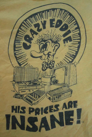

The Crazy One
Just across the street from the Kingsway was Crazy Eddie, the electronics store where Eddie Antar claimed he could beat any price you brought in. His “prices were insane”, and Eddie eventually wound up on the wrong side of the law. Of late, the Crazy Eddie imprint has resurfaced, along with long-time spokesman, deejay “Doctor” Jerry Carroll.
A Boy Named Joyce
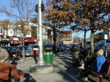
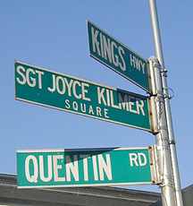
 Poet, editor, and soldier Joyce Kilmer was born in New Brunswick, NJ. He wrote voluminously in the early 20th century and joined the staff of the New York Times in 1913. When the USA entered World War I in 1917, Kilmer eagerly enlisted, and was subsequently transferred to Francis P. Duffy’s 165th Regiment…the famed Fighting 69th. He died in combat in France in 1918 and is buried at Fere-en-Tardenois in that country. Though his given name was Alfred, he preferred his middle name, Joyce, from his mother’s family.
![]() Kilmer’s granddaughter Miriam has a page with just about everything you’d want to know about him.
Kilmer’s granddaughter Miriam has a page with just about everything you’d want to know about him.
In case you’re curious about these things, Joyce Kilmer is a cousin of actor Val Kilmer (Batman, Jim Morrison) and a distant relative of 1970s NFL quarterback Billy Kilmer.
The Brighton Line
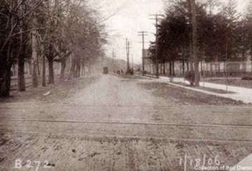
The Brighton Line at Kings Highway in 1906. The Brighton began in 1878 as the Brooklyn, Flatbush and Coney Island Railroad and ran between Prospect Park and the Brighton Beach Hotel on the surface trackage seen here. As rural as this scene seems, by 1906 the Brighton Line was already a vital connection between Brooklyn and Manhattan via the Brooklyn Bridge.
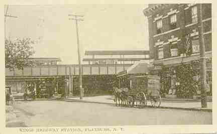
Just east of Kilmer Square the Brighton Line (today’s Q and previously the D) train passes over Kings Highway on an elevated overpass. Like the Sea Beach, the Brighton got its start as a steam railroad on the surface but was later absorbed by the BRT, electrified, and separated from the street. The photo shows it just after its new steel overpass was opened in 1907.
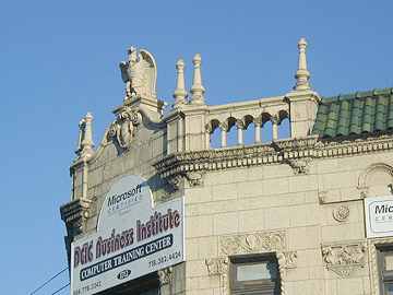
In 1920, the Brighton gained a connection with the Manhattan Bridge. The Kings Highway area became more of a ‘bedroom community’ as more homes and businesses were built along its length some of them ornate. This building at Kings Highway and East 17th Street boasts a Beaux Arts eagle.
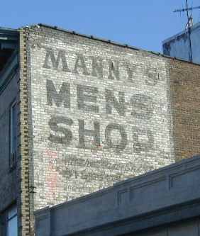
Painted ad, Kings Highway
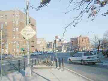
The eastern end of Kings Highway, from Ocean Avenue to East 98th Street, was saved from death by Brooklyn Borough President Edward Riegelmann. As development encroached on the area in the early-to-mid 1920s, Kings Highway was in real danger of being de-mapped and built over, as so many aboriginal Brooklyn roads had been. But Riegelmann and his staff recognized its historical importance…and not only retained it, but turned it into an 8-lane behemoth that bruits its way through staid East Flatbush. Riegelmann also has his name on the Coney Island Boardwalk, still the country’s longest.
At Ocean Avenue, Avenue P and Kings Highway, our World War I motif continues as yet another WWI hero, Corporal Clifford Wiltshire Triangle, marks Kings Highway’s pupation from two-lane road to 8-lane faux expressway. In the photo, Avenue P (left) meets Kings Highway (right) at Wiltshire Triangle.
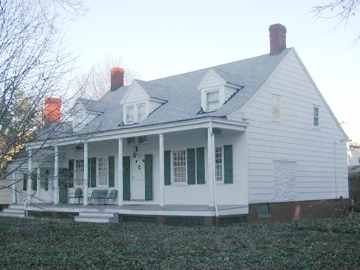
Flatbush and Midwood are dotted with ancient Dutch and British dwellings from the Colonial era. At East 22nd Street and Kings Highway you will find the Henry & Abraham Wyckoff House, built in 1766. Kings Highway was used as a conduit for British troops during the Revolution (the Brits burned Flatlands to the ground in 1776) and this house was seized and used to house Hessian troops, who carved graffiti into a glass door, which has to this day not been replaced.
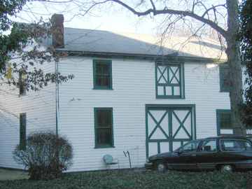
What appears to be a barn used for the old Wyckoff House is next door, used these days for storage and as a garage.
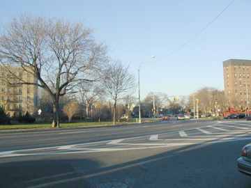
One of the very few examples in New York City of a British-style traffic roundabout is at Avenue M, East 35th Street and Kings Highway. The incorrectly-named Fraser “Square” is named not for the pretentious TV psychologist but for a hero cop in the first half of the 20th Century.
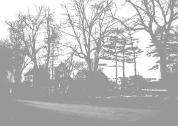
In 1923, the Jeremiah Bergen homestead (center) remained at the still-rural Kings Highway at what would be East 38th Street. Changes were imminent though, and the house would be gone within two years so that Kings Highway could be widened.
photo courtesy Brooklyn Collectibles
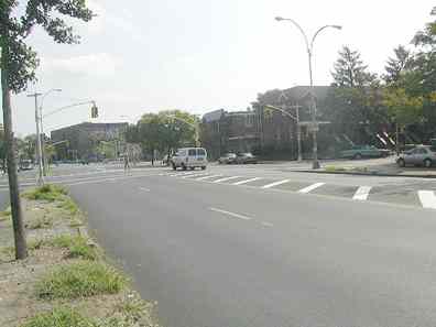
The same scene, Kings Highway and East 38th Street, today.
Flatlands
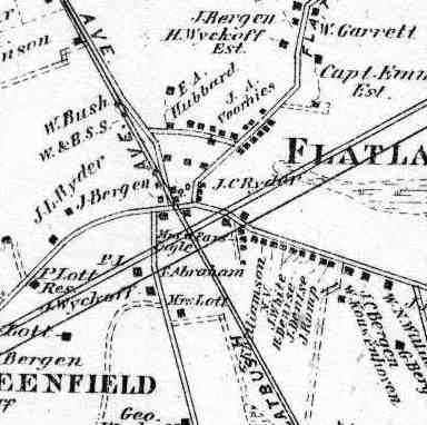
The Beers map shows Flatlands as it was in 1873. The diagonal line from NW to SE is Flatbush Avenue, which has yet to be laid out and straightened from Flatbush Turnpike, aka. Old Flatbush Road…which was originally a part of Kings Highway and led to Fulton Ferry. The road going off to the northeast is Flatlands Neck Road, which is roughly the present path of Kings Highway, and the road heading southeast has been known through the decades as Bergen Beach Road or Mill Lane. It exists these days only in very short segments.
Flatlands is one of Kings County’s original six towns. At one time, it encompassed what is today Marine Park, Mill Basin, Bergen Beach, Georgetown, Canarsie, East Flatbush, and Starrett City. For centuries the Canarsee Indians were the sole inhabitants, but in 1636 the Dutch arrived settled the area. The Dutch named their settlement New Amersfoort, after a Dutch city (explaining the name Amersfort, which turns up on streets and parks in the area today). The town acquired home rule from Peter Stuyvesant in 1661, but the British conquered New Netherland without firing a shot in 1664.
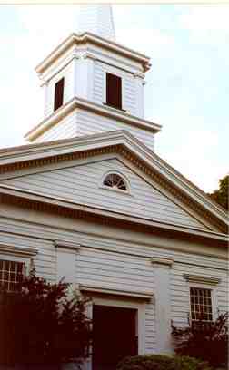
There has been a church at Kings Highway and what is now East 40th Street since 1654, by order of the then ubiquitous Peter Stuyvesant. The original Flatlands Dutch Reformed Church was here until 1794; this building, the third church on the site, dates to 1848. The church’s original graveyard, with names like Lott, Wyckoff and Kouwenhoven but also some of Brooklyn’s earliest freed blacks, is still in place.
photo: R. Safir
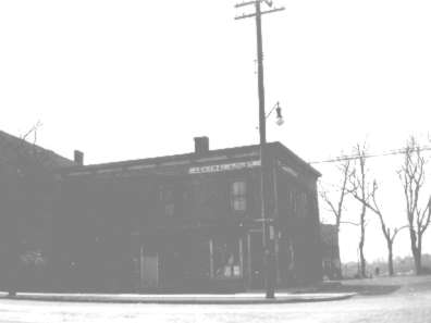
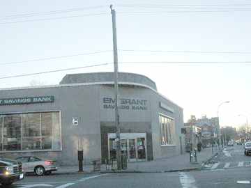
Flatbush Avenue and Kings Highway in the 1920s (above) and today. Bare trees marked Kings Highway’s path in the 20s; today it’s all filled in.
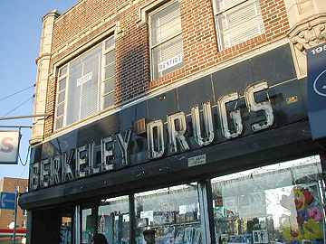
Venerable Berkeley Drugs, across the street from the Emigrant, was likely using its original neon sign in 2002, but it’s since been replaced.
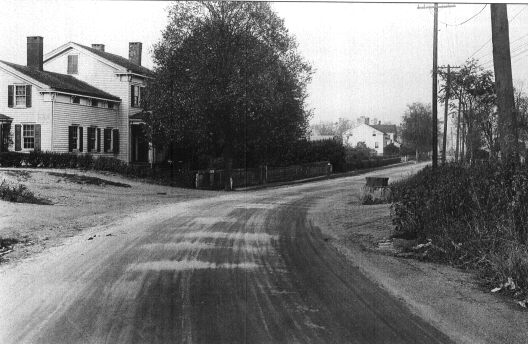
photo courtesy Brooklyn Collectibles
Looking west, Kings Highway makes the curve east of Flatbush Avenue in the early 1920s.
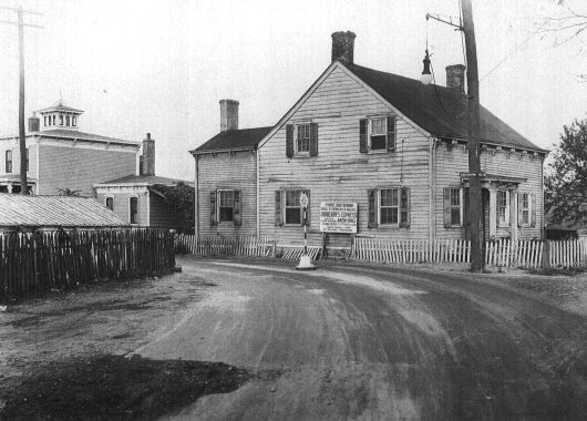
photo courtesy Brooklyn Collectibles
The same scene, looking east. Mill Lane (at the right side) forks to the southeast as Kings Highway curves to the northeast.
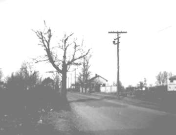
Kings Highway and East 55th Street in 1923. The building in the center is the Flatlands Neck School.
photo courtesy Brooklyn Collectibles
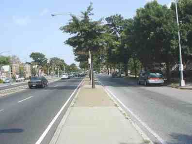
Kings Highway and East 55th Street today. Years before Matt Groening got hold of the word, the Futurama Homes, attached brick dwellings, were built in this area in the 1950s.
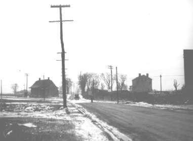
Kings Highway and Utica Avenue in 1923. The Garrett Kouwenhoven house, built around 1800, stands at the southwest corner. A nearby LIRR station (the LIRR had passenger service to this area until 1924) was named Kouwenhoven.
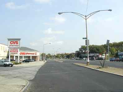
Kings Highway looking toward Utica today. A CVS Pharmacy obscures the Kouwenhoven house site today; the house fell victim to the Highway’s widening in the early 1920s.
SOURCES...
The Neighborhoods of Brooklyn, ed. John Manbeck, Yale University Press 1998
BUY this book at Amazon.COM
Brooklyn, The Way It Was, Brian Merlis, Israelowitz Publishing 1995
BUY this book at Amazon.COM
I’ll be walking the rest of Kings Highway into Brownsville sometime soon.
11/8/2002; revised 2012

20 comments
My Grandfather, born either 1896 or 1898 (they’re not sure; the midwife took her time with the birth info) lived on Kings Highway as a child, and remembers goats on that street. Can you imagine?
“Grandpa” Van Sicklen lived on McDonald Ave. off Kings Highway until he died in the mid’ 70’s. He used to let us sit in his backyard porch swing (which didn’t thrill his wife), and he always carried lollipops in case he ran into a group of kids. It was safe for a little girl to take a lollipop from a kind, old man back then. The Kings Highway of today looks almost as different from the Kings Highway of my childhood as the one back then looked in comparison to the Kings Highway of the turn of the century. Where do kids graduate now that they no longer have movie theaters with balconies?
The “Beaux Arts eagle” is at East 17th Street, not E 16th.
Technically, Quentin does not cross KH twice, as Quentin is “interrupted” at East 13th Street, resuming at East 16th Street. So Quentin crosses once, meets twice.
The “second” intersection of Quentin Rd. With Kings Highway occurs at W. 10th St.
Disregard my comment. I failed to realize the distinction between “crossing” and “meeting”.
Your right, used to play touch football on that block. That is where Quentin Rd. begins or ends.
By the way, can you clarify something? According to this page, the original KH wended its way from the ferry landing, along what is now Old Fulton and Fulton (you only mention Fulton, but it is pretty clear its alignment must have followed both), meandering more or less along Flatbush Avenue, until reaching Flatlands Neck Road (you just call it Flatlands in the corresponding sentence), and then veering northeast, along the old Flatlands Neck alignment.
It would thus appear that the current western segment of KH, from Bay Parkway to Flatbush Avenue, must have had a different name in years past, along with the lost segment and the section of 84th Street that was apparently a section of the same road. Do you know what the name of that old road was? And when it became KH? Or was that the old KH, and the road originally veered southwest at Flatlands, not northeast?
Very confusing!
Separate question: Was the current Flatlands Ave a realignment of Flatlands Neck Rd until it became KH?
Finally, KH is not an 8-laner, unless you count the parking lane along the service road. It has two main lanes in each direction, a median/left turn lane, and a service road lane in each direction.
The current Kings Highway from Flatbush Ave to Brownsville used to be called Flatlands Neck Road.
[…] 1922, Kings Highway and Flatbush Avenue were both narrow, curvy dirt roads lined with trees and frame houses with picket fences. It’s interesting to note that the very […]
At the very eastern end of Kings Highway are a few small mysteries of street layout. The eastbound service road curves sharply right for its last 100′ or so, seemingly for no reason. On the other side, as Kings starts at E 98th westbound, you can enter at either the service road or the main road, with a concrete island separating them — but only about 150′ in, there is a crossover lane from main road to service road, for which there is absolutely no need.
The reason can be explained in two words: Clarkson Street. They are now slightly misaligned, but if you were to extend an imaginary line from the end of Clarkson at Rockaway, and stretch Clarkson straight a bit further to E 98th, you’d find both the crossover lane and the curved stretch of eastbound service road, are both almost parallel and only a few feet distant from your “Clarkson.”
Before became such a big deal with six lanes of traffic and two island separators, Clarkson extended across it to at least E 98th. When they paved and enlarged Kings Highway, they left cuts in for Clarkson, and ended the eastbound service lane at Clarkson. Later they found that it snarled traffic and created a safety hazard. So Clarkson traffic was only allowed one-way coming from the main road, and the tail end across the highway was cut off, connected only to the termination of the service road on that side… effectively making it part of the service road. Since the cut between the main road and the service road was angled a little too sharply when aligned with Clarkson, they dialed it back a bit, making a more oblique cut that also gives a short length of merge before coming to Clarkson, preventing main road traffic from directly cutting across the cut and colliding with service road traffic… as unlikely as that is to need to occur anyway.
“East Clarkson Street” was a main route through Pigtown in the 19th and early 20th Century but as an overall grid was laid out it disappeared.
To me it’s odd that while Kings Highway extends north of East 98th to Howard near Sutter, the DOT and its predecessors always treated it as widenings of Tapscott St and Howard Avenue. It’s to late to change all the house numbers now, but they could have called it Kings Highway and numbered it in the 9800s and 9900s.
I grew up around the other end of Kings Highway,where it turns into Howard Avenue on the edge of Brownsville.Right where the el turns from E.98th St onto Livonia Avenue.
Theodore Roosevelt Jr. lasted a month after D-Day …
[…] Paper have each published their take on the place, Vice has actually done so two times, and a host of blogs have followed suit as well. I’d imagine that at any given day there’s probably […]
Great, in depth piece! I posted a link to it on the Facebook page of my novel “Different Drummer” which mentions many of these locales.
My mother grew up in this area. I grew up in Maryland, but would like to know more about it. We visited the area a few times when I was young, so I don’t remember too much. She passed away, but she graduated from Madison High, and lived in an apartment building of about 8 floors. I remember a Kings Highway, and a Flatbush Ave.(?) I also remember a hospital near the apartment building. I don’t remember much else, except driving to Loehman’s (?), with 2 lion statues out front. Any ideas of where she lived? Is this area Bensonhurst?
She could have grew up near king highway. There is a hospital on bedford ave and Madison HS is right there too.
Kings Highway Hospital was at the corner of Kings Highway and New York Avenue. It’s still a medical building but I’m not sure what it’s titled now.
I remember back in the 1950’s at the corner of East 40th St. and Kings Hwy. there was a Homestead house that had to go back to the 1800’s. It was made of wood. Had a open porch with a gazebo in the backyard. In order to enter into the house you had to walk down the cement steps as the house was built below the street and sidewalk. It was destroyed in order to build an apartment house that now stands in its place. Today, it most likely would have been a landmark,
If anyone can appreciate this, it would be none other than you.
As a kid growing up in Homecrest, I was of course familiar with the 10 block east-west shopping strip of Kings Highway, from Coney Island Avenue to Ocean Avenue.
At around age 12, I started expanding my exploring horizons via bike, assisted by my holy grail: The giant sized, Hagstrom 5 Borough, (spiral bound & laminated!) Atlas.
This one time, setting out to explore the eastern leg of Kings Highway, I neglected to consult it.
East of Ocean Avenue, I was amazed as it swung northeast, slicing it’s way diagonally through the street grid. I remember how disorienting it was at Fraser Square (actually an oval; why not create even further confusion), causing me to veer off onto say, Avenue M while thinking I was still on Kings Highway.
But the best was yet to come a few blocks ahead, where it swings straight north at Avenue K, “sharing” East 40th Street for one block until Avenue J. Apparently I wasn’t paying attention, because imagine my surprise when I came to the perfect 90° intersection of Kings Highway & Avenue J!
Now I was REALLY stumped. I always knew Avenue J as an east-west avenue; did it somehow take a turn south somewhere, intersecting with more or less Eastbound Kings Highway?!?
It wasn’t until I got home & found my answer from the atlas. The problem was (& still is for me) that I ALWAYS have the perception Kings Highway is going east, despite it’s northerly stretches (which, for the most part, it is).
If you know if a support group for the direction perceptionally challenged, please let me know so that I can sign up ASAP!