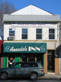
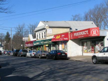
Eltingville is the name of a neighborhood on Staten Island, one of the five boroughs of New York City, USA. It is on the island’s South Shore, immediately to the south of Great Kills and north of Annadale.
Originally called South Side, and later Seaside, the neighborhood owes its present name to a prominent family by the name of Elting which settled there in the late 19th Century. It was the southern terminus of the Staten Island Railway until 1860, when the line was extended to Tottenville. The community’s main business district sprang up around the railroad station, which is located a short distance west of the intersection of Amboy Road and Richmond Avenue. It is probably with the neighborhoods of Eltingville and Great Kills collectively in mind that New York Telephone named a telephone exchange “Honeywood” in the 1920s; this exchange, which also served Annadale and Huguenot, was retired from service in 1959, but a local business establishment — Honeywood Liquors on Hylan Boulevard — remained for decades as a reminder of the exchange’s existence.
Beginning in the mid-1960s, Eltingville, like many other Staten Island neighborhoods, was the scene of massive new home construction, replacing the farmland that had heretofore predominated. This caused some logistical problems, chief among them the lack of existing sewer lines in the region, which then needed to be built. As a result, local traffic frequently had to be detoured from many main thoroughfares, including a large section of Hylan Boulevard in the early 1990s.
Actor Steven Seagal once lived in Eltingville, the western portion of which is sometimes reckoned as a separate neighborhood called Greenridge. One other Notable celebrity from Eltingville is fashion model Patti Hansen, wife of Rolling Stones’ Keith Richards. wikipedia
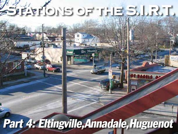
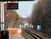
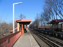
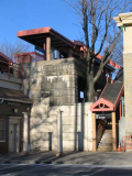
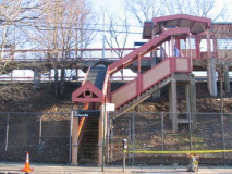
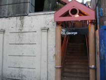
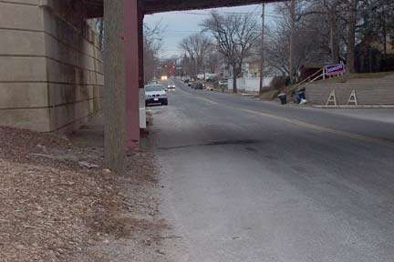
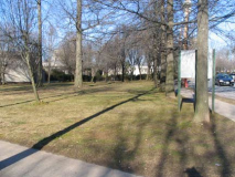
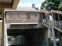
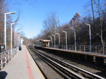
Views from the elevated Eltingville station.
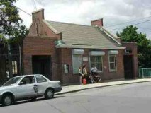
Eltingville Station, 1932, a few years before the grade crossing was elevated.
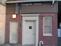
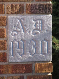
On the exterior of this stationhouse, under the overpass on Richmond Avenue, is a plaque noting the Great Kills to Huguenot grade separation project was done under the auspices of the Works Progress Administration. Note the date: 1939; the southern stretch of the SIRT wasn’t grade-eliminated till then.
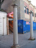
What are probably original elements from the 1939 elevation are still here, including a pair of Doric columns that once held a canopy. The stationhouse one time featured a signal lamp that alerted those waiting that a train was arriving.
Richmond Avenue is an integral north-south thoroughfare on Staten Island. Measuring approximately 7.2 miles (11.59 km), the road runs from the community of Graniteville to the south shore community of Eltingville.
The road is one of the older ones on Staten Island, presumably dating back to the early to mid-1800s. Prior to its being named Richmond Avenue, it was known as Church Road, Port Richmond Plank Road and the Old Stone Road. Originally, the roadway extended further north to Richmond Terrace, at Port Richmond. However, the construction of the Dr. Martin Luther King, Jr. Expressway divided Richmond Avenue into two sections, the northern segment being later renamed Port Richmond Avenue.
Early writings and periodicals refer to Richmond Avenue as the road from Port Richmond to New Springville, just north of the Fresh Kills. Indeed the Fresh Kills Bridge, which carries Richmond Avenue over the Fresh Kills to Arthur Kill Road and beyond, wasn’t constructed until the late 1920s and was completed in 1930. However, maps from the 1890s indicate that Richmond Avenue not only crossed the Fresh Kills, but extended to its current terminus just beyond Hylan Boulevard, albeit prior to the creation of said boulevard. Ergo, there exists some ambiguity as to Richmond Avenue’s history.
The completion of the Fresh Kills Bridge was extolled by many for it reduced travel time considerably, particularly for those driving from the north shore to the Outerbridge Crossing.
In the 1920s and 1930s, most of Richmond Avenue, particularly south of Victory Boulevard, was predominantly farmland. The road itself was merely one-lane wide. However, indicative of the economic transformation the Richmond Avenue corridor of Staten Island experienced, specifically with the opening of the Staten Island Mall, the roadway was widened. The roadway from Rockland Avenue to Forest Hill Road has been widened to an eight-lane thoroughfare (four lanes each way), while other sections are two and three lanes wide.
Prior to the construction of any expressway on Staten Island, Richmond Avenue, north of Drumgoole Boulevard, was designated New York Route 440, which it held until the West Shore Expressway was completed in 1976. wikipedia
1940s-era neon signs on Richmond Avenue north of the SIRT.
From the works of William Shakespeare we get the name of one of Staten Island’s older roads, Arden Avenue; 19th-century developer Erastus Wiman, who also had a hand in the development of the SIRT, named a region in the southern end of Eltingville for the Forest of Arden, the woodland setting of “As You Like It”, and Woods of Arden Road and Arden Heights, near the junction of Arden Avenue and Woodrow Road, are named for it as well. Arden Avenue was called Washington Avenue until about the turn of the 20th Century.
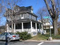
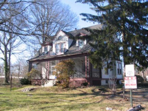
The house with the gorgeous wraparound porch was likely there before Arden Avenue was bridged by the SIRT in 1939, ruining the view. There really isn’t anything substantially different in this scene as it was in 1939.
There may or may not be a genuine artifact on Arden Avenue just north of the RR trestle.
It has to do with a small hunk of concrete embedded in the turf at the side of the road. Forgotten Fan R. Orlando posits that this may be a remnant of a gate crossing or warning sign from the pre-1939 era when the SIRT ran at grade here. It’s quite a reach. But this is a city where I found a RR crossing X sign on Hancock Street in Ridgewood, warning of a railroad crossing on the Evergreen Branch that hadn’t seen a train for several decades. You never say no.
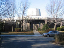
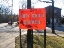
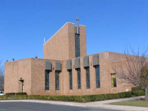
Pressing on to our next SIRT station, you pass a strangely open triangle of curated lawn on Amboy Road and May Place. In an era where every available piece of property is snapped up for architecto-junk, I wondered what this was about, but the “Holy Child Church” metal sign answered the question, and it wasn’t long before I spied the church itself, a piece of modern architecture dating to 1969. To me, it resembled the U.S.S. Monitor, the ironclad vessel built by John Ericsson in the Greenpoint, Brooklyn Continental Iron Works that battled the Confederate Merrimac to a standoff at the Battle of Hampton Roads, March 9, 1862.
An intentional resemblance? Who knows?
Annadale
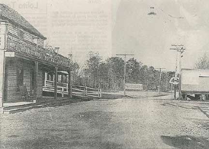
Annadale station, early 20th Century, left; station house at Richmond Town Restoration, minus its veranda
Annadale received its present name circa 1860, and is named after Anna Seguine, a descendant of French Huguenots who were among the South Shore’s earliest settlers; this settlement is also responsible for the neighborhood immediately to the southwest of Annadale being named Huguenot, and the Seguine family also lends its name to Seguine Avenue, the principal north-south thoroughfare on the east side of Prince’s Bay, the neighborhood next southwest of Huguenot.
In 1929, immigrants from Spain purchased land along the Annadale shoreline, and founded a settlement that became known as the Spanish Camp, or Spanish Colony. First tents, and later bungalows, were built at the site; social activist Dorothy Day purchased one of the bungalows in 1972. By the mid- 1990s, land developers had begun aggressively seeking to purchase the property, and finally succeeded in 1999. The buildings at the site were then demolished so that several large, upscale homes could be constructed.
Annadale once had abundant woodland, but much of it was cleared in the last three decades of the 20th Century to make room for new homes. However, a city park in the heart of the neighborhood was converted into a wildlife preserve; known as Blue Heron Park, it covers 222 acres, much of it consisting of ponds, swamps and small streams which empty into nearby Raritan Bay. wikipedia
1939 Annadale stationhouse and platform, February 2007
Author Gertrude Egish (1912-1998), an Annadale resident in the early 20th Century, remembered the days of steam railroading on Staten Island…
Each of the 17 railroad stations from St. George Terminal to the extreme end of the island at Tottenville had a distinct style and quality of its own. One could not possibly have mistaken one for another when glancing out the train windows, by night or day. The stations and platforms were made entirely of wood. The trains were run by the Baltimore and Ohio RR and the fare per mile was considered the best in the country [and today, still are; the SIRT fare is free of charge everywhere except at St. George — your webmaster]. The passenger cars were built for much longer routes and had seats of plush, window shades, and a toilet at the end of each car…the seats were comfortable and ample enough for an adult to lay his head back for a short snooze. At the end of each one-way trip the seats were reversed so that passengers could face forward on the return ride. The huge black engines were made of iron with a cowcatcher out front. The train whistles could be heard for miles away on quiet nights…
…Alas, all things must eventually come to an end. Came the day when the familiar trains were replaced by new ones that resembled the ugly subway trains in the city. On the Saturday the change was made, we all assembled at the station around noon, crowding the platforms on both sides of the tracks. And then it happened. The last of the steam trains, making its final run from Tottenville, pulled into our side of the platform while at the same time the new, strange-looking one pulled alongside from the opposite direction on its first run from St. George. There they met, for the first and only time, at the Annadale station. I felt a pang and a sense of shock, bewilderment and frustration all at once, for the first time in my life.
The Annadale station house was a wooden structure with a kind of veranda which extended all around and which had a sloping overhang, a protection against the sun and rain or snow, so that once could wait for the train out there rather than in the cigar smoke-filled waiting room. However, the waiting room could be a mighty welcome place when seeking warmth on real cold days, when one’s hands coild be held near the pot-bellied stove which burned witha steady blue flame, the door wide open. Boys would spit up against the hot sides of the stove, producing a sputtering sound and acrid odor…when the trains stopped to let on or off passengers, the firemen could be seen shoveling coal into the huge roaring fire in the locomotive, in order to bring up the necessary amount of steam to run the engine. The engineer would look toward the front of the platform and the crossing, then the conductor back inside the closed doors, would pull an overhead switch and the train would be on its way. Coming toward our station, he would call out, “Next stop, Anna-day-elle!” and we were always glad to be there no matter where we had been. It was our station, very special. G. Egish, Next Stop, Annadale!
Annadale station features a pedestrian crossover west of Annadale Road.
We’re long past the era of steam trains, plush seats and bathrooms in every car; the SIRT was electrified in the 1920s and its Standard steel cars lasted well past their expiration date, with modified R-44 BMT units replacing them beginning in 1971.
Is there anything left over in Annadale from Gertrude Egish’ day?
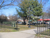
This triangle of green at Annadale Road and Jefferson Boulevard is located at the intersection of Annadale Road and Jefferson Boulevard, this park fell under the jurisdiction of the Staten Island Borough President. In 1962, it was transferred to Parks in order to facilitate changes being made throughout town. These included a newly laid out street system and the installation of sidewalks. In 1997, the park’s pavement and paths were improved with $37,952 of funding from Mayor Giuliani. One year later, the name of this site was changed from Annadale Park to Annadale Green.
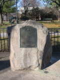
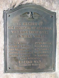
In 1953, a war memorial was erected on this site. It honors the 12 residents of Annadale who gave their lives in World War II and the Korean War. The bronze tablet was originally posted near the mall on Jefferson Boulevard, but when Annadale was redesigned in 1962, it was moved to its present location and mounted on a boulder. Each Memorial Day and Veterans Day, the Beauvais-Hudson Post No. 126 of the American Legion holds a ceremony at this site. This service includes the placement of a wreath on the memorial, as well as a traditional three-gunshot salute with the playing of Taps.
Today, Annadale Green is a focal point for the center of town. Shops, restaurants, and the train station surround the park’s open space. The Annadale Garden Club, a volunteer organization, beautifies the park throughout the year: decorating it for the Fourth of July, Easter, and Halloween, and dressing an English White Pine each holiday season. Aesthetically and functionally, Annadale Green is reminiscent of a colonial town square, and enhances the small-town atmosphere that still endures here. NYC Parks
Striking off on Jefferson Boulevard northwest from Annadale Green, you spot a pond on the left side of the street, which feeds a brook on the right side. We’ll see more of the brook as we hit the side streets.
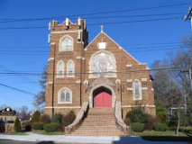
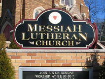
Messiah Lutheran Church, built 1930, Jefferson Boulevard and Drumgoole Road South. Honestly, I didn’t think there was much to Annadale beyond the immediate train station area — before the 50s or 60s, I thought it was all farms and fields here. But this church has been here quite awhile.
Sweet Brook
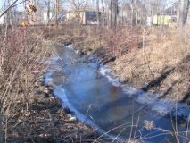
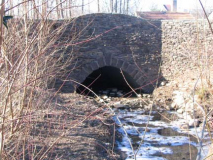
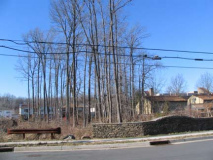
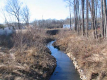
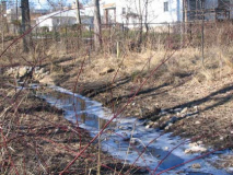
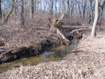
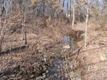
I was on N. Railroad Street (elswehere on Staten Island streets bordering the SIRT are called N & S. Railroad Avenue) when I noticed a fenced-off section of Carlton Boulevard on the left. I thought something was up, so I investigated…and was rewarded with a fairly substantial unmarked creek in what on maps is labeled Belfield Avenue. I followed it……past a culvert under Detroit Avenue…
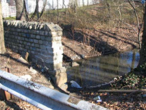
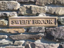
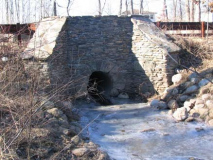
…as far as Edgegrove Avenue, where another handsome stone bridge of recent vintage carries the road over the brook, and a metallic sign helpfully identifies it as Sweet Brook.
I was surprised to find Sweet Brook here, since I had already found it elswhere off to the east in Eltingville and didn’t know it extended this far southwest. Further, maps show some interrupted streets west of Korean War Veterans Parkway (Rt. 440), so I imagine it runs there, as well.
Does anyone have a good topo map of the area than can show me the entire run of Sweet Brook?
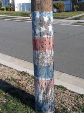
This corner of Annadale has some relatively older homes, and was settled before the mid-20th Century as well as some painted poles left over from the 1976 Bicentennial celebration. Both, Edgegrove Avenue northeast of Sweet Brook.
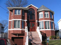
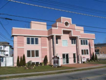
Meanwhile, back on Amboy Road… on either side of the junction with Annadale Road, there’s a pair of new structures that intrigue me. They’re trying hard to rise above the spate of quickie junk most new architecure winds up being, and for the most part they succeed. The building on the left is on Amboy Rd. and Poillon Avenue and is a medical arts building housing a number of doctors. I like the pink and white color scheme. Follow Poillon Avenue, by the way, to Blue Heron Pond Park from spring through fall and make a day of it. On the right is a building using now-rare dark brick, and I like the bay windows and octagonal inside porch.
On the opposite side of Amboy, at Philip Avenue, is a mystery; at one time this was a grand estate. Only the brick gateposts remain. It’s been a weedy lot for several years.
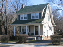
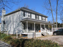
As we continue down Amboy Road toward our final SIRT station today, in this very old section of Staten Island, we find some of the more classic domiciles of the borough, dating to the early 20th Century, with porches, some wraparound.
I’m no longer surprised to find mysterious brooks and creeks in Staten Island. This one, opposite Kingdom Avenue, is Arbutus Creek and probably feeds one of the ponds in Blue Heron Pond Park. Arbutus Woods Park and Arbutus Avenue are named for a plant that has been locally extinct since the 1940s; you will not find any arbutus here.
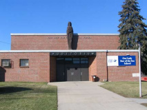
St. Mary Star of the Sea Church and school, built 1982 on Amboy just east of Huguenot Avenue
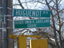
I suppose Father Owen Gartland was a parish priest; in its usual practice, the DOT will add a named street sign without providing any explanation or context.
I thought the church was striking as I ambled past and, scoff if you want, but perhaps it’s a maoden classic that will be admired more in a few decades, after the modernist style has passed. I think churches, in the future, might be tempted, budgets allowing, to become more ornate.
We have definitely arrived in…
Huguenot
Originally named Bloomingview, its present name is derived from the French Huguenots, many of whom came to Staten Island in the 18th Century to escape religious persecution. The community gained a station along the Staten Island Railway soon after the line was extended to Tottenville in 1860. This station was given the name Huguenot Park, even though no park was actually located nearby; by the 1970s the word “Park” had been dropped, but later a branch of the New York Public Library was opened one block west of the station, replacing what was once the smallest New York Public Library building just east of the station (still standing), and named the Huguenot Park Branch, perhaps in honor of the station’s former name.
Long noted for the beauty of its woodlands, Huguenot began to be transformed soon after the Verrazano-Narrows Bridge opened in 1964, leading to a large number of Brooklyn residents relocating to Staten Island. wikipedia
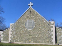
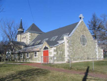
Ernest Flagg, the prolific architect who built the old Singer Tower (demolished 1967) on lower Broadway, Flagg Court Apartments in Bay Ridge and Flagg Estates on Staten Island’s Todt Hill, created the magnificent Huguenot Reformed Church at Amboy and Huguenot in 1924 using native serpentine rock. Flagg maintained a special interest in the French Huguenot colonial tradition. It replaced an earlier church built in the 1850s that burned down, it is said, from a cinder thrown up by a passing steam locomotive on the SIRT.
Flagg once proposed extending Central Park north to the Harlem river and south to Greenwich Village.
But the real surprise here is next door…
The parsonage, just west of the church, also stands just to the west of a former cemetery of the Dutch Reformed Church, which was active between 1851 and about 1913. No evidence presently exists that shws a cemetery was ever here…or is there?
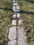
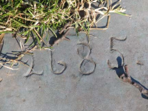
A path paved with bluestone winds across the lawn to the parsonage. Some are numbered. While they obviously can’t be dates, speculation exists that headstones were once numbered this way in some staten Island cemeteries. You never know.
Parkway with Three Names
Korean War Veterans Parkway runs from the Outerbridge Crossing to a rather abrupt end at Arthur Kill Road and Richmond Avenue; it was going to be rammed through LaTourette Park and Todt Hill to meet the Staten Island Expressway, and there are existing offramps that mark that aborted connection, but local residents sued and stopped the would-be intrusion into Staten Island’s now-shrinking forest.
It was expanded to its present width and sunk in an open cut in 1972; formerly, a four-lane surface road, Drumgoole Boulevard, ran from the bridge to Arthur Kill Road. The boulevard was built in the early 1940s; before that, bridge traffic ran directly onto Pleasant Plains Avenue to Amboy Road, explaining the former’s width. From 1972-1997 the roadway was known as Richmond Parkway, but perhaps realizing that most of the main roads in Staten Island are named Richmond, the city decided to rename it Korean War Veterans Parkway in 1997.
The service roads still carry the Drumgoole name. Father John C. Drumgoole (1828-1888) made the care of homeless and destitute children his life’s work, founding Mount Loretto on Staten Island’s south shore in 1882
Fr. Drumgoole was a great innovator in the field of childcare. The layout of the Mission was designed to provide plenty of light and air to each resident so as to avoid the spread of influenza and tuberculosis, which was common in the tenements of the day. Fr. Drumgoole felt that the general environment of the City at the time was a great threat to younger children, so he sought out a more rural setting. He looked to the Borough of Staten Island and found a farm for sale that must have reminded him of his earliest years in County Longford, Ireland. With the purchase of this and several adjacent lots, Fr. Drumgoole founded Mount Loretto, named as a tribute to the Sisters who accompanied him there to teach the children on a completely self-sufficient farm.
Perhaps the greatest innovation made at the Mission was the introduction of vocational training. Children at the St. Josephs School at Mt. Loretto learned shoe making, woodworking, baking and printing. In fact, the children contributed much of the interior of the Church Of Sts. Joachim and Ann and printed their own paper, The Homeless Child. Subscriptions to the Homeless Child and memberships to St. Josephs Union, a religious Fund-raising organization generated the funding which sustained the Mission for one hundred years. At the time of his death in 1888, the Mission of the Immaculate Virgin had two residences, the City House at the corner of Great Jones and Lafayette Streets in Manhattan and the farm at Mt.Loretto, the largest farm in the State of New York. The Mission housed almost two thousand children. It was completely solvent. Fr. Drumgoole did not owe anyone any money as a result of his work. mountloretto.org.
The Huguenot station house looks much like others along the Staten Island Railway.
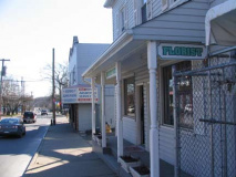
The buildings on Huguenot Avenue in the SIRT station’s immediate vicinity still have a small-town vibe. The platform itself resembles other fairly recent renovated ones along the line.
PART 5: Prince’s Bay, Pleasant Plains, Richmond Valley, Atlantic
2/10/07

