The other day I poked my head in Mary Beth’s office and there, on the wall, was a picture of Liberace. I remarked that Mr. Showmanship was so square, he was cool out the other end. “You’re cool when you do what you do,” I said. “That should be your motto,” said M.B. Your webmaster has a way of putting things succinctly, with a dearth of syllables, notwithstanding this sentence.
You could plunk me into any of Williamsburg’s or Greenpoint’s trendy watering holes, slam a Pabst in front of me, and I’d have absolutely no idea where I was in any of them.
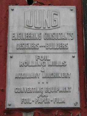
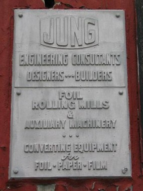
Pressed metal sign, Judge Street
But give me a wrinkled torn-out page of a Hagstrom and a point and shoot camera, however and I feel right at home trodding the glass-strewn streets in what is the Dark Territory of the far eastern end of Williamsburg, with its endless blocks full of wholesalers, importers, auto collision places, fast food joints, and dog crap parks.
The boundaries of East Williamsburg are in dispute. Where does Williamsburg end and East Willie begin? What about Greenpoint? I have settled on a simple solution. Anything south of the BQE, north of Flushing Avenue, and east of Humboldt Street is East Willie. In a discussion your webmaster had last week with Miss Heather, the Dog Shit Queen of Greenpoint, she forcefully demurs and sets theGreenpoint boundary further south, at Maspeth Avenue, and as we’ll see in our tour today she may just have a point.
WAYFARING: EAST WILLIAMSBURG PART 1
A Gore-ing We Will Go
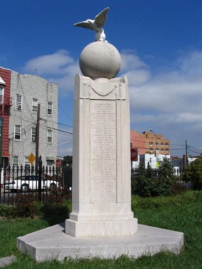
The Graham Avenue station on the BMT Canarsie Line is the closest the NYC subway system penetrates into East Williamsburg (after that the “L” turns southeast, reaching the Grand Street and Montrose Avenue stations). Our route (I was accompanied by longtime Forgottener Vincent Losinno) took us along Metropolitan Avenue, the former Brooklyn and Jamiaca Turnpike constructed between 1815 and 1820, to an odd little fenced-off triangle in which we see a memorial statue, topped by a sphere with an eagle standing on top of it.
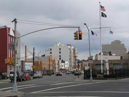
Memorial Gore, at Humboldt Street and Maspeth and Bushwick Avenues. Maspeth Avenue trails off into the distance. above photo: Bridge and Tunnel Club
There are two Gores in Brooklyn, and I don’t mean Al and Tipper. Before researching this page, I didn’t know there was an English word gore, but in fact, according to the Parks Department the word refers to a small triangular park, taken from the word’s original meaning of a small odd-shaped or triangular piece of material sewn into clothing to alter the shape. I’m not sure the word is widely used in the context of a park, but in Brooklyn we have two just a couple of blocks apart. This one, Memorial Gore, contains a memorial stature recognizing area soldiers who perished in World War I sculpted by the famed Piccirilli Brothers firm, and dedicated December 5, 1920. Working from their studio in Mott Haven, Bronx, The Piccirillis also sculpted the statue of Abraham Lincoln at Washington’s Lincoln Memorial as well as the twin lions, Patience and Fortitude, at the New York Public Library at 5th Avenue and 42nd Street, and dozens of other instantly recognizable works. In another bit of synergy, the designer of the Lincoln Memorial, Henry Bacon, also designed the ubiquitous NYC park lampposts.
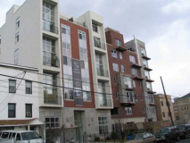
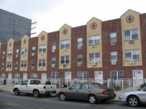
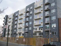
We’ll catch up to the other gore presently. Meanwhile we sauntered down Maspeth Avenue, which, rather incongruously, is blossoming with expensive apartment buildings of dubious design.
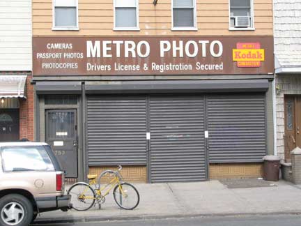
Photo developer, complete with old Kodak sign, on Met Ave. between Graham Ave and Humboldt Street. Can Kodak adapt to the digital era?
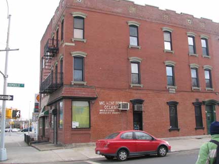
Taxpayer building, Met Ave. and Humboldt Street. You have to love the painted sign: We Rent Formal Occasions. The a.c. was installed after the deb balls moved uptown I suppose.
Humboldt Street is named for the famed scientist and explorer, Alexander von Humboldt (1769-1859) who is also memorialized by a bust at Central Park West and West 77th Street. He was described by Charles Darwin as “the greatest scientific traveler who ever lived.” Between 1799 and 1804, von Humboldt travelled to South and Central America, exploring and describing it from a scientific point of view for the first time. His description of much of this journey was written up in an enormous set of volumes over a 21-year span. He was one of the first to propose that the lands bordering the Atlantic were once joined (South America and Africa in particular). Late in life, in his five-volume work Kosmos, he attempted to unify the various branches involved in knowledge of the world. wikipedia
Humboldt Street had acquired its present name around 1870. Before that it was called Smith Street. Since no surrounding streets are named for mid-19th Century scientists or explorers, we might guess that in 1870 East Williamsburg’s then-populous German community wanted to honor one of its own.
What a Mess-peth
Formerly known as Maspeth Plank Road because in the 19th Century it was paved with wooden planks, Maspeth Avenue begins at Memorial Gore at Metropolitan Avenue and followed a relatively straight line from Williamsburg to Newtown and crossed English Kills via a bridge that is evidenced only by wooden pilings today. Sometime between 1875 and 1890 the bridge ceased to be used, with traffic redirecting to the nearby Grand and Metropolitan Avenue bridges. Today, after it reaches Vandervoort Avenue, Maspeth Avenue ends at Newtown Creek — one of NYC’s longest dead ends. It serves local chop shops and wholesalers. It continues on the other side of the creek where it reaches its titular neighborhood in Queens.
The name “Maspeth” first appears in the colonial record in 1638, as Newtown Creek was called Mespacht Kill. It comes from a Delaware or Canarsee Native American term that means “place of bad water” (apparently Newtown Creek is ineluctably toxic), “great brook,” or “those who live scattered.” Maspeth Plank Road extended throuh a marshy area of Newtown Creek over a now-filled-in island called Furman.
Rather inexplicably, in the few blocks between Met Avenue and Olive Street, new buildings that aspire to luxury status have begun to sprout…
Above Gallery: we have a new entry in the Highly Visible Air Conditioner sweepstakes, joining Fedders and Friedrich, with some more conventional Brooklyn krapp on Maspeth. All made out of ticky tacky and all look just the same.
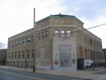
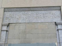
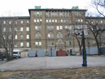
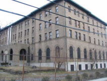
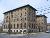
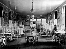
Outpatient Service: Greenpoint Hospital
On Maspeth Avenue between Kingsland, Jackson and Debevoise Avenues is collection of hulking, beetling brick buildings, some of which are abandoned, some of which are apparently being rehabilitated, and since I heard raucous laughter coming from some of them, still in use. This was Greenpoint Hospital, built in 1914. Above right, from Greenpoint USA Timeline, is a picture of the interior shortly after it opened. Note the wall murals.
By the 1980s, the hospital had become at least partially a homeless shelter, a function it might still employ today. It’s more likely a developer will sweep in and demolish the property, or perhaps rehab it for apartments.
Note the appellation Greenpoint Hospital, though by my bearings, it’s southeast of Greenpoint. Bear in mind that this neighborhood wasn’t called East Williamsburg till some real estate folks had to come up with a name, since renters were being forced out of go-go Williamsburg and began to move east.
Cooper Dale
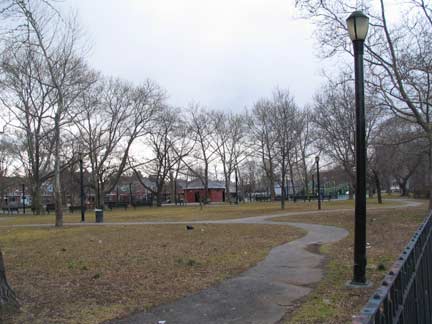
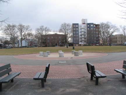
Cooper Park looks rather desultory, bounded as it is by the near-abandoned Greenpoint Hospital and the industrial wastelands of Maspeth and Morgan Avenues along its eastern end. Things seem to be perking up at its southern end as we see some new high rises sprouting, much as they are along larger McCarren Park about 10 blocks to the northwest. The park was named for Peter Cooper (1791-1883) , the industrialist-inventor who conceived of the transatlantic cable, the steam railroad engine, and Jell-O. He established Cooper Union, the architecture, art, and engineering school still going strong in Cooper Square, Manhattan. He is buried in Green-Wood Cemetery.
Why is Cooper honored here, at this far redoubt? Cooper Park was the site of his successful glue factory for about 40 years:
In 1821 Cooper purchased a working glue factory in Kips Bay, and manufactured high quality glue economically. He stated, “I determined to make the best glue, and found out every method and ingredient looking to that end, and so it has always been in demand.” In 1838 he relocated the business to Maspeth Avenue in Brooklyn, a strategic site which had access to roads connecting with New York-bound ferries and Long Island farms. Cooper retired from the glue business in 1865 and sold the factory to family members. The company moved to Smith Island (since filled in –ed.) in Newtown Creek in 1878 and left Brooklyn for good in the 20th century. The Gowanda, New York headquarters of the Peter Cooper Glue Company closed in the early 1990s. NYC Parks
Lonely Roads
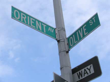
South of Cooper Park there’s a small tangle of Brooklyn streets that have nothing to do with the rest of the East Williamsburg street grid, most of them no more than a block or two in length. Orient Avenue, Sharon Street, Olive Street, Catharine Street and Judge Street really don’t go anywhere but to each other.
Hand-lettered Hagstrom, 1997. This edition was retired in a couple of years and replaced by uglier digital maps.
Over 100 years ago, Orient Avenue used to extend through the present Cooper Park area all the way to Newtown Creek. It’s just a block long now…but it’s a not to be missed block…
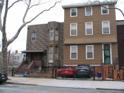
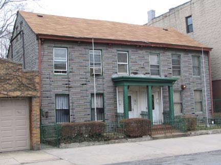
So nice I’m showing it twice. Rumor has it 59 Orient was a former residence of Peter Cooper (it wasn’t, since he had left his local glue business in 1865 and this place was built in 1899, 16 years after his death) and another rumor has it appearing in Eternal Sunshine of the Spotless Mind. It’s on the market for nearly $2m as development property…don’t get used to it being here long (think those Maspeth Avenue condos).
2011: R.I.P.
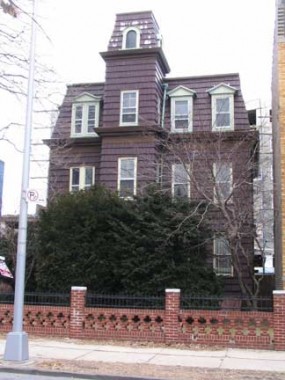
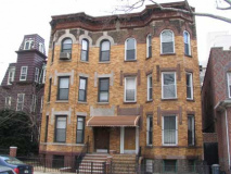
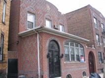
Orient Avenue is chock-a-block with quirky gems, and it seems the majority of them have for sale signs. I wouldn’t accustom yourself to this block as-is. The modern uglifiers of our age have it in their bombsights.
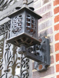
How about that lamp that looks like a medieval torture device?
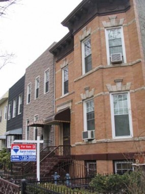
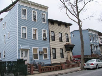
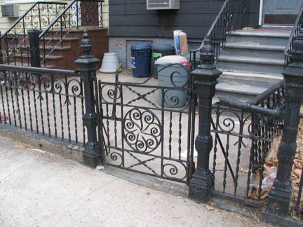
It’s near Greenpoint–so there’s generous application of aluminum siding. But some original cast-iron railing is in place. How about those lintels on the windows of the brick building top right?
Orient Avenue was formerly called “Doctor’s Row” since so many physicians working at nearby Greenpoint Hospital lived here.
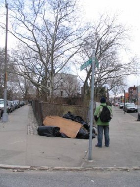
Orient Avenue meets Metropolitan Avenue on an angle, creating a rough triangle-shaped park that NYC Parks has, or had, designated a gore…
Cooper Gore
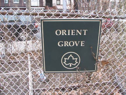
The small diamond-shaped parcel at the corner of Orient and Metropolitan Avenues was sold for $2500 to the City of Brooklyn in 1896. It was graded and fenced for use as a park by 1897 and named for Peter Cooper, whose glue factory once stood nearby. According to the 1918 Annual Report of the Brooklyn Department of Parks, there were facilities for tennis (most likely a lawn and a net that could be easily installed and removed) at this tiny park in the 1910s. The park preserves its late-1930s improvements of new oriental plane trees, concrete paths, and wrought iron picket fence.
This park was originally known as Cooper Gore. Orient Grove’s new name refers to Orient Avenue. The street may have been so called for its location to the east of Bushwick Avenue, or the street name might nod to the definition of orient as “bright or shining.” The word “grove” derives from the Old English “graf” meaning a small stand of trees or wood without dense undergrowth. NYC Parks
Other “gores” in Brooklyn include Cuyler (at Fulton and Cumberland Streets and Greene Avenue in Fort Greene) , Grant (at Bedford Avenue, Rogers Avenue and Bergen Street, where there’s a statue of Ulysses S. Grant on horseback), Memorial (see above).
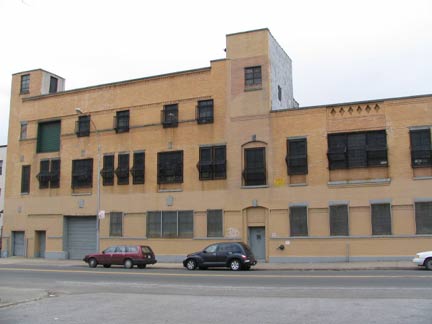
This big blond-bricked building on Met Ave. across from Orient Grove was a milk processing plant.
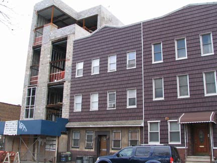
To its east, I honestly don’t know what’s worse, the siding or what’s going up alongside.
Bushwick Avenue
Your webmaster has covered Bushwick Avenue on my Frederick Cook/Bushwick page, but I haven’t touched on its unusual origin. Its northern end nearly exactly follows the path of a colonial-era road, Old Bushwick Road, from Bushwick Avenue at its intersection with Metropolitan Avenue all the way to about Menahan Street, where it cut briefly east and then followed the path of Evergreen Avenue (explaining a slight jog in its path) south through what became the Cemetery of the Evergreens, finally ending at the Brooklyn, Flatbush and Jamaica Turnpike (today’s Jamaica Avenue). Old Bushwick Road closed in stages between 1869 and 1890, and Bushwick Avenue became the main route; it had earlier been known as Morrell Street. A bend in Old Bushwick Road still remains as Bushwick Place between Meserole and Boerum Streets just east of Bushwick Avenue.
Dutch settlers purchased what became Bushwick in 1638 from the local Canarsee Indians. In 1660, a group of French immigrants applied to Petrus Stuyvesant, director-general of New Netherland, for a patent to start a community. Stuyvesant granted them land between the villages of Breuckelen and Middleburgh (Newtown), and the settlement became known as Boswijck, or “town in the woods” (BOS why’k), later Anglicized to Bushwick.
Bushwick Avenue and Devoe Street. Note the telephone poles and lamp masts on the mural art. Below: even the siding is old on this Devoe Street house.
Here Come the Judge
Judge Street runs for only one block between Devoe and Powers Streets (I don’t know why it exists at all; could it have been the carriageway to a mansion? Is it named for a judge or someone named Judge?) I did find some items of interest here, and well, some modern Brooklyn realities as well.
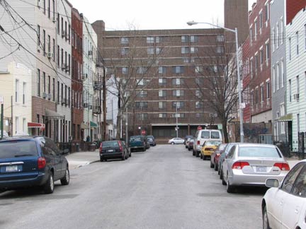
Judge Street is overshadowed by the massive Jennings Hall (a former residence for St. Catherine’s Hospital, it is now senior housing) at the end of the block. Some cheap Fedders-style construction is arising mid-block.
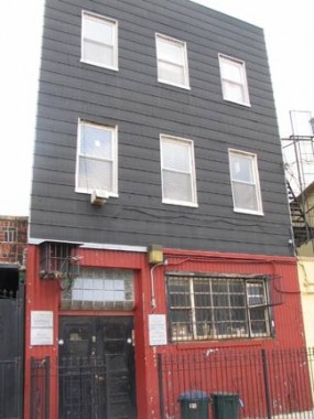
The dark red first floor drew my attention, which was sealed when I got a look at these terrific pressed metal signs on either side of the door. Would such care be taken these days for a small sign by a doorway?
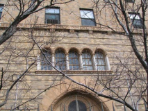
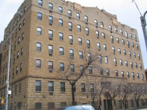
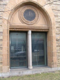
This richly detailed building on Bushwick Avenue between Powers and Grand Streets is the former nurses residence for St. Catherine’s Hospital. The hospital, a grand old three-peaked Victorian structure, was razed long ago; it stood on Bushwick and Maujer Streets.
Tanks a Lot
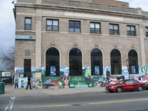
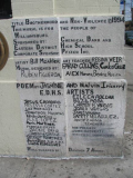
The Chase bank at Bushwick Avenue and Grand Street contains a well-maintained ground floor mural that contains a hidden historic image from East Williamsburg…
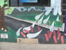
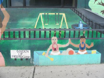
The mural contains several striking images. Raindrops embazoned with peace symbols drop from the heavens to extinguish sticks of dynamite marked “crime,” violence,” “drugs.” Adam and Eve play in a sandbox.
The mural dates to 1994, when this bank was a Chemical branch. Pfizer, named on the legend, is closing down its Williamsburg plant.
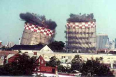
But the most fascinating item...for your webmaster at least…is the above image, which depicts two large checkerboard topped tanks. These were the Maspeth Avenue gas tank towers…
..which, having outlived their usefulness to KeySpan, were imploded by explosive charges in July 2001. tanks photo: Bernard Ente
This video depicts the demolition. Note the World Trade Center is visible on the right side of the film, and to view the implosion of the Maspeth Tanks is haunting when you consider what happened to the WTC just a few weeks later.
Williamsburg Houses
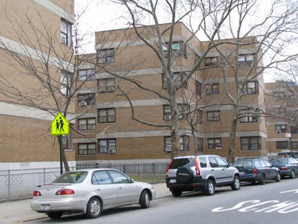
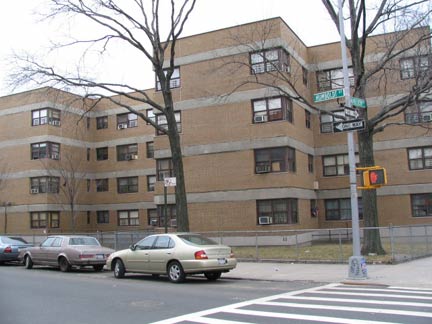
Public housing projects usually repel me; they’re usually forbidding, depressing and dismal tall buildings without personality plopped into a plain of concrete or nondescript green. But there’s a very special case in Williamsburg.
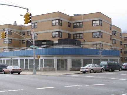
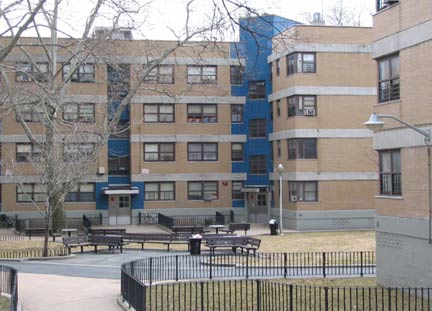
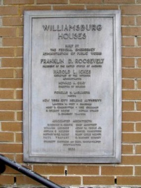
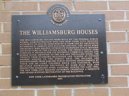
Williamsburg Houses, occupying 12 blocks and approximately 23 acres between Maujer Street on the north, Scholes on the south, Leonard on the west and Bushwick Avenue on the east, were one of the very first housing projects built in NYC, reaching completion in 1938, before the dismaying Le Corbusier-inspired ‘boxes-in-a-park” pattern took hold. They were built by the Williamsburg Associated Architects, which comprised Shreve, Lamb and Harmon (who designed the Empire State Building) and Swiss architect William Lescaze, in a streamlined “International” style.
Facades in tan brick alternate with entrances and storefronts in blue tile. The Williamsburg Houses pioneered the ‘superblock’ concept as Stagg and Ten Eyck Streets were truncated and their roadbeds given over to pedestrian traffic. Never before had streets been closed to accommodate housing.
Maujer near Leonard Street
Humboldt and Maujer Streets
Williamsburg Houses were officially made a NYC Landmark in 2003.
Maujer
Despite the Dutch-looking name, attorney Daniel Maujer (1809-1882) was from Guernsey, one of Britain’s Channel Islands. He became an alderman in the 15th Ward, which once encompassed this area. In 1937, 55 years after his death, his name was unearthed and plopped onto the former Remsen Street to avoid confusion with the Brooklyn Heights street so named. How is it pronounced? My guess has always been “Moyer”, but perhaps the locals are more literal-minded and say “Maw-jer.” (cf. Luquer Street).
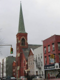
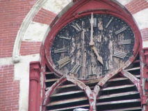
On Maujer just west of Humboldt is the tall-spired Lutheran Church of St. John the Evangelist, with a rare wood clock that has serendipitously stopped at the stroke of five. The congregation goes back to 1847…
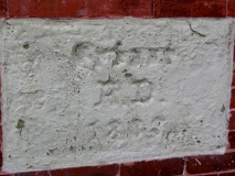
…while this building dates to 1883. Like many old churches in East Williamsburg and Bushwick, there is an inscription in German reflecting the early demographic.
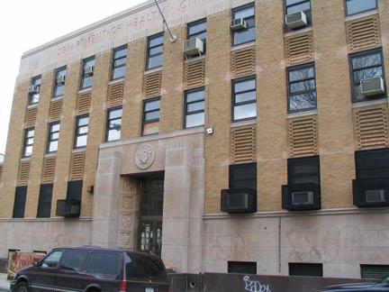
A block or so further west on 151 Maujer, and still facing the Williamsburg Houses, we have a sober Machine-Age-era 1935 Department of Health building.
So…on one modest Brooklyn street only a few blocks in length we have a modified Gothic, an International Style complex, and a 1930s streamlined style structure. Not bad eh, considering this is Aluminumsidingville.
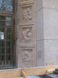
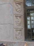
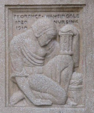
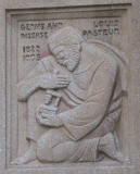
Though it looks like something rational and sober that Peter Keating of The Fountainhead might create, this building is far from boring. There’s plenty of detail surrounding the front door…where we find a selection of bas reliefs depicting some of the great names in medical and nursing history.
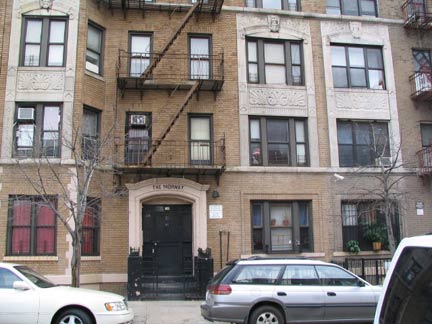
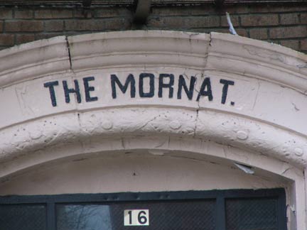
The Mornat, 16 Maujer near Union Avenue. The origins of most apartment house names are lost in the mist of time.
Vinny and your webmaster decided to truncate the East Williamsburg walk (it was about 30 degrees out) and head north along Union Avenue to DuMont, for supposedly one of their world-famous hamburgers. Along the way we discovered:
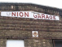
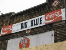
At Union and Powers, two Forgotten items in one, the Union Garage with its decades-old sign, and the long-moved Big Blue, with the Coca-Cola swoosh of a few ad campaigns ago (Coke still uses a modified swoosh).
2011: Union Garage has passed into history; as New Williamsburg begins to spread east, it’ll begin consuming everything in its path. We learn fromCurbed that a nondescript glassy 6-story 66-unit condo will go here in its place.
We stuck our heads in DuMont, but its small room was jammed with hipsters, which from the look on their faces, were none too pleased to see us grizzled geezers.* Rather than drink at the bar for an hour we moved on and pushed east on Met Avenue…
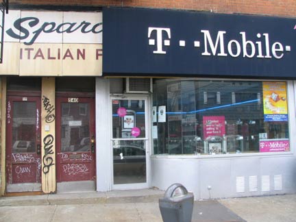
*I’ve had the tattooed, pierced countergirl at Sparky’s All American Food in Williamsburg give me the stink-eye more than once, so I think it’s a pattern. 2011: Rude service doesn’t pay; Sparky’s is long gone.
Your webmaster prefers the Brooklyn of Sparo…whatever Italian Food more than he likes the Brooklyn of T Mobile.
2011: The entire bakery sign is now ironically revealed!
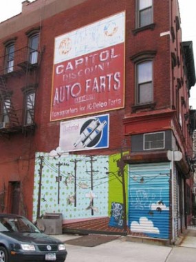
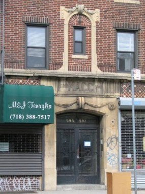
Anyone know what M.A.C.C. on that apartment building means? M.A. is Metropolitan Avenue of course, but what of C.C.?
Here we lept onto the L at Lorimer and went back to Williamsburg, where we found sustenance at Plan-Eat Thailand. Leave it to your webmaster to ferret out a chopped meat, noodles and vegetables in citrus tomato sauce item on the menu.
It wasn’t till a month later that I returned to finish my East Williamsburg walk…
CONTINUE to EAST WILLIAMSBURG PART 2
Photographed March 2007; page completed April 8, 2007
©2007
Metropolitan Avenue and Leonard Street









1 comment
[…] [Outpatient Building of the old Greenpoint Hospital, via Forgotten NY] […]
Comments are closed.