 Continuing my exploration of the neighborhood my parents warned me against as a kid due to the presence of “bad boys”, this time we’ll stick a bit closer to the water at the bottom of the slope (the same hill that gives its name to both Bay Ridge and Sunset Park), as well as look at a couple of forgotten Sunset Park anomalies…
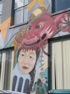
LEFT: mural, 5th Avenue (see below)
1st things
Brooklyn’s 1st Avenue runs only 19 blocks, from 39th Street to 58th. It’s nearly all industrial with the west side of the street facing the Cross Harbor Railroad yards. The CHRR is one of Brooklyn’s last ‘pocket railroads’ and still serves a few warehouses and businesses along 1st Avenue and some of the side streets, with a track running down the middle of the street. I never see the CHRR in action, since I’m only in the area on weekends. OLDNYC went on a CHRR tour a few years ago, and my I Cover the Waterfront page has a summary of its operations.
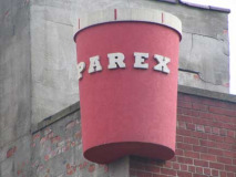
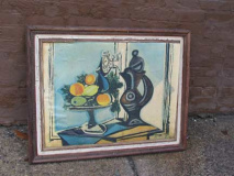
Some sights along 1st Avenue. The faux Picasso (or was it a real one?) was found in the Bush Terminal complex at about 40th Street. Parex makes synthetic coatings and finishes for interior or exterior use and has a distributing plant on 1st Avenue in the 50s.
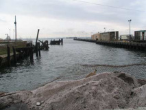
The western end of 39th Street is a former ferry landing and the terminal of the Brooklyn, Bath and West End Railroad, first built in 1887. Pieces of it exist as Brooklyn’s South Brooklyn Railroad (see the I Cover The Waterfront page linked above) as well as the BMT West End El–at present (2007) the D train. Though the BB& West End orginated at 5th Avenue and 25th Street, the Green-Wood Cemetery entrance, it leased this link from the South Brooklyn and Flatbush RR. By 1897, the Long Island Rail Road ran the ferry link. This is also a former trolley terminal, and even today, the B70 bus route ends here, linking to a ferry that ceased to run decades ago.
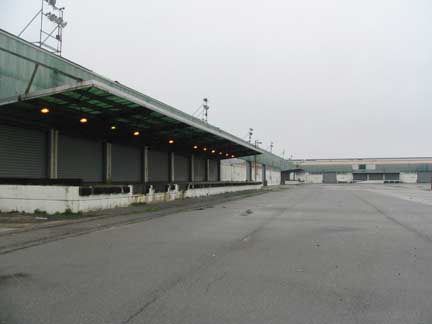
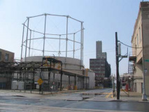
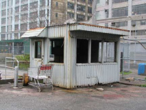
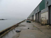
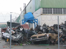
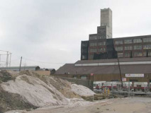
The old 39th Street Terminal industrial complex, occupying the site of the old ferry landing between 1st Avenue and Upper new York Bay, is a vast, forbidding expanse, nearly postapocalyptic in its desolation.
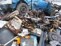
It seems to function mainly as a junkyard at present.
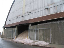
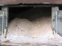
The Department of Sanitation seems ready for winter with stockpiles of salt at the west end of 52nd Street.
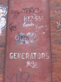
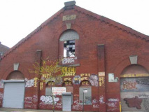
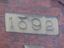
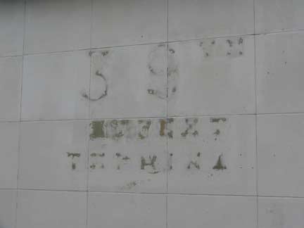
1892 building at 1st Avenue and 52nd Street hosted electric generators. Itwas the power plant for the Brooklyn City Railroad Company (see below). I like the type treatment on the “8” in 1892!
HY was for HYacinth.
Take 2
I didn’t know Brooklyn had a 1st or 2nd Avenue till relatively late in the scheme of things…not until age 11 or 12, when I started devouring street maps and roving the streets on a bicycle, which, given the state of things in the 70s, was lucky to never have had stolen. The only time I ever had a bike stolen was outside a bar in Bay Ridge. I found out those U-locks weren’t impregnable after a brand new bike (I forget the make) was reappropriated by the local youth for community use back in 1985. Since then I have ridden a battered Motobecane which, after 22 years, now has only one gear. No matter, since at your webmaster’s middle age, I walk bikes uphill anyway.
When I was a boy, though, Brooklyn’s numbered avenues began at 3, since 1st and 2nd Avenues were occupied by Colonial Road and Ridge Boulevard respectively. I’ve never found any ancient maps in which those streeets were ever numbered, though it’s hard to find maps before the 1890s that show them, since before that, Bay Ridge was part of the Town of New Utrecht, and maps of Kings County’s individual towns are fairly scarce.
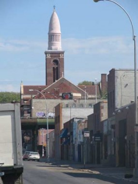
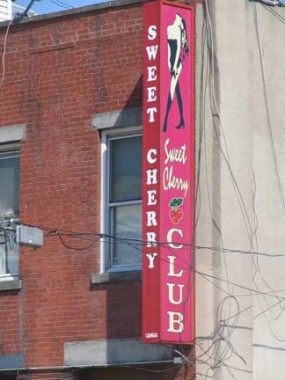
42nd Street. I’m told the ladies of the Sweet Cherry Club have departed but St. Michael’s will be there till … well, it’ll be there for awhile yet.
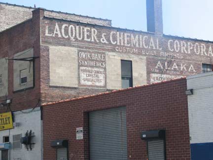
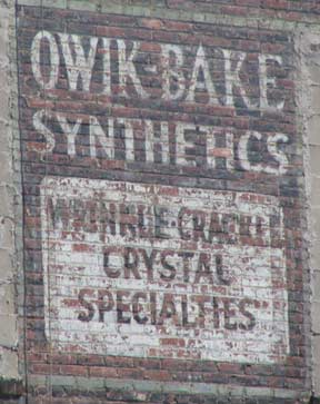
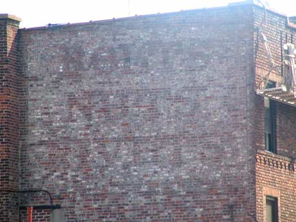
No one can really see it except the people who work down here during the week, but 41st Street near 2nd Avenue has a great painted sign from the Serif Era of signpainting. You have to love the little flourish on the ‘Q’ and the oddball spelling gave the wall dog another chance to do a Q.
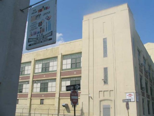
For the most part 2nd Avenue in the 40s and 50s is lined on both sides with huge, concrete clad lofts like this one at 52nd Street, each of which looks as if it could survive a bomb blast. The little sign gives you an idea of what is produced here.
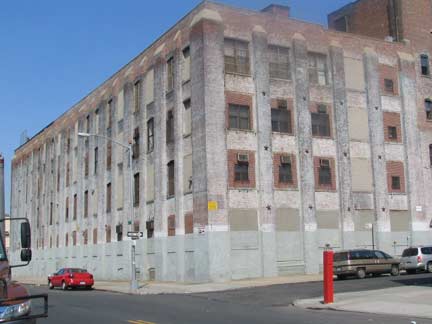
These loft buildings look ripe for residential conversion. Could the manufacturers ever be ridden out and the young urban professionals move in? It’s a possibility, but I believe the Third Avenue BQE Viaduct (see below) would have to be placed underground first.
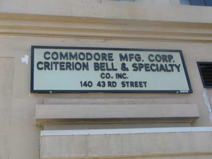
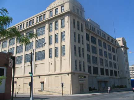
I had never spent much time on 2nd Avenue and was impressed by these monsters of manufacture. Commodore has a number of buildings in the area and makes Christmas decorations for the most part.
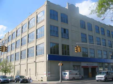
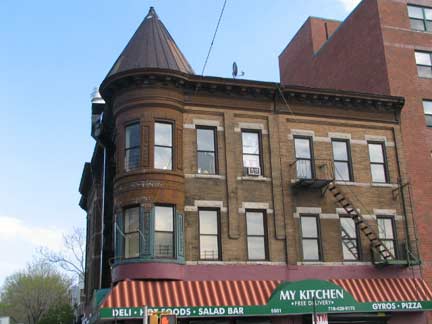
As you approach the upper 50s 2nd Avenue livens up a bit, since Lutheran Medical Center and its ancillary businesses are here.
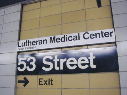
You can ferret out some amazing information by looking closely at subway signage. A footnote on the Lutheran Medical Center sign on the 53rd Street BMT (R, N) subway sign, installed in the 1968-70 period, mentions a “Sister Elizabeth.”
Lutheran Medical Center was founded in 1883 by a Norwegian Lutheran Deaconess-Nurse, Sister Elizabeth Fedde, to serve the Norwegian immigrant community. The institution has provided care for the southwest Brooklyn communities and for 80 years grew and declined with other neighborhood institutions on the Brooklyn waterfront. In recent decades Lutheran Medical Center aggressively volunteered to be the corporate stimulus for community renewal, the catalyst for constructive change, and the advocate for the health and well-being of this entire urban area. Volunteer NYC
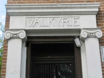
Lutheran Medical Center is a modern-day relic of Sunset Park’s Scandinavian past. You’ll find others, though, on 57th Street between 2nd and 3rd Avenues:
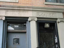
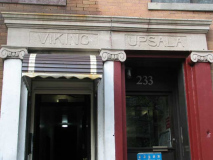
A series of apartment buildings on 56th Street between 2nd and 3rd Avenues in Sunset Park featured chiseled names with Scandinavian themes above their doors. Skansen is a celebrated open air museum and zoo in Sweden, while Upsala is Sweden’s oldest university.
Perhaps the builder was Swedish?
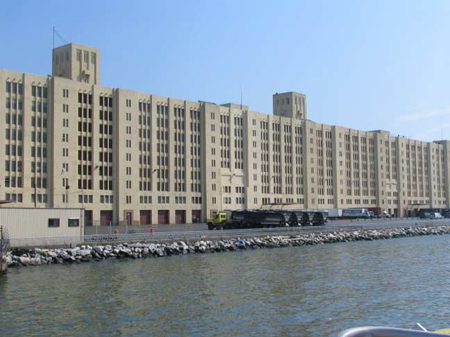
The Brooklyn Army Terminal, between 2nd Avenue, Upper NY Bay, and 58th and 65th Streets, is an impressive sight from the ferry to Staten Island. It consists of large complex of piers, docks, warehouses, cranes, railroad sidings and cargo loading equipment. It was formerly responsible for the shipment of arms and soldiers overseas…in Elvis Presley’s only visit to Brooklyn, he embarked from here to Germany after being drafted into the Army. The building is currently operated by the City of New York as a center for dozens of light manufacturing, warehousing and back-office businesses, and a planned biotech/biomanufacturing center.
A lot got built in this area in 1892.
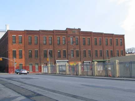
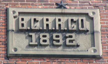
Forgotten Fan Warren Davis via this wikipedia reference: The Brooklyn City Railroad (BCRR) was the oldest and one of the largest operators of streetcars (horsecars and later trolleys) in the City of Brooklyn, New York, continuing in that role when Brooklyn became a borough of New York City in 1898.
The BCRR was incorporated on December 17, 1853 with capital of $2,500,000, a large sum in those days. Its first line, the Myrtle Avenue Line, was the first horsecar line in Brooklyn, and opened on July 3, 1854. The line operated from Fulton Ferry via Fulton Street and Myrtle Avenue to the former stagecoach stables at Marcy Avenue.
Ultimately, through a series of mergers and acquistions beginning in 1893, the BCRR became Brooklyn Rapid Transit, the precursor to the BMT –Brooklyn Manhattan Transit–subway line. When the BRT was dissolved following the Malbone Street Wreck, however, the Brooklyn City didn’t become part of the BMT and remained separate, joining Brooklyn-Queens Transit in 1929, which survived until NYC consolidated all its transit lines in 1940.
The building in question was likely a carbarn (or stables) for either the 3rd Avenue Line (running from Fulton Ferry to Fort Hamilton), or the 2nd Avenue Line (form Sunset Park to Gravesend).
Ferry at 58th
The 58th Street Pier is the Bay Ridge-Sunset Park stop for New York Water Taxi and several other lines. About 15 years ago it replaced the 69th Street Pier as the area’s ferry landing.
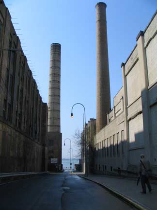
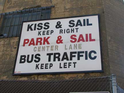
I’ve heard of the booze cruise and the casino cruise but your webmaster will have to investigate this one.
Forgotten Fan Tom Walsh: The sign “directs car parkers to one lane, and drop offs to another (kiss passenger goodbye, passenger sails off, driver moves on). There’s a parking area on the ever-attractive NJ Turnpike (adjacent to the Vince Lombardi Service Area)served by NYC-bound express buses which has a ‘Kiss & Ride’ ramp.”
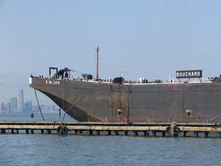
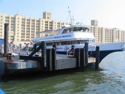
Bouchard is an oil barging company; American Princess Cruises is Queens-based.
43rd Street between 3rd and 4th Avenues: while some of Sunset Park’s attached brownstones have been subject to poor renovation decisions like aluminum sidings, encasing them in a metal accordion, others have been left gloriously intact.
They look as if they are marching down the hill to the water.
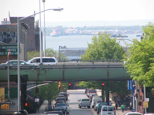
The BQE and Upper New York Bay from 43rd Street
Power of 3
Third Avenue has been in shadow, at least between 38th and 65th Streets, ever since 1893, when the 5th Avenue el ran on an elevated structure above it. (The el was on 5th Avenue from Flatbush Avenue to 38th Street.) After the el ceased operations in 1940, the elevated structure remained in place as NYC infrastructure czar Robert Moses built the Sunset Park leg of what was then the Gowanus Parkway, today a part of the Brooklyn-Queens Expressway, opening it November 1, 1941.
Third Avenue today in Sunset Park is mainly a service road for trucks and cars that use it if the BQE above is especially jammed. Few buildings and businesses face Third Avenue on its east side, since all buildings that did were torn down when the parkway was constructed. But there was a time when Third Avenue was the community’s focal point, even though covered by the el. Writes Robert Caro in The Power Broker: Robert Moses and the Fall of New York:
Lining [Third Avenue] along with newsstands off which 9,000 Nordisk Tidendes were sold every day, were seven movie theatres, dozens of tiny restaurants run by couples and featuring recipes from the old countries…and scores of small, friendly “Mama and Papa” stores…thatoccupied the ground floor of three- and four-story brickfronts in which Mama and Papa lived upstairs with the children.
Though the el had brought foot traffic to support 3rd Avenue’s businesses, the Gowanus Parkway, of course, didn’t; the theatres, restaurants and stores closed, and the neighborhood suffered for it. When the Verrazano-Narrows Bridge was built from 1959-1964, the old el structure was torn down and the road was shored up to accept truck traffic and became an expressway…and shrouded Third Avenue all the way to 19th Street.
In recent years plans have been bandied about to depress the BQE in a tunnel, opening up the avenue to the sun again and revitalizing, especially, the side streets from 1st to 3rd Avenues and from 19th to 65th Street. Based on Boston’s experience with the Big Dig, which finished years behind schedule and for billions in co$t overruns, though, any hope of a Brooklyn Big Dig is remote at best.
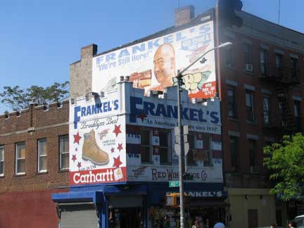
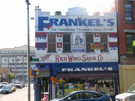
Frankel’s, a work clothes and boots store, has been a Third Avenue fixture since the el days (not sure if it’s been in this location at 3rd Avenue and 40th Street all that time). If it has, it predated the el!
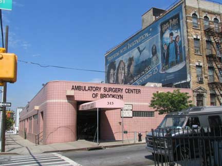
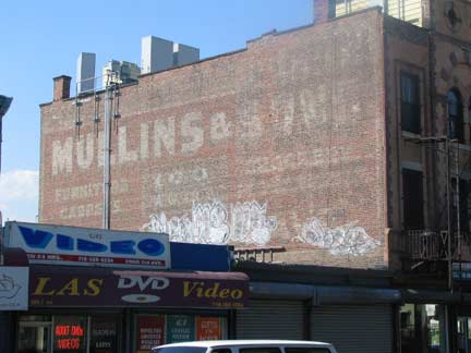
The somewhat incongruous Lutheran Medical Center’s surgery center and an old wall dog ad for Mullins Furniture, 3rd Avenue and 40th Street.
5 Alive
If 8th Avenue is the heart of Asian Sunset Park, 5th Avenue is its Latino heart as immigration from Puerto Rico, Mexico and the Dominican Republic was prominent from the 1950s onward. There is also a little-remarked upon Indian community as well.
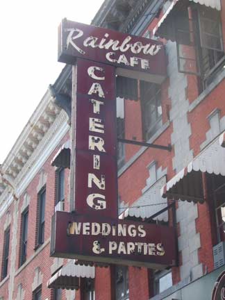
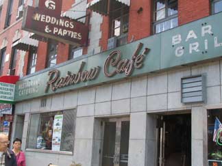
The Rainbow Café, 5th Avenue between 39th and 40th, has been here as long as its classic neon signs and that’s quite a long time.
[The Rainbow closed in 2010 and the fate of these signs is unclear.]
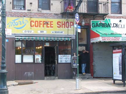
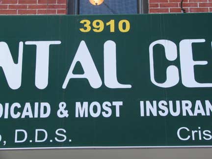
Note that Mark’s Coffee Shop, 881 5th Avenue, is on the north side of 39th Street, while the dentist office at 3910 is on the south side. Street numbering on 4th and 5th Avenues changes abruptly here from the numbering begun at the avenues’ origins downtown to house numbers that match up with the cross street. (3rd Avenue makes the swicth at 18th Street). The reasons are somewhat complicated. When 3rd, 4th and 5th Avenues begin downtown, they do not reach numbered cross streets (1st Street, 2nd Street, etc.) until they go past about 15 cross streets, such as Atlantic Avenue, Pacific Street, Dean Street, etc. So it’s impossible to number the avenues in a conventional fashion. Long ago, the conversion point was set at 39th. Other avenues in the series are separated from Park Slope by Green-Wood Cemetery.
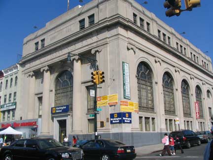
54th Street: this handsome bank building was originally a branch of the Bay Ridge Savings Bank, and has been converted, as so many have, to a Washington Mutual (I disdain their nickname, Wamu), until the next merger down the line happens; then the name will change again. (Bay Ridge became Anchor Savings Bank in 1968)
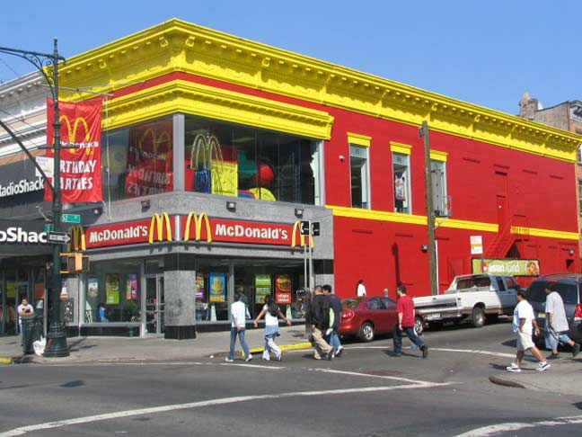
This riotously-colored McDonald’s at 52nd Street takes its red and yellow color scheme to extremes.
A colorful and somewhat bizarre mural featuring Asian imagery was placed on the Citibank side wall on 54th Street in 2001 by the Groundswell Community Mural Project.
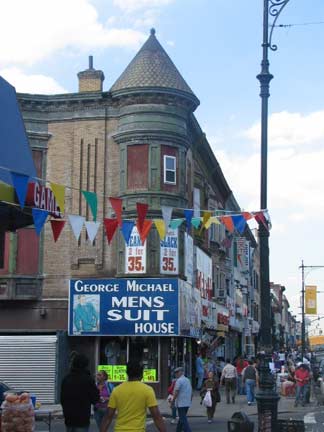
Corner turret, 5th Avenue and 57th St.
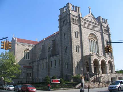
The Basilica of Our Lady of Perpetual Help (we kids called it OLPH) is a magnificent structure visible from the ferry on what was once called Irish Hill at 5th Ave. between 59th and 60th Streets. It dates to sometime around 1910 (here’s what the original church looked like after it was founded in 1893)
Chuck (The Rifleman) Connors (1921-1992) was an altar boy here a few years before he appeared briefly with the Boston Celtics, Brooklyn Dodgers and Chicago Cubs before Hollywood came calling.
The ever-prickly Mystery Worshipper describes the church thusly:
A massive granite building in the Romanesque style, it stands out as a landmark and can be clearly seen even from boats in New York Bay. The interior is of light beige granite with cocoa brown faux marble columns. Dark oak pews fill the nave, and matching dark oak confessionals embellish the side aisles. Intricate and colorful stained glass windows line each wall. In the sanctuary are an electronic organ and grand piano; a large pipe organ in the choir loft stands unused. Both the high altar and communion table are of light marble. A white marble reredos behind the high altar depicts the Crucifixion and is framed by a string of small Christmas-tree-like white lights.
Did the Worshipper enjoy his experience at OLPH? You’ll have to continue reading from the link to find out.
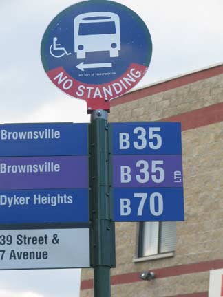
You can get to Dyker Heights or Brownsville from Sunset Park, two widely separated areas.
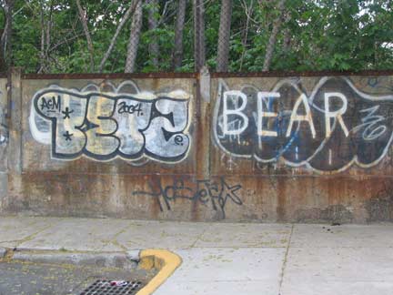
For as long as I can recall–the mid-70s–a tagger or a succession of taggers have labeled the stone wall at 8th Avenue east of 39th Street “Cucco Bear.”
If anyone can shed light on who the mysterious Cucco Bear is, it would solve an over 30 year mystery for your webmaster!
ForgottenFan Michael Puzanskas: J.Cucco went to school with my brother-in-law Greg G. So did Sal C. (not Cucco) who was BEAR. Two different people for sure. They were part of the 8th Avenue click.
ForgottenFan John Dell: I have a correction: Cucco Bear IS J. (Joey) Cucco but Bear is Frankie Castellanos. (not Sal C. as stated)
This information comes from an impeccable source and friend of Joey Cucco himself and corroborated by 2 Sunset Park natives who lived & grew up 2 blocks from the Cucco Bear tag on 41st Street. The original (before another rude egotist tagger spray painted on top) was a familiar landmark and was prominently centered on the old West End subway cut wall on 39th Street and 8th Avenue next to the Toll House Bar & Grill for nearly 50 years!
Pro-Zak has many, many more photos of Sunset Park’s industrial wasteland aspect.
Photographed April 2006; page completed November 25, 2007
erpietri@earthlink.net
©2007


