“Bergen” comes up frequently on the Brooklyn map — there’s Bergen Street, which runs from Cobble Hill to Brownsville, Bergen Beach playground, Bergen Triangle and Bergen Avenue. The neighborhood, which is delineated by Ralph Avenue on the west, Paerdegat Basin on the north and east, Avenue U, East Mill Basin and the Belt Parkway, was originally an island inhabited by the Canarsee Indians and, beginning in the 1600s, owned by Dutch colonist Hans Hansen Bergen. In the 1890s-19-oh’s, entrepreneurs Percy Williams (a theater builder) and Thomas Adams Jr. (who developed chewing gum and whose house still stands in Park Slope), developed an amusement park on the grounds of Bergen’s homestead, accessible via a streetcar on Flatbush Avenue (the precursor to today’s #41 bus).
Coney Island was far more accessible from numerous subway lines by 1920, and within a few years the resort and amusement area was sold off to developers Max Natanson and Mandlebaum & Levine, who hoped to open a residential community, bathing beach, pavilion and yes, another amusement park. They were never built, and Bergen’s homestead and any remains of the amusement area were razed in 1939 when the Circumferential (later mercifully renamed Belt) Parkway was rammed through by Robert Moses in 1939.
The marshiness of the land in the area prohibited large-scale residential development in Bergen Beach until it was more fully landfilled in the 1960s. Until that time, there was a small cluster of houses along Avenue U (PS 236 educated children in those buildings beginning in the 1930s). Still, much of Bergen Beach was not built up until the 1960s.
Your webmaster was a relatively frequent visitor to Bergen Beach and Georgetown (see below) in the 1970s and 1980s — it was easily accessible for me by bike and I knew people who lived there when I was in school — but since moving to Queens in 1993, this was only my third visit. It was fun to see it again and view it through a Forgotten eye.
WAYFARING: BERGEN BEACH/GEORGETOWN
Bergen Beach, like much of southern and eastern Brooklyn, does not have subway service (there was going to be a subway line and elevated running south on Utica Avenue as part of the IND’s Second System; turnouts were built and can be seen at the Utica Avenue station on the IND Fulton Street line, the A train; but the Depression happened and it wasn’t built).
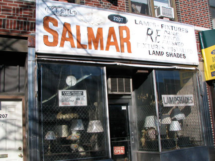
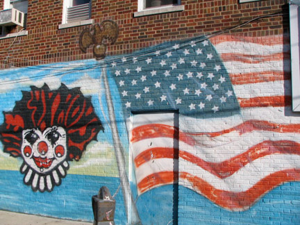
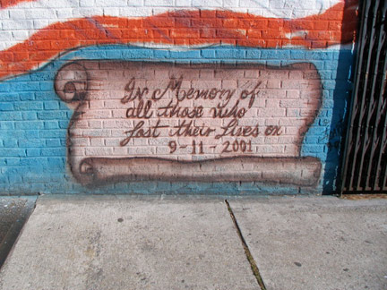
Thus, if you don’t drive, you get the B and Q train to Avenue U or Kings Highway stations and a then ride on the B3 or B100 buses, respectively, or the B41 bus on Flatbush, Avenue N and Veterans Avenue. I declined the bus and simply walked Avenue U, the connector from Marine Park to Bergen Beach, and snapped some scenes along the way, such as the painted Salmar Lamp sign and the 9/11/01 themed mural at East 23rd and Avenue U.
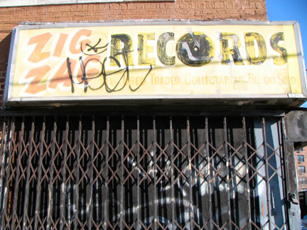
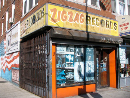
Zig Zag, at Avenue U and East 23rd, was here in the 1970s and still here, with the same sign. (The window posters are the same as in 2004). Here’s a recently unearthed video of a chat with Lemmy ofMotorhead at Zig Zag in 1982; Motorhead were touring with Wendy O. and the Plasmatics at the time:
http://www.youtube.com/watch?v=t9MrGKkKm3s&feature=player_embedded
I’ll give props to Lemmy for putting up with this incredibly annoying interviewer.
Zig Zag closed for good in late 2010.
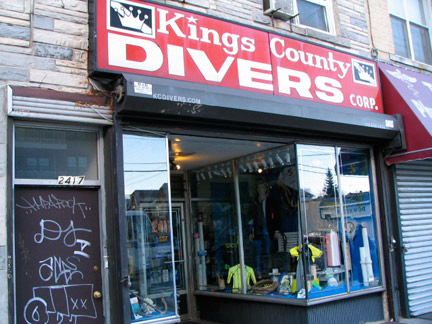
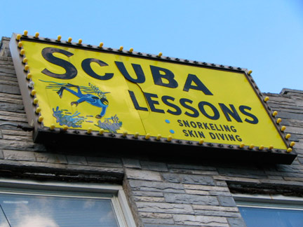
One of the few scuba shops in Brooklyn, Avenue U just west of Bedford.
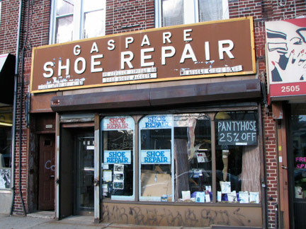
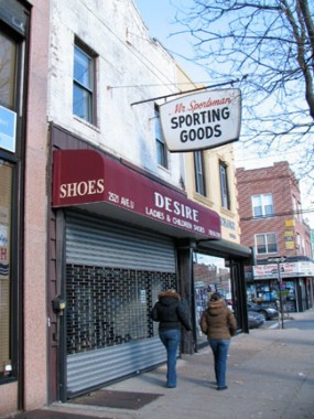
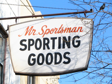
Old school signs on Avenue U just east of Bedford. I wonder where Mr. Sportsman is these days.
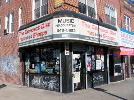
Your webmaster’s technology sense trails the rest of the world by about 5 or 10 years. To me, “blackberries” are what you put on cereal and “twitter” is what birds do. I see the new IPod or IPhone Touch TV commercials and marvel at how anyone can understand it — it looks more complicated than Sulu’s console on the Starship Enterprise. That said: I marveled at all the compact disc and video emporiums along Avenue U. It seems to me that an analogy can be drawn between these and buggy whip dealers in Detroit in 1910 — fin de siecle. Adapt or die.
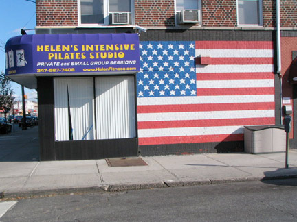
The flag on East 26th is beautifully rendered. The space the artist had available, though, forced him/her to forgo the accepted 1.9-1.0 standard ratio, though this is not hard and fast.
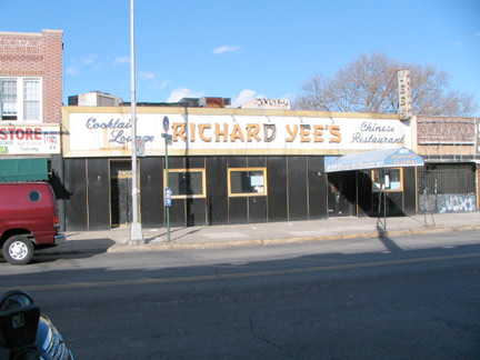
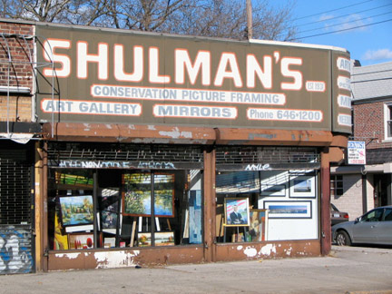
Not being a Chinese food aficionado (I know, sometimes my existence is defined more by what I don’t like than what I do; the list of the former is a lot longer than the latter) I’ve never eaten at Richard Yee’s, but one thing I do know: the sign and vinyl front have been here on East 27th for as long as I’ve been coming out this way, as has the Shulman’s sign.
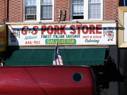
An animal cannibal pork store sign. Pigs who eagerly anticipate the consumption of other pigs (chickens come in second) are featured on many deli or restaurant signs around town.
I’m quite sure that if I walked in and asked about the strange cartoon showing a pig with a string of sausages, I’d be met with, at best, a blank stare and at worst, an angry command to leave immediately.
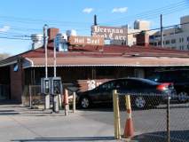
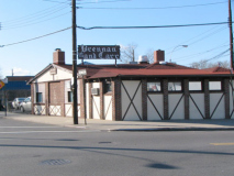
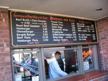
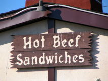
Bay Ridge may have lost Zeke’s Roast Beef (it was replaced by a Chinese restaurant — on 8th Avenue in Sunset Park — did they really need another Chinese restaurant? There?) but Marine Park’s Brennan and Carr has been here at the triangle of Avenue U, Gravesend Neck Road and Nostrand Avenue since 1938 — when there was nothing else here; Marine Park had not yet been built, and the Bergen Beach amusement park was gone by then. I couldn’t stop in — no time — but I will return.
Brennan & Carr’s was located on the corner of Ave. U & Nostrand Ave., and across the street was an empty lot, on which a bank now stands, and on the opposite side of that was a big circle in which the Nostrand Ave. trolley car used to turn to head back downtown. Later it was the bus turn. At one point in my teens (1948-50) I dated a few young ladies from Good Shepherd Parish (Cissy Paterno, kid sister of Penn State Coach, Joe Paterno, was one of them) and Brennan & Carr’s was a favorite date spot for them. The Roast Beef with the roll dipped in the natural juices was outstanding, and they had very good fries. Depending on the waiter, a guy could get a beer under age (the drinking age was 18 at the time). There was one waiter I always held in awe, but I never knew his name. He had served in the Army in Europe, and had been wounded and captured and was a POW in Germany until the war ended. When I got out of the U.S. Marine Corps, I went to college with the Carr’s son’s, Bob, who I had known in my teens, and his brother, who became a Veterinarian at the race track, where their illustrious grandfather, “Sunny Jim” Fitzsimmons (sp?) had been one of the great race horse trainers. We used to see, “Sunny Jim” at Ryan’s Stables from time to time … In the early 80’s, I took my 3 youngest children to Brennan & Carr’s, and took their picture in the restaurant out of nostalgia. I returned again in October, 1999, when I was in Brooklyn for the Resurrection 75th Anniversary reunion, but it was under new ownership. It had not changed physically, but the food had lost it’s special edge. I guess they don’t get Ryan’s old horses anymore! –George Broadhead, message board, Gerritsen Memories
Cows, George — cows!
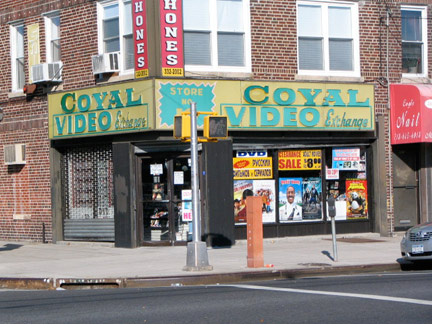
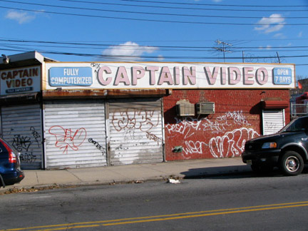
Sic transit, Gloria! In the age of digital downloads, ITunes video, etc. can video rental outfits like these two, at Avenue U and Coyle Street survive? Already, even Netflix is adapting to streaming broadband.
I suspect there’s still a lively VHS business in Marine Park, and I’m not really trying to disparage. Your webmaster still busily works a VCR that I bought in 1995 or so, and dozens of videotapes, and I see no need to spend $$$$ to convert them all. Long live Captain Video and Royal, ah, Coyal Video. (Royal is a video chain with distinctive green and yellow signage; here, they were being clever and lopped off the R and installed a C. A little Brooklyn comedy forya.)
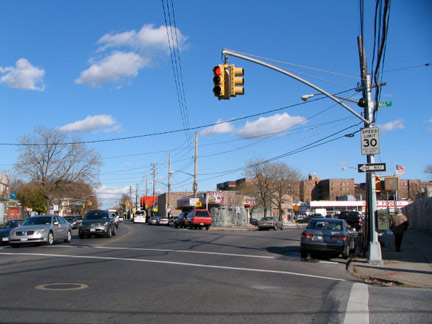
U Two. There’s more of Avenue U to love at Bragg Street — it splits in two, with the southern branch aiding southbound traffic on Gerritsen Avenue. In Manhattan, Duane Street and Waverly Place split into two identically-named streets as well. How many superheroes can do this? Duo Damsel, I know about. (She has been rebooted as her original identity, Triplicate Girl, in the DC Comics universe.)
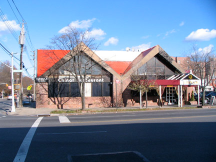
Chinar Restaurant, Avenue U and Gerritsen, looks suspiciously like a former Howard Johnson’s or IHOP restaurant. Anyone know?
The consensus holds that it had been a Jahn’s and before that, a restaurant called The Flame.
ForgottenFan Andrew Baum: The site was originally “The Charcoal Burger” – a small octagonal shaped restaurant (the interior octagonal portion of the present building forms the boundaries of the kitchen where the waitstaff picks up orders.) serving typical burger-joint fare. It featured car-hop service and was in business through 1966.
The restaurant was built out to its present dimensions in 1967 and was re-opened as The Flame, and later as “Ray & Shy’s Flame Restaurant”. Briefly, in the 1980s it was a Jahn’s franchise location – this was after the Jahn’s on Nostrand and Avenue Z had gone out of business in 1977.
In the 90’s it was an Italian restaurant called “Tricolore”. One New Year’s Eve, the entertainment was Ron Palillo of “Welcome Back, Kotter” fame. It has been “Chinar” for approximately seven or eight years.
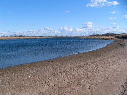
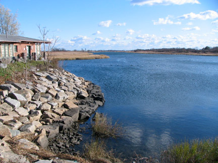
To the north and west of Floyd Bennett Field can be found vast (about 800 acres) Marine Park. Until a few years ago, Marine Park south of Avenue U was mostly ‘wilderness’, but trails are now maintained and residents of Gerritsen Beach and the surrounding neighborhood, also called Marine Park, can enjoy a shoreline nature milieu.
The park surrounds Gerritsen Creek, an arm of Jamaica Bay. The creek was a freshwater stream that once extended about twice as far inland, all the way up to Kings Highway The creek had been converted to a storm drain by the early 1920s. The creek’s fresh water, however, supports a wide range of plant and animal life.
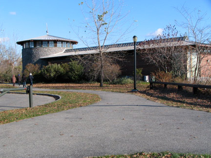
Over the past sixty years, portions of Marine Park have been improved with recreational facilities, while other areas have been conserved to protect wildlife and plant life. In 1939 the Pratt-White athletic field, north of Avenue U, was dedicated in tribute to the two fathers of Marine Park. A 210-acre golf course opened in 1963. Nature trails established along Gerritsen Creek, on the west side of Burnett Street, in 1984-85, invite parkgoers to observe a wealth of flora and fauna. Ongoing improvements at the end of the 20th century include the reconstruction of basketball, tennis, and bocce courts; of baseball fields; and of Lenape Playground at Avenue U. New ballfields on the west side of Gerritsen Avenue were opened in 1979 and named for local baseball lover and police officer Rocco Torre (LA Dodgers manager [as of 2008] Joe Torre’s brother, who passed away from a heart attack in 1996). A new Saltwater Marsh nature center, seen above, opened in 2000. Marine Park boasts regular cricket “tests” on its spacious grounds.
The stretch of Avenue U between Flatbush and Mill Avenues is called Old Mill Basin, since it began to be populated between 1920 and 1945 (Mill Basin proper was built up after World War II on the former Mill Island, named for many tidal mills in the region in the colonial era). In 1970 I made the first of, um, two visits to the brand-new Kings Plaza at Flatbush Avenue and Avenue U, the first salvo challenging the hegemony of the then all-powerful Fulton Street shopping strip. It was the first enclosed shopping mall in NYC; it has, perhaps, been superceded by the Staten Island Mall, which is really a shopping “neighborhood” consisting of several malls.
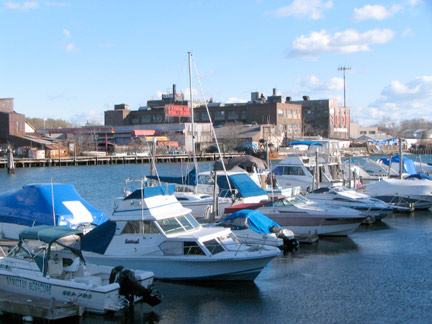
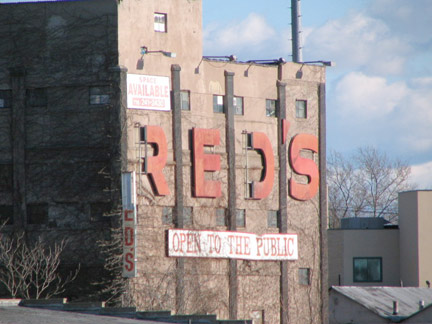
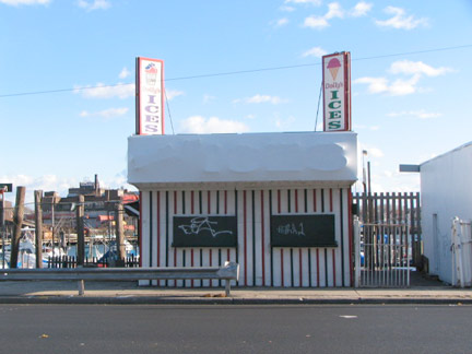
ABOVE: Mill Basin Creek, with a collection of pleasure boats belonging to neighborhood residents; back end of Red’s Warehouse Outlet wholesale toy store; and the seasonal Dolly’s Ices at Avenue U and East 56th Street.
A yelp review: Dolly’s is precariously positioned right on Avenue U near Kings Plaza, so you stand a decent chance of getting hit by a car in your quest for icy goodness. If you’re traveling on foot, make sure you’ve started your journey on the south side of Avenue U several blocks in advance, so you don’t have to dodge traffic for your reward. If traveling by car, don’t count on being able to pull right over in front of Dolly’s, especially on really hot days or any summer day during after-dinner hours.
In short, a trip to Dolly’s can be a pain in the ass. In spite of that, Brooklynites still come in droves — because it’s just that good. Think of a flavor. Any flavor. They probably have it in ice form. (And if they don’t, head about 5 minutes west on Avenue U for the Marine Park branch of Uncle Louie G’s. Between the two of them, you should be covered.)
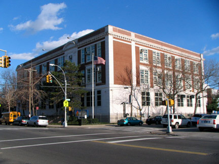
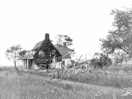
PS 236, the Mill Basin School, East 63rd Street and Avenue U, stands very close the same spot ,(2133 East 63rd) that the Jan Martense Schenck (“sch” is pronounced “sk” in Dutch, thus it’s pronounced “skenk”) House stood from about 1675 to 1954.
Schenck built the house near one of the area’s grist mills about 5-6 years after he had immigrated from Holland. In 1784 the family sold the house and land to Joris Martense — who left it to his daughter and granddaughter, who married into the Caton and Crooke families. Martense, Schenck, Caton and Crooke can all be found on Brooklyn street atlases. The last private owner, Frederick Crooke, sold it to the Atlantic, Gulf and Pacific Company in 1952.
You might have thought that would be the end of the house, but AGP donated it to the Brooklyn Museum, which took it apart, numbered every piece, stored it alongside what is now the Jackie Robinson Parkway in Cypress Hills, and reassembled it in the Museum in 1964. (St. Saviour’s Church in Queens awaits a similar reassembling and restoration.) In 2004 the Jan Martense Schenck house was disassembled once again and moved to a different location in the Museum to make way for a new exhibit. This time, it was appointed in the way curators believed a Dutch homestead in Brooklyn appeared in 1730. The Museum now holds the Jan Martense Schenck House and the “newer” house of his grandson Nicklaes Schenck, built about 1775.
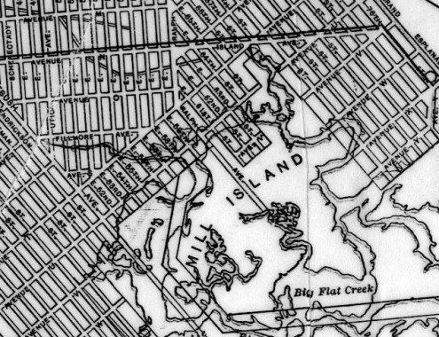
Above: 1913 Rand McNally map of Mill Basin. The streets as shown on the map were in the planning stages in 1913 and it would take several decades for them to actually be built.
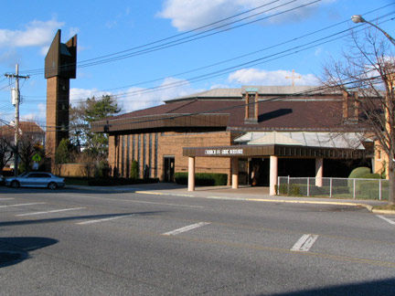
Church of St. Bernard, East 68th near Avenue U. The parish was established in 1961, when the area was first being developed, but the ultramodern church building has a 1970s aura about it. I won’t mention what I think the bell tower looks like (am I gonna get it for that?)
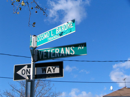
Pvt. Cosmo L. Barone Triangle, Avenue U, Veterans Avenue and East 71st Street. The triangle honors a soldier who died from his injuries in the Vietnam War. Veterans Avenue was renamed from Island Avenue in the 1960s, and likely honors World War II combatants (Island Avenue formerly led to the region when it was indeed an island).
Georgetown
The streets north of Avenue T, east of Ralph Avenue and west of Paerdegat Basin make up a subdivision of Bergen Beach known as Georgetown, named for a planned development in the 1960s to be called Georgetowne Greens in the vicinity of Ralph Avenue and Avenue L. The project never got off the ground, but the name survived in the Georgetowne Shopping Center on Ralph and the neighborhood, minus the final “e.” The area was slowly developed from the 1960s through the 1980s, and indeed some parts of Georgetown remained empty lots until the 2000s.
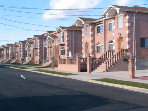
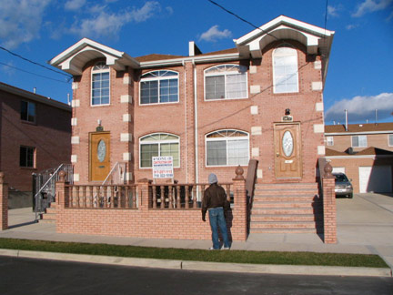
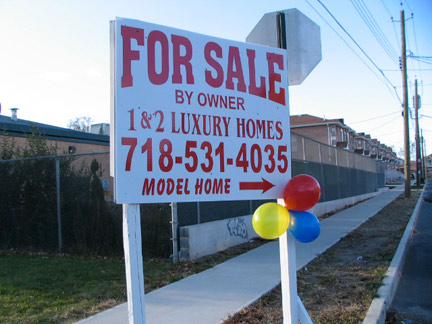
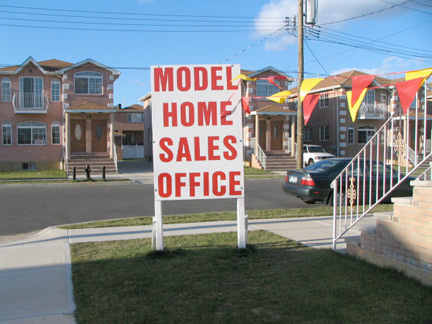
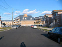
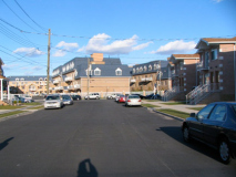
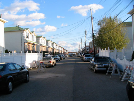
Pleasant Valley Sunday: East 71st Street between Avenues T and N (they skip some letters in Bergen Beach) has a row of freshly built new houses, most of which are still unoccupied. The stretch is still missing streetlights.
You wonder if any trees will be planted. There are garages in the back (as we’ve seen the subway is nowhere near) so the big wagons don’t have to be parked on the lawns, some of which are actually green.
Avenue N between East 71st and East 72nd. You’re welcome, but not too.
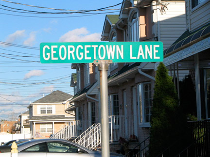
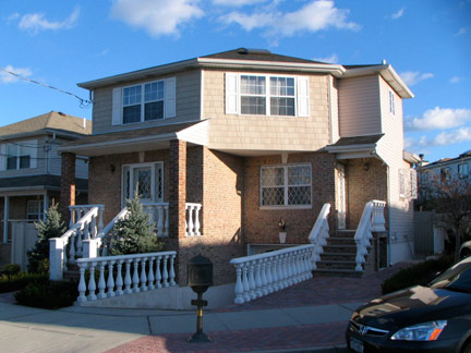
New streets such as Georgetown Lane (above), Bergen Beach Place, and Bergen Court (imaginative street names are not a forte around here) have been carved out over the last 20 years or so.
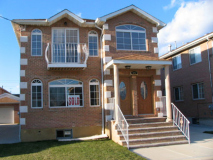
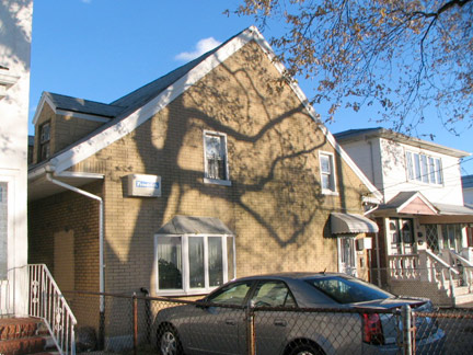
Cottage-style residence, Bergen Court. Nice enough, but developers’ proclivities for Italianate-style fencing frustrates me. It’s a matter of taste and a lot of people like this stuff, I suppose.
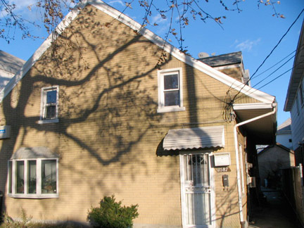
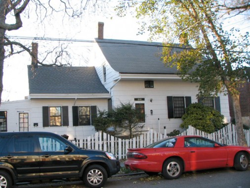
Moving west from Georgetown across Ralph Avenue we are in East Flatbush, and we move from some of the city’s newest construction into a region with some of its oldest. At 1587 East 53rd Street, between Avenues M and N we find the privately-owned Stoothoff-Williamson House.
Douwe Stoothoff built this lengthy building shortly after his 1797 marriage on his farm in the vicinity of today’s Mill Island, near Jamaica Bay. By 1828, after Douwe’s death, his brother Cornelius sold it to John Williamson, where he lived with his wife Maria, daughter Joanna and sons Garret and James. Garret inherited the property and became a rhubarb farmer, incorporating then-new farming techniques. After his death the house was sold and moved to its present location on what would be East 53rd Street, positioned perpendicularly to the newer houses that surround it — the street was cut through after the building was placed here, and despite its age, this colonial relic hides here in plain sight. For a side view of the house, see Brooklyn Genealogy.
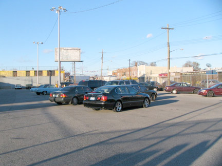
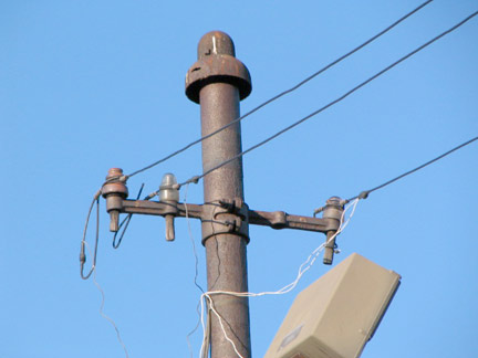
The B41 trolley line ran down Avenue N and Island Avenue to Bergen Beach until March 1951; it was replaced with the B41 bus, which has routes to both Kings Plaza and Bergen Beach. A parking lot at Avenue N and Utica Avenue was once a trolley yard — the distinctive trolley poles, now light stanchions, give it away.
ForgottenFan Jeffrey Wasserman: That trolley pole at the lot on the northwest corner of Utica and N wasn’t for a trolley yard but for the trolley loop/terminus of the Utica Avenue line. The trolleys of the Utica line used to turn around there in jug handle fashion. Later, the Utica buses did likewise. Passengers would disembark from southbound Utica Avenue trolleys and buses in that lot. The loop was J shaped and was three buses wide. There was a business (a used car lot?) at the actual corner of Utica and N which was framed by the loop. The loop/terminus was no longer necessary once the Utica buses extended their run down to Kings Plaza and the MTA sold the jug-handle.
Across from that turn-around on the southwest corner of Utica and N used to be a trolley garage. That’s just north of another still-standing trolley garage building which has had affixed to it several bus garage buildings that extend down to Fillmore Avenue. A playground now exists on the southwest corner of Utica and N.
Concluding today’s exploration of Marine Park, Bergen Beach and Georgetown is the Stoothoff-Baxter House at 1640 East 48th Street, again between Avenues M and N. One of the few extant Flatlands colonial houses owned by an Irishman, this house was built by the Dutch Stoothoff family about 1745. John Baxter, born in 1765 in Omagh, County Tyrone in Ulster, Northern Ireland, sailed from Londonderry for the USA in 1784; by 1790 he was living in Flatlands and married Altje Stoothoff in 1791 and moved into the Stoothoff house.
The house stood on a now-extinct section of a colonial-era trail called Mill Lane, which still exists in pieces in the neighborhood. By 1811 Baxter wished to expand the property and moved it to its present location south of old Mill Lane. Baxter’s daughter Abigal inherited the house and married William Kouwenhoven. It was turned to its present position about 1900.
SOURCES:
Old Dutch Houses of Brooklyn, Maud Esther Dillard, Richard R. Smith 1945
The Neighborhoods of Brooklyn, ed. John B. Manbeck, Yale University Press 1998
Photographed November 22, 2008


1 comment
[…] Brooklyn. It was undeveloped until the 1960s, when a community of 400 two-story colonials called Georgetowne Greens was proposed, but was never executed. Other buildings filled in the area, which had its last […]
Comments are closed.