New York City borders on an ocean, several straits and a tidal estuary (the Hudson River). This propitious location has given rise to over 400 bridges, including two of the four remaining rectractile bridges in the USA (Carroll Street in Brooklyn and Borden Avenue in Queens); High Bridge, the oldest bridge over the Harlem, favored by Edgar Allan Poe; the beloved Brooklyn, which unfortunately (to some) pales its brother bridges the Manhattan and Queensborough; and 3 of the country’s smaller cable-stayed bridges, two crossing the FDR Drive and Easy 62nd Street at Rockefeller University and the other taking pedestrians over West 46th Street at 12th Avenue. In May 2009 I walked the five bridges that cross the Harlem between Manhattan and the South Bronx, all originally built in the same era, and took in the sights that present themselves on both sides of the river.
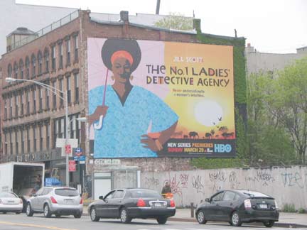

I began my trip at the 125th Street station on the Lexington Avenue, the nearest to the Willis Avenue Bridge, first on my list. Heading east on 125th I noted that the huge painted ad at the SE corner of 3rd Avenue had been pasted over with a giant HBO TV show ad. Luckily I had snagged the ad in the summer of 2005, but unfortunately, the camera focus wasn’t cooperating and I was able to get only a shaky image. Checking the block serif lettering, the ad for a tailoring company appears to be from the late 1870s-early 1880s.
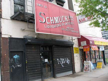

I don’t hear much about it, but east of 3rd Avenue, 125th is an antique row of sorts. One of the shops is Schmuck Bros. liquidators, in business, as the sign says, since 1929. I can’t help but think the design for their awniing sign was inspired by the lost classic Young & Schmuck saloon sign, which had been located on 8th Avenue between West 47th and 48th, also exposed briefly in 2000 during a demolition.
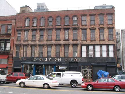
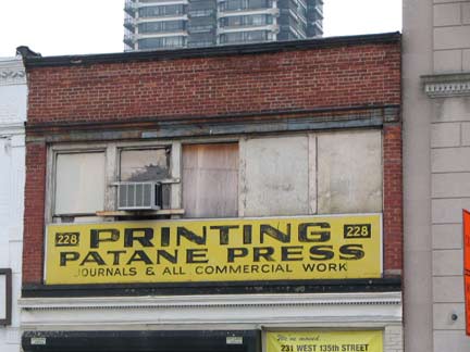
Another antique shop in a very old building, The Demolition Depot, which has some interesting items; and the handpainted sign for the Patane Press at 228 East 125th. Patane has since moved to 231 Wst 135th.
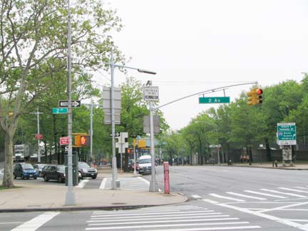
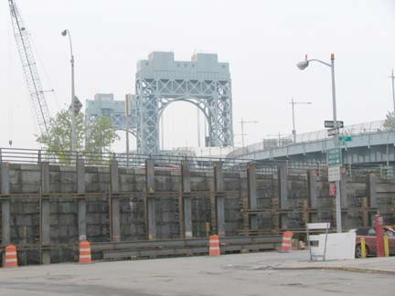
I found the corner of East 125th Street and the Triboro Bridge off ramp at 2nd Avenue very interesting for its flock of vintage 1930s Triborough Bridge lampposts. Heading east on East 126th and approaching the difficult-to-find pedestrian starircase to the Willis Avenue Bridge, you can get a glimpse of the massive RFK/Trib. Some motorists prefer the Willis because; unlike the RFK, it has no toll. This is also the northernmost limit of 1st Avenue, which runs continuously from here south to East Houston Street.
Beholdeth, the pedestrian entrance to the mighty Willis. The daring explorer must risk being flattened by buses speeding round the corner at East 127th to access the depot entrances on 126th, then dodge the barriers to get to the staircase, littered with bum vodka bottles. What’s this? No bikes allowed? Well, cyclists are pretty much allowed to do anything they want under new DOT doyenne Janette Sadik-Khan (except ride with traffic and obey the stoplights, as your webmaster does) and so I passed several bike riders on the bridge, despite the signed DOT ban.
Willis Avenue Bridge
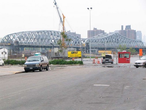
Flouting the usual nomenclature, the Willis Avenue Bridge is the only bridge connecting Manhattan and the Bronx that bears the name of a Bronx thoroughfare. (It could have been called the 1st Avenue Bridge, since the Manhattan entrance ramp emanates from that avenue). The Willis, a swing bridge that can allow ship traffic to pass, was built between 1897-1901 for $1 million; the architect was Thomas C. Clarke, who also built the Willis’ sister bridge, the Third Avenue (see below). It connects 1st Avenue in Manhattan and Willis Avenue in the Bronx.
The Willis Avenue is the bridge in most need of an overhaul of any of the bridges visited on the trip, though that gives FNY a boost in that it has several features that haven’t been updated in years, such as the scrolled “all persons must leave” sign, safety gate, and walkway lamp, each with nifty metal scrollwork. A view of the murky Harlem River reveals both the 3rd Avenue Bridge and Metro North bridge beyond.
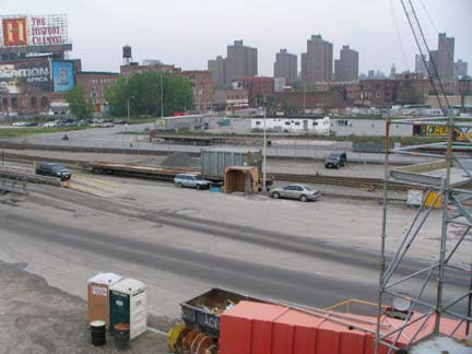
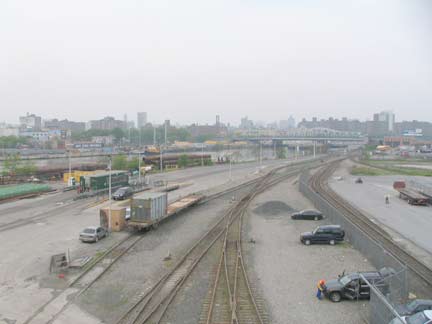
On the Bronx side we see the western end of the Harlem River freight terminal.

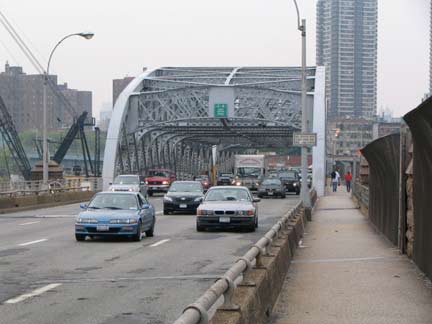
Looking southeast to the RFK/Triboro and back toward Manhattan. Note the low fence and potholed roadway, which don’t slow down the pedal to the metal traffic one bit. As stated earlier many motorists use the Willis to avoid the RFK toll.
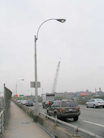
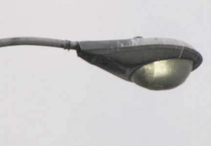
The Bronx ramp featured several very old GE M400 luminaires; these look like 1960 originals. Some are dayburning and are encrusted with grime and salt; nighttime illumination must be minimal.
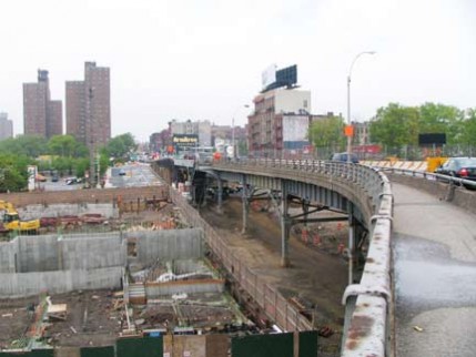
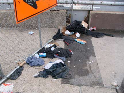
A stalled building foundation greets Bronx-bound pedestrians. A chain link fence marks a changing room.
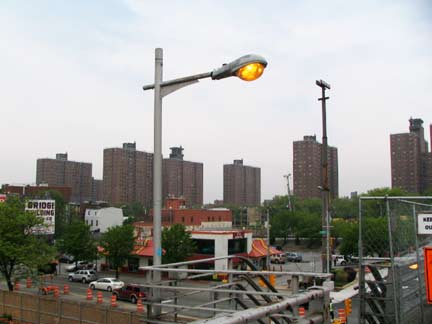
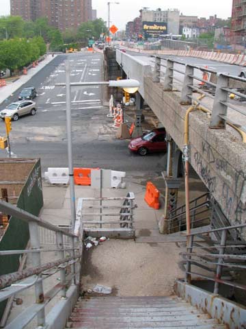
The staircase to Bruckner Boulevard boasted two vintage finned Whitestone Bridge style utility posts; they first appeared on the WB in the 1940s and originally employed pendant lumes like Westinghouse AK-10 cuplights or gumballs.
The DOT, the NY State Department of Transportation and the Federal Highway Administration, the three agencies that run the show on Harlem River crossings, decided in 2001 to replace the old Willis with a new one, with construction slated to begin in 2007 and ending 2012. From the looks of things, that has been pushed back as I saw no evidence of construction in May 2009.
However: Martha Holstein, community liaison for the DOT engineer working on the new bridge, sends this:
Your comment about the Willis Avenue Bridge in need of reconstruction was a surprise, however. Since the fall of 2007 the Willis Avenue Bridge Replacement project has been underway with the continued use by motorists and pedestrians of the existing Willis Avenue Bridge throughout construction. Contractors working for NYCDOT are building a replacement bridge just to the south of it. The construction of new spans and piers, ramp demolition, temporary loop ramp from Manhattan, new pedestrian bridge over the Major Deegan in the Bronx are all built, demolished or taking place. A new swing span will be floated-in about a year from now that will be connected to the Bronx and Manhattan spans. Project completion is scheduled for the end of 2012.
As a matter of fact, the completion of the new bridge proceeded apace, and the new bridge replaced the old in October 2010. These were among the last photos of the old Willis Avenue Bridge ever taken.
Bruckner Boulevard
The roadway that the Willis Avenue pedestrian exit empties onto, Bruckner Boulevard, was renamed in 1942 from its old name, Eastern Boulevard, which was in turn created in the early 20th Century from a number of different routes in Port Morris, Soundview, Castle Hill, Middletown and the Pelham Bay Park area such as East 133rd (Mott Haven), Whitlock Avenue, Ludlow Avenue (Soundview), 6th Street (Castle Hill) and Willow Lane (Middletown). Henry Bruckner was Bronx Borough President from 1918-1933. In 1951 NYC transit czar Robert Moses proposed Bruckner Expressway along the road,and, aftr initial opposition was conquered, the Bruckner and its complicated interchanges with the Hutchinson River Parkway, Cross-Bronx Expressway and Pelham Parkway along the route, was completed between 1957 and 1962.
In Mott Haven, Bruckner Boulevard enjoys a few blocks on its western end apart from its namesake expressway. East of the RFK Bridge, the Boulevard serves as the roadway under the elevated expressway or the service road on either side.
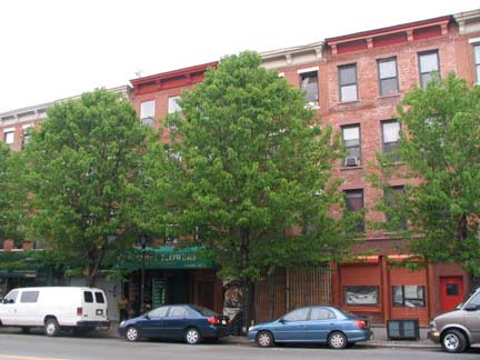
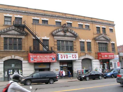
This stretch of the Bruckner, between Lincoln and Willis Avenues, is about as attractive as the road gets, with brick loft buildings and icehouses now divided into apartments. When they were built the street was called East 133rd.
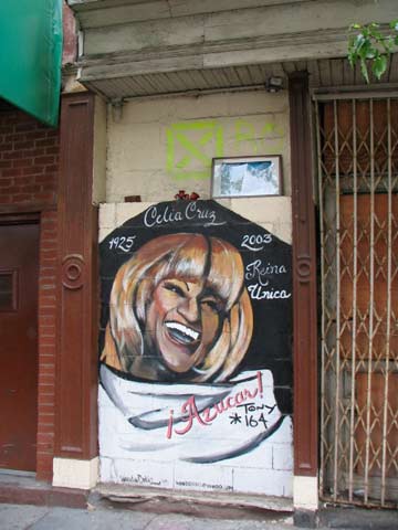
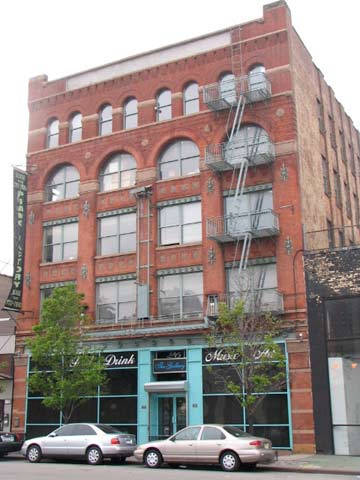
Cuban-born “Queen of Salsa” Celia Cruz (1925-2003) is remembered on the north side of Bruckner; 4th from left: former Behning Piano factory, south side of Bruckner west of Alexander Avenue (in the 1920s, the Kohler & Campbell Piano Co. acquired Behning). Mott Haven once featured over a dozen piano manufacturing companies in the area.
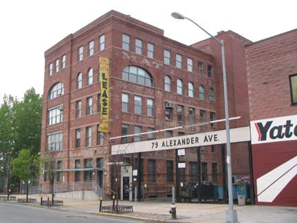
Kroeger Piano (originally Haines Piano) Alexander Avenue and East 132nd; (right) Bollermann Piano, later sold to Kroeger, SE corner Lincoln Avenue and Bruckner Boulevard. Now a glassware wholesaler. Kroeger was also later acquired by Kohler.
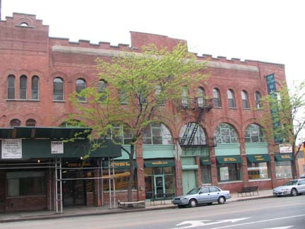
Bollermann Piano, later sold to Kroeger, SE corner Lincoln Avenue and Bruckner Boulevard. Now a glassware wholesaler. Kroeger was also later acquired by Kohler.
The massive, clock-towered Estey Piano building on the NE corner of Lincoln and Bruckner, now converted to private residences, was built in 1885 by architects A.B. Ogden and Son. The company was founded by Jacob Estey in 1869 to produce organs, began making pianos in 1885 and sold to the MCM Corp in 1963.
The factory was designated by NYC Landmarks in 2006.

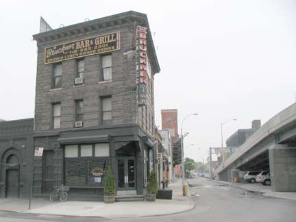
Tucked alongside the ramp to the 3rd Avenue Bridge we find, at #1 Bruckner, the Bruckner Bar & Grill, which may be worth a visit one of these days. In the Bronx, Third Avenue is almost always spelled out on the street signs to differentiate it from the Manhattan 3rd Avenue. Like Park Avenue (see below) 3rd Avenue was extended into the Bronx in association with a railroad: in this case, the 3rd Avenue El, which reached the Bronx in the 1880s. Third Avenue was built in some areas under the el and also took over former streets along the way.

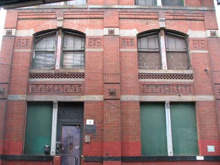
The pedestrian stair to the 3rd Avenue Bridge is hard to find, lost amid a sprawl of old loft buildings that still have an air of sophistication, having been constructed in an era when there was still a decorative flair, no matter how utilitarian a building was.
3rd Avenue Bridge
The 3rd Avenue Bridge links 3rd Avenue (Manhattan) with Third Avenue (Bronx). It’s the 4th bridge in its location, replacing bridges constructed in 1797, 1868 and 1898, and the newest one, having been completed in 2005 after damage from a 1999 fire prompted the replacement of the 1898 bridge, a swing span designed by Thomas C. Clarke as the sister bridge of the Willis Avenue span. The 3rd Avenue El, by the way, did not run over this traffic and pedestrian bridge but rather had it own span over the Harlem.


As you enter Manhattan via the 3rd Avenue Bridge, detour to the handball courts on the “Crack Is Wack” playground to your left. On one of the handball walls you will find Keith Haring’s Crack Is Wack double-sided mural, completed by the acclaimed street artist (1958-1990) in 1986. You can find another Haring mural at the Carmine Street Pool at James J. Walker Park downtown.
All Saints Church
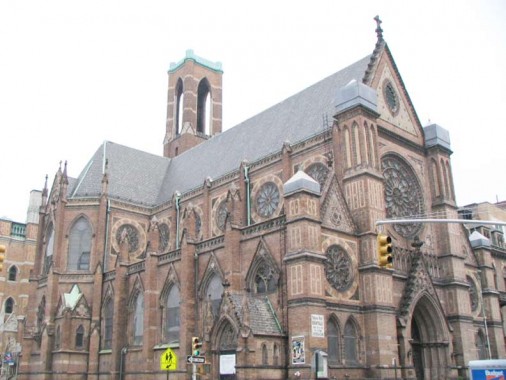
Making my way in East Harlem toward the Madison Avenue Bridge, next on my list, I passed the massive Gothic All Saints Church at Madison Avenue and East 129th Street, completed in 1894 by Renwick, Aspinwall and Russell, founded by James Renwick, Jr., who designed St. Patrick’s Cathedral, Grace Church at Broadway and East 10th Street, and the newly landmarked Smallpox Hospital on the south end of Roosevelt Island.

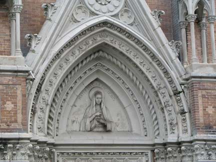
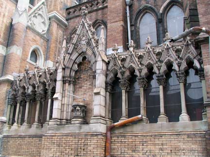
Indeed All Saints has been called the “St. Patrick’s of Harlem.”The Landmarks Preservation Commission designated the wheel-windowed, flying buttressed-church in January 2007.

1100, meet 2009. Some Manhattan Crap has sprung up just next door to the church (left). See the link above for gorgeous interior pictures.
Question: why does the Star of David appear on either side of the entrance?
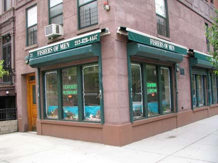
Madison Avenue and East 130th Street. The cleverly named Fishers Of Men restaurant, across the street from the church, recalls Mark 1:17, as Christ urged his followers, many of them fishermen such as Peter, to “follow me and I will make you fishers of men.” 1:18: “and immediately they left their nets and followed him.”
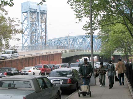
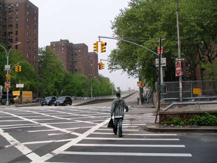
Before discussing the Madison Avenue Bridge, there is one more bridge in between it and the 3rd Avenue bridge to talk about — the majestic lift bridge that brings Metro North, formerly the NY, New Haven and Hartford RR and New York Central, over the Harlem. The bridge is able to be lifted along the towers to allow shipping to pass. In 1956, this bridge was constructed; it replaced an earlier box truss and wood spring span (1841) and a 4-track steel swing bridge built by Alfred Pancoast Boller, who built the remaining traffic bridges featured here (1893). East 135th Street is seen looking east and a view to the Madison Avenue Bridge ramp. A look at the Roosevelt Island lift bridge in action can be seen on this FNY page. In photo right we see the Riverton Houses on either side of the avenue.
Madison Avenue Bridge
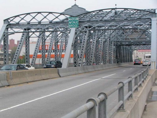
The Madison Avenue Bridge was opened in 1910 and designed by architect Alfred Pancoast Boller (1840-1912), replacing an earlier bridge opened in 1884, also designed by Boller. The bridge connects Madison Avenue with East 138th Street in the Bronx. As we’ll see with this bridge and the Macombs Dam Bridge, Boller was a proponent of ornamental ironwork, making his bridges among the city’s most beautiful vehicular bridges. His work was so admired that a Bronx avenue in Eastchester was named for him; though Boller Avenue was mapped to run continuously from Crawford Avenue to beyond Stillwell Avenue at the Hutchinson River, much of it has been swallowed by Co-Op City. A few blocks of it still remain.
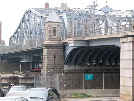
Each of Boller’s Harlem River spans feature these little stone houses on either side of the river. I am not sure what their function was other than provide a booth for guards providing safety for pedestrians passing across the bridge. They are unoccupied these days.
On the Bronx side, East 138th Street meanders down to the water, giving a glimpse of the Madison Avenue bridge in full glory.
Deegan Rock
At the overpass that takes the Major Deegan Expressway over East 138th, a sign and a park path lead to an unassuming memorial marker that answers a question voiced repeatedly over the years…who was the mysterious major?
Major William Deegan constructed Army bases in and around New York during World War I. He was a State Commander of the American Legion, a Commissioner of Public Housing, and a close friend of Mayor Jimmy Walker. He died from complications after an appendectomy.
The expressway named for Deegan was constructed in stages beginning in 1944. By 1956 the road reached the Westchester County line, where it changes its allegiance to New York governor Thomas E. Dewey; motorists know it best as the Thruway.
One more mystery can be gleaned here, however…
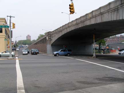
The Grand Boulevard and Concourse makes an inauspicious debut here at East 138th. It becomes a 10-lane behemoth at Easy 161st and then roars up the Bronx’ spine along a glacial ridge to Mosholu Parkway just south of Van Cortlandt Park. Its narrowwer section here was once called Mott Avenue, and a couple of mosaic Mott Avenue signs can still be found in and at the vicinity of the IRT East 149th Street station at The Conk.
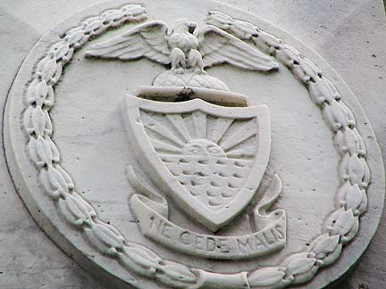
An odd insignia featuring an eagle perched above a shield bearing rising sun, along with a banner bearing the Latin words Ne Cede Malis, or “Cede not to evil,” can be found on each side of East 138th. What is the origin of this shield and what agency does it represent?
ForgottenFan Laura Healy: The seal with the rising sun and “Ne Cede Malis” is actually the official seal of the Bronx, derived from the Bronck family coat of arms, and adopted for the Borough’s use in 1912.
CONTINUED ON Harlem River Bridges Part 2!

