 I’ve done an East Williamsburg page before. However, I’ve been prevailed upon by Miss Heather and others that I was incorrect.
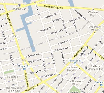
She maintains that my East Williamsburg page was really southeast Greenpoint. I defer to Miss Heather in these matters. She is an area resident and what’s more, she has won the 2009 Village Voice award for Best Neighborhood Blog. Arguing is futile. Therefore I have pressed further south and east to a neighborhood that cannot possibly be claimed by Greenpoint. Or can it? My venture took me east of Morgan, south of Met Ave, and north and west of Flushing Avenue…
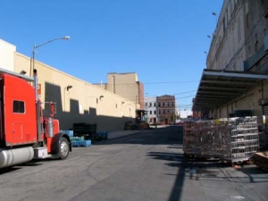
More specifically, my visit concerned the East Williamsburg Industrial Park, located mainly east of English Kills, a tributary of Newtown Creek. Trucks rattle through the mostly empty streets, trees are few and far between and the area is generally deserted, even on weekdays. The perfect antidote to midtown Manhattan, where I had found myself quite a bit recently! The area has, in recent years, gotten some residential spillover from Williamsburg proper, as at least some factories and warehouses have been converted to apartment space, and even a few new restaurants have joined already existing delis and bodegas. To get to Far East Williamsburg, as I’ll call it, a trip on the L train is necessary … when the MTA isn’t repairing it.
Two Brilliant Stations
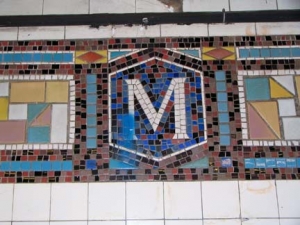
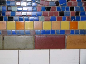
When I pass Montrose Avenue on the L train or on the surface I think momentarily about the band where Sammy Hagar gained his first fame. But the street should be remembered because it contains some of the most beautiful mosaics in the entire subway. The Canarsie Line, constructed in from 1924-1928 from 6th Avenue to Broadway Junction (connecting in 1928 to the elevated portion in East New York, formerly an at-grade railroad, and extended west to 8th Avenue in 1931), was among the last lines built using multicolored tiles in station nameplates and decoration, and while most earlier lines in the IRT and BMT used a mostly muted pallette (earth tones such as dark brown, blue and olive predominate) the Canarsie occasionally presaged Technicolor and psychedelia by using the entire spectrum.
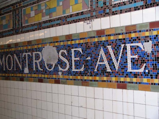
Note that while the station nameplates are in a mostly blue field, there are red, green and black tiles mixed in, along with thick and thin borders using red and gold.
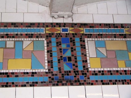
NYCSubways: The mosaic band here is of exquisite cut porcelain, with vivid pastel shades of sky blue, cerulean blue, rose, yellow, maize and white, on a background of black, raspberry and greyed lavender. Brilliant blue stripes adorn the top and bottom of the tile band.
And that’s not all. Even the borders above and below are intricately designed. Both have robin’s egg blue tiles, but the one above the band has a thin white border interspersed with red triangles on gold fields.
Only the Wilson Avenue station, a few stations down the Canarsie Line, can rival Montrose Avenue with an even wilder array of color on its Manhattan-bound side. (The Canarsie bound section is actually on the surface!)
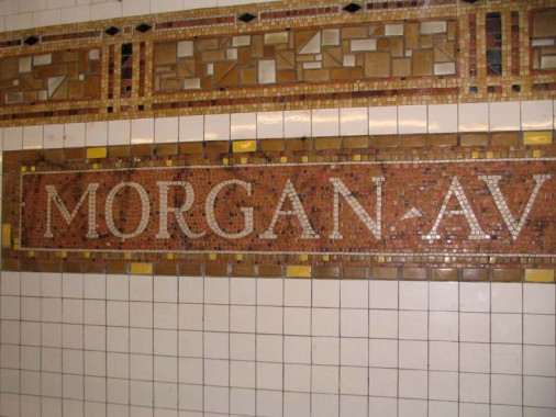
In actuality I wanted to explore the neighborhood served by the following station, Morgan Avenue. The Canarsie Line actually has pioneered a helpful system that tells you when the next two trains are coming. (The Metro in Washington, DC has had this for years throughout the entire system). To me, it amounts to a misery index, since knowing when the train is coming doesn’t make it come any quicker; I’d rather the MTA spend on the 2nd Avenue line or cleaning up decrepit stations — such as Bedford Avenue — a postapocalyptic disaster area — on the Canarsie, where traffic has increased manifold over the last decade.
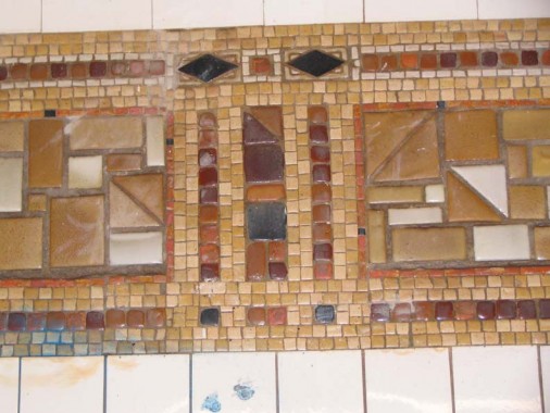
Shooting tilework from the platform is tricky: my Canon Powershot S1-IS simply did not want to focus on the tiles, a short distance of zooming. Undoubtedly there’s a workaround or a solution for this — let me know. In any event Morgan Avenue follows the same general template as Montrose, except for the tiles being mainly shades of brown or gold (5th Avenue on the 42nd Street crosstown-Flushing Line #7’s pallette is quite similar). There’s a bit of red and black worked in, as well.
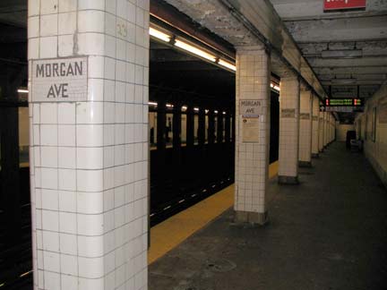
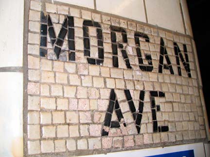
Two stations on the Canarsie Line, Morgan Avenue and Bushwick-Aberdeen, have tile-covered pillars on the platforms. This is usually done when the tunnel runs directly under a building, as a way of shoring up the vault. These two stations are unique in the subways, however, in that the station name has been inscribed in mosaic (the usual way, of course, is to simply install a plaque). There are subtle differences among these tiled signs….
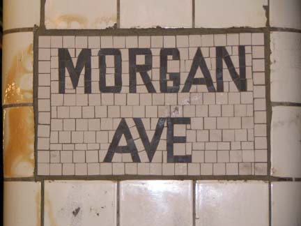
Note that while one pillar sign looks hastily done, with uneven tiles and smaller ones cut around the black letters, another looks more polished, with mostly even tiling. I can’t explain the discrepancy.
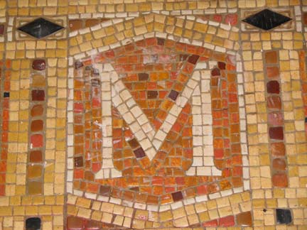
Closeup of the station’s M identifier. All Canarsie line tiles were hand cut and inserted manually.
For me the irony of the grandeur of the Far East Williamsburg stations is that the Morgan and Jefferson Street stations leave you, essentially, in very lo-trafficked areas, at least until recently when new residences and attendant amenities began popping up. We see that upon getting out at the Bogart Street exit-entrance at the Morgan Avenue station…
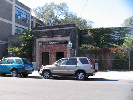
Brick station entrance, similar to the next station at Wyckoff Avenue and Jefferson Street.
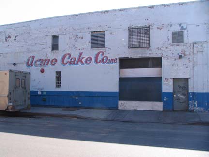
Acme Cake Company
Acme Cake Company is apparently a going concern as a supplier of baked goods — to me it sounded like where Wile E. Coyote would buy birdseed to stop the Road Runner in his tracks.
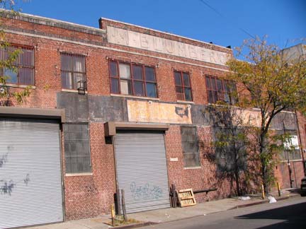
Warehouse marked M. BLUMBERG, Johnson Avenue east of Bogart Street.
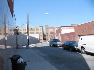
Far East Williamsburg is a curious area…streets that are cut off from the overall grid and don’t lead anywhere but elsewhere in the neighborhood. English Kills effectively cuts it off on the west.
There’s a George Street (in Bushwick proper) a couple of blocks south of Flushing Avenue, and another one about a mile away in Ridgewood. Area residents have to be careful to not mix up Jefferson Street and Jefferson Avenue. They are about 20 blocks away from each other in Bushwick-Ridgewood, a few blocks south of here.
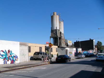
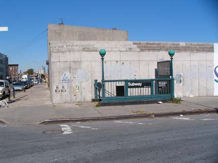
The Morgan Avenue entrance is on desolate Harrison Place, one of the unlikeliest streets in NYC that has a subway tunnel under it. It’s unknown why this isn’t Harrison Street, since there isn’t another street named Harrison in the vicinity. Harrison Avenue runs in southern Williamsburg while Harrison Alley is in Vinegar Hill.
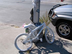
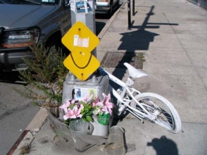
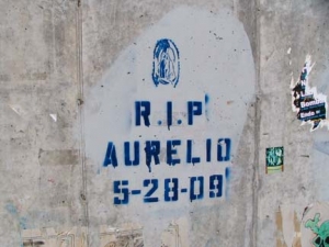
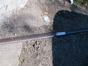
There is a “ghost bike” at the corner of Morgan Avenue and Harrison Place — these are memorials set up to recall bicyclists killed by motor vehicles. They were first created in St. Louis, MO in 2003, and the practice has spread to Mexico, South America, Europe, Australia and New Zealand.
This bike commemorates Aurelio Perez.
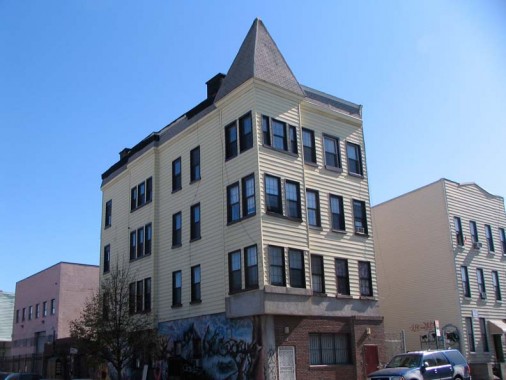
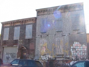
Despite the aluminum siding I liked this peaked 4-story building on Morgan and Grattan Street. I wonder what it’s been in the past. A school perhaps?
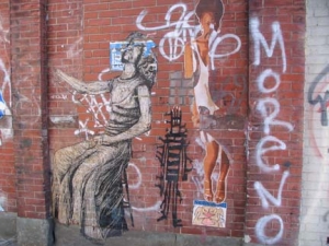
Street art and aged decrepit buildings, Grattan Street between Morgan Avenue and Bogart Street. The Pres. Barack Obama mural is appropriate on Grattan Street: according to Leonard Benardo and Jennifer Weiss’ Brooklyn By Name, Grattan was named for a 18th Century Irish Parliamentarian,Henry Grattan (1746-1820), who argued for Irish independence and the civil and political rights of Catholics. In the short run, he was unsuccessful, as the 1800 Act of Unionmerged the kingdoms of Ireland and Great Britain. The Irish Free State would not come into being until 1921.
Most streets in Far East Williamsburg, except the already-existing roads that became Bushwick Avenue, Evergreen Avenue and Flushing Avenue, were constructed in the early 1850s.
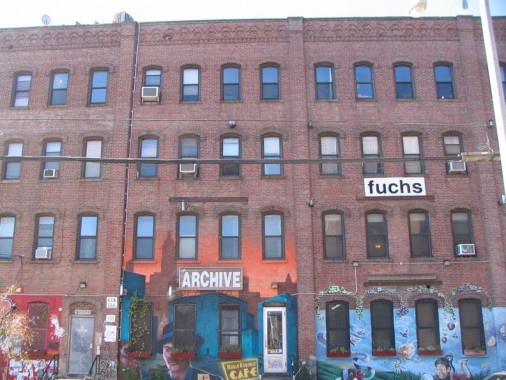
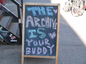
At Bogart Street we have a brick factory or warehouse, the bottom floor of which is home to the Archive Café. I’ve always liked these stolid brick buildings — I live in a complex in Little Neck consisting of a series of squarish brick buildings that look like this with 2 floors knocked off the top.
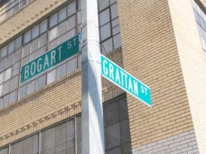
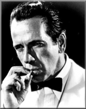
The Archive remains one of the few cafes or coffeeshops in the immediate area though another has opened on nearby McKibben Street. According to Benardo and Weiss, the great film actorHumphrey Bogart could claim a Bogart Street connection, since the street was named for one of his forebears, Teunis Bogaerdt, who arrived from Holland in the Wallabout Bay area in the mid-1600s, marrying the first European woman born in New Amsterdam, Sarah Rapelye (the Rapelyes are also represented on a Brooklyn street sign). The Bogaerdts later Anglicized their name to Bogart. It’s unknown if the actor knew about Bogart Street.
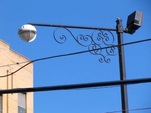
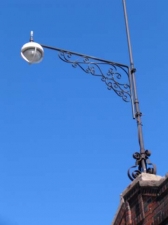
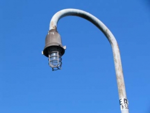
There are a couple of curios in a yard across the street at Bogart and Grattan from the Archive. Someone has either an imaginative design sense, or a copy of my manual of former NYC lampposts.
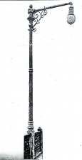
Two stanchions holding security cameras bear resemblance to some of the wrought and cast iron scrollwork formerly featured on NYC lampposts (The old one shown above was formerly used on the Macombs Dam Bridge across the Harlem River.
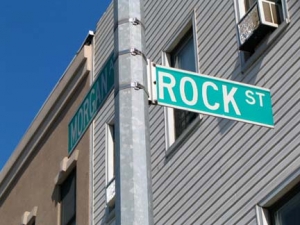
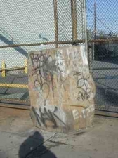
Rock Street runs for a single block between Bogart Street and Morgan Avenue a block north of Flushing Avenue. Undoubtedly, it was named for a lage boulder (shown left in a 2002 photo) found on the east side of Morgan Avenue between Rock and Grattan Streets. It had likely been there for decades, if not centuries; it was removed in 2008 probably because it was in the way of a driveway protected by a security gate. Rock Street is notable today only for a large Boars Head cold cut distributor.
[By 2012 it had been cleaned and put back in place, with a plaque, yet. I have to find that photo…]
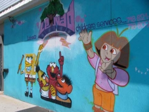
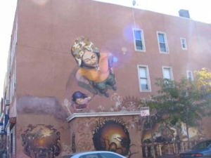
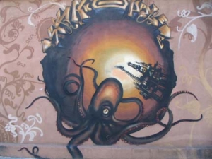
Contrasts in street art on Flushing and Morgan Avenues, and a block away at Wilson Avenue and Noll Street. You won’t likely see Spongebob, Sesame Street and Dora in the same scene unless Roger Rabbit puts the band back together. The bottom two form a triptych on the Noll Street wall. No idea what this surreality is supposed to depict though.
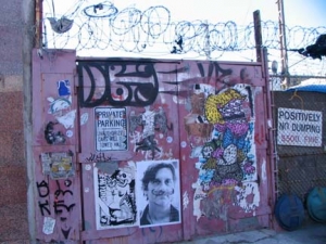
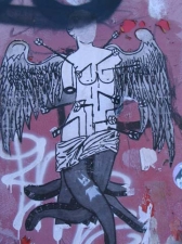
Vandervoort Place runs for one block between Flushing Avenue and Thames Street east of Morgan Avenue (what the maps don’t show is a surprising bend in the road). It seems to correspond to the longer Vandervoort Avenue, several blocks to the north. The street is notable only for a barbed-wire and street art mashup, in particular a depiction of an octopus-tentacled and winged St. Sebastian that reminded me of the woodcuts depicting the ‘monsters’ of Ambroise Paré, the 16th Century French surgeon with a peculiar interest in teratology.
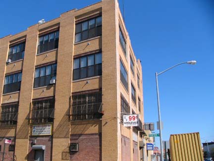
Pair of classics at Porter and Flushing
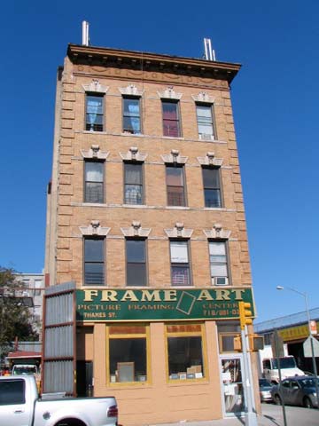
and Thames and Varick Avenue. Most of the area residential buildings are south of Flushing Avenue but there are a few in Far East Williamsburg proper.
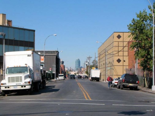
The Citicorp Tower in Long Island City is a horizon marker throughout Far East Flatbush, Ridgewood, Blissville, Sunnyside, Astoria, and even Turtle Bay and Lenox Hill in Manhattan. This view is from the center of Varick Avenue at Johnson Avenue.
LIRR Evergreen
At Johnson and Varick Avenues we find pieces of a long-lost chapter of Long Island Rail Road history. A branch known as the LIRR Evergreen Branch once ran from the East River in Greenpoint to a junction with the Bay Ridge Branch at Cooper Avenue, beginning operations in 1876 and not being taken completely out of service until 1984, though much of the trackage was closed in 1939. The Evergreen was a freight service for much of its existence but was actually a passenger line for its first couple of decades. FNY shot several scenes of right of way trackage in 2000 (much of that has since disappeared) and, as always, LIRR historian Art Hunecke has plenty of vintage photos and maps at Arrts Archives. Bob Andersen’s LIRR History also provides valuable information.
Some of the old right of way and tracks are still here on Johnson Avenue and Varick Avenue.
The real Arbitration Rock?
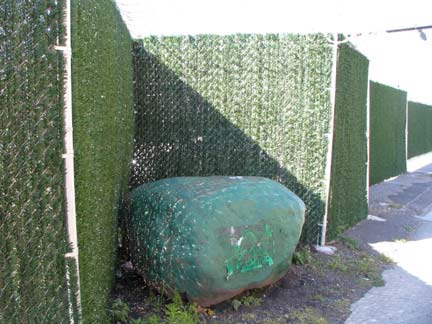
Rock, Varick Avenue north of Randolph Street. Is this the rock used to mark the boundary between Bushwick and Newtown, and not the Arbitration Rock found in the back yard at the Ridgewood Historical Society?
Bob Singleton of the Greater Astoria Historical Society:
The confusion has to do with which right branch of the stream you use – the main waterway, or English Kills (so called because of the claim by the English in Maspeth against the Dutch in Bushwick) Both the Dutch and English continously harassed them to leave, finally folding the village up into Newtown (1705) and giving the salt meadows to Bushwick (1769). My grandmother’s family (as many others) left in a migration to Princeton about 1705 for this reason.
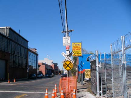
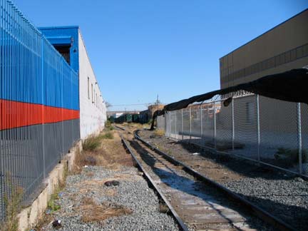
Varick Avenue crosses yet another railroad right of way between Randolph and Meserole Streets, this one being the Long Island Rail Road Bushwick Branch. Unlike the defunct Evergreen, these tracks are still in active freight / trash hauling use. Passenger service on the Bushwick, which runs from Bushwick Junction with the LIRR Montauk tracks just east of Flushing Avenue west to a terminal at Bushwick Place and Montrose Avenue, ended in the 1920s. Check OLDNYC for a complete tour of the Bushwick; Bob Andersen also has a photo essay on LIRR History.
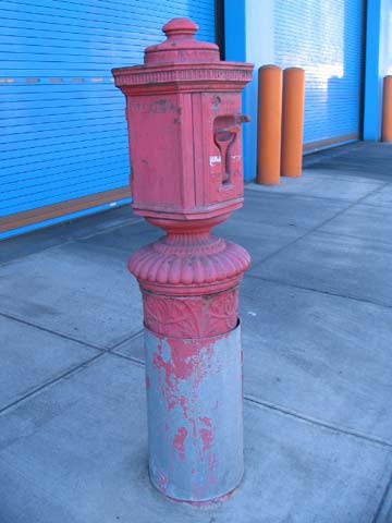
This vintage fire alarm (with old school pull handle) has seen its base completely covered by repeated repavings…
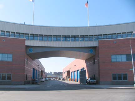
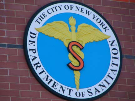
On Varick between Meserole and Starr Streets is a brand spankin’ new Sanitation Department transfer station, opened in March 2009. Trash is hauled along the Bushwick Branch to Fresh Pond Yards, where the NY Connecting RR takes it across the East River to upstate facilities.
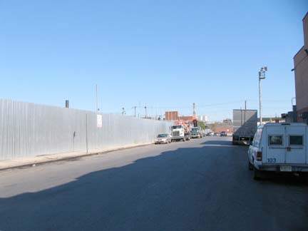
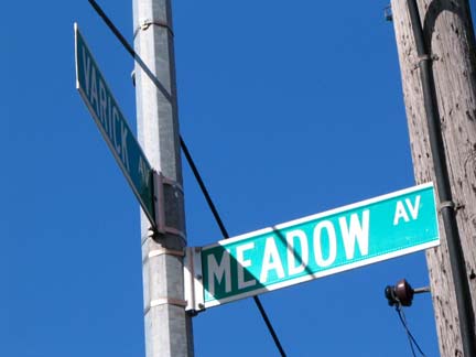
A couple of streets in these parts seem illogically named. Meadow Street, for example, has not a speck of green (and to add insult, the DOT mislabels it Meadow Avenue on a street sign). The street resumes west of English Kills, where it is likely even less meadow-like.
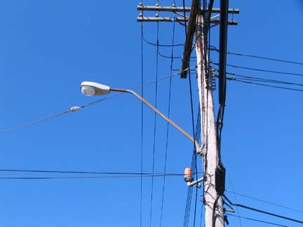
The Department of Transportation uses these particular cobra masts almost exclusively in industrial areas, though I have no idea why.
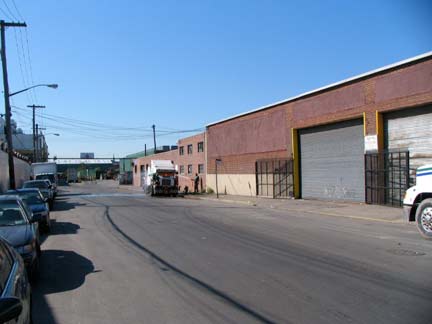
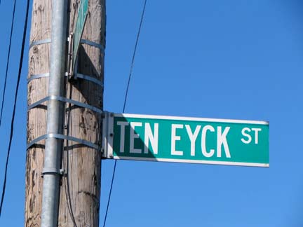
Similarly, though Ten Eyck means “The Oak” in Dutch, there are no oaks or any other trees to be found here, though there’s an alibi. According to Benardo and Weiss the street is actually named for Conraedt (Conrad) Ten Eyck, who immigrated from Germany (not Holland) to new Amsterdam in 1651. This is not the only obscure NYC street named for him; in the South Ferry area, Coenties Alley and Coenties Slip are also named for him and his wife, Antje — a contraction of their two names.
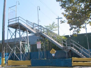
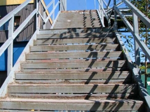
I’ve been attracted to the Scott Avenue footbridge like a cat to catnip ever since I first saw it in the 1990s — Morgan Avenue, Varick Avenue and this bridge provide the only means of crossing the Bushwick Branch in Brooklyn. What’s more, until a couple years ago, it featured several nonfunctional Crescent Moon luminaires! When the bridge, built in 1952, was spiffed up (relatively speaking) the moons were replaced and the lamps once again work, though I don’t know what kind of light these new bulbs give, and I don’t think I’ll stop by at 10PM to find out. Somebody fill me in.
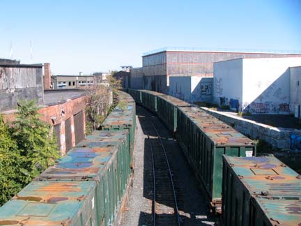
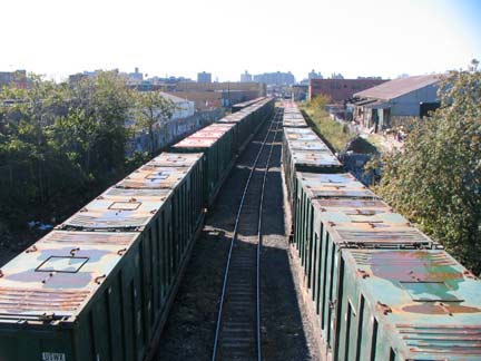
There were several railcars (filled with trash perhaps?) laid up on the Bushwick Branch today.
ForgottenFan Thomas Ketchum: From the website http://www.pwrr.org/rrm/rrmu.html, the reporting marks on the car end in the photo (USWX) indicate the car is owned by USA Waste Services Inc. So it is possible these are cars in transit to a transfer station for loading or to a landfill or incinerator for unloading.
It might also be possible that, in the recession, there aren’t enough loads for USA Waste Services to handle, and there might not be any space at USA Waste to store the uneeded cars. It is a common practice for railroads to lease sidings not needed because of a downturn in traffic, changed operation proceedures, or such, for storage. All over the midwest on shortline railroads, one can see stored trilevel auto transport cars, boxcars, and more, waiting for the economy to rebound. If you took note of a particular car or two, including the numbers above or below the USWX stencil, and see that it has not moved over the course of a week or two, it most likely is being stored.
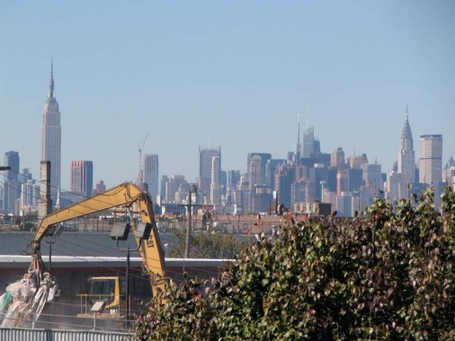
The chief attraction of the Scott Avenue Bridge is the skyline view it provides. It’s actually wider than this but I telephoto’ed in to exaggerate the King of All Buildings and the Chrysler and Met Life Buildings on the right. A trash recycler in the foreground completes the scene.
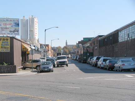
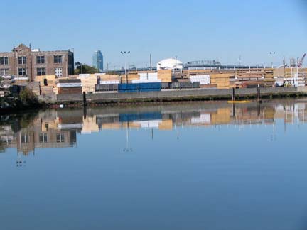
Finished the tour at Metropolitan Avenue, where a short piece of Onderdonk Avenue shows the spires of St. Aloysius Church. Here also is the southern limit of Newtown Creek, which provided the boundary between Brooklyn and Queens along its entire length.
For further reading: in Greenpoint, New York Shitty; along the creek, the Newtown Pentacle.
erpietri@earthlink.net
Photographed October 18, 2009; page completed October 24
©2009 FNY


