Continuing south on Cross Island Parkway, the roadway briefly sneaks into Nassau County, and then straightens south of Belmont Racetrack, neatly delineating the Queens-Nassau border. The highway then splits into the eastbound Southern State Parkway and westbound Belt Parkway.
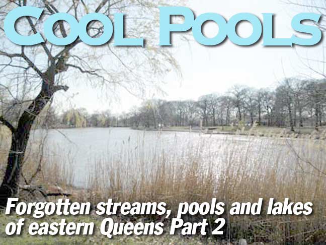
The Laurelton segment of Belt Parkway between exits 23 and 25 has a creek following it, but where does this stream begin, and what was its historical name?
To find out, we must venture a bit outside the city limits, where the uninspiring 115th Avenue becomes the exotic-sounding Dutch Broadway once it crosses the underpass/county line.
Simonson’s Creek
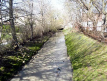
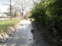
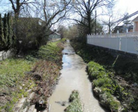
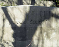
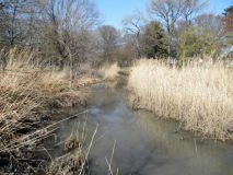
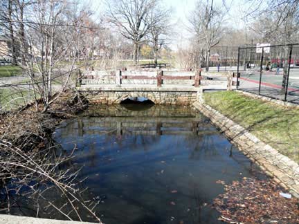
Simonson’s Creek (above and below) originates just south of Belmont Racetrack and flows between backyards a bit west of Elmont Road. Though the stream runs past the backyard of Sprung Monument Corporation, the “Nassau County 1933” below is not the region’s tombstone. The county may be financially broke, but it’s still physically alive. It is a marker signifying the year when the stream was tamed and forced into a concrete channel, similar in design to the Los Angeles River.
The county is diligent with its “no trespassing” signs, but the idea of putting on galoshes to walk the stream’s length brings back childhood memories. At age 7, I hiked with my grandfather along the length of Marupite, an obscure backyard stream that runs through the suburbs of my birthplace Riga, Latvia.
Space Age Catholicism
Saint Boniface Church on Elmont Road has a lovely Jetson-esque clerestory and dome to beckon the faithful. It is not the only space age church in the area. The American Martyrs Church in Bayside and Immaculate Conception in Douglaston also have similar clerestory domes. Across the road from the church, the stream is buried beneath the athletic field of Elmont Memorial High School, where the Spartans play.
Fork in the Road
Approaching the Queens border, Elmont Road splits into Brookville and Hook Creek Boulevards. It’s a double shot of forgotten streams here! Hook Creek Boulevard runs south along the city line, above its buried namesake, which emerges at the road’s southern end, almost two miles to the south. Adding to the confusion is that the city line runs down the middle of the street. The Nassau side is called Ocean Avenue.
The way it was
Foster’s Meadows was the old name for Elmont and Rosedale, after a colonial family that settled here in 1650. This 1893 map shows Simonson’s Creek, with its fork in the road and some of the forgotten streams in nearby Five Towns. Today, there are still streams running through some Woodmere and Hewlett backyards.
I’ve been spending a lot of time here lately, reporting for The Jewish Star, a free local weekly.
Also worth noting is a Long Island Railroad spur south of Cedarhurst (Cedarhurst Cutoff: see below). This one didn’t last too long, but there is a Railroad Avenue in Woodsburgh to mark its path. At the top of the map is a second no-longer extant LIRR route; the street grid in Rosedale still makes room for it.
To the west of Simonson’s Creek is the village of Springfield, which has its own forgotten stream, but more on that later.
Laurelton’s ponds
Just south of the treacherous hairpin bend that starts Southern State Parkway, Siminson’s Creek reemerges with a muddy appearance as it continues its crawl south to the ocean. A century ago, water from these ponds supplemented the drinking water supply for Brooklyn, which received a lion’s share of its water from Hempstead Reservoir. The water ran along the aqueduct marked by Sunrise Highway and Conduit Avenue. It was stored in Highland Park before ending up in people’s faucets.
Conselyea’s Pond, Brookville Park
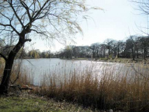
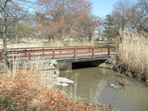
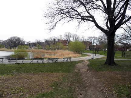
After disappearing beneath the sharp bend at the merging of Sunrise Highway and Belt Parkway, Simonson’s Creek gets the royal welcome in Brookville Park in the form of Conselyea’s Pond. A trail that runs diagonally across the park (left) marking the path of the Cedarhurst Cutoff, a short-lived railroad spur that was abandoned in 1934. It’s odd how Queens had more railroad stations when it was less developed than today. Many were abandoned in favor of the automobile. That was the shortsighted thinking in those days.
Cornell’s Pond, Springfield Park
Thurston Creek once emerged just west of Old Springfield Cemetery and ran south towards Jamaica Bay along Springfield Boulevard. As the area developed, the stream was forced into a ditch and then buried. Atop the stream are a number of local schools including Springfield Gardens High School, IS 59 and IS 231. The only section that still sees daylight runs through Springfield Park. In the middle of this park, it widens into Cornell’s Pond, then returns into a narrows stream, running past airport cargo warehouses into the marshes of Idlewild and Thurston Basin before emptying into the bay.
The fall season photos were taken in November 2010. At the time, a tropical snake was found in the park. Likely a discarded pet. I was there to report on it for a newspaper.
South of the Belt Parkway, Springfield Boulevard skirts the park’s eastern end (top) and resembles a countryside road bathed in fall splendor.
Stream-view birdhouse. Looking south, this bird house overhangs Thurston Creek with pristine views, but looking down is the detritus left by an evolved species of primate.
Springfield Lane
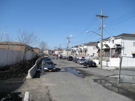
Springfield Lane splits from the more well-known Springfield Boulevard south of 146th Avenue and runs for one block to 147th. It then trails off into the marshes (top). It used to snake its way as a gravel road to busy Rockaway Boulevard but that old intersection is gone, covered up by the massive AMB JFK Logistics Center, which was built in 2001, taking up 527,000 square feet in the middle of the marshland.
Baisley Pond Park
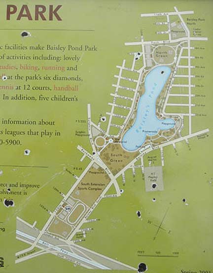
Baisley Pond Park is designed around a colonial-period mill pond that immortalizes local landowner David Baisley. For the second half of the 19th century, the pond satisfied the thirst of Brooklyn residents as one of their drinking water reservoirs. While connecting the pond to the aqueduct, workers dug up a mammoth skeleton from the Ice Age. The park’s design is similar to Central Park, with winding paths and a symmetrical pedestrian mall (above right) that ends at a war memorial.
The outline of Baisley Pond Park (below) follows the path of the buried Cornell’s Creek, which started in Jamaica’s long-buried Beaver Pond, and flowed south towards Jamaica Bay. A drain at the southern end of the pond takes the stream underground to its conclusion.
This 1927 Red Book map (again, sorry for poor reproduction) shows a fully developed street grid with Baisley’s Pond and Cornell’s Creek running down the middle. In reality, the southern third is a massive super-block that is JFK Airport. The dotted line was a streetcar line that is still followed by today’s public buses.
The park strip running from east to west is Conduit Avenue, which was built above and below the old Brooklyn aqueduct. The median is presently used by the Belt Parkway.
Captain George H. Tilly Park
Nestled in the Jamaica Hills is another kettle pond, Goose Pond, located inside Captain Tilly Park. The park’s namesake was George Tilly, son of a local landowning family who fought in the American conquest of Philippines in 1899, where he was killed in combat. The spring-fed pond nearly dried by in the 1990s, and the city then dug deeper and restored the pond, which features a bird sanctuary isle. This is likely the tiniest isle in the smallest public pond in the city.
Pond Necrology
Needless to say, Queens once had many more ponds, but each is now a distant memory, and many never ever rose to earning their own names. Here is the best-known forgotten pond in eastern Queens.
Beaver Pond was once a focal point of the colonial settlement of Jamaica, an English bastardization of Jameco, the local native term for beaver. Relentless pollution led to growing calls for the pond’s burial and in 1906, it was wiped from the map. More on the pond here.
In western Queens, there was Linden Pond in Corona, which was once the village’s centerpiece park, but was later buried to make way for a baseball diamond. Jackson Pond inside Forest Park was buried in 1966 and covered with a playground. A rarity is Strack Pond, also inside Forest Park, which was buried and later restored to its natural appearance. The Forest Park Golf Course still has its pond, with a fountain. Crystal Lake in Kew Gardens is buried by a train station. There’s also Fresh Pond Road in Glendale, but I’m not sure where its namesake used to be.
FNY contributor Sergey Kadinsky has been living in Queens since age eight. His interest in journalism can be traced back to childhood, when he made a hobby out of writing letters to the editors of local newspapers. He has assisted in the production of news stories at NY1 and has been a contributing reporter at the New York Daily News. At times, he has been spotted giving tourist-friendly monologues atop Gray Line buses.
Photographed November 2010; page completed May 1, 2011












13 comments
Very informative.
My Dad grew up in a community called Cornell Park in Queens in the 1930s. I assume the community bore some relation to Cornell Creek. He used to play and fish in Jamaica Bay (and coupled with employment at the Brooklyn Navy Yard did not enjoy a long life as a result).
This area was bulldozed to make way for Idlewild Airport, but I would love to find a street map or reference as to exactly where Cornell Park was. My Mom is past the age she can recall things.
My Grandmother lived in a little house on 153rd Place. It was down the hill from Conduit Avenue, which ran parallel with the Belt Parkway. If you know where Baisley’s Park and pond is, you might be able to locate 150th Street. That street went south from Jamaica. When she lived there, 150th Street continued for a short distance south of the Belt Parkway. If you went east from 150th along Conduit Avenue, you would pass part of the wetland on the right and there was a creek running out from under the road. It came from Baisley’s Pond and continued through the wetland to end at Jamaica Bay. That was Cornell Creek. If you continued eastward for the space of about two or three blocks, the first street you would come to would be 153rd Place. It was a short street with about 5 houses on it. At the end was the marshland. If you continued going east on Conduit Avenue you would see 4 or 5 more streets, some not accessible to the road because the road had been built up. So that was a small neighborhood of about 40 houses. South ot it was marshland. If you continue on you would come to Rockaway Blvd. There were roads parallel to Conduit Ave, so even if some people could not drive on to the Ave, they could take another road to reach Rockaway Blvd. At the intersection of Rockaway Blvd. and Conduit there was a small business district, which my grandmother referred to as “182”. Neither I nor my siblings ever knew why it was called that. We could get a bus to Jamaica from 182, and we could take a bus to South Ozone Park at 150th Street. I believe that neighborhood was Cornell Park. There was always a gas station at the corner of 153rd Place. I think there is a hotel there now. All that land has been filled in and my grandmother’s house and others are gone.
Thank you for the interesting description of Siminson’s Creek. I grew up near the northern beginning, it was just an open storm water sewer; the local children simply called it “the creek”.
I grew up in the Hillcrest section of Jamaica. Near St. John’s University. Wondering if anyone has info on Redder’s Pond. Found an article about several drownings back in 1907, said it was 12′ deep and was a kettle lake near an Estate owned by Judge Bert J. Humphries home. Thanks
Thanks for all the incredible info! I used to live in Jamaica in the 60s, and my some of my fondest memories involve my father and I fishing for HUGE goldfish in Goose Pond Park in Jamaica Hill. It’s interesting to note that Prospect Cemetery and the long-gone Beaver Pond were just a mere 12 blocks from the street in Jamaica on which I lived, although I never knew it at the time.
Oh, silly me. When I replied to the question about Cornell Park, Queens, I didn’t realize how long the question had been on there. He probably found out what he wanted to know a long time ago.
WAS THERE EVER A WALK UNDER TUNNEL FOR PEOPLE TO WALK UNDER THE LAURELTON PARKWAY
There was one under the Belt Parkway from the S Conduit to the N Conduit. It was closed up in the late 80’s
I grew up at 220 street and 145 road (the old Sheffield Ave.) in SE queens in the 1950s. Springfield Park was the center of our life. The area we called “the hollows” north of the lake is still there. The lake used to be fed from a creek that ran north and disappeared north of the Belt Parkway. It ran under what is now Arthur Street and no longer feeds the lake other than being a storm sewer. We used to travel under the streets there in a small boat we built. You could travel under the Belt Parkway, entering where the “stream” entered Brookville Park at the north end.
The “pumping station” and huge tank are long gone but I can still hear the growl it created while aerating the water! We explored the station after it closed and within was a HUGE sandbox used as filtration. The creek exiting the park’s south end is thankfully intact.
There were MANY small streams in the area. There were bridges under 145 road at 223rd street and just west of the “Fur Factory” around 227 street. That one ran from Pollywog Pond near the Long Island wells to Jamaica bay. When “they” tried to build on the marshy block on 145 and 223, the poured foundations were there one day and gone the next! That’s what happens when you destroy what nature builds!
Springfield Lane had 2 businesses I remember, “Teddy” Josiah’s junk yard and Karl’s Airport i\INN on the corner of Rockaway Blvd. It was reputed to be a brothel but was demolished before I could properly investigate.
Brookville Boulevard had housing and farms on it’s east side in those days. We swam at the “third bridge” of Hook Creek; probably not a good idea! Good Grief, so much gone. It was “country” back then and I woke to the crow of roosters. I miss it dearly.
Hi Fred. My name is Vinny, I lived on 225thSt. and 145th ave back around 1958- 1968. I remember the parks etc but have not heard of ” The Fur factory for eons. It brings back memories. There we’re some places we weren’t to supposed play- by the factories was one. But we did anyhow. Such a great pkace to grow up..
Hi Vinny. So, you lived near PS 137. I went there and decided to research it 10 years ago. I have come up empty and can find no mention of it’s existence anywhere. I still have my old report cards so I know it’s not a figment of my imagination. I wonder why it’s existence has been wiped from all records!
My mother worked at the Fur Factory in the early 1960s assembling toys. So much gone, but the building is still there! Take a virtual tour with the Google driving thing and you’ll see.
https://digitalcollections.nypl.org/items/510d47e2-639f-a3d9-e040-e00a18064a99
You can see the former location of the two Fresh Ponds on this old 1873 map of Newtown. One is located within Mt. Olivet cemetery, the other just east, labeled Fresh Pond.
I want to thank you for the information you have provided. It is difficult to find information on these topics.