The north shore of Staten Island is a fairly Godforsaken place. There, I have said it. It does have its moments, and we saw most of them on a ForgottenTour in May 2011 in which we hit the admittedly gorgeous Hamilton Park and Liedy’s Inn, the oldest bar in Staten Island, or so the management says. That, and Sailor’s Snug Harbor, a maritime museum, are about the only reason any non-residents ever have to darken the place (or any residents, for that matter). Of course, I run Forgotten New York, and I have plenty of reasons.
When the Verrazano -Narrows Bridge opened in 1964, a bus ran from 95th Street and 4th Avenue over the bridge to one of two Staten Island locales, depending on which one you chose. One ended at Clove Road and Victory Boulevard, the entrance to the vast Clove Lakes Park. I was lost in the park’s vastness at age eight, which helped lead to a lifelong wandering instinct; it also earned me a paddling from the old man. The other route let you out in downtown Port Richmond, the largest town on the north shore of the island, and it was beginning to wear its peculiar shabbiness even in 1965 when I first saw it at the same age of eight. That was years before the Staten Island Mall opened, which sucked the life out of many Staten Island downtowns. I think the Port Richmond rot set in starting in 1953, when direct railroad service from the ferry was severed. Then the blow from the Mall, and Port Richmond was forever stuck in 3rd or 4th gear, even though the Kinks and Jethro Tull played the Ritz Theater on Richmond Avenue in the early 1970s. (Disparate neighborhoods in the ‘outer boroughs’ playing host to big-name rock groups is an untold story in rock music. The Grateful Dead played afternoon shows in Borough Park, of all places.)
Port Richmond has its blocks of wonderful architecture and a Carnegie library, which have been featured in Forgotten New York (as of October 2011 I had not moved the Port Richmond page over to the new blog) and block after block of shabbiness and slumminess. I feel somewhat at home in such places, so I jumped on the LIRR in Little Neck, took the R and A trains and then the S53 bus from 4th Avenue and 86th Street, and lickety split (well, 2.5 hours) I was alighting on a stretch of Clove Road at Castleton Avenue on a dumpy, humid day and embarking on a walk from Port Richmond to Westerleigh, which was started as Prohibition Park by abstainers from the demon likker in the 1800s. Today’s page is the first leg of that walk.
WAYFARING: PORT RICHMOND TO WESTERLEIGH
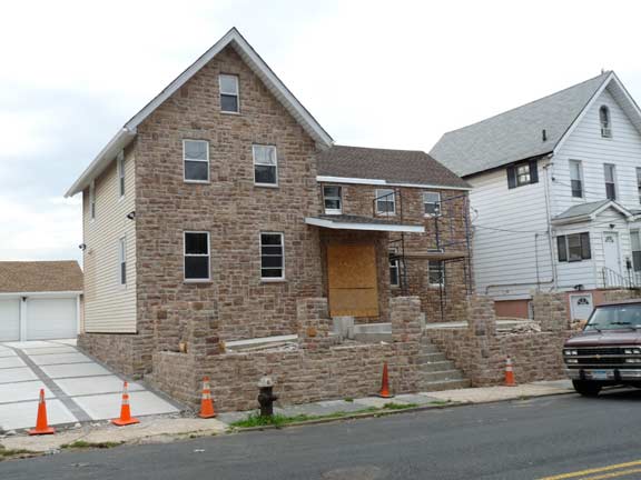
On this house on Clove Road, they’re adding a fake (or real perhaps?) stone cladding to the otherwise prosaic aluminum-sided exterior. Tin siding is, sadly, the default option in many parts of town since it’s the most effective and cheapest method of insulation. I once lived in a place on 73rd Street in Bay Ridge, and the cracks between the windows and sashes were so big the temperature in the room routinely dropped under 60 in the winter. I’d buy these long strips of insulation and jam them in the cracks and then cover with scotch-taped on cellophane, which only partially did the trick. I loved the place, though. In the winter I had a great view of the Narrows Bridge out the rear window. I worked nights then. A quiet time when everyone else my age was having a noisy time.
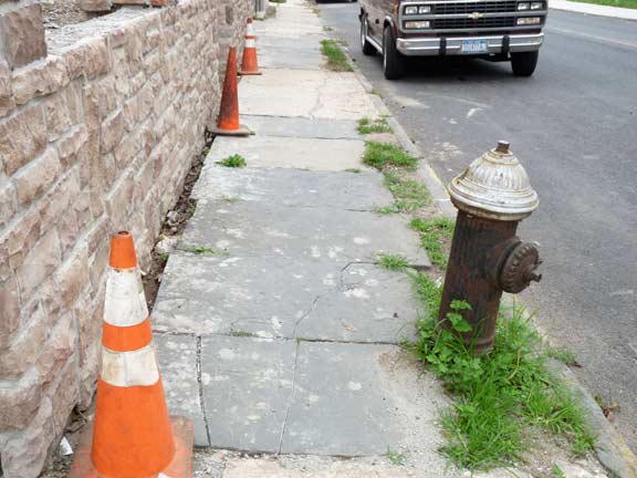
Care seems to be taken at the renovation that the bluestone sidewalk slabs are not unduly troubled. Such sidewalk pavings almost always denote neighborhoods that sprung up prior to 1920. Mixed concrete sidewalks didn’t become common until after that. In the late 1800s, when sidewalks first appeared, they were either large, ponderous slabs of stone or slate-like plates like this.
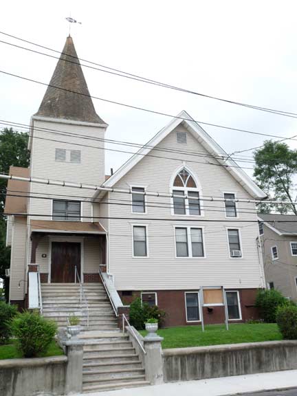
181 Clove Road is a standard aluminum-sided residence, but signs point to its once being a church. It was formerly the Salem Evangelical Free Church.
Clove Road has nothing to do with cloves or clovers. The name comes from a Dutch word cognate to our cleft, or divide between hills. Clove Road runs through a valley between Grymes and Emerson Hills (in that stretch it is now the service road for the Staten Island Expressway).
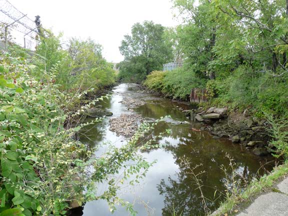
This is an inlet from the Kill Van Kull as seen from Richmond Terrace just east of Jewett Avenue. Known (to few) as Palmer’s Run, it runs generally south to Westerleigh mostly in sewers, but sometimes makes surprising appearances above ground, too.
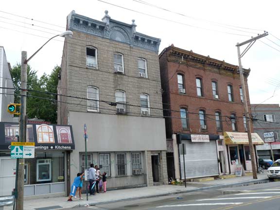
Southwest corner, Jewett Avenue and Richmond Terrace. Whether a building is old or not can be detected by the corbelling, or eaves treatment. In general when corbelling is present you’re seeing an old building — though corbelling has just recently come back as an embellishment on 2010s buildings as well.
At Jewett Avenue, Richmond Terrace, which twists and turns as a rule, makes an abrupt but brief jog to the northwest. Here’s a pair of 19th Century structures, recognizable as such by corbelling, among other features.
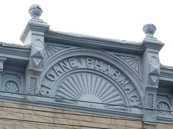
Long ago there was a Sloane’s Pharmacy, which likely occupied the ground floor when the building was constructed. Note the unusual apostrophe s treatment in the sanserif lettering. Toward 1900 there was a sanserif trend in signage. Also, note the sunrise on the facade — also a common motif.
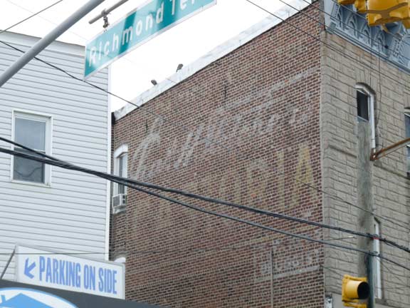
There’s an added attraction on the side of the house, a Charles H. Fletcher‘s Castoria ad. The mild children’s stomach treatment was likely sold at the pharmacy. Note the smaller sign lower right that reads “druggist.” The product was heavily advertised on radio when I was a kid and is still sold as “Fletcher’s Laxative.”
Fletcher (1837-1922) didn’t originally make the stuff. It was originally produced by Samuel Pitcher in 1868 and originally called Pitcher’s Castoria. Fletcher acquired the company in 1871 and immediately applied his name to it. He acquired great wealth; his mansion in South Orange, NJ still stands, and he rests with other bigwigs in Green-Wood Cemetery in Brooklyn.
There are still dozens of Castoria wall ads scattered all over NYC and other cities, many of which bear Fletcher’s signature. All of them were painted prior to 1920, and have borne up well in direct sun, so the paint quality must have been excellent.
JEWETT AVENUE runs from Richmond Terrace south to Victory Boulevard and generally speaking, forms the boundary between Port Richmond and West Brighton. The avenue is named for John Jewett and his sons, who ran a linseed oil and later, a white lead (a lead paint ingredient since banned for poisonous properties) factory on Richmond Terrace from 1830-1898. The Jewett-Taintor House, which formerly stood at 2105 Richmond Terrace in Port Richmond was the house where the last slave was born on Staten Island, Benjamin Perine (d. 1900). The large mansion was demolished in the 1950s. Slavery was outlawed in NYS in 1827.
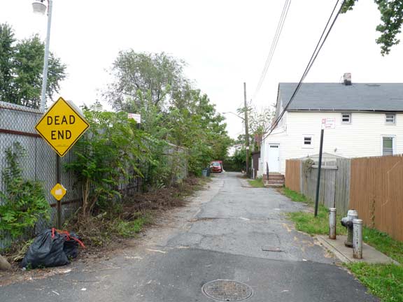
There are, perhaps, a handful of people in the world aware there is a Wygant Place in Staten Island. (The person who lives on it, and me.) Staten Island has more dead ends by far than any other borough, many of them built as part of real estate developments over the last 20 years. Wygant has been on the maps for decades and was probably named for a local family (see below for another.)
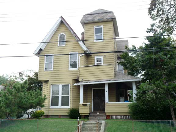
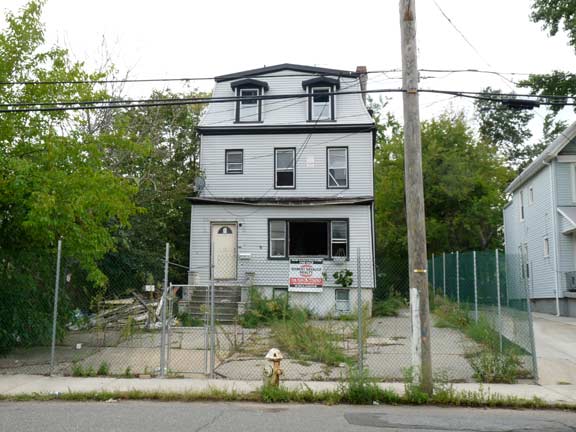
A couple of buildings in the vicinity of New Street on Jewett Avenue. Both were likely built within a few years of 1900 and both were long ago hammered into aluminum siding submission. The second building awaits its fate, razing or renovation?
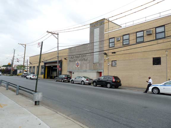
One of the largest bus depots on Staten Island at Castleton Avenue and Jewett. The bus from Bay Ridge runs along Castleton as it heads toward Port Richmond.
Castleton Avenue is one of 3 major east-west arteries in West Brighton into Port Richmond (the others are Forest Avenue and Richmond Terrace), running from Jersey Street west to Nicholas Street near the Bayonne Bridge. At its eastern end it has to take a lot of twists and turns to get around some hills. It is the main commercial street in the area along with Forest.
Castleton was one of the five towns of Staten Island before its absorption into New York city in 1898. (Brooklyn, across the Narrows, had six towns at one point that became the City of Brooklyn before it, too, was commingled with NYC). The town was named for the country manor house of Irish-born colonial-era NYS Governor Thomas Dongan.
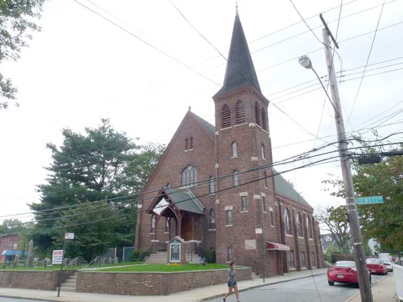
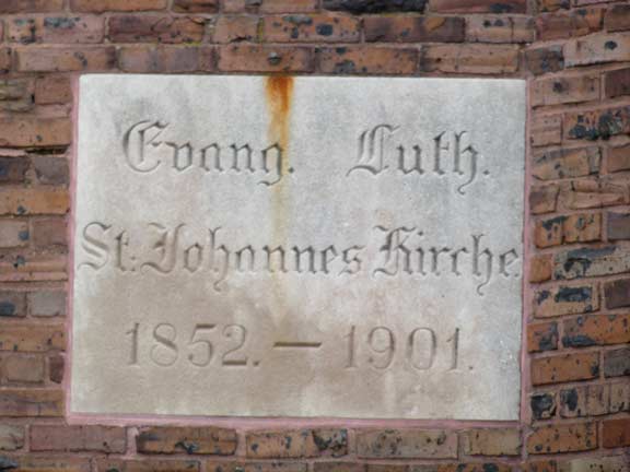
ST. JOHN’S EVANGELICAL LUTHERAN CHURCH, Jewett Avenue at Catherine Court. The Church was organized in 1852, and the present handsome Gothic structure was built in 1901-1902. There was an original German-speaking congregation.
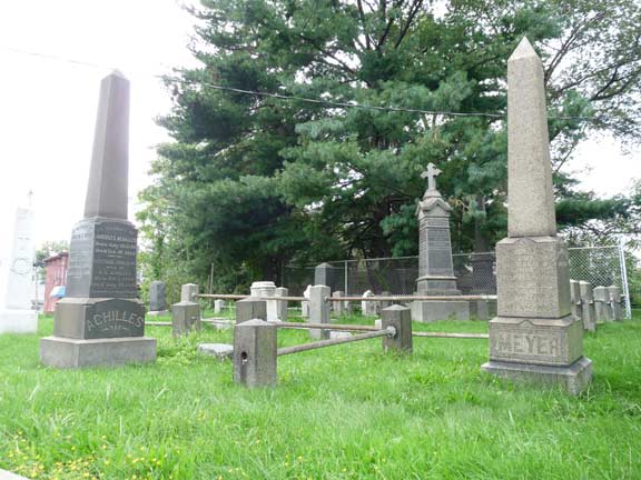
A charming aspect of many small town churches of a certain age is their accompanying churchyards where prominent congregants are interred. This churchyard, however, was not originally associated with St. John’s.
ForgottenFan Etta-Lee Heiman: The churchyard does NOT belong to St. John’s Ev. Lutheran Church. The church just maintains it. It is comprised of two sections. The front and side portion belonged to Trinity Methodist Church (North Side Methodist) when the church was located there in a clapboard wood frame building. The back portion, 1/4 acre corner of Simonson Place and Catherine Court, is the Hillyer Family Burying Ground.
And, people had great names back then.
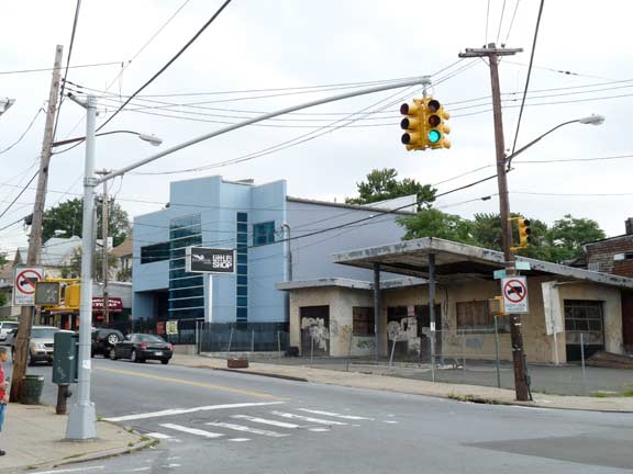
Jewett and Post Avenues. I had to snag this ultramodern building plopped seemingly in the midst of rampant “outer borough” general sh!tholiness. The sign says, Julia Music Presents Little Shop Studios. I gather, from their website, that it’s an event/performance space.
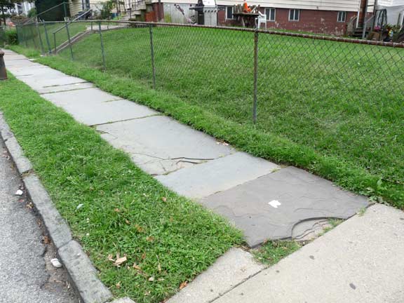
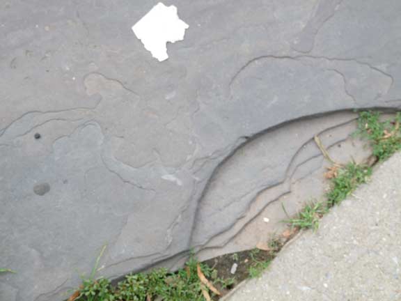
Dubois and Post Avenues. Once again the presence of a bluestone sidewalk means the neighborhood has a lengthy pedigree. I can’t resist closing up to these sidewalks because the striations in the stone are different in each one.
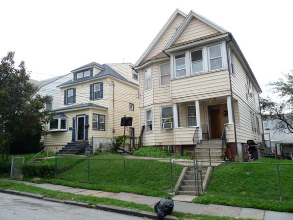
This building at Dubois and Post occupies a corner lot and has a large lawn, meaning it could have been of some importance at one time, but any individual detail has been subsumed under the siding.
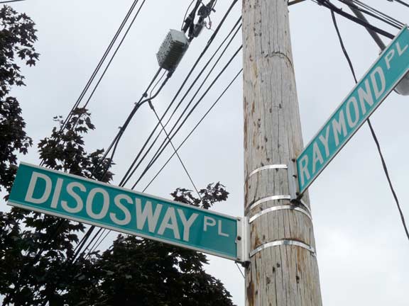
There’s a maze of streets in West Brighton lowlands in the vicinity of Palmer’s Run, which here is buried in a sewer. Brooks Place, Olive Street, Cornell Avenue, Raymond Place, Disosway Place are all interlocked, and you may find yourself wandering there for hours if you cannot find the way out.
Disosway Place, misspelled Dissoway or Dissosway on some maps, commemorates an apparently unique Staten Island family. There were families that lived for generations on Staten Island and never left for centuries, such as this one, the Journeays, the Sleights, the Deckers, that turn up in dozens of Staten Island’s cemeteries and street maps. To the west of here, there are street names that commemorate a Walloon, or Belgian Protestant, community. To the southwest a Huguenot, or French Protestant group is referenced. The names of Staten Island, more than any other borough, represent its demographic history.
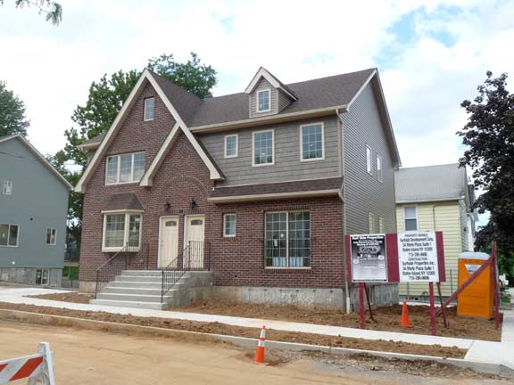
This is a brand-new house, on Raymond and Brooks Places. For once, a developer is getting it right.
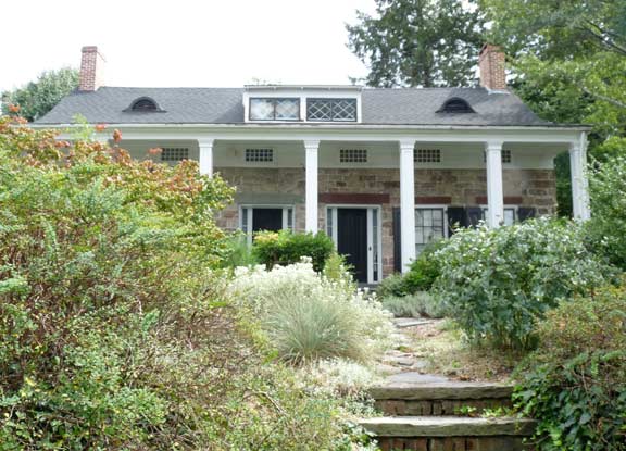
I headed further east on Delafield Avenue to visit #752, the Scott-Edwards House. The residence, a NYC landmark, was constructed in 1730 by Captain Nicholas Manning (at least some of it, since there have been additions over the years). The portico was added ca. 1840 by Ogden Edwards, the first NYS Supreme Court Justice from Staten Island and a cousin of Aaron Burr (whose final residence and decease were in Port Richmond).
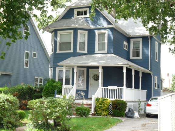
Pleasant frame house, porch, yard on Delafield just west of Clove Road.
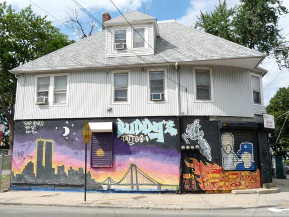
This is a fairly large building on the NW corner of Delafield Ave and Clove Road. The curve on the corner implies that the house is several decades old, though the siding camo makes any building looks like it’s from the blander later 20th Century. The tattoo shop promo graffiti shows the Twin Towers and Verrazano-Narrows Bridge.
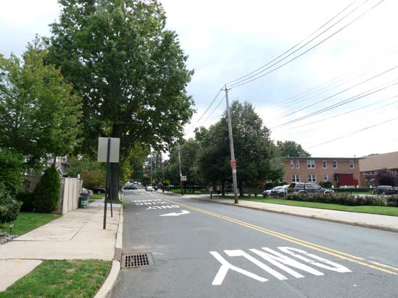
MANOR ROAD is a major north-south thoroughfare that runs from West Brighton south and southwest through Castleton Corners and then into the central Staten Island hilly area to Rockland Avenue, almost to Richmondtown. It was one of the first roads laid out in the area and appears on 1873 maps. It begins modestly at Delafield Avenue, with traffic controlled by only a blinking Cyclops light (the 1873 map shows that the portion of Delafield between Manor Road and Clove Road was originally a part of Manor.)
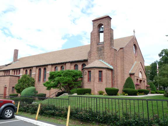
The Roman Catholic Church of the Blessed Sacrament was completed in 1952 at Forest Avenue and Manor Road. The name refers to the consecrated Host, or wafer, which according to the Catholic doctrine of transubstantiation becomes the actual body of Christ. The parish has been in existence since 1911 and celebrated its centennial in 2011.
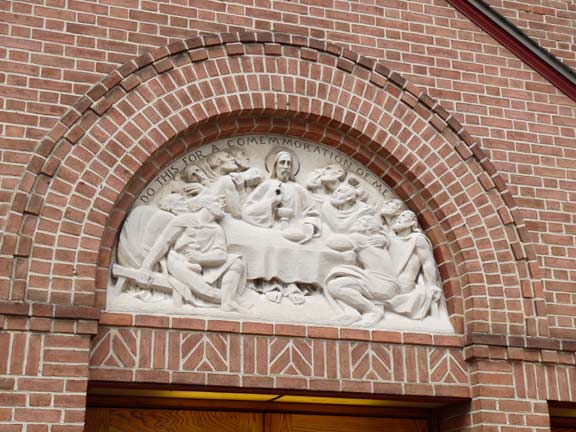
A frieze over the front door depicts the Last Supper, with Jesus and the 12 apostles just before His crucifixion. At the supper, Jesus announced that one of the apostles would betray Him. Note the misspelling of commemoration.
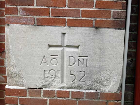
On the cornerstone, the abbreviations stand for anno Domini, Latin for ‘year of our Lord.’
Pressing further south on Manor Road, we enter a more expensive neighborhood and see some spacious plots and large houses. This is 50 Manor, on the SW corner of Forest.
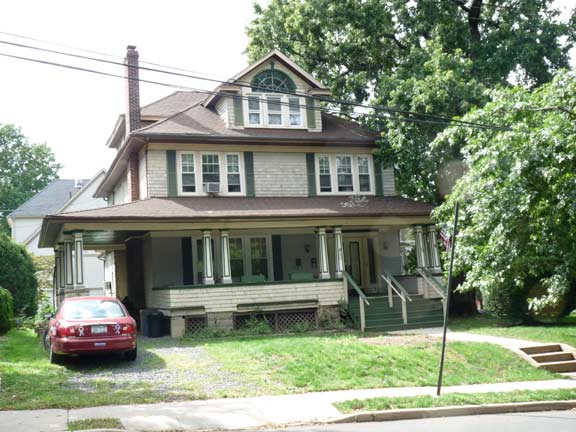
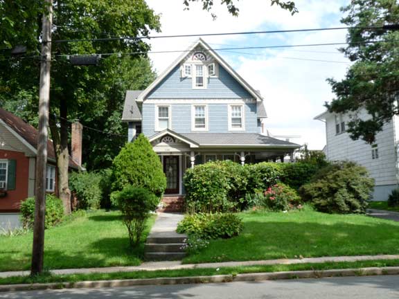
109 Manor shows some “stick style” Victorian frame house stylings. Once again, a shady porch and large lawn and hedges. We have seen the sunrise motif (below the eave) before, on Richmond Terrace.
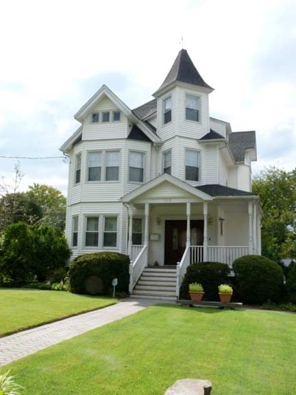
A distinguished residence at Manor Road and Egbert Avenue. The avenue, and the (tiny) town of Egbertville, commemorate Abraham Egbert (1695-1723), whose family occupied the area for generations.
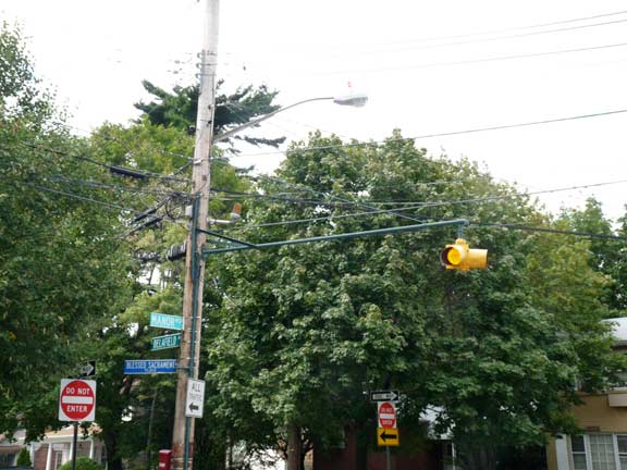
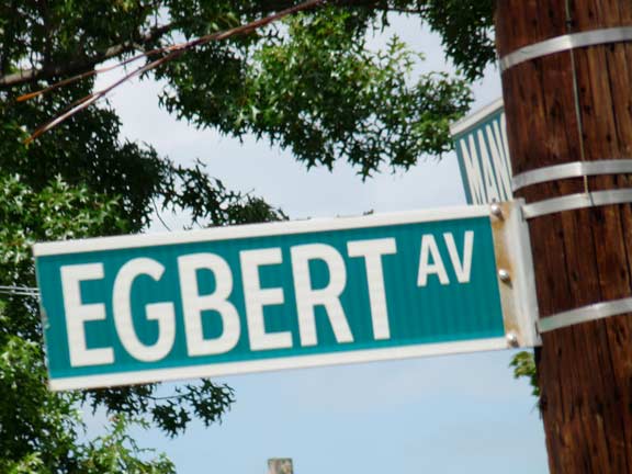
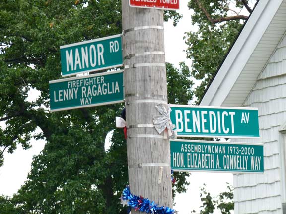
And now for a complete waste of money. This is a brand new street sign in the Cleartype font (replacing Highway Gothic). The signs are supposed to be set upper and lower case by federal mandate, but this all-caps Cleartype sign made it through the QC process. The old sign was exactly the same but in Highway Gothic.
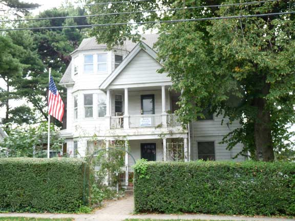
This house at Alpine Court and Manor Road is slightly more run-down than its neighbors.
Multiple street signs have appeared where a local firefighter or cop perished in the 9/11/01 terrorist massacre. In addition, longtime political representatives sometimes have their names added to utility poles. It all adds up to a sometimes confusing thicket of signs.
(The former practice used to be to simply bruit in a name change, like 6th Avenue to Avenue of the Americas, or 7th Avenue to Adam Clayton Powell Boulevard, but that kind of wholesale change is rarely done these days.)
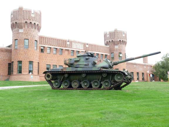
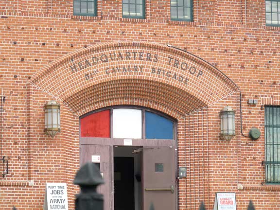
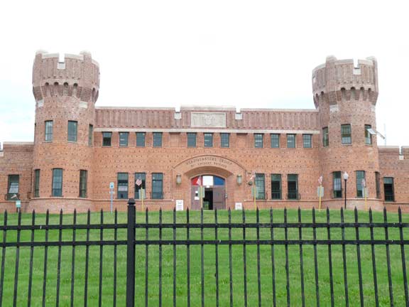
STATEN ISLAND ARMORY (51st CAVALRY BRIGADE), 321 Manor Road between Martling Avenue and Constant Avenue, the only National Guard facility in Staten Island. The armory is by the architects August Windolph and Harold Werner and was completed in 1927.
Two tanks on the lawn are for ornamental purposes only, though this armory did indeed once service tanks.
The armory sits on Manor Road, a prosperous street whose roomy, suburban-style houses are framed by sculpted banks of flowers and elegant, drooping trees. Inside the fortresslike structure, the hallways are flag-decked and lined with mementos: a braided uniform next to a beaver hat, dating to 1899, according to a small display card; a snapshot of soldiers encamped in Central Park before heading off to the Spanish-American War; and a rakish 1938 portrait of a future New York governor, Hugh Carey, then a member of the unit. The battalion standard, a giant gold flag with an eagle, is not in a display case yet. But for the past two weeks, it has not presided over the battalion commander’s office either. The battalion, which had about 300 soldiers in the armory and 200 others stationed elsewhere in the state, was formally extinguished by the state National Guard in a short ceremony on Aug. 20. The decision was part of a streamlining effort, which included a plan to establish a smaller force that will be based in the armory. NY Times, 9/3/06
The armory currently houses a tactical unit of the National Guard. It features a large stained glass window by Louis Comfort Tiffany, which was moved from the 14th Regiment Armory in Park Slope, Brooklyn, in the 1990s. The armory won Landmarks status in 2010. See this link for all architectural detail information.
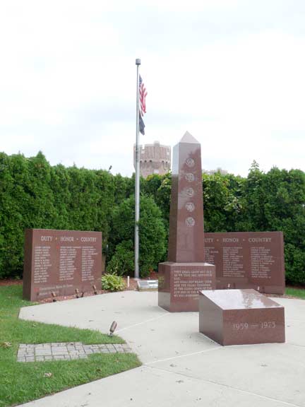
In the shadow of the Armory is the Vietnam Veterans Memorial of Staten Island. It’s relatively new — information on the memorial is sketchy on the internet, so send me some details. I hear the gate is shut weekdays to prevent neighborhood youth from desecrating it, so I was lucky I came by on a Sunday.
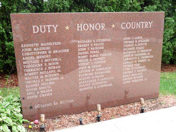
Names of the dead and missing in action are displayed on two slabs flanking a central shaft. The memorial, of course, includes the name of Father Vincent Capodanno, who earned a posthumous Medal of Honor for valor in battle.
For conspicuous gallantry and intrepidity at the risk of his life above and beyond the call of duty as Chaplain of the 3d Battalion, in connection with operations against enemy forces. In response to reports that the 2d Platoon of M Company was in danger of being overrun by a massed enemy assaulting force, Lt. Capodanno left the relative safety of the company command post and ran through an open area raked with fire, directly to the beleaguered platoon. Disregarding the intense enemy small-arms, automatic-weapons, and mortar fire, he moved about the battlefield administering last rites to the dying and giving medical aid to the wounded. When an exploding mortar round inflicted painful multiple wounds to his arms and legs, and severed a portion of his right hand, he steadfastly refused all medical aid. Instead, he directed the corpsmen to help their wounded comrades and, with calm vigor, continued to move about the battlefield as he provided encouragement by voice and example to the valiant Marines. Upon encountering a wounded corpsman in the direct line of fire of an enemy machine gunner positioned approximately 15 yards away, Lt. Capodanno rushed a daring attempt to aid and assist the mortally wounded corpsman. At that instant, only inches from his goal, he was struck down by a burst of machine gun fire. By his heroic conduct on the battlefield, and his inspiring example, Lt. Capodanno upheld the finest traditions of the U.S. Naval Service. He gallantly gave his life in the cause of freedom. wikipedia
I will continue this walk through Westerleigh on a future FNY page.
10/16/11



8 comments
[…] – as someone who grew up in Port Richmond, I even learned a great deal from it! But the author got the wrong impression: “The north shore of Staten Island is a fairly Godforsaken place. There, I have said […]
Hello, I am a resident of Staten Island. Although I do not live in the neighborhood, I am frequently in the Port Richmond area several times throughout the 7 days of the week. 181 Clove Road is still a church building, it now houses the First Church of God in Christ. Although I feel you did a very good job, you missed many historic churches and buildings that have been in the Port Richmond Area since before the 20th Century.
What happened to the beautiful gothic church on the. Corner of Delafield and Elizabeth St. I grew up on Roe St. It had a carillon. 44 Elizabeth st. Was purchased by my great grandparents,the La Piedras. My grandmother was born there. Later Howard Vanderbilt bought it, who married my aunt, Rae Decker. Large lot housed Vanbro Construction equipment. Blue stone sidewalks on both streets.
Thank you. I attended PS 19 and
Port Richmond H?s
The building you refeerto was at 641 Delafield Avenue. It was originally a Methodist church (I think United Methodist?) which became an Orthodox synagogue circa 1970 and existed as such until about 2005. It was also home in its later years to Yeshiva Tiferes Torah, a yeshiva high school. The synagogue rented space to the high school, which kept the synagogue functioning for its last decade.
I was an occasional congregant in the building’s Jewish phase from the late 1980s until the demise of the congregation.
As the congregants died and moved away, the building was sold and once more became a church but a fire erupted (some say it wasn’t such a coincidence) and today it’s all townhouses.
Here are some articles about the fire, it was called Trinity Methodist Church before it became Agudas Achim Anshei Chesed.
I have many memories of it in its Jewish phase, we called it the “Triple A” . That congregation was the oldest Orthodox synagogue on Staten Island and used to be on Jersey Street in Tompkinsville/New Brighton (it was founded in 1900, I believe) and then moved to Delafield/Elizabeth in West New Brighton circa 1970.
https://www.silive.com/timecapsule/2015/11/trinity_methodist_church_destr.html
https://www.dnainfo.com/new-york/20150930/west-brighton/suspicious-fire-destroys-vacant-staten-island-church-officials-say/
Our family were members of AAAC from before World War 1. After AAAC became defunct, the memorial plaques in the semi-abandoned (before it was sold by somebody)
Elizabeth St building, including ours, disappeared and no one could tell us what happened. Maybe the copper in the plaques attracted vandals. For many years, my late
father, Royal Miller, served on the AAAC board of directors and helped keep that building in working order by bringing in roofing contractors, etc.
Hi Bob,
I believe I remember your father, at least his name is familiar to me. I still sometimes see Carl Eisenberg at either Temple Emanuel or Toras Emes as well as Joel Cohen, who has moved to Bay Terrace.
Hi Bob,
I remember your father alav ha-shalom (or at least I recall his name).
I think I last went to services at AAAC was circa 2000 or 2001, for Rosh ha Shanah services, Rabbi Zacahariash was not doing well and his son Avi led the services.
The last time I was was for Sam Greenberg’s funeral, such a lovely man.
I still see Carl Eisenberg and Joel Cohen from time to time.