On Thanksgiving Friday I decided to walk the Harlem River area from Yankee Stadium north into Inwood, the most northerly neighborhood on Manhattan Island. Understand, though, access to the Harlem River is limited, as it’s lined with warehousing, industry and the twin barriers of the Major Deegan Expressway and the NY Central, now Metro-North, Railroad. There are fascinating bridges and scenery to be seen, though, as I had in mind when I selected the route. The Bronx ascends on a steep hill on the east side of the river, and wide-ranging vistas, curved streets, and unmapped staircases abound.
Getting to the Stadium is a snap from Little Neck, though not the most economical trip. The Long Island Rail Road, then the A and D trains, make it about a 75-minute voyage.
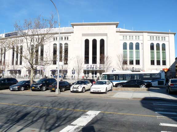
The New Yankee Stadium was built on the old site of John Mullaly Park between 2006 and Opening Day 2009. Its official name is simply Yankee Stadium, as the Steinbrenners have resisted the current method of selling naming rights to a corporation. I’ll always call it the New Yankee Stadium, though. You will forgive this Mets fan for mentioning that I had attended only about ten games at the old Stadium over the years, though I was there for Jim Abbott’s no-hitter in September 1993, Mike Mussina’s final victory at Yankee Stadium in 2008, and in the 1980s, I noticed Mitch Miller was seated in back of me behind third base. His dyed-black goatee was unmistakable. So far I haven’t attended any games at the new place, though I was furnished a tour of the Stadium in April 2011 by my pal Larry Steller, a Yanks tourguide. I got in the clubhouse and the dugout, places I never ventured into at old Shea in 40 years of Metfandom.
The Yanks opened the new Stadium in 2009 with a World Series championship season, just as they had with the old Stadium in 1923. When the Yankees returned to Yankee Stadium after a multimillion dollar renovation in 1976, they went to the World Series, but lost to Cincinnati.
A source of friction between the Yankees and the Bronx neighborhood surrounding the Stadium has been the slow replacement of John Mullaly Park. The good news in 2011 was that the new section of Macombs Dam Park and Heritage Field, in the footprint of the old Stadium, was finally completed. This view looks west from River Avenue. The dimensions of the old Stadium field are noted with a blue stripe. The Polo Grounds Houses (more later) loom in the background. The Big Bat, where so many Yanks fans have met before entering the park, has been permitted to remain.
This portion of the park provides the Bronx with a premier running track and 600+ person grandstand. In addition, it features a soccer/football field, eight handball courts, four basketball courts, fitness equipment, drinking fountains, storage space, misters, picnic tables, grass berms, and a new comfort station. This 7-acre area is completed and open to the public. NYC Parks
The Yanks had an opportunity to preserve one of the old Stadium entrance gates when the city was building Heritage Field, but declined to do so. However, a replica of the original Yankee Stadium upper deck frieze, popularly known as “the facade” appears behind the plate on the River Avenue side. When the old Stadium was renovated before the 1976 season, most of the frieze was removed, but a new steel and zinc frieze appears in approximately its old position in the new Stadium.
A short street on the west side of the old Stadium, Ruppert Place, has been replaced by a walkway called Ruppert Plaza, with flagstones commemorating Yankee Stadium highlights. In addition to 26 World Series championships, the old Stadium was the home of the football New York Giants; heavyweight boxing; religious conventions and rock concerts.
Brewery magnate Colonel Jacob Ruppert (1867-1939) purchased the Yanks in 1914 with partner Tillinghast Huston, a successful engineer. Ruppert bought him out three years later and became sole owner. Ruppert oversaw the beginnings of a five-decade Yankee “dynasty” that saw them win more World Series titles by far than any other major league team. A street on the western edge of Yankee Stadium between East 157th and 161st Streets, Doughty Street, was renamed for Ruppert in 1933. Doughty Street has a lengthy lineage, overlaying Cromwell’s Creek, or Doughty Brook. The Dutch called the now-underground rivulet Maenappis Kill, and the Indians called it Mentipathe.
This view of the south diamond in Macombs Dam Park faces about the same way the old Yankee Stadium did, i.e. the Bronx County Courthouse was over the right center field fence.
When the new Stadium opened in 2009, part of the agreement with the City called for a new Metro-North station. Fans arriving by rail can access the Macombs Dam Park plaza alongside the Big Bat and the new stadium beyond via a new truss bridge that spans the Major Deegan Expressway.
The Macombs Dam Bridge consists of two spans over the Harlem River linking 155th Street in Manhattan and Jerome Avenue in the Bronx. There’s a brotherhood of bridges spanning the Harlem between Manhattan and the Bronx. The 3rd Avenue, Madison Avenue, East 145th, Macombs Dam, and University Heights (originally Broadway Bridge, which we will see later on) were all designed by Alfred Pancoast Boller and all share a certain thematic style, with spidery ironwork and stone gatehouses on each end. All opened between 1895 and 1910.
From 1923-1963, the Polo Grounds (home of the Giants and then the Mets) faced Yankee Stadium across the Harlem River. The Polo Grounds Houses stand on the site today.
Farmer Robert Macomb opened the first drawbridge on this site in 1813, but annoyed neighbors by damming the Harlem River in the East 160s. After some years they tore down Macomb’s bridge and replaced it with a wooden swing span.
Finally, the City commissioned Boller to build this iron swing bridge in the late 1890s.
I continued north along the service road on the east side of the Major Deegan Expressway, which becomes Sedgwick Avenue at the beginning of Jerome Avenue. The road runs along the railroad, and the Harlem River, for miles and has been in place for well over a century and a half. Sedgwick Avenue commemorates Civil War Major General John Sedgwick, who was killed at the Battle of Spotsylvania Courthouse in 1864. The road had earlier been named for a revolutionary War-era enemy Hessian, Andreas Emmerich.
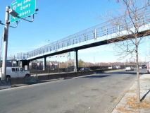
A nearly unused pedestrian bridge, guarded by a Type E lamppost, spans Sedgwick Avenue at about West 161st, now going to an abandoned park. I used this catwalk, however, in 1999 to access the platforms of the abandoned Sedgwick Avenue 9th Avenue el station. a tunnel runs beneath the hill to another abandoned platform, the Jerome-Anderson Avenue station. These, the last extant vestiges of the 9th Avenue El, connected to the Jerome Avenue Woodlawn el. We found the tunnel full of abandoned car wrecks. The City, alerted to the tunnel’s existence by railfans’ exploits, subsequently sealed the tunnel.
Though I didn’t photograph the tunnel interior, Mark Feinman has photos at NYCSubway.org.
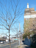
Up ahead there is a fork in the road where University Avenue (Martin Luther King Boulevard) branches away from Sedgwick, and here, a tall building with a FOR SALE sign, with a conspicuous sculpture of a lighthouse, looms into view.
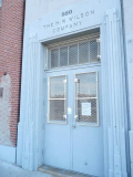
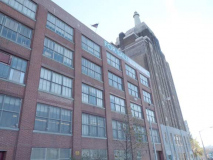
The building is the home office of the H(alsey) W(illiam). Wilson Company, an over 100-year-old bibliography and periodical index publisher.
The firm built its eight-story building with the lighthouse here in 1929. The lighthouse, shown perched on a book, is meant to symbolize “ guidance to those seeking their way through the maze of books and periodicals, without which they would be lost.” At night, the structure is bottom-lit: in 1998, the company’s centennial, the lighthouse was relit after being out of commission for several years.
Since its merger with EBSCO Publishing in Massachusetts in May 2011, the firm may be looking to sell its Bronx HQ.
The first of quite a few step streets I saw on this walk, running through High Bridge Houses at West 165th Street.
High Bridge Tower stands in High Bridge Park on the Manhattan side of the Harlem River east of East 174th Street.
The High Bridge Tower was the first tower of its kind to be built in NY and is currently the only remaining water tower. When it opened in 1872, Manhattanites viewed it as one of the most spectacular structures from which to gain views of the city and surrounding area. It was a site that people made trips out of and was marketed as such. It was constructed in order to provide water pressure to the recently-developed higher elevations of Northern Manhattan, which could not be serviced by the existing gravity-fed system.
The octagonal Tower consists of a base, a simple but high shaft, a louvered belfry, with conical roof surmounted by a lantern, spire and weather-vane. The rough cut stone base resting on a low footing is separated from the shaft by a shouldering of smooth faced stone making the transition from base of the tower to the shaft. The arched doorway is crowned by a massive horseshoe arch with heavy voussoirs carried on corbels at each side. It is a striking feature of the tower. Windows in the tower have handsome round arched drip moldings. The belfry contains a series of narrow round-arches louvered opening supported on large corbels. The conical roof above them likewise has a corbelled cornice. Croton Aqueduct
The Tower is presently closed to tours as the NYC Parks Department has determined that it requires a lot of structural repairs — part of the repairs will entail restoration of the carillon bells, which have not rang since 1957. Previously, the roof had been replaced after a devastating 1984 fire.
In the 1960s, New York Yankees players stayed at the Stadium Motor Lodge on Sedgwick Avenue near West 167th, but in recent years, the motel has become a homeless lodging, much to the consternation of neighborhood locals.
The 44th
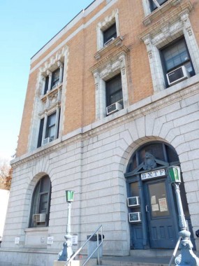
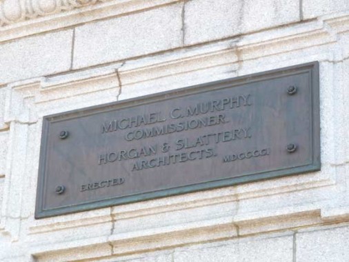
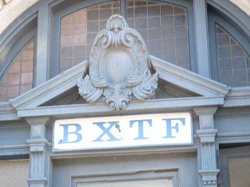
The old 44th Precinct House (1901), with the traditional pair of green lamps at the entrance steps, just north of the Stadium motel on Sedgwick, is the headquarters of the NYPD Bronx Task Force (a better photo can be found here)
A look at the 44th in 1989:
The NYPD BXTF is flanked by two motels. The one on the north side is a Howard Johnson Motor Inn. I had been unaware Hojo had Bronx bastions. The reviews are decidedly mixed.
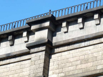
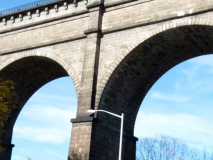
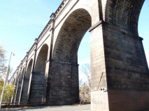
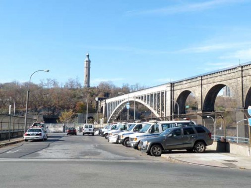
High Bridge, for my money, is one of NYC’s most distinctive bridges, rising high over the Harlem River on a series of concrete arches, some of which were replaced by a steel span in the 1920s to allow the busier shipping that the construction of the Harlem River Ship Canal produced. The pedestrian walkway has been closed since 1960s, but plans are afoot to someday restore it and build fencing that will prevent the vandalism that forced the bridge closure.
High Bridge, which connects High Bridge Park near West 174th Street, Manhattan, and West 170th Street in the Bronx, is the oldest remaining bridge connecting two boroughs. When the bridge was built between 1837 and 1848 by architect John Jervis, it actually connected two separate towns, since that area of the mainland would not become a part of New York County until 1874.
The bridge was built as a conduit to bring the City water from the upstate Croton Aqueduct . Originally, High Bridge featured massive stone arches (like Roman aqueducts had) for its entire length. The arches survive on the Bronx side, but the steel span was constructed in the 20s to allow navigation on the Harlem River. Water was carried in two 33”-diameter pipes, later replaced by a more massive 90” pipe. It was able to conduit as much as 24 million gallons of water per day.
High Bridge has featured a walkway since the 1860s, although it never had roads for auto or horse traffic. Edgar Allan Poe, a Bronx resident toward the end of his life, enjoyed frequenting the bridge. The walkway, closed since 1960, features attractive cast iron hand railings and interlocked red brick paving stones, along with views of High Bridge’s neighboring spans across the Harlem, the Alexander Hamilton and Washington Bridges.
Depot Place runs west from Sedgwick Avenue over the Deegan to Exterior Street. It is named for the former High Bridge NY Central Station formerly at its end. Spectacular views of High Bridge and its Tower can be gotten from here.
A little-used walkway runs from Sedgwick along the hill beside High Bridge to University Avenue, illuminated by a now-rare Type 8S curved-mast light post. There were in the first generation of modern octagonal shaft poles installed in NYC in the early to mid 1950s.
Hard to get close enough to the Alexander Hamilton Bridge from Sedgwick Avenue (better from a boat in the Harlem River or from Washington Bridge). The Hamilton arch bridge connects the Trans-Manhattan Expressway (and the George Washington Bridge) with the Cross-Bronx Expressway; it opened 1/15/63 along with the westernmost section of the Cross-Bronx. The bridge and its ramps (known to Bronxites as The Corkscrew) were undergoing major repair and rehab in late 2011. The bridge carries both Interstate 95 and United States 1 traffic. The much older Washington Bridge (see below) had previously carried all traffic over the Harlem.
Running parallel with the Hamilton Bridge is the much older Washington Bridge connecting West 181st Street in Manhattan with University Avenue in the Bronx, with ramps and approaches connecting to the Trans-Manhattan and Cross-Bronx Expressways. The bridge opened in December 1889.
Because of the relatively deep and narrow valley that surrounds the Harlem River, the large arch design was particularly well suited to the site. The two main arches of the Washington Bridge are 510 feet long, and consist of riveted plate girders with a maximum depth of nine feet. Each of the main arches has a clearance of 135 feet above mean high water.
The length of the main spans exceeds those of the Eads Bridge across the Mississippi River in St. Louis, a bridge that is often considered the most impressive steel-arch bridge of its time. Each of the main spans is actually made up of six parallel arches that carry the traffic loads to the masonry foundations. The multi-ribbed, plate girder arches reveal the artistic sensitivity of the designer. On the Manhattan and Bronx approaches, a series of masonry arches supplement the two main steel-arch spans. NYC Roads
From this redoubt I was unable to obtain a great photo of the Washington (originally the Harlem River) Bridge. I ascended a hill on Undercliff Avenue — the masonry arches would be better seen from Sedgwick, but it’s a dark shadowed area and discretion is the better part of valor in the Beautiful Bronx. I did walk the bridge in the spring of 2010 and it’s longer than it looks on the maps.
Alida Hall is a relatively nondescript apartment building on Undercliff but I noticed an ancient wrought iron Apartments to Let (rent) sign advertising Electrolux refrigerators, which are still made. I turned up the saturation to make the magnificent rust stand out. The Bronx is the Borough of Apartment Houses, with more per square mile than any other borough save perhaps Manhattan.
The Sedgwick Houses were built between Sedgwick and Undercliff Avenues to take advantage of the river views. According to legend, hip hop was invented at the Sedgwick Houses with a two turntable set up by Kool Herc (Clive Campbell) at parties in the recreation room here.
Originally the small, cottage like homes on the west side of Undercliff Avenue all had terrific river views.
Some no longer do, though.
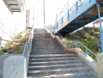
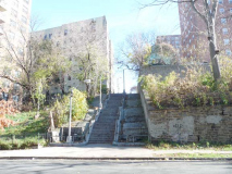
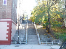
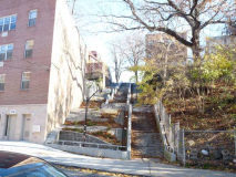
Step streets at West 174th, 175th and 176th run up the hill between Undercliff and Popham Avenues. The latter was named for Irish Brigadier Major General William Popham, the last general serving Washington during the Revolution to survive (1752-1847); he married into the Morris family and had land holdings in the area where his avenue runs.
This Undercliff Avenue house has a long, sloping lawn and is older than many of the fellow homes on the street.
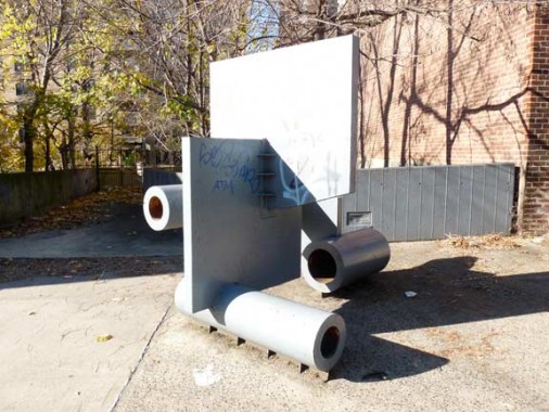
This is either an art piece, or has an industrial function of some kind. With modern stuff, you never quite know for sure.
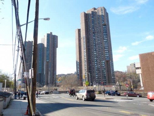
Eventually Undercliff Avenue ends at Sedgwick, where it began about 10 blocks to the south. To access the river, I went a short way south again on Sedgwick and encountered two of the Bronx’s tallest buildings, the River Park Towers. Architects Davis and Brody also designed the Waterside complex on East 34th and the East River in Manhattan, which this resembles.
The Towers, which sit next to Robert Clemente Park a few minutes drive from Yankee Stadium, sit on a prime piece of real estate. In 1974, when its doors first opened, city officials and planners lauded it as the first modern high-rise for the poor. But things quickly fell apart.
[Leon] Johnson [president of the Tenant’s Association in 2010] watched the women plant and reminisced about the early days of the Towers. Before he moved to the building in 1981, he used to drive down Harlem River Drive at night and stare at the Towers, its 40 stories lit up like beacons in the darkness. “I wanted to live there,” he said.
When he got to the Towers the floors shined like glass and fancy draperies hung in the windows, he said. But when RY Management took over the building a few years later, the floors turned dull. Men came one day and took down the draperies. Johnson and other tenants thought they were taken to be cleaned, but the curtains never came back.
Residents complain about the elevators, garbage and vacant apartments, and request repairs, but management is either slow to respond or doesn’t respond at all, Johnson contends. Department of Buildings records show a long history of broken or unsafe elevators. Residents in one section of the building complained that elevators were hurtling past floors. In the other, residents complained that some elevators had not been working for more than five years. There are currently eight open complaints, all filed last month, that say three out of four elevators—and sometimes all four—in one section of the building do not work. City Limits
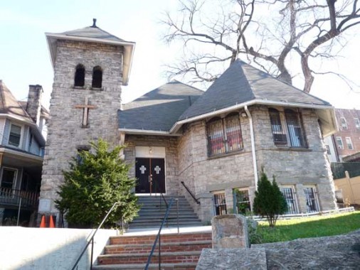
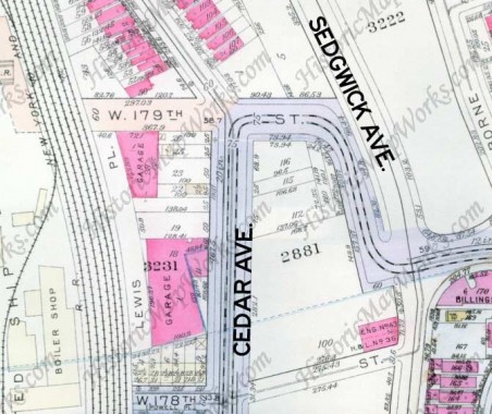
St. Matthew’s African Methodist Episcopal Church at Sedgwick and Cedar Avenues. I am unsure of the church’s age but a 1923 property atlas shows it in place as the Morris Heights Methodist Episcopal Church.
Roberto Clemente State Park runs between the Harlem River and the Metro-North Railroad’s Morris Heights station for 25 acres. The facilities include a multi-purpose recreation building, an Olympic-size pool complex, ball fields, basketball courts, picnic areas, playgrounds and a waterfront promenade. It is named for Clemente, the first Latin superstar in the major leagues; he played for the Pittsburgh Pirates (1955-1972) on two World Series victory teams. He was killed in a plane crash December 31, 1972 on a plane bringing supplies to Managua, Nicaragua, which had been struck by a damaging earthquake. He had his 3000th hit in his final regular season game.
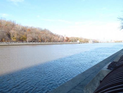
For what’s ostensibly a Harlem River-side walk, Clemente State Park provides the only unfettered public access to the shoreline because of the presence of the railroad. The view is of High Bridge Park, which has resisted city efforts to clean it up and make it safe despite its status as one of Manhattan’s larger parks, following Central and Riverside Parks. The roadway on the Manhattan side facing the river is the Harlem River Drive, the northern extension of the Franklin Roosevelt Drive.
Pay binoculars in NYC have resisted inflation over the decades. As far back as I can remember, they have always cost a quarter.
Tremont Avenue begins at Clemente State Park and the Morris Heights Metro North station. The longest street entirely within the Bronx, it runs from here east to the East River in Throg(g)s Neck; it was developed by accretion of several shorter routes. The name was suggested by a 19th Century Morrisania postmaster named Hiram Tarbox for three hills in the area which have since been largely leveled: Mount Hope, Mount Eden and Fairmount. In the Bronx, it’s pronounced TREE-mont, but in Boston, which also had three now-leveled hills, Tremont Street is pronounced TREM-ont.
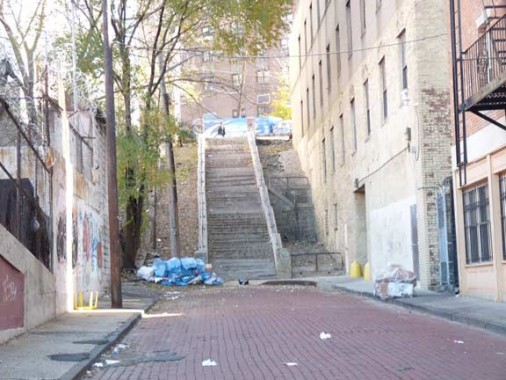
Between Cedar and Sedgwick Tremont is reduced to a step street, with a short stub still sporting now-rare red brick paving stones.
A number of very old homes on the east side of Cedar Avenue (the east service road of the Major Deegan) have survived, built on a crest and needing lengthy staircases to access.
For a lengthy stretch the only vehicular access between Cedar and Sedgwick Avenues is West 179th, now part of an off ramp of the Deegan (which now runs west of Cedar Avenue). The angle is so steep the road was built along a reverse S-curve to modify the pitch.
Above two: West 179th ascends a steep hill in an S-curve.
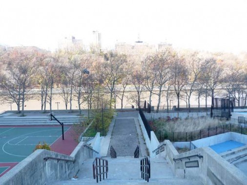
Two views of Cedar Park, one from the bottom of the hill and another from the top, show clearly the steep elevation.
Upon attaining Sedgwick Avenue at the top of the hill, a short climb up another hill rewards you with a view of the back side of the Hall of Fame for Great Americans, located in the Bronx Community College campus.
Open every day of the year save selected holidays, the Hall has been one of the great ignored treasures of NYC since 1901, a domed colonnade featuring 93 busts of Americans of great achievement from the worlds of politics, science, literature and the military. It was among the very first features on Forgotten NY in 1999 and was a stop on ForgottenTour #2 on July 18 of that year.
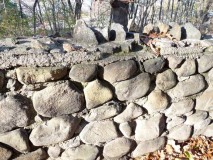
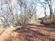
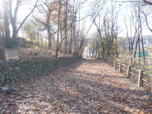
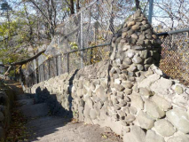
University Woods, on the left side of Sedgwick below the Hall of Fame, is a similarly little-known mostly undeveloped park area alongside the cliff looking down toward the Harlem River. It features cobblestone/concrete fences (some of which sport stone bum spikes). The area became a park in 1899 after being acquired by the City from New York University, which formerly occupied the Bronx Community College campus.
University Woods is a forested area situated on a steep slope overlooking the Harlem River. It commands an impressive view of Upper Manhattan, and a glimpse of the Hudson River and New Jersey Palisades. During the American Revolution, the site proved strategically important for British forces in their efforts to maintain control of New York City. Several small forts lined the river and formed part of the British stronghold. British Fort #8 occupied the crest of the ridge now known as University Woods. This obstinate fort defied assault until the end of the war. NYC Parks
In January 1960, Dr. Theodore Kazimiroff undertook a dig on the NYU campus and found numerous artifacts from the fort, including rum bottles, pipes, cannonballs and regimental uniform buttons, as well as a complete fireplace and kettle! Kazimiroff had a section of Southern Boulevard in Bronx Park named for him for a number of decades, until the road was renamed Southern Boulevard by the City.
There’s a hint of former magnificence (that has been swaddled under siding) about this gabled, dormered dwelling on Sedgwick north of University Woods. A day nursery school is located on the ground floor.
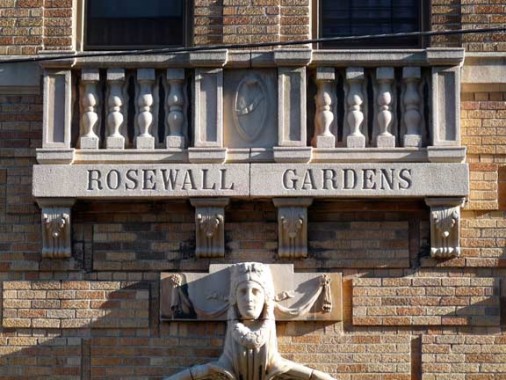
A pair of apartment buildings on Sedgwick just south of Fordham Road catch the afternoon light just right. The name reminds me of the Aussie tennis champ Ken Rosewall, whose lengthy career ran from the 1950s into the 1970s.
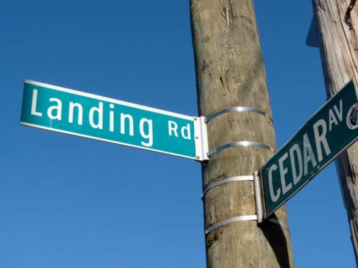
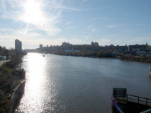
Landing Road is a short street running downhill from a bend in Fordham Road to the Deegan Expressway. It provides a good view of the Harlem River and the 207th Street Subway Yards beyond. Formerly Old Fordham Road, it was renamed in 1916.
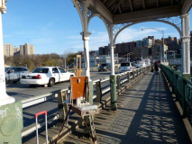
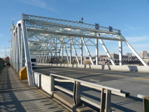
The University Heights Bridge, completed in 1906 (Alfred P. Boller; see Macombs Dam Bridge, above) spans the Harlem River between Fordham Road and West 207th Street in Inwood, Manhattan.
See this FNY page for the full scoop.
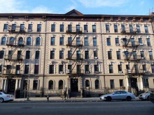
After lunch at Jimbo’s Hamburger Palace at 10th Avenue and W. 207th in Inwood, I turned left on Sherman Avenue, marvelling at its monolithic collection of apartment buildings…
…and hand painted and hand lettered sign near Dyckman.
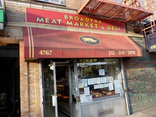
I was going to finish up at Broadyke Meat Market, and leave it at that, but upon entering the subway to catch the A train …
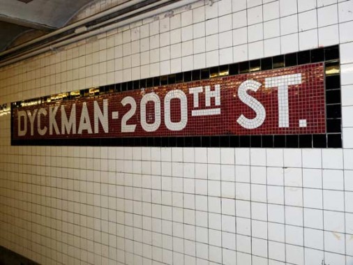
…I noticed an oddity on the 1932-tiled INDependent Subway signage. Nowhere in Manhattan or the Bronx is there a 200th Street — in the Bronx its place is taken by Bedford Park Boulevard. And, on every map I consulted going back to the 1880s, Dyckman Street is Dyckman, not 200th. For a few decades, the MTA was affixing black and white Unimark-type 200th Street signs in Helvetica on the station pillars, but has removed most, if not all of them.
So, this is not a case where the IND signage is preserving an archaism, as at Ely/23rd Street or the Rowan Street signs at 65th Street. The only thing I can think of is that in the 1930s there was a plan afoot to rename Dyckman Street (which commemorates the colonial-era landowners whose farmhouse still stands at Broadway and 204th) as 200th Street. Other than that, you got me.
Sources: John McNamara’s History in Asphalt and McNamara’s Old Bronx.
Photographed 11/25/11; completed 11/27




























28 comments
the parks dept. should make a greenway/park conecting inwood hill park and high bridge park
Check out recently-opened Bridge Park and Mill PondPark, both on the Bronx side of the Harlem River. A shoreline greenway is on its way, piece by piece.
Great info, as always! Thanks for another fun page!
Remember the horrific derailment of 4 train near 14th Street in the early 1990s? I believe the operator of that errant train lived in River Park Towers.
Right u are. His name was Robert Ray, or something like that.
Allegedly, he was high on crack when the tragedy occurred.
Well done! I’m really enjoying this post
There are other water towers in nyc. On Staten Island there are two others. One is on Howard Avenue next to the entrance to St. Johns University. The other is on Forest Hill Road by Walcott Street, by the back entrance of the College of Staten Island.
Nice unflinching view of the way it is.
I speculate that “200th St” is used simply to suggest where you are in the street grid. The next stop, 190th St, references a real street, but the only entrance is a block north of that street, so it also seems to be just for reckoning.
Walsh,whats that in front of the pay binoculars?A sundial?
That looks like a tremendous walk. The Bronx has always seemed like another world to me and you made it come alive.
.
.
As always . . .great piec.
Waterside is at 25th St.
PegLegGuy
.
Loved this, love your site. I was only in NYC for a few months over three years in the mid fifties–your photos show me the NY that I only suspected was out there, and is so much more engrossing than standard NY photologs.
This is pretty minor, but I believe the “frieze” replicated at the ballfields on the Yankee Stadium site is not a replica at all, but rather a portion of the old frieze that used to adorn the old stadium. Great read!
. . The 2 sections of Frieze that is part of Heritage Field is made of concrete and was from the Frieze that hung above the outfield scoreboard in the Renovated Yankee Stadium.
That frieze was a replica of the copper frieze that hung off of the roof of the original Yankee Stadium.
Kevin, this brought back ancient memories buried in my childhood past. Can’t thank you enough for this page and, as always, your blog (my favorite).
The City University of NY purchased the New York University Bronx Campus in the 1970’s (I took a summer Spanish class there), not 1899. I would have loved to join you for the walk as a former Bronxite I could have pointed out additional interesting items along the way.
Great memories. I grew up on 165 St and Anderson Ave. and ” the River” as we affectionately called the Harlem was my stomping grounds. From the park(which we called “Green Park” because it was all grass and trees) near Yankee Stadium to the area under the Highbridge , that you could drive to to get to the commuter railroad station(directly west of the old 44th precinct building), this was my home away from home. HW WIlson was my first job in 1962 and my mom worked there for 25 years. The abandoned El(tunnel) between Yankee Stadium and the Polo Grounds was our “haunted house”. It was a wonderful childhood.
Hey Cliff, I was a kid living at 1081 Anderson in the sixties. I also explored the old tunnel. Some of us even found a way to get into the D train tunnel. The secret is knowing where the best place to go sledding was. A block from where the 44th cops got heroes for lunch. It’s alarmed up like Fort Knox today. Love your stuff Kevin.
Dennis Harper
I walked across the High Bridge what we called the foot bridge to the tower many many times and then went to the pool …called High Bridge Pool…………..at 10 cents mornings and 25 cents afternoon…………great pictures
I haven’t lived in NY for many years (born and raised in Queens), so I found this very enlightening. Thank you for the info.
fond memoirs of times and friends growing up in highbridge —-waiting for bridge to be reopened for another walk across i used to take with my father and brother to get to highbridge pool
Great piece. I took this virtual stroll as a meory laden trip to my poast. I grew up in the areas of NYC and I am happy to see development and maintenance to many of the places but sad abt neglect and and stuff . Thanks for sharing, great pics and info.
Nice post. I learn something totally new and challenging on websites I stumbleupon every
day. It will always be exciting to read content from
other authors and practice something from other web sites.
Check out my web blog; online marketing portfolio (http://www.slideshare.net)
The photo of the building (1590 Undercliff Ave.) where it is described as the “birthplace of hip hop” isn’t. That building pictured (1590) isn’t even on Sedgwick Ave, that is on Undercliff Ave. The birthplace of hip hop (music) is 1520, on Sedgwick Ave. The community center wasn’t large enough for the party-crowd so they took it down to Cedar Park, which is a few blocks (walking-distance) south of 1520 Sedgwick Ave.
I have no idea how I missed this page originally, as it features a walk up my home street, Undercliff Ave. Quite a story can be written how this street survived during the 70s thru the crack days of the early 90s. Might worth a revisit after the opening the the High Bridge.
Great walk through my past. I grew up on University Ave., which parallels Sedgwick at the top of the hill, in Highbridge and lived there from 1944 through 1971. When I returned from military service in 1968 I found a very much changed neighborhood. From ’68 onwards I worked in an office on the Grand Concourse from which I watched much of my old ‘hood literally burn down. My old apartment building stood gutted for several years but has since been rehabbed, as has much of the area.
Many thanks to the photographer/narrator.