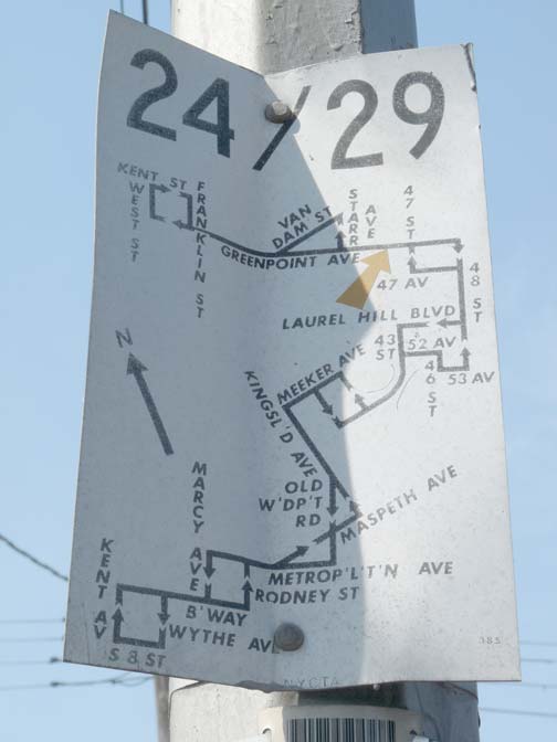
The Transit Authority (it was called that once) posted small bus route maps on the nearest available utility poles at bus stops in the Swinging Sixties. This one appears at Greenpoint and Gale Avenues at the Calvary Cemetery entrance. The #24 doesn’t follow this exact route anymore, and the #29 is a dim memory.
In the 1990s, the MTA began posting more detailed bus maps and schedules, but the cardinal rule is, the schedules are guesstimates at best!
4/9/13


5 comments
I like the way they abbreviated ‘Metropolitan’, with the apostrophes taking up just as much space as the actual letters would have.
Also notable was that its terminals were Kent Ave and Kent St
I remember seeing another map like that in Queens at the Union St @ Bayside Ave stop for the Q14/16/20/44 about 10 years ago. I know I took a photo of it, but then the external hard drive that it was on literally crashed. 🙁
As for bus schedules, I’ve been making use of “Bus Time” in the Bronx. Proving to be helpful when not wanting to get impatient with the posted schedule.
In the mid-60s the TA began producing small metallic maps like this one all over the system. This route was actually one that carried the moniker 24/29 because it was combination of the two separate routes B24 and B29 that were later combined because they had a common terminal near 48th Street and Queens Blvd. Today’s route is known as the B24 and is not much different from the B24/29 routing except that its south terminal is at the Williamsburg Bridge Plaza. Originally the buses went another mile west to the waterfront at Kent Ave. and Broadway.
I remember those bus signs quite well. In Manhattan, they were mass produced so that more than route typically appeared on the map. Problem was that the same map often appeared at stops where only some of the routes listed actually operated. Case in point were the 5th Avenue routes 2, 3, 4, 5, and 15 (now Q32). They fanned out from Midtown but even at stops along Riverside Drive, where only Route 5 stopped, the map with all five routes was posted at every bus stop.
Does this map predate the eastward expansion of the LIE? 52nd Avenue is basically where the LIE is right now, & there’s no way to get down off the bridge before 48th Street.