Your webmaster has never been an oceangoer, beach comber or even gone fishing, despite my admiration of mermaids and crab cakes. New York is nearly completely surrounded by water, however, and as Herman Melville observed in Chapter 1 of Moby-Dick, there’s a pull to the shoreline…as in going down to the shore, just to look at the watery expanses… that even the most avowed land-lubber can’t deny:
Circumambulate the city of a dreamy Sabbath afternoon. Go from Corlears Hook to Coenties Slip, and from thence, by Whitehall northward. What do you see? Posted like silent sentinels all around the town, stand thousands upon thousands of mortal men fixed in ocean reveries. Some leaning against the spiles; some seated upon the pier-heads; some looking over the bulwarks of ships from China; some high aloft in the rigging, as if striving to get a still better seaward peep. But these are all landsmen; of week days pent up in lath and plaster — tied to counters, nailed to benches, clinched to desks. How then is this? Are the green fields gone? What do they here?
I can answer Ishmael: it’s a combination of the desire for relaxation and a thirst for the mysteries of what lies beneath the surface and what lies beyond the horizon. In my case, as when I took a boat ride from Sheepshead Bay to Far Rockaway, it was driven by a desire to scout out new Forgotten locations to chronicle.
WAYFARING MAP: Sheepshead Bay – Far Rockaway
Our excursion boat sailed from a Sheepshead Bay jetty as a large thunderstorm approached. Sheepshead Bay, along with City Island, is one of two New York City fishing villages. Sheepshead Bay is far from what it was…its focus has shifted from commercial fishing over the years to excursion and casino boats that travel past NYC jurisdiction. It’s now a lively retail center (as you see from the Loehmann’s) and nightlife mecca, despite the loss of Pip’s Comedy Club and, for a second time, Lundy’s, in recent years.
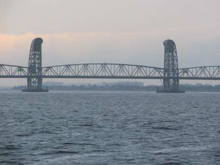
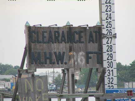
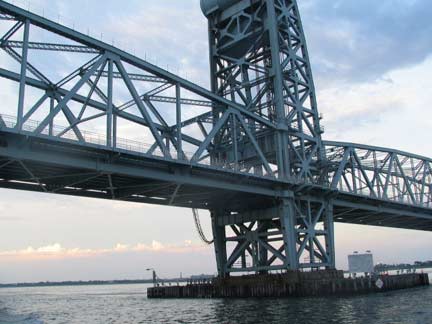
Despite some rain this storm was more bark than bite. Quickly leaving Sheepshead Bay and entering Rockaway Inlet, the Marine Parkway-Gil Hodges Bridge quickly loomed into view. The vertical lift bridge, opened July 3, 1937, connects Flatbush Avenue and Riis Park on the Rockaway peninsula; it is approximately 4,000 feet in length and can rise as much as 135 feet above the water. We are looking at the center span, which can be raised to allow tall shipping to pass beneath. It wasn’t necessary in our case though.
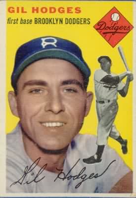
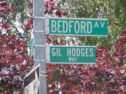
Hodges, a native of Princeton, Indiana, played for the Brooklyn and Los Angeles Dodgers and the New York Mets from 1947-1963 (having appeared in one game for the Dodgers in 1943 and entering the military afterward). Despite 370 career home runs and seven straight seasons of more than 100 runs batted in, he has never made the Baseball Hall of Fame. During his time in Brooklyn he and his family resided in Midwood, where a stretch of Bedford Avenue bears his name. As a manager he led the New York Mets to their first world championship in 1969, using the perennially effective combination of pitching and defense, as well as a platoon system rarely employed in today’s game. A heavy smoker, he suffered a massive heart attack that killed him in April 1972 at the young age of 48, and the bridge was named for him six years later.
Jamaica
Jamaica Bay is New York City’s equivalent of the Mediterranean Sea, linking various communities as Sheepshead Bay, Howard Beach, Belle Harbor, Howard Beach, Broad Channel, Edgemere, Bayswater, Inwood and Meadowmere. Once one of NYC’s prime fishing and oystering centers, its waters were sufficiently polluted by 1916 to put an end to its once thriving shellfishing businesses. It took over 5 decades, but the Clean Water Act finally made dumping and polluting illegal by 1972 and the big bay has since made a comeback as a nature preserve and for amateur fishers. The Jamaica Bay Wildlife Refuge in Broad Channel was established in 1953 and is home to dozens of species of seabirds as well as turtles and other wildlife.
Jamaica Bay is full of islands and channels whose names, given by sailors over a century ago, have names whose derivations have been lost in the mists of time: Point Elders Marsh, Old Swale Marsh, Nestepol Marsh, Grass Hassock, Jo Co’s Marsh, and many more known and seen only by local mariners.
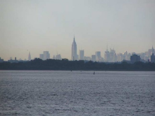
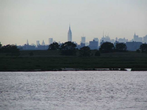
The King of All Buildings and its attendants are a constant marker in Jamaica Bay. Here they loom over Floyd Bennett Field. We can see that the sun is shininig over Manhattan as it soon would here.
The storm quickly retreats to the Atlantic Ocean over the Rockaway Inlet and Belle Harbor.
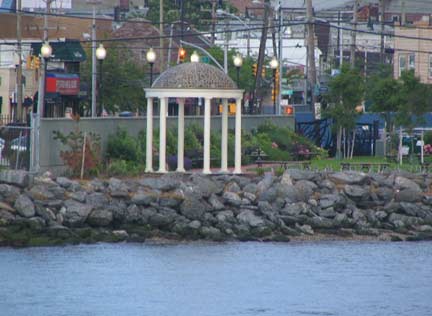
Rockaway Park’s 9/11/01 Memorial at Beach Channel Drive and Beach 116th Street
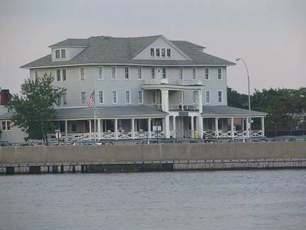
Nearby is a building that is seemingly coated in vanilla frosting, like a wedding cake.
Looking south at Beach Channel Drive and then west toward Riis Park and Breezy Point. The storm is now over the Atlantic and we have sailed quite a bit past the Marine Parkway-Gil Hodges bridge, which is now just a hint on the right.
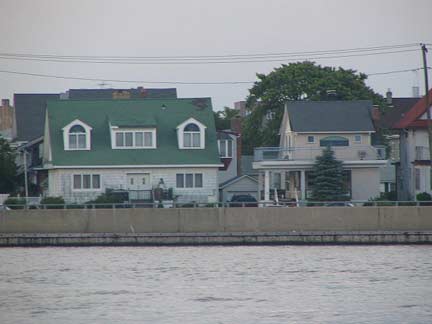
Beach Channel Drive, Rockaway Park. There are several odd buildings, some old and grandiose, some young and crappy, that are ripe for investigation.
We have been sailing in the Rockaway Inlet right along the Queens-Brooklyn borough line. At Little Egg Marsh, above, the line zags northeast and we are entirely in Queens.
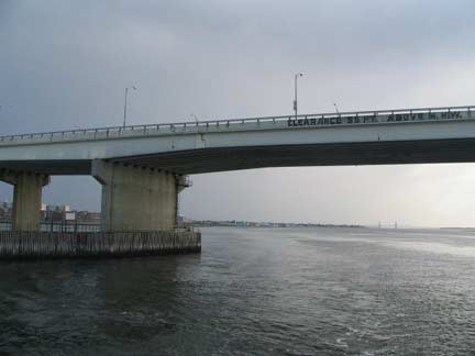
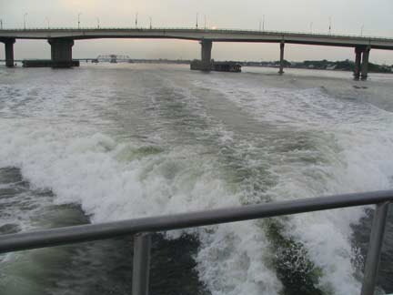
We have arrived at what is officially called the Cross Bay Parkway Bridge, a 3000-foot span that carries Cross Bay Boulevard over Rockaway Inlet to the peninsula. Got it? It’s 55-feet above the water and is the third bridge to span here, replacing a pre-World War I concrete trestle and later, a Robert Moses-ordered drawbridge that opened June 1939.
The newest incarnation opened May 28, 1970; the drawnridge had proved a traffic bottleneck and the new bridge was built high enough to permit all water traffic to pass.
Like other parts of Queens the Rockaway peninsula consists of a series of small towns that were knitted together, whether they desired it or not, when Queens became a borough of New York City in 1898. The Cross Bay Parkway Bridge enters what used to be the town of Hammels.
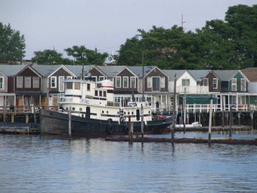
Long Island Rail Road and later subway and passing boat traffic has always been surprised to see fishing shacks built on stilts jammed into the bottom of Broad Channel (both the Jamaica Bay channel and the inhabited island in the middle of the bay are called Broad Channel).
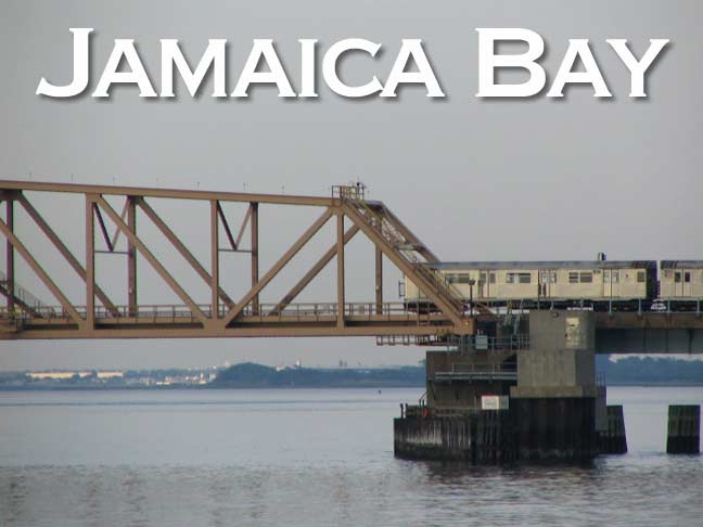
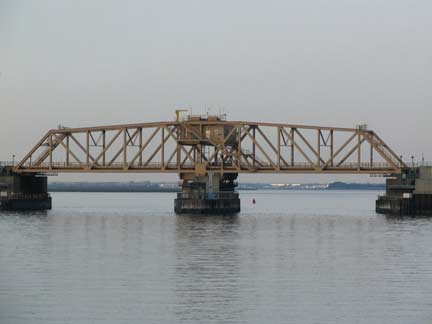
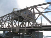
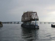
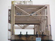
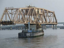
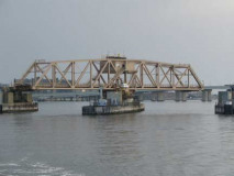
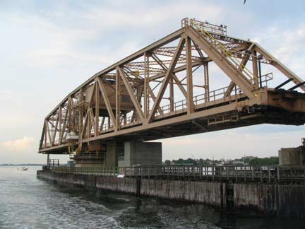
We now approach the NYC subway’s oddest locale, a bridge crossing Jamaica Bay’s Broad Channel. The IND A line has run here since 1956, replacing the Long Island Rail Road which crossed the bay on a wood trestle until 1950. At the time the trestle had burned one time too many and the LIRR, reeling under Pennsylvania Railroad control at the time, said enough was enough and abandoned the route, at the same time eliminating stations at The Raunt and Goose Creek that served fishermen.
The Transit Authority purchased the route and built an iron swing bridge, and trans have run here under various routes and letter ID’s since. Sometimes it’s been the E, sometimes the H (now an abandoned MTA letter) and sometimes the S; these days the A runs to Mott Avenue in Far Rock, and travelers heading west for Rockaway Park have to switch at Broad Channel for the S shuttle.
This actually used to be a double fare route: you paid once upon entering and again exiting from Broad Channel on south, but the MTA changed to one fare in 1975.
The boat waited for about 10-15 minutes as train traffic was held by the dispatcher and the bridge swung into open position, and we motored through.
On the north end of the peninsula is a little-known Queens community called Somerville. It is bisected by the Vernam Basin. Arverne, the community south of the subway tracks, and Vernam Basin have the same derivation…developer Remington Vernam, who signed his papers “R. Vernam.”
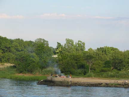
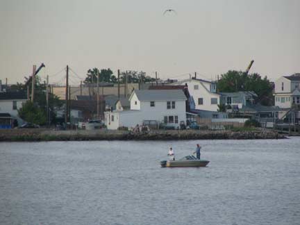
Passing Dubos Point Wildlife Sanctuary, where blue herons and oystercatchers were in evidence, we sailed by largely undeveloped Edgemere Park. A group of fishermen had started a fire, perhaps cooking the catch.
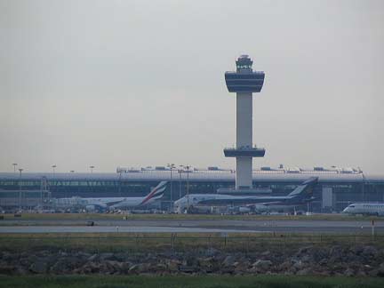
John F. Kennedy International Airport has reinforced some of the Jamaica Bay marshes and uses them for runways.
That’s as far as we go. The eastern limb of Jamaica Bay, Head of Bay, enters a series of small creeks at Meadowmere, a small community divided fairly evenly between Queens and Nassau Counties. The boat turned around and …
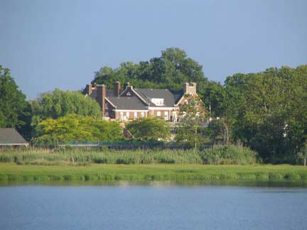
…and went past the Inwood Country Club golf course and Bayswater, a northwest Far Rockaway community in Queens. Bayswater is filled with several waterfront mansions, some inhabited, some not.
…past the subway swing bridge again…
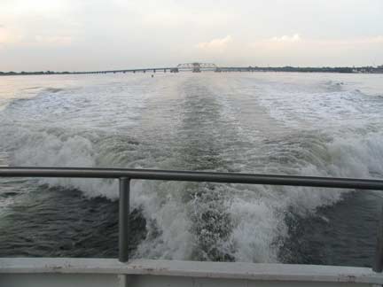
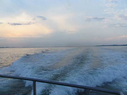
Like Gilligan’s, this was supposed to be a 3-hour tour and so the Minnow was hurrying on the way back to Sheepshead Bay. Note how the wake resembles the tail flukes of a whale.
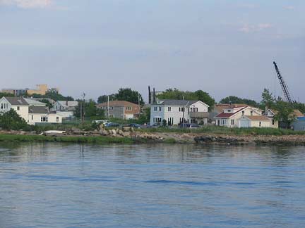
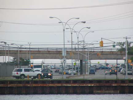
I took out the Forgottenbinocs for a closer view of Beach Channel Drive on the way back. What I assumed would be a character-free stretch of gas staions and convenience stores has its moments, with handsome waterside homes and clubhouses. At Beach 108th Street (top), we see the concrete trestle the LIRR built in the early 1940s to eliminate grade crossings and subsequently was incorporated by the TA.
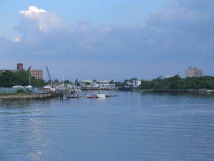
Under the Hodges again and a final look at Jamaica Bay.
Photographed June 16, 2007; page completed July 15, 2007







2 comments
what an awesome place! especially nice are those cosy fisherman-houses: they make me want to move to NYC and become a fisherman to live in one of these although i study marketing:)
Subway crossing is beautiful. Hammils East/West requires renewal.
The bay view is worth sighteeing. The rockaways need a rebirth.