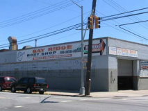
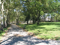
Corridor parks…long, narrow strips of green that go on for block after block between two streets, are relatively rare in NYC. The Bronx has two lengthy ones on either side of Mosholu and Pelham Parkways, Kissena Corridor Park in Flushing and Fresh Meadows, and perhaps even Eastern and Ocean Parkways in Brooklyn can come under consideration for the classification.
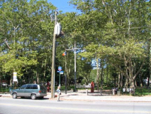
Bay Ridge’s Leif Ericson Park can also be called a corridor park, running between Ridge Boulevard and Fort Hamilton Parkway in fits and starts, mostly between 66th and 67th Streets. What’s notable is that the park is used for a different function on each block.
Your webmaster returned to Bay Ridge in August 2007 and walked the Leif Ericson corridor along its entire length, which I had never done while living in the neighborhood between 1957 and 1993, my first 35 years.
WAYFARING: LEIF ERICSON SQUARE (open in new window)
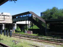
I arrived at the Fort Hamilton Parkway N train station (on one of the new R160 cars no less), originally known as the Sea Beach Line since, when it ran at grade prior to 1915, it led to the seaside Sea Beach Palace Hotel. Surprisingly the N was running on a normal schedule and route on the weekend.
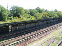
Both Ft. Hamilton Parkway (which I’ll call FHP) and its adjoining station, 8th Avenue, present a somewhat suburban aspect since it is paralleled by the Long Island Rail Road Bay Ridge line, now used as freight by the New York and Atlantic. After the two lines diverge at New Utrecht Avenue the Sea Beach enters a more conventional open cut (making it a rather boring ride for rail buffs even though it is in open air. Amazingly the line was built with no express stations, but with express tracks.
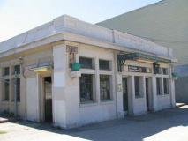
At left is a Typical Brooklyn Rapid Transit, later Brooklyn-Manhattan Transit (BMT) station house, complete with terra cotta diamond ornamentation.
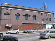
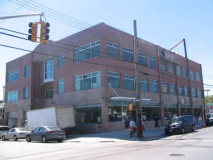
In my youth I would take hundreds of bus rides on the B16 (Fort Hamilton Pkway) route and would always pass this building on FHP and 60th Street. In the 60s, and prior, it was home to the Rogers car dealership and later, in the 1980s, United Skates of America had a franchise here (Brooklyn’s last roller rink, Bed-Stuy’s Empire, closed in April 2007). Currently, the building houses a couple of wholesalers.
Was the building ever a theater?
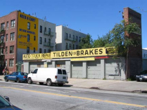
Tilden Brakes has been at FHP and 61st Street since time immemorial, or at least the Swingin’ Sixties, and its painted sign has seen it through most of those years.
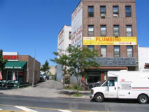
This is an unusual building on the north side of FHP between 64th and 65th Street. There’s a curving driveway and, if you will notice, the building has a slant in it to conform to the driveway. It’s as if the driveway came first.
It probably did. It’s likely a remant of Kouwenhoven Lane, an old road that existed in the Town of New Utrecht before it became part of Brooklyn in 1894. The road originated where 5th Avenue is now (we’ll see that later) and ran east, north and then east again to the New Utrecht Plank Road, now New Utrecht Avenue. Old maps show it crossed FHP at approximately this location.
Brooklyn has many such aboriginal roads.
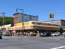
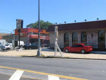
Three Guys from Brooklyn, “the poor people’s friend,” has had a huge fruit and vegetable stand at FHP and 65th Street, always packed, for several decades. Note the hand-lettered sign at the top of the brick building, and at right, a Sunkist logo from several campaigns ago.
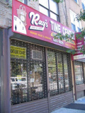
Ray’s Time Center, between 66 and 67, has similarly been around for over 25 years. I bought a kicthen table at an adjoining furniture store in the 1980s that I still use, but that store has gone.
Fortway Theater
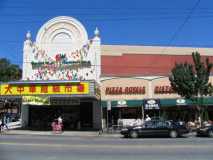
Opened in 1928, this medium sized movie theatre (2300 seats) on 6720 FHP had a beautiful atmospheric interior. Electric stars used to twinkle on the dark blue ceiling. The Fortway originally had a Kilgen theatre organ. There was a small stage in front of the proscenium. The theatre was divided into a multiplex in the 1970’s. The Fortway was closed by Loews Cineplex in June of 2005. cinematreasures.org
When I was in Bay Ridge you had your pick of 4 movie theatres (the Fortway, the Dyker (86th St. and Gelston), the Harbor (4th Avenue and 93rd Street) and the Alpine (5th Avenue and Bay Ridge Avenue) and before I came along, there were even more. Of these, only the Alpine remains, and it stayed because a developer had a change of heart and decided to keep the building as a movie theater.
The Pizza Royale next door is formerly a 10-lane bowling alley. Like many theatres, the Fortway doubled as a concert venue; Chuck Berry appeared here in 1972 touring behind his only #1 hit: “My Ding-A-Ling.”
Your webmaster’s last flick here? “Young Sherlock Holmes” in 1986.
An Old Leif
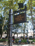
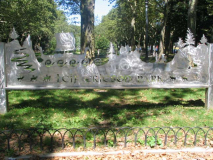
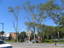
The eastern end of the Leif Ericson corridor is at Fort Hamilton Parkway between 66th and 67th. In 1997 the NYC Parks Department outdid itself in the sign department, erecting several gorgeous indicators with a Norse-Vikings theme.
Leif Ericson (c.960-c.1020), [for whom the park corridor as well as the section of the Belt Parkway in Bay Ridge is named], was probably the first European to set foot on the American continent, nearly 500 years before Christopher Columbus’s voyages.
Ericson was born in Iceland around 960, the son of Eric the Red, an Icelandic king who discovered and colonized Greenland. The Icelandic Sagas offer two explanations of Ericson’s famous voyage. One suggests that Ericson, en route to Greenland, was blown off course and arrived on the northeastern coast of America. In the other, he organized an expedition to confirm a previous report of hilly, heavily forested land west of Greenland.
The Sagas record that Ericson – afterwards known as “Leif the Lucky” – made three significant land discoveries in the year 1000. He named the first Helluland (Flat-Stone Land), now thought to be Labrador. He called the second Markland (Wood Land), possibly Newfoundland. The site of the third landfall, named Vinland (Vine Land) for the wild grapes found there, may have been as far north as Newfoundland or as far south as Cape Cod. The crew wintered in Vinland and returned to Greenland in 1001, drawing “behind them a boat filled with grapes.” NYC Parks
Scandinavians first began moving to Bay Ridge and Sunset Park in the 1820s, and by the early and mid-1900s made up a nearly majority population in the neighborhoods. When NYC bought a parcel of properties between 4th Avenue and FHP in the 1930s, Robert Moses developed them as a unified park and it was named Leif Ericson Square to acknowledge the presence of the Norse here. The Norwegian Day Parade is still held on 5th Avenue in May, though the Sacndinavian population here has severely diminished since the 1960s.
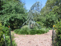
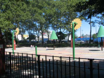
Leif Ericson Square runs continuously from FHP to 8th Avenue; the square interrrupts 9th Avenue. In this block are a flower and herb garden, a kiddie play area, and basketball courts now (2007) under renovation.
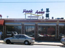
The Park Asia, 8th Avenue and 66th, was formerly Zeke’s Roast Beef, which dispensed roast beef sandwiches, hamburgers and fried chicken to your webmaster once a week between 1982 and 1993, and several times after that. There was a free all you can eat salad bar, and it was a piece of heaven on earth. Zeke’s was gone by 2004.
Fast food lovers still have the Americana Diner on 65th Street and 7th Avenue. You know what, though. I have never eaten at the Americana. I was always a Zeke’s loyalist.
Question: why do most, if not all, restaurants in Asian neighborhoods have to serve Asian food?
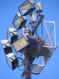
It is no longer a novelty to see wild green parrots in New York City. Flocks have made their nests in the tall light stanchions ringing the field.
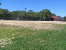
Across the street from Park Asia is a huge sandlot home to Bay Ridge’s many soccer and softball clubs. My father was frequently in the crowd for the soccer matches and yes, there were crowds. The field probably produced some of the Northeast’s biggest soccer stars. Of course, I have no idea who they are.
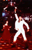
Karen Lynn Gorney and John Travolta. Karen Lynn Gorney
The 2001 Odyssey disco on 64th just off 8th Avenue, featured in 1977’s Saturday Night Fever, soldiered on as the Spectrum for many years. The property was finally sold and the disco razed in 2004, but not before its lit-up dance floor was auctioned. The site is now occupied by a wholesaler.
Your webmaster may have bowled his last frames at Bay Ridge Lanes, 8th Avenue between 63rd and 64th, in the mid-1980s. (I could never get my average over about 150 without a hook.) The lanes are long gone, having moved out soon after I departed its nicotine-drenched interior.
My home lanes were always Leemark on 88th Street between 4th and 5th. Later, Lee left and it became Mark Lanes. Those lanes finally expired in 2006 when Century 21 purchased the property. I also bowled at Mark Roth’s Rainbow Lanes on Knapp Street and Avenue X. Ironically I have never bowled at Melody, in Sunset Park, or Gil Hodges, in Bergen Beach, both of which remain.
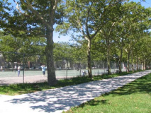
Between 8th and 7th, Leif Ericson Square is occupied by tennis courts, which are refreshingly left unshielded, so everyone can see how good or bad you are.
Intermission
Between 1959-1964 the Gowanus Expressway was extended as a link from the Brooklyn-Queens Expressway to the new Verrazano-Narrows Bridge. This necessitated the destruction of a section of Leif Ericson Square between 6th and 7th Avenues.
A triangle was created at 66th Street and 7th Avenue as the avenue was bridged over the expressway, with 7th Avenue now serving as the Gowanus’ Expressway’s service road.
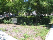
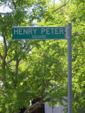
For many years this was a barren, pockmarked blacktopped space, with signs identifying it as “Henry Peter Square.” When Henry Stern was Parks commissioner, he playfully renamed the space “Greenland” and planted some greens. The Henry Peter sign remains, although I have no idea who he is and the Parks Department website is silent oin his identity.
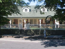
The house, above right, 6510 7th, is also a mystery. It’s not on the old 7th Avenue route. My guess is it was moved when 7th Avenue was bridged, or, it’s on the old line of Kouwenhoven Lane, which passed this way a century ago.
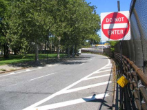
Leif Ericson Square between Eirik Place and 6th Avenue.
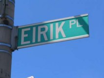
Eirik Place? It doesn’t figure on Brooklyn maps, but it was opened in 1964 as an important service road connecting 6th and 7th Avenues along the Gowanus Expressway. I suppose it was named for Eirik, or Eric, the Red.
6-6-6
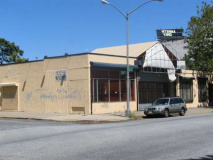
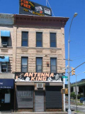
This unoccupied building on 6th Avenue and 66th Streets was important to your webmaster into the late 1980s, since it was home to Karl Droge, a soft ice cream business that came in handy after I had returned from cycling to Coney, Ozone Park, Valley Stream or wherever. RIGHT: Antenna King has been at 6th and 65th since the 1960s.
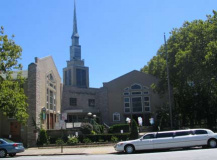
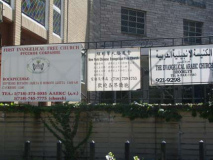
The First Evangelical Free Church, built in 1962, has services in languages for everyone. And, it’s good to be as helpful as possible when your church is at a corner that reads 6-6-6.
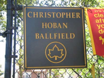
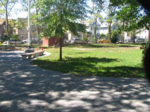
Between 6th and 5th Avenues, Leif Ericson Square has some mixed-use ballfields named for 26-year-old Police Officer Christopher Hoban, killed in a failed drug sting in Manhattan Valley October 17, 1988 in the wild west atmosphere NYC was in those years.
A five-mile memorial run is also held in Officer Hoban’s name in Brooklyn each September.
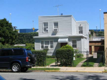
I noticed this tiny house on 66th Street with a lush lawn and hedges…and every window barred. Bay Ridge is not an inordinately high crime area (your webmaster had two separate Bay Ridge apartments broken into in the 1990s, however).
In our efforts to repel criminals, some of us are forced to encase ourselves in barred quarters, where the crooks ought to be.
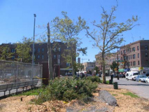
No, the truncated tree branches and mulch are not from an overzealous Parks Department tree pruning. The decapitated 5th Avenue Retro-Corvington should tell you that this was the work of the F2 tornado that wreaked havoc (havoc is always “wreaked,” no other verb, unless you’re Shakespeare and you “cry” it) in Bay Ridge, Sunset Park and Flatbush the morning of August 8, 2007. It was the first such tornado to hit the ground in Brooklyn in 118 years, and the strongest tornado in NYC since records were kept. It caused millions in damage, but took only one life, in Staten Island.
The destruction caused by the F2:
5th Avenue opposite Senator Street: another remnant of Kouwenhoven Lane, this time at its western end. Note the name of the bar, the Leif Erickson. The road may have led to…
Senator Street is named for Sen. Henry Cruse Murphy (1810-1882), NY state senator, Brooklyn mayor (Brooklyn of course was an independent city before its consolidation with NYC in 1898) and original owner of what became Owls Head Park (see below).
Salem Lutheran Church, 67th Street between 4th and 5th facing Leif Ericson Square, was built in 1905.
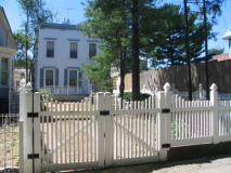
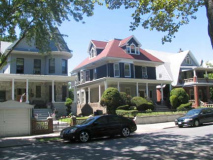
There are a number of interesting dwellings on the south side of 67th facing tha square. Note the incredibly big lawn proportionate to the above building’s size.
This trio is under the gun from developers. There used to be a fourth off to the left; it has been replaced by the Plywood Fence of Death.
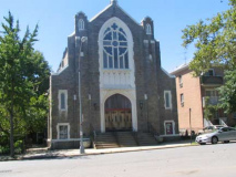
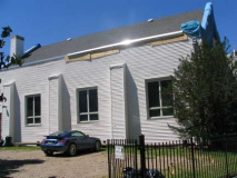
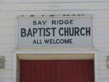
Could the Bay Ridge Baptist Church, 67th and 4th Avenue, be the oldest building on the block? It’s been heavily aluminum-sided, but its position askew the grid might be the tipoff that it was here before the streets were cut from 1890-1910.
Ronald Gross, Senator Street Historic District: The Bay Ridge Baptist Church building only dates from the 1950s as evidenced from the date on the cornerstone. It is actually not “askew the grid,” it is firmly square to Fourth Avenue. It is the side streets that are askew, originally square to Stewart Avenue. The Avenues were cut through later.
lief
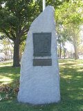
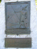
Crown Prince Olav, later King, of Norway dedicated this replica of a Viking rune stone in Tune, Norway on a 1939 visit. The stone stands on Leif Ericson Square just east of 4th Avenue. (Tune, southeast of Oslo near the Swedish border, was incorporated into the town of Sarpsborg in 1992.)
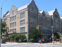
There are a pair of impressive buildings on 4th Avenue near Leif Ericson Square: The High School of Telecommunications, earlier Bay Ridge High School, at 67th Street, left; and a mixed-use building on Senator Street, right.
A Detour
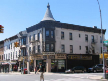
I decided to do a brief spin down Bay Ridge Avenue (which everyone in Bay Ridge calls 69th Street). This is as close to a bohemian area that Bay Ridge has; there’s a Circles vegetarian restaurant on the SW corner at 3rd Avenue!
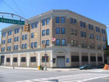
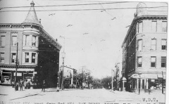
3rd and Bay Ridge Avenue looked pretty much the same in 1913, with the handsome corniced building on the NW corner. In ’13 it was Wolff’s Pharmacy; today it’s Lowen’s. Bay Ridge and Fort Hamilton, a Photographic Journey, Brian Merlis and Lee Rosenzweig, 2000
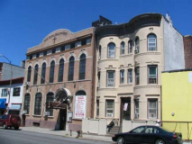
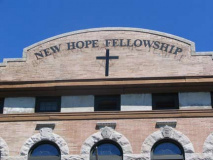
A pair of handsome buildings on the east side of Bay Ridge Avenue. The one on the left side is particularly intriguing: now the New Hope Fellowship church, it bears faint marks of its previous incarnation as a Masonic temple. However…
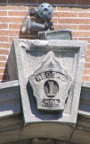
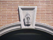
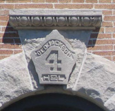
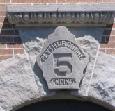
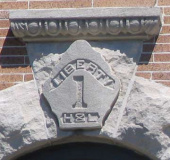
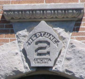
The building was originally the New Utrecht Fireman’s Hall (from the days when this was in the town of New Utrecht.) The names and shields of the firefighting units that were former tenants, Neosho, Bay Ridge, Old Jackson, Liberty, Neptune, can still be found above the windows. Some have been chiseled off. Blythebourne was formerly a development in Borough Park, but I’m drawing a blank on Neosho, a river in Kansas and Oklahoma and a small town in Missouri. Why Neosho, why here? H&L = Hook and Ladder.
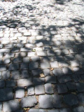
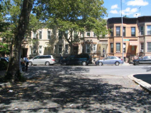
Bay Ridge Place is a one-block alley between Bay Ridge and Ovington Avenues. Unsuspecting urbanophiles can stumble on wonders like this occasionally: tree-shaded with attached 19th-Century buildings and best of all, some worn, cracked but original paving stones.
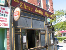
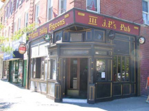
Three Jolly Pigeons, 3rd Avenue and 68th Street, is one of those Bay Ridge institutions that has seemingly always been there. Active since 1907, the bar stood strong during Prohibition utilizing the front room as a “newspaper place” and the back as a speak-easy. Stained-glassed windows arch above the bar’s partition, as well as the men’s bathroom and an original tin ceiling still proudly hangs overhead.
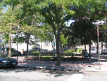
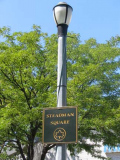
Steadman Square, 3rd Avenue and Senator Street, honors Monsignor Joseph F. Steadman (1896-1946). In the course of his life, Monsignor Steadman served as a chaplain, directed three churches in Queens and Brooklyn and wrote several religious missals (books containing the readings and prayers for each Roman Catholic Mass or prayer service) still in use throughout the world.
Steadman Square, located at the intersection of Third Avenue and Senator Street in Brooklyn, was the terminus for the Third Avenue Trolley line until the late 1950s, when busses replaced the City’s trolley service. Thereafter, the site was transformed into the triangle’s present form. The sitting area is enclosed by wrought iron fencing and paved with both red cement blocks and hex block paving stones. Fifteen World’s Fair benches surround a woodchip-filled area planted with various shrubs. NYC Parks
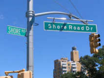
Shore Road Drive
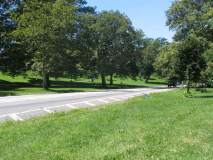
Awkwardly-named Shore Road Drive (which the Department of Transportation can’t make up its mind what to call) is actually the original northern end of Shore Road, which now runs from 68th Street southwest along the Narrows to 4th Avenue. Like the rest of Shore Road, it was built as a pastoral carriage road for leisurely shore-side traffic, and gently curves and twists from 4th Avenue and Leif Ericson Square to the junction with the Belt Parkway, built here in 1940.
Shore Road Drive kept its collection of type-G Corvington posts well into the 1970s, long after surrounding streets had replaced them.
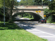
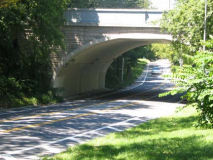
A pair of picturesque stone arches carry 3rd Avenue and Ridge Boulevard over Shore Road Drive. These are not the originals though; they were replaced a few years ago.
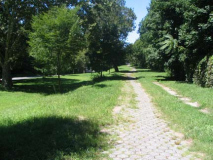
The pedestrian walk is not often frequented by foot traffic.
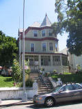
Sedgwick Place is one of apair of short streets (along with Bergen Place) between Wakeman Place and 67th Street south of Colonial Road. It has a couple of beautiful homes with huge lawns, enclosed porches and original stained glass.
Some had beautiful homes, and chose to change them (left).
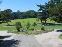
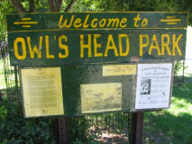
Owls Head Park is Bay Ridge’s largest public park, stretching between the Belt Parkway, Colonial Road and 68th Street, and its high hill provides a prime viewing spot during Brooklyn’s occasional tall ship parades. The park was created from the estate of Eliphalet Bliss (1836-1903).In 1867 he founded the machine shops that became the E. W. Bliss Company and the United States Projectile Company, concerns which at his death employed 1,300 men.
Bliss’s interests developed along two lines: the manufacture of tools, presses, and dies for use in sheet metal work, and the manufacture of shells and projectiles. His estate, Owls Head, possibly named because the promontory on which it was located resembled an owl’s head (or because there may have been stone owls’ heads on the gateposts), featured an observatory known as the Bayard Tower. Bliss had purchased the estate from US State Senator, US Representative and Mayor of Brooklyn, and Brooklyn Eagle founder Henry Cruse Murphy (1810-1882) mentioned above.. Bliss willed the estate to NYC provided it be used for parkland. The park, still known by old-timers as Bliss Park, has been in use by local residents since the 1920s; Robert Moses redesigned it in the 1930s. The mansion and tower were razed in 1940. Senator Street is named for Murphy, while nearby Bliss Terrace was named for the industrialist.
In the 1920s, the BMT started construction on a new subway branch that would connect the 4th Avenue subway to Staten Island. Parts of the tunnel made it as far as underneath Owls Head Park, and the subway shafts are rumored to be visible somewhere within the park. The project was aborted by the mid-1920s.

