I must admit…the subhead on this week’s title card is a little bit facile; after all, other neighborhoods in Brooklyn, like Midwood, East Flatbush, Flatbush, and even Brownsville can be called Brooklyn’s “heartland” since they are well within the central area of Brooklyn. While embarking on exploring the neighborhoods of southwest Brooklyn for Forgottenana, including places I haven’t been in much since moving to Queens in 1993, I’ve been able to seize upon several things that act as neighborhood trademarks such as Sunset Park and Borough Park with their Asian/Latino and Asian/Jewish dynamics, or Bay Ridge, which was my home for 35 years.
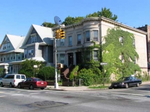
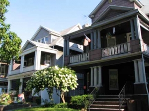
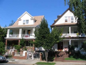
Kensington, though, was a different beast since, despite traveling its outskirts almost weekly while I lived in Brooklyn, I have never been able to get a handle on the neighborhood’s personality. Its architecture consists of pleasant detached homes, some with beautiful porches on both floors, but none of the wow! factor the opulent Queen Annes of Ditmas Park or the block after block of brownstones Park Slope boasts.
I must also admit that, prior to the 1980s or so, I never knew the area had a distinct name. I had always thought of it as an eastern extension of Borough Park or a northwestern arm of Flatbush. After a close look, though, Kensington has comparatively little in common with its neighbor to the west in demographics or in street layout; Borough Park, especially the area that borders Kensington, is mostly Hasidic and Orthodox Jewish, while Kensington, which certainly has a Jewish flavor, is incredibly polyglot with over fifty different foreign languages spoken. Perhaps it’s that very diversity that prevented me from getting a fix on it.
Kensington is named for a western borough of London; there are many British-sounding place names in the area, mostly by design since in the mid-1800s, when the region was developed, a patina of sophistication was desired. There were scattered farms around until the 1850s when the Coney Island Plank Road (Coney Island Avenue) was built and some dwellings began to concentrate at Coney Island and Church Avenues, as well as the northern end of the area near Ft. Hamilton Parkway. As early as 1851, the street pattern began to appear.
Kensington’s borders are generally accepted to be Ft. Hamilton Parkway on the north, 18th Avenue on the south, 36th Street and Dahill Road on the west and Coney Island Avenue on the east, though some demographers fudge a little, saying separate areas called Dahill (defined by a triangle formed from FHP, Dahill Road and 36th Street) and Albemarle (the northern extent from FHP south to Church Avenue) are subsections.
Of perhaps more interest to me though is its position on the clash of two street systems. Western Brooklyn has streets numbered 1-101 and avenues numbered 1-28 that run along a NE-SW axis, while mid-Brooklyn (which has a rather more complicated system) features avenues lettered A-Z and streets numbered East 1-East 108 and West 1-West 37, with McDonald Avenue serving as the divider between the two systems. I’ve always been attracted to the areas where the two systems come together, such as Windsor Terrace (Kensington’s northern neighbor).
Parallelling McDonald at different spots, on the map Dahill seems like the wider, el-shrouded street’s faithful companion. Actually Dahill is where SW Brooklyn’s “1-101” system ends, and central Brooklyn’s “A-Z” system starts. Even that can’t be strictly said, though; Avenues A and B are found only on the East Flatbush-Brownsville border, while Avenue C is restricted to Kensington. (Even so, Brooklyn’s street system doesn’t match Philadelphia’s for sheer irrationality.)
One last thing about Kensington Streets: one group of streets, Minna, Tehama, Clara, Louisa, which cluster between 36th Street and Dahill Road south of Green-Wood Cemetery, are also to be found inSan Francisco’s SoMa (South Market) district. Did the two areas share a developer, or was the San Francisco developer a Brooklynite? Perhaps.
The Warmth of the Sun…
…shines on McDonald Avenue in Kensington, a last respite before it is shrouded for the remainder of its route south to Gravesend (Gravesend Avenue was McDonald’s first name) by the Culver elevated, carrying the F train.
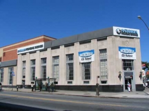
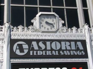
Astoria Federal Savings was chartered as Central Permanent Building & Loan Association in 1888, and became Astoria Federal in 1936, which seems about right for the date this branch at McDonald and Church Avenues was built. This branch was formerly the Greater NY Savings Bank, purchased by Astoria in 1996.
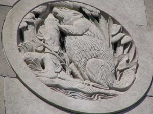
It’s streamlined, as buildings started to be in that era, but architects were still able to add touches like the beaver, a symbol of thrift as well as of New York State (let’s not forget the bank’s namesake, John Jacob Astor, the USA’s first millionaire, made a smash as a fur trader and a dealer of musical instruments.)
The handsome clock above the front door is one of a number around town I’m gradually collecting for a FNY page.
Some Kensingtonians have recently pushed for some trees to be planted on the sidewalk outside the bank.
I’m told that this building housed a number of banks before Astoria FS moved in.
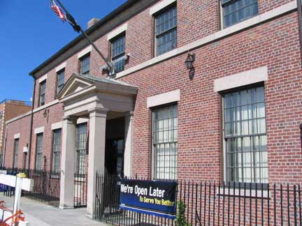

Kensington’s post office on McDonald Avenue, north of Church, has an interesting Federal design that’s unusual for NYC post offices; any Kensingtonians know anything about its construction? The Gowanus Lounge recently posted a videofeaturing an extremely dissatisfied customer, whom the clerk apparently eggs on to even more histrionics. Of course, no one expects courteous or swift service at a post office. At least, your webmaster never does.
(I am further told that the Flatbush PO looks like this one; a number of them were built by Postmaster James Farley during the FDR Administration.)
Albemarle Road is named for Kensington, London’s Albemarle Road, in turn named for George Monck (1608-1670), the soldier who helped restore the British monarchy in 1660 after the dissolution of the Protectorate of Oliver Cromwell; he was subsequently named the Duke of Albemarle by Charles II. He was also granted territory in today’s North Carolina.
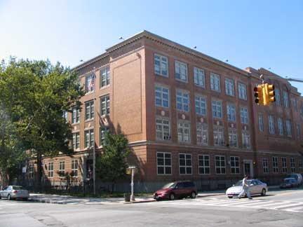
PS 230, the Doris Cohen School, #1 Albemarle Road between Dahill and McDonald.
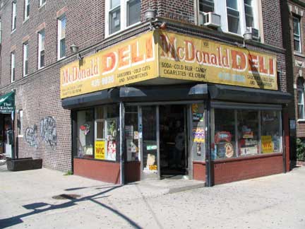
The McDonald Deli’s painted signs have been there for a few decades.
Church Key
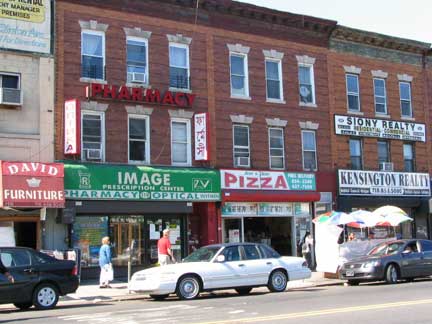
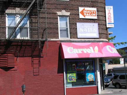
Though I hadn’t yet seized upon a “hook” with which to describe Kensington, I found one when I walked down East 2nd to Church Avenue and found, in the incredibly busy couple of blocks east of McDonald Avenue…signs, signs and more signs, rivalling the “Koreatown” area of Flushing in density. There was an Italian restaurant along this stretch about 20 years ago that had a back room where I attended a bachelor party. The name began with “S”. Anyone remember it?
I’m told by a few Forgottoners that restaurant was Scarola’s.

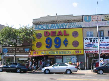
So many signs that the areas above the second floor windows are forced into action.
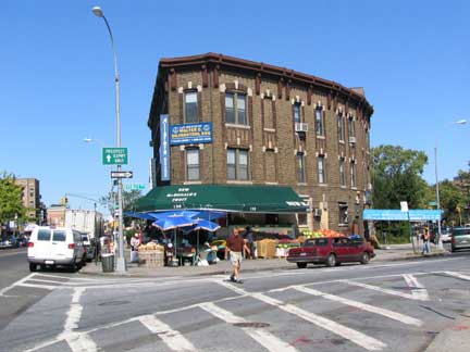
Beverl(e)y Road was laid out in a gentle curve away from Church Avenue, which runs athwart the general street grid, necessitating this oddly-shaped building.
Along with Coney Island Avenue, Church Avenue is the oldest road in Kensington; it was the country lane that led to the Dutch Reformed Church at Church and Flatbush Avenues, first organized in the 1650s. The present building on the site was built in 1799.
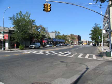

Some Kensingtonians may wonder why Church Avenue becomes a 6-lane behemoth between East 5th and East 7th Street, crossing Ocean Parkway. I had originally thought, several years ago, that it was in order to accommodate the extra traffic from the Prospect Expressway, which begins, or ends, depending on your POV, at Church Avenue. The real answer is because Church Avenue widened here to accommodate a trolley tunnel that conveniently ran cars under the busy parkway. Church Avenue’s trolley, the #8, later the #35, was one of the last remaining Brooklyn trolleys, hanging in there till 1956. Here’s a full list.
I wonder if the old trolley tunnel is still under there! Could this be a job for Bob Diamond? Picture above right from Brian Merlis’ excellent Brooklynpix.

The handsome synagogue at East 5th and Church is officially known as the Flatbush Jewish Center, though Flatbush pretty much centers around its namesake avenue, about 20 blocks east. The Center was built in 1924.
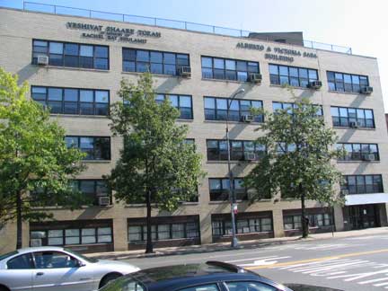
Solomon Schechter High School, affiliated with the center, is next door between East 5th and Ocean Parkway. The school figured mightily in the academic career of your webmaster.
Huh? What? you’re probably saying. Your webmaster, a good Catholic boy, had never attended shul. But in 1975, the Regents math tests were stolen, from this school. They canceled the math tests. And that’s how your webmaster, never great at math, got out of high school and went on to a 2.5 index at St. Francis College. And worked my … off for grades that high.
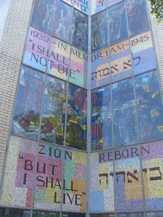

The wondrous mosaic and stained glass work on the center’s Ocean Parkway side reflects the Holocaust and subsequent formation of Israel.
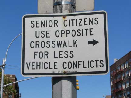
Pedal to the metal Ocean Parkway, originally a horse and carriage route built by Frederick Olmsted and Calvert Vaux between 1874-1880, is now a 9-lane behemoth bringing cars from the Prospect Expressway to all points mid-Brooklyn.
It’s hard for pedestrians to cross, elderly or not.

A little faded glory on Church Avenue and East 8th. We are on the northern fringe of a number of meticulously developed areas featuring large, multi-roomed houses in all manner of architectural varieties of the late 1800s. Among them are Prospect Park South (the largest), Caton Park, Beverl(e)y Squares East and West, Ditmas Park and Ditmas Park West, Midwood Park, South Midwood, and Fiske Terrace. All are worth a look–they are perhaps the most beautiful neighborhoods in NYC, give or take a Richmond Hill or New Brighton. The neighborhoods are sometimes grouped under the moniker Victorian Flatbush.
Victorian Flatbush: An Architectural History
Crazy Stable. 20 years of renovating a house in Caton Park

One of the smaller masterworks of Prospect Park South on East 7th.

This ad for an HBO Dodgers documentary fooled me: I thought it might have been an original ad uncovered by a teardown!
Since the Dodgers have been gone for 50 years now (and your webmaster has been on the scene for the same amount of time) isn’t now the time to call a halt to the endless Brooklyn Dodgers evocations?
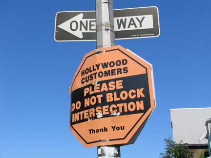
I was completely flummoxed by this sign at East 8th…
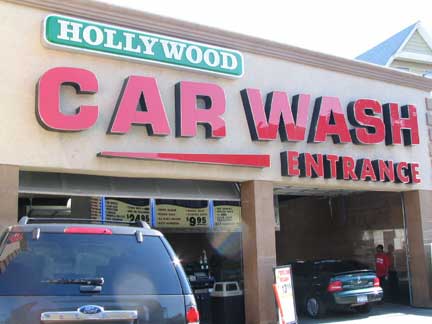
…till I discovered it referred to the Hollywood Car Wash.

No frills drugstore sign, Church between East 8th and Coney Island Avenue

An amazing persistence–in my mind at least–is this NYS Route 27 sign on Church Avenue west of Coney Island Avenue.
State routes, within city limits, were important before the construction of parkways and expressways beginning in the 1930s.
In Brooklyn and Queens, Rte 27 runs along the Prospect Expressway, East 5th Street, Church Avenue, Coney Island Avenue, Caton Avenue, Linden Blvd., the Belt Parkway, Sunrise Highway out to the end of Long Island.
If you have to get from Park Slope to Long Island, there are faster routes to take these days.
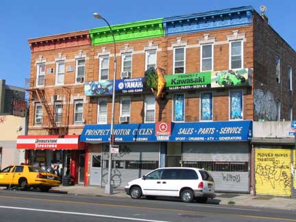
Colorful facades, Coney Island Avenue opposite Church.
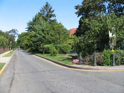

A look at the edge of Prospect Park South from Albemarle Road and Coney Island Avenue. Corners are marked by picturesque signposts with the PPS monogram, and many streeets have leafy center medians. Breathtaking views await you if you press east from here. (FNY will do it when the leaves are down.)
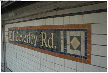
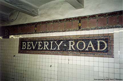
So, what is it? Beverley or Beverly? The BMT (left) and the IRT (right) can’t agree. Older maps show Beverley, mid-20th Century maps say Beverly, and I believe NYC DOT signs had Beverley west of Holy Cross Cemetery, and Beverly to the east of it. (I didn’t get that far east and couldn’t check.) To me Beverly makes more sense, since that’s how it’s spelled elsewhere, but maybe “Beverley” is another reason Brooklyn is unique. nycsubway.org
Beverl(e)y Road and N-S cross streets don’t boast the spectacular architecture of Albemarle Road in Prospect Park South, but they do have some interesting double-porched homes.
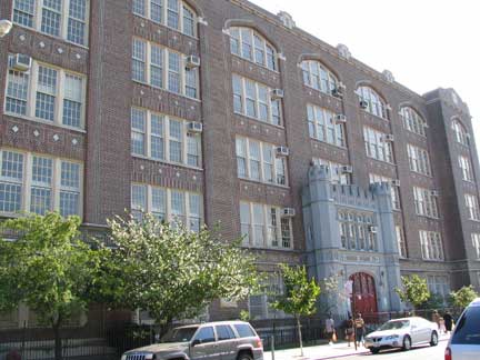

PS 179, Avenue C and East 2nd Street. DJ Bruce “Cousin Brucie” Morrow didn’t attend the school, but lived across the street in the 1960s.

The G train prepares to descend into a subway tunnel, and McDonald Avenue takes a last look at the sun before the elevated covers it. The G here? Weekend reroutes frequently take the G onto the Culver tracks where it stands in for the F.
The connection here is a result of the demise of the 5th Avenue El, of which the now-defunct Culver Shuttle was a part. After the 5th Avenue shut down in 1940, what would be the Shuttle ran from 36th Street where it connected with the 4th Avenue BMT, southeast and south to Coney Island. Meanwhile a new IND line had been constructed out to Church Avenue in the 1930s. In 1954 the IND was connected to the Culver via this ramp, leaving a portion of the Culver as an orphaned shuttle; it served that truncated function until 1975. The Culver had begun as a surface steam railroad built by Andrew Culver in 1875.
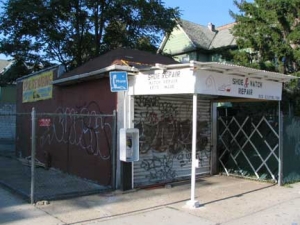
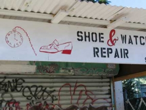
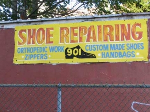
Cortelyou Road, named for an 18th and 19th Century Dutch landowning family, runs from Dahill Road east to Schenectady Avenue in East Flatbush; in Ditmas Park, it has become a burgeoning commercial and social strip. At East 9th Street, though, it claims a roadside shack home to a shoe and watch repair shop, a throwback, perhaps, to the neighborhood’s old days.

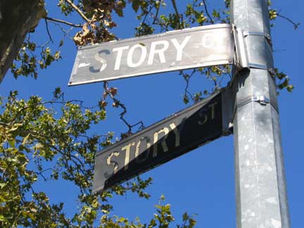
Story Court, perhaps Brooklyn’s shortest street, issues from Story Street, which itself runs one block from Church Avenue to Louisa Street just west of Dahill Road. I’d like to discover the, ah, story behind these two of Brooklyn’s least-known thoroughfares…which boast two of the last of Brooklyn’s 1960s color-coded street signs. Brooklyn’s were black and white. Apparently the Stories were yet another local Dutch landowning family. Interestingly, on maps from the late 1800s, Story Street is parallel to Louisa just north of Church.
Photographed August 2007; page completed October 14, 2007.
erpietri@earthlink.net
©2007


