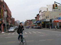
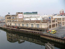
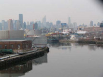
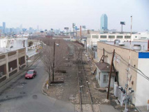
Believe it or not Forgotten NY does get complaints. Well, one or two once in awhile. Many of them concern FNY’s stuck-in-1999 design. To your webmaster, RSS sounds like an auto parts store and twitter is what birds do. Others complain about underrepresentation of some neighborhoods. I will plead guilty in this — in ten years, there are still some areas that I have not been with a camera, and there are some that I seemingly visit again and again. There are reasons for this. When I visit some neighborhoods, their Forgotten aspects are so numerous that I simply did not see all of them on previous visits. Our feature today is set in three neighborhoods — Greenpoint, Blissville and Sunnyside — that have all been covered by FNY before. Yet, when I walked the route that connects all three, I found numerous aspects, nuances and structures that I had not yet noticed. That is the mission statement of FNY, after all.
Greenpoint Avenue shows up on maps of Williamsburg (the city it was part of until it became part of Brooklyn) and Queens as far back as the 1850s, and it has been called Greenpoint Avenue on both sides of Newtown Creek going back to the mid-1860s. Unlike, say, Flushing Avenue and Bayside Lane, Greenpoint Avenue does indeed traverse the neighborhood it is named for. In Brooklyn, Greenpoint Avenue has been called L Street and Lincoln Street (it is in Greenpoint’s sequence from Ash to Quay) as well as National Avenue before Brooklyn nabobs settled on Greenpoint Avenue. And, while other lengthy NYC routes such as Broadway (Manhattan-Bronx), any of Manhattan’s lengthy north-south numbered avenues, or Brooklyn’s Fulton Street or Brooklyn-Queens’ Atlantic Avenue, Greenpoint Avenue never really does change personalities along its route. While it’s more commercial here, more residential there, more industrial there, it is resolutely gritty from the East River to where it completes its run at Queens Boulevard in Sunnyside.
And, it doesn’t end there — it merely changes its name to Roosevelt Avenue and runs to a shopping mall at Northern Boulevard and 156th Street in fab Flushing. You can walk or drive along one route from the East River to Flushing!
Greenpoint Avenue begins traditionally, for Brooklyn, at a waterfront setting that is blocked to the public, and a metal wholesaler.
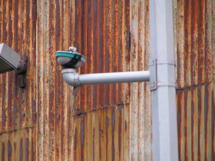
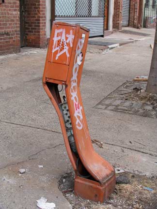
After the Giuliani administration decommissioned thousands of fire alarms because of pranking in the early 1990s, the alarms, and the streetlight-mounted lamps that marked them, many are now deteriorating and being allowed to collapse. I intend to do a full history on them in the future but here’s a dead alarm and lamp at the western end of Greenpoint Avenue.
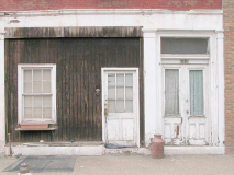
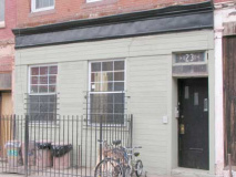
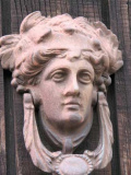
25 Greenpoint Avenue, between the river and West Street, appears unchanged for decades; I suppose door #1 is for the ground floor and door #2 for the upper floors. The first door has its own knocker. The changes to #23 are more recent, but it still has its stained-glass house number. Is that a spittoon?
ForgottenFan Denise Reinecke: No, that’s a milk can, used for rail transporting of milk.
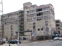
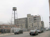
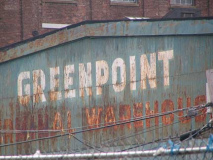
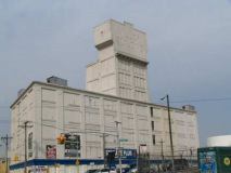
“Look on my works, ye mighty, and despair.” West Street south of Greenpoint can have books written on its dystopian deterioration. It resembles NYC in a future age, after its abandonment due to nuclear fallout, rising water levels or the cancellation of whatever show Conan O’Brien is hosting. Many of the buildings were part of the Greenpoint Terminal Warehouse, which burned down in a suspicious fire in 2006.
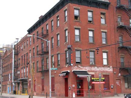
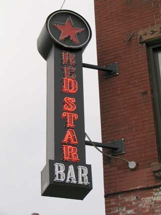
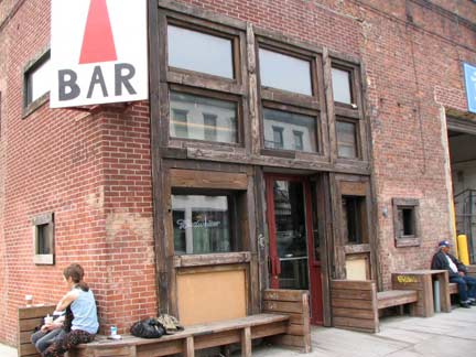
At Greenpoint and West Street is the Red Star Bar, a sports bar one block west of Greenpoint’s new tavern and restaurant row on Franklin. Outside are some sneakers on wires and neo-neon. The Greenpoint Gazette had a favorable review.
I’d like some input from some local Greenpointers about why the burned-out stable opposite the Red Star has a newish lit red-and white sign on it.
Miss Heather: The burned out stable used to be a restaurant called Paloma. It caught fire on election day last year.
Pencil Man
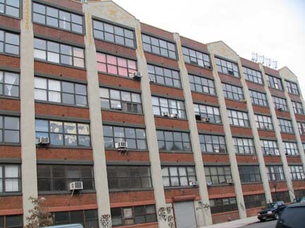
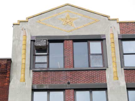
From the ForgottenBook: Eberhard Faber, the scion of a Bavarian pencil producing family, arrived in the USA from Germany in 1848, and after his first Manhattan factory burned down in 1861, he relocated to Greenpoint in 1872; the Faber company moved to Pennsylvania in 1956. The manufacturer is recalled by a large sign facing the East River painted on its original building at 37 Greenpoint Avenue at West Street, and by the huge yellow terra cotta pencils on its newer Art Deco building next door at Franklin. The pencil factory itself, on Franklin Street, is recognizable by a distinctive yellow star-in-diamond symbol.
Other Faber holdings in the area can be recognized by the star- in-diamond symbol.
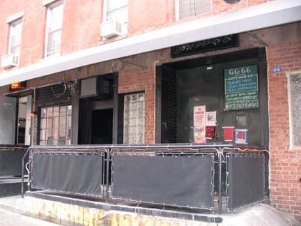
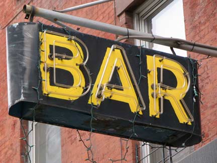
I was drawn to CoCo 66, another restaurant on Greenpoint between West and Franklin, by its retention of an ancient neon sign. According to New York Magazine, it was earlier a woodworking shop, but the sign looks as if it has been here awhile or CoCo 66 owners brought it from elsewhere.
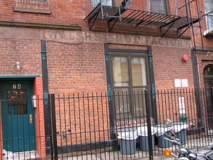
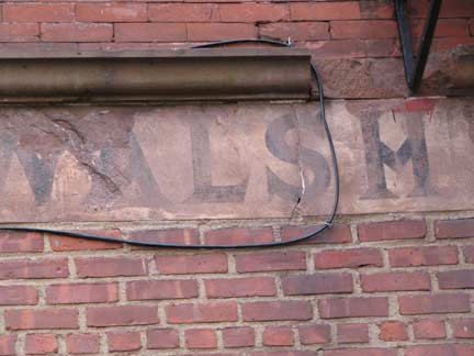
It is sometimes hard in NYC to distinguish true ancient signage from movie props that were made to look that way. I have been taken in in the past, for example, by markings that can still be seen on Greenpoint Terminal Warehouse buildings (see above). So, I can’t be sure if the “Walsh Shoe Factory” sign here on Greenpoint Avenue’s south side just west of Franklin is the McCoy or not. If it isn’t, it certainly is a good reproduction.
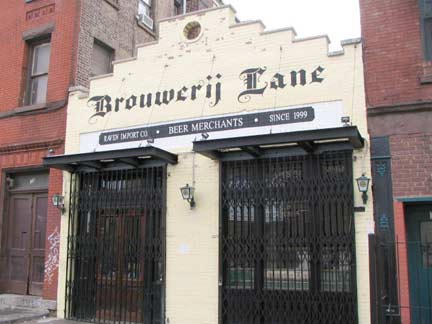
“Brouwerij Lane,” apparently a takeoff on both Bowery Lane and the Dutch brouwer or brewer, is slated to be a new craft beer store on Greenpoint Avenue. Miss Heather reports that it will be a “beer spa.” Apparently you will be able to buy beer and get a massage here in the same place. Liquor will be unavailable — NYState laws prohibit the sale of beer and liquor in the same store.
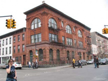
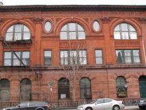
One of Greenpoint’s most fascinating structures is at the corner of Greenpoint and Franklin, the 1895 Mechanical and Traders Building, described thusly in the AIA Guide to New York City:
Brooding but glorious Renaissance Revival in Pompeian red terra- cotta, brick, and rock-face brownstone, with grand pilasters crowned by fantastic Composite capitals. Savor the terra-cotta frieze among other riches adorning this lovely building.
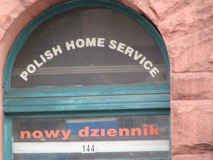
The building now hosts offices of the Polish-language newspaper Nowy Dziennik, or New Day.
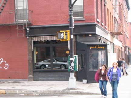
Two newish restaurant/bars are catercorner from each other at Franklin and Greenpoint Avenues, Alligator 2 (left) and Pencil Factory, named for the actual former one across the street. (March 2009 — bars seem to change their names every couple of years as they pass from owner to owner).
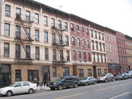
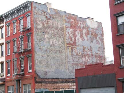
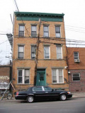
The stretch of Greenpoint Avenue between Franklin Avenue and Manhattan Avenue is relatively unchanged for over 120 years. According to Greenpoint USA, in 1887 developer James Sparrow built this row of 21 four story brick houses … prior to the construction, this was the place where the circus pitched their tents when they came to town.
The ancient “Syrup of Figs” painted sign, that was long ago superimposed over an older ad, has long been a fixture here despite getting a good deal of sun. The mild laxative is still used, though it was much more popular between about 1870-1920.
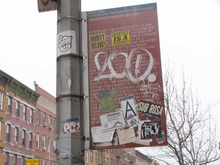
Greenpointers: here’s your freakin’ Landmark District!
(Actually the vast majority are proud of the status.)
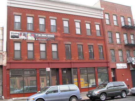
118 Greenpoint is a new condo conversion, a welcome occurrence in a city that has seen more than its share of teardowns. This has been slated to be the venue of a reality show hosted by rapper 50 Cent — I wonder what became of that project.
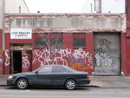
Live Poulty Slaughter, adjoining the new condo, is not the name of a postpunk Greenpoint band, it’s an actual slaughterhouse and, as the graiffito says. “this place stinks.”
Under its current incarnation, the slaughterhouse is called New Lee’s Live Poultry Market. One recent morning, a man working there named John Chen stood outside the building in a white coat as another man loaded a cargo van with paper bags containing slaughtered birds bound for Chinatown. Pointing to the recently hosed-off sidewalk as evidence of the establishment’s cleanliness, Mr. Chen said of the long-established business, “You can’t expect you come in and we move out.” NYTimes
In The City in downtown London, England, there is an actual street called Poultry (just Poultry, not Poultry Street) probably named for a former preponderance of slaughterhouses there.
[a local funnyman has whited out the S in SLAUGHTER]
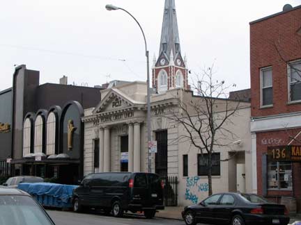
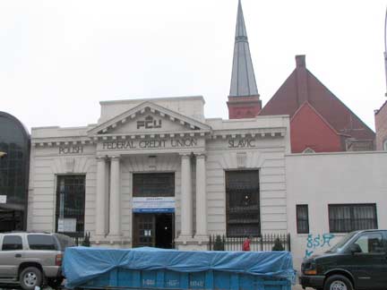
The low-rise Polish and Slavic Federal Credit Union building allows a glimpse of St. Anthony of Padua Church on Manhattan Avenue (above) and St. John’s Evangelical Lutheran Church on Milton Street (below). This building turns up in very old photos of this stretch, but I don’t know its original use. The organization was founded in 1976 to aid recent immigrants to whom banks would not extend credit; this branch opened in 1981.
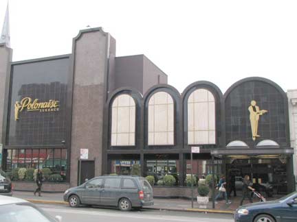
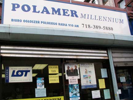
I’m amused that catering hall Polonaise Terrace is on the same block as a slaughterhouse, but that’s Greenpoint Avenue. Below: Polamer, a local tax office that sounds like a synthetic material. Plenty of local businesses’ names begin with the prefix Pol-.
Manhattan Avenue was named somewhat late in Greenpoint timeline — it was called Union Avenue in the mid-1800s and Ewen Street further south; by Brooklyn’s consolidation, it was Manhattan all the way. I’m somewhat amused by the name, since I’m sure — and I’m sure you can’t either — imagine a street in Manhattan called Brooklyn, Queens, Bronx or Staten Island Avenue.
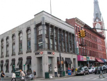
The Beaux-Arts bank on the corner is now part of the huge HSBC conglomeration. But what bank was here the longest?
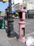
Unusually there are a 1910s-era and 1960s-era fire alarm on the corne. The old one has now become a de facto wastebasket.
For most of its length Manhattan towers such as the Citicorp building can be seen looking north up Manhattan Avenue, but the avenue takes a slight jog here. Note the old American Theatre, which became the Chopin, then a Roy Rogers, Popeye’s, Burger King and now a Starbucks, in the backgound. Just about every genre of American fast food has occupied the American Theatre.
ForgottenFan Chster Klyn: The bank on the corner of Greenpoint and Manhattan was the old Chemical-Corn Exchange Bank.
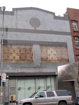
The Greenpoint Avenue entrance to the American/Chopin has been fierecely renovated over the past decade. It is now home to Qwest Diagnostics and (I think, still) Club Exit.
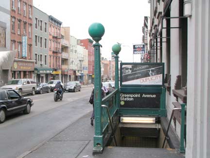
The IND Crosstown line (presently, the G train) has run subway service in Greenpoint as far south as Nassau Avenue since 1933; the remainder of the line, connecting with the IND A/C at Hoyt-Schemehon and the F at Bergen Street, opened in 1937. To ride the line is akin to opening a time capsule, as most of the original 1930s tiling is still present, and R46 cars, which were built in the early to mid 1970s, are still on the tracks. Because the line does not go to Manhattan, the MTA treats it like a stepchild with the G being the first in line for cuts during difficult economic periods. Many of the stations, especially in Queens, have water and rust damage.
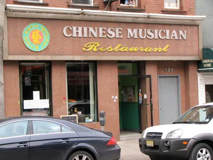
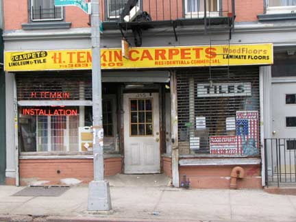
I can’t think of any really famed Chinese or Chinese-American musicians except Yo-Yo Ma, but that’s on me — fill me in. I liked the sign since it uses the somewhat kitschy ITC Souvenir Bold typefont. The font was first originated by designer Morris Fuller Benton in 1914 and redrawn for Photo-Lettering/ITC by Ed Benguiat in the 1970s. (Benton also drew Franklin Gothic Bold, one of the fonts used for this website). RIGHT: hand painted Temkin Carpets sign at Leonard and Greenpoint Avenue.
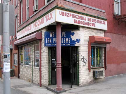
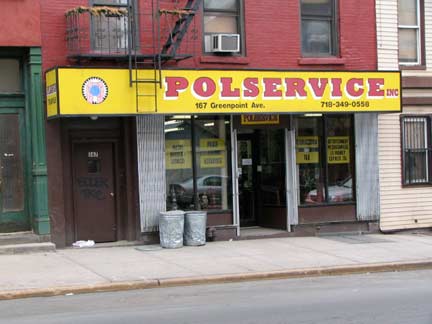
Leonard Street: Income taxes, and another Pol-prefixed place, this one dispensing notary service, money orders, etc.
I am going to say something now that will appear chauvinistic, but isn’t really at least in my opinion. I’ll direct it at ForgottenFans who learned English relatively late in life. Did you find, when you spoke only your first language, that English looked totally incomprehensible and you weren’t confident at all about ever being able to understand it? I feel that way when looking at Polish or other Eastern European languages, with all the J’s and Z’s.
I’m heartened by Fernando Lamas’ comment about his accent, something like, “my accent means I speak two languages and you only speak one.”
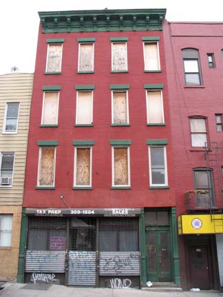
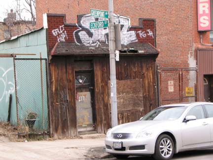
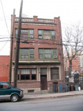
At Eckford Street and Greenpoint Avenue. While Greenpoint has not been a slum in recent memory it does have pockets like this, and the places seen near the river, that look unchanged for decades, and unlikely to ever improve.
Your webmaster has lived in Bay Ridge, Flushing and Little Neck, but I do have a somewhat sketchy Greenpoint history. When I was in high school in the Super 70s we were in a bowling league that played at a now-vanished without-a-trace lanes at Moultrie and Humboldt Streets (now Greenpoint Wood Exchange) and, when we weren’t tooling up Kent Avenue to Greenpoint in a Dodge Ram van, we took the GG (as it was then) and hauled our bowling balls and shoes up Greenpoint Avenue, past the sewage plant to Moultrie, where we walked a couple blocks south to the lanes. Unfortunately I remember nothing at all about the lanes — I’m a total blank.
ForgottenFan Chester Klyn: The bowling alley was named “Greenpoint Bowl.” Really original, huh! It looked like a factory with no windows on the outside and was in a seedy part of Greenpoint. It was where my friend and I bowled. The shack on the corner of Eckford and Greenpoint was a Taxi Meter and Speedometer repair shop. My Uncle Stanley lived just up the block on Eckford.
Flash forward a decade or so, and in college three of my pals lived in Greenpoint so I thought I would, too. I obtained an apartment for $275 a month at 193 Green Street. I was young and did not thoroughly vet the place, which was a mistake. It had a single electric outlet and the bathtub was in the kitchen. (This was not unusual for the area: my friend Brian rented a place in a backhouse at 14 North Henry that had a toilet and shower stall adjoining the kitchen.) Well, I managed to maneuver my way out of the lease and lived in Bay Ridge until 1993.
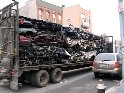
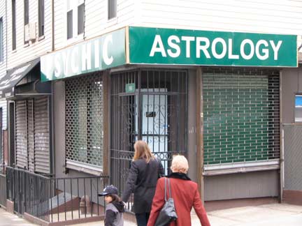
Though Greenpoint’s downtown area is bustling and busy and has its pockets of sophistication, like the Polonaise, you are also quite likely to see a big tractor trailer trundling up Greenpoint Avenue full of rusted wrecks heading for the auto salvage shops in East Willieburg.
Astrology and psychic purveyors are still a multimillion-dollar business at this late date, despite the fact that planetary positions in the heavens have absolutely nothing to do with human personalities, and the fact that there is no fixed future at all — present events determine what the future is. Why people believe this clap-trap is beyond my ken. And if you’re female, it should be beyond your Barbie.
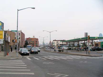
McGuinness Boulevard, Greenpoint’s connector to Long Island City via the Pulaski Bridge over Newtown Creek, was created in 1964 when all the buildings on the east side of Oakland Street were knocked down and the roadway turned into a 6-lane pedal to the metal road connecting the Pulaski with the Brooklyn-Queens Expressway. The road was renamed for Democratic alderman Peter McGuinness (1888-1948) who, according to legend, coined the term “Garden Spot of the Universe” as Greenpoint’s moniker. McGuinness testified in the Seabury investigation that revealed Mayor Jimmy Walker’s corruption and forced his 1932 resignation, paving the way for the Little Flower.
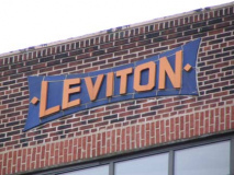
Crossing McGuinness Blvd. you quickly come upon a large complex of brick buildings on the south side of the street between Newel and Jewel Streets, each bearing multiple terra cotta “Leviton” signs. This is the old Leviton electric works factory built in the mid- 1910s for the company, which originated in 1906. Though Leviton moved out several years ago and is now in Little Neck, of all places, the signs remain. The factory now houses a number of industrial concerns.
Information on street names in this part of town is hard to come by, but three consecutive streets are named Newel, Diamond, and Jewel and have been since the mid-1850s at least.
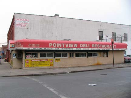
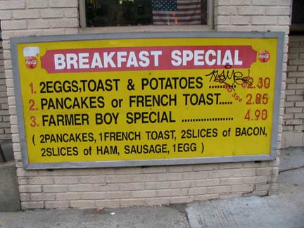
Pointview Deli, Greenpoint Avenue and Provost Street. Signs point to a “nature walk” north on Provost, which I assume is along Newtown Creek; I didn’t have time to investigate it. Sometime soon.
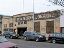
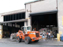
Business picks up as we reach Humboldt Street, where the telltale stench informs us about the massive Newtown Creek Sewage Treatment plant. Actually I always find the one in Sheepshead Bay on Knapp Street much more odiferous. Across the street, forklifts picking up garbage and putting it down at Michelman Iron Works, whose motto is Steel Is Beautiful.
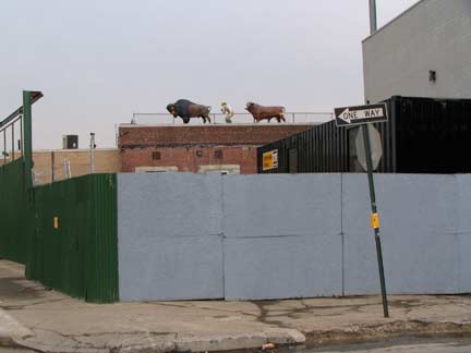
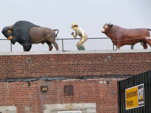
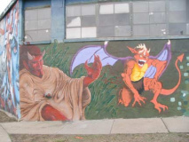
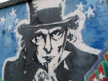
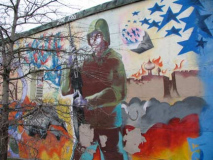
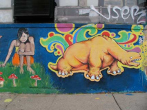
Greenpoint Avenue and Russell Street. Your opinion is as good as mine. Possibly participants of the great Cow Parade of 2000 that decided to hang around.
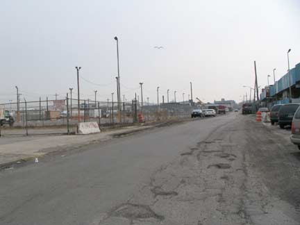
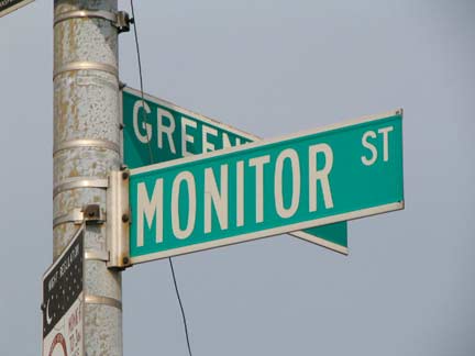
Monitor Street is named for the USA’s first ironclad seaborne vessel, the Civil War-era Monitor, built at Continental Iron Works by engineer John Ericsson, who has a monument dedicated to him in McGolrick Park three blocks to the south. After its launch from the pier at Quay (pronounced key) Street, the Monitor engaged the Confederate States’ Merrimac at Hampton Roads in 1862.
Anaerobic Digestion Boobs
Well, we’ve seen the udders … here are the boobs …
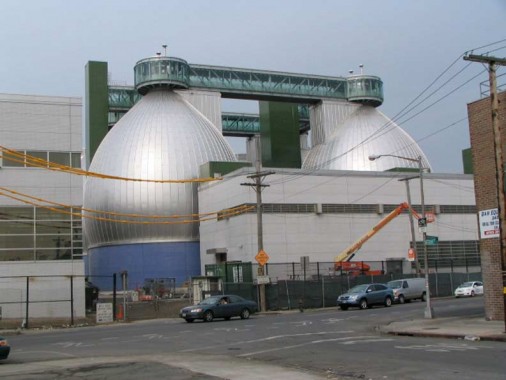
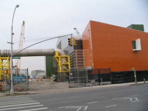
These somewhat disturbing objects at North Henry Street are called digester eggs. Through a process called anaerobic digestion they reduce the volume of sludge (what’s left of sewage after debris and liquid are removed) by nearly half. The egg shape is a space- efficient and minimal maintenance European design. The green thing in between the eggs is an elevator, in case you want to see what’s going on up there.
In the 1960s the oil refineries moved out of Greenpoint and the sewage treatment facility moved in. When the current upgrade is completed it will feature twelve of these eggs, to give an idea of its size. To this day it is a source of various pungent odors which, to your relief, current Internet technology prevents me from presenting here. The fact, however, is that the facility has cut down on the amount of raw sewage flowing into the East River and has brought some amount of government attention to the environmental situation in Greenpoint. So it is a lesser evil than the refineries. Alex Reisner
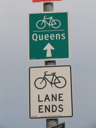
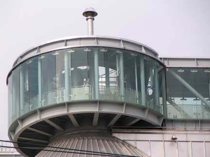
What is underpublicized is that the “nipples” at the boobs’ apices house guard stations. The wardens are ordered to shoot to kill any native Greenpointers who are attempting to flee over the JJ Byrne Memorial Bridge. Nevertheless, helpful signs for bicycle riders are posted. I’m kidding.
Before Greenpoint Avenue leaves Brooklyn, there is one more site to see: the massive concrete warehouse known as the Miller Building. A glance up Kingsland Avenue reveals the Citicorp Building, which looms ever closer as we approach Queens. And, a short walk up Kingsland will grant you a rear view of the biggest boobs in Brooklyn.
I used to think Kingsland Avenue was a Brooklyn tribute name, but according to Brooklyn By Name it commemorates Ambrose Cornelius Kingsland (1804-1878), a Whig NYC mayor (1851-1853) and sperm whale oil merchant, of which Greenpoint had a number. Kingsland appropriated funds during his term that went toward the construction of Central Park. The Bronx’ Kingsland Avenue is named for him, as well.
A descendant, William Kingsland, (d. 2006) was a “walking city gazeteer.”
Byrne-ing Bridges
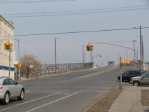
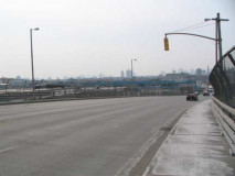
The James J. Byrne Memorial Bridge takes Greenpoint Avenue over Newtown Creek. From FNY’s Newtown Creek page:
The J. J. Byrne Memorial Bridge, also known as the Greenpoint Avenue Bridge, was opened in 1929 and was completely overhauled in 1987. It is the fifth bridge that has carried Greenpoint Avenue over Newtown Creek. It is a bascule drawbridge as is the Pulaski Bridge.
According to the Department of Transportation, a drawbridge first operated here in 1855; one of its successor bridges also carried a defunct section of the Long Island Rail Road from the Greenpoint waterfront to a connection with the similarly-vanished Evergreen Branch.
In 1950, in what is considered to be the worst oil spill in United States history, 17 to 30 million gallons of oil spilled into Newtown Creek. Oil is believed to have been seeping into the groundwater since then. Groundwater in this area is not used as drinking water, as all of New York City’s drinking water presently comes from upstate reservoirs. In January 2006, state and oil company officials asserted that to date half of the spill has been cleaned up. wiki.trytop
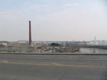
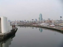
Looking west on Newtown Creek; Lukoil (Russia’s second largest oil producer); an overhead look at the Long Island Rail Road Montauk Branch tracks. Now used mostly for freight, these tracks see three passenger train runs each weekday.
Land of Bliss
We’re now in Queens, but in a little-known subneighborhood known as Blissville. From FNY’s Blissville page:
Blissville is the small wedge of Queens positioned between Newtown Creek, Calvary Cemetery and the Queens-Midtown Expressway; it takes its name from Neziah Bliss, inventor, shipbuilder and industrialist, who owned most of the land here in the 1830s and 1840s. Bliss, a protegé of Robert Fulton, was an early steamboat pioneer and owned companies in Philadelphia and Cincinnati. Settling in Manhattan in 1827, his Novelty Iron Works supplied steamboat engines for area vessels. By 1832 he had acquired acreage on both sides of Newtown Creek, in Greenpoint and what would become the southern edge of Long Island City. Bliss laid out streets in Greenpoint to facilitate his riverside shipbuilding concern and built a turnpike connecting it with Astoria (now Franklin Street in Greenpoint, Vernon Blvd. in Queens); he also instituted ferry service with Manhattan. Though most of Bliss’ activities were in Greenpoint, he is remembered chiefly by Blissville in Queens and by a stop on the Flushing Line subway (#7) that bears his family name: 46th Street was originally known as Bliss Street.
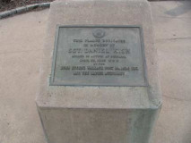
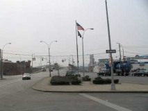
After arriving in Queens via the JJ Byrne Memorial Bridge we are immediately greeted by busy Van Dam Street, whihc funnels traffic from western Sunnyside south to the bridge. The traffic island formed by Greenpoint Avenue and Van Dam Street contains a flagpole dedicated to Sgt. Daniel Kish, a local who perished in the Vietnam War.
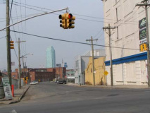
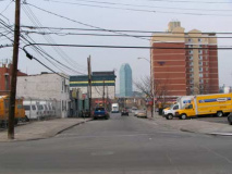
Greenpoint Avenue between Van Dam Street and Starr Avenue. I lked the older multifamily buildings but was also fascinated by the thickly wired utility posts. Starr provides a direct sight of the sea green Citicorp Building, Long Island’s tallest.
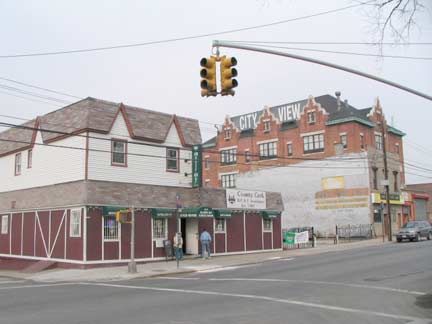
The former Bradley Hotel at Bradley and Greenpoint Avenues was a way station for weary 19th Century travelers and a watering hole for Calvary Cemetery visitors. It has hosted a succession of pubs in recent decades, includsing today’s Bantry Bay Publick House.
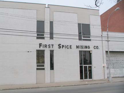
The bland First Spice Mixing Company on the other side of Best Western.
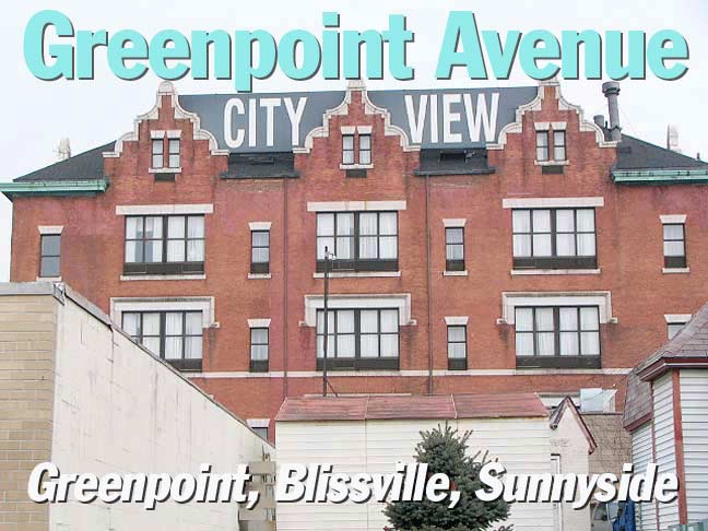
The City View
Rebecca Cooney of Living in Blissville limns the recent history of the most unusual Best Western you’ll ever see, the incredible former PS 80 on Greennpoint Avenue east of Bradley, now the City View:
In the brick school that overlooks all of Blissville, boys entered from the front, girls from the side, so the stone lintels dictated anyway. Judging by its architecture, it must have been built around the turn of the century. Its builders constructed it to last a century or more. They couldn’t have known that events greater than weather and age would force the school to close its doors, only after 30 years or so. Blissville lost much of its population in the years of the second World War.
In the peace that followed, new people came to Blissville, even a community of Satmars. They bought the school and converted the building into a yeshiva. But after five years or so, they left to migrate to Williamsburg, where they still live.
And so the school emptied out again. It stood vacant during the the 1960s passed, the 1970s, and for part of the 1980s, until an outside investor purchased it. He renovated it, then turned it into a hotel. He named it the City View Motor Inn after the top rooms that look over all of Blissville, out to the skyline of Manhattan. Then for some reason he sold it. One after another, hotel hopefuls tried to make it work, five owners in five years. And still the building stood empty.
Mohammad Daoud is its latest owner, smarter and more determined than his predecessors. His first move was to join forces with Best Western. He’s been with them now over 15 years. Then he renovated the hotel again until barely a vestige of the old school remained. He instituted a shuttle service to the airports and city. And he signed on to take LaGuardia Airport’s stranded passengers. He has garnered business from the Brooklyn Navy Yard, the Chamber of Commerce and the District Attorney’s office, all because of his innitiatives.
A room at the Best Western here starts at $150. A room with a view costs twice as much. But all rooms include his Delux Complimentary Continental Breakfast, with fresh juice, donuts and bagels with a special bagel cutter.
And now the 71 rooms are always occupied.
While researching the ForgottenBook, I wanted to stay for a couple days at the City View, so I called and asked for a room with a city view, quite reasonably, in my opinion. The reservations person thought I was kidding and told me to take what they had. I never got a room but I might try again.
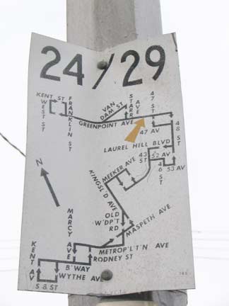
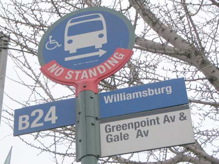
The B24 bus, given a B since it spends most of its time in Brooklyn, has an odd route– beginning in Greenpoint, it runs along Greenpoint Avenue to Sunnyside, then south across the Kosciuszko Bridge into Williamsburg to Broadway and Marcy Avenues where there is a J train el station. There is no longer a B29 bus — this sign goes back to the 1960s.
Calvary
From FNY’s Blissville page:
The presence of Calvary Cemetery in southwestern Queens is due to the influence of the parish of St. Patrick’s in Manhattan, which bought land here from the Alsop family in the early 1840s. A careful look in southern Calvary Cemetery (near old Penny Bridge) will reveal the Alsop family burial ground, which was incorporated into Calvary, with stones dating to 1743. The parish purchased land that became “New” Calvary Cemetery just to the northeast from the Burroughs family in 1870. A large swamp, known as Wolf Swamp because of the presence of the canines, had to be drained to create the cemetery.
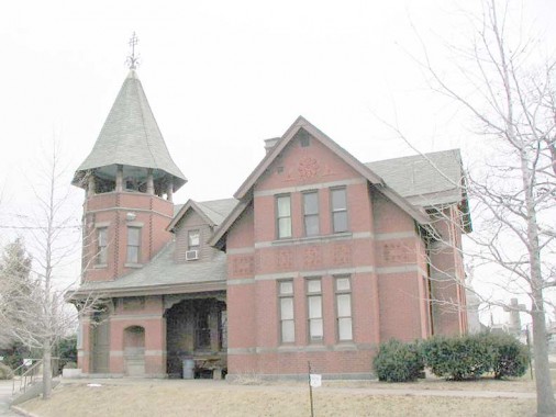
Though the great skyscrapers of Manhattan loom over the cemetery, its architecture is not to be overshadowed, as witness its grand Queen Anne gatehouse at Greenpoint and Gale Avenues.
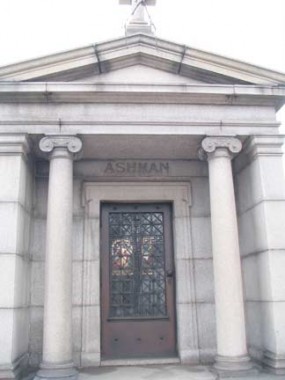
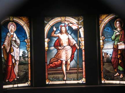
On my cemetery tours I encourage people to look through the mausoleum doors — you will often find fine stained glass artwork. The Ashman tomb, right by the gate of Calvary Cemetery on Gale Avenue, is no exception.
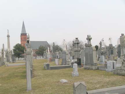
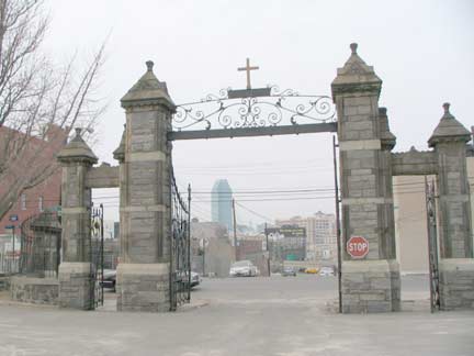
St. Raphael’s Church looms over Calvary; front gate and Citicorp, Gale and Greenpoint Avenues.
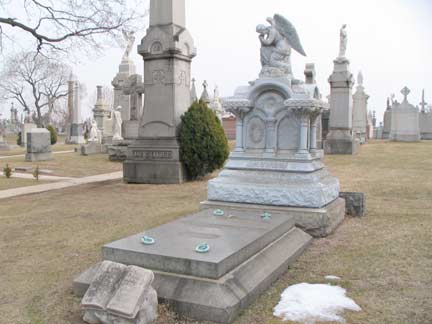
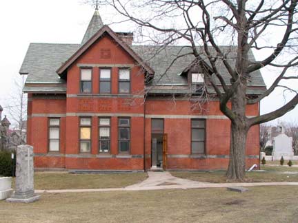
Elaborate monuments, many with weeping angels, near the front gate; cemetery gatehouse, side view.
If you look at a map the original Blissville street layout is still quite clear, as it runs athwart the dominant street grid. Review, Starr, Bradley and Gale Avenues are the north-south routes, while 34th (originally Young) and 35th (Pearsall) Streets and Greenpoint Avenue are the east-west routes.
A group of local artists’ work appears here on a building on 35th Street and the Queens Midtown Expressway.
Across the Queens Midtown Expressway, we are in Sunnyside….
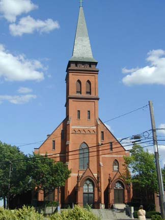
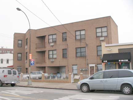
It was admittedly a bad day for photos — I used a picture of St. Raphael’s on Greenpoint and Hunters Point Avenues from an earlier walk to do it justice. At 100 feet tall, it is the tallest building in the area, rivalled only by the Celtic Park Houses, and was constructed in 1885. Meanwhile, a much humbler Fedders Special sits nearby.
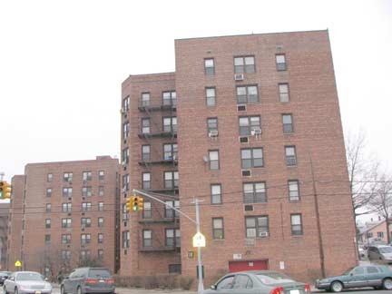
The Celtic Park Houses complex, near 50th Avenue and Greenpoint Avenue (resembling the project shown here), remembers Celtic Park, a recreational spot and sports center for the area’s large Irish population during the first quarter of the 20th century. The site nurtured athletes who participated in the Olympic Games between 1900 and 1912; the spot subsequently became a greyhound racetrack. The name is perpetuated in Celtic Avenue, a short remnant between 43rd and 50th Avenue, of the once-much longer Bowery Bay Road.
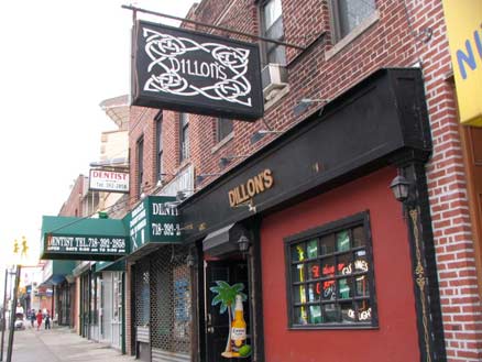
Dillon’s near 40th Street, one of the numerous Irish pubs in Sunnyside and Woodside.
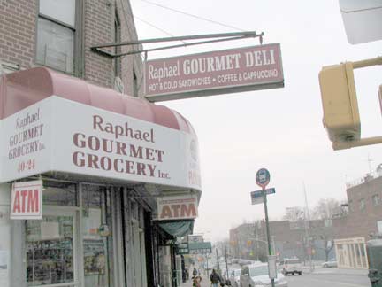
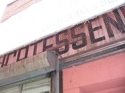
Raphael Deli, possibly named for the church, Greenpoint Avenue at 41st Street and 48th Avenue. It has a modern vinyl awning, but a peek underneath reveals a vintage sign.
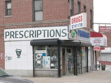
The Greenpoint Pharmacy, next to the Raphael Deli, is actually in Sunnyside. Its vintage sign, complete with a vessel with a pestle, is right out in the open.
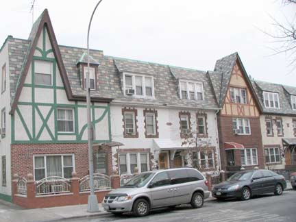
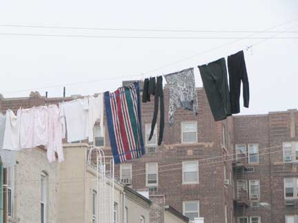
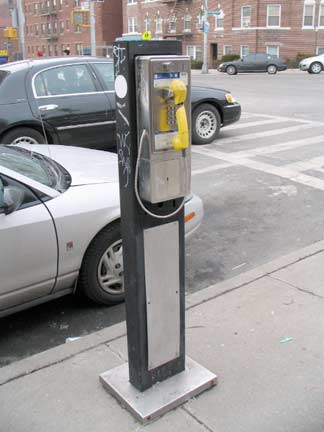
Some handsome multi-colored Tudors and some Sunnyside wash adjoin a smashed phone on 41st street. Public pay phones have come a long way from booths, where you could actually close a door and not bother anyone, to hoods, to posts. I suppose all public pay phones will soon be extinct, anyway.
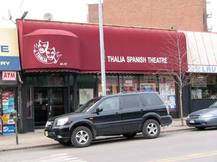
Featuring music and song by Spanish and Latin American composers and artists, this bilingual Queens theater company has produced more than 100 plays, operettas and folklore shows since its 1977 founding by actress and director Silvia Brito. Her successor, Angel Gil Orrios, has served as artistic director since 1999 and innovated by presenting bilingual casts and alternating performances in English and Spanish. NYCGO
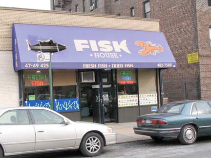
Someone was so hungry, they ripped the vinyl fish off the awning here on 42nd Street.
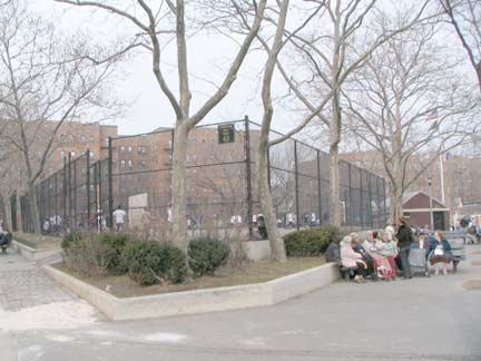
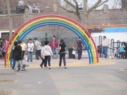
Thomson Hill Park, a triangle at Greenpoint Avenue, 47th Avenue and 42nd street, and the Lance Corporal Thomas P. Noonan Playground make up the only park and play space in all of Sunnyside. While eastern and southern Queens can boast Forest Park, Flushing Meadows-Corona Park, Kissena Park, Cunningham Park, Alley Pond Park, Springfield, Brookville and Baisley Pond Parks, western Queens is relatively park-starved with the exception of Astoria Park in the extreme northwest.
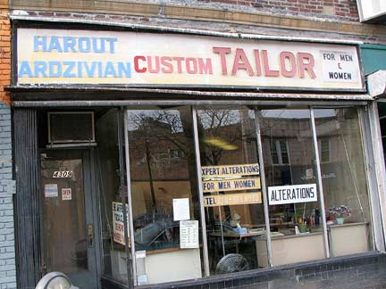
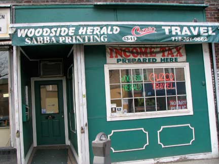
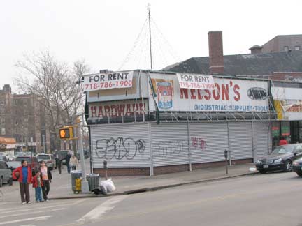
The Harout Ardzivian Custom Tailor sign, east of 43rd, has been here many seasons. The Woodside Herald offices strongly resemble a former pub. Nelson Hardware, a Sunnyside fixture for many years (especially in Christmas season when it sold ornaments and trees) is gone for good.
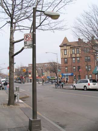
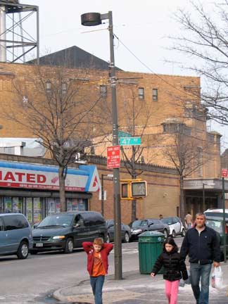
In the 1990s (or was it the 1980s?) Greenpoint Avenue in Sunnyside underwent a radical remake, with new sidewalks, benches and tall and short lampposts. Most were replaced in the early 2000s, but a few around 47th Avenue are still hanging on.
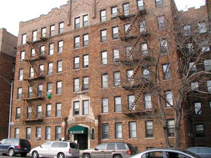
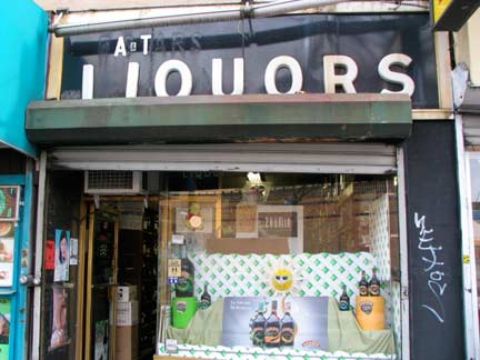
Apartment building, 47th and Greenpoint Avenues and 1950s era sign, A&T Liquors.
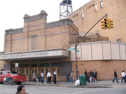
The former Bliss Theatre, Greenpoint Avenue and 45th Street. Cinematreasures:
The Bliss first opened in 1931 and was built by Century Theatres with its usual architect-designer team of R. Thomas Short & William Rau. By that time, the sound era was well underway, so the Bliss was designed solely for movies, with a stage just deep enough for the hanging of a Magnascopic Screen that could be enlarged for special effects from the projection booth.
The Bliss’ interior decor was a modern interpretation of motifs found in ancient Egyptian architecture. Boldly-colored murals on the side walls and above the proscenium arch depicted scenes from Egyptian history. Located in the heart of the Sunnyside shopping district, the Bliss was never more than a subsequent-run neighborhood house until the 1960s when movie distribution switched to city-wide Premiere Showcase openings. But the change didn’t increase attendance at the Bliss, and Century decided to close it due to its high operating costs.
The building was sold to Jehovah’s Witnesses, which converted it into a church with almost no changes to the exterior. The interior, however, has been extensively renovated, although an atmospheric lobby remains but with new paintings on the walls. The new owners removed everything of the Egyptian decor that showed nudity and/or pagan symbolism. The result now is an auditorium that looks like it was built yesterday, though you can still find touches of the original Bliss decor if you look hard enough. Church services are held every Sunday morning at 10 AM, and non-members are welcome to attend.
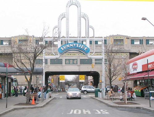
Near the heart of Sunnyside, the arch at Queens Boulevard and 46th Street, Greenpoint Avenue finally comes to an end … but as Roosevelt Avenue it hosts the #7 “International Express” to Flushing.
Photographed March 7, 2009; page completed March 8.

