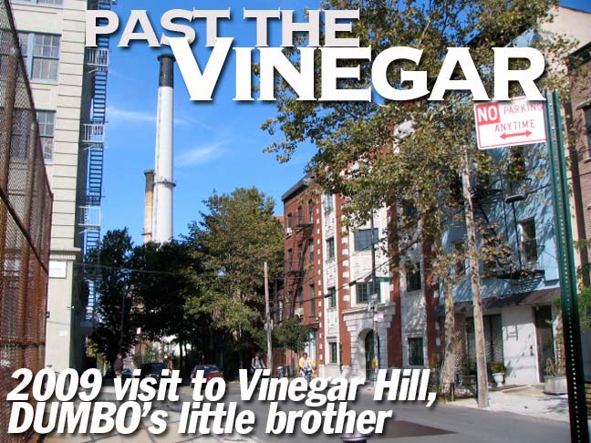
When I first began doing FNY in 1998 one of my original shoots was in Vinegar Hill, an improbably isolated swatch of Brooklyn found by heading east on one of the DUMBO east-west streets all the way until there’s no further to go. The brick warehouses, powerhouses and light manufacturing that make up the eastern half of DUMBO (and indeed until about 6-8 years ago made up all of DUMBO before it was rezoned and went residential) give way, rather magically, to a Brigadoonish enclave of frame homes, long-disused storefronts, and on parts of Gold and Front Streets, some attached brownstones that appear as if they were airlifted in from Park Slope.
Lording over all on the north is the massive Con Ed power plant, and on the east, the Brooklyn Navy Yard, with a view of one of its more beautiful edifices, the Naval Commandant’s House.
I visited and photographed again in October 2003 in FNY’s very successful Tour 14, Brooklyn Between The Bridges. The first residents of DUMBO, repopulating old lofts and factories, had begun moving in as I began my surveys. Vinegar Hill, however, had been settled in the early part of the 19th Century after John Jackson began developing his holdings there. After selling part of his property to the US Government, which built the Navy Yard along Wallabout Bay, he subdivided the remaining land, building several houses, some of which survive along Hudson Avenue, Vinegar Hill’s “main” north-south drag (it was originally named Jackson Street: the name was changed sometime between 1825 and 1855. However, John Street remains). A proud Irishman, Jackson named his enclave Vinegar Hill after the June 1798 Battle of Vinegar Hill, an engagement in County Wexford, Ireland, during the Irish Rebellion of that year. (The rebels were defeated, and a massacre ensued — there would not be an Irish Free State until 1922).
The immediate origins of the 1798 Rebellion in Ireland can be traced to the setting up of the Society of United Irishmen in Belfast in October 1791. Inspired by the French Revolution, and with great admiration for the new democracy of the United States, the United Irishmen were led by Theobald Wolfe Tone, Thomas Russell, Henry Joy McCracken and William Drennan. They came together to secure a reform of the Irish parliament; and they sought to achieve this goal by uniting Protestant, Catholic and Dissenter in Ireland into a single movement. BBC
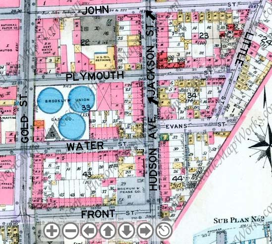
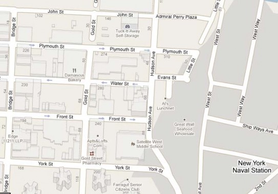
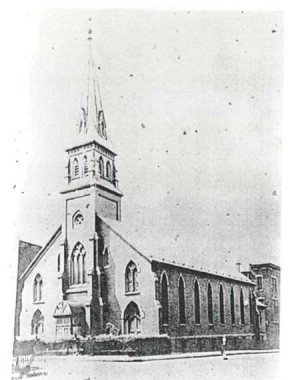 The street layout of Vinegar Hill has changed little, at least north of Front Street, from 1916 (top) to 2009, although too many buildings to count have been eliminated since 1916, including the historic, lofty steepled St. Ann’s Church (in 1992) at Gold and Front Streets and St. George’s Church (in 2009) at 109 Gold (torn down by the same developer). St. Ann’s was designed in 1860 by a local resident, Patrick Keely, one NYC’s most prolific ecclesiastical architects. [Historic Map Works, Google]
What I didn’t know was that at the corner of Gold and Water (I wonder if the 1964 Republican Presidential candidate ever heard of this corner?) there used to be three immense Brooklyn Union Gas tanks. That’s improbable, but for the evidence shown here; on the opposite corner stood, and stand today, a row of handsome stooped brownstones.
South of Front Street, by the way, was once a lively, some say sleazy, row of entertainments along Sands Street serving the sailors and workers of the Brooklyn Navy Yard, as well as another street grid with brick and row houses. Most of this was eliminated when the Farragut Houses were constructed in the late 1940s — a series of “towers in a park” built under the influence of French architect and designerLe Corbusier. In fairness, many of the houses torn down, documented by the photographs of Berenice Abbott, were poverty-stricken firetraps and at the time, it was thought that the towers would be a vast improvement. They are today a forbidding entrance gate on Vinegar Hill’s southern flank. Le Corbusier’s philosophy has had some air let out of it as the decades pass, but Robert Moses was a disciple, and many towers in the park still dot urban landscapes worldwide. (Besides, Your Webmaster believes that anyone using a title instead of his name is being impossibly pretentious.)
Southern Vinegar Hill defunct streets can be found in FNY’s Downtown Brooklyn Street Necrology. (My necrologies will resume someday, I promise. In the meantime there’s always Gil Tauber for Manhattan, Steve Morse in Queens, and Brooklyn Genealogy.
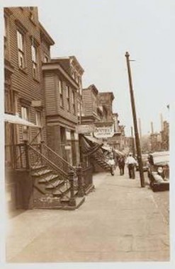
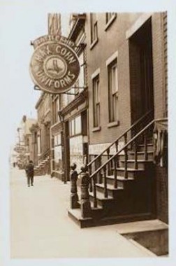
Sands Street, early 1900s. (LEFT: near the defunct intersection of Sands and Charles; right: Max Cohn Uniforms, serving the Navy Yard.) Forgive the poor proofs; these were taken from the NYPL site, which has a very awkward and inhospitable viewer interface — likely due to the fact that they want you to purchase the prints to get a better view. For similar reasons, Historic Map Works has slapped an intrusive logo all over its online views.
One of history’s most infamous gangsters made his original home on Navy and Sands, very near the main Navy Yard entrance, and its influence was not lost on him.
When little Al came along, the Capones lived at 95 Navy Street … bordering the New York Naval Shipyard — better known as the Brooklyn Navy Yard. Predictably, the neighborhood was rough, Sands Street especially. Conveniently dead-ending on Navy street at the Navy Yard gate, Sands offered all the diversions suggested by the phrase “drunken sailors.” …Sailors could swagger into the salons that lined sands, then stagger out to the attendant pickup dance halls, brothels, hot-bed rooming houses, pawn shops and tattoo parlors. Sands was a street, as one of its historians put it, “of cheap liquor and even cheaper women.” —Mr. Capone, Robert J. Schoenberg
Sands Street is still rough — it’s now the main east-west bisecter of the Farragut Houses.
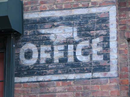
Prior to 1980 or so, DUMBO was nameless, because no-one lived there. It was all warehousing and light manufacturing until then. The area “down under the Manhattan and Brooklyn Bridge Overpasses” had largely been built up in the 1850s by Scottish immigrant Robert Gair, who arrived in the 1850s at age 14, apprenticing in the paper trade. He patented a machine for inventing folding paper boxes in 1877 and built a small empire: 10 buildings, many of which still stand and still bear his name, employing over 1700 workers. When Gair arrived, he found a mixed-use area of industry and slight frame homes, most of which he bought up and demolished. Companies that developed into today’s Nabisco, A&P supermarkets, Pond’s hand cream, and Grand Union all used thousands upon thousands of Gair’s boxes for packing and shipping. His concrete buildings, built to stand for centuries, have now been converted to lofts and condos, though some light industry still remains. The massive Sweeney (concrete manufacturing) Building on Main Street for decades announced its name on giant letters that could be seen from Brooklyn Heights. The letters were removed when the building went residential in 2003. The Gair company moved its operations out of DUMBO in the 1930s.
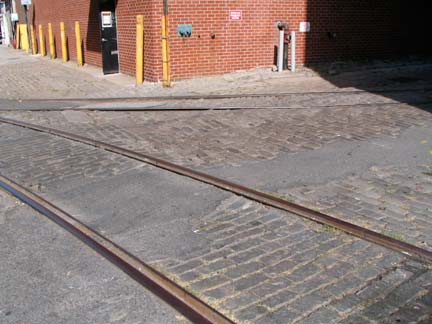
In the place of Gair and the Eliphalet Bliss munitions companies, DUMBO played host to foodstuff manufacturers, big names in fact, such as Hellman’s Mayo, Planter’s Peanuts that joined the already-established Arbuckle Brother’s coffee empire. The Jay Street Connecting Railroad, whose tracks can still be seen in the Belgian blocked streets (above left), moved products from buildings to riverside carfloats. Developer David Walentas began to buy up many of the manufacturing and industrial buildings in 1981, and with necessary zoning changes, DUMBO gradually became residential. It was a slow go at first, with art gallerists being the first pioneers, but as Walentas developed luxury apartments beginning in the Main Street Clock Tower Building (the apartment with the clocks was for sale in 2009) DUMBO began to take on an air of nascent sophistication. It is the only neighborhood that can boast spectacular upfront views of both bridges, and the massive Brooklyn Bridge abutments name dramatic appearances from certain corners.
I have a new batch of photos from DUMBO ready and am awaiting the acquisition of more (my last DUMBO page, linked above, came around 2002) but today, we’re marching to Vinegar Hill.
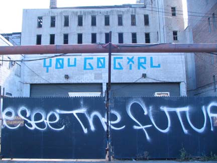
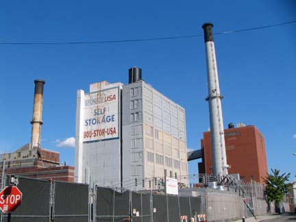
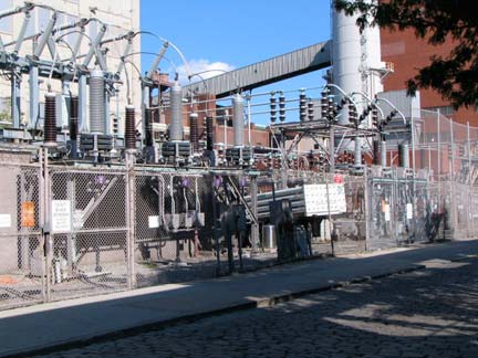
No man’s land, Plymouth Street east of Bridge Street. Plymouth Street is likely named for famed preacher Henry Ward Beecher‘s Plymouth Church of the Pilgrims on Hicks and Orange Streets in Brooklyn Heights. A chunk ofPlymouth Rock is embedded in the wall of an adjoining church building, while a statue of Beecher at the church joins a larger one at Borough Hall Plaza. Like Taylor, we are riding toward…our destiny.
We now begin to pass the huge Con Ed complex. Power can be heard sizzling and burbling through the dynamos, protected by a double helping of barbed wire.
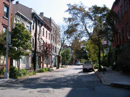
At length, after what seems like an eternity stumbling past barbed wire, the hiss of power plants, broken pavements and forbidding warehouses, you encounter Hudson Avenue, the main north-south Vinegar Hill thoroughfare, which looks like this. We have more business on Plymouth Street and a couple of small streets around the corner, but we’ll explore Hudson presently. This is essentially a ghost town but the corpse is slowly reviving.
Know that this streetscape will likely survive, as is, indefinitely. Vinegar Hill in 1997 was designated a Landmarked District.
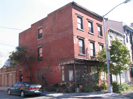
49 Hudson Avenue, corner Plymouth, was likely constructed by John Jackson himself prior to 1835.
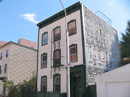
324 Plymouth, right, is one of a pair of residential buildings on Plymouth between Hudson Avenue and Little Street.
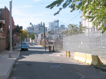
Looking west on Plymouth Street toward the Manhattan Bridge and DUMBO.
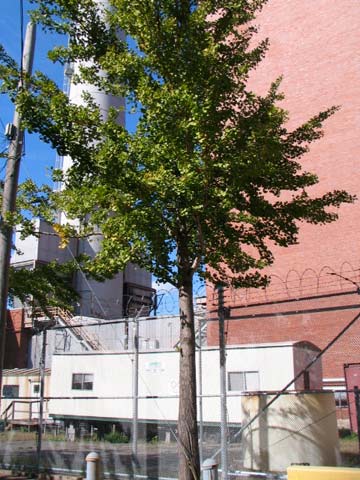
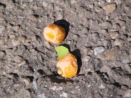
A pungent ginkgo tree grows on Plymouth despite the unholy proximity of the massive Con Ed plant.
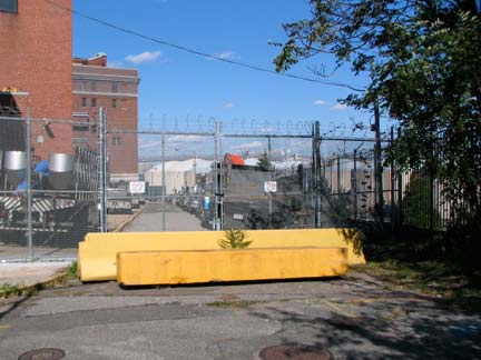
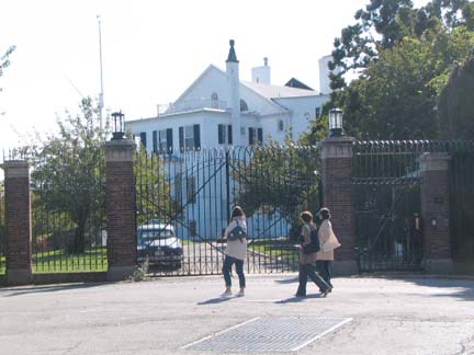
Little Street runs for one block, at least its public section, between Plymouth and Evans Streets. However, it is not named for its short length. According to Leonard Benardo and Jennifer Weiss inBrooklyn By Name, it honors a local tavern owner, John Little, who ran a ferry with Captain Samuel Evans (also honored here with a street name) from Little Street across the East River to Walnut Street in Manhattan. (Walnut Street is now called Jackson Street). It does extend into the Con Ed plant but that section has been closed to the public for years. RIGHT: Unfortunately, the best view you can get of the Naval Commandant’s House, which, when the Navy Yard closed in 1966, was sold to a private owner. Check FNY’s Navy Yard Slice for a better view. The mansion was built in 1806. The NY Times’ Christopher Gray got inside for a look in 2006.
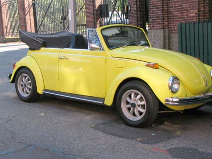
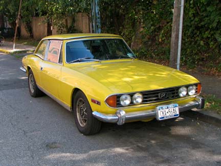
VW SuperBeetle, 1971 or 1972 and British Triumph Stag. While shooting the Bug a guy behind me said, ‘want to talk to the owner?” I identified myself and mentioned FNY, and he told me that he was a Forgotten Fan and made the decision to move to Vinegar Hill based in part on his seeing it on the site. I have gotten that more than once.
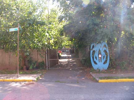
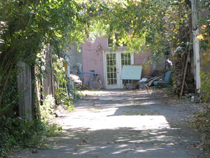
The perpetually mysterious Harrison Alley runs south from Evans Street — for as long as I’ve been coming into the area (on and off since the 1980s) it’s been behind a locked gate. A Google area view shows a couple houses near the end, and all I can get with a zoom lens is a glass paned double door.
Hudson Avenue
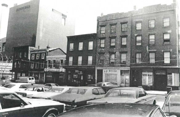
Fascinating look at the east side of Hudson Avenue in 1977, showing, from left to right, 49, 51, 53, 55, 57 and 59. Since then, #53 has had two stories added. This appears in the Landmarks Preservation Commission report designating Vinegar Hill as a Historic District. I’m at something of a loss about how this shot was gotten — there must have been empty lots on Hudson Avenue used as parking areas on the west side of the street at the time. Cars looked completely different in 1977– boxes on wheels.
Hudson Avenue, originally called Jackson Street for the area’s original developer, once extended continuously south from the East River to Fulton Street, but the construction of the Farragut Houses, Brooklyn-Queens Expressway, Ingersoll Houses, University Towers Houses, and Long Island University completely obliterated it south of Front Street beginning in the 1940s. Till 1940, a section of the old 5th Avenue El ran above it. There are just 3 short blocks remaining in Vinegar Hill, and a one block chunk between DeKalb Avenue and Fulton Street.
In the 1800s, Hudson Avenue in Vinegar Hill was a main business strip, with butchers, tailors, tobacconists, bars and grills. In the 20th Century the construction of Farragut Houses and the BQE cut the neighborhood off from the rest of Brooklyn and served to strangle it, so that population dropped greatly. Of late there has been an uptick as DUMBO became re-settled and some pioneers have been making their was east. A York Street bodega is still the main grocery, although more shops selling necessities have appeared in DUMBO. Let’s take a look at some of the Hudson Street buildings, some of which have long-unused storefronts…
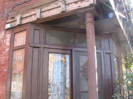
As previously mentioned, 49 Hudson at Plymouth was built by John Jackson prior to 1835. Changes over the years have included the removal of a gable roof and addition of a 5-car garage.
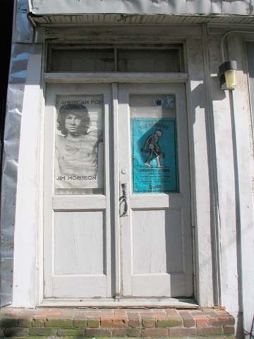
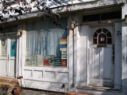
51 Hudson Street, built between 1840-1847 by shipbuilder Lawrence Powers. It has a backhouse completely invisible from the street.
53 Hudson, which I didn’t photograph but can be seen third building from the left on the above 1977 photo, has a fascinating Vinegar Hill-Flushing connection. It was built by Samuel Bowne of the Flushing Bownes (the John Bowne House in Flushing is the borough’s oldest building). When the building was constructed the Bownes were involved in the shipping industry in lower Manhattan.
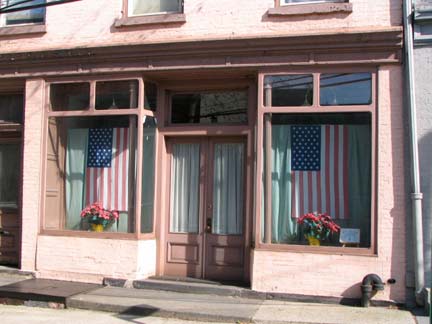
55 Hudson was also originally owned by Samuel Bowne.
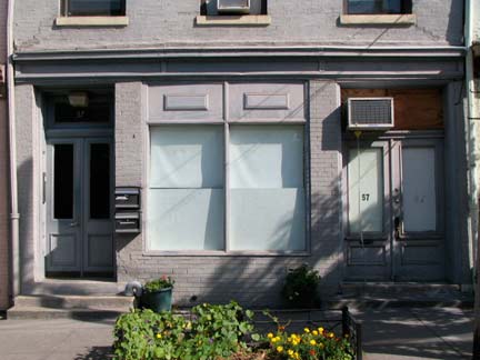
57 Hudson was built in 1852 by Dr. George Gilfilland, an Irish immigrant. With his lawyer brother, George, the Gilfillands owned much of the property in the area in the 1850s.
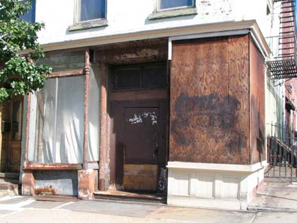
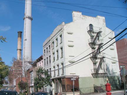
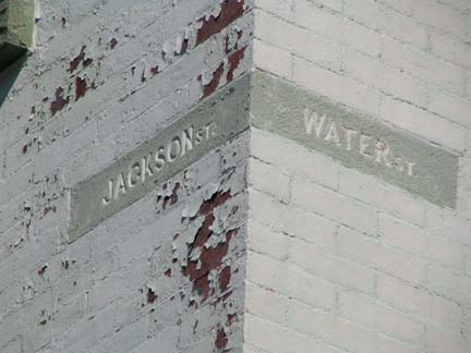
59 Hudson Avenue, corner of Evans Street, a Greek Revival house built by the Gilfillands around 1850. This was formerly the corner of Jackson and Water — when built, Evans Street was the eastern end of Water Street.
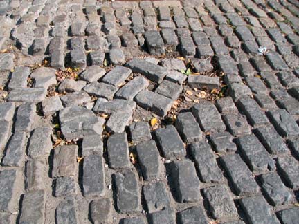
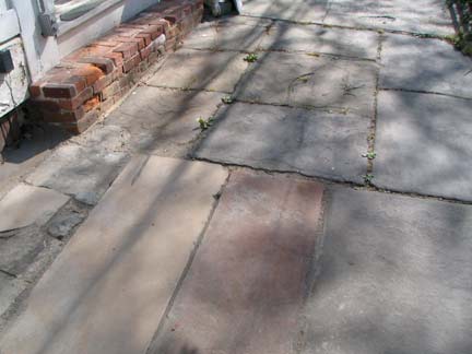
Driving on Hudson Avenue can be an adventure — the Belgian blocks are occasionally uneven. Sidewalks are still mostly bluestone.
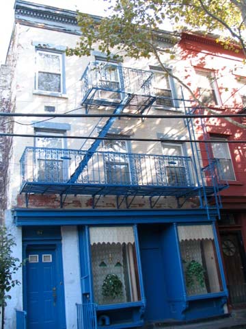
67 Hudson is one of the oldest buildings in the district –it was built by John Jackson in 1817, along with neighboring 69 and 71 Hudson. The year after the buildings were constructed they were sold to Captain Samuel Evans, who sold them in 1847.
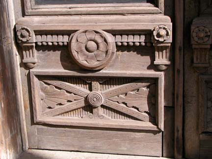
doorway detail, 77 Hudson
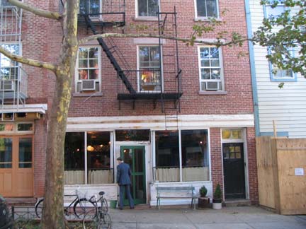
72 Hudson Avenue, built around 1870 by grocer John Shutte, houses the first restaurant to open in the neighborhood in decades, the Vinegar Hill House, opened by a couple who met working in Freeman’s (on Freeman’s Alley in Manhattan).
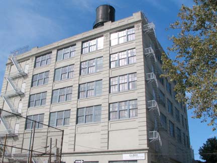
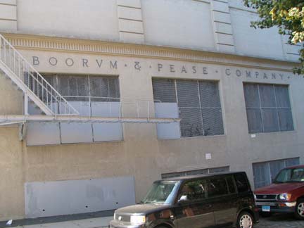
Boorum & Pease manufactured and marketed office supplies, record-keeping supplies, and information storage and retrieval products, and was a leading manufacturer of blank books and loose-leaf binders. The company had an office and factory for many years in Vinegar Hill at Hudson Avenue and Front Street, and many Vinegar Hillers found employment here over the years. B&P, which had moved to Elizabeth, NJ, was acquired by Esselte Pendaflex in 1985.
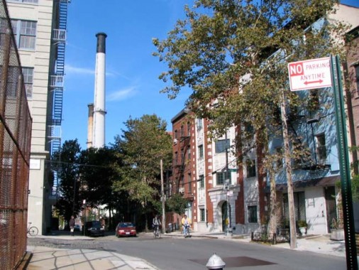
Looking north on Hudson Avenue from Front Street.
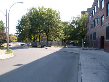
When the Farragut Houses were built, eliminating much of Hudson Avenue’s route, a short connector was built to redirect traffic to Navy Street.
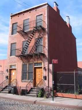
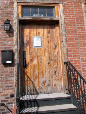
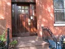
One of the few residences remaining on Water Street, with a wood plank door.
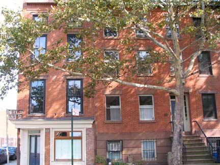
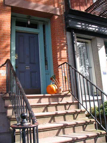
Another landmarked enclave in Vinegar Hill is 69-77 Gold Street, the east side of the street south of Water. The row of five handsome brownstones was likely constructed between 1840-1850.
Front Street
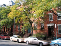
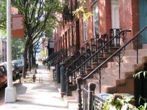
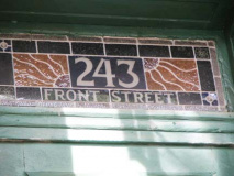
The third of Vinegar Hill’s landmarked enclaves can be found on the north side of front street between Gold and Bridge Streets. Until 1992 this block was anchored by St. Ann’s Church at Gold and Front. 235-249 Front are brick 3-story homes built between 1840 and 1850. Additionally, the firehouse at 225 Front and former Benjamin Moore paint factory, 231-233 (designed by prominent architect William Tubby) have been landmarked.
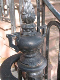
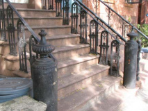
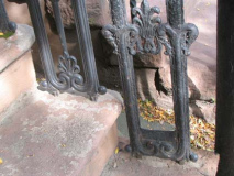
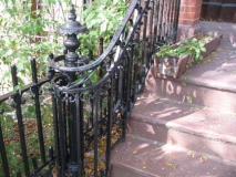
Every house has a different iron stoop railing, and most still have boot scrapers.
photographed October 2009; page completed November 29, 2009
erpietri@earthlink.net
©2009 FNY

