ABOVE: BILLOPP/CONFERENCE HOUSE, Conference House Park
Although officially, New York City is the southernmost town in New York State, Tottenville, on the southern end of Staten Island, was actually the southernmost village when it was a part of Westfield Township when Staten Island was an independent county prior to 1898. The house shown above, constructed by Captain Christopher Billopp in the late 17th Century, is actually the southernmost building in the state, and figures heavily in Revolutionary War history, as will be related in Tottenville, Part Two (how’s that for a teaser?) The Totten family owned a large amount of property in the area in the 18th Century, and after a series of names like Unionville, Bentley Dock, and others, the village settled on a name befitting its major property holders.
Tottenville and your webmaster are old acquaintances. First impressions mean a lot — I remember the first bus ride I took to Tottenville with my parents in the mid-1960s. True to form, what I remember most is the streetlighting. The bus traveled a rutted road called Arthur Kill Road through most of the southwest end of Staten Island, and though the lengthy route has largely been “tamed” these days and lined with suburban developments and malls, back then it was a rural route illuminated by the occasional incandescent “crescent moon” fixture, and, though I didn’t notice it at the time, passed through the occasional small town like Greenridge, Rossville, and Kreischerville (which produced the light brown brick seen on so many apartment buildings in western Queens). Oh what price I would not pay to jump into an H.G. Wells time machine, or turn the Lost “donkey wheel” and return to 1964 or so, not as a young boy but as the Forgotten NY webmaster… but I remember little of that trip, except the utter strangeness of being in a place so different from Bay Ridge. Or so I thought.
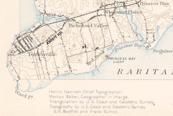
The above is a slice of an 1891 topographical map of southern Staten Island. When I consult these maps, I don’t look at them as a geographer would. Instead I seek out the street layout, which is faithfully rendered as it was at the time. On this map, notice Amboy Road (which I marked) approaching from the northwest, and at the top, Arthur Kill Road, which came in further north. At that time these two narrow farm roads were the only two ways of getting to Tottenville by wagon, cart or on horseback. You could also sail to Tottenville — note the docks scattered at the waterline. At the time Hylan Boulevard was not yet constructed along staten Island’s south shore.
Also, note that the northern end of Tottenville was the only part really built up at the time. Today, the oldest houses in Tottenville are still located on the streets north of Amboy Road. I did my Tottenville survey taking special note of these houses.
I began taking rides to Tottenville on my own once I reached my teens, in the early 1970s. I took the very same S74 bus along Arthur Kill Road and I remember being somewhat annoyed that the maps for this part of Staten Island were nearly always incorrect, since they showed streets that city planners and developers hoped to construct. The missing streets would not appear for years, till Staten Island’s population boom forced massive tract housing construction. I also recall the bus driver asking me if I was going all the way to Tottenville — in those days, the drivers apparently felt free to shorten the route if there were no one riding, and I was the only passenger on the bus! When I got out in Tottenville, I noted that many streets south of Amboy Road were still on maps only, and they were just woods at the time.
Today, I see Tottenville as I see other small isolated villages in the five boroughs, such as Broad Channel or City Island. It is a self-contained place, and while it is more integrated into NYC than it used to be because of the expressway network and Verrazano-Narrows Bridge, it has an architectural tradition all its own (sadly the neighborhood is not a designated Landmarks district, and so developers are putting an increasingly hideous stamp on the town) that makes me think of Cape May, NJ, a town at the southeastern tip of New Jersey with its own collection of beautiful houses.
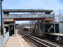
I boarded Staten Island Railway at the ferry terminal and took an approximately 40-minute ride to the Atlantic station. Along with its sister station, Nassau, the Atlantic station platform is so short that it only allows one car to platform and the motorman has to key the car’s doors open to allow entrance and egress. Both stations are in a ramshackle condition and were not renovated along with other SIR stations in the 1990s; the MTA intends to close both and replace them with a regular-sized station midway between the two, but with the recession and the MTA’s perpetual money problems, that plan is likely on hold.
Atlantic Station is named the now-defunct Atlantic Terra Cotta Company, once one of Staten Island’s largest employers, who made the decorative materials used on skyscrapers (including the Woolworth Building, Coney Island’s Child’s Restaurant, and Philadelphia Museum of Art) and for fire-resistant cladding. The company’s smokestack was a familiar Tottenville landmark for 80 years until 1988 with the demolition of the 135 foot structure.
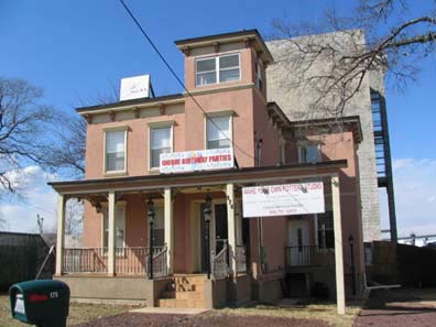
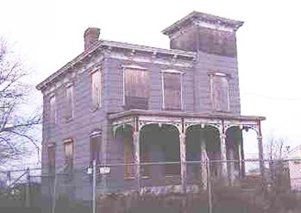
Alighting from the Atlantic Station leaves you on Ellis Street, essentially a lengthy dead end, but it admits entrance to several boatyards, businesses, and a restaurant at the end. This late 19th Century building was decrepit when I first found it in 1999 (right) but has since underwent a renovation.
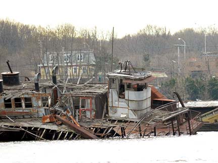
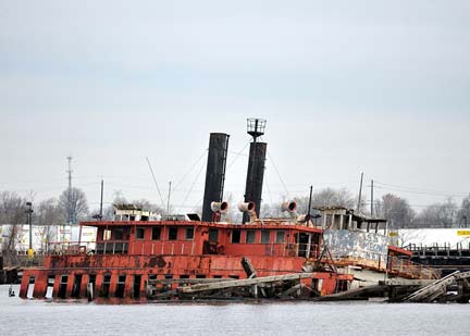
Walking into the shipyard accessible from Tracy Avenue will give you a view of some abandoned vessels in the Arthur Kill. This particular collection of ghost ships is not as large as the one in Rossvillea couple of miles to the northeast. photos: Bernard Ente
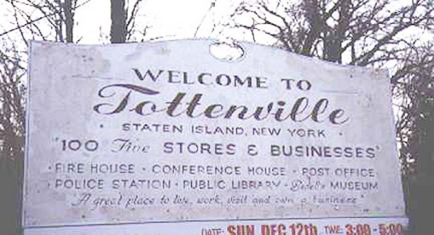
Sign photographed in 1999 at Amboy Road and Page Avenue. It has since been replaced by a newer one. I can’t identify what “Bedell’s Museum” was, but I have a feeling it has something to do with the Biddle House, a preserved 1840s mansion near the Conference House we’ll see anon.
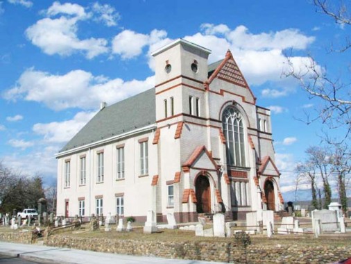
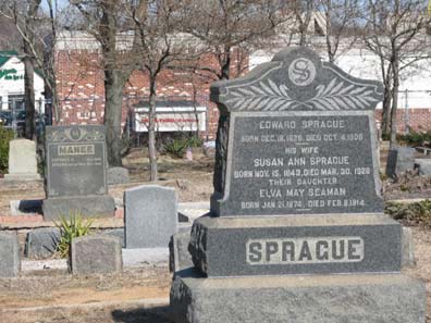
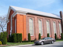
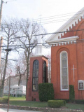
Tottenville has many historic, or at least very old churches, too many, in fact, to list in total here. This one greets travelers entering Tottenville via Amboy Road just past Page Avenue, the borderline separating Tottenville from adjacent Richmond Valley — the Bethel Methodist Episcopal Church — serves a congregation that has existed since 1823. The church, built in the late 1880s, replaced an 1841 structure that burned down in 1886. The adjacent cemetery bears many names that you will find on Staten Island street signs, such as Sprague and Manee.
Arthur Kill Road
After a quick visit to the Bethel churchyard I backtracked to Arthur Kill Road. The road, among Staten Island’s lengthiest (it’s exceeded by only Richmond Avenue, Hylan Boulevard, and perhaps by Amboy and Richmond Roads — a Google Earth measurement would settle things) runs from Richmondtown to Tottenville along the Arthur Kill, the waterway separating Staten Island’s western shore from New Jersey, specifically Union and Midlesex Counties. “Arthur Kill” is an English corruption of the Dutch “Achter Kul,” meaning “behind the Kol, or Kul,” Kul being an old name for Bergen Point, the southwestern tip of Bayonne, New Jersey. The Dutch term kol refers ro a witch or sorcerer — Native American ceremonies in Bergen Point convinced some Dutch colonists that the Indians were in league with the Devil!
The “Amboy” of Amboy Road and Perth Amboy, NJ is harder to pin down. It can derive from a number of Dutch terms — “een boge,” or bow, perhaps describing the curve of the Arthur Kill, or “am bog,” elbow (the mysterious word “akimbo” is likely a contraction of “in a keen bow”), or, perhaps, “het ambacht, “(“the hundred”) or the Malaysian island of Amboyna, an outpost of the Dutch East India Company, site of an infamous massacre in 1623. Brooklyn’s Amboy Street was the setting for Irving Shulman’s 1946 novel about a street gang, The Amboy Dukes — later used by Ted Nugent’s band The Amboy Dukes who hit with the classic Journey To The Center of The Mind in 1968.
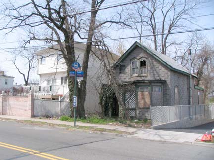
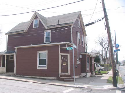
Arthur Kill Road and Wood Avenue. (Most Tottenville street names come from prominent residents in the 19th Century.) A pair of superannuated homes that likely go back to sometime in the late 1800s.
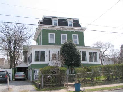
5300 Arthur Kill Rd. at Lee Avenue, one of the first real Victorian-era classics seen along the road.
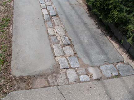
Slate and brick sidewalk directly across the road.
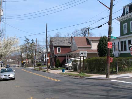
Arthur Kill Rd. looking east. It remains mostly a two-lane road throughout its length, widening to accept traffic from the West Shore Expressway, Veterans of Korean War Parkway and Richmond Avenue.
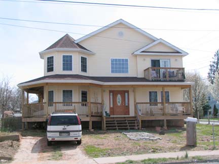
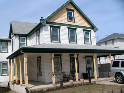
Arthur Kill Rd. at Yetman Avenue. Owing to harsh weather conditions, most older Tottenville houses, as we’ll see, have been resided, with varying degrees of uglification. This pair have had it done tastefully, with the building on the right allowing elements from years gone by to remain.
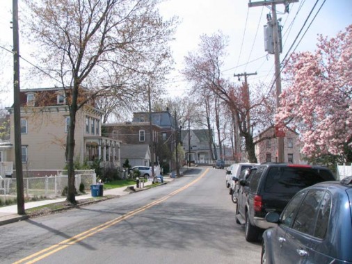
Arthur Kill Road, looking west from Johnson Avenue. This stretch boasts Arthur Kill Road’s greatest concentration of classic architecture.
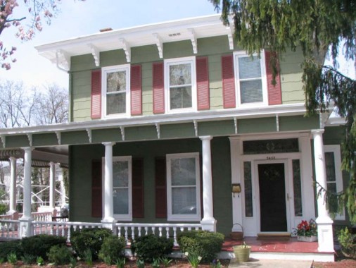
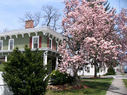
5403 Arthur Kill Rd. at Tyrrell Street. So nice, I shot it twice to get the Oriental Magnolia in. The house was constructed in 1853 for Cornelius C. Ellis, a tugboat captain and NYC harbormaster — likely the Ellis the street adjacent to the Staten Island Railway was named for.
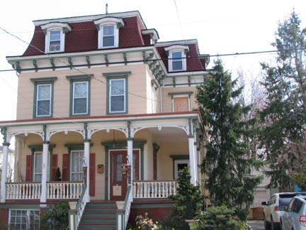
5414 Arthur Kill Road, constructed 1866
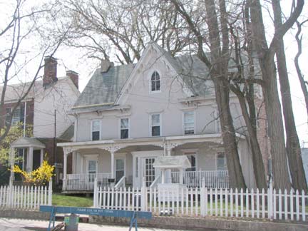
104 Main Street faces Arthur Kill Road as the latter jogs a bit before ending just past Bentley Street. 104 Main contains original fretwork at the roofline and porch from when it was constructed in 1845 for boatman Alfred Smith.
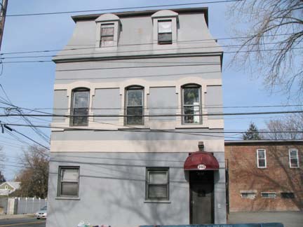
Modern mangling has sullied 103 Main, at the SE corner of Arthur Kill Road; brick facing can still be seen on the north side of the building. It was built for pharmacist Rinalder Fisher ( there is a nearby street called Fisher Avenue) and later became Lehman Pharmacy. Its former store windows have now been enclosed.
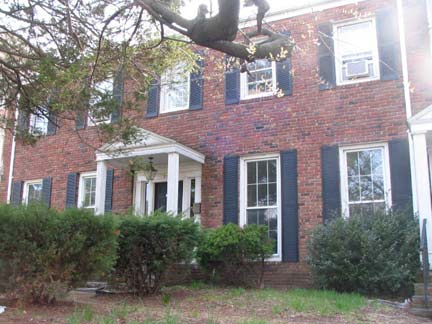
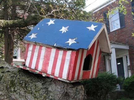
108 Main Street appears to have an original brick facing, but the brick itself is a later addition covering a wood siding. This house was built in 1850 for ship carpenter John Wood — note nearby Wood Avenue. Loved that stars and stripes bird house.
It will take some trust, and some imagination, to picture these next few houses as being from the mid to late 19th Century because their siding makes them look new-ish. Still, some hints about their age peek out here and there.
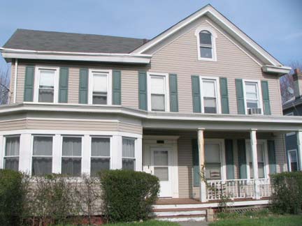
115 Main Street was built for oyster fisherman Henry Van Name in 1866; true to Staten Island form, there’s a Van Name Avenue on Staten Island’s north shore, albeit several miles away.
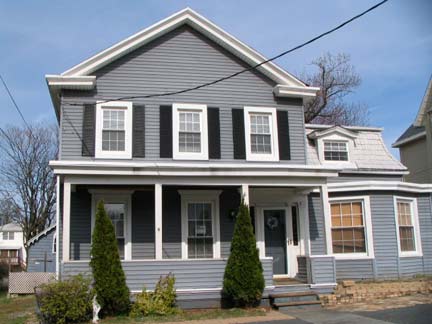
121 Main Street was built in 1859 for one of the Tottens of Tottenville, Abraham, a mariner.
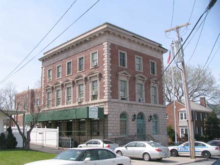
The new kid on the block, 116 Main, was built in 1926 as the 123rd Police Precinct and still serves in that capacity.
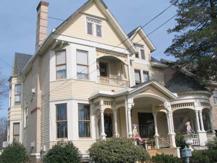
127 Main, though re-sided, preserves quite a bit of its Queen Anne “stick style” construction. It was built in 1887 for Dr. Walker Washington, a distant relative of the first President.
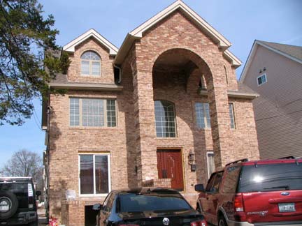
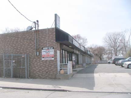
An unrefreshing pause. The monstrosity at 133 Main, complete with wagon parking in lieu of a front lawn, replaced an 1848 two-family house. Developers have already set to work building tract hosuing andmini-malls amid the older homes.

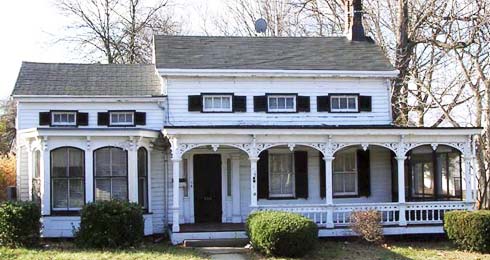
Though it seems to be getting a new re-siding, there’s reason to hope that 134 Main Street comes out looking the way it has always looked — since it has officially been landmarked by the Landmarks Preservation Commission. The corner porch has retained its fancy fretwork, and you have to like those eyelet windows. The house was built in 1849 for Henry Butler and later, oyster fisherman Theodore DeHart. photo right: Tottenville Memories
Landmarks Preservation Commission report
Oyster fishing was big business in NYC before 1916; after that, the waters in the bays and oceans became too polluted to safely serve the bivalve mollusks, and NYC outlawed oyster fishing.
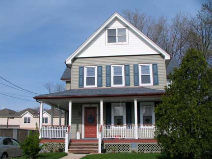
145 Main Street was built in 1870 for butcher Gilbert Decker. The Deckers are an old Staten Island family, many of whose members still live on the island. All Staten Island cemeteries are stocked with many Deckers, and of course, there’s Decker Avenue in Port Richmond.
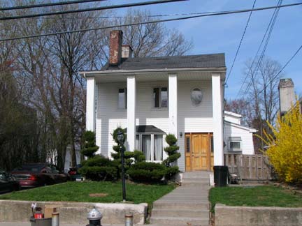
The columned 151 Main is unusual in that it is set back from the street a good distance. It was constructed in 1844 for James Butler and was later home to a sea captain, Benjamin Warford.
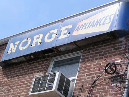
Ancient neon sign for the now-defunct line of Norge appliances. “Norge” is what Norwegians, Danes and Swedes call Norway. Sverige is Swedish for Sweden, and Suomi is Finnish for Finland.
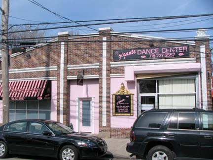
Danskins and tutus have replaced chassis and gearboxes at 153 Main Street, which is a dancing school now but was opened as a Chevrolet dealership in 1926. Some original detailing is visible at the roofline.
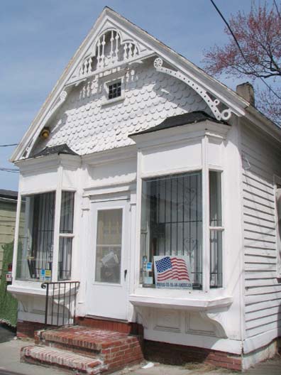
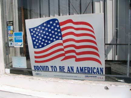
This little jewelbox at 173 is one of Main Street’s pride and joys. It was constructed in 1892 as George Cunningham’s meat market. To this day the fish scale shingles and detailed fretwork has been lovingly preserved, as well as the storefront display windows. The owners are 110% American. Are you?
The George Cunningham Store at 173 Main Street, Tottenville, built c. 1892, is a rare and intact vernacular commercial building in the Queen Anne style from a significant period of development for Tottenville and its downtown Main Street. Its robust bay windows with decorative brackets are rare survivors of a once popular feature of early American commercial architecture. The building also features a distinctive decorated gable end that gives this small one-story building great presence on the street. It is the best preserved of the early shops remaining on Tottenville’s Main Street and perhaps one of the few shops with bay windows remaining in New York City. NYC.gov
Craig Avenue and Main
Craig Avenue is Tottenville’s other original main NE-SW artery, joining Arthur Kill Road and Amboy Road. The 1891 topographic map (above) shows the western section already in place. Three of the corners with Main Street feature notable buildings…
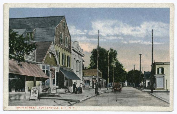
An early 20th Century postcard view of Main Street looking south toward Craig Avenue. All the buildings on the left side of the picture remain today; #173 Main (see above) looks virtually the same today, except for a white paint job. Horton’s Ice Cream was a popular brand then; in the 1960s I remember the Howard Johnson brand being nearly universal. I suppose Breyer’s is the first thing you see in the freezer case today.
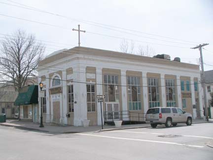
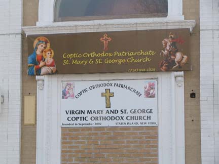
I’ve had trouble getting the exact lowdown on the building at the NW corner of Craig and Main — I gather it was a savings and loan and was built in the late 1910s. Currently it is a house of worship, the Virgin Mary and St. George Coptic Orthodox Church. The Copts are an ancient Egyptian Christian sect; Staten Island seems to be a stronghold, as I have seen another Coptic church in Great Kills. The Coptic Church predated the arrival of Islam in Egypt by several centuries; presently, there are 9 million Copts in Egypt in a population of nearly 60 million.
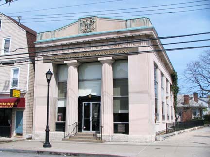
The Doric-columned building on the SE corner of Craig and Main, Richmond County Savings Bank (originally the Tottenville National Bank), was constructed in 1915.
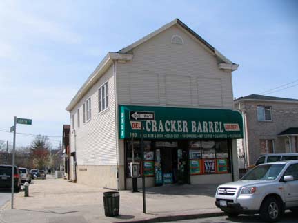
As long as I have been coming to Tottenville, it seems the Cracker Barrel deli has held down the NE corner at #180. It was originally a Baptist church and temperance center built in 1870, known as Pepper Hall after the original owner Kinsey Pepper.
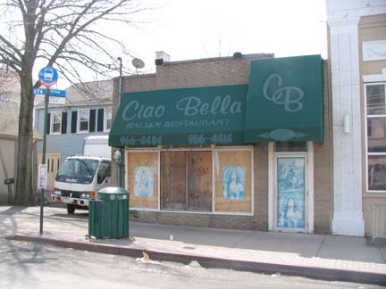
A defunct pizzeria at #198; the small building was constructed in 1870 as a barber shop. The S74 bus that plies the St. George-Tottenville route along Arthur Kill Road terminates here.
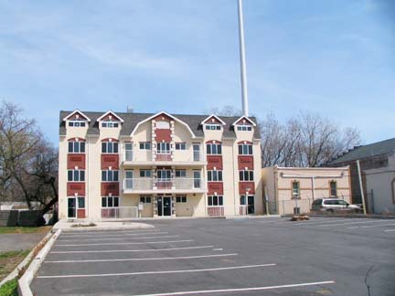
The future face of Main Street, just north of Craig Avenue? Huge concrete parking lot, check; ungainly cell-phone tower, check; anonymous-appearing building front, check.
At least there’s a little strip of green on the left…
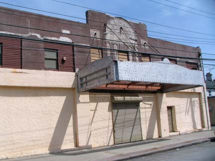
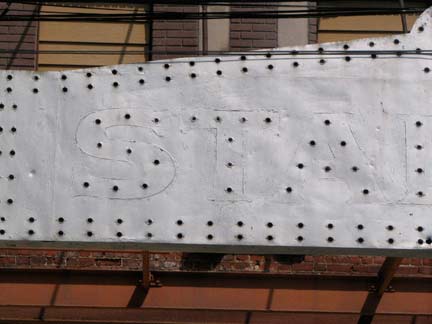
The metal bones of the Stadium Theatre’s marquee still have ghost letters betraying the name, as well as holes where the lightbulb sockets were. The Stadium (#217 Main) was constructed from 1925-1927. Like the Ritz in Port Richmond it spent some time in the 1960s hosting rock acts before becoming a roller rink in the 1970s disco era. It has been rumored for conversion to condo apartments or razed to be replaced by condos for years, but it’s still there. The interior has been completely gutted. Across the street, older houses have been torn down and new tracts have appeared.
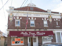
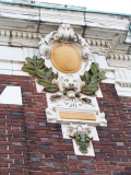
The grand 1910 Masonic Temple, formerly housing Tottenville’s post office, is at 234-236; its terra cotta ornamentation comes courtesy of the old Atlantic works.
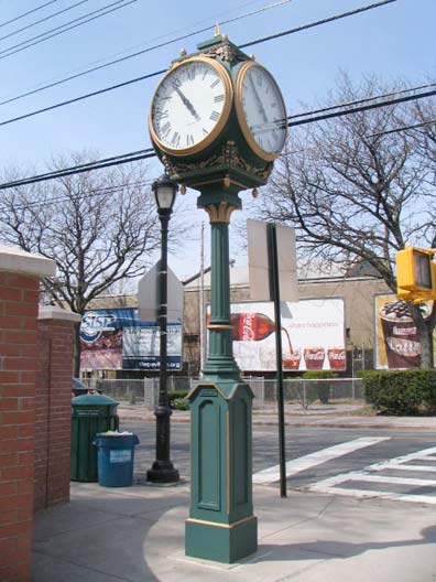
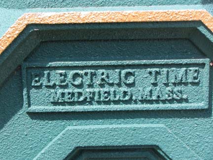
The street clock at Amboy Road and Main Street was placed here only a few years ago, but evokes the elaborate models that can still be found around Midtown Manhattan and in surprising locations around town. Electric Time of Medford, MA does reproductions of old-fashioned clocks.
Amboy Road and Hylan Boulevard boast Tottenville’s rare stoplights.
St. Paul’s Methodist Episcopal Church, at Amboy Road and Swinnerton Street, built 1883 in Romanesque revival, gained, or regained a bell tower in 2000. When I visted Tottenville as a teenager in the early 1970s, there was not much but woods south of the church.
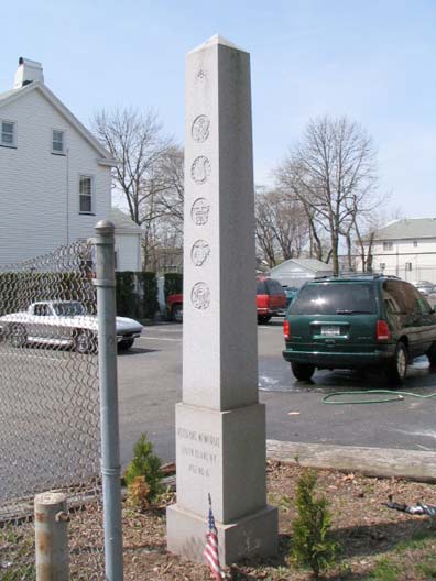
A veterans memorial stands rather forlornly across Amboy Road from the church.
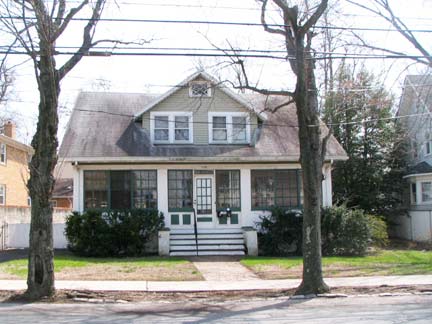
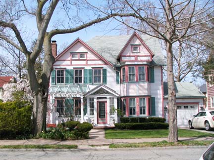
Amboy Road, as one of Tottenville’s original routes, joins Main Street and its parallel north-south routes in boasting a number of historic, handsome houses. The top two can be found between Butler Avenue and Bentley Street.
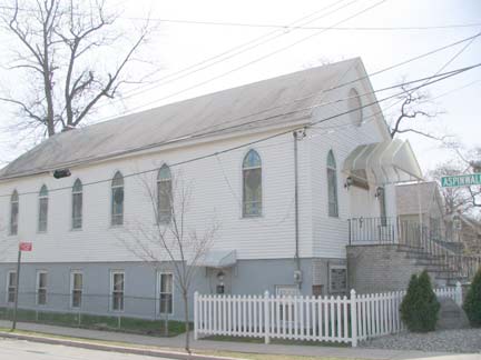
Congregation Ahavath Israel, 7460 at Aspinwall, was constructed in 1933.
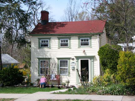
The cottage at 7639 Amboy Road, west of Bentley, is one of the smaller freestanding homes in Tottenville. It was built in 1850 for ship jointer Abraham Romaine. It looks smaller than it is, however, as additions were made to the rear.
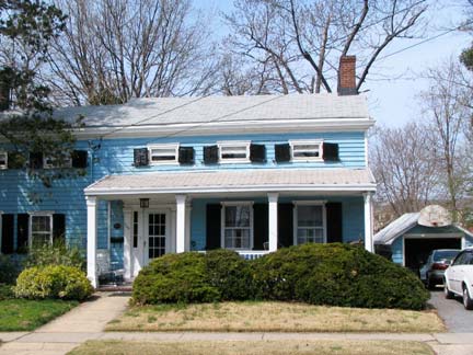
7647 Amboy Road, with its eyebrow windows, is a NYC landmark constructed in 1848:
The Rutan-Journeay House at 7647 Amboy Road, built ca. 1848, is a rare survivor ofearly Tottenville, an important 19th-century town on Staten Island’s South Shore. This vernacular clapboard cottage merges older local building traditions with newer Greek Revival modes. Its doorway and porch are excellent examples of the Greek Revival style. The front porch features four square pillars and simple, but sophisticated, railings, in original condition. Sharing architectural forms with other early Tottenville houses, it is one of the best-preserved houses representing the early building traditions of Staten Island’s South Shore. The Rutan-Journeay House is one of the earliest documented houses of newly created Tottenville, and the first on Amboy Road. Through its first two owners the house has close ties to the shipbuilding industry, which flourished in Tottenville from its beginnings in the 1840s through the early 20th century. Shipbuilding and ship repair were important partners of the oyster industry that created the town. NYC.gov
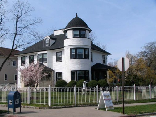
The most prominent house on Amboy Road, #7725, benefits from a large plot formed by the angle of the intersection with Craig Avenue. It was just resided before I went past — the contractor’s shingle is still on the sidewalk. It was built for carpet salesman Charles Winant in 1897.
The most historic buildings in Tottenville can be found in Part Two.
4/11/10


1 comment
[…] is a blog that includes a lot more detail on Tottenville. Share this:TwitterFacebookLike this:LikeBe the […]
Comments are closed.