In June 2010 there was a near riot in the normally crowded, but placid South Street Seaport when a Canadian rapper called Drake (whether he is the next Jay-Z or Diddy or whatever is yet to be determined; he has been anointed as the next big thing) and the Hanson Brothers (the blond pop stars, not the be-goggled hockey thugs) were to play an open-air show; 10,000 were expected, 20,000 showed up, and horseplay turned to thuggery. The cops corralled things before we had a new Draft Riots (1863, New Yorkers protesting conscription) Astor Place Riot (1849, supporters of British and American Shakespearian actors facing off) or even the Hard Hat Riots (1970, construction workers vs. Vietnam War opponents). Your webmaster unsteadily maneuvered South Street in the fall/winter of 2009/2010, when all was peaceful and calm, befitting my no-drama persona.
I’ve visited the Seaport a lot — I’m in there every couple of months or so. Unlike a lot of New Yorkers I do not have a disdain for out of town tourists, or find them irritating or inconvenient. For one thing I am not in Manhattan every day and don’t have to maneuver around them all that much, and secondly, I’m one of them — I’ve been a tourist in my own city for decades. I also like the pasta tuna salad in the food court on Pier 17, and I also liked the food court itself — it had a view in three directions up and down the East River and across to Brooklyn. I say “had”– most of the food court has now been eliminated for a kiddie attraction. In the 1980s, there were a lot of vast food courts built around town, and some of them in spectacular locations: Manhattan Mall’s faced the great old Broadway hotels across from Greeley Square, and the Pier 17 food court was this vast space where you could get something to eat and either sit indoors or out, depending on the weather, and enjoy riverside vistas of the New York harbor. Building managements have, in recent years, found big food courts to be wasted space and have rushed to fill them — especially in these days of diminished incomes during the Great Recession of 2008-2011? 2012?
Upon nearing the Seaport, it used to be that your nose was immediately infused, or assaulted, depending on your outlook — with the smell of raw fish. For over 180 years, from 1822-2005, this was the Fulton Fish Market, where every wholesale seafood dealer brought in catches from all over the Northeast to sell to restaurateurs and deli owners — in the early morning hours, the fish was unloaded from the South Street docks which lined the street from here to the Battery, and then, after the East River Drive was constructed and the docks mostly eliminated, the fish were unloaded from trucks. The facility moved to Hunts Point in the Bronx in November 2005.
When I walk in the Seaport area, I think of The New Yorker Magazine journalist, North Carolinian Joseph Mitchell (1908-1996), who spent years here speaking to many of the thousands of workers in the Fish Market area, chronicling their stories and writing about the area’s architecture. Mitchell was a quirky figure — he stopped writing and editing in 1964, yet maintained his office at The New Yorker for every year of his life after that, with the apparent indulgence of editor William Shawn for many of those years. Mitchell helped found the South Street Seaport Museum. In the 1980s, a friend gave me a copy of the Mitchell compendium Up In The Old Hotel, which gathered some of his best work together in one volume. It was, and continues to be, one of Forgotten New York’s main inspirations.
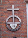
I had been curious for several years about the cross above 50 Fulton Street, marked with the Latin phrase per angusta ad augusta, or ‘through trials to triumph.’ The Neale House at 50 Fulton is home to the Society of St. Margaret, an Anglican-Episcopalian order of women founded by British writer and hymnist John Mason Neale in 1854. (Neale wrote the Christmas favorite “Good King Wenceslas.”)
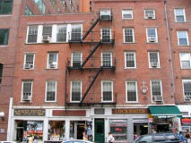
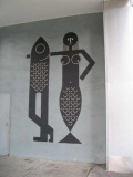
Fulton and Water Streets. “I’d like to see what you look like with a fish’s head and a human tail” — British musican Jowe Head.
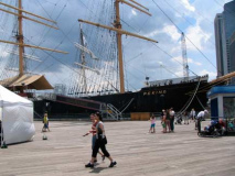
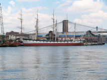
The barque Peking, which was commissioned in 1911 by the German shipping company F. Laeisz, well into the steamship era. Tall ships like the Peking worked difficult routes that the steamships found difficult to negotiate. The Peking was retired in 1975 and was soon sold to the South Street Seaport, which exhibits it along with the 1885 Wavertree, 1885 Pioneer, the 1893 Lettie G. Howard, and other vessels.
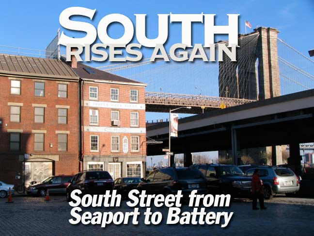
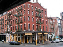
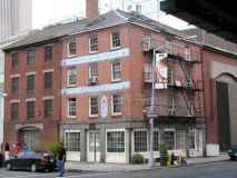
#2-8 Fulton Street/#92-93 South Street, the east end of Schermerhorn Row, a Georgian-style commercial block constructed by Captain Peter Schermerhorn from 1810-1812 and leased to merchants, who combined their offices and warehouses in one building. When the Fish Market opened in 1822 its value increased manifold. The ground floor now hosts Heartland Brewery and has always hosted restaurants and saloons, most notably Sweet’s (1847-1992) and Mitchell favorite Sloppy Louie’s (until 1998).
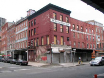
Sloppy Louie’s occupies the ground floor of an old building at 92 South Street, diagonally across the street from the sheds. This building faces the river and looks out on the slip between the Fulton Street fish pier and the Old Porto Rico Line dock. It is six floors high, and it has two windows to the floor. Like the majority of the older buildings in the market district, it is made of hand-molded Hudson River brick, a rosy-pink and relatively narrow kind that used to be turned out in Haverstraw and other kiln towns on the Hudson and sent down to the city in barges. It has an ornamental tin cornice and a late-covered mansard roof. It is one of the handsome, symmetrical old east River waterfront buildings that have been allowed to dilapidate. The windows of its four upper floors have been boarded over for many years, a rain pipe that runs down the front of it is riddled with rust holes, and there are gaps here and there on its mansard where slates have slipped off. In the afternoons, after two or three, when the trading is over and the stands begin to close, some of the slimy, overfed gulls that scavenge in the market roost along its cornice, hunched up and gazing downward. — Joseph Mitchell, “Up In the Old Hotel,” 1952
In the story, Sloppy Louie’s owner Louis Marino took Mitchell upstairs to the shuttered rooms to see what was there. Flash forward several decades, and a manager at the South Street Seaport Museum explored the upstairs once again and found it more or less unchanged since 1952, with artifacts from decades prior. The WNET City Concealed series presented several items from that archeological hunt.
M. Slavin & Sons Ltd. at Beekman and South Streets. With the motto “Eat fish, live longer” M. Slavin is apparently still in business, though its website has not been updated since 1999:
In the early 1900’s, Morris and Minnie Slavin opened a small fish store in Brooklyn, New York in order to support their growing family. As soon as their sons Herb, Jack and Barry were old enough, they joined their parents in what was the beginning of the Slavin organization. An extraordinary amount of hard work and self-sacrifice during the early years went into building of the multifaceted company that is today M.Slavin & Sons, Ltd.
A walk around the Seaport area will still reveal a number of painted wall signs from fish wholesalers who have since decamped to Hunts Point.
A look at South Street facing the Brooklyn Bridge from James Slip in 1933. The Al Smith Houses are in the present-day outlook on the right and the elevated East River Drive on the left.
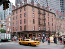
The Paris Café occupies the ground floor of a 5-story brick building at South Street and Peck Slip. The handsome structure was built in 1873 and was purchased 10 years later by liquor merchant Henry Mayer and converted to a hotel and a boardinghouse. Some of the frequent guests were inventor Thomas Alva Edison, sharpshooter Annie Oakley, gourmand “Diamond Jim” Brady, and Teddy Roosevelt when he was police commissioner. Meyer opened the Paris Café in 1883 and while the hotel is long gone, the Paris is still going strong.
Jasper Ward House, NW corner of Peck Slip and South Street, was constructed in 1806 — merchant Ward had speculatively purchased the property in 1800 while the East River still occupied the site, and built on it after it was landfilled.
Peck Slip is unusually wide because it was actually once a “slip” where vessels could sail in and dock. It was named for a colonial-era merchant, Benjamin Peck.
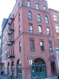
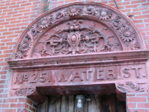
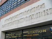
I had to wander inland and register 251 Water, at the corner of Peck, with its ornate terra cotta frieze, or tympanum, indicating the address. The 1888 building stil boasts its original arched double doors. Note that the windows have a different treatment on each floor. RIGHT: aggressively Machine Age lettering on the Peck Slip P.O. Station on the north side of the street.
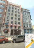
85 and 87 South Street. (Do I use Google Earth? You bet I do, and I enjoy it.) 85, with its pencil-like ornaments on each side, is a former tobacco warehouse and sharp-eyed observers can see leaf motif elements on the exterior. 87 was formerly home to the Yankee Clipper Restaurant.
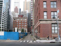
Fletcher Street, a narrow lane leading for a couple of blocks inland. It’s paved with Belgian blocks between Front and South Streets.
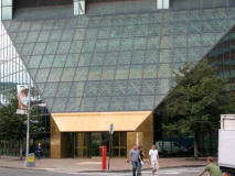
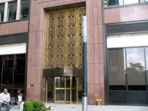
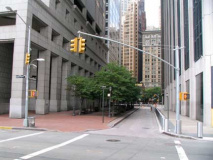
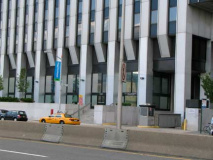
A pair of modern monsters on South Street, 180 Maiden Lane, left, and 120 Wall Street, right. 180 Maiden, constructed in 1983, is a character-less glass rectangle with a wide chamfer on South. The AIA Guide to New York City calls it a “deceptively suave but actually tacky green monster with a greenhouse base, a project of the Rockefeller Center Development Corporation. (The resemblance to Rockefeller Center ends with the developer’s name).” 120 Wall, with its then trendy Art Deco touches, was built in 1929-1930 by architect Ely Jacques Kahn (Ayn Rand worked in his office while researching for her novel The Fountainhead). Its original tenant was the American Sugar Refinery Company — sugar and other goods were still unloaded from docks across the street in 1930.
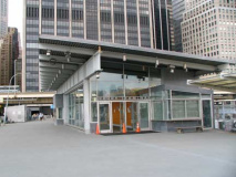
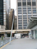
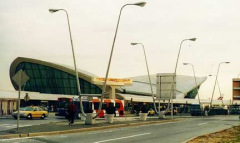
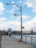
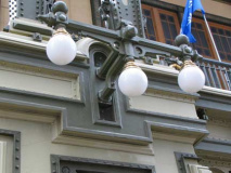
Pier 11 ferry terminal opposite Wall Street serves NY Waterway to points in New Jersey, and the NY Water Taxi. Ah, but those angled lampposts! Memories of the classic John F. Kennedy International Airport 1960s Mad Men-era “snake” posts come to mind. By 1998, when lamppost king Jeff Saltzman got this photo at the Eero Saarinen (former) TWA terminal, JFK had rid itself of most of the snakes.
A look at the Brooklyn Bridge and the Marion M, one of the last sailing freigher ships, built in 1932. Pier 11 also serves as a pedestrian strolling area. RIGHT: lower Manhattan used to have a number of short lanes trailing down to the waterfront — Cuylers Alley, Jones Lane, De Peyster Street. All were demapped and built over by 1970, but this one, Gouverneur Lane, still runs for 2 blocks from Water to South Street. Both is street and Gouverneur Street and Slip to the northeast were named for Abraham Gouverneur, a French immigrant merchant and religious and political leader allied with unjustly hanged (for treason) NY Governor Jacob Leisler in 1691.
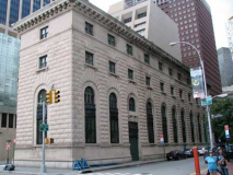
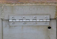
100 Old Slip at South Street, the NYC Police Museum, also Landmarks Preservation Commission offices from 1993-2001, a replica of an Italian Renaissance palazzo, constructed from 1909-1910 as the 1st Precinct, which had moved out in 1975.
Old Slip, which was constructed in 1691, was the site of a momentous event in American history. In 1792, the 90-ton merchant brig Betsy, captained by Edmund Fanning, sailed out of Old Slip, to become the first ship to carry the American flag around the world. archaeology.org
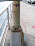
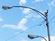
Just south of Old Slip on the river side of South Street, there are a trio of gloriously rusted octagonal-shafted posts with curved, bracketed masts. These were among the first generation of this particular style, and they first appeared on NYC streets in 1950.
Other than that I’m stumped as to how the design was first arrived at and what company first developed them. They gradually took over in NYC by attrition — as late as the early 1960s, the wrought- and cast-iron posts still held sway in many areas, and it would still be years before they became odd curios, before the city actually began having new casts made of the old bishop crooks, Corvingtons, Twins, et al. and began reinstalling them all over town.
It’s a simple matter to tell the age, or date of installation, of any octagonal post. It’s stamped on the base, just over the access door to the electronics. This post is stamped 1959.
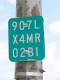
Does anyone know what the set of numbers affixed to one of the posts (left) indicate? (If it’s a sensitive matter of security, I won’t post it.)
The tunnel under Battery Park connecting auto traffic with West Street once boasted a few short-masted Triboro-style posts on the entrance ramp that were removed about 20 years ago.
907L is the state route number for the FDR /East River Drive. The others, I’m stumped yet. Thanks ForgottenFan Edward Fitzgerald.
Here’s more… X4MR = New York City (X); Mainline Ramp (MR); 02B1 = Exit 2 (02); Ramp B (B); Reference Marker 1 (1)
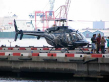
You’ll never get me up in one of those. The Downtown Manhattan Heliport at Pier 6 opened in 1960, supporting the original West 34th Street Heliport, providing passenger service to NYC area airports, as well as excursion flights. Service was suspended after the bankruptcy of Pan American Airlines in 1986, but resumed about 20 years later.
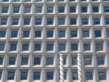
A pair of 1970s-era skyscrapers face South Street just north of the Battery: 125 Broad/2 New York Plaza (left) and 1 New York Plaza, with its striking almost-square windows. All New York Plaza buildings, which are between South and Water Streets and the Battery and Vietnam Veterans Park, remade the southern extent of the Manhattan financial district, doing away with 19th Century counting houses and some of the aforementioned alleys trailing down to the river, when they appeared between 1969 and 1973.
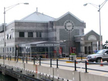
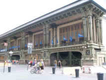
Meanwhile, just across South Street is an example of how prevailing architectural design had changed in just 70 short years. The Beaux Arts 1909 Battery Maritime Building was built as a terminal for the many Brooklyn ferries, but as one by one those ferries went out of business, the BMB became decrepit and verdegris-encrusted. It has been wonderfully restored in recent years and jas a new life as the Governors Island Ferry terminal. The island is poised to become more of a recreational mecca after its military bases were decommissioned, so the BMB will increase in importance.
South Street begins, or ends, at Whitehall Street and the Peter Minuit Plaza, named for New Amsterdam’s first Director General, who supposedly purchased Manhattan Island from the Lenape or Weekquaeskeek for what amounted to $24 in trinkets in 1626. The story is more complicated than that, and the transaction likely took place where Inwood Hill Park on the northern extreme of the island is today.
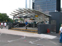
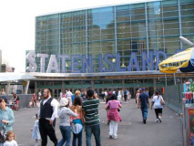
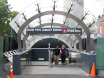
Beginning in 2005, the Port Authority and Metropolitan Transit Authority have remade the space, building the new Staten Island Ferry Terminal and opening a new, straight South Ferry IRT station, replacing the 1905 curved one that modern trains couldn’t fit in.
6/20/10

