GOOGLE MAP: WOODLAWN HEIGHTS TO RIVERDALE
Where was I? At the confluence of 5 streets at one intersection: Webster Avenue, East 238th, East 240th/McLean Avenue and Bronx River Road, and Nereid Avenue if you count what the locals call the bridge over the Bronx River and its parkway.
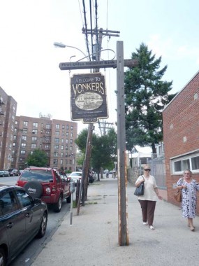
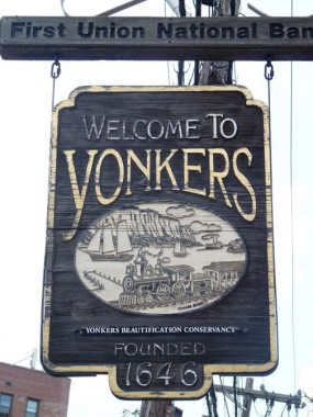
Heading west again on McLean, here’s a wood sign welcoming travelers to Yonkers, featuring the relatively rarely-used Korinna type font. The art shows what is now the NY Central Hudson Line, boats in the Hudson River, and the NJ Palisades.
The ‘first’ north-south street west of Bronx river Road is First Street. There’s no Second or Third, so it was likely named First because it’s the first street when you enter Yonkers from the west. There’s an interesting mix of country suburban (with siding) and apartment buildings.
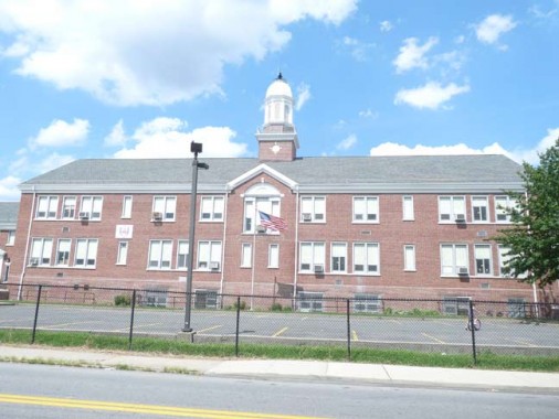
Originally School #11, this handsome building on Wakefield Avenue between Hyatt and Woodlawn is now the Yonkers Montessori Academy.
Montessori education is an educational approach developed by Italian physician and educator Maria Montessori. Montessori education is practiced in an estimated 20,000 schools worldwide, serving children from birth to eighteen years old.
Montessori education is characterized by an emphasis on independence, freedom within limits, and respect for a child’s natural psychological development, as well as technological advancements in society. wikipedia
Wakefield Avenue ascends an especially steep hill to its western end at Kimball Avenue and the edge of the Hillview Reservoir.
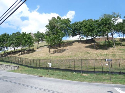
The Hillview Reservoir is at the crest of this hill at Hillview and Harding Avenues. The reservoir, which spans 164 acres and holds 900 million gallons, was built by the NYC Board of Water Supply from 1909-1915 to receive water from the new Catskill Aqueduct in southern Ulster County; ultimately water is drained from the upstate Ashokan Reservoir. Water enters NYC through Water Tunnels #1 and #2.
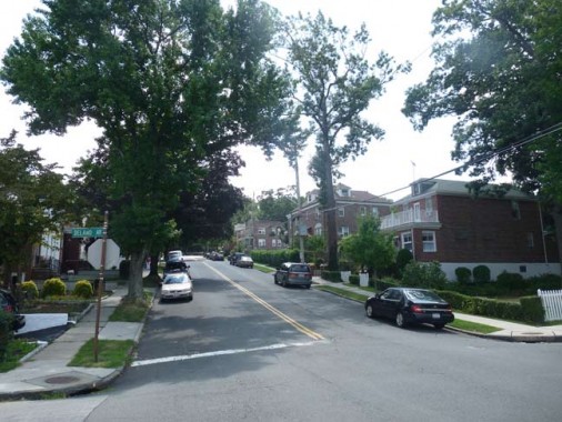
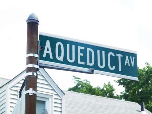
Crossing McLean Avenue and heading west on Delano Avenue, I found a couple of notable street names.
Aqueduct Avenue, which runs from Van Cortlandt Park North to Hillview, runs on top of the underground New Croton Aqueduct, constructed in 1890 as an addition to the older Croton Aqueduct.
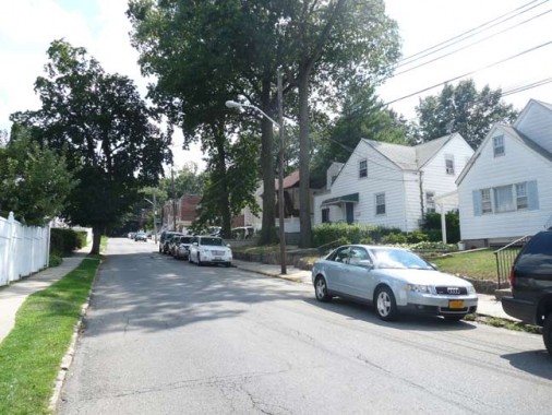
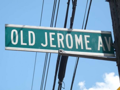
Old Jerome Avenue, which runs a couple of blocks from VCP North to a dead end just north of Delano, is indeed part of what used to be an northern extension of the Bronx’ Jerome Avenue.
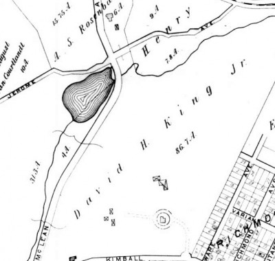
In this 1908 map, what would become Van Cortlandt Park is on the left side of the map. We see Jerome Avenue entering and intersecting at Jerome Avenue near a now-filled in pond. The Hillview Reservoir now takes up most of the right side of this map.
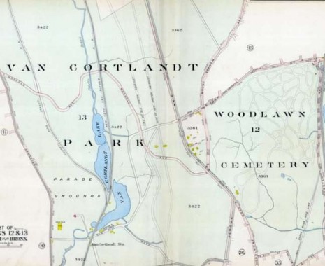
Today, Jerome Avenue ends at East 233rd and the Major Deegan Expressway in Van Cortlandt Park. But, in this map produced before the Deegan was built, we see Jerome Avenue making a straight line for the Bronx border at the top of the map. The Deegan would later cover this part of Jerome Avenue. Van Cortlandt Park East is the road that curves northeast above Woodlawn Cemetery.
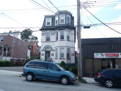
Picturesque but small, on Devoe Ave south of McLean, west of the NYS Thruway, which is what the Major Deegan becomes north of the Bronx
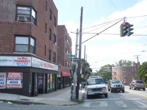
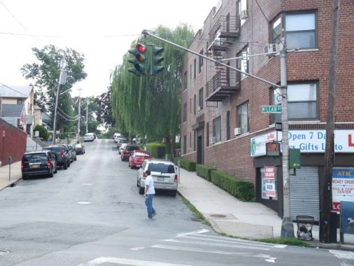
On Lee and McLean Avenues, this stoplight is not quite as vintage as the one I showed in Part 1, but it’s still an old model, possibly the 1950s or 1960s.
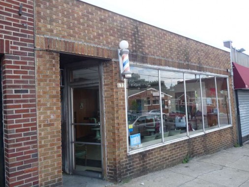
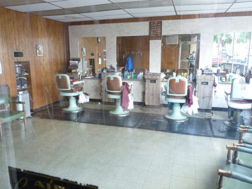
The local denizens must know what this barber shop is called. There’s no awning sign on the outside.
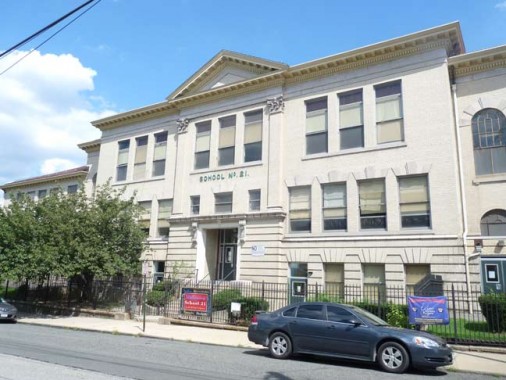
School No. 21, on Lee north of McLean.
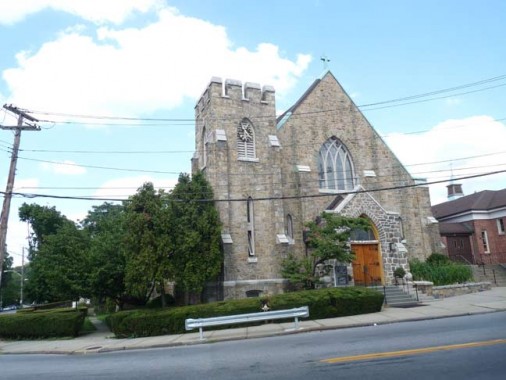
Church of St. Paul Apostle at McLean and Sherman Avenues. The parish was founded in 1923 and the church building was completed in 1925.
To get around a steep hill, here McLean Avenue takes a severe turn to the north, turning west again after a few hundred feet. Curving Lawton Street connects the two curves of McLean Avenue.
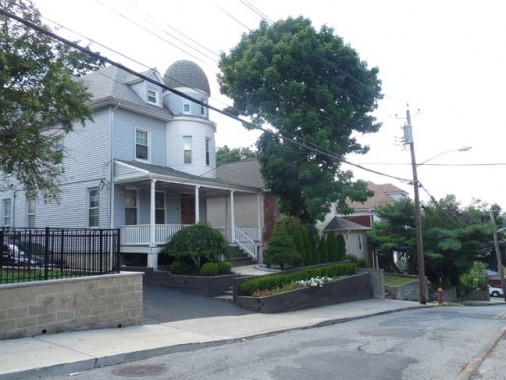
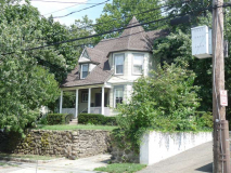
This domed residence on Lawton Street was more impressive before it was visited by the God of Siding.
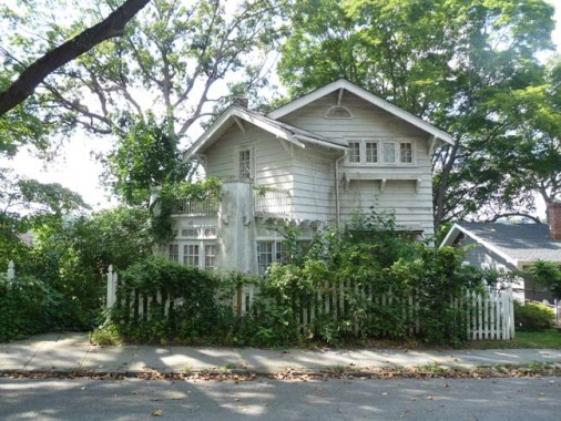
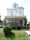
Country cottage on a severe Lawton Street curve.
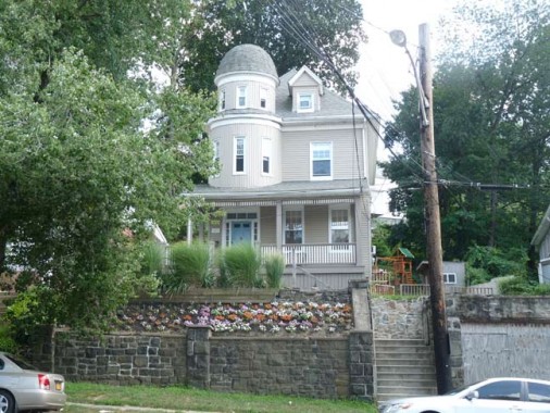
A domed house similar to the one on Lawton, this one at McLean and Sedgwick Avenues.
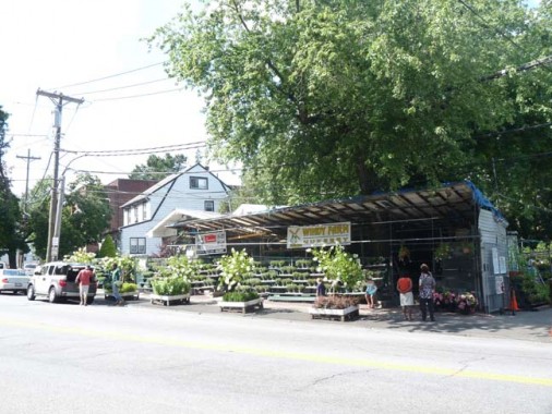
Roadside flower and vegetable stand on McLean Avenue west of Saw Mill River Parkway, which is what Henry Hudson Parkway becomes at the Bronx line. NYC has proprietary names for its expressways; the Horace Harding becomes Long Island Expressway at the Nassau line. Sunrise Highway enters Queens for just a couple of blocks in Rosedale. The Grand Central becomes the Northern State and Laurelton Parkway becomes the Southern State. Only the New England Thruway pretty much keeps the same name in and out of NYC.
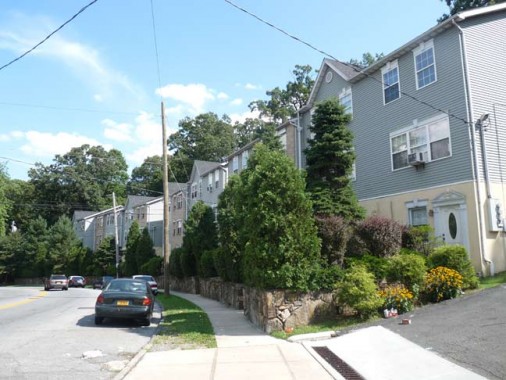
This development is called Stonehedge, not Stonehenge. Which makes sense, anyway. What’s a henge?
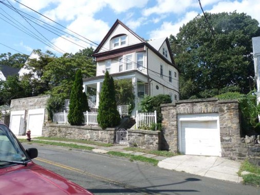
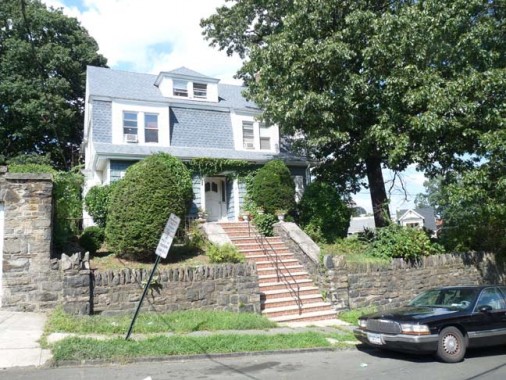
Since McLean Avenue runs northwest and ends at Broadway pretty much in the heart of Yonkers, which was further than I had time to go, I detoured left on Caryl Avenue, which has some picturesque houses on its eastern end.
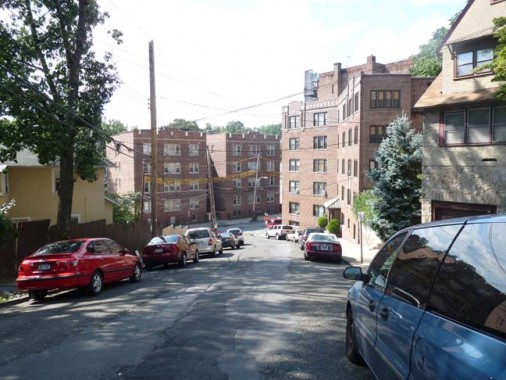
Caryl Avenue runs down a hill to Van Cortlandt Avenue, named for the colonial-era family whose mansion still stands in Van Cortlandt Park in the Bronx.
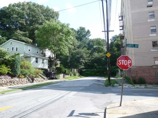
In fact south of Caryl Avenue, Van Cortlandt Avenue dead-ends at Van Cortlandt Park, which is wholly in the Bronx.
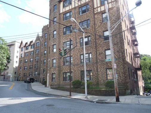
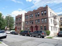
I found another classic Yonkers stoplight in front of a brick Tudor apartment on Caryl and Saratoga Avenues. This stretch of Caryl Avenue doesn’t resemble the other, as it’s lined with tall multifamily houses.
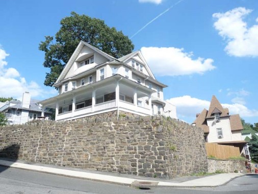
This house at Caryl and Landscape Avenues seems to be protected by a high stone wall.
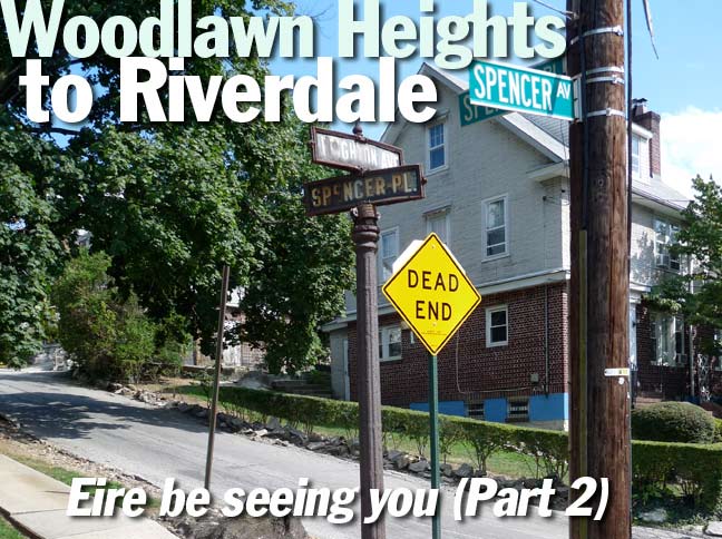
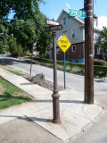
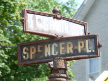
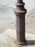
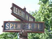
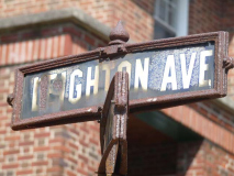
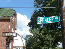
Zigzagging north on Broadway, west on Fanshaw and south on Leighton Avenue, I once again paid tribute to this survivor at Leighton and Spencer Place. Note the blue and white street signs, the manufacturer’s stamp on the base, and the NYC signs saying Spencer Avenue and the Yonkers sign saying Leighton. What happened is likely the city line runs between the signs. In the Bronx, Leighton becomes Spencer Avenue.
Meanwhile, Spencer Place begins in Yonkers, but curves south to a dead end in Riverdale!
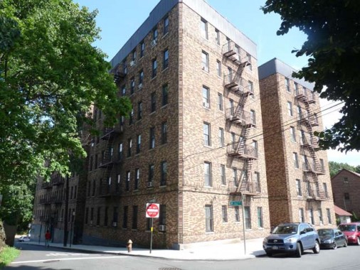
I liked the multicolor brick on this apartment building at Huxley Avenue and West 262nd in Riverdale.
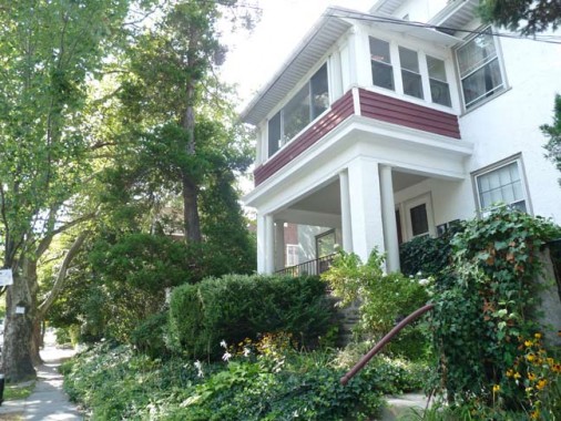
West 261st, west of Huxley.
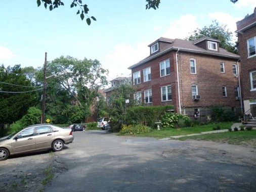
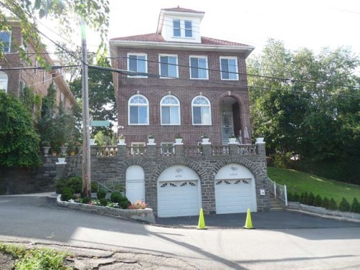
Forster Place, a dead end lined with nearly identical dormered homes, on Huxley south of West 261st.
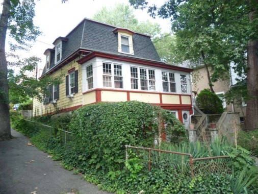
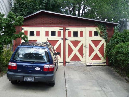
I liked that the owner of the corner house on Huxley and West 260th used the same maroon and beige color scheme on both the house and garage.
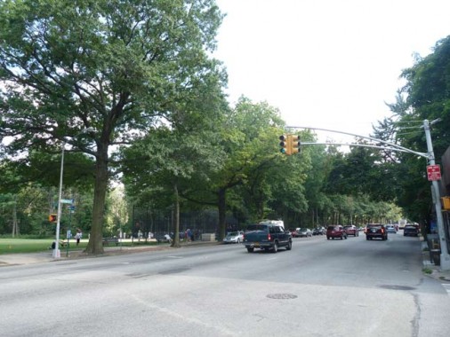
I packed it in at Broadway and West 260th. As Albany Post Road, NYS Route 9 and other names, this road runs north almost all the way to the Canadian border.
Here’s a fascinating film, shot around 1931, that shows Broadway from Yonkers all the way down to the Battery.
8/24/12

34 comments
From wikipedia: an ancient, circular, earthwork with an external bank and an internal ditch that range from under 20 meters to greater than 300 meters
As late as the 1970s, the public enjoyed free access to the heights surrounding Hillview Reservoir, which is now sadly restricted. A walking path circumnavigated the reservoir’s basin, from which the view — especially on a clear day — was magnificent. Yes, Kevin, the King of All Buildings could be seen from Yonkers! I was exiled to the Midwest in 1972, so I can’t attest whether the Twin Towers were also visible from Hillview, but I’d guess they were.
I have some relatives who live in the northern end of Yonkers, and even though it’s several miles north of Hillview, the Empire State is clearly visible from their house.
I believe the building can be seen from many places in Westchester; I didn’t mean to suggest otherwise. Yonkers, in particular, is a mighty hilly place. And the building is just mighty! I’m just a little sad that our FNY guru probably missed the extraordinary view from Hillview’s crest. Nothing quite matched it, in my (very long) memory.
Bob,
I have to apologize–I didn’t mean to suggest that you were suggesting otherwise. It’s too bad you can’t get up to the reservoir to see the building anymore–I’d love to see that view.
I suggest changing your email address.
Bob–
I grew up in this neighborhood in the 80s 90s and 2000s. I used to go sleighriding at Hillview, but in the late 90s and early 2000s (I believe) they stopped letting us go onto their property. And then everything was fenced off after 9/11. While I don’t think I ever looked to see if you could see the Towers from Hillview, I know you used to be able to see them from the Hall Place overpass over the New York State Thruway, which is very close to the reservoir.
Riverdale, really does give a different look of The Bronx. I did once here that postal service actually includes separately from the rest of the borough when it comes to mailing addresses, though that might have been just a rumor. Then again, there are places all over NYC that have hidden areas that aren’t even like the rest of the borough they are in. One thing I don’t get is why Riverdale has higher street numbers than Wakefield does despite the fact that the northernmost part of Wakefield has a higher latitude than Riverdale does according to a map.
“…Laurelton Parkway becomes the Southern State.”
Beg to differ. Unless the map changed since I drove home on the Southern State this afternoon (or we’re speaking of an extension destroyed when the current Belt/Cross Island/Southern State interchange was built), Laurelton Parkway runs at a 90-degree angle to the Southern State as the service road for the Belt Parkway. Coming west, the Southern State T-bones into the Belt (if you go left) and the Cross Island (going right).
The confluence of the Cross Island and Laurelton Parkways produce the Southern State Parkway at Exit 25a/B just south of Linden Bouelvard
Thanks for putting this up ,i enjoyed it .
Kudos to Ira Gallen for restoring this wonderful historical record of Broadway, and to Kevin for featuring it here.
Here Here! To see the city thriving like this in 1930-1931, it’s impossible to believe that The Great Depression was on. People were bustling about everywhere and you could feel the pulse of the ultimate driving machine: the human spirit. I didn’t realize how long Broadway stretched despite being a native New Yorker (my first 32 years); it was beautiful to see it from tree to sea. Loved the cat and her kitten – soooo precious – along with seeing the horses, who looked well fed despite everything and made use of the “horse fountain.”
There is also a Sedgewick Avenue in Yonkers, north of VCP. Could be a continuation of the same Avenue in the Bronx.
Thank you Kevin for sharing the short film restored by Ira Gallen. Amazing how many ways there were then to travel around town – by els, streetcars, subways, covered double-decker busses, cars and foot.
Terrific issue! If one goes due East on Wakefield Avenue from the pictured Montessori Academy (old Yonkers PS 11 / Mark Twain School), one descends a horrendous hill to the Bronx River Road, crosses into a wacko outgrowth of the North Bronx, navigates the Wakefield Bridge (which accommodates Metro North’s dinky Wakefield Station), and climbs E 241st Street to the 241st Street / Wakefield Station (and terminus) of the elevated IRT # 2 Line. The Bronx extens about two blocks farther northward, here on White Plains Road — far more northerly, latitudinally, than Riverdale’s 262nd Street. Why?
Incidentally, until 1949 or 1950, the elevated station here at 241st Street was the northern terminus of the Third Avenue El. Thereafter, its service was cut back to Gun Hill Road. So, romantics can still ride the beloved El’s route on the # 2’s tracks from Gun Hill to 241st Street!
Are you sure that the Third Av el went past Gun Hill Rd? I thought it always terminated at White Plains Rd. Hence teh lower level of track.
In ancient days, I used to ride the El from 241st Street to Fordham Road. South of the 218th Street station, the White Plains Road line’s three elevated tracks split into five, two of which descended below the others to form the old double-decker station at Gun Hill Road. (A similar track arrangement once linked the old 9th Avenue El “spur” and the IRT # 4 Line north of the old Yankee Stadium.) The 3rd Avenue El’s service was cut back to Gun Hill Road during my Junior Year in High School; thereafter, one had to change trains at Gun Hill. See the official 1948 System Map at http://www.nycsubway.org/wiki/Historical_Maps
Wow. Great maps. Thanks for that info.
The house at Caryl and Landscape is quite reminiscent of:
http://cp.c-ij.com/en/contents/3152/03348/index.html
Thanks again for your hard work…Great pictures
I think the service roads of the Deegan, from 233rd St. to the City line, are technically considered part of Jerome Avenue. Certainly where the ramps to and from the southbound side cross over the Deegan, a sign identifies the overpass as Jerome Av.
As for Horace Harding Expressway, that is the name of the service roads. The expressway itself is the Long Island Expressway, even in Queens.
Finally, the story of Spencer Place is even more complicated than you let on. Spencer Place is the name of the east-west portion of that curving dead end. The part that turns south from there to the end is actually Spencer Terrace.
Hillview Reservoir has 2 uptake shafts supplying the reservoir both are fed from Kensico Reservoir, in Valaha.(these supply the reservoir with water)
Shaft 1 A is from the original construction in the early 1900 and Catskill Aqueduct
Shaft 2 A is from the construction in the late 20’s and early 30’s the Delaware Aqueduct
Shaft 1A and 1B are on the permiter of the reservoir basin
Shaft 2A and 2B are set back off the Reservoir basin 100 to 200 feet
Shaft 3B is adjacent and South of Shaft 2B
There are three Downtake shafts each supplies one of each of the three city water tunnels
1B is for tunnel one
2B is for tunnel two
3B is for tunnel three this went on line around 1998/99 to feed Stage one of Tunnel # 3 in the Bronx , Manhattan, Roosevelt Island and Astoria ,Queens
I have been reading your site for years. I live in Texas now, but your picture 70.Aqueduct is of the block I grew up on. Thanks!
I just randomly stumbled on this page. I’ve lived on the corner of McLean and Midland for the past 6 years. The barber shop is the one I go to and even I don’t know the name of it. Two very nice older Italian gentlemen run the place.
I think it is the Yasmin Barber Shop.
The NYS Thruway actually becomes the Major Deegan in the Bronx. It does change its name.
One important fact you missed of Caryl ave. was that was a stop on the now Defunct Putnam line….
I grew up on Kimball Ave. across from the reservoir (rezey). As kids we used to sleigh ride down the hill there. Does anyone remember the big brown house adjacent to the reservoir on Kimball? I believe it was occupied by a caretaker. Any information on this house or the existence or non-existence of a caretaker there would be appreciated.
Great pictures of the area. Thanks for compiling and sharing them!
Interesting coverage of an area I spent 30 years living in. Didn’t appreciate the “Mob” comment about southeast Yonkers, when encountering some guys with attitude. Noticed no mention of the large concentration of pubs/bars on Mclean Avenue.. Wonder why… lol.
this is great! So great to see the Bronx being farmed. Thanks for this.
Great site. Now what u describe as a vegetable and flower stand is actually more of a nursery and landscaping place called windy farms. I don’t believe they sell vegetables, but they may sell small pumpkins around Halloween. Across the street & down the block a little from there is the VFW post which has a lot of Yonkers history attached to it. There’s a pinic area at the post and the back of the property runs into van cortlandt park. I remember seeing people riding horses from the van cortlandt stable back there . It was awhile ago, I don’t know if they still do.
As for Hillview Reservoir, if I remember correctly you can look east and see the Long Island Sound but I don’t think you can see the NYC skyline from the reservoir. There’s a pedestrian overpass over Central Avenue ( & the thruway, as at this point they are running parallel) that goes straight toward the reservoir. From the end of the overpass you can look down at the water of the reservoir, so it’s a little higher than the water. I don’t remember being able to see the NYC skyline from the overpass, but you can see the very top of the Whitestone bridge. The overpass is a little south of the 2nd precinct and goes to a bus stop on the other side.
Look at this very nice picture from a NYT article:
http://www.nydailynews.com/opinion/kudos-sens-schumer-gillibrand-fighting-federal-order-put-concrete-lid-city-reservoir-article-1.158155
This picture shows Hillview with NYC in the background, but where was it taken from? It looks pretty high.
Yonkers to New York City Via. Broadway during the Great Depression was incredible ..,
Maybe nit-picking, NYS Rt.9 is actually US Rt.9. I joke with some friends I live on North Broadway, 250 miles north on Broadway.