There are a number of short streets along the East River from the Financial District northeast to Corlear’s Hook, where the East River turns north, called “slips.” I’ve pored over maps of other cities over the years, and in the United States at least, “slip” seems to be a unique appellation to streets in NYC, because Manhattan used to have a unique feature: man-made inlets, mini-harbors where cargo-laden sailing ships could sail in and unload goods, and the aroma of coffee beans, spices, nutmeg and condiments filled the air. Manhattan Island’s edges were swampy; the Dutch expanded the island into the East River by landfill, but originally left the inlets, or ‘slips’ for docking.
Our shorelines have, in recent decades, been turned over to lazers, parkgoers and idlers, as port activity has moved to other locations like Newark or even further away. But there was a time when South Street presented a vista as far as the eye could see of sailing ships’ bowsprits and hausers, and West Street was thronged with shop owners buying wholesale from merchants docked along the Hudson River shoreline. As late as the early 2000s, tourists’ and revelers’ noses were struck by a pungent fishy odor along Fulton, South and the maze of streets in the Seaport, as the Fulton Fish Market was still there, a hive of activity from the overnight hours to the early morning; the Market has since retreated to Hunts Point in the Bronx.

Here’s a map drawn in 1803 showing the various docks, ships and wharves then existing along Manhattan’s shoreline. Look closely and you can see the various indentations along the east side where there were numerous “slips” and wharves. Can you pick out the slips still found on NYC street signs? (there are three of them here) If not, they’re shown in this FNY article.
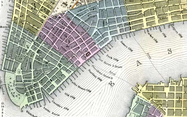
Moving along to 1850, we can see that while the “slips” are still shown on the map, by then they had all been filled in except one, Coenties Slip. You can see on the map, though, things that characterize Manhattan’s slips to this day: they are wider than the streets they issue from; indeed, streets sometimes gradually widened as they became “slips.” Their interiors were filled with the East River and the ships that docked on the slips; today, they are filled with parking areas, parks or playgrounds.
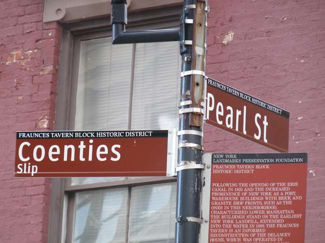
There probably isn’t another street in the USA named “Coenties” and in lower Manhattan, we have two. So there. Herman Melville mentions Coenties Slip in Moby-Dick, Chapter 1:
Circumambulate the city of a dreamy Sabbath afternoon. Go from Corlears Hook to Coenties Slip, and from thence, by Whitehall, northward. What do you see? Posted like silent sentinels all around the town, stand thousands upon thousands of mortal men fixed in ocean reveries.
Coenti(e)s Slip was one of the largest of lower Manhattan’s boat slips. It has pretty much kept its old slanted shape, too. The slip was filled in around 1870. In the background looms 85 Broad Street, the present NYC home of Goldman Sachs, built in 1983. It demolished part of Stone Street, which prompted the NYC Landmarks Preservation Commission to protect the original Dutch street layout in lower Manhattan. 85 Broad stands where the seat of Dutch colonial government, the Stadt Huys, or State House, used to be. Archeological remnants of the neighboring Lovelace Tavern are still there.
The name “Coenties” is old Dutch as Dutch can be since it recalls an early landowner from New Netherlands era, Conraet Ten Eyck, a tanner and shoemaker. He was nicknamed Coentje, or “Coonchy” to the British, and over time settled into this spelling. Ten Eyck Street in Brooklyn’s East Williamsburg was also named for him. Another story has it that the name is a contraction of “Conraet’s and Antje’s”–Conraet Ten Eyck and his wife Antje.
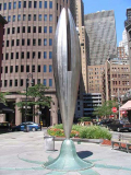
It resembles a lobster claw turned tuning fork, but Bryan Hunt’s “Coenties Ship” recalls the sailing vessels that once used this route. It was installed in 2006 and was part of a near $1 million rehab of the triangle where it stands.

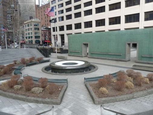
Coenties Slip’s eastern extremity has been removed; NYC’s Vietnam Veterans Memorial Plaza stands in its place.


Before subways arrived in 1904, the el was king in Manhattan; today, there’s only one left, as the #1 comes above ground at Dyckman Street. The Third Avenue El opened in 1878, running from South Ferry eventually all the way to the White Plains Road El at Gunhill Road; the Bronx section remained in service all the way to 1973.
Dimly remembered now are Manhattan’s downtown els. The 2nd and 3rd Avenue els converged at Chatham Square (at East Broadway), ran south along New Bowery (now St. James Place) and Pearl Street, than made this graceful S-curve through short Coenties Slip to Water, and then south again to South Ferry, where the 6th and 9th Avenue Els ran uptown. The 2nd, 6th and 9th Avenue Els were closed by 1942, the spur from Chatham Square to South Ferry in 1950, and the 3rd Avenue El in Manhattan in 1955. Promised subways to replace the 2nd and 3rd Avenue Els never materialized; after years of talk and even more years of construction, three subway stops along 2nd Avenue are expected to open in 2016.
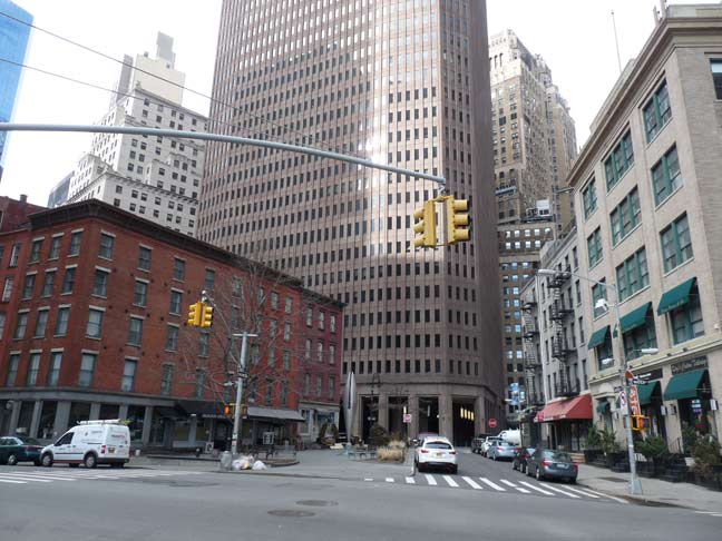
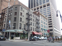
In this photo from Water Street we can see how the original slip converged inward toward its original end point at Hanover Square. Looming over all is 85 Broad Street, but three very old post-colonial era buildings can be seen along Coenties Slip at left: from left to right, they are 38 Water Street, built in 1834 by merchant and grocer John Suydam; 3 Coenties Slip, built 1837 by Suydam; and 66 Pearl/1 Coenties Slip, again by Suydam, on the site of an earlier building in which a cannonball was found from Leisler’s Rebellion, a two-year occupation of New York by German merchant Jacob Leisler and his followers between 1689-1691. Leisler was deposed and later executed by the British.
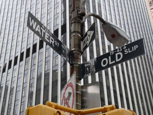
Going uptown, the next slip encountered is Old Slip, first encountered on maps in 1691. This Slip was the site of a momentous event in American history: in 1792, the 90-ton merchant brig Betsy, captained by Edmund Fanning, sailed out of Old Slip, to become the first ship to carry the American flag around the world.

Much of the formerly watery part of Old Slip at its Water Street end is now occupied by Old Slip Park, which, oddly enough, has a connection to the Mormon Church and its founder Joseph Smith.
….on February 4, 1846, the ship Brooklyn sailed away from Old Slip bearing more than 200 [Latter-Day Saints] men, women, and children. Under the direction of Samuel Brannan, the group traveled south, rounded Cape Horn and then sailed back up the western coasts of South and North America, stopping at Hawaii and landing at Yerba Buena, later San Francisco. LDS Today
A statue of the “Frontier Prophet” stood in Old Slip Park from 2005-2006.
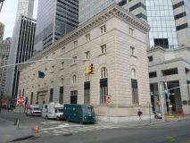
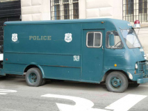
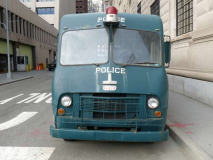
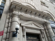
100 Old Slip at South Street, the NYC Police Museum, a replica of an Italian Renaissance palazzo, was constructed from 1909-1911 by the firm Hunt and Hunt as the 1st Precinct, replacing an earlier building on the site constructed in 1884. After the precinct moved out in 1973, the building served as the Landmarks Preservation Commission offices from 1993-2001, and was then dedicated as the Police Museum. I found a 1960s-era “paddy wagon” parked outside.
From its Mission page:
Incorporated in 1998, The New York City Police Museum is dedicated to preserving the history of the New York City Police Department, the world’s largest and most famous police service. The Museum strives to be an accessible resource for all the communities of the city of New York. Through its exhibitions, collections and educational programming, the Museum illustrates how the policies and culture of the NYPD have evolved over time to meet the changing needs of the City. The Museum serves as an educational institution, living memorial, and bridge of understanding between the various communities of New York, the international community and the New York City Police Department.
The Police Museum gives visitors an insider’s look at the history and traditions of the largest police service in the country and its role in the history of New York City. With artifacts that date all the way back to the Dutch settlers, visitors can discover the impact of the NYPD over the last three centuries. They will find out the reason police precincts around the nation are marked with green lights outside their doors, why officers are called “cops,” why their bosses are called “brass” and which came first, the Model T or the Highway Unit? Visitors will hear the moving stories of officers responding to the tragic attacks of September 11, 2001 and learn how the NYPD now works beyond the borders of New York City to ensure the safety of every citizen. They will also view the shields of every officer who lost their lives in the line of duty since 1857, and can contemplate the bravery and dedication it takes to be one of New York’s Finest.
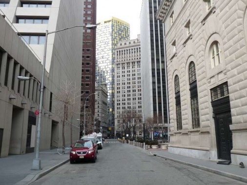
Looking west from Old Slip and South Street.
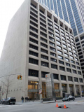
Flanking Old Slip on Water Street are a pair of buildings of chief interest for what you find on their roofs.
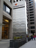
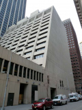
55 Water Street is the headquarters of Emblem Health, a 53-story tower built in 1972 that has a 15-story wing along Old Slip with an unusual slanted edge. But that’s not what’s really unusual about it.
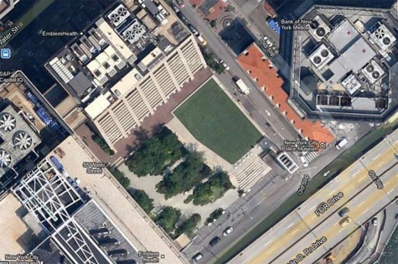
Viewed from the air, the wing features a public park called the “Elevated Acre.”
You enter at the widest, most heavily trafficked section of Water Street, where the buildings are all corporate titans. You ride to the green on a long clean escalator that promises open sky up ahead. The south part of the acre has islands of plants that divide it into more or less private spaces; whatever your neurosis, you’ll find a spot to suit you. On the north end are tiered cement steps or seats that lead down to the holy lawn. This is where office workers peering down from the surrounding glass skyscrapers are gladdened and saddened to see sunbathers in the summer, and where you could have a harrowing game of Frisbee. To savor the effect, stand near the rail that keeps you from plunging a couple of stories down into Old Slip; the sight of lawn above and busy street below is truly odd. T.M. Rives, Secret New York
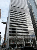
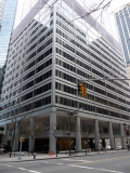
77 Water Street, on the north side of Old Slip, is a perfectly acceptable glass and metal office tower built in 1970. But once again, there’s something unusual on the roof, and this time, it’s not open to the public and you need special access, or work in a neighboring building, to see it.

Look closely at this google earth satellite view and you see what looks like a runway, complete with what appears to be an early 20th-Century biplane.
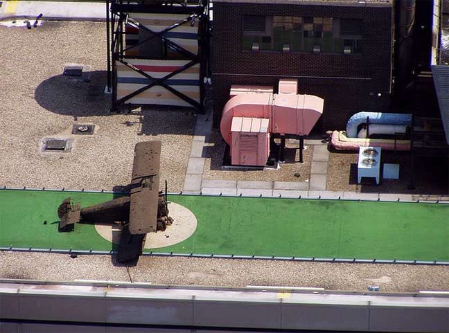
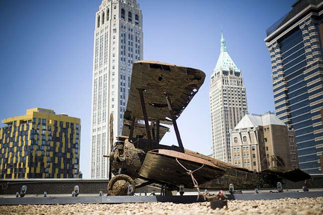
photos: Phil Hollenback (top), Rob Bennett (bottom).
The nonfunctional biplane is a model of a World-War I era 1916 British Sopwith Camel, designed by Rudolph de Harak and built by sculptor William Tarr in 1969, so it has been there for over 40 years, explaining its rust. It was placed there by the owners on a whim, to amuse workers in surrounding buildings, complete with a runway that actually lights up. Film location scout Nick Carr, who sees all the good stuff for his site Scouting NY, explains further here.
But 77 Water Street has other unusual aspects. Carr also notes that the courtyard features a full-size replica of a turn-of-the-century penny candy store, open for business (which I didn’t see) but there’s also…
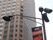
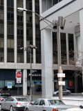
… a set of special lampposts that surround the building, illuminating Water and Front Streets and Old Slip. One or two have now-rare glare shields, and each has a bank of lights that shine down on the sidewalk. These probably go back all the way to 1970, when the building was constructed.
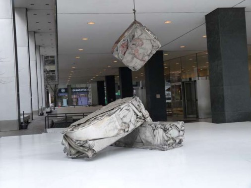
There’s also some hit-or-miss art under the entrance overhang, like William Tarr’s rather ugly Rejected Skin, 1969. This was done by the same sculptor who did the biplane the same year. The aluminum panels were originally supposed to go on the building exterior but were rejected for imperfections.

The Corchia-de Harak firm also designed ‘heat trees.’ illuminated metal umbrellas that would render the open space under the building more usable in the winter.” NYC Architecture
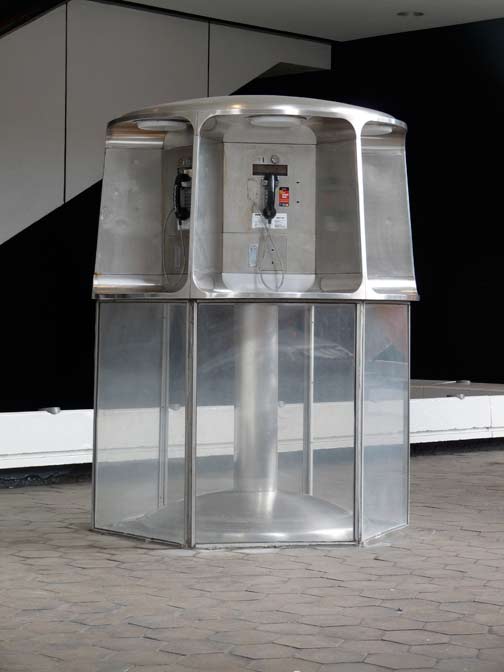
… and lastly, a bank of pay phones straight out of the Super Seventies…


Burling Slip is the east end of John Street between Front and South Streets. Unlike other Slips it carries dual signage. The name comes from a late 18th, early 19th Century family of merchants and businessmen. According to The Street Book‘s Henry Moscow, Burling Slip was in place by 1752, while the Revolutionary War Battle of Golden Hill was fought there in 1770. The Slip had previously been known as Rodman’s Slip.
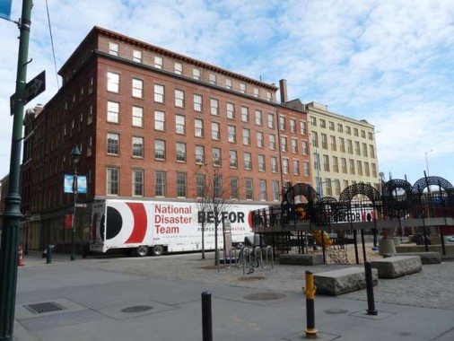
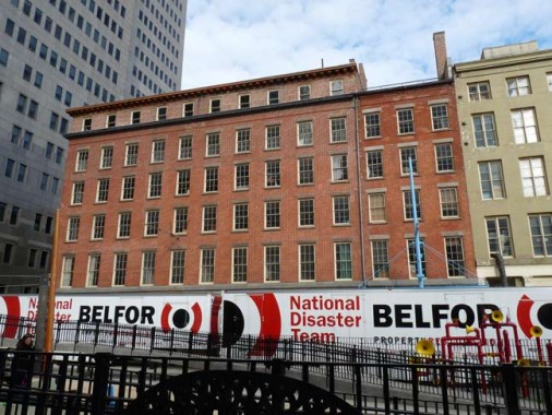
The back end of two prominent Fulton Street buildings face Burling Slip. Schermerhorn Row, a Georgian-style commercial block, was constructed by Captain Peter Schermerhorn from 1810-1812 and leased to merchants, who combined their offices and warehouses in one building. When the Fish Market opened in 1822 its value increased manifold. The ground floor now hosts Heartland Brewery and has always hosted restaurants and saloons, most notably Sweet’s (1847-1992) and Joseph Mitchell favorite Sloppy Louie’s (until 1998). Many of the businesses are in a temporary shutdown after Hurric …er, Superstorm Sandy, as of January 2013.
The center of Burling Slip, which used to be filled with East River water, is now home to Imagination Playground, an interactive, transformable space that prompts children to manipulate their environment and create a play space of their own with sand, water and loose parts. With giant foam blocks, mats, wagons, fabric, and crates at their fingertips, children have the potential to build and explore endless possibilities. NYC Parks

On the south side of Burling Slip is an 1845 ship chandlery (supplying) building converted to condos, with the Yankee Clipper restaurant on the ground floor.

Bike rentals, South Street and Burling Slip.
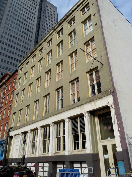
A(biel) A(bbott) Low Building, 17 John Street (Burling Slip). Low, an importer and philanthropist, operated a successful clipper ship line and imported teas, porcelains, and silk from China. This, his NYC headquarters, was completed in 1850. His father, Seth Low, was mayor of Brooklyn Village while A.A.’s son, also Seth Low, became mayor of NYC and president of Columbia University.

Peck Slip, which runs through the heart of the landmarked seaport district from Pearl to South Streets, is the east end of the now-vanished Ferry Street, which fell victim to “urban renewal,” i.e. the Southbridge Towers. Benjamin Peck was a British merchant in pre-Revolutionary New York, and the Slip first appeared in 1755 at Peck’s market. The Slip was filled in by 1817.
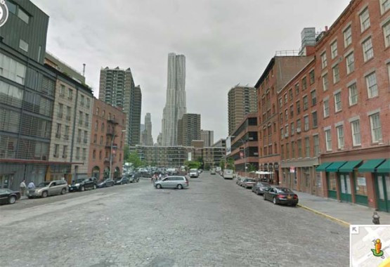
Peck Slip has retained more of an “old New York” ambience than any of its fellow Slips, since it’s the widest street in NYC paved with Belgian blocks remaining in town. There had been a wide expanse of brick streets at the intersection of Gansevoort Street, Greenwich Street and 9th Avenue, but the city felt the need to divert traffic and clog that space with traffic islands and bollards. Here we are looking at the new Frank Gehry-designed 8 Spruce Street, with a typical Gehry undulating surface, the tallest residential building in NYC to date.
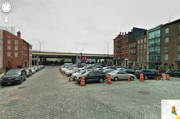
Looking east on Peck Slip toward South Street. On the left at the corner of South Street is the 1807 Lydig flour storehouse and the mercantile Jasper Ward House. On the right is the 1873 Paris Café, which has been home to a tavern or restaurant since it was built. Like most other establishments in the Seaport area it closed in the wake of Sandy and the restaurant will have to be rebuilt.

Moving north past the Brooklyn Bridge, Catherine Slip is the final two blocks of Catherine Street between Cherry and South Streets. Many streets in the Lower East Side are associated with Hendrick Rutgers, who owned most of the land here in the pre-Revolutionary era; Catherine was married to him. Both Henry and Rutgers Streets (see below) were named for Hendrick’s son.
The first Lord & Taylor store was located at 47 Catherine Street, opening in 1826.

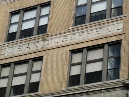
Though it’s on Catherine Street (not Slip) and Monroe Street I couldn’t resist taking photos of the twin-towered St. Joseph Church.
The Roman Catholic parish of St. Joseph (“San Giuseppe”) was established by the Missionaries of St. Charles, an order of priests and brothers founded by Blessed John Baptist Scalabrini in 1887 to serve the needs of Italian immigrants. The present church was designed by Matthew W. Del Gaudio and opened in 1924. Shortly after the founding of the parish, the Scalabrinians were joined by the Apostles of the Sacred Heart of Jesus, who helped open St. Joseph School in 1926.
Today, St. Joseph Church is a national parish designated as an Italian and Chinese parish. The parish continues the mission of the Church of St. Joachim, located at 26 Roosevelt Street until the 1960s, which was founded by the Missionaries of St. Charles who arrived in New York City in 1889. Immediately after, Mother Cabrini was welcomed by the same church as she arrived in the United States. American Guild of Organists, NYC Chapter
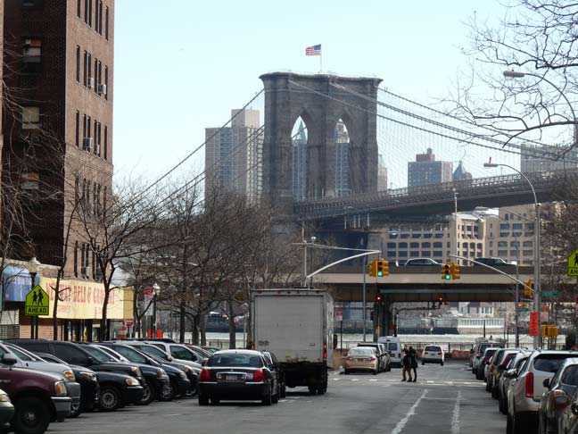
The Brooklyn Bridge is front and center as you go east on Catherine Slip toward the river.
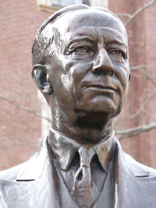

Catherine Street runs between two of the Lower East Side’s many housing projects, Knickerbocker Village and the Al Smith Houses. The latter was named for three-time NYS Governor Alfred J. Smith (1873-1944), who was born and raised on the Lower East Side. Known as “The Happy Warrior,” he worked in the Fulton Fish Market and later a pump factory. He was elected assemblyman at age 30 and later became Speaker. “The working man’s friend”, he championed the Workmen’s Compensation Law, banning corporate campaign contributions, and supported women’s right to vote.
He was defeated in 1928 for the Presidency against Herbert Hoover, suffering through a grueling campaign in which he suffered countless attacks, especially in the South, for his Roman Catholicism. Despite his staunch Democratic Party membership, he opposed Franklin Roosevelt’s New Deal and supported Roosevelt’s Republican opponents in the elections of 1936 and 1940. Charles Keck’s memorial was installed in the Al Smith Playground in 1950.
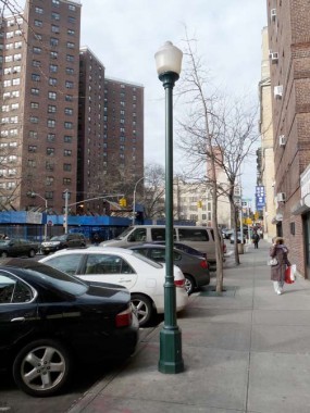
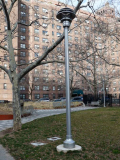
A number of these post-top lampposts, rare in NYC, have recently made their debut on Catherine Street at Knickerbocker Village.

Another great American is honored on Catherine Slip by the Jacob Riis School at Cherry Street. The Danish immigrant and Richmond Hill, Queens resident (1849-1914) was a tireless social reformer, using his camera and pen to showcase how the poor, the “other half,” lived, at a time when the robber barons held sway and much like the early 21st Century, there was a widening gap between the rich and the not-as-rich.
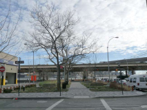
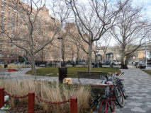
On Catherine Slip between Cherry and South Streets, there’s a brand-new park; so new, in fact, that it apparently hasn’t yet been given a name. The park does showcase NYC’s new genus of park lamps, known as the Flushing Meadows post, since they made their debut in that park in 2004.
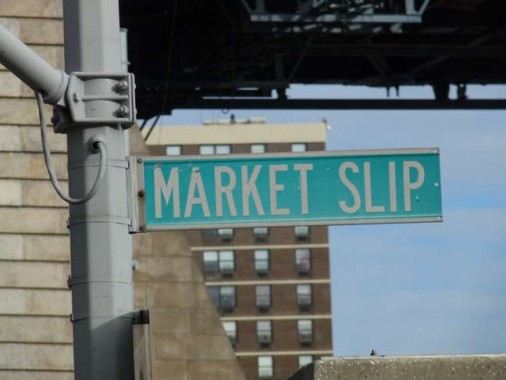
Market Slip is the eastern end of Market Street between Cherry and South Streets. The slip was likely the site of a produce exchange in the early 19th Century.

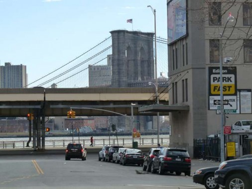
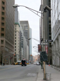
With a parking lot on one side of the street and an enclosed playing field on the other, Market Slip is nothing to write home to Mother about. And yet, it could be the shortest street in NYC with nearly unobstructed views of both the Manhattan and Brooklyn Bridges, especially in the winter months.

Not to be confused with Peck Slip, Pike Slip and Street commemorate the namesake of Pike’s Peak in Colorado, Zebulon M. Pike, a soldier and explorer who surveyed lands acquired in the Louisiana Purchase. He was killed during a War of 1812 battle on 4/27 the following year.
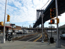
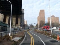
When the Second Avenue El above Allen Street was torn down in 1942, Allen, as well as its southern extension, Pike Street, were widened with center malls to accommodate additional traffic. In 2012, Pike, as well as Allen, were given new and improved bicycle paths. Interestingly, the new paths serve to display NYC’s newest species of street lighting: the aforementioned Flushing Meadows posts, and davit-style posts using the new “Stad” luminaires, which shine a high-intensity white light.

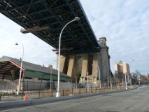
One of the Manhattan Bridge’s two massive anchor arches crosses Cherry Street just south of Pike.
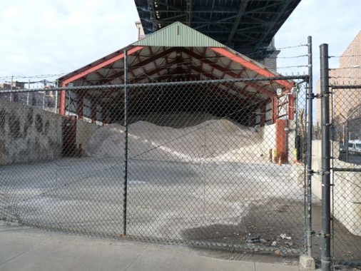
During the winter of 2012-2013 the Department of Sanitation hasn’t had to use a lot of salt for snow removal, but a shedfull of salt is at the ready in this yard at Pike Slip and South Street.
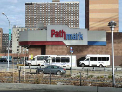
Since the 1980s, one of lower Manhattan’s biggest supermarkets, this Pathmark at Cherry Street and Pike Slip, served residents of the many LES housing projects — until its closure on 12/21/12. It is scheduled to be replaced by yet more residential projects, and where their groceries will be acquired is not apparently a factor in the planning.
TV, stage and film actor James Karen (1923- ) was the longtime Pathmark TV spokesman:

Rutgers Street and Slip, as well as Henry Street, were named for Henry Rutgers (1745-1830), son of Hendrick, the Rutgers who owned most of the Lower East Side in the early colonial era. An active patriot, Henry Rutgers organized Sons of Liberty meetings and served in the American army; he was also an early patron of Tammany Hall, the longtime New York Democratic Party organization. New Jersey’s Rutgers University also bears his name after its president was hoping for a large donation. Rutgers left a total of $5200 (in early 19th Century money, but still). Rutgers is buried in Green_Wood Cemetery in Brooklyn, though the burial site was unmarked until 2008.
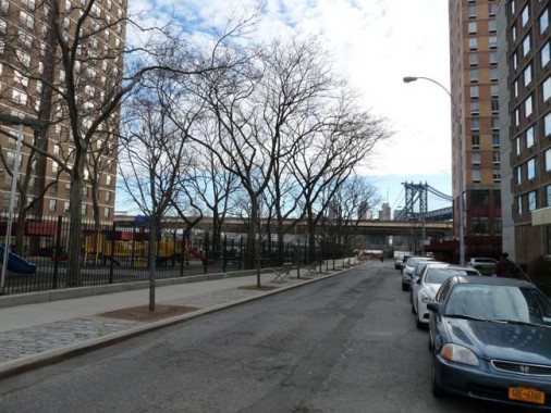
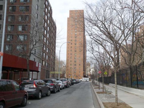
Rutgers Slip, now reduced to one lane, faces the Brooklyn Bridge to the south and the Rutgers Houses to the north.
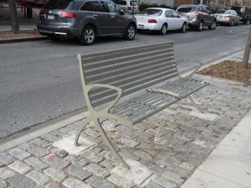
We’ve seen the newest iterations of NYC street lighting — here’s the newly redesigned park bench, a lightweight model replacing the old concrete and wood benches.
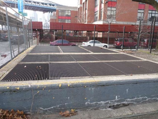
A pair of massive vent openings are clues that the IND Rutgers street Tunnel, serving the F train, passes under here, as it has since the early 1920s.
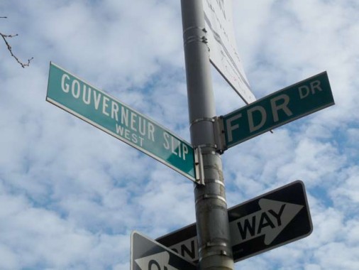
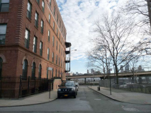
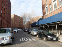
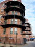
The last remaining Slip is the only one given East and West divisions: Gouverneur Slip. The divided Slip flanks the foemer Gouverneur Hospital. The Slip, as well as a Street and a downtown Lane, honor colonial-era French immigrant merchant Abraham Gouverneur, an ally of revolutionary Jacob Leisler (see above).
Gouverneur Lanes East and West surround the distinctive metal balconies of the back end of the former Gouverneur Hospital. Completed in 1901, Gouverneur moved to Madison and Jefferson Streets in 1970, and the old building serves as housing for the homeless.
1/27/13


29 comments
Those old buildings on the south side of Coenties Slip were badly damaged during Hurricane Sandy and the very popular restaurant Ziccolini’s on the ground floor has yet to reopen.
Nice post,Kevin. All kinds of good info here. You keep coming up with lots of interesting subjects. That second avenue subway sure has had a long gestation, originally proposed back in the twenties.
I I FOUND YOUR PHOTOS & WRITINGS VERY INTERESTING. I WORKED ON PECK SLIP FROM 1973 TO 1986 AS A LETTER CARRIER FOR THE U.S.POSTAL SERVICE WHICH IS LOCATED ON PECK SLIP & WATER STREET.I DELIVERED TO THE FULTON FISH MARKET FOR MANY YEARS.I WAS ALWAYS INTERESTED IN THE OLD BUILDINGS IN THAT AREA I ALWAYS WONDERED WHAT THEY USE TO BE.ANY OTHER INFORMATION OR PHOTO’S WOULD BE HELPFUL
Could these be called slip streets because they once connected to actual slips ie boat docks?
According to nycsubway.org, trains began running through the Rutgers Street tunnel from East Broadway to York Street in Brooklyn in April, 1936.
this article was so interesting, i live on madison and market street and I really like your street by street historical insight on the entire neighborhood. Where did you get all your information?
I lived on Rutgers Slip an my future wife lived on Catherine Slip. I use to walk under the Manhattan bridge every day to see her. I’m glad we got married, a lot less walking!
One of my favourite posts, so far.
i moved from PA to new york a few years ago, and years agowe had pathmarks, butbthey disspaered ages ago. i thought they went out of business. when i came here, it was a pleasant shock and surprise from my younger years…
Where does Catherine Lane,around the court houses, fit into Catherine slip and street?
All named for Catherine Rutgers
I recently retired from 35 years of working for the NYC Housing Authority. I spent several of those years working on Madison St., specifically 356 which is Vladeck Houses.
The Slips bring back memories. On occasion in the late ’70s, I would commute to my job near Battery Park by driving from the East Bronx (just to take a break from the subway) and parking for free beneath the FDR, usually near Peck Slip. Then a near-mile walk to work, fun!
St. Joseph’s School (now known as St.Joseph – St. James) will be closed by the Archdiocese at the end of the school year. Link: http://newyork.cbslocal.com/2013/01/22/archdiocese-to-close-22-elementary-schools-2-high-schools/
Two Hagstrom Subway maps (1939 and 1948) show the Third Avenue El continuing north of The Bronx’s Gun Hill Road on the IRT’s White Plains Road tracks (the # 2 Line) as far as the 241st Street terminus. I used to ride this stretch to High School. Film of it is rare, but a two-minute segment of this old movie of the East Side Els, between minutes 50 and 53, shows Third Avenue “Express” trains operating above Gun Hill before 1950: http://www.youtube.com/watch?v=wyYnVKhRNYk
I really love this article and next time I go up to NYC, I’ll have to check through your blog for cool places to visit. Still, I have to say, slips are not unique to NYC. Richmond, VA, has Shockoe Slip, now a neighborhood. From shockoeslip.org:
“Shockoe Slip earned its unusual name from the creek that once flowed through it. “Shacquohocan” was the Indian word for the large, flat stones at the mouth of the creek, and “slip” refers to the area’s position on the canal basin where boats loaded their cargo.”
Enjoyed reading about Peck’s Slip. My 3rd great grandfather, John Peck, ran the family business (import/exporting goods) from 1820 to his death in 1850. To my knowledge, he was the last of the family to work out of Peck’s Slip.
Read “South Street A Maritime History of New York” by Richard C McKay. I find no mention of Manhattan Island which was once located on the lower east side of the Island of Manhattan except in his history.
[…] foggy dusk near Catherine Slip; Brooklyn Bridge disappears from […]
111 Wall St. had many of the artifacts that were unearthed during its construction on display in the lobby. Although not formally called a slip today, the widened foot of Wall St. was just that.
Most beautiful city in the world.
Love NY
Interesting and important article. The former Post Office will be PS 343 The Peck Slip School once construction is done. Thinking about Burling Slip and Imagination Playground. Especially in light of 151 Maiden Lane aka One Seaport. So much history!
Per The New York Times, The National Trust for Historic Preservation put the district, which is south of the Brooklyn Bridge, on its annual list of “America’s 11 Most Endangered Historic Places.”
Melville mentions “Whitehall” in the same first chapter of Moby-Dick. Do you know of this reference?
The Number One Train (West Side IRT) comes above ground at 125th Street and Broadway and goes underground to the next stop, 137th Street. It was an engineering and geological problem that created that anomaly.
Coenties Slip played an important role in the growth of the Abstract Expressionist art movement right after World War II – artists Jackson Pollock, Lee Krasner and Willem de Kooning had studios there.
Thanks for this page! I grew up in the “Two Bridges” neighborhood in the 1950’s and 60’s. I remember St. Joseph’s, and attended PS 1 up Madison street for kindergarten and St. James on James St. I remember when St. Joachim’s church burned down. I read that St. James and St. Joseph’s are now both closed. I remember riding the old 3rd Avenue El, and so many interesting old buildings torn down at this time. The nuns from St. Joachim’s ran a mission house called the “Madonna House” on Cherry St. beneath the Manhattan Bridge. I remember they gave us little ragamuffins lovely brand new donated dolls still in their packages one Christmas.
My brother was born at Gouveneur Hospital in the 1950’s.They kept new mother’s in the hospital for about a week in those days, and my overworked mother said she enjoyed the chance to relax and sit on the balcony watching the river traffic.
Idea of “slips” was also used in Charleston S.C. And for the same purpose–get shipments to merchants.
During the 1950s there was a Catholic mission on Cherry Street called Madonna House. It was staffed by nuns. My father’s cousin Rita Cleary was one of those nuns. She had taken the name Sister Maureen. We used to visit her from time to time.