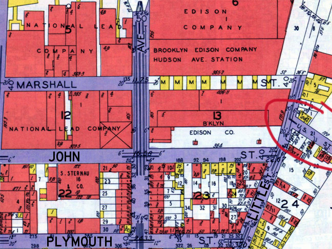
Brooklyn has its share of patriotic-sounding street names, such as State Street downtown, as well as Union and President in Cobble Hill, Park Slope and Crown Heights, but there actually was a street called United States Street or, as it was commonly represented on maps, U.S. Street, in tiny Vinegar Hill.
It was a dead end alley off a northern portion of Little Street, which has itself since been reduced to a single short block between Evans and Plymouth. I have circled it on this 1929 Belcher Hyde atlas. Since then, the massive nearby Con Edison plant expanded and a waste treatment plant was built in the Navy Yard, eliminating all trace of U.S. Street.
Also located within the Con Ed grounds is an old cast iron Corvington lamppost, but that Con Ed plant is more heavily watched than Fort Knox, especially against impudent photographers like your webmaster. Thus, it will likely never be photographed…
7/4/13


2 comments
You can’t knock on the gate and say hi? Maybe they will let you in then. 🙂
What do you think those M’s stand for on the map? Motor?