I thought I was done with Walnut Street in Forest Hills. I really thought I was.
A few months ago [February 2014] I devoted a page to this one-block street between 70th Drive and 71st Avenue just north of Union Turnpike.

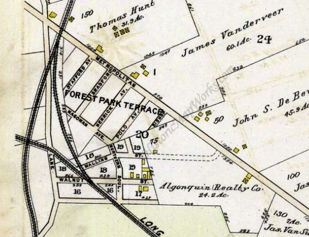
It’s a final remnant of a real-estate development called Forest Park Terrace. This 1909 map shows it running across the Long Island Rail Road south of Metropolitan Avenue. The green area at the bottom of the section is Forest Park. Union Turnpike had not yet been built this far east. Then, as now, Metropolitan Avenue is the main east-west drag. The railroad no longer has a junction, since the old Rockaway Branch tracks were torn up in the 1960s; and the mostly freight “Montauk branch” is now elevated here.
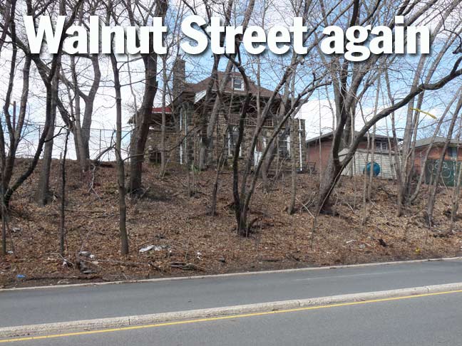
I was on a walk east on Union Turnpike from its Glendale origins east to Fresh Meadows when I spotted this unusual house on my left (title card). I had to investigate.

There it was, tucked against Walnut Street and 70th Drive, on the ridge separating it from Union Turnpike. A rare cobblestone house! I had only found a few of these in Queens, in Waldheim, in Bayside, and a church in Elmhurst, and I’m always happy to find another. They usually have stories behind them, and this building likely goes back to the old Forest Park Terrace days.

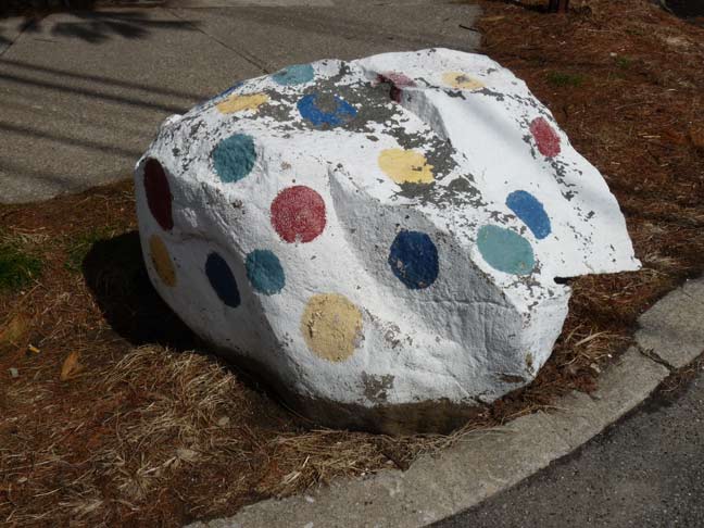
To add to Walnut Street’s other quirks, there’s a polka dot painted rock on the opposite corner.
5/8/14


5 comments
I don’t get the remarks about the Montauk line. As of November 2012 passenger service on the lower Montauk was halted so it is now just freight. The 5 local station in this stretch closed in 1998. And ‘mostly elevated’ is an exaggeration but there are bridges over Union Turnpike and the Jackie Robinson. It does not become elevated till it leaves Forest Park in Richmond Hill.
The 1909 map is very confusing with trying to align it to the current street grid in the area platted originally as Forest Park Terrace, as there must have been at least one replatting of that subdivision. I have compared the 1909 map with a 1929 E. Belcher Hyde Map and a current google map of the area, and the only streets that still are apparently extant from the 1909 map are Metropolitan Avenue, Walnut Street and three small unconnected sections of Trotting Course Lane; The northerly section of Trotting Course Lane running from Woodhaven Blvd. in the north and crossing Metropolitan Avenue as it runs southward and ends into 73rd Avenue, and the second section of the street, which appears as a small unnamed driveway at Union Turnpike next to the Starbucks Coffee with another driveway across Union Turnpike next to an apartment house, and the third and last section starting just north of Margaret Place and ending back again at Woodhaven Blvd. As Kevin says, and the 1909 map shows, Union Turnpike was an unnamed road in 1909, just south of Walnut Street and behind the stone house featured in the article. However, it appears by 1929 that the area was replatted, and the street configuration pretty much resembles what we see today. Union Turnpike was in existence as a named street by 1929, Walnut Street was still there paralleling Union Turnpike one block to it’s north, and Sybilla Street which runs parallel to Metropolitan Avenue, appears with today’s cross streets cutting at right angles to both Sybilla and Metropolitan, and at an almost 45 degree angle to Walnut Street and Union Turnpike; These cross streets are the numbered avenues, roads and drives, beginning with 69th Avenue through to 70th Drive at Walnut Street’s western end to 71st Avenue at Walnut Street’s eastern end, and ascending numerically to 74th Avenue before Metropolitan and Union Turnpike intersect. Sybilla Street like Walnut Street also ends at it’s intersection with 71st Avenue, leaving 71st Road to 74th Avenue as one block long streets. In addition the 1929 map does show the dual namage of 71st/Continental Avenue in the area (as well as the former names of all the numerically platted streets), however today all street signs just reflect 71st Avenue; The only place in Forest Hills where 71st Avenue remains signed as Continental Avenue is in Forest Hills Gardens, and one lone dual named Continental Ave/71st Ave street sign at the southwest corner of Austin Street and 71st Avenue, as well as the subway station name.
The1915 map here shows the area much better. http://www.historicmapworks.com/Map/US/3069/Plate+027/Queens+1915+Vol+2A/New+York/
The spotted rock was at the corner of my great grandfather’s dairy farm. He had st. Bernards that guarded my grandmother and aunt from walking into traffic. It was spotted so a colorblind dog could see it as property line as to not let baby girls walk off property. My grandmother and great aunt rode the dog.
My great grandmother was Rose and my grandmother Mary hence my name Rosemary. My great grandfather was killed while delivering milk by horse wagon in Queens. The business no longer existed and debt of farm was sold including the cows. The company was on Walling street.